Local events in Salineville
Nothing is posted for Salineville itself yet; here is what is on within 20 miles. All local events in Salineville
Know a calendar we should watch? Send the link
Checked October 20; the events page is refreshed daily.
How Salineville began
Salineville was laid out in 1839 by John and James Farmer and incorporated in 1848, taking its name and its motto, 'Salt of the Earth,' from salt deposits along Yellow Creek, where the first salt well in Columbiana County is said to have been bored about 1809. The Cleveland and Pittsburgh Railroad reached the village in 1852 and coal mining followed. On July 26, 1863, Union cavalry defeated the remnant of John Hunt Morgan's command at the Battle of Salineville, which Wikipedia calls the northernmost military action involving an official command of the Confederate States Army. The population peaked at 2,700 in 1920 and was 1,206 in 2020.
Settled 1839, platted 1839, incorporated 1848, by John and James Farmer.
Where the name comes from
Named for the salt deposits, or salinity, found along Yellow Creek near the village, worked by early settlers; the village's motto, 'Salt of the Earth,' carries the same reference.
Before the town
No source names a specific Native American village, camp or burial site within present Salineville's boundaries. The village sits along Yellow Creek, the same waterway associated further downstream (near Wellsville) with the Mingo leader Logan's village and the 1774 Yellow Creek massacre, though no source places Native settlement specifically at the Salineville site itself.
Timeline
- — George James, who came to Salineville from Kentucky, is said to have bored the first salt well in Columbiana County; his two wells, 300 and 900 feet deep, gave a strong flow of water with little salt.
- — John Farmer, who had come from New Garden in Hanover Township, buys three abandoned salt wells on Little Yellow Creek and goes into the salt business on a large scale.
- — The salt industry reaches its height around Salineville, with 20 producing wells along Little Yellow Creek; Farmer's output is more than 50 barrels a week.
- — James Farmer and Isaac Kirk build the first important grist mill in Salineville.
- — Salineville is established, named for the salt deposits along Yellow Creek.
- — James Farmer's influence is credited with bringing the Cleveland and Pittsburgh Railroad's survey south to Salineville, where the salt works and coal mines lay, rather than north through New Lisbon and Salem; he becomes the company's second president in 1847.
- — Salineville incorporates as a village.
- — The Methodist Episcopal congregation, organized about 1840, builds a frame church; a brick church costing $10,500 replaces it in 1870. The Free Presbyterian church is organized January 28.
- — The Cleveland and Pittsburgh Railroad is completed through Salineville; the village, which had little east of Lacock's mill before, grows quickly as coal mining develops.
- — John Farmer sells his salt business to Isaac Kirk, who operates the wells until 1865, when salt-making at Salineville ceases to be profitable.
- — Union cavalry under Brig. Gen. James M. Shackelford defeats the remnant of Confederate raider John Hunt Morgan's command at the Battle of Salineville; Morgan surrenders about two o'clock near West Point, about eight miles northeast of Salineville.
- — The Ohio and Pennsylvania Coal Company is organized with $80,000 capital and takes over six of the town's largest mines, employing 200 miners from the start; by 1875 its output is 800 tons a day.
- — The census counts 1,429 residents, up from 485 in 1860.
- — McGarry, Black and Company build a grist mill near the Cleveland and Pittsburgh station; the Faloon brothers start the Ohio Flouring Mill the same year.
- — The census counts 2,302 residents.
- — Salineville's population peaks at 2,700.
- — The census counts 1,206 residents.
Stories
The northernmost battle of the Confederacy
On July 26, 1863, Union cavalry under Brig. Gen. James M. Shackelford destroyed what remained of John Hunt Morgan's cavalry at the Battle of Salineville, ending Morgan's Raid. Morgan had left Tennessee with about 2,460 troopers; he surrendered at about 2 p.m. to Maj. George W. Rue of the 9th Kentucky Cavalry near West Point, about eight miles northeast of Salineville. Wikipedia calls the battle the northernmost military action involving an official command of the Confederate States Army.
Salt-boilers on Little Yellow Creek
Salineville began as a place to boil salt. George James, from Kentucky, is said to have bored the first salt well in Columbiana County about 1809; in 1818 John Farmer bought three wells that others had abandoned and made a business of it, and by 1835 there were twenty producing wells along Little Yellow Creek. The 1879 county history notes that the salt-boilers made up a numerous and sometimes boisterous community, for they 'considered it one of the moral obligations of existence that it should be kept in a state of proper and lively agitation.' Farmer's son James carried the fortune into coal and railroads, and John sold the wells in 1853 to Isaac Kirk, who worked them until 1865, when salt from Michigan and New York undersold them. The village kept the name, and the motto 'Salt of the Earth.'
The railroad that was bent to reach Salineville
When the directors of the Cleveland and Pittsburgh Railroad chose their route on October 29, 1845, one of the original surveys ran far north of Salineville, through New Lisbon and Salem. The promoters of the Sandy and Beaver Canal, which reached New Lisbon in 1846, opposed a competing railroad, and no railroad feeling could be roused there. James Farmer, a Salineville merchant who had run a steamer of his own to St. Louis and New Orleans, argued instead for a southern line touching his village, where the salt works and the coal measures lay, and the survey was bent south. The 1905 county history says the change lengthened the line to Pittsburgh and that the directors later regretted it, but when the road opened in 1852 its locomotives were among the first in the country to burn coal instead of wood, drawn from the Salineville mines.
Photographs
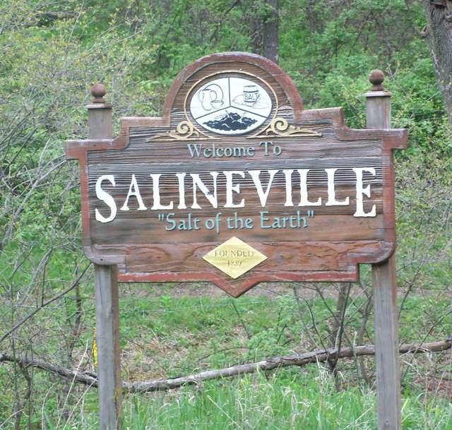
Photo: Roseohioresident (Wikimedia Commons), CC BY-SA 4.0 · Wikimedia Commons
Local history sources: en.wikipedia.org · en.wikipedia.org · commons.wikimedia.org · archive.org · archive.org · en.wikipedia.org
Water
Mostly private wells The water here
- Buckeye Water District - Ohio River100% of residentsOhio River
Hospitals, fire stations and more
Inside Salineville's boundary: 1 health center, 1 fire or EMS station, 1 public school, 1 poor-rated bridge, 1 police station and 1 spill case. Press a pin or a name for its whole record and its source.
Community health centers (1)
-
Salineville Community Health Center at MelhornHealth center · Salineville
- Run by
- a federally qualified health center
- Setting
- Clinic
- City
- Salineville
- Coordinates
- 40.62196, -80.84210
Find a Health Center (HRSA) ↗ HRSA data (source) ↗ Street map and directions ↗
Source: HRSA health center service delivery sites, active, September 2026 (school-based sites left out). Health centers see patients whether or not they have insurance, with fees on a sliding scale.
Fire and EMS stations (1)
-
Salineville Volunteer Fire DepartmentSalineville
- Address
- 34 Washington Street, Salineville, OH 43945
- Coordinates
- 40.62509, -80.83976
USGS National Map structures (source) ↗ Street map and directions ↗
Source: USGS National Map structures (most Ohio records last updated 2019 to 2022), checked against the Columbus and Cleveland station lists. The department that answers a call is set by jurisdiction and mutual aid, not by distance.
Public schools (1)
-
Utica Shale Academy of OhioSalineville
- Address
- 50 E Main St, Salineville, OH 43945
- Kind (NCES)
- Regular School
- Students, 2023-24
- 116
- Teachers (full-time equivalent)
- 3
- NCES school ID
- 390156605837
Source: NCES EDGE public school locations 2024-25 and Common Core of Data 2023-24 (type, students, teachers); Ohio School Report Cards 2025-26 (Department of Education and Workforce), matched by name within the district.
Bridges rated poor (1)
-
Spring Street over Riley RunPoor · built 2001
- Condition
- Poor: a deck, superstructure, substructure or culvert rated 4 or below on the 0 to 9 scale
- What it is
- Culvert
- Built
- 2001
- Length
- 6 ft
- Owner
- City
- Vehicles a day
- 100
- Coordinates
- 40.62204, -80.85813
National Bridge Inventory (source) ↗ Street map and directions ↗
Source: FHWA National Bridge Inventory 2025. "Poor" means one major part rated 4 or below on the 0 to 9 scale; it calls for repair, not closing, unless the state posts or closes the bridge.
Police stations (1)
-
Salineville Police DepartmentSalineville
- Address
- 66 East Main Street, Salineville, OH 43945
- Coordinates
- 40.62417, -80.83102
USGS National Map structures (source) ↗ Street map and directions ↗
Source: USGS National Map structures, police stations, corrected and completed by hand (September 2026). The department that answers a call is set by jurisdiction, not by distance.
Spills reported since 2021 (1)
-
Brine Oil And Gas Related2023-08-12 · Salineville
- Reported
- 2023-08-12
- What spilled
- Brine Oil And Gas Related
- Where
- Salineville, Columbiana County
- Ohio EPA district office
- NEDO
- Ohio EPA case number
- 2308EPA0001388
Ohio EPA spill reports (source) ↗ Street map and directions ↗
Source: Ohio EPA emergency response spill reports, 2021 to September 2026, one point per case where Ohio EPA placed it. A report is what the caller or responder recorded; amounts are often blank or estimated.
Its ZIP codes
Each ZIP code that touches Salineville, with the share of its residents who live here and the same headline figures as the ZIP page.
| ZIP | Share | Water | Radon | Home value | Schools | Flood |
|---|---|---|---|---|---|---|
| 43945 Salineville | 41% | Mostly private wells | 15.5 pCi/L average radon | Appraisal records without year built | Southern Local · 3 stars overall | 0.4% of residents in the 1% floodplain |
Local government
Who holds office in Salineville, how its elections and ballot issues came out, and the state auditor's record.
Money issues on the ballot since 2022: 4 of 4 passed.
Ballot issues
| Date | Issue | For | Against | Result |
|---|---|---|---|---|
| 2024-11-05 | Issue: Village of Salineville Tax Levy EMS | 320 | 104 | Passed (75.47% for) |
| 2023-11-07 | Issue: Salineville Village Tax Levy Cemetery | 173 | 65 | Passed (72.69% for) |
| 2023-11-07 | Issue: Salineville Village Tax Levy Current Expenses | 160 | 77 | Passed (67.51% for) |
| 2022-11-08 | Issue: Salineville Village Tax Levy Police | 197 | 69 | Passed (74.06% for) |
Elections for office
| Date | Office | Candidates and votes |
|---|---|---|
| 2023-11-07 | Member of Council | Amie Forbes 176, 54.83%; Sylvia Keating 145, 45.17% |
| 2023-11-07 | Mayor | Chad J. Bettis 217, 100.0% |
| 2021-11-02 | Member of Council | Nancy Needham 115, 49.36%; Pamela A. Tedeschi 118, 50.64% |
| 2021-11-02 | Member of Board of Public Affairs | Chad J. Bettis 142, 100.0% |
Winners in bold. Results from the county board of elections' official canvass unless marked.
Auditor of State record
- No fiscal caution, watch or emergency on the Auditor of State's lists.
- Agreed Upon Procedures, 2023 to 2024, released 2025-10-16
The county
Columbiana County: 20 ZIP codes, 33 cities, villages and townships, 106,075 people.
Nearby places
Rain and snow
How much has actually fallen on Salineville, day by day, from 1878 to now. Daily totals, not averages.
- rain, last 30 days
- 1.92 in
- 2026-10-01 to 2026-10-30
- rain so far in 2026
- 42.5 in
- 6.9 in above normal for the date
- snow so far in 2026
- 30.9 in
- a normal year brings 27.3 in
- a normal year
- 41.8 in
- average of 30 years, 1991-2020
| Month | Rain (in) | Snow (in) | Days counted |
|---|---|---|---|
| October 2026 | 1.92 | — | 30 |
| September 2026 | 6.04 | — | 30 |
| August 2026 | 7.32 | — | 31 |
| July 2026 | 4.98 | — | 31 |
| June 2026 | 3.71 | — | 30 |
| May 2026 | 4.95 | — | 31 |
| April 2026 | 4.90 | — | 30 |
| March 2026 | 5.29 | 4.2 | 31 |
| February 2026 | 1.04 | 5.2 | 28 |
| January 2026 | 2.35 | 21.4 | 31 |
| December 2025 | 2.61 | 11.2 | 31 |
| November 2025 | 1.91 | 0.1 | 30 |
| Wettest year | 2018 — 58.6 in |
|---|---|
| Driest year | 1930 — 27.0 in |
| Snowiest year | 2010 — 62.1 in |
| Wettest day on record | 20 September 1883 — 4.50 in |
| Heaviest snowfall in a day | 6 February 1878 — 15.98 in |
| Deepest snow on the ground | 26 November 1950 — 21.82 in |
Estimated, not measured. No rain gauge has ever stood inside Salineville, so every figure here is worked out from the gauges around it - the nearest ones weighted most. Treat them as close estimates rather than readings.
51,045 days of records, 1878-02-01 to 2026-10-30. Source: NOAA NCEI GHCN-Daily, 3,240 gauges in and around Ohio. A day is "gauged" when a gauge standing inside the boundary reported it, and the value is the mean of those gauges. Otherwise it is interpolated by inverse distance from every gauge reporting within 50 miles. Nothing is carried forward, back-filled or smoothed. Against NOAA nClimDiv county monthly precipitation over 136,848 complete county-months (checked 2026-11-01): correlation 0.9515, median absolute difference 0.217 in a month. Built 2026-11-01 from the Cracked Buckeye precipitation archive. Snow is the softer number — snowfall is measured by hand with a ruler, no agency publishes a gridded county snowfall series, and blowing snow defeats every observer.
Quick answers
What county is Salineville, Ohio in?
Salineville is a village in Columbiana County, Ohio, with 1,206 residents.
When was Salineville, Ohio founded?
Salineville was settled 1839; laid out 1839; incorporated 1848. Founders on record: John and James Farmer. Source
How did Salineville, Ohio get its name?
Named for the salt deposits, or salinity, found along Yellow Creek near the village, worked by early settlers; the village's motto, 'Salt of the Earth,' carries the same reference. Source
What ZIP code is Salineville, Ohio?
Most of Salineville is in ZIP code 43945.
Where does Salineville, Ohio get its water?
The main water source for Salineville (Buckeye Water District - Ohio River): Mostly private wells.
Cite this page
Cite this page as:
Cracked Buckeye, "Salineville, Columbiana County", https://crackedbuckeye.com/place/salineville/, built 2026-10-31, accessed [date].
How to cite · Report a correction · Built 2026-10-31