Local events in Richland Township, Fairfield County
Nothing is posted for Richland Township itself yet; here is what is on within 10 miles. All local events in Richland Township, Fairfield County
Know a calendar we should watch? Send the link
Checked October 20; the events page is refreshed daily.
How Richland Township, Fairfield County began
Richland Township, in the eastern part of Fairfield County, was named for the richness of its soil and was reduced to its present four-by-six-mile size in 1817, when two tiers of its eastern sections were struck off to Perry County. Edward Murphy, a Marylander, settled permanently in 1800 near the site that became East Rushville, one of two villages a mile apart on Rush Creek; East Rushville (first called Clinton) was laid out by Joseph Turner in 1808 and West Rushville by John Gams about 1815, both on Zane's Trace, Ohio's first public road, completed in 1797. For several years after settlement began, an Indian encampment with a log fort stood near the site of West Rushville, its residents trading venison and bear meat to the newcomers for cornmeal. Andrew Jackson and Henry Clay are both remembered as having stopped at Edward Murphy's hotel on the Trace while traveling to Washington. The two Rushvilles remain the township's villages today.
Settled 1798-1800 (Edward Murphy, wintering 1798-99, permanently from 1800).
Where the name comes from
Richland Township was so named, according to the 1883 and 1912 county histories, because of the richness and fertility of its soil.
Before the town
For several years after Richland Township's first settlement, an Indian encampment stood near the present village of West Rushville, where the residents had built a rude log fort around which their habitations clustered. The 1883 county history describes them as peaceable and friendly, rarely troubling the settlers and frequently visiting pioneer homes to trade venison and bear meat for cornmeal and hominy. No source consulted names the nation of this encampment specifically, though the county as a whole was Wyandot and Lenape (Delaware) territory in this period; the mixed 'Wyandot and Delaware' framing used elsewhere in the same county history for similar encampments suggests either or both peoples may be meant here. County historian A. A. Graham also counted Richland among the roughly twenty Fairfield County townships holding ancient mound-builder works, alongside Bloom, Clear Creek, Greenfield, Hocking, Berne, Walnut and Rush Creek, though he gives no specific location or description for a Richland Township mound. Zane's Trace, completed in 1797, ran directly through both Rushville villages and served for decades as one of the heaviest-traveled roads out of the Ohio country.
Nations recorded here: Wyandot, Lenape (Delaware), Adena culture, Hopewell culture.
- West Rushville encampment (camp) — near the present village of West Rushville, occupied into the early 1800s (archive.org)
Timeline
- — The Treaty of Greenville cedes most of what becomes Ohio, including the future Richland Township, to the United States.
- — Zane's Trace, the first public highway in Ohio, is completed from Wheeling to Limestone (Maysville), Kentucky, passing through the future villages of East and West Rushville.
- — Edward Murphy, from Maryland, winters in the township in 1798-99, returns home, and settles permanently on Section 17 in 1800.
- — Edward Murphy marries his cousin Sarah Murphy in the township's first recorded marriage; Mary Turner is the first child born in Richland.
- — Judge William McClung, who later serves in the Ohio Legislature and as an Associate Judge, settles in Richland Township.
- — A Methodist camp meeting is held in the Stevenson settlement, claimed as the first camp meeting in Ohio.
- — Joseph Turner lays out East Rushville, first named Clinton, on Zane's Trace.
- — The first church in the township, a small Methodist log building, is erected on Section 28.
- — John Gams lays out West Rushville, about a mile from East Rushville on the opposite bank of Rush Creek.
- — Two tiers of sections are struck off Richland Township's eastern side and attached to Perry County, reducing it to its present four-by-six-mile size, the smallest township in Fairfield County.
- — Zane's Trace through the township is converted into the Zanesville and Maysville turnpike.
- — The Ohio Central Railroad is completed through the township, running between the two Rushville villages.
Stories
Trading Across the Fence Line
For years after Richland Township's first white settlers arrived, an encampment of Indians remained nearby, its people living around a rude log fort near the site that later became West Rushville. The county historian describes them as peaceable and rarely troublesome, and their visits to pioneer cabins as almost routine: they came bringing venison and bear meat, trading for cornmeal and hominy in a pattern of exchange that seems to have continued for years without serious incident. It is one of the few surviving accounts from Fairfield County of ordinary, sustained contact between settlers and Native residents that was neither violence nor removal, just neighbors trading what each side had for what the other needed.
Andrew Jackson's Overnight Stop
Zane's Trace, cut through the wilderness in 1797 as Ohio's first public road, ran directly between East and West Rushville, and for decades carried an immense volume of travel toward Washington and the settled East. Edward Murphy, the township's first permanent settler, kept a hotel near the road not far from West Rushville, and according to the county history it hosted two of the era's most famous political travelers: General Andrew Jackson and Henry Clay, both said to have stopped there en route to the capital. The old hotel building, the historian noted in 1883, was still standing, though by then rather dilapidated, and occupied by a grandson of Murphy himself.
Two Villages, One Creek
East and West Rushville sit a mile apart on opposite banks of Rush Creek, and their early histories ran on similar but separate tracks. Joseph Turner laid out East Rushville in 1808, first naming it Clinton before the name changed; John Gams laid out West Rushville about 1815. Both profited for decades from the tobacco trade — Joseph Ijams of West Rushville and William Coulson of East Rushville were the principal dealers — and both sat directly on Zane's Trace, drawing steady traffic until the railroad arrived in 1880, running its track midway between the two villages as if determined not to favor either one.
Photographs
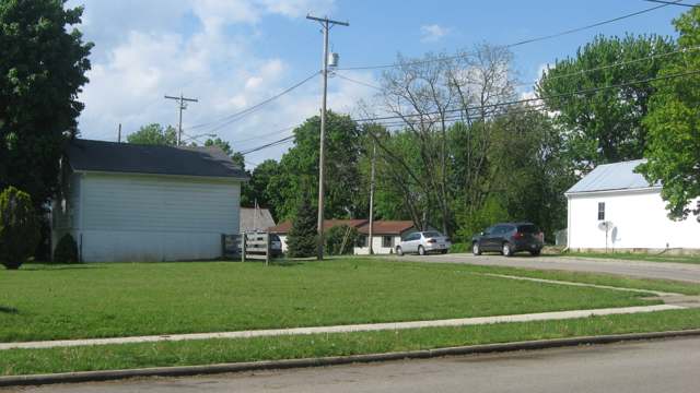
Photo: Nyttend, public domain · Wikimedia Commons
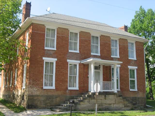
Photo: Nyttend, public domain · Wikimedia Commons
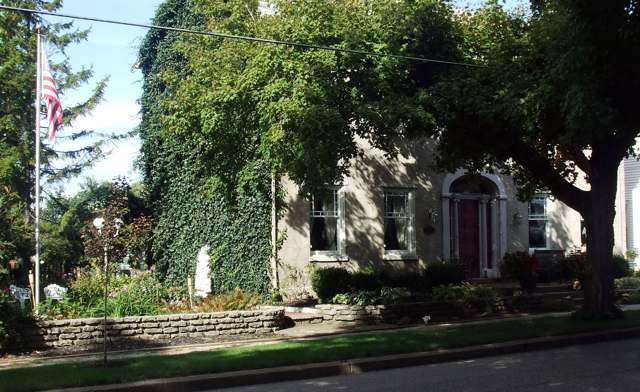
Photo: Sadpine, via Wikimedia Commons, CC BY-SA 3.0 · Wikimedia Commons
Local history sources: archive.org · archive.org · en.wikipedia.org · en.wikipedia.org · en.wikipedia.org · commons.wikimedia.org · commons.wikimedia.org · commons.wikimedia.org
Historic places
1 place in Richland Township, Fairfield County on the National Register of Historic Places. Press a pin or a name for its whole record.
-
Ijams, Joseph, HouseBuilding · West Rushville · listed 1983
- Address
- Broad and Main Sts.
- Where
- West Rushville, Fairfield County · ZIP 43130
- What it is
- Building
- Listed on the National Register
- 1983
- NRIS reference number
- 83001965
- Coordinates
- 39.76358, -82.45988
National Register file (NPS) ↗ Search Wikipedia ↗ Street map and directions ↗ On the Cracked Buckeye map
Source: National Park Service, National Register of Historic Places point file. The listing year is shown where NPS's certification date agrees with the listing's reference number. Listing recognizes significance; it does not restrict a private owner.
Water
Mostly private wells The water here
- Pleasantville Village23% of residentsGroundwater wells (3 wells)
- Thornville, Village Of20% of residentsGroundwater wells (2 wells)
- Northern Perry Co.water #119% of residentsGroundwater wells (2 wells)
- Rushville Village19% of residentsGroundwater wells (4 wells)
- Buckeye Lake, Village Of13% of residentsGroundwater wells (4 wells)
- Licking County Harbor Hills6% of residentsGroundwater wells (4 wells)
- Roberts Trailer Park0% of residentsGroundwater wells (1 wells)
Hospitals, fire stations and more
Inside Richland Township, Fairfield County's boundary: 2 high-hazard dams, 2 public schools, 1 poor-rated bridge, 1 Superfund site and 1 spill case. Press a pin or a name for its whole record and its source.
High-hazard dams (2)
-
Rushcreek Structure No. Vi-ALittle Rush Creek · condition: fair
- Hazard class
- High: a failure would probably cost a life
- Condition
- Fair (assessed 04/12/2022)
- River or stream
- Little Rush Creek
- Purpose
- Flood Risk Reduction;Recreation
- Type
- Earth
- Height
- 58 ft
- Storage
- 15,386 acre-feet
- Completed
- 1982
- Owner type
- Local Government
- County
- Fairfield County
- Nearest town (NID)
- Rushville
- Last inspection
- 04/12/2022
- Emergency action plan
- No
- NID ID
- OH01564
National Inventory of Dams record ↗ National Inventory of Dams (source) ↗ Street map and directions ↗
-
Rushcreek Structure No. Vi-DIndian Creek · condition: satisfactory
- Hazard class
- High: a failure would probably cost a life
- Condition
- Satisfactory (assessed 04/12/2022)
- River or stream
- Indian Creek
- Purpose
- Flood Risk Reduction;Recreation
- Type
- Earth
- Height
- 52 ft
- Storage
- 2,150 acre-feet
- Completed
- 1975
- Owner type
- Local Government
- County
- Fairfield County
- Nearest town (NID)
- Oakthorpe
- Last inspection
- 04/12/2022
- Emergency action plan
- No
- NID ID
- OH01077
National Inventory of Dams record ↗ National Inventory of Dams (source) ↗ Street map and directions ↗
Source: U.S. Army Corps of Engineers National Inventory of Dams, August 2026. "High hazard" rates what a failure would cost downstream, not how likely one is; the condition is the state's assessment.
Public schools (2)
-
Fairfield Union High School4 of 5 stars · Lancaster
- Address
- 6675 Cincinnati Zanesville Rd, Lancaster, OH 43130
- School district
- Fairfield Union Local School District
- Kind (NCES)
- Regular School
- Students, 2023-24
- 561
- Teachers (full-time equivalent)
- 32
- Report card, 2025-26
- 4 of 5 stars
- Performance index
- 80.8%
- Four-year graduation rate
- 98.7%
- Ohio building IRN
- 011072
- NCES school ID
- 390468702682
NCES school record ↗ Ohio School Report Card ↗ Street map and directions ↗
-
Fairfield Union Rushville Middle School4.5 of 5 stars · Lancaster
- Address
- 6409 Cincinnati Zanesville Rd, Lancaster, OH 43130
- School district
- Fairfield Union Local School District
- Kind (NCES)
- Regular School
- Students, 2023-24
- 625
- Teachers (full-time equivalent)
- 35.5
- Report card, 2025-26
- 4.5 of 5 stars
- Performance index
- 80%
- Ohio building IRN
- 067991
- NCES school ID
- 390468702683
NCES school record ↗ Ohio School Report Card ↗ Street map and directions ↗
Source: NCES EDGE public school locations 2024-25 and Common Core of Data 2023-24 (type, students, teachers); Ohio School Report Cards 2025-26 (Department of Education and Workforce), matched by name within the district.
Bridges rated poor (1)
-
Ric-20 Rushville over Rush Cr & Conrail (cr 77Poor · built 1928
- Condition
- Poor: a deck, superstructure, substructure or culvert rated 4 or below on the 0 to 9 scale
- What it is
- Bridge
- Built
- 1928
- Length
- 46 ft
- Owner
- County
- Vehicles a day
- 244
- Coordinates
- 39.76392, -82.43965
National Bridge Inventory (source) ↗ Street map and directions ↗
Source: FHWA National Bridge Inventory 2025. "Poor" means one major part rated 4 or below on the 0 to 9 scale; it calls for repair, not closing, unless the state posts or closes the bridge.
Superfund sites (1)
-
Fairfield Union High School MercurySuperfund program · Lancaster
- Address
- 6401 State Route 22, Lancaster, OH 43130
- County
- Fairfield County
- Status
- Superfund program site, not on the National Priorities List
- EPA program ID
- OHN000510270
- EPA registry ID
- 110034191283
EPA facility record ↗ EPA Facility Registry Service (source) ↗ Street map and directions ↗
Source: EPA Facility Registry Service, Superfund (SEMS) and National Priorities List sites. Many program sites were assessed and needed no cleanup.
Spills reported since 2021 (1)
-
Oil Crude Reached water2024-03-27 · Richland Twp
- Reported
- 2024-03-27
- What spilled
- Oil Crude
- Reached a waterway
- 99 - Unnamed
- Where
- Richland Twp, Fairfield County
- Ohio EPA district office
- CDO
- Ohio EPA case number
- 2403EPA0000476
Ohio EPA spill reports (source) ↗ Street map and directions ↗
Source: Ohio EPA emergency response spill reports, 2021 to September 2026, one point per case where Ohio EPA placed it. A report is what the caller or responder recorded; amounts are often blank or estimated.
Its ZIP codes
Each ZIP code that touches Richland Township, Fairfield County, with the share of its residents who live here and the same headline figures as the ZIP page.
| ZIP | Share | Water | Radon | Home value | Schools | Flood |
|---|---|---|---|---|---|---|
| 43150 Richland Township and Rushville | 39% | Mostly private wells | 8.3 pCi/L average radon | Median year built 1985 | Fairfield Union Local · 4.5 stars overall | 0.0% of residents in the 1% floodplain |
| 43148 Pleasantville | 6% | Mostly private wells | 7.0 pCi/L average radon | Median year built 1969 | Fairfield Union Local · 4.5 stars overall | 2.0% of residents in the 1% floodplain |
| 43076 Thorn Township and Thornville | 5% | Mostly private wells | 7.3 pCi/L average radon | Median year built 1983 | Northern Local · 3.5 stars overall | 0.6% of residents in the 1% floodplain |
Local government
Who holds office in Richland Township, Fairfield County, how its elections and ballot issues came out, and the state auditor's record.
Elections for office
| Date | Office | Candidates and votes |
|---|---|---|
| 2023-11-07 | Township Trustee | Ryan Young 626, 100.0% |
| 2023-11-07 | Township Fiscal Officer | Vicki Young 582, 100.0% |
Winners in bold. Results from the county board of elections' official canvass unless marked.
Auditor of State record
- No fiscal caution, watch or emergency on the Auditor of State's lists.
- Financial Audit, 2023 to 2024, released 2026-07-28
The county
Fairfield County: 13 ZIP codes, 27 cities, villages and townships, 144,692 people.
Nearby places
Quick answers
What county is Richland Township, Ohio in?
Richland Township, Fairfield County is a township in Fairfield County, Ohio, with 1,837 residents.
When was Richland Township, Ohio founded?
Richland Township, Fairfield County was settled 1798-1800 (Edward Murphy, wintering 1798-99, permanently from 1800). Source
How did Richland Township, Ohio get its name?
Richland Township was so named, according to the 1883 and 1912 county histories, because of the richness and fertility of its soil. Source
What ZIP code is Richland Township, Ohio?
Richland Township, Fairfield County is served by ZIP codes 43150, 43148 and 43076; 43150 holds the largest share of its residents.
Where does Richland Township, Ohio get its water?
The main water source for Richland Township, Fairfield County (Pleasantville Village): Mostly private wells.
Cite this page
Cite this page as:
Cracked Buckeye, "Richland Township, Fairfield County", https://crackedbuckeye.com/place/richland-township-fairfield-county/, built 2026-10-31, accessed [date].
How to cite · Report a correction · Built 2026-10-31
