How West Rushville began
West Rushville stands on the west bank of Little Rush Creek, a mile from its twin village of Rushville across the water, in a stretch of Richland Township that an early Indian encampment and log fort once occupied before white settlement. The 1883 county history dates its platting to about 1815, though a post office under the name West Rushville was not established until the 1840s; either way, the village grew on the same tobacco trade and Zane's Trace travel that built its neighbor. Its two best-documented landmarks are the Joseph Ijams House, a brick Federal-style tavern built around 1810 at the village crossroads, and the Dilger Store, an 1867 general store and Odd Fellows lodge that stood at the same crossroads until sometime before 2013. Today it is a village of about 165 people.
Settled the eastern part of Richland Township, including this ground, was settled from about 1802 by families including the Sains, Turners, Plummers, Ijamses and Koutzes, who came from Maryland, platted about 1815, according to the 1883 county history, which names the founder "John Gams" (a spelling not corroborated elsewhere and possibly a rendering of another surname); a post office named West Rushville was established in the early 1840s, by "John Gams" per the 1883 county history.
Where the name comes from
The village is named for its position on the west bank of Little Rush Creek, the stream that separates it from Rushville, its twin village a mile to the east.
Before the town
For several years after Richland Township's first white settlement, an Indian encampment stood near the site of West Rushville. Its residents had built a rude log fort there, around which they raised their habitations, and the 1883 county history describes them as "of a peaceable and friendly disposition," rarely troubling the settlers and frequently trading venison and bear meat for cornmeal and hominy at pioneer homes. No source names which nation held this camp. Fairfield County's documented historic-era occupants were the Wyandot, whose principal town, Tarhe Town, stood on the Hocking River at Lancaster until the 1795 Treaty of Greenville ceded the valley; most withdrew toward the Sandusky River afterward, though the county history notes some lingered near old hunting grounds for a time. No prehistoric mound or earthwork is recorded for this part of Richland Township in the sources consulted.
Nations recorded here: Wyandot.
- Indian encampment and log fort (camp) — near the village of West Rushville, Richland Township, documented in the years following the township's first white settlement (from 1798); nation not named in the source (archive.org)
Timeline
- — Zane's Trace is completed through the site, giving West Rushville its road.
- — Phillip Sain, with families of Turners, Plummers, Ijamses and Koutzes, come from Maryland and take up government land in the eastern part of Richland Township.
- — The Rush Creek Presbyterian Church is organized by the Reverend John Wright of Lancaster, meeting first in a log building about two and a half miles south of the later village, on the Thompson farm.
- — Joseph Ijams builds a brick Federal-style house at the village crossroads, later known as "The Old Tavern," serving travelers on the Zanesville-to-Lancaster road.
- — West Rushville is laid out, according to the 1883 county history.
- — The Rush Creek Presbyterian congregation moves into a newly built brick church in West Rushville itself, after its original log church two miles south is abandoned.
- — The Methodist Episcopal Church of West Rushville is organized, an outgrowth of camp meetings held in the nearby Stevenson settlement.
- — A post office is established at West Rushville, with George Young as first postmaster; other sources place the post office's establishment in 1842.
- — Philo Lodge No. 392 of the Independent Order of Odd Fellows is organized in West Rushville.
- — The Dilger Store is built at the northwest corner of Main and Broad Streets, later housing the post office, an Odd Fellows lodge hall on its second floor, and tobacco storage in its attic.
- — West Rushville has about 175 residents, two dry goods stores, a hotel, a schoolhouse, and Presbyterian and Methodist churches.
- — The Dilger Store remains in the same family's hands for a full century.
- — The Joseph Ijams House is listed on the National Register of Historic Places.
- — The Dilger Store is listed on the National Register of Historic Places.
- — The Dilger Store building is demolished; a Wikimedia Commons photograph from May 2013 already shows an empty lot at the site, though it remains listed on the National Register.
- — West Rushville's population is recorded as 166.
Stories
The Old Tavern at the Crossroads
Joseph Ijams built his brick house at the center of West Rushville around 1810, at the crossing of Main and Broad Streets, in a plain Federal style that has changed little in the two centuries since. It stood on the road between Zanesville and Lancaster, the same corridor that had been Zane's Trace a decade earlier, and it served travelers as an inn known locally as "The Old Tavern" -- one of the last of the many taverns that once lined this heavily used route through Fairfield County still standing. Ijams himself became one of Richland Township's principal tobacco dealers, buying and shipping the crop that was the area's main cash product in its first decades of settlement; the house he built passed later to Judge William McClung, one of the township's most prominent early citizens, and was added to the National Register of Historic Places in 1983.
A Store That Held a Whole Village's Business
When it was built in 1867 at West Rushville's only crossroads, the Dilger Store was general store, post office and lodge hall all under one roof: a two-story frame building with a full basement, its ground floor stocked with dry goods for the town and surrounding farms, its attic used for years to store locally grown tobacco before shipment to Kentucky and Maryland -- the smell, by one account, still detectable generations later. The Odd Fellows met on the second floor, complete with a stage for lodge ceremonies, and the same family ran the store from 1882 until 1982, a full century of continuous ownership. It was listed on the National Register of Historic Places in 1985 for its nearly unaltered nineteenth-century storefront, original shelving and gas fixtures, but the building did not survive to see its own historic designation protect it for long: a 2013 photograph already shows nothing left on the lot but bare ground, though the site remains on the National Register to this day.
A Log Fort Before the Village
Before West Rushville had a name, a Native encampment already stood on or near its ground, its people having built a rude log fort and clustered their homes around it. The 1883 county history, drawing on the memory of Richland Township's oldest settlers, describes them as peaceable neighbors who visited pioneer cabins to trade venison and bear meat for cornmeal and hominy, and who rarely gave the newcomers any trouble. No source names which nation lived there, or says when the encampment was finally abandoned, only that it existed "for several years after the first settlement" of the township -- a reminder that the crossroads where Joseph Ijams later built his tavern had already been a meeting place for a very different kind of traveler.
Photographs
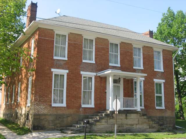
Photo: Nyttend, via Wikimedia Commons, public domain · Wikimedia Commons
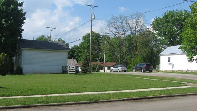
Photo: Nyttend, via Wikimedia Commons, public domain · Wikimedia Commons
Local history sources: archive.org · archive.org · en.wikipedia.org · en.wikipedia.org · en.wikipedia.org · historic-structures.com · en.wikipedia.org · commons.wikimedia.org · commons.wikimedia.org
Water
Mostly private wells The water here
- Rushville Village100% of residentsGroundwater wells (4 wells)
Its ZIP codes
Each ZIP code that touches West Rushville, with the share of its residents who live here and the same headline figures as the ZIP page.
| ZIP | Share | Water | Radon | Home value | Schools | Flood |
|---|---|---|---|---|---|---|
| 43150 Richland Township and Rushville | 7% | Mostly private wells | 8.3 pCi/L average radon | Median year built 1985 | Fairfield Union Local · 4 stars overall | 0.0% of residents in the 1% floodplain |
The county
Fairfield County: 13 ZIP codes, 27 cities, villages and townships, 144,692 people.
Nearby places
Cite this page
Cite this page as:
Cracked Buckeye (Open Shower Co), "West Rushville, Fairfield County", https://crackedbuckeye.com/place/west-rushville/, built 2026-09-16, accessed [date].
Machine-readable: /api/place/west-rushville.json (open JSON, CC BY 4.0 for the compilation; the underlying records keep their own terms) · How to cite · Report a correction · Built 2026-09-16