How Rushville began
Rushville was laid out by Joseph Turner in 1808 on Zane's Trace, Ohio's first federal road, at first under the name Clinton before it became East Rushville to distinguish it from its twin village a mile west across Rush Creek. Its position on the Trace made it a stopping point for westward travelers and a center of the local tobacco trade, and before the Civil War it was also a station on the Underground Railroad: the village's most famous native son, composer Benjamin Hanby, was born there in 1833 to a conductor on the network, and it was in Rushville that a freedom-seeker named Joe Selby died in 1842, his story of a fiancee sold away from him becoming the basis for Hanby's 1856 song "Darling Nelly Gray." The 33-acre Rushville Historic District, with 87 contributing buildings spanning the 1820s to the early 1900s, was listed on the National Register of Historic Places in 1980, and U.S. Route 22's modern bypass has left the village largely unchanged since. It remains a small Richland Township community of about 300 people.
Platted 1808, by Joseph Turner; first named Clinton, soon changed to East Rushville, by Joseph Turner.
Where the name comes from
The village is named for Little Rush Creek, which runs between Rushville and West Rushville, a mile apart on opposite banks. No source consulted explains why the creek itself was called Rush Creek.
Before the town
No source names a Native village, camp, or named site within Rushville itself. The wider Richland Township record does include one unnamed site: for several years after the township's first white settlement, an Indian encampment stood near what became the neighboring village of West Rushville, its residents having built a log fort there and living, by the 1883 county history's account, on peaceable terms with the settlers, trading venison and bear meat for cornmeal. No source names which nation held this camp; it is treated in fuller detail in the West Rushville village file. More broadly, Fairfield County's documented historic-era occupants were the Wyandot, whose principal town, Tarhe Town, stood on the Hocking River at Lancaster until the 1795 Treaty of Greenville ceded the valley and most of the nation withdrew toward the Sandusky River.
Nations recorded here: Wyandot.
Timeline
- — Zane's Trace, the first federal road in Ohio, is completed from Wheeling to Limestone, Kentucky, passing through the future site of Rushville.
- — Joseph Turner lays out the village, first named Clinton and soon changed to East Rushville, on the line of Zane's Trace.
- — Moses Plummer builds Richland Township's first grist mill, of unhewn logs, near the bridge over Rush Creek between the two Rushvilles.
- — The first church in Richland Township, a small Methodist log building, is erected on section 28; the congregation is transferred to East Rushville about 1831.
- — Benjamin Russell Hanby, later a composer and songwriter, is born in Rushville, the oldest of eight children of the Reverend (later Bishop) William Hanby, who ran an Underground Railroad station from his home there.
- — Zane's Trace through the township is turnpiked as the Zanesville and Maysville Turnpike.
- — Joe Selby, a freedom-seeker who had fled slavery in Kentucky, dies in Rushville within days of arriving, under the care of Dr. Simon Hyde, after his intended bride, Nelly Gray, had been sold away from him.
- — Rushville Lodge No. 211 of Free and Accepted Masons is instituted at East Rushville.
- — Benjamin Hanby writes "Darling Nelly Gray," an anti-slavery ballad based on Joe Selby's story, at the Hanby family home.
- — The Ohio Central Railroad is completed through Richland Township, running north to south midway between East and West Rushville.
- — East Rushville has a population of about 200, with two dry goods stores, a drug store, three groceries, a hotel, a harness shop, two blacksmith shops and two physicians.
- — The 33-acre Rushville Historic District, with 87 contributing buildings, is listed on the National Register of Historic Places.
- — Descendants of the Hanby family gather in Rushville for the dedication of a memorial marker in Pleasant Hill Cemetery to Joe Selby and seven other unnamed freedom-seekers buried there.
- — An Ohio historical marker recognizing Rushville's role in the Underground Railroad is dedicated in the village.
- — Rushville's population is recorded as 304.
Stories
Darling Nelly Gray
Sometime around 1842, a freedom-seeker named Joe Selby reached Rushville after fleeing slavery in Kentucky, making his way, as fugitives on this stretch of the Underground Railroad did, to the home of the Reverend William Hanby, a United Brethren preacher who ran a station there. Selby was gravely ill, and Dr. Simon Hyde, whose own house still stands in the village, could not save him; before he died he told the Hanby family about Nelly Gray, the woman he had meant to marry, who had been sold away from him to Georgia the day before their wedding. William Hanby's son Benjamin, nine years old when Selby died and later a composer living in Westerville, turned the story into "Darling Nelly Gray," published in 1856 and sung across the North as one of the era's best-known anti-slavery ballads. Selby is buried in Rushville's Pleasant Hill Cemetery alongside at least seven other freedom-seekers whose names were never recorded; a marker naming him was dedicated there in 2019, and a further Ohio historical marker for the village's Underground Railroad history followed in 2025.
Two Names Before Breakfast
The village that became East Rushville was not called that when Joseph Turner first platted it in 1808. He named it Clinton, a common enough choice in the young republic, but the name did not last: with a second village, West Rushville, growing up a mile away across Rush Creek within a few years, the two settlements needed names that told them apart, and Turner's town became East Rushville instead. Both villages sat squarely on Zane's Trace, the road Ebenezer Zane had blazed from Wheeling to Limestone, Kentucky in 1797, and for decades the tobacco trade and the steady traffic of westward travelers gave both places a prosperity that outlasted the road's later demotion to a mere turnpike around 1840. William Coulson was East Rushville's principal tobacco dealer, buying and shipping the crop to eastern markets from a village whose name had already changed once before it was ten years old.
A Village the Highway Missed
When the state routed modern U.S. Route 22 around Rushville rather than through it, the bypass did what decades of railroads and turnpikes elsewhere in Fairfield County had not: it left a nineteenth-century village standing mostly still. The Rushville Historic District, 33 acres bounding Bremen Avenue, Main and Market Streets, holds 87 contributing buildings raised between the 1820s and the early 1900s in log, Federal, Gothic Revival, Italianate and Queen Anne styles, listed on the National Register of Historic Places in 1980. It is the same village where Joseph Turner's tobacco warehouses once stood, where Rushville Lodge No. 211 of the Masons met from 1852, and where the Hanby family's Underground Railroad work quietly continued for years without drawing the attention of the slaveholders whose property passed through on the very road the village was built to serve.
Photographs
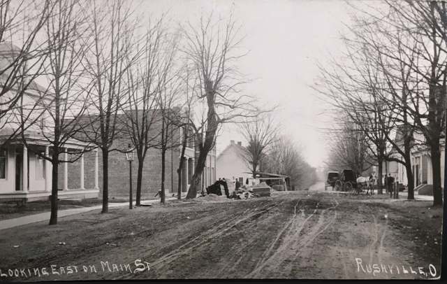
Photo: unknown publisher, via Wikimedia Commons, public domain · Wikimedia Commons
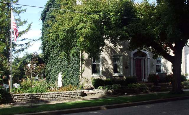
Photo: Sadpine, via Wikimedia Commons, CC BY-SA 3.0 · Wikimedia Commons
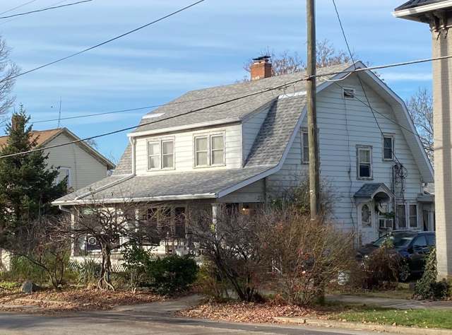
Photo: Zohoe, via Wikimedia Commons, CC BY-SA 4.0 · Wikimedia Commons
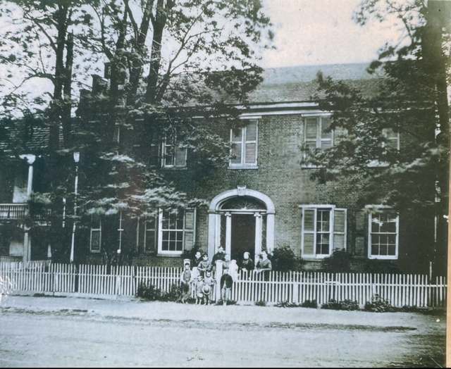
Photo: Zohoe, via Wikimedia Commons, CC BY-SA 4.0 · Wikimedia Commons
Local history sources: archive.org · archive.org · en.wikipedia.org · en.wikipedia.org · en.wikipedia.org · spectrumnews1.com · en.wikipedia.org · commons.wikimedia.org · commons.wikimedia.org · commons.wikimedia.org · commons.wikimedia.org
Water
Mostly private wells The water here
- Rushville Village100% of residentsGroundwater wells (4 wells)
Its ZIP codes
Each ZIP code that touches Rushville, with the share of its residents who live here and the same headline figures as the ZIP page.
| ZIP | Share | Water | Radon | Home value | Schools | Flood |
|---|---|---|---|---|---|---|
| 43150 Richland Township and Rushville | 13% | Mostly private wells | 8.3 pCi/L average radon | Median year built 1985 | Fairfield Union Local · 4 stars overall | 0.0% of residents in the 1% floodplain |
The county
Fairfield County: 13 ZIP codes, 27 cities, villages and townships, 144,692 people.
Nearby places
Cite this page
Cite this page as:
Cracked Buckeye (Open Shower Co), "Rushville, Fairfield County", https://crackedbuckeye.com/place/rushville/, built 2026-09-16, accessed [date].
Machine-readable: /api/place/rushville.json (open JSON, CC BY 4.0 for the compilation; the underlying records keep their own terms) · How to cite · Report a correction · Built 2026-09-16