How Reynoldsburg began
Reynoldsburg grew up on the Cumberland (National) Road in Truro Township, where storekeeper James C. Reynolds persuaded landowner John French to plat a village on his farm in 1831; the plat was registered that November and, despite French's own preference for ‘French Town,’ was officially listed as ‘Reynoldsburgh’ by 1832, for the merchant whose store anchored it. The Crawford family, the area's first known settlers, had arrived by 1802, and the village was incorporated in 1839, becoming a city in 1960. It is known today as the birthplace of the modern tomato: horticulturist Alexander W. Livingston spent two decades stabilizing the wild tomato on his Graham Road farm and released the first commercially successful variety, the Paragon, in 1870, a legacy the city has marked with a Tomato Festival every August since 1965. Though the atlas files Reynoldsburg under Franklin County, where most of its roughly 41,000 residents live, the city's own boundary also crosses into Fairfield County — where Blacklick Creek briefly leaves and re-enters Franklin County through the city's southwest side — and into Licking County to the east, making it, by its own city history, the first Franklin County city to expand into two neighboring counties.
Settled 1802, platted 1831, incorporated 1839, by John French (platted the village on his farmland); James C. Reynolds, the storekeeper it was named for, persuaded him to do it.
Where the name comes from
Reynoldsburg is named for James C. Reynolds (1806-1854), a merchant who arrived around 1831, boarded with landowner John French, and opened a store supplying whiskey, molasses, calico and work clothes to the crews building the National Road through Truro Township. French, on whose farmland the village was platted, is remembered locally as having wanted to call it ‘French Town’ (Ohio Town Names gives the one-word ‘Frenchtown’) after his own family. Instead, when the plat was officially listed the following year, it appeared as ‘Reynoldsburgh’ — possibly, the Reynoldsburg-Truro Historical Society suggests, simply because mail for the settlement was being delivered to Reynolds's store. The post office opened under that spelling in 1833; Wikipedia, citing postal records, dates the change to the modern spelling ‘Reynoldsburg’ to 1893.
Before the town
No named Wyandot, Shawnee, Lenape (Delaware), Mingo or Miami village, camp or burial ground within Reynoldsburg's own footprint turned up in the sources checked; for the broader county-level record — the Adena and Hopewell mound builders, the historic nations who held and hunted the Scioto valley, the 1795 Treaty of Greenville that ceded this ground, and the Mingo village at the forks of the Scioto and Olentangy — see the Franklin County file. What is recorded locally is thinner but specific to place. Blacklick Creek, which still forms Reynoldsburg's western and southern edge (and briefly crosses into Fairfield County on the city's southwest side), carries a name that Wikipedia's sourced account traces to Native observation: settlers were told the creek was named for the way animals were seen licking its black-colored, salt-bearing rocks. Main Street through town, later the National Road and today US 40, is described by the Reynoldsburg-Truro Historical Society as having begun as 'an animal and Indian trail,' corduroyed with logs and posts by arriving settlers before the National Road was built over it in 1831; no source names the trail or the people who used it. An 1885 manuscript history of the village by local resident David Graham, written while people who remembered the 1820s and 1830s were still living, records that early settlers found a Native sugar camp on the ground where the village later stood, and that a grave marked with poles — still visible as late as 1817, by his account — held a man remembered locally as having died there in an accident while sugaring; Graham does not name a nation or give a firm date. The same account describes several small mounds and earthwork 'forts' that could still be traced around Reynoldsburg in 1885: one about ten feet high near the southeast corner of the village corporation line; a square earthwork, twenty-eight to thirty rods on a side, on Ed. Parkison's farm northwest of town; a circular earthwork sixty to seventy feet around, a half-mile south of the village on the old Lancaster road; and a larger earthwork, its walls ten to fifteen feet above a ten-to-twelve-foot ditch, about two and a half miles northeast toward Jefferson Township. None were mapped or excavated by a trained archaeologist so far as the sources checked record, most had already been plowed down by the time Graham wrote, and no source ties any of them to a specific culture or people — they are noted here as Graham recorded them, not as confirmed sites. Truro Township itself, which Reynoldsburg grew up in, lay within the Refugee Tract, land Congress began setting aside in 1801 for Canadians and Nova Scotians who had aided the American cause in the Revolutionary War and lost their homes for it; the township took its own name from Truro, Nova Scotia, the hometown of early settler families such as the Taylors. The tract, and all of what became Franklin County, lay inside the much larger cession the United States took from the Wyandot, Shawnee, Lenape, Miami, Ottawa and other nations at the Treaty of Greenville in 1795.
- Blacklick Creek salt lick (other) — Blacklick Creek, Reynoldsburg's western and southern city boundary, undated, before white settlement (en.wikipedia.org)
- Trail under Main Street (later the National Road) (trail) — Main Street through Reynoldsburg, later the National Road / US 40, pre-1831 (rths.info)
- Sugar camp and grave (camp) — on the ground where the village of Reynoldsburg was later built, undated, before 1802 (genealogytrails.com)
- Mound near the southeast corporation line (mound) — southeast edge of the old Reynoldsburg village corporation, undated (precontact) (genealogytrails.com)
- Square earthwork on the Parkison farm (earthwork) — Ed. Parkison's farm, northwest of Reynoldsburg, undated (precontact) (genealogytrails.com)
- Circular earthwork on the old Lancaster road (earthwork) — half a mile south of Reynoldsburg, west side of the old Lancaster road, undated (precontact) (genealogytrails.com)
- Earthwork toward Jefferson Township (earthwork) — about 2.5 miles northeast of Reynoldsburg, on the former Dr. Lunn farm, undated (precontact) (genealogytrails.com)
Timeline
- — James and Martha Crawford (given as 'Margaret' in some secondary accounts) become the first known pioneer family in the area that becomes Reynoldsburg; their daughter Margaret later marries early settler James Graham.
- — John and Jane French settle in the fall on land along the future National Road route, in what is still known locally as 'Old Reynoldsburg.'
- — Storekeeper James C. Reynolds persuades John French to plat his farmland into a village (registered November 1831); by August 1832 it is officially listed as 'Reynoldsburgh' rather than French's preferred 'French Town,' and a post office under that name opens in 1833 with Reynolds as postmaster.
- — Reynoldsburg is incorporated as a village on March 16.
- — Reynoldsburg reaches its greatest prosperity as a National Road stopover, by the account of the 1880 Franklin County history.
- — The Baltimore & Ohio Railroad is built through the area on a route that bypasses the village, and the wagon and stagecoach trade that had built Reynoldsburg's National Road businesses drains away.
- — Cabinetmaker Nathan Orcutt builds Alexander W. Livingston's house at what is now 1792 Graham Road, its foundation cut from William Forrester's local freestone quarry.
- — The Reynoldsburg Union Academy opens under Dr. Darlington J. Snyder, drawing tuition-paying students from other counties and states and becoming Franklin County's major public high school of the era.
- — Alexander W. Livingston introduces the Paragon, selected and crossed from many varieties on his Buckeye Farm — the first tomato variety bred and stabilized for commercial sale.
- — The village's name is officially respelled from 'Reynoldsburgh' to 'Reynoldsburg.'
- — Alexander W. Livingston dies November 11 and is buried in Greenlawn Cemetery, Columbus.
- — Columbus dedicates Hoover Dam on Big Walnut Creek; the reservoir it impounds now feeds the Hap Cremean treatment plant that supplies most of Reynoldsburg's tap water.
- — Reynoldsburg is granted city status.
- — The Franklin County Historical Society designates Reynoldsburg 'The Home of the Tomato,' the city and society erect a marker, and the first Tomato Festival (originally called the Tomato Fair) is held.
- — The Alexander W. Livingston House is listed on the National Register of Historic Places, reference number 94000593, on June 17.
Stories
The Store That Named a Village
In 1831 James C. Reynolds, a young merchant boarding with landowner John French, opened a sutler's store to sell work clothes, whiskey, molasses and calico to the gangs building the Cumberland Road — the National Road — through Truro Township. The store became the neighborhood's gathering place, and Reynolds persuaded French to have his farmland surveyed and platted into a village, registered that November. French, by local tradition, wanted to name the new village after his own family, 'French Town,' but when the plat was officially recorded the following year it was listed instead as 'Reynoldsburgh' — quite possibly, the Reynoldsburg-Truro Historical Society suggests, because mail for the settlement was simply being delivered to Reynolds's store. Reynolds went on to serve as the village's first postmaster and justice of the peace, was elected a Brigadier General in the Ohio Militia and a state representative, and died of complications from malaria in 1854.
The Ark and the Underground Railroad
The Underground Railroad ran through Reynoldsburg from about 1840 until the spring of 1865, carried along one of its regular routes: out old Friend (now Main) Street from Columbus, through Reynoldsburg, and twenty miles northeast to Granville. James C. Reynolds's own general store, a log building put up in 1839-1840 on what is now East Main Street, hid a cellar chamber about seven by fifteen feet with airholes on three sides and a trapdoor; the best-remembered station was the David Graham house, where later residents told of digging noises in the cellar and voices in the hallway at night. Alexander W. Livingston — the same man who would later stabilize the tomato — kept a long, bench-lined covered wagon called the Ark, and his employee Ben Patterson (1836-1914) drove it loaded with freedom seekers north to Granville or the many miles to Mt. Vernon, a trip that took a full night. Carpenter Harrison 'Hack' Long hid people in his own house, its living-room floor raised about five feet above ground on a brick wall reached by an outside stair. No single record dates when this network began in Reynoldsburg, but those who took the risk — merchants, carpenters, farmers, several of them elders of the town's Presbyterian and Seceder churches — left enough traces, remembered by name, that the Reynoldsburg-Truro Historical Society could still reconstruct the routes and stations a century and a half later.
From Wild Tomato to Paragon
Alexander W. Livingston was born in 1821 (his own 1965 memorial marker gives October 14, 1821; the city's history page gives 1822) and grew up around his family's farm near Reynoldsburg, at a time when tomatoes were still small, ribbed, hard-cored and often nearly hollow — barely resembling the fruit sold today. Working seed by seed on his own ground, Livingston selected and crossed varieties for uniform roundness, size and flavor for two decades before he had anything worth selling. In 1870 he introduced the Paragon, grown in a field of many varieties on his 'Buckeye Farm' at what is now 1792 Graham Road — the first tomato variety bred and stabilized specifically for commercial sale. He followed it with more than a dozen others, including the purple Acme and yellow Golden Queen, built the seed company that became A. W. Livingston's Sons, and by the U.S. Department of Agriculture's own later reckoning, he and his sons were responsible for roughly half of the major American tomato varieties grown by the early 20th century. Livingston died November 11, 1898, and is buried in Greenlawn Cemetery in Columbus; in 1965 the Franklin County Historical Society made the connection official, naming Reynoldsburg 'The Home of the Tomato' and launching the Tomato Festival the city still holds every August.
Boom on the National Road, Bypassed by the Rails
For about fifteen years Reynoldsburg rode the National Road's traffic to real prosperity: within six years of the construction crews passing through, the young village had four taverns, two churches, a school, a post office and two more platted additions, and the 1880 county history recalled the town's best years as falling around 1846 or 1847. Then the railroads came. When the Baltimore and Ohio Railroad was built through the area in 1853, it ran on its own route rather than through the village, and the wagon and stagecoach trade that had built Reynoldsburg's taverns, stores and blacksmith shops drained away with it. The county historian, writing in 1880, described a village that had settled into quieter farming and small industry — tile-making, a stone quarry, slaughterhouses — rather than recovering its National Road bustle. It would be Columbus's growth into a metropolis, not a railroad, that eventually brought Reynoldsburg's suburban-era growth in the 20th century, marked by the city status it was granted in 1960.
The Meetinghouse That Fell on Its Builders
Raising a meetinghouse by hand was dangerous work, and Reynoldsburg's Presbyterian congregation learned that firsthand when a supporting beam gave way during construction of their church building. Joseph McCray took the worst of it, a blow to the head that left him with lasting memory trouble; a Mr. Sincebaugh and Mark Evans were also hurt, and Blythe Dixon carried visible scars from the accident for years afterward — still noticeable, the 1885 local history noted, as late as 1885. The congregation rebuilt anyway: their meetinghouse had already burned once, around 1860, one of at least ten Reynoldsburg buildings lost to fire over the young village's history, including a two-story dwelling valued at $1,500 and an earlier meetinghouse worth $2,000. Fire and falling beams aside, the church endured, one of half a dozen congregations — Baptist, Methodist, Universalist, Campbellite and the United Presbyterian (Seceder) church among them — that anchored the small village through the 19th century.
Photographs
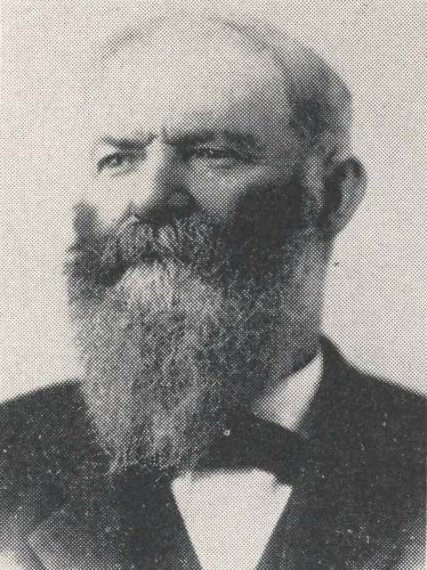
Photo: Franklin County Historical Society, published in Early Agriculture in Franklin County (1954); Columbus Metropolitan Library, no known copyright restrictions · Wikimedia Commons
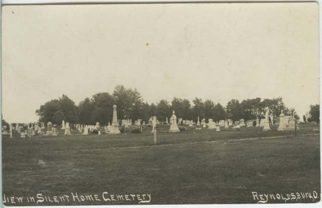
Photo: Columbus Metropolitan Library, Ohio Postcard Collection, no known copyright restrictions · Wikimedia Commons
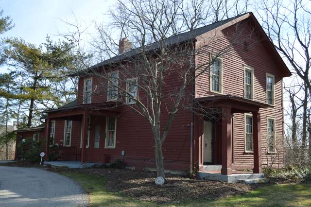
Photo: Nyttend, public domain · Wikimedia Commons
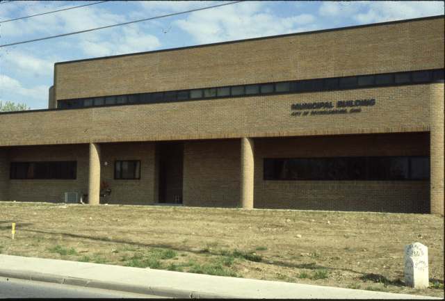
Photo: David E. Lucas, David Lucas Collection, Columbus Metropolitan Library, no known copyright restrictions · Wikimedia Commons
Local history sources: rths.info · reynoldsburg.gov · en.wikipedia.org · en.wikipedia.org · genealogytrails.com · ohiogenealogyexpress.com · en.wikipedia.org · en.wikipedia.org · wosu.org · hmdb.org · hmdb.org · hmdb.org · remarkableohio.org · en.wikipedia.org · en.wikipedia.org · npgallery.nps.gov · commons.wikimedia.org · digital-collections.columbuslibrary.org · digital-collections.columbuslibrary.org · digital-collections.columbuslibrary.org · en.wikipedia.org · en.wikipedia.org
Water
Big Walnut Creek at the plant's low-head dam and screen house on Morse Rd, below Hoover Dam The water here
- Reynoldsburg City68% of residentsScioto River (Griggs & O'Shaughnessy), Hoover Reservoir on Big Walnut Ck, plus wells
- Columbus Public Water System29% of residentsScioto River (Griggs & O'Shaughnessy), Hoover Reservoir on Big Walnut Ck, plus wells
- Licking Regional Water District3% of residentsRaccoon Creek Valley aquifer (local wells)
- Fairfield County Utilities0% of residentsLocal groundwater wells (central Ohio, aquifer undocumented)
- Jefferson Water and Sewer District0% of residentsLocal groundwater wells (Blacklick/eastern Franklin Co.)
Its ZIP codes
Each ZIP code that touches Reynoldsburg, with the share of its residents who live here and the same headline figures as the ZIP page.
| ZIP | Share | Water | Radon | Home value | Schools | Flood |
|---|---|---|---|---|---|---|
| 43068 Reynoldsburg | 68% | Big Walnut Creek at the plant's low-head dam and screen house on Morse Rd, below Hoover Dam | 5.8 pCi/L average radon | Median year built 1987 | Reynoldsburg City · 3 stars overall | 4.9% of residents in the 1% floodplain |
| 43004 Columbus and Blacklick | 1% | Big Walnut Creek at the plant's low-head dam and screen house on Morse Rd, below Hoover Dam | 6.0 pCi/L average radon | Median year built 2003 | Licking Heights Local · 4 stars overall | 1.2% of residents in the 1% floodplain |
The county
Franklin County: 45 ZIP codes, 42 cities, villages and townships, 1,356,733 people.
Nearby places
Cite this page
Cite this page as:
Cracked Buckeye (Open Shower Co), "Reynoldsburg, Franklin County", https://crackedbuckeye.com/place/reynoldsburg/, built 2026-09-16, accessed [date].
Machine-readable: /api/place/reynoldsburg.json (open JSON, CC BY 4.0 for the compilation; the underlying records keep their own terms) · How to cite · Report a correction · Built 2026-09-16