How Pleasant Township, Franklin County began
Pleasant Township, in the southwest corner of Franklin County along Big and Little Darby Creek, was first settled in the fall of 1799 by brothers Thomas and Elijah Chenoweth and organized as a township in 1807, before losing territory to the new Jackson (1815) and Prairie (1819) townships. It has stayed agricultural ever since, its two historic centers being Harrisburg, a Darby Creek crossroads platted in 1836 and known as Harrisburgh until 1893, and Georgesville, laid out in 1816 and largely vanished by 1880. The name follows a pattern common across Ohio, which has fifteen other Pleasant Townships, and no source found explains why this one chose it. Today the township is still mostly farmland, and includes part of Battelle Darby Creek Metro Park along the creek the Chenoweths settled beside.
Settled 1799, incorporated 1807, by Thomas and Elijah Chenoweth, brothers from Maryland who came by way of Pike County, Ohio, were the township's first settlers, arriving in the fall of 1799; the township itself was organized in 1807.
Where the name comes from
No source found explains why this particular township took the name Pleasant. It is one of fifteen townships named Pleasant in Ohio, a generic, favorable name common across the state's early townships; the 1880 county history describes the land itself only in practical terms, as fertile bottomland along the Darby creeks and clay upland good for corn and grain.
Before the town
The 1880 county history's account of Pleasant Township's settlement contains one telling but unelaborated line: as the Chenoweth brothers and their neighbors built cabins and cleared land after 1799, 'in time, the Indian neighbors were supplanted by the hardy backwood settlers.' No source found names which nation those neighbors belonged to, or any village, trail, or camp site specific to this township; broader county-level context, including the historic nations who lived in, hunted, or traveled this part of the Scioto valley, will be in the Franklin County file. This land lay south and east of the Greenville Treaty Line and so was ceded to the United States by the 1795 Treaty of Greenville, four years before the Chenoweths arrived. Earlier evidence does survive: the John Galbreath Mound, built by people of the Adena culture sometime between roughly 500 BC and AD 500, stands in Battelle Darby Creek Metro Park along Big Darby Creek, within or immediately adjoining the township. No excavation history or further detail on the mound was found in the sources checked.
Nations recorded here: Adena culture.
- John Galbreath Mound (mound) — Battelle Darby Creek Metro Park, Galloway, along Big Darby Creek, within or immediately adjoining Pleasant Township, Adena culture, roughly 500 BC – AD 500 (en.wikipedia.org)
Timeline
- — The Treaty of Greenville cedes this part of the Scioto valley, lying south and east of the treaty line, to the United States.
- — In the fall, brothers Thomas and Elijah Chenoweth, natives of Maryland who had lived in Pike County, Ohio, become the township's first settlers, each buying 200 acres in and north of the future village of Harrisburg and building log cabins.
- — On December 9, the first white child born in the township, a daughter of Elijah and Rachel Chenoweth, is born; she is named Cassandra.
- — Samuel Dyer builds the township's first grist-mill, later rebuilt and owned by the widow of William Dyer.
- — Pleasant Township is formally organized, at the time covering a much larger area than today; Samuel Kerr, John Smith, and others serve as its first justices of the peace.
- — In summer, Thomas Miller teaches the township's first known school, in a log cabin on Samuel Kerr's farm, to children of the Chenoweth, Kerr, and Foster families.
- — A post office named for the township opens in 1815; Georgesville is laid out the following year at the forks of Big and Little Darby Creek, and the post office is renamed for it.
- — Prairie Township is formed partly from Pleasant Township's territory (Jackson Township had already been cut off in 1815), reducing Pleasant to approximately its present limits.
- — A gristmill and sawmill are operating on Little Darby Creek in the northern part of the township, according to Wikipedia's sourced history.
- — In June, Joseph Chenoweth has surveyor Frederick Cole lay out the village later called Harrisburg, on the site of the existing Darby Cross Roads post office.
- — On March 24, George Geiger and William Foresman open the township's first store, in a small building in what is now Harrisburg.
- — Harrisburgh incorporates as a village; Dr. J. Helmick is elected its first mayor.
- — Dyer Chapel, a Methodist church attached to the California circuit, is built near Georgesville at a cost of $1,800.
- — On March 30, the village's post office spelling is officially shortened from Harrisburgh to Harrisburg.
- — The John Galbreath Mound is listed on the National Register of Historic Places on July 15.
Stories
The Chenoweth brothers break ground
In the fall of 1799, Thomas and Elijah Chenoweth, brothers who had come from Maryland by way of Pike County, Ohio, bought 200 acres apiece in and north of what would become Harrisburg and raised log cabins before winter closed in. Elijah's cabin stood at the foot of a hill near a spring, a short walk from where a son's house would later stand. The 1880 county historian, working from the memory of Elijah's son and namesake, the only Chenoweth still living in the township, recorded the pace of change in a single line: 'the Indian neighbors were supplanted by the hardy backwood settlers,' and log cabins gave way, in time, to substantial houses and broad fields of grain. The first white child born in the township, a daughter of Elijah and his wife Rachel, arrived on December 9, 1800, and the family's first marriages and first burials followed soon after, all on Chenoweth land.
Darby Cross Roads becomes Harrisburg, twice
Before it had its present name, the crossroads settlement in southern Pleasant Township was a post office called Darby Cross Roads. In June 1836, Joseph Chenoweth had surveyor Frederick Cole lay the site out as a proper village, and it took the name Harrisburgh, after Harrisburg, Pennsylvania. Its first tavern, built by John Morgan, was grandly named White Hall; by 1880 it had passed through several hosts and was known as the United States Hotel. The village incorporated in 1851 with Dr. J. Helmick as its first mayor, and by then had stores, a doctor, shoe and wagon shops, and a cornet band of ten musicians. The spelling only became 'Harrisburg,' as it is today, when the post office department officially dropped the final 'h' on March 30, 1893.
Georgesville, a village that mostly disappeared
Georgesville was laid out in 1816 near where Big and Little Darby Creek meet, a site earlier settlers had simply called the forks of the Darby. It was substantial enough in its early years to take over the township post office from Harrisburgh's predecessor and to support a store and a school. By the time the 1880 county history was written, though, its author could report that 'there is no vestige of a village on the opposite side of Darby creek' any longer; what remained was a separate little hamlet at the nearby railroad station, called J. L. Moore's Addition or New Georgesville, with a general store and a grocery. Dyer Chapel, a Methodist church built in 1875, stood in this later settlement. It is a small, concrete example of the kind of platted village that Ohio's nineteenth century produced by the dozen and then, just as often, let go.
Mills on the Darby
Water power shaped where people settled and what they could grow here. Samuel Dyer built the township's first grist-mill in 1805, on a site that was rebuilt at least once and was still running, owned by his son William's widow, when the county history was written in 1880. Roughly fifteen years before that, around the mid-1860s, Thomas Chenoweth put up a second flouring mill on Darby Creek. Wikipedia's sourced history adds a third data point: a gristmill and sawmill operating on Little Darby Creek in the township's northern end as early as 1833. Between these and the 'numerous,' mostly small, sawmills the 1880 account mentions in passing, Pleasant Township's Darby creeks did the same work nearly every early Ohio farm township's streams did, turning timber into lumber and grain into flour close to where both were grown.
Photographs
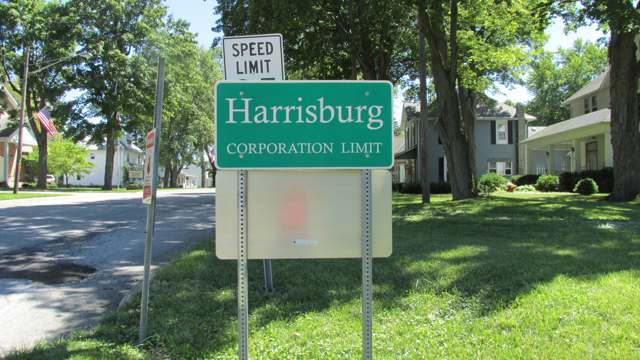
Photo: Aesopposea, CC BY-SA 3.0 · Wikimedia Commons
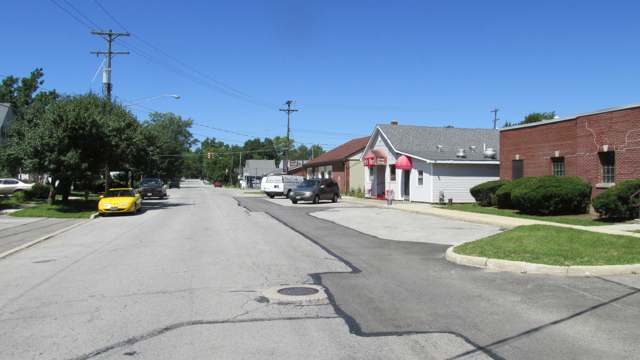
Photo: Aesopposea, CC BY-SA 3.0 · Wikimedia Commons
Local history sources: archive.org · en.wikipedia.org · en.wikipedia.org · en.wikipedia.org · en.wikipedia.org · commons.wikimedia.org · commons.wikimedia.org
Water
Mostly private wells The water here
- Columbus Public Water System92% of residentsScioto River (Griggs & O'Shaughnessy), Hoover Reservoir on Big Walnut Ck, plus wells
- Mid-ohio WSD - Chrisman Avenue WTP4% of residentsLocal glacial sand-and-gravel wells (Madison County)
- Aqua Ohio - Lake Darby1% of residentsGroundwater wells (2 wells)
- Oak Hills Mobile Home Park1% of residentsGroundwater wells (2 wells)
- Choctaw Utilities, Inc.1% of residentsGroundwater wells (3 wells)
- Commercial Point Village1% of residentsGroundwater wells (6 wells)
- Village of Orient0% of residentsGroundwater wells (7 wells)
- Monterey Care Center0% of residentsScioto River (Griggs & O'Shaughnessy), Hoover Reservoir on Big Walnut Ck, plus wells
- Darbyville Village0% of residentsGroundwater wells (3 wells)
- Johnson Mobile Home Park0% of residentsGroundwater wells (2 wells)
- Timberlake Water System0% of residentsGroundwater wells (2 wells)
- Green Meadows Mobile Home Park0% of residentsGroundwater wells (2 wells)
- Greentree Mobile Home Park0% of residentsGroundwater wells (1 wells)
Its ZIP codes
Each ZIP code that touches Pleasant Township, Franklin County, with the share of its residents who live here and the same headline figures as the ZIP page.
| ZIP | Share | Water | Radon | Home value | Schools | Flood |
|---|---|---|---|---|---|---|
| 43146 Scioto Township and Orient | 11% | Mostly private wells | 8.0 pCi/L average radon | Median year built 1988 | Teays Valley Local · 4 stars overall | 1.4% of residents in the 1% floodplain |
| 43123 Grove City | 7% | Scioto River intake at the plant on Dublin Rd, a few miles below Griggs Dam, opposite Marble Cliff | 6.9 pCi/L average radon | Median year built 1995 | South-Western City · 3 stars overall | 3.0% of residents in the 1% floodplain |
| 43140 London | 2% | Local glacial sand-and-gravel wells (Madison County) | 7.3 pCi/L average radon | Median year built 1974 | London City · 3.5 stars overall | 3.2% of residents in the 1% floodplain |
| 43119 Columbus and Galloway | 1% | Scioto River intake at the plant on Dublin Rd, a few miles below Griggs Dam, opposite Marble Cliff | 6.0 pCi/L average radon | Median year built 1996 | South-Western City · 3 stars overall | 2.1% of residents in the 1% floodplain |
The county
Franklin County: 45 ZIP codes, 42 cities, villages and townships, 1,356,733 people.
Nearby places
Cite this page
Cite this page as:
Cracked Buckeye (Open Shower Co), "Pleasant Township, Franklin County", https://crackedbuckeye.com/place/pleasant-township-franklin-county/, built 2026-09-16, accessed [date].
Machine-readable: /api/place/pleasant-township-franklin-county.json (open JSON, CC BY 4.0 for the compilation; the underlying records keep their own terms) · How to cite · Report a correction · Built 2026-09-16