Local events in Prairie Township, Franklin County
Nothing is posted yet for this township in the calendars we watch. What we watch, and what is on nearby
Know a calendar we should watch? Send the link
Checked October 20; the events page is refreshed daily.
How Prairie Township, Franklin County began
Prairie Township took its name from the tall grasses that once covered its level, poorly-drained ground along Darby Creek — reportedly tall enough to hide all but the head of a man on horseback. It was organized under that name in 1819, its bounds then reaching farther north than today, into what later became Brown Township. Settlement began around 1800 with a handful of families and grew through scattered mill hamlets — Alton on the new National Road in 1836, Rome (later New Rome) the same year, Galloway in 1861 — rather than any single town. In the twentieth century the insurance-company-built planned community of Lincoln Village and the notorious governance collapse of tiny New Rome, dissolved by the state in 2004, became the township's best-known modern chapters.
Settled c. 1800, incorporated 1819, by organized under its present name; bounds then extended farther north into present-day Brown Township.
Where the name comes from
The township was named for the tall prairie grasses that covered much of its level ground before settlement and drainage; local accounts recorded by the Southwest Franklin County Historical Society and repeated on Wikipedia describe the grass as tall enough to hide all but the head of a man riding a horse through it. Ohio has only one other Prairie Township, in Holmes County, in the state's hill country, which underscores how distinctive this stretch of flat, grass-covered ground was on the west side of Franklin County.
Before the town
Before settlement, Shawnee and Wyandot people hunted game and fished in the township's streams, especially Darby Creek and a smaller stream called Hell Branch, according to the Southwest Franklin County Historical Society. One compiled list of historic Ohio Indian villages places a Huron (Wyandot) village on the upper reaches of Darby Creek, roughly midway between present-day Columbus and Marysville — north and west of the township, in the same Darby Creek watershed the township's earliest settlers used. No source found names a specific mound, camp, burial site, or trail within Prairie Township's own boundaries, and the township's 1880 and 1858 county history chapters, which describe its first settler families in some detail, do not mention Native people at all.
Nations recorded here: Shawnee, Wyandot.
- Huron (Wyandot) village on upper Darby Creek (village) — upper Darby Creek, roughly midway between present Columbus and Marysville, before Ohio settlement (accessgenealogy.com)
Timeline
- — Samuel Higgins, Shadrick Postle and William Mannon are among the first settlers of the area that became Prairie Township.
- — Joseph Hickman, a Virginia-born Revolutionary War soldier, comes to Ohio and settles first at Franklinton before later moving into Prairie Township.
- — Henry and Katharine Clover, with their fourteen children, settle in the northern part of the township, founding what becomes known as the Clover Settlement.
- — Peter Clover, son of Henry and Katharine, opens the township's first school, in a small log building on the family farm, teaching about twenty pupils.
- — The township is organized under the name Prairie; its bounds then extend farther north than today, taking in a considerable part of what later becomes Brown Township.
- — Adam Gantz, whose father Andrew had bought land in the area in 1817, builds the brick farmhouse later known as the Gantz Homestead, in the Grove City area.
- — Thomas Graham plats the village of Alton along the newly built National Road; the Alton House becomes the township's first tavern and hotel.
- — James Bryden and Adam Brotherlin plat the village of Rome, later renamed New Rome, with 64 lots.
- — The vernacular farmhouse later known as the Samuel Landes House is built on what is now Hibbs Road, near Georgesville.
- — Samuel and Jean Galloway found the village of Galloway; a railroad station follows by 1872.
- — New Rome incorporates as a village.
- — Farm Bureau Mutual Insurance Company (later Nationwide) develops Lincoln Village, a planned community on 1,120 acres in the township's east end.
- — Ohio Attorney General Jim Petro sues to dissolve New Rome over its speed-trap policing and financial corruption; a judge orders dissolution, and on September 9, 2004 the former village is absorbed into Prairie Township.
Stories
The Clover Settlement
Henry and Katharine Clover arrived from Virginia in 1813 with fourteen children and put down roots in the northern part of the township, in a cluster of farms that became known simply as the Clover Settlement. Their children scattered into very different lives: Peter became the township's first schoolmaster, teaching about twenty children in a small log building on the family farm from 1817, and later served as a justice of the peace; Solomon became locally known as a skilled hunter in the years when deer and other game were still plentiful along Darby Creek; Philip left farming altogether and became a house painter in Columbus. A single large family, in other words, supplied the township's first teacher, one of its first law officers, and one of its links to the growing capital a few miles east.
Grass Tall Enough to Hide a Rider
Before drainage ditches and plows changed it, much of Prairie Township was exactly what its name says: a stretch of level, poorly-drained ground in the Darby Creek watershed covered in tall native grass rather than the forest that covered most of the rest of Franklin County. Local tradition, recorded by the Southwest Franklin County Historical Society, held that the grass grew tall enough to hide all but the head of a man riding through it on horseback — an image early settlers used to describe just how different this corner of the county looked from the timbered land around it. Shawnee and Wyandot hunters had used the same grassland and the streams running through it, Darby Creek and Hell Branch, for hunting and fishing before settlement began.
The Gantz Farmhouse
Andrew Gantz, a Pennsylvania emigrant, bought 200 acres near what is now the corner of Hoover and Home roads in 1817. His son Adam, born in 1805, married Catherine Pennix in 1830 and two years later bought land across Hoover Road, where he built a brick farmhouse — the clay dug and molded into bricks on site, dried in the sun, and fired in a scove kiln, with a center beam hewn from local timber and plaster mixed from lime and animal hair. The house stayed in Gantz hands for five generations, until Blodwen Jones Gantz, widow of Adam's grandson William, arranged in 1973 to donate the surrounding land to Grove City as a public park. The farmhouse, now within Gantz Park, was added to the National Register of Historic Places in 1979.
America's No. 1 Speed Trap
New Rome was platted in 1836 and stayed a small crossroads village on West Broad Street for more than a century. It found national notoriety instead through its police force: with a population of about 60, the village fielded as many as fifteen part-time officers who wrote citations at a spot where the speed limit dropped abruptly from 45 to 35 miles an hour, bringing in close to $400,000 a year — enough that Car and Driver magazine in 2003 called it 'a chickenshit town, a little police state.' Ohio's own transportation department found the signage violated state guidelines. Behind the tickets, the state auditor later found roughly $120,000 embezzled over a decade, falsified court records, and a council that simply reappointed the same mayor year after year without holding an election between 1995 and 2002 — and then refused to recognize a reform candidate who did win one. Ohio Attorney General Jim Petro sued to dissolve the village outright; a judge agreed in 2004 that 'the body is already dead,' and on September 9, 2004, New Rome ceased to exist, its streets and the businesses still standing along them absorbed into Prairie Township.
Photographs
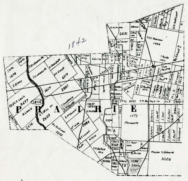
Photo: E. F. Wheeler; Columbus Metropolitan Library, via Digital Public Library of America, public domain · Wikimedia Commons
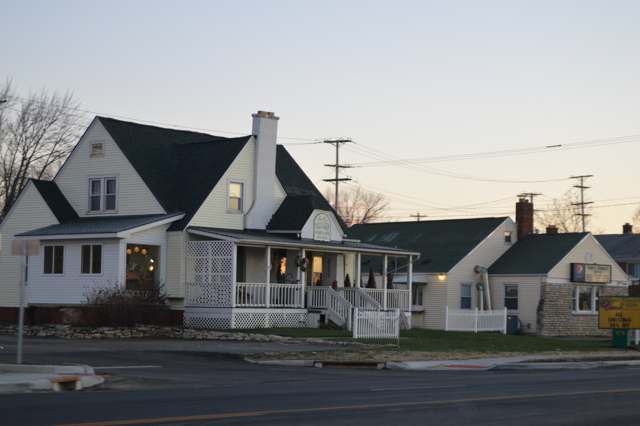
Photo: Nyttend, public domain · Wikimedia Commons
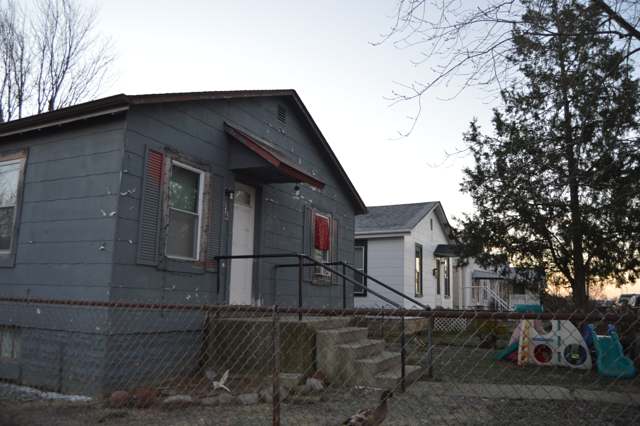
Photo: Nyttend, public domain · Wikimedia Commons
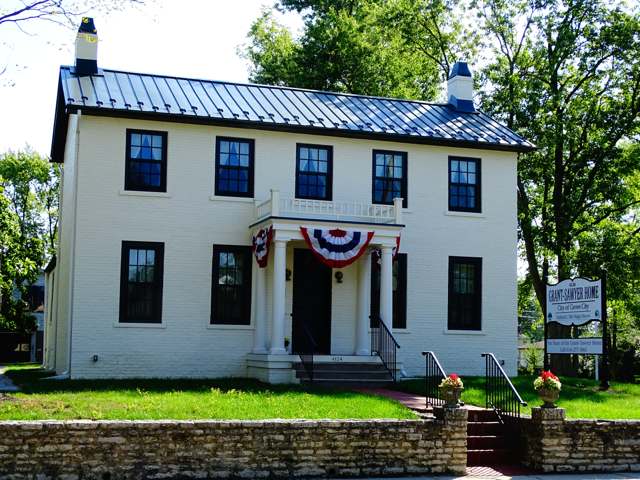
Photo: Grovetucky, CC BY-SA 4.0 · Wikimedia Commons
Local history sources: en.wikipedia.org · swfchs.org · genealogybug.net · ohiogenealogyexpress.com · accessgenealogy.com · en.wikipedia.org · en.wikipedia.org · en.wikipedia.org
Water
Scioto River intake at the plant on Dublin Rd, a few miles below Griggs Dam, opposite Marble Cliff The water here
- Columbus Public Water System91% of residentsScioto River (Griggs & O'Shaughnessy), Hoover Reservoir on Big Walnut Ck, plus wells
- Aqua Ohio - Lake Darby5% of residentsGroundwater wells (2 wells)
- Sanitary District #42% of residentsScioto River (Griggs & O'Shaughnessy), Hoover Reservoir on Big Walnut Ck, plus wells
- Aqua Ohio - Timberbrook Pw1% of residentsGroundwater wells (2 wells)
- Greentree Mobile Home Park0% of residentsGroundwater wells (1 wells)
Hospitals, fire stations and more
Inside Prairie Township, Franklin County's boundary: 1 hospital, 1 dialysis center, 2 fire and EMS stations, 7 public schools, 1 library, 1 museum and 13 spill cases. Press a pin or a name for its whole record and its source.
Hospitals (1)
-
Doctors Hospital WestGeneral hospital · Columbus
- What it is
- General hospital
- Address
- 5100 West Broad Street, Columbus, OH 43228
- County
- Franklin County
- Beds
- 251
- Helipad
- Yes
- Ownership
- Non-profit
- Medicare overall rating
- 4 of 5 stars
- Emergency department (Medicare)
- Yes
- Medicare reports it as
- Doctors Hospital
- Phone
- (614) 544-1000
- Medicare ID
- 360152
Medicare Care Compare ↗ Hospital's website ↗ Where HIFLD got this record ↗ HIFLD hospitals (source) ↗ Street map and directions ↗
Source: HIFLD hospitals inventory via FEMA (closed hospitals it still lists left out, hospitals opened since added), with Medicare Care Compare ratings matched by name and address.
Dialysis centers (1)
-
Fmc Liberty Dialysis West ColumbusDialysis · Columbus
- Address
- 4500 West Broad St, Columbus, OH 43228
- Dialysis stations
- 19
- Medicare star rating
- 3 of 5 stars
- Services
- in-center hemodialysis, peritoneal dialysis, home hemodialysis training
- Ownership
- for profit
- Chain
- Fresenius Medical Care
- Medicare certified since
- 2016-08-02
- Phone
- (614) 853-5995
- Medicare ID
- 362839
Medicare Care Compare ↗ CMS dialysis facility list (source) ↗ Street map and directions ↗
Source: CMS dialysis facility list, September 2026, geocoded with the Census Bureau batch geocoder (an address it could not place sits at its ZIP center).
Fire and EMS stations (2)
-
Prairie Township Fire Department Station 241 HeadquartersColumbus
- Address
- 123 Inah Avenue, Columbus, OH 43228
- Coordinates
- 39.94882, -83.13793
USGS National Map structures (source) ↗ Street map and directions ↗
-
Prairie Township Fire Department Station 243Galloway
- Address
- 451 Hubbard Road, Galloway, OH 43119
- Coordinates
- 39.95680, -83.23289
USGS National Map structures (source) ↗ Street map and directions ↗
Source: USGS National Map structures (most Ohio records last updated 2019 to 2022), checked against the Columbus and Cleveland station lists. The department that answers a call is set by jurisdiction and mutual aid, not by distance.
Public schools (7)
-
Alton Hall Elementary School3 of 5 stars · Galloway
- Address
- 982 Alton Rd, Galloway, OH 43119
- School district
- South-Western City School District
- Kind (NCES)
- Regular School
- Students, 2023-24
- 515
- Teachers (full-time equivalent)
- 26.5
- Report card, 2025-26
- 3 of 5 stars
- Performance index
- 67.6%
- Ohio building IRN
- 000505
- NCES school ID
- 390448001654
NCES school record ↗ Ohio School Report Card ↗ Street map and directions ↗
-
Norton Middle School2.5 of 5 stars · Columbus
- Address
- 215 Norton Rd, Columbus, OH 43228
- School district
- South-Western City School District
- Kind (NCES)
- Regular School
- Students, 2023-24
- 632
- Teachers (full-time equivalent)
- 38.6
- Report card, 2025-26
- 2.5 of 5 stars
- Performance index
- 55.1%
- Ohio building IRN
- 062216
- NCES school ID
- 390448001668
NCES school record ↗ Ohio School Report Card ↗ Street map and directions ↗
-
Prairie Lincoln Elementary School3.5 of 5 stars · Columbus
- Address
- 4900 Amesbury Way, Columbus, OH 43228
- School district
- South-Western City School District
- Kind (NCES)
- Regular School
- Students, 2023-24
- 521
- Teachers (full-time equivalent)
- 26.5
- Report card, 2025-26
- 3.5 of 5 stars
- Performance index
- 59.1%
- Ohio building IRN
- 030676
- NCES school ID
- 390448001671
NCES school record ↗ Ohio School Report Card ↗ Street map and directions ↗
-
Prairie Norton Elementary School3 of 5 stars · Columbus
- Address
- 105 Norton Rd, Columbus, OH 43228
- School district
- South-Western City School District
- Kind (NCES)
- Regular School
- Students, 2023-24
- 515
- Teachers (full-time equivalent)
- 26.5
- Report card, 2025-26
- 3 of 5 stars
- Performance index
- 65.9%
- Ohio building IRN
- 030684
- NCES school ID
- 390448001672
NCES school record ↗ Ohio School Report Card ↗ Street map and directions ↗
-
Stiles Elementary School3 of 5 stars · Columbus
- Address
- 4700 Stiles Ave, Columbus, OH 43228
- School district
- South-Western City School District
- Kind (NCES)
- Regular School
- Students, 2023-24
- 555
- Teachers (full-time equivalent)
- 29.5
- Report card, 2025-26
- 3 of 5 stars
- Performance index
- 54%
- Ohio building IRN
- 036129
- NCES school ID
- 390448001676
NCES school record ↗ Ohio School Report Card ↗ Street map and directions ↗
-
Stiles Family CenterColumbus
- Address
- 4702 Stiles Ave, Columbus, OH 43228
- Kind (NCES)
- Regular School
- Students, 2023-24
- 14
- Teachers (full-time equivalent)
- 3
- NCES school ID
- 390448005923
-
Westland High School3 of 5 stars · Galloway
- Address
- 146 Galloway Rd, Galloway, OH 43119
- School district
- South-Western City School District
- Kind (NCES)
- Regular School
- Students, 2023-24
- 1,864
- Teachers (full-time equivalent)
- 88.5
- Report card, 2025-26
- 3 of 5 stars
- Performance index
- 66.5%
- Four-year graduation rate
- 89.7%
- Ohio building IRN
- 061333
- NCES school ID
- 390448001679
NCES school record ↗ Ohio School Report Card ↗ Street map and directions ↗
Source: NCES EDGE public school locations 2024-25 and Common Core of Data 2023-24 (type, students, teachers); Ohio School Report Cards 2025-26 (Department of Education and Workforce), matched by name within the district.
Public libraries (1)
-
Westland Area BranchBranch · Columbus
- Address
- 4740 W. Broad St., Columbus, OH 43228
- What it is
- Branch
- Library system
- Southwest Public Libraries
- Open
- 3,120 hours a year, 52 weeks
- Building
- 29,000 sq ft
- System's visits, FY2024
- 304,408
- System's loans, FY2024
- 1,117,953
- People the system serves
- 147,074
- Phone
- (614) 878-1301
IMLS Public Libraries Survey (source) ↗ Street map and directions ↗
Source: IMLS Public Libraries Survey FY2024 (outlets and their systems). Any Ohio resident can get a free card at any Ohio public library.
Museums, historical societies, gardens and zoos (1)
-
North American Trap Collectors MuseumHistory museum · Galloway
- What it is
- History museum
- City
- Galloway
- Coordinates
- 39.90479, -83.16078
Search Wikipedia ↗ IMLS Museum Data Files (source) ↗ Street map and directions ↗
The museum list is IMLS's 2018 file; a museum may have closed or moved since.
Source: IMLS Museum Data Files, 2018.
Spills reported since 2021 (13)
-
Sewage Sludge / Biosolids2025-06-18 · Prairie Twp
- Reported
- 2025-06-18
- What spilled
- Sewage Sludge / Biosolids
- Largest amount reported
- 20,000 gallons
- Where
- Prairie Twp, Franklin County
- Ohio EPA district office
- CDO
- Ohio EPA case number
- 2506EPA0000999
Ohio EPA spill reports (source) ↗ Street map and directions ↗
-
Oil Petroleum Not Otherwise Specified (Nos)2025-06-02 · Prairie Twp
- Reported
- 2025-06-02
- What spilled
- Oil Petroleum Not Otherwise Specified (Nos)
- Largest amount reported
- 1,000 gallons
- Where
- Prairie Twp, Franklin County
- Ohio EPA district office
- CDO
- Ohio EPA case number
- 2506EPA0000885
Ohio EPA spill reports (source) ↗ Street map and directions ↗
-
Fuel Diesel / Diesel Fuel (Vehicle On Or Off Road)2025-05-22 · Prairie Twp
- Reported
- 2025-05-22
- What spilled
- Fuel Diesel / Diesel Fuel (Vehicle On Or Off Road)
- Largest amount reported
- 30 gallons
- Where
- Prairie Twp, Franklin County
- Ohio EPA district office
- CDO
- Ohio EPA case number
- 2505EPA0000823
Ohio EPA spill reports (source) ↗ Street map and directions ↗
-
Mercury / Quicksilver (Hg)2024-12-09 · Prairie Twp
- Reported
- 2024-12-09
- What spilled
- Mercury / Quicksilver (Hg)
- Where
- Prairie Twp, Franklin County
- Ohio EPA district office
- CDO
- Ohio EPA case number
- 2412EPA0001989
Ohio EPA spill reports (source) ↗ Street map and directions ↗
-
Milk2022-10-13 · Prairie Twp
- Reported
- 2022-10-13
- What spilled
- Milk
- Where
- Prairie Twp, Franklin County
- Ohio EPA district office
- CDO
- Ohio EPA case number
- 2210EPA0001555
Ohio EPA spill reports (source) ↗ Street map and directions ↗
-
Sewage Sludge / Biosolids2022-08-20 · Prairie Twp
- Reported
- 2022-08-20
- What spilled
- Sewage Sludge / Biosolids
- Where
- Prairie Twp, Franklin County
- Ohio EPA district office
- CDO
- Ohio EPA case number
- 2208EPA0001273
Ohio EPA spill reports (source) ↗ Street map and directions ↗
-
Sewage Human Reached water2021-08-02 · Prairie Twp
- Reported
- 2021-08-02
- What spilled
- Sewage Human
- Reached a waterway
- 99 - Unnamed
- Where
- Prairie Twp, Franklin County
- Ohio EPA district office
- CDO
- Ohio EPA case number
- 2108EPA0001173
Ohio EPA spill reports (source) ↗ Street map and directions ↗
-
Bentonite / Drilling Mud2021-06-07 · Columbus
- Reported
- 2021-06-07
- What spilled
- Bentonite / Drilling Mud
- Where
- Columbus, Franklin County
- Ohio EPA district office
- CDO
- Ohio EPA case number
- 2107EPA0001007
Ohio EPA spill reports (source) ↗ Street map and directions ↗
-
Contaminated Water Reached water2021-06-25 · Prairie Twp
- Reported
- 2021-06-25
- What spilled
- Contaminated Water
- Reached a waterway
- 99 - Unnamed
- Where
- Prairie Twp, Franklin County
- Ohio EPA district office
- CDO
- Ohio EPA case number
- 2106EPA0000929
Ohio EPA spill reports (source) ↗ Street map and directions ↗
-
Fuel Diesel / Diesel Fuel (Vehicle On Or Off Road)2021-06-15 · Columbus
- Reported
- 2021-06-15
- What spilled
- Fuel Diesel / Diesel Fuel (Vehicle On Or Off Road)
- Where
- Columbus, Franklin County
- Ohio EPA district office
- CDO
- Ohio EPA case number
- 2106EPA0000866
Ohio EPA spill reports (source) ↗ Street map and directions ↗
-
Other / All Other / Trade Name / Mixture / Solution Etc2021-03-09 · Prairie Twp
- Reported
- 2021-03-09
- What spilled
- Other / All Other / Trade Name / Mixture / Solution Etc
- Where
- Prairie Twp, Franklin County
- Ohio EPA district office
- CDO
- Ohio EPA case number
- 2103EPA0000301
Ohio EPA spill reports (source) ↗ Street map and directions ↗
-
Formaldehyde (Ch20)2026-08-16 · Prairie Twp
- Reported
- 2026-08-16
- What spilled
- Formaldehyde (Ch20)
- Where
- Prairie Twp, Franklin County
- Ohio EPA district office
- CDO
- Ohio EPA case number
- 2608EPA0001526
Ohio EPA spill reports (source) ↗ Street map and directions ↗
-
Oil Motor / Lube Oil / Vehicle2026-04-06 · Prairie Twp
- Reported
- 2026-04-06
- What spilled
- Oil Motor / Lube Oil / Vehicle
- Where
- Prairie Twp, Franklin County
- Ohio EPA district office
- CDO
- Ohio EPA case number
- 2604EPA0000579
Ohio EPA spill reports (source) ↗ Street map and directions ↗
Source: Ohio EPA emergency response spill reports, 2021 to September 2026, one point per case where Ohio EPA placed it. A report is what the caller or responder recorded; amounts are often blank or estimated.
Its ZIP codes
Each ZIP code that touches Prairie Township, Franklin County, with the share of its residents who live here and the same headline figures as the ZIP page.
| ZIP | Share | Water | Radon | Home value | Schools | Flood |
|---|---|---|---|---|---|---|
| 43119 Columbus and Galloway | 23% | Scioto River intake at the plant on Dublin Rd, a few miles below Griggs Dam, opposite Marble Cliff | 6.0 pCi/L average radon | Median year built 1996 | South-Western City · 3.5 stars overall | 2.1% of residents in the 1% floodplain |
| 43228 Columbus | 18% | Scioto River intake at the plant on Dublin Rd, a few miles below Griggs Dam, opposite Marble Cliff | 5.0 pCi/L average radon | Median year built 1988 | South-Western City · 3.5 stars overall | 1.4% of residents in the 1% floodplain |
Local government
Who holds office in Prairie Township, Franklin County, how its elections and ballot issues came out, and the state auditor's record.
Who holds office
| Office | Name | Party | Term ends | Contact |
|---|---|---|---|---|
| FISCAL OFFICER () | Alec Milam | |||
| TRUSTEE () | Douglas A. Stormont | |||
| TRUSTEE () | Rod Pritchard | |||
| TRUSTEE () | Cathy Schmelzer |
Roster as of 8/17/2026: county board of elections.
Elections for office
| Date | Office | Candidates and votes |
|---|---|---|
| 2025-11-04 | Township Trustees | Cathy Schmelzer 2,820, 33.35%; Michelle M. Bolzenius 1,484, 17.55%; Mike Hewlett 1,448, 17.12%; Rod Pritchard 1,942, 22.97%; Scott Newbury 762, 9.01% |
| 2023-11-07 | PR For Township Trustee (number of seats not on file, so winners are not marked) | Candidate Withdrawn 1,028, 13.72%; Catherine Martinez 2,584, 34.5%; Doug Stormont 3,878, 51.78% |
| 2023-11-07 | PR For Township Fiscal Officer | Alec Milam 4,120, 62.35%; Candidate Withdrawn 2,488, 37.65% |
Winners in bold. Results from the county board of elections' official canvass unless marked.
Auditor of State record
- No fiscal caution, watch or emergency on the Auditor of State's lists.
- Financial Audit, 2023 to 2024, released 2026-02-03
The county
Franklin County: 45 ZIP codes, 42 cities, villages and townships, 1,356,733 people.
Nearby places
Quick answers
What county is Prairie Township, Ohio in?
Prairie Township, Franklin County is a township in Franklin County, Ohio, with 17,347 residents.
When was Prairie Township, Ohio founded?
Prairie Township, Franklin County was settled c. 1800; incorporated 1819. Founders on record: organized under its present name; bounds then extended farther north into present-day Brown Township. Source
How did Prairie Township, Ohio get its name?
The township was named for the tall prairie grasses that covered much of its level ground before settlement and drainage; local accounts recorded by the Southwest Franklin County Historical Society and repeated on Wikipedia describe the grass as tall enough to hide all but the head of a man riding a horse through it. Source
What ZIP code is Prairie Township, Ohio?
Prairie Township, Franklin County is served by ZIP codes 43119 and 43228; 43119 holds the largest share of its residents.
Where does Prairie Township, Ohio get its water?
The main water source for Prairie Township, Franklin County (Columbus Public Water System): Scioto River intake at the plant on Dublin Rd, a few miles below Griggs Dam, opposite Marble Cliff.
Cite this page
Cite this page as:
Cracked Buckeye, "Prairie Township, Franklin County", https://crackedbuckeye.com/place/prairie-township-franklin-county/, built 2026-10-31, accessed [date].
How to cite · Report a correction · Built 2026-10-31