Local events in Montgomery Township, Ashland County
Nothing is posted for Montgomery Township itself yet; here is what is on within 10 miles. All local events in Montgomery Township, Ashland County
Know a calendar we should watch? Send the link
Checked October 20; the events page is refreshed daily.
How Montgomery Township, Ashland County began
Montgomery Township was surveyed in 1807 by Jonathan Cox and organized by the commissioners of Richland County in 1816, when it was detached from Vermillion Township; it holds most of the city of Ashland, laid out as Uniontown by William Montgomery in 1815 and renamed in 1822. Its first settler came in midwinter and sheltered in an open tent until he could raise a cabin a mile northeast of the future town, and settlement filled in quickly between 1818 and 1821. Robert Newell, with a thousand acres, was the largest landholder, and a block of about nine hundred acres owned by a Mr. Lanterman became the 'Tunker Settlement.' Presbyterians built the log 'Old Hopewell' church a mile west of Ashland in 1819. The township also holds Gamble's Fort, a prehistoric earthen circle now inside Ashland's city limits.
Settled 1814 (the 1909 county history dates real settlement from about 1818), platted 1815 (Uniontown, by William Montgomery), incorporated 1816 (organized by the commissioners of Richland County), by William Montgomery (town); township organized 1816.
Where the name comes from
Named for William Montgomery, who laid out the town of Uniontown (renamed Ashland in 1822) on land in the township on July 28, 1815; the township took his name when organized the following year.
Before the town
Several prehistoric works stood in the township. Gamble's Fort, on high ground north of Ashland in the southwest quarter of section 8 (land Henry Gamble entered in 1815), was a circular embankment 2,145 feet long enclosing about eight acres, with a gateway on the southwest side near a spring; by 1909 it lay inside the city limits, just north of the Erie railroad, and had been plowed nearly flat. A mound on the northeast part of section 9, opened by 1880, held human bones, charcoal and wood fiber, and a smaller mound on section 3 held bones, arrowheads and stone axes; the 1880 history says other small mounds in the township held similar contents. In the historic period, a trail from the Mingo village of Mohican Johnstown ran up the east side of the Jerome Fork to the mouth of the Catotaway in eastern Montgomery, and an old Indian hunter named Catotawa, remembered by the township's pioneers, lived near the Gierhart farm on the stream that the 1880 history says was named for him. The 1909 history also places 'the well known Wyandot trail' in the south of the township, the route followed by Major Robert Rogers's rangers in 1761 and by General Beall's army during the War of 1812.
Nations recorded here: Wyandot, Mingo (Seneca-Cayuga).
- Gamble's Fort (earthwork) — southwest quarter of section 8, north of Ashland; now inside the city limits, just north of the Erie railroad, prehistoric (culture not identified in the sources) (archive.org)
- Mounds on sections 9 and 3 (mound) — northeast part of section 9, and section 3 about a quarter mile northeast of it, near Gamble's Fort, prehistoric (culture not identified in the sources) (archive.org)
- Catotaway trail (trail) — up the east side of the Jerome Fork to the mouth of the Catotaway in eastern Montgomery Township, past the old Gierhart farm, historic, 1700s to early 1800s (archive.org)
- Wyandot trail (Rogers and Beall route) (trail) — southern part of Montgomery Township, continuing into Milton Township, 1761 (Rogers) and 1812 (Beall) (archive.org)
Timeline
- — Jonathan Cox surveys the township, and the survey is platted and certified to Jared Mansfield, surveyor general of the United States.
- — Benjamin Cuppy, Robert Newell, Daniel Carter Sr., the widow Trickle, Daniel Mickey and David Markley and their families make up the township's earliest recorded population.
- — William Montgomery lays out the town of Uniontown, on July 28, on the site that becomes Ashland.
- — Henry Gamble enters the land north of the future town that holds the prehistoric earthwork later called Gamble's Fort.
- — The commissioners of Richland County organize Montgomery Township, detaching it from Vermillion; Robert Newell is its first justice of the peace.
- — Settlement picks up: the 1909 county history dates the real start of Montgomery's settlement to about 1818, with considerable growth by 1821.
- — Presbyterians build 'Old Hopewell,' a log church a mile west of Ashland, the township's first church.
- — The township's population is counted at 704.
- — Uniontown is renamed Ashland.
- — Conrad Kline builds a small gristmill two miles east of Ashland at the foot of Roseberry Hill; it runs eight or ten years.
- — An Evangelical Lutheran church is organized on the township's east line; its later brick building seats about 350.
- — Michael Diblebess builds a small water mill on the Catotaway, on the site of the later Berkholder mill.
- — Ashland County is formed on February 24, and Montgomery Township, with the city of Ashland as its seat, becomes part of it.
- — The township's population is counted at 3,501.
Stories
A tent in January
Montgomery lay back from the main streams and was settled later than the river townships; no settler came until several years after the settlement at Greentown. The first one arrived in midwinter and lived in a tent open at one end while he cut and hauled logs for a cabin. He could not raise the walls alone, and had to walk sixteen miles through the forest to find a fourth man to help. The cabin went up a mile northeast of the present town of Ashland. After the War of 1812 the township filled quickly: Robert Newell held a thousand acres, and a Mr. Lanterman of Trumbull County owned about nine hundred acres that became known as the 'Tunker Settlement.' Because Congress then sold nothing smaller than a quarter section, settlers often bought a quarter and divided it among others, which packed the farms close together.
Gamble's Fort
On high ground north of Ashland, overlooking the Jerome Fork valley for four to seven miles, an unknown prehistoric people built a circular earthen wall 2,145 feet around, enclosing a little over eight acres. When Henry Gamble entered the land in 1815 the wall stood nearly four feet high and ten or eleven feet wide, covered with forest trees, with a gateway on the southwest side facing a ravine and a spring. By 1880 it had been plowed for nearly fifty years, the New York, Pennsylvania and Ohio railway ran down the ravine just south of it, and the old spring filled the railroad's water tank. The 1909 history describes it as inside the city limits, just north of the Erie railroad, with scarcely a trace left. From the mounds on Sprott's Hill in Clear Creek Township, two and a half miles to the northwest, the fort could be seen across the valley.
Photographs
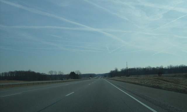
Photo: Nyttend, public domain · Wikimedia Commons
Local history sources: en.wikipedia.org · genealogytrails.com · archive.org · en.wikipedia.org · archive.org · archive.org · archive.org · archive.org · archive.org · archive.org · archive.org · archive.org · archive.org · commons.wikimedia.org
Water
Wells (14 listed as active in EPA SDWIS: Wells 1-7 and 10-15; Well 9 was deactivated 2025-11-17) in the Jerome Fork Basin sand-and-gravel aquifer, sited generally north of the treatment plant on Cleveland Road The water here
- Ashland City92% of residentsJerome Fork Basin sand-and-gravel aquifer (wells)
- Rural Lorain Co. Water A6% of residentsMostly Lake Erie (bought from Avon Lake); some New London Reservoir and Ashland wells
- Bailey Lakes Village2% of residentsLake Erie
- Hayesville Village1% of residentsGroundwater wells (2 wells)
Hospitals, fire stations and more
Inside Montgomery Township, Ashland County's boundary: 1 high-hazard dam, 2 poor-rated bridges, 1 public charging site, 2 Toxics Release Inventory facilities and 11 spill cases. Press a pin or a name for its whole record and its source.
High-hazard dams (1)
-
Artesian Lake Dam PoorTributary To Newell Run · condition: poor
- Hazard class
- High: a failure would probably cost a life
- Condition
- Poor (assessed 02/20/2025)
- River or stream
- Tributary To Newell Run
- Purpose
- Recreation
- Type
- Earth
- Height
- 18 ft
- Storage
- 86 acre-feet
- Owner type
- Private
- County
- Ashland County
- Nearest town (NID)
- England
- Last inspection
- 10/10/2024
- Emergency action plan
- No
- NID ID
- OH01144
National Inventory of Dams record ↗ National Inventory of Dams (source) ↗ Street map and directions ↗
Source: U.S. Army Corps of Engineers National Inventory of Dams, August 2026. "High hazard" rates what a failure would cost downstream, not how likely one is; the condition is the state's assessment.
Bridges rated poor (2)
-
County Road 1600 over Jerome ForkPoor · built 1969
- Condition
- Poor: a deck, superstructure, substructure or culvert rated 4 or below on the 0 to 9 scale
- What it is
- Bridge
- Built
- 1969
- Length
- 31 ft
- Owner
- County
- Vehicles a day
- 854
- Coordinates
- 40.82800, -82.22373
National Bridge Inventory (source) ↗ Street map and directions ↗
-
Township Road 1104 over Lang CreekPoor · built 1977
- Condition
- Poor: a deck, superstructure, substructure or culvert rated 4 or below on the 0 to 9 scale
- What it is
- Bridge
- Built
- 1977
- Length
- 20 ft
- Owner
- County
- Vehicles a day
- 349
- Coordinates
- 40.90161, -82.31271
National Bridge Inventory (source) ↗ Street map and directions ↗
Source: FHWA National Bridge Inventory 2025. "Poor" means one major part rated 4 or below on the 0 to 9 scale; it calls for repair, not closing, unless the state posts or closes the bridge.
Public EV charging (1)
-
Holiday Inn - Tesla Supercharger DC fast12 DC fast · Ashland
- Address
- 1392 Enterprise Parkway, Ashland, OH 44805
- Ports
- 12 DC fast
- Plugs
- Tesla (NACS)
- Network
- Tesla
- Hours
- 24 hours daily. Please check Tesla's online station map to see if an adapter is required at this location.
- Phone
- 877-798-3752
Station Locator (NREL) ↗ Alternative Fuels Data Center (source) ↗ Street map and directions ↗
Source: NREL Alternative Fuels Data Center station list (May 2026), public and open stations, the posts at one address counted as one site.
Facilities reporting toxic releases (2)
-
Atlas Bolt & Screw Co LlcToxics Release Inventory · Ashland
- Address
- 1628 Troy Rd, Ashland, OH 44805
- County
- Ashland County County
- Status
- Reports to the Toxics Release Inventory (active)
- EPA program ID
- 44805TLSBL1628T
- EPA registry ID
- 110000917599
EPA facility record ↗ EPA Facility Registry Service (source) ↗ Street map and directions ↗
-
Automatic Welding & Manufacturing CoToxics Release Inventory · Ashland
- Address
- 532 County Road 1600, Ashland, OH 44805
- County
- Ashland County
- Status
- Reports to the Toxics Release Inventory (active)
- EPA program ID
- 44805TMTCW532CO
- EPA registry ID
- 110002444276
EPA facility record ↗ EPA Facility Registry Service (source) ↗ Street map and directions ↗
Source: EPA Facility Registry Service, Toxics Release Inventory reporters. Reporting a release is required of large users of listed chemicals; it is not by itself a violation.
Spills reported since 2021 (11)
-
Oil Transformer Non Pcb2025-07-21 · Montgomery Twp
- Reported
- 2025-07-21
- What spilled
- Oil Transformer Non Pcb
- Largest amount reported
- 24 gallons
- Where
- Montgomery Twp, Ashland County
- Ohio EPA district office
- NWDO
- Ohio EPA case number
- 2507EPA0001212
Ohio EPA spill reports (source) ↗ Street map and directions ↗
-
Fuel Oil/ Home Heating / Heating Oil2025-06-14 · Montgomery Twp
- Reported
- 2025-06-14
- What spilled
- Fuel Oil/ Home Heating / Heating Oil
- Largest amount reported
- 50 gallons
- Where
- Montgomery Twp, Ashland County
- Ohio EPA district office
- NWDO
- Ohio EPA case number
- 2506EPA0000974
Ohio EPA spill reports (source) ↗ Street map and directions ↗
-
Fuel Diesel / Diesel Fuel (Vehicle On Or Off Road)2025-01-10 · Montgomery Twp
- Reported
- 2025-01-10
- What spilled
- Fuel Diesel / Diesel Fuel (Vehicle On Or Off Road)
- Where
- Montgomery Twp, Ashland County
- Ohio EPA district office
- NWDO
- Ohio EPA case number
- 2501EPA0000039
Ohio EPA spill reports (source) ↗ Street map and directions ↗
-
Fuel Diesel / Diesel Fuel (Vehicle On Or Off Road)2024-09-04 · Montgomery Twp
- Reported
- 2024-09-04
- What spilled
- Fuel Diesel / Diesel Fuel (Vehicle On Or Off Road)
- Where
- Montgomery Twp, Ashland County
- Ohio EPA district office
- NWDO
- Ohio EPA case number
- 2409EPA0001518
Ohio EPA spill reports (source) ↗ Street map and directions ↗
-
Manure Swine2024-04-04 · Montgomery Twp
- Reported
- 2024-04-04
- What spilled
- Manure Swine
- Where
- Montgomery Twp, Ashland County
- Ohio EPA district office
- NWDO
- Ohio EPA case number
- 2404EPA0000532
Ohio EPA spill reports (source) ↗ Street map and directions ↗
-
Oil Motor / Lube Oil / Vehicle2024-01-08 · Montgomery Twp
- Reported
- 2024-01-08
- What spilled
- Oil Motor / Lube Oil / Vehicle
- Largest amount reported
- 12 gallons
- Where
- Montgomery Twp, Ashland County
- Ohio EPA district office
- NWDO
- Ohio EPA case number
- 2401EPA0000039
Ohio EPA spill reports (source) ↗ Street map and directions ↗
-
Waste Water2023-03-25 · Montgomery Twp
- Reported
- 2023-03-25
- What spilled
- Waste Water
- Where
- Montgomery Twp, Ashland County
- Ohio EPA district office
- NWDO
- Ohio EPA case number
- 2303EPA0000446
Ohio EPA spill reports (source) ↗ Street map and directions ↗
-
Fuel Diesel / Diesel Fuel (Vehicle On Or Off Road)2023-03-21 · Montgomery Twp
- Reported
- 2023-03-21
- What spilled
- Fuel Diesel / Diesel Fuel (Vehicle On Or Off Road); Oil Motor / Lube Oil / Vehicle
- Largest amount reported
- 100 gallons
- Where
- Montgomery Twp, Ashland County
- Ohio EPA district office
- NWDO
- Ohio EPA case number
- 2303EPA0000411
Ohio EPA spill reports (source) ↗ Street map and directions ↗
-
Oil Motor / Lube Oil / Vehicle2022-09-09 · Montgomery Twp
- Reported
- 2022-09-09
- What spilled
- Oil Motor / Lube Oil / Vehicle; Fuel Diesel / Diesel Fuel (Vehicle On Or Off Road)
- Largest amount reported
- 80 gallons
- Where
- Montgomery Twp, Ashland County
- Ohio EPA district office
- NWDO
- Ohio EPA case number
- 2209EPA0001375
Ohio EPA spill reports (source) ↗ Street map and directions ↗
-
Fuel Diesel / Diesel Fuel (Vehicle On Or Off Road)2022-04-27 · Montgomery Twp
- Reported
- 2022-04-27
- What spilled
- Fuel Diesel / Diesel Fuel (Vehicle On Or Off Road)
- Largest amount reported
- 100 gallons
- Where
- Montgomery Twp, Ashland County
- Ohio EPA district office
- NWDO
- Ohio EPA case number
- 2204EPA0000597
Ohio EPA spill reports (source) ↗ Street map and directions ↗
-
Fuel Diesel / Diesel Fuel (Vehicle On Or Off Road)2021-05-18 · Montgomery Twp
- Reported
- 2021-05-18
- What spilled
- Fuel Diesel / Diesel Fuel (Vehicle On Or Off Road)
- Where
- Montgomery Twp, Ashland County
- Ohio EPA district office
- NWDO
- Ohio EPA case number
- 2105EPA0000695
Ohio EPA spill reports (source) ↗ Street map and directions ↗
Source: Ohio EPA emergency response spill reports, 2021 to September 2026, one point per case where Ohio EPA placed it. A report is what the caller or responder recorded; amounts are often blank or estimated.
Its ZIP codes
Each ZIP code that touches Montgomery Township, Ashland County, with the share of its residents who live here and the same headline figures as the ZIP page.
| ZIP | Share | Water | Radon | Home value | Schools | Flood |
|---|---|---|---|---|---|---|
| 44805 Ashland | 9% | Wells (14 listed as active in EPA SDWIS: Wells 1-7 and 10-15; Well 9 was deactivated 2025-11-17) in the Jerome Fork Basin sand-and-gravel aquifer, sited generally north of the treatment plant on Cleveland Road | 5.8 pCi/L average radon | Median year built 1964 | Ashland City · 4 stars overall | 2.6% of residents in the 1% floodplain |
Local government
Who holds office in Montgomery Township, Ashland County, how its elections and ballot issues came out, and the state auditor's record.
Money issues on the ballot since 2021: 2 of 2 passed.
Ballot issues
| Date | Issue | For | Against | Result |
|---|---|---|---|---|
| 2022-11-08 | Issue: Montgomery TWP., Levy Renewal, Bridges and Roads - 1mill/5yrs. (1.0 mills, renewal) | 820 | 373 | Passed (68.73% for) |
| 2021-11-02 | Issue: Montgomery Twp. Renewal Fire 2.6 mills/5yrs. (2.6 mills, renewal) | 397 | 124 | Passed (76.2% for) |
| 2018-11-06 | Issue: Montgomery Township Natural Gas Agg | 631 | 470 | Passed (57.31% for) |
| 2018-05-08 | Issue: Montgomery Township Add RBs 1m (1.0 mills) | 190 | 145 | Passed (56.72% for) |
Elections for office
| Date | Office | Candidates and votes |
|---|---|---|
| 2025-11-04 | Township Trustee (unofficial count) | John W. Keim 332, 35.62%; Hugh B. Troth 242, 25.97%; Stephen Uhler 358, 38.41% |
| 2023-11-07 | Township Trustee (unofficial count) | Joshua S. Boley 840, 100.0% |
| 2023-11-07 | Township Fiscal Officer (unofficial count) | Andrea M. Wertz 828, 100.0% |
| 2021-11-02 | Township Trustee | Hugh B. Troth 314, 47.43%; Stephen J. Uhler 348, 52.57% |
| 2019-11-05 | Township Trustee | Trudy Bates 77, 15.78%; Joshua S. Boley 285, 58.4%; Daniel Kamburoff 126, 25.82% |
| 2019-11-05 | Township Fiscal Officer | Andrea M. Wertz 398, 100.0% |
| 2017-11-07 | Township Trustee | Joshua S. Boley 266, 27.03%; Hugh Britton Troth 305, 31.0%; Stephen Uhler 413, 41.97% |
Winners in bold. Results from the county board of elections' official canvass unless marked.
Auditor of State record
- No fiscal caution, watch or emergency on the Auditor of State's lists.
- Agreed Upon Procedures, 2023 to 2024, released 2026-02-12
The county
Ashland County: 9 ZIP codes, 22 cities, villages and townships, 50,803 people.
Nearby places
Quick answers
What county is Montgomery Township, Ohio in?
Montgomery Township, Ashland County is a township in Ashland County, Ohio, with 2,815 residents.
When was Montgomery Township, Ohio founded?
Montgomery Township, Ashland County was settled 1814 (the 1909 county history dates real settlement from about 1818); laid out 1815 (Uniontown, by William Montgomery); incorporated 1816 (organized by the commissioners of Richland County). Founders on record: William Montgomery (town); township organized 1816. Source
How did Montgomery Township, Ohio get its name?
Named for William Montgomery, who laid out the town of Uniontown (renamed Ashland in 1822) on land in the township on July 28, 1815; the township took his name when organized the following year. Source
What ZIP code is Montgomery Township, Ohio?
Most of Montgomery Township, Ashland County is in ZIP code 44805.
Where does Montgomery Township, Ohio get its water?
The main water source for Montgomery Township, Ashland County (Ashland City): Wells (14 listed as active in EPA SDWIS: Wells 1-7 and 10-15; Well 9 was deactivated 2025-11-17) in the Jerome Fork Basin sand-and-gravel aquifer, sited generally north of the treatment plant on Cleveland Road.
Cite this page
Cite this page as:
Cracked Buckeye, "Montgomery Township, Ashland County", https://crackedbuckeye.com/place/montgomery-township-ashland-county/, built 2026-10-31, accessed [date].
How to cite · Report a correction · Built 2026-10-31
