Local events in Clear Creek Township, Ashland County
Nothing is posted for Clear Creek Township itself yet; here is what is on within 10 miles. All local events in Clear Creek Township, Ashland County
Know a calendar we should watch? Send the link
Checked October 20; the events page is refreshed daily.
How Clear Creek Township, Ashland County began
Clear Creek Township, in northwestern Ashland County, was surveyed in 1807 by Mansfield Ludlow and settled in the spring of 1815 by the Haney, Freeborn and Shaw families, who came by keelboat from Washington County, Pennsylvania; the Freeborns had named the creek when they first saw it in 1814 and gave the name to the township. Rev. John Haney laid out the village of Savannah, first called Vermillion, in the winter of 1818, and families largely of Scottish descent built Presbyterian, Associate Reformed and United Presbyterian churches there; Savannah lost its bid to be a county seat to Ashland and was revived by the Savannah Academy of 1858. The Vermillion River rises in the lakes southeast of Savannah, near today's village of Bailey Lakes, and the prehistoric mounds of Sprott's Hill and the earthwork called Bryte's Fort lie in the township.
Settled 1815 (spring; Haney, Freeborn and Shaw families), incorporated 1818-10-15 per Wikipedia; 1820 per Hill 1880; unknown per Knapp 1863 and Baughman 1909, by commissioners of Richland County.
Where the name comes from
John or Richard Freeborn gave the name. According to Rev. John Haney's 1861 letter, printed in the 1909 county history, the Freeborns named the township's principal stream Clear Creek when they first saw it in the summer of 1814, and one of them applied for the township's organization under the same name.
Before the town
Sprott's Hill, on the northeast quarter of section 35, is a natural hill of gravel and boulders about ninety feet high with a flat top on which two mounds were built, each about twenty-five feet across and four or five feet high. When Thomas Sprott and a brother opened the south mound, about 1850, they found a coffin of flat stones set on edge holding the skeletons of six or eight people, with more than a peck of red pigment on the lid stones; they put the remains back. The site is listed on the National Register (1976). About a mile and a half northwest, on section 26 on the farm of John Bryte, was Bryte's Fort, a rectangular embankment about 500 by 250 feet with a gateway toward a spring, on the summit where the brooks divide between Lake Erie and the Ohio; stone axes, fleshers, arrowheads, pipes and pierced stones were found around it. In the historic period, Rev. John Haney recalled that Delawares (Lenape) and Wyandots hunted in the township for several years after settlement began in 1815. No source names the culture that built the mounds.
Nations recorded here: Lenape (Delaware), Wyandot.
- Sprott's Hill Mounds Site (mound) — northeast quarter of section 35, on the western side of Township Road 1193 between Bailey Lake and Ashland, prehistoric (culture not identified in the sources); NRHP 1976 (archive.org)
- Bryte's Fort (earthwork) — section 26, on the John Bryte farm, about a mile and a half northwest of Sprott's Hill, prehistoric (culture not identified) (archive.org)
Timeline
- — Clear Creek Township is surveyed by Mansfield Ludlow.
- — On March 10, Rev. James Haney, his son John, Richard Freeborn, William Shaw and Daniel Devlin set out from Wellsburg, Virginia, in a keelboat they had built in Washington County, Pennsylvania; they reach Finley's bridge south of Jeromesville on April 26 and camp on April 29 at the later graveyard on the Clear Creek-Orange line.
- — Mrs. Elliott teaches the township's first school, in her own house, in 1817-18.
- — Clear Creek Township is organized from the northern half of Milton Township (the date Wikipedia gives; the 1880 county history says 1820, and two other histories call the date unknown).
- — Rev. John Haney lays out the village of Savannah, first named Vermillion and locally called Haneytown, in the winter of 1818 (December 25, 1818, per the 1909 history).
- — Elias Ford settles in the township; his family later includes Thomas H. Ford, lieutenant governor of Ohio.
- — The township's population is counted at 309.
- — Joseph Davis builds the township's first sawmill, on Clear Creek a mile and a half west of Savannah; Thomas Ford's horse mill is then the only gristmill.
- — John Hendricks builds a gristmill on the Vermillion just below the mouth of Clear Creek (1823 in the 1880 history).
- — At the township election held at Thomas Ford's on April 3, John Freeborn, Jacob Foulks and John Bailey are chosen trustees.
- — A Disciple church is organized with seventeen members, and Ford's Meeting House is built; its first service is the funeral of Thomas Ford, who died October 10, 1830.
- — The Associate Reformed congregation of Savannah is organized in September; it builds the village's first house of worship in 1834.
- — The Clearcreek Presbyterian church is organized on July 1 with twenty-seven members, an offshoot of the Hopewell church of Ashland; women members are given an equal vote for ruling elders.
- — The names of the village and post office are changed from Vermillion to Savannah.
- — Ashland County is formed; Clear Creek Township is divided, with four sections joining Ashland County and two remaining in Richland County.
- — The Savannah Academy is founded, checking the village's decline after Ashland won the county seat; a United Presbyterian church is formed in June.
- — The township's population is 1,327; Savannah's is counted separately for the first time.
- — Sprott's Hill Mounds Site is listed on the National Register of Historic Places on January 31.
Stories
By keelboat to Clear Creek
In the winter of 1814-15 Rev. James Haney, John and Richard Freeborn and William Shaw built a small keelboat in Cross Creek Township, Washington County, Pennsylvania, and hauled it twelve miles to the Ohio River. On the evening of March 10, 1815, Richard Freeborn, Shaw, Daniel Devlin, Haney and his sixteen-year-old son John pushed off from Wellsburg, Virginia, loaded with goods and provisions, while John Freeborn drove the horses and cattle overland. High water on the Muskingum made the poling hard. They reached Finley's bridge, about five miles south of Jeromesville, on April 26, met their pack horses there, and on April 29 camped on the ground later used as a graveyard on the Clear Creek-Orange line, a mile and a half southeast of Savannah. Rev. James Haney preached the first sermon in the township, and the first religious meeting is believed to have been held at his house east of Savannah; and John Haney laid out Savannah in the winter of 1818. The Freeborns planted the first apple seeds in the township, which grew into several of its oldest orchards.
Ford's Meeting House
Before there were churches, the cabin of Thomas Ford was the township's main place of worship; men and women walked six or eight miles through the woods at night, lighting the way with torches of hickory bark. Ford also ran the township's first mill, a horse mill for grinding grain. In 1830 a church was built near his place, known as Ford's Meeting House, and for several years the four quarterly meetings of the Methodist circuit, which included Mansfield, were held there. The first service in it was Ford's own funeral: he died on October 10, 1830, at fifty-seven, and his was the first burial in the graveyard beside it.
A mound on Sprott's Hill
Long before Clear Creek Township was surveyed off the north half of Milton Township in 1818 (or 1820, by another account), Native people built a mound on what settlers would later call Sprott's Hill, on the township's western side. The site's listing on the National Register of Historic Places is the clearest documentary evidence of pre-contact occupation anywhere in this cluster of Ashland County townships, though the sources reviewed here do not identify which mound-building culture raised it or when. It stands today as the township's most significant historic site, alongside the villages of Savannah and Bailey Lakes that grew up in the two centuries after the mound was built.
Photographs
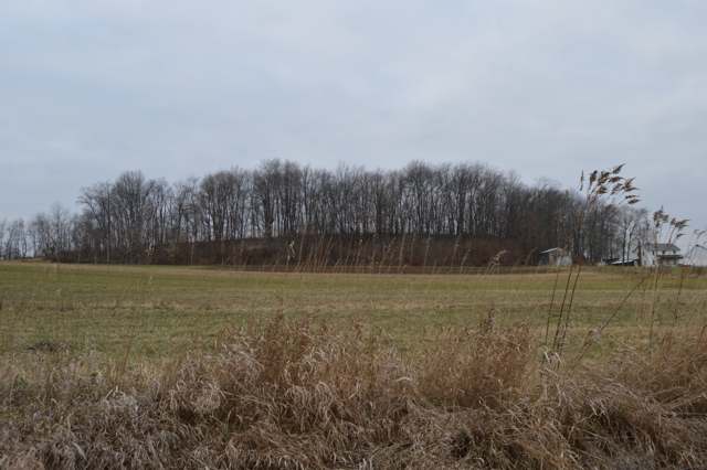
Photo: Nyttend, public domain · Wikimedia Commons
Local history sources: en.wikipedia.org · en.wikipedia.org · archive.org · archive.org · archive.org · archive.org · archive.org · archive.org · archive.org · archive.org · archive.org · archive.org · commons.wikimedia.org
Water
Wells (14 listed as active in EPA SDWIS: Wells 1-7 and 10-15; Well 9 was deactivated 2025-11-17) in the Jerome Fork Basin sand-and-gravel aquifer, sited generally north of the treatment plant on Cleveland Road The water here
- Ashland City67% of residentsJerome Fork Basin sand-and-gravel aquifer (wells)
- Rural Lorain Co. Water A26% of residentsMostly Lake Erie (bought from Avon Lake); some New London Reservoir and Ashland wells
- Greenwich Village3% of residentsGroundwater wells (6 wells)
- Shiloh Village2% of residentsGroundwater wells (2 wells)
- Bailey Lakes Village1% of residentsLake Erie
- Hayesville Village1% of residentsGroundwater wells (2 wells)
- Northern Ohio Rural Water - SE District0% of residentsLake Erie
Hospitals, fire stations and more
Inside Clear Creek Township, Ashland County's boundary: 1 poor-rated bridge. Press a pin or a name for its whole record and its source.
Bridges rated poor (1)
-
County Road 658 over Clear CreekPoor · built 1969
- Condition
- Poor: a deck, superstructure, substructure or culvert rated 4 or below on the 0 to 9 scale
- What it is
- Bridge
- Built
- 1969
- Length
- 25 ft
- Owner
- County
- Vehicles a day
- 180
- Coordinates
- 40.96755, -82.38520
National Bridge Inventory (source) ↗ Street map and directions ↗
Source: FHWA National Bridge Inventory 2025. "Poor" means one major part rated 4 or below on the 0 to 9 scale; it calls for repair, not closing, unless the state posts or closes the bridge.
Its ZIP codes
Each ZIP code that touches Clear Creek Township, Ashland County, with the share of its residents who live here and the same headline figures as the ZIP page.
Local government
Who holds office in Clear Creek Township, Ashland County, how its elections and ballot issues came out, and the state auditor's record.
Money issues on the ballot since 2026: 1 of 1 passed.
Ballot issues
| Date | Issue | For | Against | Result |
|---|---|---|---|---|
| 2026-05-05 | Issue: Proposed Tax Levy - Renewal - Clear Creek Twp. - Roads - 1 mill / 5 yrs (1.0 mills, renewal) | 117 | 57 | Passed (67.24% for), unofficial |
| 2021-11-02 | Issue: Clear Creek Twp. Renewal Roads and Bridges 1mill/5yrs. (1.0 mills, renewal) | 139 | 64 | Passed (68.47% for) |
| 2021-11-02 | Issue: Clear Creek Twp. Additional Current Expenses 0.5mill/5yrs. (0.5 mills, additional) | 135 | 206 | Failed (39.59% for) |
| 2019-11-05 | Issue: Clear Creek Township Rep RBs 2m (2.0 mills) | 131 | 64 | Passed (67.18% for) |
Elections for office
| Date | Office | Candidates and votes |
|---|---|---|
| 2025-11-04 | Township Trustee (unofficial count) | Aaron Bauckman 107, 16.67%; Standley Crist 165, 25.7%; Nick Stuart 113, 17.6%; Ervin Yoder 257, 40.03% |
| 2025-11-04 | Township Trustee (unofficial count) | Titus Lamb 71, 21.85%; Ralph Weaver 254, 78.15% |
| 2025-11-04 | Township Fiscal Officer (unofficial count) | Katelyn Lamb 289, 100.0% |
| 2023-11-07 | Township Trustee (unofficial count) | David Shoup 546, 100.0% |
| 2023-11-07 | Township Fiscal Officer (unofficial count) | Nick Stuart 295, 46.6%; Teri Yoder 338, 53.4% |
| 2021-11-02 | Township Trustee | Aaron Arter 133, 22.93%; Timothy A. Calame 92, 15.86%; Stan Crist 177, 30.52%; Ervin Yoder 178, 30.69% |
| 2019-11-05 | Township Trustee | David A. Shoup 250, 100.0% |
| 2019-11-05 | Township Fiscal Officer | Kelly I. Bracken 122, 39.23%; Leighanna Cawrse 42, 13.5%; Nicholas J. Stuart 147, 47.27% |
| 2017-11-07 | Township Trustee | Tim Calame 238, 50.53%; Standley Crist 233, 49.47% |
Winners in bold. Results from the county board of elections' official canvass unless marked.
Auditor of State record
- No fiscal caution, watch or emergency on the Auditor of State's lists.
- Financial Audit, 2022 to 2023, released 2025-06-17
The county
Ashland County: 9 ZIP codes, 22 cities, villages and townships, 50,803 people.
Nearby places
Quick answers
What county is Clear Creek Township, Ohio in?
Clear Creek Township, Ashland County is a township in Ashland County, Ohio, with 1,539 residents.
When was Clear Creek Township, Ohio founded?
Clear Creek Township, Ashland County was settled 1815 (spring; Haney, Freeborn and Shaw families); incorporated 1818-10-15 per Wikipedia; 1820 per Hill 1880; unknown per Knapp 1863 and Baughman 1909. Founders on record: commissioners of Richland County. Source
How did Clear Creek Township, Ohio get its name?
John or Richard Freeborn gave the name. Source
What ZIP code is Clear Creek Township, Ohio?
Clear Creek Township, Ashland County is served by ZIP codes 44859, 44805, 44878 and 44837; 44859 holds the largest share of its residents.
Where does Clear Creek Township, Ohio get its water?
The main water source for Clear Creek Township, Ashland County (Ashland City): Wells (14 listed as active in EPA SDWIS: Wells 1-7 and 10-15; Well 9 was deactivated 2025-11-17) in the Jerome Fork Basin sand-and-gravel aquifer, sited generally north of the treatment plant on Cleveland Road.
Cite this page
Cite this page as:
Cracked Buckeye, "Clear Creek Township, Ashland County", https://crackedbuckeye.com/place/clear-creek-township-ashland-county/, built 2026-10-31, accessed [date].
How to cite · Report a correction · Built 2026-10-31
