Local events in Mesopotamia Township, Trumbull County
Nothing is posted for Mesopotamia Township itself yet; here is what is on within 10 miles. All local events in Mesopotamia Township, Trumbull County
Know a calendar we should watch? Send the link
Checked October 20; the events page is refreshed daily.
How Mesopotamia Township, Trumbull County began
Mesopotamia Township, owned principally by Pierpont Edwards of New Haven, Connecticut, was first settled in fall 1800 by Hezekiah Sperry, who built the township's first cabin on lot twenty-nine before returning to Connecticut the next year for his wife and the rest of his large family. Edwards's son and land agent, John Stark Edwards, had visited the township in 1799 and offered generous incentives to draw settlers -- 100 acres to each of the first five family men who purchased land and stayed several years, 50 acres to each of the first five single men -- and growth remained slow regardless, with only about a dozen families in the township by the War of 1812. The township was set apart as its own election precinct in 1819, taking the name Mesopotamia specifically because settlers requested it by that name in their petition to the state legislature, though no source explains why that particular name was chosen. Its unincorporated center, Mesopotamia Center, preserves a New England-style village green ringed by historic commercial buildings and a GAR Civil War memorial, together forming the Mesopotamia Village Historic District on the National Register of Historic Places.
Settled 1800-fall (Hezekiah Sperry, first settler), incorporated 1819 (set apart as an independent election precinct, having been governed jointly with a neighboring township from 1806), by Hezekiah Sperry, first settler, fall 1800.
Where the name comes from
The 1882 county history states that the township took the name Mesopotamia because that was 'the name requested in the petition to the Legislature' when the township was set apart as an independent election precinct in 1819 -- confirming the name was a deliberate choice by the township's own settlers rather than an accident, though the book does not explain why they specifically chose this classical name for the land between the Tigris and Euphrates rather than a transplanted Connecticut town name, as most neighboring townships did.
Before the town
No Native village, camp or treaty event specific to Mesopotamia Township is recorded in the sources we reviewed. The township lies in northeastern Trumbull County within the wider region the county's 1882 history describes as Delaware-occupied hunting ground used seasonally by Seneca and Mingo bands through the 1700s, but no source found names a site inside the township's present boundaries.
Nations recorded here: Lenape (Delaware), Seneca, Mingo (Seneca-Cayuga).
Timeline
- — John Stark Edwards, son and land agent of township owner Pierpont Edwards of New Haven, Connecticut, visits the township and, on his return to Connecticut, offers 100 acres to each of the first five family men and 50 acres to each of the first five single men who would purchase land and settle here.
- — Hezekiah Sperry, his son Alpheus and daughters Martha and Cynthia become the township's first family, Sperry building the first cabin on lot twenty-nine (on the later Woodruff farm); he returns to Woodbridge, Connecticut the following year for his wife and remaining children.
- — Otis and Lois Guild, from Sharon, Connecticut, arrive as the settlement's second family, settling near the township center on lot forty-one after about a year elsewhere on the Reserve.
- — Seth Tracy, from Pittsfield, Massachusetts, arrives with his family after an overland-and-water journey that included hauling their boat around Niagara Falls on trucks and coasting Lake Erie's south shore to the mouth of Grand River.
- — The township (as number seven, fifth range) is taken from the Middlefield election district and joined to the district of Troy; first township officers are chosen April 7, with Otis Guild as chairman.
- — John Stark Edwards, who had resided part of each year in Mesopotamia and served as Trumbull County recorder since 1800, dies; Seth Tracy succeeds him as land agent.
- — The township is organized as an independent election precinct under the name requested in its own petition to the state legislature -- Mesopotamia; an election at the center schoolhouse April 5 chooses Otis Guild as chairman.
- — The village green at Mesopotamia Center is photographed, documenting the historic district's commercial buildings and GAR Civil War memorial; the accompanying file description confirms the green and surrounding buildings compose the Mesopotamia Village Historic District, listed on the National Register of Historic Places under reference number 74001635.
- — The census records 3,404 residents in Mesopotamia Township across 27.1 square miles, with no incorporated municipality within its borders.
Stories
Land for the taking, but few takers
Pierpont Edwards, the Connecticut proprietor who owned Mesopotamia Township outright, sent his son John Stark Edwards to look the land over in 1799; the younger Edwards -- a Princeton graduate who would go on to serve as Trumbull County's recorder for thirteen years -- returned to Connecticut with an offer meant to seed the township fast: a hundred free acres to each of the first five family men who bought land here and stayed a set number of years, fifty acres to each of the first five single men who did the same. It worked, eventually, on at least three men -- Hezekiah Sperry, Otis Guild and Seth Tracy all took up the offer and stayed the rest of their lives -- but the wider settlement crept forward at nothing like the pace Edwards must have hoped for. By the time of the War of 1812, a dozen years after his offer went out, the township held only about a dozen families, and the 1882 county history notes flatly that growth remained slow until after 1820, the village at the center 'built up very gradually' even by the patient standards of the Western Reserve.
A Connecticut green with a classical name
Mesopotamia Township carries one of the more puzzling names on the Western Reserve map -- most neighboring townships took the names of Connecticut hometowns (Weathersfield), land company agents (Hubbard) or investors (Champion, Bazetta), but Mesopotamia borrowed instead from the ancient land between the Tigris and Euphrates. The 1882 county history at least confirms the choice was deliberate: when the township petitioned the state legislature in 1819 to become its own independent election precinct, its own residents requested that specific name, though the book does not say why. What the township's settlers did keep unmistakably New England was its physical layout: Mesopotamia Center is built around a classic Connecticut-style village green, ringed by historic commercial buildings and marked by a Grand Army of the Republic memorial to the township's Civil War veterans, together forming a historic district distinctive enough to earn National Register listing -- a transplanted New England town square carrying a name its own founders chose from the opposite end of the ancient world.
Photographs
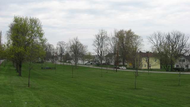
Photo: Nyttend, public domain · Wikimedia Commons
Local history sources: en.wikipedia.org · en.wikipedia.org · en.wikipedia.org · archive.org · commons.wikimedia.org
Water
Mostly private wells The water here
- Middlefield Village88% of residentsGroundwater wells (3 wells)
- Middlefield Mobile Home Park10% of residentsGroundwater wells (11 wells)
- West Farmington Village1% of residentsEast Branch Mahoning River
- Plalan Lake Water Assoc.1% of residentsGroundwater wells (2 wells)
- Nelson Ledges Estates MHP0% of residentsGroundwater wells (3 wells)
Hospitals, fire stations and more
Inside Mesopotamia Township, Trumbull County's boundary: 1 fire or EMS station, 1 public school, 7 private schools, 2 poor-rated bridges, 1 museum and 1 spill case. Press a pin or a name for its whole record and its source.
Fire and EMS stations (1)
-
Mesopotamia Volunteer Fire DepartmentMesopotamia
- Address
- 8800 State Highway 534, Mesopotamia, OH 44439
- Coordinates
- 41.46037, -80.95271
USGS National Map structures (source) ↗ Street map and directions ↗
Source: USGS National Map structures (most Ohio records last updated 2019 to 2022), checked against the Columbus and Cleveland station lists. The department that answers a call is set by jurisdiction and mutual aid, not by distance.
Public schools (1)
-
Mesopotamia Elementary School3 of 5 stars · Mesopotamia
- Address
- 4466 Kinsman Road, Mesopotamia, OH 44439
- School district
- Bloomfield-Mespo Local School District
- Kind (NCES)
- Regular School
- Students, 2023-24
- 116
- Teachers (full-time equivalent)
- 10.5
- Report card, 2025-26
- 3 of 5 stars
- Performance index
- 67.4%
- Ohio building IRN
- 024331
- NCES school ID
- 390500903836
NCES school record ↗ Ohio School Report Card ↗ Street map and directions ↗
Source: NCES EDGE public school locations 2024-25 and Common Core of Data 2023-24 (type, students, teachers); Ohio School Report Cards 2025-26 (Department of Education and Workforce), matched by name within the district.
Private schools (7)
-
Gates Hill SchoolPrivate, religious, independent · Middlefield
- Address
- 4525 Gates E Rd, Middlefield, OH 44062
- Kind
- religious, independent
- Students, 2023-24
- 37
- Teachers (full-time equivalent)
- 2
- Students per teacher
- 18.5
- Phone
- (440) 321-5748
- NCES private school ID
- A1702852
-
Grapevine Creek SchoolPrivate, religious, independent · Middlefield
- Address
- 8857 St Route 534, Middlefield, OH 44062
- Kind
- religious, independent
- Students, 2023-24
- 46
- Teachers (full-time equivalent)
- 3
- Students per teacher
- 15.3333
- Phone
- (440) 693-4413
- NCES private school ID
- A1702853
-
River ValleyPrivate, religious, independent · Middlefield
- Address
- 9263 Laird Rd, Middlefield, OH 44062
- Kind
- religious, independent
- Students, 2023-24
- 47
- Teachers (full-time equivalent)
- 3.8
- Students per teacher
- 12.3684
- Phone
- (240) 693-9955
- NCES private school ID
- A1302475
-
Shady LanePrivate, religious, independent · Middlefield
- Address
- 8852 N Girdle Rd, Middlefield, OH 44062
- Kind
- religious, independent
- Students, 2023-24
- 30
- Teachers (full-time equivalent)
- 2
- Students per teacher
- 15
- NCES private school ID
- A1302491
-
Valley ViewPrivate, religious, independent · Middlefield
- Address
- 5636 Donley Rd, Middlefield, OH 44062
- Kind
- religious, independent
- Students, 2023-24
- 43
- Teachers (full-time equivalent)
- 4
- Students per teacher
- 10.75
- Phone
- (440) 437-3534
- NCES private school ID
- A1302557
-
Willow CreekPrivate, religious, independent · Middlefield
- Address
- 4213 Donley Rd, Middlefield, OH 44062
- Kind
- religious, independent
- Students, 2023-24
- 21
- Teachers (full-time equivalent)
- 2
- Students per teacher
- 10.5
- NCES private school ID
- A1302576
-
Woodchuck KnollPrivate, religious, independent · Middlefield
- Address
- 5247 Parks W Rd, Middlefield, OH 44062
- Kind
- religious, independent
- Students, 2023-24
- 52
- Teachers (full-time equivalent)
- 4.5
- Students per teacher
- 11.5556
- NCES private school ID
- A1302579
Source: NCES Private School Survey 2023-24.
Bridges rated poor (2)
-
Parks West Road over Andrews CreekPoor · built 1989
- Condition
- Poor: a deck, superstructure, substructure or culvert rated 4 or below on the 0 to 9 scale
- What it is
- Culvert
- Built
- 1989
- Length
- 9 ft
- Owner
- County
- Vehicles a day
- 385
- Coordinates
- 41.44256, -80.97506
National Bridge Inventory (source) ↗ Street map and directions ↗
-
Sweet West Road over Mill CreekPoor · built 1914
- Condition
- Poor: a deck, superstructure, substructure or culvert rated 4 or below on the 0 to 9 scale
- What it is
- Bridge
- Built
- 1914
- Length
- 9 ft
- Owner
- County
- Vehicles a day
- 209
- Coordinates
- 41.48908, -80.95011
National Bridge Inventory (source) ↗ Street map and directions ↗
Source: FHWA National Bridge Inventory 2025. "Poor" means one major part rated 4 or below on the 0 to 9 scale; it calls for repair, not closing, unless the state posts or closes the bridge.
Museums, historical societies, gardens and zoos (1)
-
Mesopotamia Memorial And Historical AssociationHistorical society · Mesopotamia
- What it is
- Historical society
- City
- Mesopotamia
- Coordinates
- 41.46441, -80.95041
Search Wikipedia ↗ IMLS Museum Data Files (source) ↗ Street map and directions ↗
The museum list is IMLS's 2018 file; a museum may have closed or moved since.
Source: IMLS Museum Data Files, 2018.
Spills reported since 2021 (1)
-
Material Undetermined / Other2021-09-27 · Mesopotamia Twp
- Reported
- 2021-09-27
- What spilled
- Material Undetermined / Other
- Where
- Mesopotamia Twp, Trumbull County
- Ohio EPA district office
- NEDO
- Ohio EPA case number
- 2109EPA0001525
Ohio EPA spill reports (source) ↗ Street map and directions ↗
Source: Ohio EPA emergency response spill reports, 2021 to September 2026, one point per case where Ohio EPA placed it. A report is what the caller or responder recorded; amounts are often blank or estimated.
Its ZIP codes
Each ZIP code that touches Mesopotamia Township, Trumbull County, with the share of its residents who live here and the same headline figures as the ZIP page.
| ZIP | Share | Water | Radon | Home value | Schools | Flood |
|---|---|---|---|---|---|---|
| 44439 Mesopotamia Township and Mesopotamia | 100% | Mostly private wells | Too few radon tests | Median year built 1932 | Bloomfield-Mespo Local · 4 stars overall | 0.0% of residents in the 1% floodplain |
| 44062 Middlefield Township and Middlefield | 17% | Mostly private wells | 3.6 pCi/L average radon | Median year built 1985 | Cardinal Local · 3.5 stars overall | 0.8% of residents in the 1% floodplain |
| 44450 Greene Township and North Bloomfield | 12% | Mostly private wells | 3.4 pCi/L average radon | Median year built 1960 | Bloomfield-Mespo Local · 4 stars overall | 5.3% of residents in the 1% floodplain |
| 44491 Farmington Township and West Farmington | 1% | Mostly private wells | 2.8 pCi/L average radon | Median year built 1977 | Bristol Local · 4 stars overall | 8.3% of residents in the 1% floodplain |
The county
Geauga County: 11 ZIP codes, 20 cities, villages and townships, 89,999 people.
Nearby places
Quick answers
What county is Mesopotamia Township, Ohio in?
Mesopotamia Township, Trumbull County is a township in Geauga County, Ohio, with 3,404 residents.
When was Mesopotamia Township, Ohio founded?
Mesopotamia Township, Trumbull County was settled 1800-fall (Hezekiah Sperry, first settler); incorporated 1819 (set apart as an independent election precinct, having been governed jointly with a neighboring township from 1806). Founders on record: Hezekiah Sperry, first settler, fall 1800. Source
How did Mesopotamia Township, Ohio get its name?
The 1882 county history states that the township took the name Mesopotamia because that was 'the name requested in the petition to the Legislature' when the township was set apart as an independent election precinct in 1819 -- confirming the name was a deliberate choice by the township's own settlers rather than an accident, though the book does not explain why they specifically chose this classical name for the land between the Tigris and Euphrates rather than a transplanted Connecticut town name, as most neighboring townships did. Source
What ZIP code is Mesopotamia Township, Ohio?
Mesopotamia Township, Trumbull County is served by ZIP codes 44439, 44062 and 44450; 44439 holds the largest share of its residents.
Where does Mesopotamia Township, Ohio get its water?
The main water source for Mesopotamia Township, Trumbull County (Middlefield Village): Mostly private wells.
Cite this page
Cite this page as:
Cracked Buckeye, "Mesopotamia Township, Trumbull County", https://crackedbuckeye.com/place/mesopotamia-township-trumbull-county/, built 2026-10-31, accessed [date].
How to cite · Report a correction · Built 2026-10-31
