Local events in Mclean Township, Shelby County
Nothing is posted for Mclean Township itself yet; here is what is on within 10 miles. All local events in Mclean Township, Shelby County
Know a calendar we should watch? Send the link
Checked October 20; the events page is refreshed daily.
How Mclean Township, Shelby County began
McLean Township was organized March 1, 1834, in the southwest of Shelby County, and was settled mainly by German immigrant families. It contains the village of Fort Loramie, surveyed in 1837 on the site of Peter Loramie's 18th-century fur-trading post and originally named Berlin before being renamed Fort Loramie in 1911. A small part of the village of Minster, mostly in neighboring Auglaize County, extends into the township's northern edge. The township's defining landmark, St. Michael Catholic Church, anchors a German Catholic community that has shaped the area since the mid-1800s.
Incorporated 1834, by organized March 1, 1834; settled largely by German immigrant families.
Where the name comes from
No source consulted documents the specific origin of the name 'McLean' for the township; it is the only McLean Township in Ohio.
Before the town
McLean Township holds the county's most historically significant Native American site: the trading post built in 1769 by French-Canadian trader Pierre-Louis (Peter) de Lorimier on Loramie Creek, at the location later occupied by the village of Fort Loramie. Shawnee raiding parties used the post as a staging area during the Revolutionary War; in November 1782 Colonel Benjamin Logan led about 150 men, as part of George Rogers Clark's campaign against the Shawnee, to raid and destroy it, and Lorimier fled west across the Mississippi. The site lay abandoned until 1795, when, after the Battle of Fallen Timbers, General Anthony Wayne ordered a fort built there; it was completed in December 1795 as a supply depot and is referenced in the Treaty of Greenville (1795) and the Treaty of the Maumee Rapids/Fort Meigs area agreements (1817). The fort was sold to a private owner, James Furrow, in 1815 and converted to a tavern and post office.
Nations recorded here: Shawnee, Miami.
- Loramie's trading post / Fort Loramie (trading post) — village of Fort Loramie, McLean Township, 1769-1782 (trading post); 1795 (U.S. fort) (en.wikipedia.org)
Timeline
- — Pierre-Louis (Peter) de Lorimier establishes a fur-trading post on Loramie Creek at the site of the future village.
- — Colonel Benjamin Logan's detachment, part of George Rogers Clark's campaign, raids and destroys Lorimier's trading post in November; Lorimier flees west of the Mississippi.
- — Following the Battle of Fallen Timbers, General Anthony Wayne orders a fort built on the site, completed in December as a U.S. Army supply depot.
- — The abandoned fort is sold to James Furrow, who converts it into a tavern and post office.
- — McLean Township is organized on March 1, settled mainly by German families.
- — Construction of the Miami and Erie Canal through the area begins, continuing until 1841 and spurring local development.
- — The village on the old fort site, first named Berlin, is surveyed on December 2 by Jonathan Counts.
- — Berlin's first flour mill and general store open, building out the village's commercial core.
- — The village of Berlin is renamed Fort Loramie, restoring the site's older name.
Stories
From trading post to fort to farm town
The ground at the center of McLean Township carried three different lives before it became the German Catholic farm village of Fort Loramie. First it was Peter Loramie's fur-trading post, a hub for Shawnee traders and, during the Revolutionary War, a staging ground for raids on American settlements -- which is exactly why Benjamin Logan's militia burned it down in 1782. Then, after the U.S. Army defeated the regional tribal confederacy at Fallen Timbers in 1794, Anthony Wayne had a proper fort built on the same spot to help hold the peace codified at Greenville. Only decades later, once the fort had been sold off as a tavern and the Miami and Erie Canal had been dug past it, did German immigrant farm families lay out a village there -- first called Berlin, only renamed Fort Loramie in 1911, likely as anti-German sentiment made 'Berlin' an uncomfortable name to carry.
Photographs
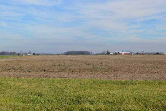
Photo: Nyttend, public domain · Wikimedia Commons
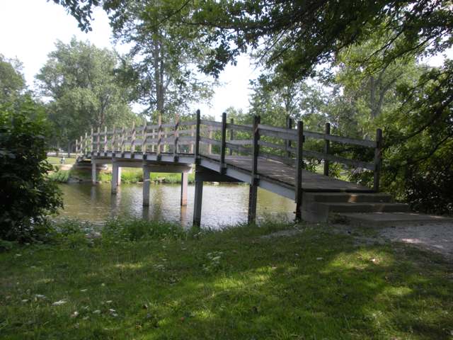
Photo: Dph414, CC BY-SA 3.0 · Wikimedia Commons
Local history sources: en.wikipedia.org · en.wikipedia.org · ohiogenealogyexpress.com · en.wikipedia.org · commons.wikimedia.org
Historic places
1 place in Mclean Township, Shelby County on the National Register of Historic Places. Press a pin or a name for its whole record.
-
Zenas King Bowstring BridgeStructure · Sidney
- Address
- Benjamin Trail, Amos Lake, Tawawa Park
- Where
- Sidney, Shelby County · ZIP 45845
- What it is
- Structure
- Latest NPS certification action
- 2021
- NRIS reference number
- 100007183
- Coordinates
- 40.34581, -84.42081
National Register file (NPS) ↗ Search Wikipedia ↗ Street map and directions ↗ On the Cracked Buckeye map
Source: National Park Service, National Register of Historic Places point file. The listing year is shown where NPS's certification date agrees with the listing's reference number. Listing recognizes significance; it does not restrict a private owner.
Water
Groundwater wells (8 wells) The water here
- Minster Village65% of residentsGroundwater wells (8 wells)
- Fort Loramie Village28% of residentsGroundwater wells (2 wells)
- West Lake Village MHP2% of residentsGroundwater wells (1 wells)
- Anna Village2% of residentsGroundwater wells (3 wells)
- Shelby County Water and Sewer1% of residentsGroundwater wells (2 wells)
- Lake View Village MHP1% of residentsGroundwater wells (1 wells)
- Mccartyville Well Association0% of residentsGroundwater wells (2 wells)
- New Bremen Village0% of residentsGroundwater wells (6 wells)
- Kettlersville Well Association0% of residentsGroundwater wells (2 wells)
Hospitals, fire stations and more
Inside Mclean Township, Shelby County's boundary: 1 high-hazard dam and 1 spill case. Press a pin or a name for its whole record and its source.
High-hazard dams (1)
-
Lake Loramie Dam PoorLoramie Creek · condition: poor
- Hazard class
- High: a failure would probably cost a life
- Condition
- Poor (assessed 11/05/2019)
- River or stream
- Loramie Creek
- Purpose
- Recreation
- Type
- Earth
- Height
- 23 ft
- Storage
- 11,717 acre-feet
- Completed
- 1844
- Owner type
- State
- County
- Shelby County
- Nearest town (NID)
- Fort Loramie
- Last inspection
- 11/07/2024
- Emergency action plan
- Yes
- NID ID
- OH00442
National Inventory of Dams record ↗ National Inventory of Dams (source) ↗ Street map and directions ↗
Source: U.S. Army Corps of Engineers National Inventory of Dams, August 2026. "High hazard" rates what a failure would cost downstream, not how likely one is; the condition is the state's assessment.
Spills reported since 2021 (1)
-
Manure Nos (Not Specified)2023-07-14 · Mclean Twp
- Reported
- 2023-07-14
- What spilled
- Manure Nos (Not Specified)
- Where
- Mclean Twp, Shelby County
- Ohio EPA district office
- SWDO
- Ohio EPA case number
- 2307EPA0001184
Ohio EPA spill reports (source) ↗ Street map and directions ↗
Source: Ohio EPA emergency response spill reports, 2021 to September 2026, one point per case where Ohio EPA placed it. A report is what the caller or responder recorded; amounts are often blank or estimated.
Its ZIP codes
Each ZIP code that touches Mclean Township, Shelby County, with the share of its residents who live here and the same headline figures as the ZIP page.
| ZIP | Share | Water | Radon | Home value | Schools | Flood |
|---|---|---|---|---|---|---|
| 45865 Minster | 21% | Groundwater wells (8 wells) | 5.2 pCi/L average radon | Appraisal records without year built | Minster Local · 5 stars overall | 6.1% of residents in the 1% floodplain |
| 45845 Fort Loramie | 18% | Mostly private wells | 4.1 pCi/L average radon | Median year built 1977 | Fort Loramie Local · 5 stars overall | 7.7% of residents in the 1% floodplain |
| 45302 Anna | 2% | Mostly private wells | 4.6 pCi/L average radon | Median year built 1981 | Anna Local · 5 stars overall | 5.0% of residents in the 1% floodplain |
The county
Auglaize County: 10 ZIP codes, 21 cities, villages and townships, 45,348 people.
Nearby places
Quick answers
What county is Mclean Township, Ohio in?
Mclean Township, Shelby County is a township in Auglaize County, Ohio, with 1,782 residents.
When was Mclean Township, Ohio founded?
Mclean Township, Shelby County was incorporated 1834. Founders on record: organized March 1, 1834; settled largely by German immigrant families. Source
What ZIP code is Mclean Township, Ohio?
Mclean Township, Shelby County is served by ZIP codes 45865 and 45845; 45865 holds the largest share of its residents.
Where does Mclean Township, Ohio get its water?
The main water source for Mclean Township, Shelby County (Minster Village): Groundwater wells (8 wells).
Cite this page
Cite this page as:
Cracked Buckeye, "Mclean Township, Shelby County", https://crackedbuckeye.com/place/mclean-township-shelby-county/, built 2026-10-31, accessed [date].
How to cite · Report a correction · Built 2026-10-31