Local events in Dinsmore Township, Shelby County
Nothing is posted for Dinsmore Township itself yet; here is what is on within 10 miles. All local events in Dinsmore Township, Shelby County
Know a calendar we should watch? Send the link
Checked October 20; the events page is refreshed daily.
How Dinsmore Township, Shelby County began
Dinsmore Township, in the north-center of Shelby County along the Auglaize County line, was one of the county's last townships to be settled and was organized on December 3, 1832, with its first election held at Joseph Green's house on Christmas Day. Settlers from Greene, Hamilton, Warren and Franklin counties and from Germany and France arrived from 1831 on, but milk sickness drove many of the first families away and slowed growth for several years. The Dayton and Michigan Railroad later ran through its western side, and Botkins grew near its north line while Anna straddles its south line with Franklin Township. The rest of the township is level farmland with country schools, the St. Lawrence Catholic parish at Rhine, and tile yards and sawmills that followed the clearing of the forest.
Settled 1831-1832, incorporated 1832-12-03 (organized as a township), by Shelby County commissioners; early settlers William Blakeley, Silas D. Allen, George Turner, Joseph Green and John Munch.
Where the name comes from
Neither the 1883 nor the 1913 county history gives a reason for the name Dinsmore; both record only the commissioners' 1832 order that the new township be organized 'under the name of Dinsmore.' No source we found states a name origin, so none is asserted here.
Before the town
No Native village, mound or trail inside Dinsmore Township is named in the county histories. The commissioners' 1832 order bounded the township on the south by 'the old boundary line,' the Greenville Treaty line of 1795, so the whole township lay north of that line and outside the 1795 cession. The 1883 county history prints the 1817 treaty at the Foot of the Rapids of the Miami of the Lakes (the Treaty of Fort Meigs), made with the Wyandot, Seneca, Lenape (Delaware), Shawnee, Potawatomi, Ottawa and Chippewa, in which the Wyandot cession ran south to the Greenville line between Fort Lawrence and Loramie's store; the county commissioners afterward called the land north of that line 'the new purchase.' Settlement here began only in 1831 and 1832. An earlier version of this page said the land fell within the 1795 Greenville cession; that was wrong and has been corrected.
Nations recorded here: Shawnee, Miami, Wyandot.
- Greenville Treaty line ("the old boundary line") (treaty) — the south line of the township as first bounded by the commissioners on December 3, 1832, 1795 (archive.org)
Timeline
- — William Blakeley of Franklin County entered land in section 9 and Silas D. Allen of Pickaway County land in sections 24 and 25, probably moving onto it the next season.
- — George Turner of Greene County settled in section 28 but left after ten months because of milk sickness; he returned in 1837 and settled in section 22.
- — John Munch of Greene County entered 120 acres in section 28 and Joseph Green of Warren County land nearby; parts of both tracts later became the village of Anna.
- — Dinsmore Township is organized independently, per Shelby County commissioners' records.
- — Voters met at Joseph Green's house to elect the first township officers, as the commissioners' organizing order directed.
- — The Mount Gilead Methodist Episcopal society (later Anna M.E. Church) was organized at Richard C. Dill's house; its hewed-log church of 1841 stood a quarter mile north of Anna in Dinsmore Township.
- — Henry Hildebrant became the first justice of the peace of record in the township.
- — The first schoolhouse, of round logs about twenty feet square, was built in section 9 at the corner of the later Loramie Graveyard; William D. Johnson was the first teacher.
- — The first blackboard in the township was taken out of the schoolhouse by night and hidden in the woods; a second one, introduced in 1849, was kept.
- — Silas D. Allen and George Duff built a steam sawmill, the "old sash mill," in section 26; it ran until about 1861 and was then torn down.
- — Father Henry J. Muckerheide organized the St. Lawrence (St. Laurentius) Catholic society in the schoolhouse of Sub-district No. 1 with about twenty families; its brick church near the southwest corner of section 36 was dedicated in the autumn of 1858.
- — The separate school district for Black pupils was abolished and its children admitted to the other township schools.
- — William P. Davis and M. Merkling opened the Montra Tile Yards on Davis's farm, three-quarters of a mile west of Montra.
- — Estey Grange No. 924, Patrons of Husbandry, was organized with twenty-four charter members.
- — The General Assembly attached parts of sections 27, 28 and 29 to Franklin Township for school purposes, creating the Anna Special Joint School District.
- — The U.S. Census records 3,379 residents in Dinsmore Township, across 36.3 square miles, including the village of Botkins and part of Anna.
Stories
Milk sickness and a slow start
Dinsmore was organized late, on December 3, 1832, and its first years were hard. The 1883 county history says so many families claimed to be first that the question embarrassed its editor, but the record points to William Blakeley and Silas D. Allen entering land in 1831 and to George Turner, Joseph Green, John Munch, Richard C. Dill and Richard Botkin arriving in 1832. Turner left after ten months because of milk sickness and returned only in 1837. The history says the disease was so common that many newcomers went back to their old homes or moved farther west, which accounts for the township's slow growth for several years. The 1913 history adds that settlement became general only in the 1840s.
The blackboard in the woods
The first schoolhouse in Dinsmore, built in 1836 in section 9, was of round logs with a puncheon floor, a stick chimney and a single-pane window, and William D. Johnson taught there first. In 1846 a teacher introduced the township's first blackboard, a planed board about five feet by three, painted black and propped against the wall on slats. Parents called it a nuisance because it drew the whole school's attention while the teacher worked at it. Someone carried it out of the schoolhouse at night and hid it in the woods. When another teacher brought in a blackboard in 1849, it stayed, and by 1883 every district school had slate boards.
A school district for Black children
The 1883 history records that several Black families, among them Moses Redman, George Goins, Humphry Clinton and Blake Reynolds, settled about 1832 in the part of Van Buren Township that was later attached to Dinsmore. When the township's school board laid out nine regular districts, one schoolhouse at the center of every four sections, it added a tenth district for Black pupils. That separate district was abolished in 1870, and Black children then attended the other township schools. The 1913 county history repeats the account and dates the end of school segregation in the township to the same year.
Photographs
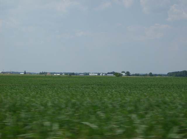
Photo: Nyttend, public domain · Wikimedia Commons
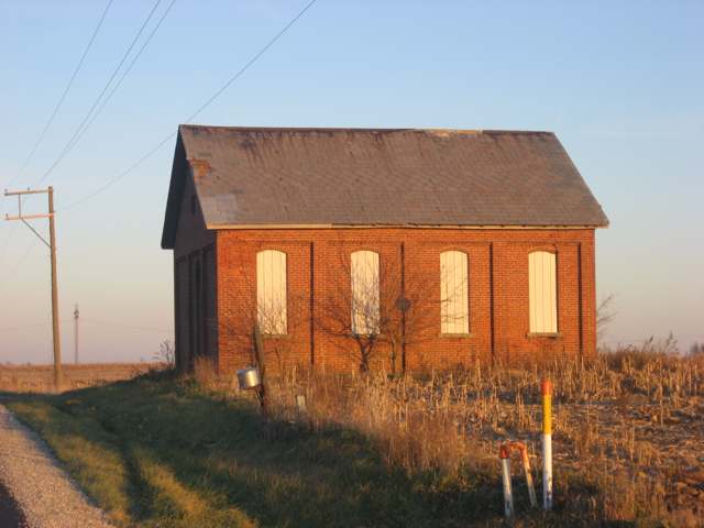
Photo: Nyttend, public domain · Wikimedia Commons
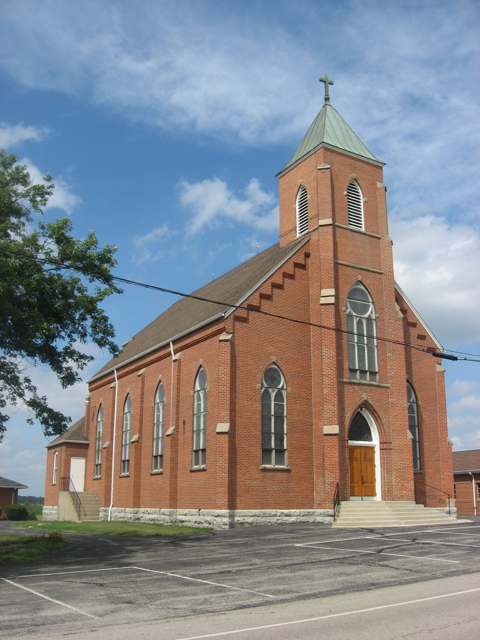
Photo: Nyttend, public domain · Wikimedia Commons
Local history sources: en.wikipedia.org · en.wikipedia.org · commons.wikimedia.org · commons.wikimedia.org · commons.wikimedia.org · commons.wikimedia.org · archive.org · archive.org · archive.org · archive.org · archive.org · archive.org · archive.org · archive.org · archive.org · archive.org · archive.org
Historic places
1 place in Dinsmore Township, Shelby County on the National Register of Historic Places. Press a pin or a name for its whole record.
-
Immaculate Conception Rectory at BotkinsBuilding · Botkins · listed 1979
- Address
- 116 N. Mill St.
- Where
- Botkins, Shelby County · ZIP 45306
- What it is
- Building
- Listed on the National Register
- 1979
- NRIS reference number
- 79002876
- Coordinates
- 40.46924, -84.17441
National Register file (NPS) ↗ Search Wikipedia ↗ Street map and directions ↗ On the Cracked Buckeye map
Source: National Park Service, National Register of Historic Places point file. The listing year is shown where NPS's certification date agrees with the listing's reference number. Listing recognizes significance; it does not restrict a private owner.
Water
Groundwater wells (4 wells) The water here
- Botkins Village51% of residentsGroundwater wells (4 wells)
- Anna Village39% of residentsGroundwater wells (3 wells)
- Mccartyville Well Association8% of residentsGroundwater wells (2 wells)
- Kettlersville Well Association1% of residentsGroundwater wells (2 wells)
Hospitals, fire stations and more
Inside Dinsmore Township, Shelby County's boundary: 1 poor-rated bridge, 1 museum and 5 spill cases. Press a pin or a name for its whole record and its source.
Bridges rated poor (1)
-
Englehaupt Road over Loramie CreekPoor · built 1971
- Condition
- Poor: a deck, superstructure, substructure or culvert rated 4 or below on the 0 to 9 scale
- What it is
- Bridge
- Built
- 1971
- Length
- 14 ft
- Owner
- County
- Vehicles a day
- 324
- Coordinates
- 40.47896, -84.14517
National Bridge Inventory (source) ↗ Street map and directions ↗
Source: FHWA National Bridge Inventory 2025. "Poor" means one major part rated 4 or below on the 0 to 9 scale; it calls for repair, not closing, unless the state posts or closes the bridge.
Museums, historical societies, gardens and zoos (1)
-
Anna District Historical SocietyHistorical society · Anna
- What it is
- Historical society
- City
- Anna
- Coordinates
- 40.42019, -84.13524
Search Wikipedia ↗ IMLS Museum Data Files (source) ↗ Street map and directions ↗
The museum list is IMLS's 2018 file; a museum may have closed or moved since.
Source: IMLS Museum Data Files, 2018.
Spills reported since 2021 (5)
-
Material Unknown2024-09-04 · Dinsmore Twp
- Reported
- 2024-09-04
- What spilled
- Material Unknown
- Where
- Dinsmore Twp, Shelby County
- Ohio EPA district office
- SWDO
- Ohio EPA case number
- 2409EPA0001519
Ohio EPA spill reports (source) ↗ Street map and directions ↗
-
Natural Gas2023-04-13 · Dinsmore Twp
- Reported
- 2023-04-13
- What spilled
- Natural Gas
- Where
- Dinsmore Twp, Shelby County
- Ohio EPA district office
- SWDO
- Ohio EPA case number
- 2304EPA0000596
Ohio EPA spill reports (source) ↗ Street map and directions ↗
-
Fuel Diesel / Diesel Fuel (Vehicle On Or Off Road)2022-12-17 · Dinsmore Twp
- Reported
- 2022-12-17
- What spilled
- Fuel Diesel / Diesel Fuel (Vehicle On Or Off Road)
- Where
- Dinsmore Twp, Shelby County
- Ohio EPA district office
- SWDO
- Ohio EPA case number
- 2212EPA0001875
Ohio EPA spill reports (source) ↗ Street map and directions ↗
-
Fuel Diesel / Diesel Fuel (Vehicle On Or Off Road)2021-07-05 · Dinsmore Twp
- Reported
- 2021-07-05
- What spilled
- Fuel Diesel / Diesel Fuel (Vehicle On Or Off Road)
- Largest amount reported
- 15 gallons
- Where
- Dinsmore Twp, Shelby County
- Ohio EPA district office
- SWDO
- Ohio EPA case number
- 2107EPA0000991
Ohio EPA spill reports (source) ↗ Street map and directions ↗
-
Fuel Diesel / Diesel Fuel (Vehicle On Or Off Road)2026-07-30 · Dinsmore Twp
- Reported
- 2026-07-30
- What spilled
- Fuel Diesel / Diesel Fuel (Vehicle On Or Off Road)
- Where
- Dinsmore Twp, Shelby County
- Ohio EPA district office
- SWDO
- Ohio EPA case number
- 2607EPA0001397
Ohio EPA spill reports (source) ↗ Street map and directions ↗
Source: Ohio EPA emergency response spill reports, 2021 to September 2026, one point per case where Ohio EPA placed it. A report is what the caller or responder recorded; amounts are often blank or estimated.
Its ZIP codes
Each ZIP code that touches Dinsmore Township, Shelby County, with the share of its residents who live here and the same headline figures as the ZIP page.
| ZIP | Share | Water | Radon | Home value | Schools | Flood |
|---|---|---|---|---|---|---|
| 45306 Botkins | 29% | Groundwater wells (4 wells) | 8.8 pCi/L average radon | Median year built 1967 | Botkins Local · 4.5 stars overall | 5.0% of residents in the 1% floodplain |
| 45302 Anna | 17% | Mostly private wells | 4.6 pCi/L average radon | Median year built 1981 | Anna Local · 5 stars overall | 5.0% of residents in the 1% floodplain |
Local government
Who holds office in Dinsmore Township, Shelby County, how its elections and ballot issues came out, and the state auditor's record.
Money issues on the ballot since 2019: 3 of 3 passed; of those asking for new or higher taxes, 1 of 1.
Ballot issues
| Date | Issue | For | Against | Result |
|---|---|---|---|---|
| 2023-11-07 | Issue: Proposed Tax Levy (Renewal and Increase) - Fire Dinsmore Township | 352 | 271 | Passed (56.5% for) |
| 2023-11-07 | Issue: Proposed Tax Levy (Renewal) - Roads Dinsmore Township | 413 | 210 | Passed (66.29% for) |
| 2019-11-05 | Issue: Dinsmore Township Tax Levy - No Villages | 199 | 144 | Passed (58.02% for), unofficial |
Elections for office
| Date | Office | Candidates and votes |
|---|---|---|
| 2023-11-07 | Township Trustee | Keith Elsass 497, 37.23%; Adam King 290, 21.72%; Doug Schmerge 548, 41.05% |
| 2019-11-05 | Township Trustee (unofficial count) | Ted T. Zimpfer 651, 100.0% |
Winners in bold. Results from the county board of elections' official canvass unless marked.
The county
Shelby County: 11 ZIP codes, 21 cities, villages and townships, 45,735 people.
Nearby places
Quick answers
What county is Dinsmore Township, Ohio in?
Dinsmore Township, Shelby County is a township in Shelby County, Ohio, with 1,372 residents.
When was Dinsmore Township, Ohio founded?
Dinsmore Township, Shelby County was settled 1831-1832; incorporated 1832-12-03 (organized as a township). Founders on record: Shelby County commissioners; early settlers William Blakeley, Silas D. Allen, George Turner, Joseph Green and John Munch. Source
How did Dinsmore Township, Ohio get its name?
Neither the 1883 nor the 1913 county history gives a reason for the name Dinsmore; both record only the commissioners' 1832 order that the new township be organized 'under the name of Dinsmore.' No source we found states a name origin, so none is asserted here. Source
What ZIP code is Dinsmore Township, Ohio?
Dinsmore Township, Shelby County is served by ZIP codes 45306 and 45302; 45306 holds the largest share of its residents.
Where does Dinsmore Township, Ohio get its water?
The main water source for Dinsmore Township, Shelby County (Botkins Village): Groundwater wells (4 wells).
Cite this page
Cite this page as:
Cracked Buckeye, "Dinsmore Township, Shelby County", https://crackedbuckeye.com/place/dinsmore-township-shelby-county/, built 2026-10-31, accessed [date].
How to cite · Report a correction · Built 2026-10-31
