Local events in Maineville
Nothing is posted for Maineville itself yet; here is what is on within 10 miles. All local events in Maineville
Know a calendar we should watch? Send the link
Checked October 20; the events page is refreshed daily.
How Maineville began
Maineville grew up on Wilson's Clearing, an abandoned 1802 improvement on the Little Miami River, after emigrants from Phillips and Farmington, Maine began arriving in 1815 and the settlement became known as "Yankeetown." By the 1820s local Baptists were calling it Maineville in tribute to the settlers' home state, and the village was incorporated on March 23, 1850. It remained a small Little Miami valley village through the 20th century before rapid suburban growth after 2000 nearly quadrupled its population. It is now a residential village in Hamilton Township, Warren County.
Settled 1815, incorporated 1850-03-23, by New England migrants led by families from Phillips and Farmington, Maine, including Moses Dudley (first arrival, 1815) and Dr. John Cottle (1818).
Where the name comes from
The site was first called Wilson's Clearing after John Wilson's abandoned improvement of about 1802, then "Yankeetown" as New England settlers moved in after the War of 1812. Around 1821-1823 local Free Will Baptist members began using the name "Maineville" to honor the home state of most of the first permanent settlers, who had come mainly from Phillips, Maine, with others from nearby Farmington; the new name gradually replaced Yankeetown.
Before the town
No site-specific record of a Native village, camp, or earthwork within present Maineville was found in the sources checked. The village sits in the Little Miami River valley, which was long-used travel corridor: the Old Miami Trail, an eminent prehistoric and historic-era trading and war path between the northern and southern Ohio nations, ran along the east side of the Little Miami River through this stretch of Warren County. Warren County also holds part of Fort Ancient, the large Hopewell-era hilltop enclosure (built roughly 100 BC-AD 400 and later reused by the Fort Ancient culture) inscribed in 2023 as part of Ohio's first UNESCO World Heritage Site, but Fort Ancient itself stands near Oregonia, not in Hamilton Township, so it is county-level rather than local context. The historic-era Miami and Shawnee both used the Little Miami watershed; a Miami village stood somewhere along the river by the late 1600s, and the most prominent regional Shawnee town was Old Chillicothe near present Xenia, both well upstream of Maineville. This part of Warren County was ceded to the United States under the Treaty of Greenville (1795).
Nations recorded here: Shawnee, Miami, Hopewell culture, Fort Ancient culture.
Timeline
- — John Wilson made an improvement on the future village site, then abandoned it; it grew into a thicket that settlers later called Wilson's Clearing.
- — Moses Dudley, an emigrant from Maine, arrived and built the first frame house in the village, the start of the migration that founded Maineville.
- — Dr. John Cottle, also from Maine, settled in the village and became its prominent early physician.
- — Benjamin Tufts arrived from Phillips, Maine and settled on the north side of the town, part of the wave of New England settlers who gave the place its first name, Yankeetown.
- — The Free Will Baptists organized a congregation with Elder Moses Dudley as first pastor; it was among the members of this church that the name Maineville began to be used.
- — A Methodist congregation was established in the village.
- — The Ohio legislature incorporated Maineville as a village; at the first election on April 2, 1850, Silas Dudley was elected mayor but declined to serve, and R.Y. Blackstone became the first acting mayor.
- — A post office was established at Maineville.
- — Maineville appears as a named village inset on P. O'Beirne's map of Warren County, Ohio.
- — The Maineville Village Council adopted an official village flag, designed by John Michael (later village mayor), combining the Ohio and Maine state seals.
- — The U.S. Census recorded Maineville's population at 1,405, up from 359 in 2000, reflecting rapid suburban growth in the village.
Stories
A hundred families from Maine
After the War of 1812 a thicket on the Little Miami River called Wilson's Clearing began filling with New England families. Moses Dudley arrived from Maine in 1815 and built the settlement's first frame house; Dr. John Cottle followed in 1818, and Benjamin Tufts came from Phillips, Maine in 1822 to settle the north side of town. So many families arrived from Maine, chiefly from Phillips and neighboring Farmington, that the growing settlement was first nicknamed Yankeetown by its neighbors. Around 1823, members of the newly organized Free Will Baptist church, led by Elder Moses Dudley, began calling the place Maineville in tribute to the settlers' home state, and the name stuck, eventually replacing Yankeetown entirely. The village was formally incorporated under that name on March 23, 1850. Nearly a century and a half later, in 1994, the village council adopted a flag pairing the Ohio and Maine state seals, formally memorializing the same migration story in civic symbol.
Butterworth: the station that vanished
A few miles from Maineville, in Hamilton Township along the Little Miami River west of what is now Butterworth Road, stood Butterworth, also known as Butterworth Station. It took its name from Benjamin Butterworth, the original owner of the site. The place appears in Warren County's historical gazetteer records as a named locality tied to the Little Miami valley rail corridor, but it never grew into an incorporated town and no longer functions as a community today; it survives mainly as a place name and, locally, the remains of a stone house. It stands alongside other vanished Warren County places such as Beedles Station, Browns Store, Hammel and Venable as a reminder of how many small landings and stops along the Little Miami dwindled once the surrounding villages, including Maineville, absorbed the local population and trade.
Photographs
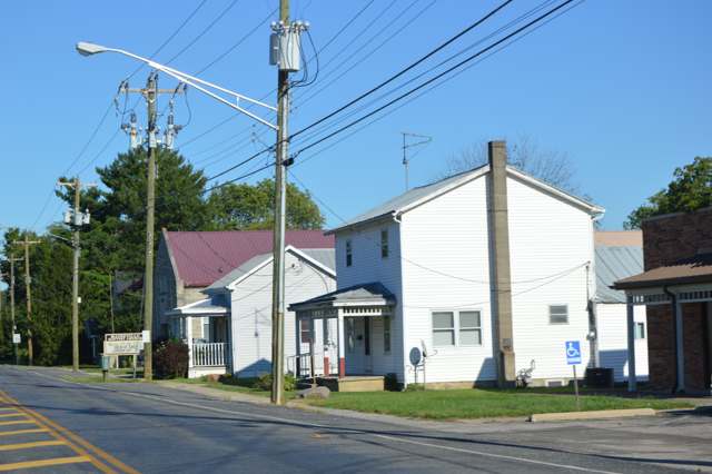
Photo: Nyttend, public domain · Wikimedia Commons
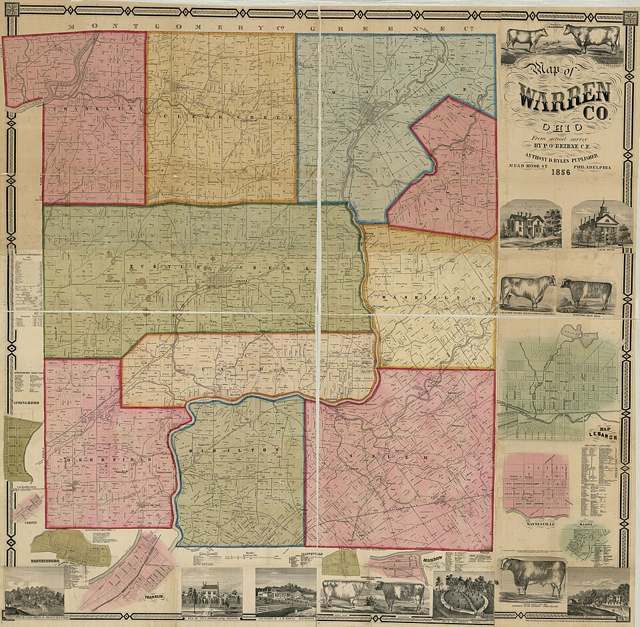
Photo: P. O'Beirne; Library of Congress Geography and Map Division, public domain · Wikimedia Commons
Local history sources: en.wikipedia.org · warren.ohgenweb.org · warren.ohgenweb.org · en.wikipedia.org · mainevilleoh.com · warren.ohgenweb.org · ohiohistory.org · wcpo.com · en.wikipedia.org · commons.wikimedia.org · commons.wikimedia.org · water.warrencountyohio.gov
Water
17 groundwater wells drawing from the Little Miami River buried valley (sand-and-gravel) aquifer along the river near Maineville, in southern Warren County The water here
- Warren County93% of residentsWells in the Little Miami and Great Miami river valley aquifers
- Western Water Company5% of residentsLittle Miami River valley wells (51%) plus Cincinnati Ohio River water (49%)
- Morrow Village1% of residentsGroundwater wells (3 wells)
- Cincinnati Public Water System0% of residentsOhio River (Miller Plant, ~88%) plus Great Miami Buried Valley Aquifer wells (~12%)
- South Lebanon City0% of residentsOhio River (Miller Plant, ~88%) plus Great Miami Buried Valley Aquifer wells (~12%)
Its ZIP codes
Each ZIP code that touches Maineville, with the share of its residents who live here and the same headline figures as the ZIP page.
| ZIP | Share | Water | Radon | Home value | Schools | Flood |
|---|---|---|---|---|---|---|
| 45039 Hamilton Township and Maineville | 5% | 17 groundwater wells drawing from the Little Miami River buried valley (sand-and-gravel) aquifer along the river near Maineville, in southern Warren County | 4.4 pCi/L average radon | Appraisal records without year built | Little Miami Local · 4.5 stars overall | 3.2% of residents in the 1% floodplain |
| 45152 Hamilton Township and Morrow | 1% | Ohio River intake at the plant's riverfront on Kellogg Ave in the California neighborhood, east Cincinnati | 5.9 pCi/L average radon | Appraisal records without year built | Little Miami Local · 4.5 stars overall | 7.4% of residents in the 1% floodplain |
Local government
Who holds office in Maineville, how its elections and ballot issues came out, and the state auditor's record.
Elections for office
| Date | Office | Candidates and votes |
|---|---|---|
| 2017-11-07 | Member of Council | Linda J. Humphries 113, 36.45%; Roger Lew Bingham 112, 36.13%; Roger Gaebel 85, 27.42% |
| 2015-11-03 | Member of Council | Michael Kembel 238, 94.07%; Leslie Morris 15, 5.93% |
| 2015-11-03 | Mayor | Wm. Shearer 269, 100.0% |
Winners in bold. Results from the county board of elections' official canvass unless marked.
Auditor of State record
- No fiscal caution, watch or emergency on the Auditor of State's lists.
- Agreed Upon Procedures, 2022 to 2023, released 2024-09-24
The county
Warren County: 12 ZIP codes, 24 cities, villages and townships, 222,825 people.
Nearby places
Rain and snow
How much has actually fallen on Maineville, day by day, from 1893 to now. Daily totals, not averages.
- rain, last 30 days
- 1.11 in
- 2026-09-30 to 2026-10-29
- rain so far in 2026
- 44.2 in
- 5.0 in above normal for the date
- snow so far in 2026
- 16.2 in
- a normal year brings 16.8 in
- a normal year
- 46.1 in
- average of 30 years, 1991-2020
| Month | Rain (in) | Snow (in) | Days counted |
|---|---|---|---|
| October 2026 | 1.11 | — | 29 |
| September 2026 | 7.82 | — | 30 |
| August 2026 | 5.81 | — | 31 |
| July 2026 | 4.19 | — | 31 |
| June 2026 | 4.67 | — | 30 |
| May 2026 | 6.38 | — | 31 |
| April 2026 | 4.02 | — | 30 |
| March 2026 | 7.22 | 0.1 | 31 |
| February 2026 | 1.23 | 5.3 | 28 |
| January 2026 | 1.74 | 10.8 | 31 |
| December 2025 | 2.68 | 11.4 | 31 |
| November 2025 | 3.77 | 1.9 | 30 |
| Wettest year | 2011 — 65.2 in |
|---|---|
| Driest year | 1934 — 21.6 in |
| Snowiest year | 1977 — 50.8 in |
| Wettest day on record | 18 July 2001 — 5.11 in |
| Heaviest snowfall in a day | 23 December 2004 — 12.52 in |
| Deepest snow on the ground | 21 January 1978 — 14.14 in |
Estimated, not measured. No rain gauge has ever stood inside Maineville, so every figure here is worked out from the gauges around it - the nearest ones weighted most. Treat them as close estimates rather than readings.
47,949 days of records, 1893-01-01 to 2026-10-29. Source: NOAA NCEI GHCN-Daily, 3,240 gauges in and around Ohio. A day is "gauged" when a gauge standing inside the boundary reported it, and the value is the mean of those gauges. Otherwise it is interpolated by inverse distance from every gauge reporting within 50 miles. Nothing is carried forward, back-filled or smoothed. Against NOAA nClimDiv county monthly precipitation over 136,848 complete county-months (checked 2026-10-31): correlation 0.9515, median absolute difference 0.217 in a month. Built 2026-10-31 from the Cracked Buckeye precipitation archive. Snow is the softer number — snowfall is measured by hand with a ruler, no agency publishes a gridded county snowfall series, and blowing snow defeats every observer.
Environmental permits and filings
What Ohio EPA has on file for Maineville: permits, inspections, violations, cleanups and the state loans behind sewer and water work. Every line links to the agency's own document.
- facilities and sites on file
- 6
- those placed on the map inside Maineville
| Program | Facilities and sites |
|---|---|
| Wastewater and stormwater discharge | 4 |
| Wetland and stream fill | 2 |
| Date | Facility or site | What |
|---|---|---|
| WHISPERING WOODS SUBDIVISION | Wetland and stream fill permit | |
| WHISPERING WOODS SUBDIVISION | Wetland and stream fill permit | |
| WHISPERING WOODS SUBDIVISION | Wetland and stream fill permit | |
| WHISPERING WOODS SUBDIVISION | Wetland and stream fill permit | |
| WHISPERING WOODS SUBDIVISION | Wastewater and stormwater discharge permit | |
| WELLINGTON GLEN RESIDENTIAL DEVELOPMENT | Wetland and stream fill permit | |
| WELLINGTON GLEN RESIDENTIAL DEVELOPMENT | Wetland and stream fill permit | |
| WELLINGTON GLEN RESIDENTIAL DEVELOPMENT | Wetland and stream fill permit | |
| WELLINGTON GLEN RESIDENTIAL DEVELOPMENT | Wetland and stream fill permit | |
| WELLINGTON GLEN RESIDENTIAL DEVELOPMENT | Wetland and stream fill permit | |
| MORNINGSIDE | Wastewater and stormwater discharge permit | |
| CRANE MEAOWS SEC 3 | Wastewater and stormwater discharge permit | |
| WELLINGTON GLEN RESIDENTIAL DEVELOPMENT | Wetland and stream fill permit | |
| STOTLER II OFFSITE SANITARY SEWER | Wastewater and stormwater discharge permit |
Source: Ohio EPA eDocument portal (edocpub.epa.ohio.gov), indexed 2026-10-14. Facilities are placed on the map from Ohio EPA's own map layers, EPA's Facility Registry, coordinates written in the filings, or a geocoded street address. A permit filed under a private person's name (most are household septic systems) is counted but never named, placed or linked; licenses for individual workers and open-burning notices are left out entirely.
Quick answers
What county is Maineville, Ohio in?
Maineville is a village in Warren County, Ohio, with 1,419 residents.
When was Maineville, Ohio founded?
Maineville was settled 1815; incorporated 1850-03-23. Founders on record: New England migrants led by families from Phillips and Farmington, Maine, including Moses Dudley (first arrival, 1815) and Dr. John Cottle (1818). Source
How did Maineville, Ohio get its name?
The site was first called Wilson's Clearing after John Wilson's abandoned improvement of about 1802, then "Yankeetown" as New England settlers moved in after the War of 1812. Source
What ZIP code is Maineville, Ohio?
Most of Maineville is in ZIP code 45039.
Where does Maineville, Ohio get its water?
The main water source for Maineville (Warren County): 17 groundwater wells drawing from the Little Miami River buried valley (sand-and-gravel) aquifer along the river near Maineville, in southern Warren County.
Cite this page
Cite this page as:
Cracked Buckeye, "Maineville, Warren County", https://crackedbuckeye.com/place/maineville/, built 2026-10-31, accessed [date].
How to cite · Report a correction · Built 2026-10-31
