Local events in Salem Township, Warren County
Nothing is posted for Salem Township itself yet; here is what is on within 10 miles. All local events in Salem Township, Warren County
Know a calendar we should watch? Send the link
Checked October 20; the events page is refreshed daily.
How Salem Township, Warren County began
Salem Township was organized from Hamilton Township on June 8, 1818 (the county history gives June 24), and sits on both banks of the Little Miami River — a Virginia Military District section south of the river and a Symmes Purchase section to the north. Virginia military land warrants were surveyed here from about 1790, and the Treaty of Greenville (1795) cleared the way for permanent settlement. In 1844-45 the Little Miami Railroad platted the village of Morrow, named for Ohio Governor Jeremiah Morrow, at the confluence of the river and Todd Fork; Morrow, now the township's only village, has driven most of its growth since. The township briefly lost its name in 1860, when the legislature renamed it Corwin Township before county commissioners restored Salem within the same year.
Settled c. 1790 (Virginia Military land warrants), incorporated 1818-06-08, by organized from Hamilton Township by Warren County commissioners.
Where the name comes from
No source consulted records why this township was named Salem; it is one of fourteen townships of that name in Ohio, and the name is not explained in either Wikipedia's article or the 1882 county history's account of the township's 1818 organization and 1860 renaming dispute.
Before the town
No Native American village, mound, earthwork, trail, or treaty event specific to Salem Township itself is recorded in the sources checked. The land became available to settlers under the Treaty of Greenville (August 3, 1795), following Gen. Anthony Wayne's 1794 victory over the Western Confederacy at Fallen Timbers; before that, the 1882 county history notes that Virginia Military District land warrants began to be surveyed here around 1790, 'the Indians being then comparatively peaceable,' until renewed hostilities intervened and lasted until Wayne's victory. The wider Little Miami valley in which the township lies was Miami and Shawnee territory in the historic period; the nearest well-documented Shawnee town, Old Chillicothe (Chalahgawtha), lay on the Little Miami near present-day Xenia, outside Warren County. Fort Ancient, the large Hopewell-era hilltop earthwork on the Little Miami about seven miles from Lebanon, lies in neighboring Washington Township, not Salem, and is noted here only as regional context, not as a township site. See the county file for more in this project to expand on the county's Native history.
Nations recorded here: Miami, Shawnee, Hopewell culture.
Timeline
- — Virginia Military District land warrants were surveyed in the future township's southern section, interrupted by renewed conflict with Native nations that lasted until General Wayne's 1794 victory at Fallen Timbers.
- — The Treaty of Greenville ceded the land that would become Salem Township, along with most of southern and eastern Ohio, to the United States.
- — Warren County commissioners organized Salem Township out of Hamilton Township, following a petition from residents of both townships.
- — The Little Miami Railroad laid track to the confluence of the Little Miami River and Todd Fork, where developers William H. Clement, George Keck, and Clark Williams platted the village of Morrow on the site of a farm.
- — Morrow was established as a stop on the Little Miami Railroad and named for Jeremiah Morrow, Ohio's ninth governor; a post office opened there the same year.
- — Morrow's census population reached 458-459, described by the county history as already 'a thriving and quite a well built village.'
- — The Ohio legislature carved Harlan Township from Salem's territory and renamed the remainder Corwin Township; Warren County commissioners reversed the renaming within the same year after a second petition, and added nine sections from Union Township north of the Little Miami ('North Salem').
- — The Millgrove Road Bridge, an iron through-truss span, was built over the Little Miami Scenic River at County Road 38 near Morrow, on the Salem-Washington township line; it was later replaced and no longer stands.
- — Morrow's population peaked at 1,486 before declining over the following decades.
- — The U.S. Census recorded 5,215 residents in Salem Township and 2,049 in Morrow, a 72.5% jump for the village over 2010.
Stories
A Township Renamed Twice in One Year
In 1860 the Ohio General Assembly split Salem Township, carving the new Harlan Township from its eastern section and, in the same act, renaming what remained Corwin Township — likely honoring the prominent Corwin family of nearby Lebanon. The change did not sit well with residents. Within months a second petition reached the Warren County commissioners asking that the old name be restored, and on June 6, 1860, they granted it: Corwin Township became Salem again. In the same session the commissioners also shifted nine sections from Union Township, on the north side of the Little Miami, into Salem, giving the township the two-part shape — 'North Salem' and 'South Salem' — that its land records still show. The whole episode, name change and reversal packed into a single year, is preserved only in the county's 1882 history and the township's own subsequent minutes.
Morrow Rises With the Railroad
Before 1844 the ground where Morrow now stands was a farm at the point where Todd Fork empties into the Little Miami River. That changed when the Little Miami Railroad, building its line from Cincinnati toward Springfield, reached the site; developers William H. Clement, George Keck, and Clark Williams — all connected to the railroad's construction — platted a village there and named it for Jeremiah Morrow, the state's ninth governor and a Warren County figure in his own right. By 1850 the new town already counted 458 or 459 residents and was, in the words of the county historian, 'a thriving and quite a well built village.' Morrow's identity as a railroad town outlived the steam era: long after the line itself faded, the town's name lived on nationally through the 1903 novelty recording 'I Want to Go to Morrow,' a pun on the village's name later revived by the Kingston Trio. The village remains the only incorporated place lying entirely inside Salem Township.
Photographs
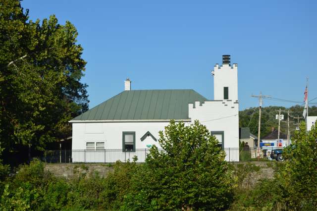
Photo: Nyttend, public domain · Wikimedia Commons
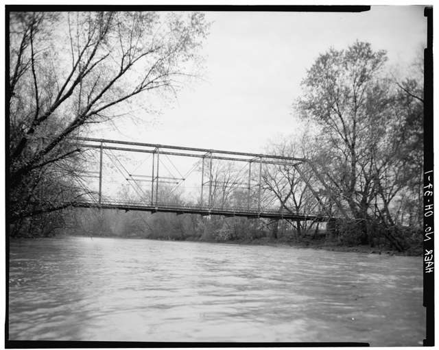
Photo: Historic American Engineering Record, National Park Service / Library of Congress, public domain · Wikimedia Commons
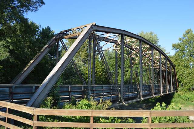
Photo: Nyttend, public domain · Wikimedia Commons
Local history sources: en.wikipedia.org · warren.ohgenweb.org · en.wikipedia.org · en.wikipedia.org · en.wikipedia.org · en.wikipedia.org · en.wikipedia.org · commons.wikimedia.org · commons.wikimedia.org · commons.wikimedia.org · commons.wikimedia.org · commons.wikimedia.org
Water
Ohio River intake at the plant's riverfront on Kellogg Ave in the California neighborhood, east Cincinnati The water here
- Western Water Company56% of residentsLittle Miami River valley wells (51%) plus Cincinnati Ohio River water (49%)
- Warren County22% of residentsWells in the Little Miami and Great Miami river valley aquifers
- Morrow Village17% of residentsGroundwater wells (3 wells)
- South Lebanon City4% of residentsOhio River (Miller Plant, ~88%) plus Great Miami Buried Valley Aquifer wells (~12%)
Hospitals, fire stations and more
Inside Salem Township, Warren County's boundary: 1 high-hazard dam and 3 spill cases. Press a pin or a name for its whole record and its source.
High-hazard dams (1)
-
Lilley Lake Dam PoorTributary To Halls Creek · condition: poor
- Hazard class
- High: a failure would probably cost a life
- Condition
- Poor (assessed 03/05/2025)
- River or stream
- Tributary To Halls Creek
- Purpose
- Recreation
- Type
- Earth
- Height
- 43 ft
- Storage
- 210 acre-feet
- Completed
- 1954
- Owner type
- Private
- County
- Warren County
- Nearest town (NID)
- Oregonia
- Last inspection
- 05/16/2024
- Emergency action plan
- No
- NID ID
- OH00547
National Inventory of Dams record ↗ National Inventory of Dams (source) ↗ Street map and directions ↗
Source: U.S. Army Corps of Engineers National Inventory of Dams, August 2026. "High hazard" rates what a failure would cost downstream, not how likely one is; the condition is the state's assessment.
Spills reported since 2021 (3)
-
Fuel Diesel / Diesel Fuel (Vehicle On Or Off Road)2025-06-18 · Salem Twp
- Reported
- 2025-06-18
- What spilled
- Fuel Diesel / Diesel Fuel (Vehicle On Or Off Road); Other / All Other / Trade Name / Mixture / Solution Etc
- Largest amount reported
- 300 gallons
- Where
- Salem Twp, Warren County
- Ohio EPA district office
- SWDO
- Ohio EPA case number
- 2506EPA0001001
Ohio EPA spill reports (source) ↗ Street map and directions ↗
-
Oil Transformer Non Pcb2025-04-03 · Salem Twp
- Reported
- 2025-04-03
- What spilled
- Oil Transformer Non Pcb
- Largest amount reported
- 30 gallons
- Where
- Salem Twp, Warren County
- Ohio EPA district office
- SWDO
- Ohio EPA case number
- 2504EPA0000483
Ohio EPA spill reports (source) ↗ Street map and directions ↗
-
Material Blue Reached water2023-09-19 · Salem Twp
- Reported
- 2023-09-19
- What spilled
- Material Blue
- Reached a waterway
- 83 - Little Miami River
- Where
- Salem Twp, Warren County
- Ohio EPA district office
- SWDO
- Ohio EPA case number
- 2309EPA0001629
Ohio EPA spill reports (source) ↗ Street map and directions ↗
Source: Ohio EPA emergency response spill reports, 2021 to September 2026, one point per case where Ohio EPA placed it. A report is what the caller or responder recorded; amounts are often blank or estimated.
Its ZIP codes
Each ZIP code that touches Salem Township, Warren County, with the share of its residents who live here and the same headline figures as the ZIP page.
| ZIP | Share | Water | Radon | Home value | Schools | Flood |
|---|---|---|---|---|---|---|
| 45152 Hamilton Township and Morrow | 22% | Ohio River intake at the plant's riverfront on Kellogg Ave in the California neighborhood, east Cincinnati | 5.9 pCi/L average radon | Appraisal records without year built | Little Miami Local · 4.5 stars overall | 7.4% of residents in the 1% floodplain |
Local government
Who holds office in Salem Township, Warren County, how its elections and ballot issues came out, and the state auditor's record.
Money issues on the ballot since 2015: 1 of 2 passed.
Ballot issues
| Date | Issue | For | Against | Result |
|---|---|---|---|---|
| 2017-11-07 | Issue 10: 10 Salem Twp Electric Aggregation | 651 | 596 | Passed (52.21% for) |
| 2016-11-08 | Issue 11: 11 Salem Twp Tax Levy Fire | 1,448 | 1,020 | Passed (58.67% for) |
| 2015-05-05 | Issue 2: 2 Salem Twp Tax Levy Fire Add 3.9 5 years | 222 | 369 | Failed (37.56% for) |
Elections for office
| Date | Office | Candidates and votes |
|---|---|---|
| 2017-11-07 | Township Trustees | R. Heath Kilburn 827, 52.74%; Ralph D. Blanton 741, 47.26% |
| 2017-11-07 | Township Trustee | Susan Ramsey 412, 33.01%; Michael Breeze 386, 30.93%; Mary Elmer 343, 27.48%; Mike Hanna 107, 8.57% |
| 2015-11-03 | Township Trustee | Kirk L. Ramsey 1,106, 77.51%; John Stern 321, 22.49% |
| 2015-11-03 | Fiscal Officer | Debbie Harper 1,210, 100.0% |
Winners in bold. Results from the county board of elections' official canvass unless marked.
Auditor of State record
- No fiscal caution, watch or emergency on the Auditor of State's lists.
- Financial Audit, 2023 to 2024, released 2026-09-08
- Financial Audit, 2021 to 2022, released 2024-07-16
The county
Warren County: 12 ZIP codes, 24 cities, villages and townships, 222,825 people.
Nearby places
Quick answers
What county is Salem Township, Ohio in?
Salem Township, Warren County is a township in Warren County, Ohio, with 3,166 residents.
When was Salem Township, Ohio founded?
Salem Township, Warren County was settled c. 1790 (Virginia Military land warrants); incorporated 1818-06-08. Founders on record: organized from Hamilton Township by Warren County commissioners. Source
What ZIP code is Salem Township, Ohio?
Most of Salem Township, Warren County is in ZIP code 45152.
Where does Salem Township, Ohio get its water?
The main water source for Salem Township, Warren County (Western Water Company): Ohio River intake at the plant's riverfront on Kellogg Ave in the California neighborhood, east Cincinnati.
Cite this page
Cite this page as:
Cracked Buckeye, "Salem Township, Warren County", https://crackedbuckeye.com/place/salem-township-warren-county/, built 2026-10-31, accessed [date].
How to cite · Report a correction · Built 2026-10-31
