Lincoln Heights
Village · Hamilton County · 3,144 residents · 2% municipal income tax
Local events in Lincoln Heights
Lincoln Heights itself has 10 events posted in the next 90 days; the others here are within 10 miles. All local events in Lincoln Heights
Checked October 20; the events page is refreshed daily.
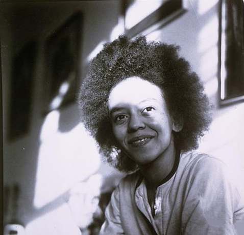
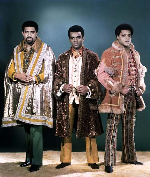
Notable people from Lincoln Heights
Ohioans tied to this place, each with a sourced profile. All notable Ohioans
How Lincoln Heights began
Lincoln Heights grew in the 1920s as an unincorporated suburb where Black families, many working in nearby Mill Creek valley industries, could buy homes, at a time when the community had none of the basic municipal services, paved roads, fire or police protection, that its incorporated neighbors enjoyed. A first attempt to incorporate in 1939 was blocked by surrounding communities; voters approved incorporation in a June 18, 1941 special election, when African Americans made up 98 percent of residents, but Hamilton County did not allow it until 1946, and then only across a tenth of the originally proposed area. The Reverend Michael J. Mangham became one of the earliest Black mayors in the northern United States, and at incorporation Lincoln Heights was described as the only Black municipality north of the Mason-Dixon line, drawing organized visits from New Yorkers under Governor Thomas E. Dewey. Factory closures in the 1970s and 1980s brought a long population decline that the village is still working through.
Settled 1920s, incorporated 1946, by Grew as an unincorporated Black homeowner suburb in the 1920s; incorporated 1946 after a 1941 special-election vote, with Rev. Michael J. Mangham as first mayor.
Where the name comes from
No source consulted gives a documented explanation for the specific choice of the name "Lincoln Heights," though the reference to Abraham Lincoln is self-evident given the community's identity as a Black-founded suburb; this connection is not confirmed by a cited source and is not presented as fact.
Before the town
No source found records a Native American village, trail, mound or treaty line specific to the Lincoln Heights site itself, in the lower Mill Creek valley.
Timeline
- — Lincoln Heights develops as an unincorporated suburb where Black families, many employed in nearby industry, can buy homes, without paved roads or fire or police service.
- — Roy M. Haley, Katherine Livingston and Wallace R. Livingston form the Haley-Livingston Land Company to sell 47.5 acres in Springfield Township bought from Henry Kuneven; the first lots of the Cincinnati Industrial Subdivision, 355 in all, have no paved streets or utilities, and the first Black residents are Sadie and William Gooch and Allie and Peter Finch.
- — Mount Moriah Baptist Church is founded and buys lot 159 from the land company; it calls itself the mother church of Lincoln Heights.
- — A first attempt to incorporate Lincoln Heights is blocked by neighboring communities.
- — On June 18, residents approve incorporation in a special election, at a time when African Americans make up 98 percent of the population.
- — While the incorporation request is delayed, Woodlawn on the west and Evendale on the east incorporate over land Lincoln Heights wanted (our Evendale entry dates that village's incorporation to 1952, so the sources do not agree here), and the Wright Aeronautical plant manager files an objection to being inside a majority-Black village.
- — Hamilton County officially allows incorporation, granting only about 10 percent of the originally proposed area; Rev. Michael J. Mangham becomes the village's first mayor, one of the earliest Black mayors in the northern United States.
- — Lincoln Heights experiences its "halcyon days," a period of relative post-World War II economic stability.
- — Lincoln Heights reaches its peak population of 7,798.
- — The Lincoln Heights Health Center is established.
- — Factory closures in the area bring economic decline and population loss to the village.
- — The census counts 4,113 residents in Lincoln Heights.
- — The census counts 3,286 residents in Lincoln Heights.
- — ArtWorks and The Heights Movement unveil a mural of village history.
- — The census counts 3,144 residents in Lincoln Heights.
- — Lincoln Heights holds a three-day celebration of the 80th anniversary of its 1946 incorporation, which officials describe as the first self-governed Black municipality north of the Mason-Dixon line.
Stories
Incorporation granted at a tenth of the size asked
Lincoln Heights had grown through the 1920s and 1930s as one of the only places in the Cincinnati area where Black families could simply buy a house, but without a government of their own, residents had no paved roads, no fire department and no police, services their incorporated white neighbors took for granted. A first attempt to incorporate in 1939 was blocked outright by surrounding communities, and even after voters overwhelmingly approved incorporation in a June 1941 special election, when the village was 98 percent African American, Hamilton County withheld approval for five more years, finally granting it in 1946 across only about a tenth of the area residents had originally proposed. What resulted was still historic: with Rev. Michael J. Mangham as its first mayor, Lincoln Heights became, by contemporary account, the only Black-governed municipality north of the Mason-Dixon line, notable enough that New York Governor Thomas E. Dewey organized tours bringing New Yorkers to see it firsthand.
A subdivision with no pavement, and a village with no factory
On October 20, 1923, Roy Haley and Katherine and Wallace Livingston formed a land company to sell 47.5 acres in Springfield Township to Black families, who were shut out of other suburbs by redlining. The Cincinnati Industrial Subdivision had 355 lots, unpaved and without curbs, sidewalks or drainage, and its first residents were Sadie and William Gooch and Allie and Peter Finch. Many early residents worked in Mill Creek valley plants such as the Tennessee Fertilizer Company and the Wright Aeronautical plant. When they asked to incorporate in 1939, Lockland objected and the plant manager objected, and neighbouring Woodlawn and Evendale incorporated first (though our Evendale entry dates that village's incorporation to 1952), taking the land with the factories. In 1946 the county allowed about a tenth of the proposed area, under one square mile and with no industry, and Rev. Michael J. Mangham became the first mayor and was later honoured with a New York ticker-tape parade.
Local history sources: en.wikipedia.org · en.wikipedia.org · stories.cincinnatipreservation.org · wvxu.org
Water
13 wells in the Great Miami Buried Valley Aquifer along the Great Miami River near Fairfield, Butler Co. The water here
- Cincinnati Public Water System37% of residentsOhio River (Miller Plant, ~88%) plus Great Miami Buried Valley Aquifer wells (~12%)
- Reading City32% of residentsOhio River (Miller Plant, ~88%) plus Great Miami Buried Valley Aquifer wells (~12%)
- Wyoming City31% of residentsMill Creek valley aquifer (6 city wells)
Hospitals, fire stations and more
Inside Lincoln Heights's boundary: 1 health center, 1 fire or EMS station, 1 high-hazard dam, 1 public school and 1 police station. Press a pin or a name for its whole record and its source.
Community health centers (1)
-
Lincoln Heights Health CenterHealth center · Cincinnati
- Run by
- a federally qualified health center
- Setting
- Clinic
- City
- Cincinnati
- Coordinates
- 39.23881, -84.45264
Find a Health Center (HRSA) ↗ HRSA data (source) ↗ Street map and directions ↗
Source: HRSA health center service delivery sites, active, September 2026 (school-based sites left out). Health centers see patients whether or not they have insurance, with fees on a sliding scale.
Fire and EMS stations (1)
-
Lincoln Heights Fire DepartmentLincoln Heights
- Address
- 1201 Steffen Avenue, Lincoln Heights, OH 45215
- Coordinates
- 39.23903, -84.45493
USGS National Map structures (source) ↗ Street map and directions ↗
Source: USGS National Map structures (most Ohio records last updated 2019 to 2022), checked against the Columbus and Cleveland station lists. The department that answers a call is set by jurisdiction and mutual aid, not by distance.
High-hazard dams (1)
-
Lincoln Heights Upground ReservoirOffstream · condition: fair
- Hazard class
- High: a failure would probably cost a life
- Condition
- Fair (assessed 06/10/2021)
- River or stream
- Offstream
- Purpose
- Water Supply
- Type
- Earth
- Height
- 30 ft
- Storage
- 70 acre-feet
- Completed
- 1942
- Owner type
- Public Utility
- County
- Hamilton County
- Nearest town (NID)
- Lincoln Heights
- Last inspection
- 06/10/2021
- Emergency action plan
- Yes
- NID ID
- OH01703
National Inventory of Dams record ↗ National Inventory of Dams (source) ↗ Street map and directions ↗
Source: U.S. Army Corps of Engineers National Inventory of Dams, August 2026. "High hazard" rates what a failure would cost downstream, not how likely one is; the condition is the state's assessment.
Public schools (1)
-
Lincoln Heights Elementary School3 of 5 stars · Cincinnati
- Address
- 1113 Adams St, Cincinnati, OH 45215
- School district
- Princeton City School District
- Kind (NCES)
- Regular School
- Students, 2023-24
- 235
- Teachers (full-time equivalent)
- 16
- Report card, 2025-26
- 3 of 5 stars
- Performance index
- 65.5%
- Ohio building IRN
- 020917
- NCES school ID
- 390446701552
NCES school record ↗ Ohio School Report Card ↗ Street map and directions ↗
Source: NCES EDGE public school locations 2024-25 and Common Core of Data 2023-24 (type, students, teachers); Ohio School Report Cards 2025-26 (Department of Education and Workforce), matched by name within the district.
Police stations (1)
-
Lincoln Heights Police DepartmentLincoln Heights
- Address
- 1201 Steffen Avenue, Lincoln Heights, OH 45215
- Coordinates
- 39.23922, -84.45482
USGS National Map structures (source) ↗ Street map and directions ↗
Source: USGS National Map structures, police stations, corrected and completed by hand (September 2026). The department that answers a call is set by jurisdiction, not by distance.
Its ZIP codes
Each ZIP code that touches Lincoln Heights, with the share of its residents who live here and the same headline figures as the ZIP page.
| ZIP | Share | Water | Radon | Home value | Schools | Flood |
|---|---|---|---|---|---|---|
| 45215 Reading and Cincinnati | 10% | 13 wells in the Great Miami Buried Valley Aquifer along the Great Miami River near Fairfield, Butler Co. | 2.4 pCi/L average radon | Median year built 1951 | Reading Community City · 3.5 stars overall | 2.5% of residents in the 1% floodplain |
Local government
Who holds office in Lincoln Heights, how its elections and ballot issues came out, and the state auditor's record.
Money issues on the ballot since 2025: 3 of 3 passed; of those asking for new or higher taxes, 2 of 2.
Ballot issues
| Date | Issue | For | Against | Result |
|---|---|---|---|---|
| 2025-11-04 | Issue 14: PROPOSED TAX LEVY (RENEWAL) VILLAGE OF LINCOLN HEIGHTS (CURRENT EXPENSES) | 353 | 201 | Passed (63.72% for) |
| 2025-11-04 | Issue 15: PROPOSED TAX LEVY (ADDITIONAL) VILLAGE OF LINCOLN HEIGHTS (CURRENT EXPENSES) | 320 | 235 | Passed (57.66% for) |
| 2025-11-04 | Issue 16: PROPOSED TAX LEVY (ADDITIONAL) VILLAGE OF LINCOLN HEIGHTS (POLICE) | 316 | 235 | Passed (57.35% for) |
| 2023-11-07 | Issue 7: PROPOSED ORDINANCE ELECTRIC AGGREGATION VILLAGE OF LINCOLN HEIGHTS | 380 | 233 | Passed (61.99% for) |
Elections for office
| Date | Office | Candidates and votes |
|---|---|---|
| 2025-11-04 | Member of Council (Unexpired Term ending 12-31-2027) | Daronce Malik Daniels 399, 72.15%; Nona R. Calhoun-Mumia 154, 27.85% |
| 2025-11-04 | Member of Council | Tonya Key 391, 22.13%; Trina A. Carter 337, 19.07%; Syretha R. Brown 306, 17.32%; Norvery J. Tate 263, 14.88%; LaVerne Mitchell 203, 11.49%; Karen Scott Hinkston 190, 10.75%; Timothy Lowery (W) 77, 4.36% |
| 2023-11-07 | Member of Council | Ruby Kinsey-Mumphrey 450, 61.64%; Phyllis Baber 280, 38.36% |
| 2021-11-02 | Member of Council (Unexpired term ending 12-31-2023) | Jeannie Stinson 267, 100.0% |
| 2021-11-02 | Member of Council | Tonya Key 241, 29.64%; Linda L. Childs-Jeter 200, 24.6%; LaVerne Mitchell 188, 23.12%; Daronce Daniels 184, 22.63% |
Winners in bold. Results from the county board of elections' official canvass unless marked.
Auditor of State record
- No fiscal caution, watch or emergency on the Auditor of State's lists.
- Financial Audit, 2022 to 2023, released 2025-04-17
The county
Hamilton County: 54 ZIP codes, 47 cities, villages and townships, 843,791 people.
Nearby places
Rain and snow
How much has actually fallen on Lincoln Heights, day by day, from 1893 to now. Daily totals, not averages.
- rain, last 30 days
- 1.17 in
- 2026-09-29 to 2026-10-28
- rain so far in 2026
- 45.4 in
- 5.0 in above normal for the date
- snow so far in 2026
- 13.2 in
- a normal year brings 15.9 in
- a normal year
- 47.7 in
- average of 30 years, 1991-2020
| Month | Rain (in) | Snow (in) | Days counted |
|---|---|---|---|
| October 2026 | 1.17 | — | 28 |
| September 2026 | 6.33 | — | 30 |
| August 2026 | 6.11 | — | 31 |
| July 2026 | 4.41 | — | 31 |
| June 2026 | 6.63 | — | 30 |
| May 2026 | 7.07 | — | 31 |
| April 2026 | 3.78 | — | 30 |
| March 2026 | 7.04 | 0.2 | 31 |
| February 2026 | 1.22 | 3.4 | 28 |
| January 2026 | 1.63 | 9.6 | 31 |
| December 2025 | 2.54 | 11.9 | 31 |
| November 2025 | 3.95 | 2.1 | 30 |
| Wettest year | 2011 — 79.1 in |
|---|---|
| Driest year | 1934 — 22.2 in |
| Snowiest year | 2010 — 51.5 in |
| Wettest day on record | 5 March 1897 — 5.10 in |
| Heaviest snowfall in a day | 8 December 1917 — 9.68 in |
| Deepest snow on the ground | 20 December 1919 — 17.48 in |
Estimated, not measured. No rain gauge has ever stood inside Lincoln Heights, so every figure here is worked out from the gauges around it - the nearest ones weighted most. Treat them as close estimates rather than readings.
47,956 days of records, 1893-01-01 to 2026-10-28. Source: NOAA NCEI GHCN-Daily, 3,240 gauges in and around Ohio. A day is "gauged" when a gauge standing inside the boundary reported it, and the value is the mean of those gauges. Otherwise it is interpolated by inverse distance from every gauge reporting within 50 miles. Nothing is carried forward, back-filled or smoothed. Against NOAA nClimDiv county monthly precipitation over 136,848 complete county-months (checked 2026-10-31): correlation 0.9515, median absolute difference 0.217 in a month. Built 2026-10-31 from the Cracked Buckeye precipitation archive. Snow is the softer number — snowfall is measured by hand with a ruler, no agency publishes a gridded county snowfall series, and blowing snow defeats every observer.
Environmental permits and filings
What Ohio EPA has on file for Lincoln Heights: permits, inspections, violations, cleanups and the state loans behind sewer and water work. Every line links to the agency's own document.
- facilities and sites on file
- 2
- those placed on the map inside Lincoln Heights
| Program | Facilities and sites |
|---|---|
| Air pollution | 1 |
| Hazardous waste | 1 |
| Date | Facility or site | What |
|---|---|---|
| ENOVATION GRAPHIC SYSTEMS INC | Hazardous waste compliance letter |
Source: Ohio EPA eDocument portal (edocpub.epa.ohio.gov), indexed 2026-10-14. Facilities are placed on the map from Ohio EPA's own map layers, EPA's Facility Registry, coordinates written in the filings, or a geocoded street address. A permit filed under a private person's name (most are household septic systems) is counted but never named, placed or linked; licenses for individual workers and open-burning notices are left out entirely.
Quick answers
What county is Lincoln Heights, Ohio in?
Lincoln Heights is a village in Hamilton County, Ohio, with 3,144 residents.
When was Lincoln Heights, Ohio founded?
Lincoln Heights was settled 1920s; incorporated 1946. Founders on record: Grew as an unincorporated Black homeowner suburb in the 1920s; incorporated 1946 after a 1941 special-election vote, with Rev. Michael J. Mangham as first mayor. Source
What ZIP code is Lincoln Heights, Ohio?
Most of Lincoln Heights is in ZIP code 45215.
Where does Lincoln Heights, Ohio get its water?
The main water source for Lincoln Heights (Cincinnati Public Water System): 13 wells in the Great Miami Buried Valley Aquifer along the Great Miami River near Fairfield, Butler Co.
Cite this page
Cite this page as:
Cracked Buckeye, "Lincoln Heights, Hamilton County", https://crackedbuckeye.com/place/lincoln-heights/, built 2026-10-31, accessed [date].
How to cite · Report a correction · Built 2026-10-31
