Local events in Franklin
17 events in the next 90 days from 3 public calendars. All local events in Franklin
Checked October 20; the events page is refreshed daily.
How Franklin began
Franklin was founded in 1796 by General William C. Schenck on the Great Miami River and named for Benjamin Franklin. It grew as a Miami and Erie Canal town in the 1820s-40s, then as a paper-mill and railroad center through the late 1800s, surviving the catastrophic Great Miami River flood of March 1913. It was incorporated as a town in 1814 and became a city in 1951, and today sits at the northwest corner of Warren County beside Franklin Township and Carlisle.
Settled 1796, platted 1796, incorporated 1814 (town); 1951 (city), by General William C. Schenck.
Where the name comes from
The settlement was named for Benjamin Franklin.
Before the town
No Native American village or settlement site specific to what became the city of Franklin is recorded in the sources reviewed. The land was ceded by the Miami, Shawnee, Wyandot, Delaware and other nations at the Treaty of Greenville (August 3, 1795), a year before Schenck's party arrived, and lies within the Symmes Purchase between the Great and Little Miami Rivers, which the Miami people under Little Turtle (Meshekinoquah) had used as hunting ground. The one confirmed prehistoric site inside city limits is the Hill-Kinder Mound, an Adena burial mound in fields northeast of downtown Franklin (junction of Deardorff Road and Arlington Avenue), listed on the National Register in 1971. Elsewhere in Warren County, the Native record includes the Fort Ancient earthworks on the Little Miami.
Nations recorded here: Miami, Shawnee, Adena culture.
- Hill-Kinder Mound (mound) — fields northeast of downtown Franklin, near Deardorff Road and Arlington Avenue, Adena culture (c. 800 BC - AD 100) (commons.wikimedia.org)
Timeline
- — General William C. Schenck founds Franklin on the Great Miami River.
- — The log building later known as the Old Log Post Office is built at 310 South River Street; it is the oldest surviving building in Franklin.
- — President Thomas Jefferson appoints John N. C. Schenck, the founder's brother, as Franklin's first postmaster, one of Warren County's first four post offices.
- — Franklin is incorporated as a town.
- — Construction of the Miami and Erie Canal through Franklin spurs a pork slaughterhouse, a barrel factory, a sawmill and a whiskey distillery.
- — Five paper mills are operating in Franklin.
- — Franklin's only bank fails after an embezzlement.
- — Town marshal George Basore is fatally shot while making an arrest; a lynch mob gathers but is dispersed.
- — The Great Miami River overflows its banks in the March 1913 flood, devastating the town.
- — Franklin becomes a city.
- — Franklin opens what is considered the world's first garbage-recycling plant, built by the Black Clawson Company, recovering metals from solid waste.
- — US EPA Region V determines the Buried Valley Aquifer System-South is the sole or principal drinking-water source for the Franklin area.
- — The city removes a Confederate monument following the Charlottesville rally.
- — Franklin samples for PFAS under the fifth federal Unregulated Contaminant Monitoring Rule (UCMR 5), detecting nine PFAS compounds plus lithium.
Stories
The oldest building in town started as a log post office
In 1802, before Ohio was even a state, settlers on South River Street raised a two-story log cabin that would become Franklin's post office. On April 1, 1805, President Thomas Jefferson signed the appointment of John N. C. Schenck, brother of the town's founder, as postmaster, making the little log building the seat of one of Warren County's first four post offices. It kept working long after log construction had gone out of style, and it survives today as the oldest building in Franklin. In 1974 the building was moved from its original riverside lot to a new site at River and Fifth streets to save it from demolition, and it is now run as a small museum by the Franklin Area Historical Society.
A garbage plant ahead of its time
In 1971, at a moment when most American cities were still simply burying or burning their trash, Franklin opened a solid-waste recycling plant built and designed by the Black Clawson Company that was described at the time as the first of its kind in the world. The plant pulled metals back out of the municipal garbage stream for resale rather than letting them go to landfill, an idea that would not become common practice in American cities for another generation. A 1970s federal photograph shows a Logan-Long Recycling Plant employee in Franklin demonstrating the recovered, recyclable products to visitors.
The flood of 1913
In late March 1913, days of heavy rain sent the Great Miami River far over its banks across the Miami Valley, and Franklin, sitting low along the river, was hit hard. Homes and businesses flooded, and a surviving photograph -- captioned simply 'Franklin, Ohio - Flood of 1913' -- shows the scale of the water in the streets. The disaster was part of the same statewide flood that devastated Dayton and led, within two years, to the creation of the Miami Conservancy District and its system of flood-control dams upstream.
Photographs
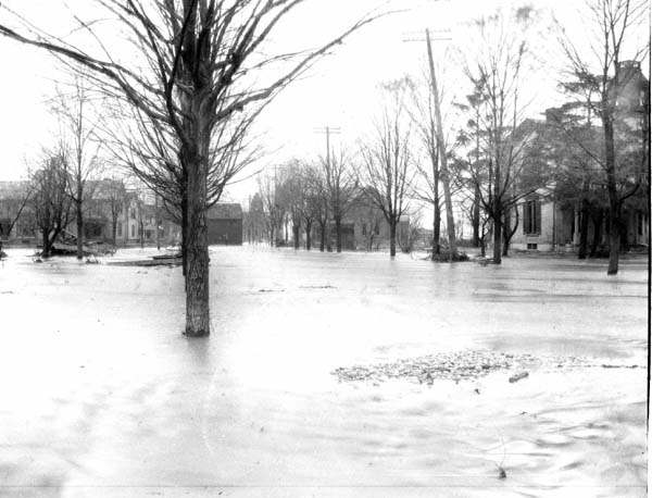
Photo: Warren County OHGenWeb (uploader); photographer unknown, public domain · Wikimedia Commons
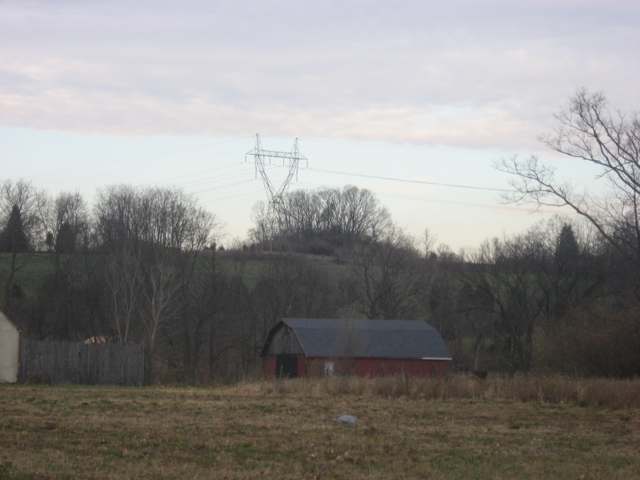
Photo: Nyttend, public domain · Wikimedia Commons
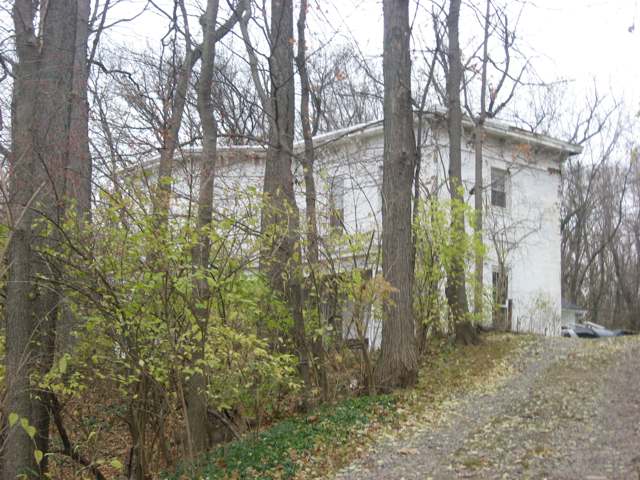
Photo: Nyttend, public domain · Wikimedia Commons
Local history sources: en.wikipedia.org · hmdb.org · en.wikipedia.org · commons.wikimedia.org · en.wikipedia.org · en.wikipedia.org · commons.wikimedia.org · commons.wikimedia.org · dam.assets.ohio.gov · cms2.revize.com
Historic places
2 places in Franklin on the National Register of Historic Places. Press a pin or a name for its whole record.
-
Butler, Charles, HouseBuilding · Franklin · listed 1982
- Address
- 13 E. Jackson St.
- Where
- Franklin, Warren County · ZIP 45005
- What it is
- Building
- Listed on the National Register
- 1982
- NRIS reference number
- 82003664
- Coordinates
- 39.56468, -84.29983
National Register file (NPS) ↗ Search Wikipedia ↗ Street map and directions ↗ On the Cracked Buckeye map
-
Old Log Post OfficeBuilding · Franklin · listed 1976
- Address
- 5th and River Sts.
- Where
- Franklin, Warren County · ZIP 45005
- What it is
- Building
- Listed on the National Register
- 1976
- NRIS reference number
- 76001541
- Coordinates
- 39.55961, -84.30666
National Register file (NPS) ↗ Search Wikipedia ↗ Street map and directions ↗ On the Cracked Buckeye map
Source: National Park Service, National Register of Historic Places point file. The listing year is shown where NPS's certification date agrees with the listing's reference number. Listing recognizes significance; it does not restrict a private owner.
Water
Five high-production wells drawing from the Great Miami Buried Valley Aquifer, treated at the city's 5 MGD iron/manganese filtration plant near the Great Miami River. The water here
- Franklin Public Water System80% of residentsGreat Miami Buried Valley Aquifer (own wells)
- Carlisle City11% of residentsGreat Miami Buried Valley Aquifer (own wells)
- Middletown City8% of residentsGreat Miami Buried Valley Aquifer (wells)
- Springboro1% of residentsGreat Miami Buried Valley Aquifer (own wells)
- Southwest Regional Water District1% of residentsGreat Miami Buried Valley Aquifer (wells)
Hospitals, fire stations and more
Inside Franklin's boundary: 2 health centers, 1 nursing home, 1 fire or EMS station, 7 public schools, 1 poor-rated bridge, 1 library, 1 police station, 2 public charging sites, 2 Superfund sites, 22 Toxics Release Inventory facilities and 10 spill cases. Press a pin or a name for its whole record and its source.
Community health centers (2)
-
Centerpoint Health Medical FranklinHealth center · Franklin
- Run by
- a federally qualified health center
- Setting
- Clinic
- City
- Franklin
- Coordinates
- 39.55627, -84.28038
Find a Health Center (HRSA) ↗ HRSA data (source) ↗ Street map and directions ↗
-
Centerpoint Health Suite DHealth center · Franklin
- Run by
- a federally qualified health center
- Setting
- Clinic
- City
- Franklin
- Coordinates
- 39.55627, -84.28038
Find a Health Center (HRSA) ↗ HRSA data (source) ↗ Street map and directions ↗
Source: HRSA health center service delivery sites, active, September 2026 (school-based sites left out). Health centers see patients whether or not they have insurance, with fees on a sliding scale.
Nursing homes (1)
-
Momentous Health at Franklin1 of 5 stars · Franklin
- Address
- 421 Mission Lane, Franklin, OH 45005
- Certified beds
- 79
- Residents on an average day
- 71
- Medicare overall rating
- 1 of 5 stars
- Health inspections
- 1 of 5 stars
- Staffing
- 1 of 5 stars
- Quality measures
- 3 of 5 stars
- Penalties since 2023
- none
- Ownership
- For profit - Individual
- Takes
- Medicare and Medicaid
- Phone
- (937) 746-3943
- Medicare ID
- 365595
Medicare Care Compare ↗ CMS nursing home data (source) ↗ Street map and directions ↗
Source: CMS Care Compare nursing home provider and penalties files; Medicare star ratings run 1 to 5.
Fire and EMS stations (1)
-
Franklin Division of FireFranklin
- Address
- 45 East 4th Street, Franklin, OH 45005
- Coordinates
- 39.55999, -84.30202
USGS National Map structures (source) ↗ Street map and directions ↗
Source: USGS National Map structures (most Ohio records last updated 2019 to 2022), checked against the Columbus and Cleveland station lists. The department that answers a call is set by jurisdiction and mutual aid, not by distance.
Public schools (7)
-
Anthony Wayne Elementary SchoolFranklin
- Address
- 16 Farm Ave, Franklin, OH 45005
- Kind (NCES)
- Regular School
- Students, 2023-24
- 299
- Teachers (full-time equivalent)
- 17
- NCES school ID
- 390440000962
-
Franklin High School4 of 5 stars · Franklin
- Address
- 750 E 4th St, Franklin, OH 45005
- School district
- Franklin City School District
- Kind (NCES)
- Regular School
- Students, 2023-24
- 679
- Teachers (full-time equivalent)
- 36
- Report card, 2025-26
- 4 of 5 stars
- Performance index
- 79.8%
- Four-year graduation rate
- 96.4%
- Ohio building IRN
- 012310
- NCES school ID
- 390440000963
NCES school record ↗ Ohio School Report Card ↗ Street map and directions ↗
-
Franklin Intermediate School3 of 5 stars · Franklin
- Address
- 752 E 4th St, Franklin, OH 45005
- School district
- Franklin City School District
- Report card, 2025-26
- 3 of 5 stars
- Performance index
- 75.5%
- Ohio building IRN
- 021610
- NCES school ID
- 390440010916
NCES school record ↗ Ohio School Report Card ↗ Street map and directions ↗
-
Franklin Junior High School3.5 of 5 stars · Franklin
- Address
- 750 E 4th St, Franklin, OH 45005
- School district
- Franklin City School District
- Kind (NCES)
- Regular School
- Students, 2023-24
- 401
- Teachers (full-time equivalent)
- 21
- Report card, 2025-26
- 3.5 of 5 stars
- Performance index
- 70.1%
- Ohio building IRN
- 062331
- NCES school ID
- 390440000964
NCES school record ↗ Ohio School Report Card ↗ Street map and directions ↗
-
George H Gerke Elementary School1 of 5 stars · Franklin
- Address
- 312 Sherman Dr, Franklin, OH 45005
- School district
- Franklin City School District
- Kind (NCES)
- Regular School
- Students, 2023-24
- 322
- Teachers (full-time equivalent)
- 14
- Report card, 2025-26
- 1 of 5 stars
- Ohio building IRN
- 013276
- NCES school ID
- 390440000965
NCES school record ↗ Ohio School Report Card ↗ Street map and directions ↗
-
Pennyroyal Elementary SchoolFranklin
- Address
- 4203 Pennyroyal Rd, Franklin, OH 45005
- Kind (NCES)
- Regular School
- Students, 2023-24
- 290
- Teachers (full-time equivalent)
- 16
- NCES school ID
- 390440000969
-
William C Schenck Elementary School1 of 5 stars · Franklin
- Address
- 350 Arlington Dr, Franklin, OH 45005
- School district
- Franklin City School District
- Kind (NCES)
- Regular School
- Students, 2023-24
- 204
- Teachers (full-time equivalent)
- 12
- Report card, 2025-26
- 1 of 5 stars
- Ohio building IRN
- 041327
- NCES school ID
- 390440000970
NCES school record ↗ Ohio School Report Card ↗ Street map and directions ↗
Source: NCES EDGE public school locations 2024-25 and Common Core of Data 2023-24 (type, students, teachers); Ohio School Report Cards 2025-26 (Department of Education and Workforce), matched by name within the district.
Bridges rated poor (1)
-
Franklin-Trenton over Dry RunPoor · built 1981
- Condition
- Poor: a deck, superstructure, substructure or culvert rated 4 or below on the 0 to 9 scale
- What it is
- Bridge
- Built
- 1981
- Length
- 14 ft
- Owner
- County
- Vehicles a day
- 4,573
- Coordinates
- 39.55673, -84.33115
National Bridge Inventory (source) ↗ Street map and directions ↗
Source: FHWA National Bridge Inventory 2025. "Poor" means one major part rated 4 or below on the 0 to 9 scale; it calls for repair, not closing, unless the state posts or closes the bridge.
Public libraries (1)
-
Franklin Public LibraryCentral library · Franklin
- Address
- 44 E. 4Th St, Franklin, OH 45005
- What it is
- Central library
- Library system
- Franklin Public Library
- Open
- 3,328 hours a year, 52 weeks
- Building
- 24,800 sq ft
- System's visits, FY2024
- 111,124
- System's loans, FY2024
- 535,948
- People the system serves
- 54,450
- Phone
- (937) 746-2665
IMLS Public Libraries Survey (source) ↗ Street map and directions ↗
Source: IMLS Public Libraries Survey FY2024 (outlets and their systems). Any Ohio resident can get a free card at any Ohio public library.
Police stations (1)
-
Franklin City Police DepartmentFranklin
- Address
- 400 Anderson Street, Franklin, OH 45005
- Coordinates
- 39.55859, -84.30193
USGS National Map structures (source) ↗ Street map and directions ↗
Source: USGS National Map structures, police stations, corrected and completed by hand (September 2026). The department that answers a call is set by jurisdiction, not by distance.
Public EV charging (2)
-
FRANKLINWILDCAT CHARGER 14 Level 2 · Franklin
- Address
- 1 Ben Franklin Way, Franklin, OH 45005
- Ports
- 4 Level 2
- Plugs
- J1772
- Network
- ChargePoint Network
- Hours
- 24 hours daily
- Phone
- 888-758-4389
Station Locator (NREL) ↗ Alternative Fuels Data Center (source) ↗ Street map and directions ↗
-
Pilot Travel Center 9 DC fast4 DC fast · Franklin
- Address
- 6830 Franklin-Lebanon Road, Franklin, OH 45005
- Ports
- 4 DC fast
- Plugs
- CCS
- Network
- eVgo Network
- Hours
- 24 hours daily
- Phone
- 877-455-3833
Station Locator (NREL) ↗ Alternative Fuels Data Center (source) ↗ Street map and directions ↗
Source: NREL Alternative Fuels Data Center station list (May 2026), public and open stations, the posts at one address counted as one site.
Superfund sites (2)
-
Franklin Ohio Residential Mercury SpillSuperfund program · Frankin
- Address
- 307 East Fourth Street, Frankin, OH 45005
- County
- Warren County
- Status
- Superfund program site, not on the National Priorities List
- EPA program ID
- OHN000507550
- EPA registry ID
- 110071101472
EPA facility record ↗ EPA Facility Registry Service (source) ↗ Street map and directions ↗
-
Franklin Voc PlumeSuperfund program · Franklin
- Address
- Georgia Pacific Road and Dayton-Oxford (Miami) Rd., Franklin, OH 45005
- County
- Warren County
- Status
- Superfund program site, not on the National Priorities List
- EPA program ID
- OHN000507846
- EPA registry ID
- 110071102161
EPA facility record ↗ EPA Facility Registry Service (source) ↗ Street map and directions ↗
Source: EPA Facility Registry Service, Superfund (SEMS) and National Priorities List sites. Many program sites were assessed and needed no cleanup.
Facilities reporting toxic releases (22)
-
A & B Foundry & MachiningToxics Release Inventory · Franklin
- Address
- 835 N. Main St., Franklin, OH 45005
- County
- Warren County
- Status
- Reports to the Toxics Release Inventory (active)
- EPA program ID
- 45005BFNDR835NM
- EPA registry ID
- 110000392067
EPA facility record ↗ EPA Facility Registry Service (source) ↗ Street map and directions ↗
-
Atlas Roofing Corporation - Felt Plant (1483040158)Toxics Release Inventory · Franklin
- Address
- 125 N River St, Franklin, OH 45005
- County
- Warren County
- Status
- Reports to the Toxics Release Inventory (active)
- EPA program ID
- 45005GRGPC125NR
- EPA registry ID
- 110001626759
EPA facility record ↗ EPA Facility Registry Service (source) ↗ Street map and directions ↗
-
Atlas Roofing Corporation, Franklin Roofing Facility (1483040201)Toxics Release Inventory · Franklin
- Address
- 675 Oxford Road, Franklin, OH 45005
- County
- Warren County
- Status
- Reports to the Toxics Release Inventory (active)
- EPA program ID
- 45005TLSRF675OX
- EPA registry ID
- 110000392101
EPA facility record ↗ EPA Facility Registry Service (source) ↗ Street map and directions ↗
-
Cheney Pulp and Paper CoToxics Release Inventory · Franklin
- Address
- 1000 Anderson St., Franklin, OH 45005
- County
- Warren County
- Status
- Reports to the Toxics Release Inventory (active)
- EPA program ID
- 45005CHNYP1000A
- EPA registry ID
- 110000392076
EPA facility record ↗ EPA Facility Registry Service (source) ↗ Street map and directions ↗
-
Faurecia Exhaust Sys Inc Franklin PlantToxics Release Inventory · Franklin
- Address
- 2301 Commerce Center Dr, Franklin, OH 45005
- County
- Warren County
- Status
- Reports to the Toxics Release Inventory
- EPA program ID
- 45005PTMTV2301C
- EPA registry ID
- 110000766886
EPA facility record ↗ EPA Facility Registry Service (source) ↗ Street map and directions ↗
-
Ferco TechToxics Release Inventory · Franklin
- Address
- 291 Conover Dr, Franklin, OH 45005
- County
- Warren County County
- Status
- Reports to the Toxics Release Inventory
- EPA program ID
- 4500WFRCTC291CN
- EPA registry ID
- 110069312470
EPA facility record ↗ EPA Facility Registry Service (source) ↗ Street map and directions ↗
-
Franklin Boxboard CorporationToxics Release Inventory · Franklin
- Address
- 50 East Sixth Street, Franklin, OH 45005
- County
- Warren County
- Status
- Reports to the Toxics Release Inventory (closed)
- EPA program ID
- 45005FRNKL50EAS
- EPA registry ID
- 110001626740
EPA facility record ↗ EPA Facility Registry Service (source) ↗ Street map and directions ↗
-
Iko Production IncToxics Release Inventory · Franklin
- Address
- 1200 South Main Street, Franklin, OH 45005
- County
- Warren County
- Status
- Reports to the Toxics Release Inventory (active)
- EPA program ID
- 45005KPRDC1200S
- EPA registry ID
- 110001626884
EPA facility record ↗ EPA Facility Registry Service (source) ↗ Street map and directions ↗
-
Lynx Chemicals of DaytonToxics Release Inventory · Franklin
- Address
- 370 Industrial Dr, Franklin, OH 45005
- County
- Warren County
- Status
- Reports to the Toxics Release Inventory (active)
- EPA program ID
- 4500WLYNXC37IND
- EPA registry ID
- 110042000991
EPA facility record ↗ EPA Facility Registry Service (source) ↗ Street map and directions ↗
-
Marble Arch Products Inc. (1483040411)Toxics Release Inventory · Franklin
- Address
- 263 Industrial Dr., Franklin, OH 45005
- County
- Warren County
- Status
- Reports to the Toxics Release Inventory (active)
- EPA program ID
- 45005MRBLR263IN
- EPA registry ID
- 110012705901
EPA facility record ↗ EPA Facility Registry Service (source) ↗ Street map and directions ↗
-
Morris Material Handling - Kone CranesToxics Release Inventory · Franklin
- Address
- 213 Industrial Drive, Franklin, OH 45005
- County
- Warren County
- Status
- Reports to the Toxics Release Inventory (active)
- EPA program ID
- 45005MPHCR213IN
- EPA registry ID
- 110004726976
EPA facility record ↗ EPA Facility Registry Service (source) ↗ Street map and directions ↗
-
Ncp FranklinToxics Release Inventory · Franklin
- Address
- 300 Chestnut Street, Franklin, OH 45005
- County
- Warren County
- Status
- Reports to the Toxics Release Inventory (active)
- EPA program ID
- 4500WNCPFR3CHES
- EPA registry ID
- 110067129636
EPA facility record ↗ EPA Facility Registry Service (source) ↗ Street map and directions ↗
-
Newark Custom Paperboard (Ncp)Toxics Release Inventory · Franklin
- Address
- 300 Chestnut St, Franklin, OH 45005
- County
- Warren County
- Status
- Reports to the Toxics Release Inventory (active)
- EPA program ID
- 45005BKCVR3CHES
- EPA registry ID
- 110031000672
EPA facility record ↗ EPA Facility Registry Service (source) ↗ Street map and directions ↗
-
Pharmacia Hepar IncToxics Release Inventory · Franklin
- Address
- 160 Industrial Dr., Franklin, OH 45005
- County
- Warren County
- Status
- Reports to the Toxics Release Inventory (active)
- EPA program ID
- 45005HPRND160IN
- EPA registry ID
- 110000392094
EPA facility record ↗ EPA Facility Registry Service (source) ↗ Street map and directions ↗
-
R.L. Drake LlcToxics Release Inventory · Franklin
- Address
- 230 Industrial Drive, Franklin, OH 45005
- County
- Warren County
- Status
- Reports to the Toxics Release Inventory (active)
- EPA program ID
- 45005RLDRK230IN
- EPA registry ID
- 110000850507
EPA facility record ↗ EPA Facility Registry Service (source) ↗ Street map and directions ↗
-
Rotadyne Roll GroupToxics Release Inventory · Franklin
- Address
- 315 Industrial Dr., Franklin, OH 45005
- County
- Warren County
- Status
- Reports to the Toxics Release Inventory (active)
- EPA program ID
- 45005DLRLL315IN
- EPA registry ID
- 110000392085
EPA facility record ↗ EPA Facility Registry Service (source) ↗ Street map and directions ↗
-
Rps Composites Ohio IncToxics Release Inventory · Franklin
- Address
- 2501 Shotwell Dr, Franklin, OH 45005
- County
- Warren County County
- Status
- Reports to the Toxics Release Inventory (active)
- EPA program ID
- 45005RPSCM25SHT
- EPA registry ID
- 110069533669
EPA facility record ↗ EPA Facility Registry Service (source) ↗ Street map and directions ↗
-
Sun Chemical CorpToxics Release Inventory · Franklin
- Address
- 125 Jay Gee Dr, Franklin, OH 45005
- County
- Warren County
- Status
- Reports to the Toxics Release Inventory (active)
- EPA program ID
- 43302BSFCR125JA
- EPA registry ID
- 110009424060
EPA facility record ↗ EPA Facility Registry Service (source) ↗ Street map and directions ↗
-
Sunstar Engineering Americas IncToxics Release Inventory · Franklin
- Address
- 700 Watkins Glenn Dr, Franklin, OH 45005
- County
- Warren County
- Status
- Reports to the Toxics Release Inventory (active)
- EPA program ID
- 45005SNNXN7WATK
- EPA registry ID
- 110031019608
EPA facility record ↗ EPA Facility Registry Service (source) ↗ Street map and directions ↗
-
Tech-Way Industries IncToxics Release Inventory · Franklin
- Address
- 301 Indl Dr, Franklin, OH 45005
- County
- Warren County
- Status
- Reports to the Toxics Release Inventory (active)
- EPA program ID
- 45005TCHWY301IN
- EPA registry ID
- 110002112641
EPA facility record ↗ EPA Facility Registry Service (source) ↗ Street map and directions ↗
-
Temple-Inland Food ServicesToxics Release Inventory · Carlisle
- Address
- 300 Ind. Drive, Carlisle, OH 45005
- County
- Warren County
- Status
- Reports to the Toxics Release Inventory (active)
- EPA program ID
- 45005TMPLN300IN
- EPA registry ID
- 110002112650
EPA facility record ↗ EPA Facility Registry Service (source) ↗ Street map and directions ↗
-
Toppan Packaging Usa Inc.Toxics Release Inventory · Franklin
- Address
- 708 South Ave, Franklin, OH 45005
- County
- Warren County County
- Status
- Reports to the Toxics Release Inventory (active)
- EPA program ID
- 45001GRPHC708SO
- EPA registry ID
- 110000392049
EPA facility record ↗ EPA Facility Registry Service (source) ↗ Street map and directions ↗
Source: EPA Facility Registry Service, Toxics Release Inventory reporters. Reporting a release is required of large users of listed chemicals; it is not by itself a violation.
Spills reported since 2021 (10)
-
Fish Kill2024-04-27 · Franklin
- Reported
- 2024-04-27
- What spilled
- Fish Kill
- Where
- Franklin, Warren County
- Ohio EPA district office
- SWDO
- Ohio EPA case number
- 2404EPA0000698
Ohio EPA spill reports (source) ↗ Street map and directions ↗
-
Fuel Diesel / Diesel Fuel (Vehicle On Or Off Road)2024-02-05 · Franklin
- Reported
- 2024-02-05
- What spilled
- Fuel Diesel / Diesel Fuel (Vehicle On Or Off Road)
- Where
- Franklin, Warren County
- Ohio EPA district office
- SWDO
- Ohio EPA case number
- 2402EPA0000194
Ohio EPA spill reports (source) ↗ Street map and directions ↗
-
Fuel Diesel / Diesel Fuel (Vehicle On Or Off Road)2024-01-26 · Franklin
- Reported
- 2024-01-26
- What spilled
- Fuel Diesel / Diesel Fuel (Vehicle On Or Off Road)
- Largest amount reported
- 100 gallons
- Where
- Franklin, Warren County
- Ohio EPA district office
- SWDO
- Ohio EPA case number
- 2401EPA0000137
Ohio EPA spill reports (source) ↗ Street map and directions ↗
-
Fuel Diesel / Diesel Fuel (Vehicle On Or Off Road)2022-09-03 · Franklin
- Reported
- 2022-09-03
- What spilled
- Fuel Diesel / Diesel Fuel (Vehicle On Or Off Road)
- Largest amount reported
- 20 gallons
- Where
- Franklin, Warren County
- Ohio EPA district office
- SWDO
- Ohio EPA case number
- 2209EPA0001351
Ohio EPA spill reports (source) ↗ Street map and directions ↗
-
Fuel Diesel / Diesel Fuel (Vehicle On Or Off Road)2022-08-10 · Franklin
- Reported
- 2022-08-10
- What spilled
- Fuel Diesel / Diesel Fuel (Vehicle On Or Off Road)
- Largest amount reported
- 120 gallons
- Where
- Franklin, Warren County
- Ohio EPA district office
- SWDO
- Ohio EPA case number
- 2208EPA0001214
Ohio EPA spill reports (source) ↗ Street map and directions ↗
-
Fuel Diesel / Diesel Fuel (Vehicle On Or Off Road)2022-02-22 · Franklin
- Reported
- 2022-02-22
- What spilled
- Fuel Diesel / Diesel Fuel (Vehicle On Or Off Road)
- Where
- Franklin, Warren County
- Ohio EPA district office
- SWDO
- Ohio EPA case number
- 2202EPA0000222
Ohio EPA spill reports (source) ↗ Street map and directions ↗
-
Oil Hydraulic Fluid(S)2021-07-28 · Franklin
- Reported
- 2021-07-28
- What spilled
- Oil Hydraulic Fluid(S)
- Largest amount reported
- 1 gallons
- Where
- Franklin, Warren County
- Ohio EPA district office
- SWDO
- Ohio EPA case number
- 2107EPA0001142
Ohio EPA spill reports (source) ↗ Street map and directions ↗
-
Sheen Rainbow / Hydrocarbon2021-03-11 · Franklin
- Reported
- 2021-03-11
- What spilled
- Sheen Rainbow / Hydrocarbon
- Where
- Franklin, Warren County
- Ohio EPA district office
- SWDO
- Ohio EPA case number
- 2103EPA0000317
Ohio EPA spill reports (source) ↗ Street map and directions ↗
-
Oil Motor / Lube Oil / Vehicle2026-04-09 · Franklin
- Reported
- 2026-04-09
- What spilled
- Oil Motor / Lube Oil / Vehicle; Material Unknown; Fuel Diesel / Diesel Fuel (Vehicle On Or Off Road)
- Where
- Franklin, Warren County
- Ohio EPA district office
- SWDO
- Ohio EPA case number
- 2604EPA0000598
Ohio EPA spill reports (source) ↗ Street map and directions ↗
-
Fuel Diesel / Diesel Fuel (Vehicle On Or Off Road)2026-02-03 · Franklin
- Reported
- 2026-02-03
- What spilled
- Fuel Diesel / Diesel Fuel (Vehicle On Or Off Road)
- Where
- Franklin, Warren County
- Ohio EPA district office
- SWDO
- Ohio EPA case number
- 2602EPA0000123
Ohio EPA spill reports (source) ↗ Street map and directions ↗
Source: Ohio EPA emergency response spill reports, 2021 to September 2026, one point per case where Ohio EPA placed it. A report is what the caller or responder recorded; amounts are often blank or estimated.
Its ZIP codes
Each ZIP code that touches Franklin, with the share of its residents who live here and the same headline figures as the ZIP page.
| ZIP | Share | Water | Radon | Home value | Schools | Flood |
|---|---|---|---|---|---|---|
| 45005 Franklin Township and Franklin | 37% | Five high-production wells drawing from the Great Miami Buried Valley Aquifer, treated at the city's 5 MGD iron/manganese filtration plant near the Great Miami River. | 5.9 pCi/L average radon | Appraisal records without year built | Franklin City · 3 stars overall | 7.6% of residents in the 1% floodplain |
Local government
Who holds office in Franklin, how its elections and ballot issues came out, and the state auditor's record.
Ballot issues
| Date | Issue | For | Against | Result |
|---|---|---|---|---|
| 2017-11-07 | Issue 3: 3 City of Franklin Charter Amendment | 936 | 639 | Passed (59.43% for) |
| 2017-11-07 | Issue 4: 4 City of Franklin Charter Amendment | 884 | 609 | Passed (59.21% for) |
| 2017-11-07 | Issue 5: 5 Franklin Charter Amendment | 1,002 | 504 | Passed (66.53% for) |
| 2017-11-07 | Issue 6: 6 City of Franklin Charter Amendment | 942 | 538 | Passed (63.65% for) |
| 2017-11-07 | Issue 7: 7 City of Franklin Charter Amendment | 776 | 715 | Passed (52.05% for) |
Elections for office
| Date | Office | Candidates and votes |
|---|---|---|
| 2017-11-07 | Member of Council | Michael Aldridge 960, 26.89%; Dennis D. Centers 922, 25.83%; Matt Wilcher 850, 23.81%; Carl Bray 838, 23.47% |
| 2015-11-03 | Member of Council | Brent W. Centers 1,374, 19.34%; Paul Ruppert 1,197, 16.85%; Todd Hall 1,085, 15.27%; Debbie Fouts 1,064, 14.98%; Jason Faulkner 1,063, 14.96%; Matt Wilcher 826, 11.63%; Douglas Greathouse 495, 6.97% |
Winners in bold. Results from the county board of elections' official canvass unless marked.
Auditor of State record
- No fiscal caution, watch or emergency on the Auditor of State's lists.
- Financial Health Indicators (the Auditor of State's 17 measures; critical / cautionary / positive): 2019 1 / 1 / 15; 2020 1 / 0 / 16; 2021 1 / 0 / 16; 2022 1 / 1 / 15; 2023 1 / 3 / 13; 2024 0 / 3 / 14.
- Financial Audit, 2025, released 2026-09-08
- Financial Audit, 2024, released 2025-10-07
- Compliance Examination, 2024, released 2025-08-07
The county
Warren County: 12 ZIP codes, 24 cities, villages and townships, 222,825 people.
Nearby places
Rain and snow
How much has actually fallen on Franklin, day by day, from 1893 to now. Daily totals, not averages.
- rain, last 30 days
- 0.77 in
- 2026-10-01 to 2026-10-30
- rain so far in 2026
- 50.1 in
- 15.2 in above normal for the date
- snow so far in 2026
- 17.5 in
- a normal year brings 11.3 in
- a normal year
- 41.3 in
- average of 30 years, 1991-2020
| Month | Rain (in) | Snow (in) | Days counted |
|---|---|---|---|
| October 2026 | 0.77 | — | 30 |
| September 2026 | 5.24 | — | 30 |
| August 2026 | 11.76 | — | 31 |
| July 2026 | 2.29 | — | 31 |
| June 2026 | 5.78 | — | 30 |
| May 2026 | 8.39 | — | 31 |
| April 2026 | 3.77 | — | 30 |
| March 2026 | 8.01 | — | 31 |
| February 2026 | 2.54 | 3.4 | 28 |
| January 2026 | 1.52 | 14.1 | 31 |
| December 2025 | 2.39 | 9.4 | 31 |
| November 2025 | 2.87 | 1.0 | 30 |
| Wettest year | 1990 — 60.0 in |
|---|---|
| Driest year | 1901 — 23.3 in |
| Snowiest year | 1906 — 61.2 in |
| Wettest day on record | 6 October 1910 — 6.58 in |
| Heaviest snowfall in a day | 25 January 2026 — 10.98 in |
| Deepest snow on the ground | 15 January 1918 — 17.17 in |
75% of these days are measurements from a gauge inside Franklin; the rest are estimated from the nearest gauges around it.
48,874 days of records, 1893-01-01 to 2026-10-30. Source: NOAA NCEI GHCN-Daily, 3,240 gauges in and around Ohio. A day is "gauged" when a gauge standing inside the boundary reported it, and the value is the mean of those gauges. Otherwise it is interpolated by inverse distance from every gauge reporting within 50 miles. Nothing is carried forward, back-filled or smoothed. Against NOAA nClimDiv county monthly precipitation over 136,848 complete county-months (checked 2026-11-01): correlation 0.9515, median absolute difference 0.217 in a month. Built 2026-11-01 from the Cracked Buckeye precipitation archive. Snow is the softer number — snowfall is measured by hand with a ruler, no agency publishes a gridded county snowfall series, and blowing snow defeats every observer.
Environmental permits and filings
What Ohio EPA has on file for Franklin: permits, inspections, violations, cleanups and the state loans behind sewer and water work. Every line links to the agency's own document.
- facilities and sites on file
- 64
- those placed on the map inside Franklin
| Program | Facilities and sites |
|---|---|
| Hazardous waste | 18 |
| Air pollution | 16 |
| Site assessment | 9 |
| Wastewater and stormwater discharge | 9 |
| State water loans | 4 |
| Sewer and water-line construction | 2 |
| Contaminated-site cleanup | 1 |
| Landfills | 1 |
| Medical waste | 1 |
| Public drinking water | 1 |
| Scrap tires | 1 |
| Voluntary cleanup | 1 |
| Date | Facility or site | What |
|---|---|---|
| TOPPAN PACKAGING USA INC | Hazardous waste violation resolved | |
| FRANKLIN PUBLIC WATER SYSTEM PWS | Public drinking water inspection | |
| FRANKLIN REGIONAL WWTP | Wastewater and stormwater discharge permit | |
| FORMER FRANKLIN BOXBOARD FACILITY | Voluntary cleanup technical help | |
| TOPPAN PACKAGING USA INC | Hazardous waste notice of violation | |
| PHARMACIA HEPAR LLC | Medical waste inspection | |
| FRANKLIN REGIONAL WWTP | Wastewater and stormwater discharge report | |
| FRANKLIN REGIONAL WWTP | Wastewater and stormwater discharge report | |
| FORMER FRANKLIN BOXBOARD FACILITY | Voluntary cleanup technical help | |
| FORMER FRANKLIN BOXBOARD FACILITY | Voluntary cleanup technical help | |
| TOPPAN PACKAGING USA INC | Air pollution permit | |
| MARBLE ARCH PRODUCTS INC | Air pollution permit | |
| VALLEY ASPHALT PLANT # 28 - 2020 | Air pollution permit | |
| FRANKLIN REGIONAL WWTP | Wastewater and stormwater discharge report | |
| VALLEY ASPHALT PLANT # 28 - 2020 | Air pollution permit | |
| TOPPAN PACKAGING USA INC | Air pollution inspection | |
| MARBLE ARCH PRODUCTS INC | Air pollution violation resolved | |
| TOPPAN PACKAGING USA INC | Air pollution permit | |
| MARBLE ARCH PRODUCTS INC | Air pollution permit | |
| PHARMACIA HEPAR LLC | Medical waste inspection | |
| FRANKLIN REGIONAL WWTP | Wastewater and stormwater discharge inspection | |
| FAURECIA | Air pollution report | |
| A&B FOUNDRY LLC | Air pollution report | |
| BILLY D ESTES OIL CO BULK STATION NO 8555 | Air pollution report | |
| SUN CHEMICAL CORP | Air pollution report |
Source: Ohio EPA eDocument portal (edocpub.epa.ohio.gov), indexed 2026-10-14. Facilities are placed on the map from Ohio EPA's own map layers, EPA's Facility Registry, coordinates written in the filings, or a geocoded street address. A permit filed under a private person's name (most are household septic systems) is counted but never named, placed or linked; licenses for individual workers and open-burning notices are left out entirely.
Quick answers
What county is Franklin, Ohio in?
Franklin is a city in Warren County, Ohio, with 11,714 residents.
When was Franklin, Ohio founded?
Franklin was settled 1796; laid out 1796; incorporated 1814 (town); 1951 (city). Founders on record: General William C. Schenck. Source
How did Franklin, Ohio get its name?
The settlement was named for Benjamin Franklin. Source
What ZIP code is Franklin, Ohio?
Most of Franklin is in ZIP code 45005.
Where does Franklin, Ohio get its water?
The main water source for Franklin (Franklin Public Water System): Five high-production wells drawing from the Great Miami Buried Valley Aquifer, treated at the city's 5 MGD iron/manganese filtration plant near the Great Miami River.
Cite this page
Cite this page as:
Cracked Buckeye, "Franklin, Warren County", https://crackedbuckeye.com/place/franklin/, built 2026-10-31, accessed [date].
How to cite · Report a correction · Built 2026-10-31