Local events in Botkins
20 events in the next 90 days from 2 public calendars. All local events in Botkins
Checked October 20; the events page is refreshed daily.
How Botkins began
Botkins sits at the northern edge of Shelby County, just south of the Auglaize County line, and grew up around a railroad deal struck by the landowner it is named for. Richard Botkin, who had moved to Shelby County from Hamilton County in 1832, agreed to donate right-of-way through his farm to the Dayton and Michigan Railroad in exchange for a station stop; shortly before his death in 1858 he asked that a town be laid out on the site, and his son Russell platted "Botkinsville" that year. The village incorporated in 1881 and grew as a rail and farm-trade town, with the Shelby House hotel (1864-65) built to serve railroad passengers. It remains a small farming-area village whose brief moment of wider notice came when the center line of the April 8, 2024 total solar eclipse passed over its northwest corner.
Settled 1832 (Richard Botkin family), platted 1858, incorporated 1881-08-02, by Russell Botkin, son of Richard Botkin, on his late father's farm.
Where the name comes from
The village is named for Richard Botkin (born in 1803), who came to Shelby County from Hamilton County in 1832 and owned the farm on which the town site sat. He struck a deal with the Dayton and Michigan Railroad to donate right-of-way through his land for a station, and shortly before his death in 1858 asked that a town be formed there; his son Russell platted and named it Botkinsville in his father's honor.
Before the town
No village-specific Native American sites are documented for the Botkins town site itself. The village lies north of the 1795 Greenville Treaty line, on land ceded by the Treaty of Fort Meigs (1817), and settlement here began only in the early 1830s; the Botkins village history page notes evidence of human presence in the area going back roughly 12,000 years, without naming a specific site or culture. The Shawnee held the east side of the Great Miami River watershed and the Miami the west side in the 18th century, with a Miami village (Pickawillany) and Shawnee towns (Upper and Lower Piqua) sited on the Great Miami River well south of Botkins; no site or village specific to Botkins or Dinsmore Township is recorded in the sources checked.
Nations recorded here: Shawnee, Miami.
Timeline
- — Richard Botkin and his family move from Hamilton County to Shelby County, settling on the farm that later became the Botkins town site.
- — Shortly before his death, Richard Botkin arranges for a town to be platted on his farm after donating railroad right-of-way to the Dayton and Michigan Railroad; his son Russell surveys and charters "Botkinsville."
- — Phillip Sheets builds the Shelby House, a coach house/hotel to serve passengers of the Dayton and Michigan Railroad.
- — A post office named Botkins begins operation.
- — The village of Botkins is formally incorporated.
- — A Catholic elementary school is built in Botkins; the building was later demolished and its site is now a parking lot.
- — The center line of a total solar eclipse passes over Botkins's northwest corner.
Stories
A railroad deal names a town
Richard Botkin farmed land at the northern edge of Shelby County through the 1830s to 1850s. When the Dayton and Michigan Railroad surveyed a line through the area, Botkin donated a strip of his own farm as right-of-way in exchange for a station stop on his property — a common bargain of the era, since a depot could turn a crossroads into a town. Botkin did not live to see it built out: shortly before he died in 1858 he asked that a town be formed on the site, and his son Russell surveyed and platted "Botkinsville" that year, with an initial plat of twelve numbered lots along the south side of what was then Rail Road Street (now West State Street). The railroad gave the new village an economic base that older farm crossroads nearby lacked, and the settlement incorporated as Botkins in 1881.
Photographs
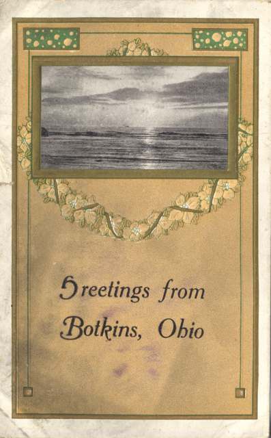
Photo: Miami University Libraries Digital Collections, no known copyright restrictions · Wikimedia Commons
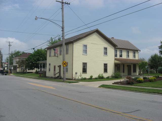
Photo: Nyttend, public domain · Wikimedia Commons
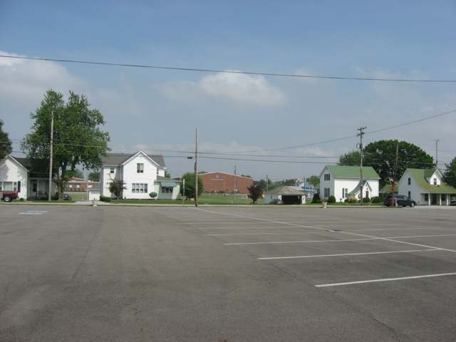
Photo: Nyttend, public domain · Wikimedia Commons
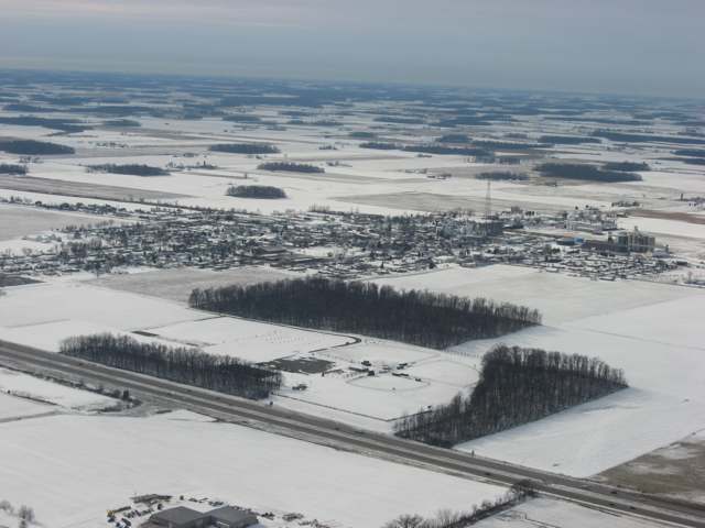
Photo: Nyttend, public domain · Wikimedia Commons
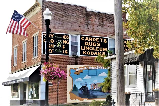
Photo: S1crow, CC BY-SA 4.0 · Wikimedia Commons
Local history sources: en.wikipedia.org · archive.org · en.wikipedia.org · botkinsohio.com · en.wikipedia.org · en.wikipedia.org · commons.wikimedia.org · commons.wikimedia.org · commons.wikimedia.org · commons.wikimedia.org · commons.wikimedia.org · commons.wikimedia.org
Historic places
2 places in Botkins on the National Register of Historic Places. Press a pin or a name for its whole record.
-
Botkins Elementary SchoolBuilding · Botkins · listed 1979
- Address
- Main St.
- Where
- Botkins, Shelby County · ZIP 45306
- What it is
- Building
- Listed on the National Register
- 1979
- NRIS reference number
- 79002851
- Coordinates
- 40.46908, -84.18255
National Register file (NPS) ↗ Search Wikipedia ↗ Street map and directions ↗ On the Cracked Buckeye map
-
Shelby HouseBuilding · Botkins · listed 1978
- Address
- 403 W. State St.
- Where
- Botkins, Shelby County · ZIP 45306
- What it is
- Building
- Listed on the National Register
- 1978
- NRIS reference number
- 78002188
- Coordinates
- 40.46738, -84.18675
National Register file (NPS) ↗ Search Wikipedia ↗ Street map and directions ↗ On the Cracked Buckeye map
Source: National Park Service, National Register of Historic Places point file. The listing year is shown where NPS's certification date agrees with the listing's reference number. Listing recognizes significance; it does not restrict a private owner.
Water
Groundwater wells (4 wells) The water here
- Botkins Village100% of residentsGroundwater wells (4 wells)
Hospitals, fire stations and more
Inside Botkins's boundary: 1 fire or EMS station, 2 public schools, 1 library, 1 museum, 1 police station, 1 Toxics Release Inventory facility and 2 spill cases. Press a pin or a name for its whole record and its source.
Fire and EMS stations (1)
-
Botkins Fire DepartmentBotkins
- Address
- 207 West State Street, Botkins, OH 45306
- Coordinates
- 40.46754, -84.18404
USGS National Map structures (source) ↗ Street map and directions ↗
Source: USGS National Map structures (most Ohio records last updated 2019 to 2022), checked against the Columbus and Cleveland station lists. The department that answers a call is set by jurisdiction and mutual aid, not by distance.
Public schools (2)
-
Botkins Elementary School4.5 of 5 stars · Botkins
- Address
- 404 E State St, Botkins, OH 45306
- School district
- Botkins Local School District
- Kind (NCES)
- Regular School
- Students, 2023-24
- 327
- Teachers (full-time equivalent)
- 16.8
- Report card, 2025-26
- 4.5 of 5 stars
- Performance index
- 94.6%
- Ohio building IRN
- 003210
- NCES school ID
- 390497603686
NCES school record ↗ Ohio School Report Card ↗ Street map and directions ↗
-
Botkins High School4.5 of 5 stars · Botkins
- Address
- 404 E State St, Botkins, OH 45306
- School district
- Botkins Local School District
- Kind (NCES)
- Regular School
- Students, 2023-24
- 283
- Teachers (full-time equivalent)
- 16.85
- Report card, 2025-26
- 4.5 of 5 stars
- Performance index
- 88.5%
- Four-year graduation rate
- 100%
- Ohio building IRN
- 003228
- NCES school ID
- 390497603687
NCES school record ↗ Ohio School Report Card ↗ Street map and directions ↗
Source: NCES EDGE public school locations 2024-25 and Common Core of Data 2023-24 (type, students, teachers); Ohio School Report Cards 2025-26 (Department of Education and Workforce), matched by name within the district.
Public libraries (1)
-
Philip Sheets Family Botkins Branch LibraryBranch · Botkins
- Address
- 109 E Lynn St, Botkins, OH 45306
- What it is
- Branch
- Library system
- Shelby County Libraries - Amos Memorial
- Open
- 1,248 hours a year, 52 weeks
- Building
- 2,210 sq ft
- System's visits, FY2024
- 174,720
- System's loans, FY2024
- 201,964
- People the system serves
- 48,230
- Phone
- (937) 693-6671
IMLS Public Libraries Survey (source) ↗ Street map and directions ↗
Source: IMLS Public Libraries Survey FY2024 (outlets and their systems). Any Ohio resident can get a free card at any Ohio public library.
Museums, historical societies, gardens and zoos (1)
-
Shelby HouseHistorical society · Botkins
- What it is
- Historical society
- City
- Botkins
- Coordinates
- 40.46766, -84.18754
Search Wikipedia ↗ IMLS Museum Data Files (source) ↗ Street map and directions ↗
The museum list is IMLS's 2018 file; a museum may have closed or moved since.
Source: IMLS Museum Data Files, 2018.
Police stations (1)
-
Botkins Police DepartmentBotkins
- Address
- 207 West South Street, Botkins, OH 45306
- Coordinates
- 40.46652, -84.18464
USGS National Map structures (source) ↗ Street map and directions ↗
Source: USGS National Map structures, police stations, corrected and completed by hand (September 2026). The department that answers a call is set by jurisdiction, not by distance.
Facilities reporting toxic releases (1)
-
Hubbard Feeds IncToxics Release Inventory · Botkins
- Address
- 104 Oak St, Botkins, OH 45306
- County
- Shelby County
- Status
- Reports to the Toxics Release Inventory (active)
- EPA program ID
- 45306PRVCN104OA
- EPA registry ID
- 110000393967
EPA facility record ↗ EPA Facility Registry Service (source) ↗ Street map and directions ↗
Source: EPA Facility Registry Service, Toxics Release Inventory reporters. Reporting a release is required of large users of listed chemicals; it is not by itself a violation.
Spills reported since 2021 (2)
-
Fuel Diesel / Diesel Fuel (Vehicle On Or Off Road)2025-12-23 · Botkins
- Reported
- 2025-12-23
- What spilled
- Fuel Diesel / Diesel Fuel (Vehicle On Or Off Road)
- Largest amount reported
- 100 gallons
- Where
- Botkins, Shelby County
- Ohio EPA district office
- SWDO
- Ohio EPA case number
- 2512EPA0002044
Ohio EPA spill reports (source) ↗ Street map and directions ↗
-
Oil Petroleum Not Otherwise Specified (Nos)2025-02-23 · Botkins
- Reported
- 2025-02-23
- What spilled
- Oil Petroleum Not Otherwise Specified (Nos)
- Where
- Botkins, Shelby County
- Ohio EPA district office
- SWDO
- Ohio EPA case number
- 2502EPA0000245
Ohio EPA spill reports (source) ↗ Street map and directions ↗
Source: Ohio EPA emergency response spill reports, 2021 to September 2026, one point per case where Ohio EPA placed it. A report is what the caller or responder recorded; amounts are often blank or estimated.
Its ZIP codes
Each ZIP code that touches Botkins, with the share of its residents who live here and the same headline figures as the ZIP page.
| ZIP | Share | Water | Radon | Home value | Schools | Flood |
|---|---|---|---|---|---|---|
| 45306 Botkins | 53% | Groundwater wells (4 wells) | 8.8 pCi/L average radon | Median year built 1967 | Botkins Local · 4.5 stars overall | 5.0% of residents in the 1% floodplain |
Local government
Who holds office in Botkins, how its elections and ballot issues came out, and the state auditor's record.
Elections for office
| Date | Office | Candidates and votes |
|---|---|---|
| 2024-11-05 | Mayor | Lance Symonds 596, 100.0% |
| 2023-11-07 | Member of Council | Jacob Roberts 448, 100.0% |
| 2023-11-07 | Mayor | Steven L. Woodruff 353, 100.0% |
| 2019-11-05 | Member of Council (unofficial count) | James P. Buehler 178, 48.5%; Lucas Greve 189, 51.5% |
| 2019-11-05 | Mayor (unofficial count) | Steven L. Woodruff 226, 100.0% |
Winners in bold. Results from the county board of elections' official canvass unless marked.
Auditor of State record
- No fiscal caution, watch or emergency on the Auditor of State's lists.
- Financial Audit, 2023 to 2024, released 2026-03-03
The county
Shelby County: 11 ZIP codes, 21 cities, villages and townships, 45,735 people.
Nearby places
Rain and snow
How much has actually fallen on Botkins, day by day, from 1893 to now. Daily totals, not averages.
- rain, last 30 days
- 1.03 in
- 2026-09-30 to 2026-10-29
- rain so far in 2026
- 42.8 in
- 7.9 in above normal for the date
- snow so far in 2026
- 17.6 in
- a normal year brings 21.1 in
- a normal year
- 41.1 in
- average of 30 years, 1991-2020
| Month | Rain (in) | Snow (in) | Days counted |
|---|---|---|---|
| October 2026 | 1.03 | — | 29 |
| September 2026 | 7.65 | — | 30 |
| August 2026 | 10.43 | — | 31 |
| July 2026 | 2.46 | — | 31 |
| June 2026 | 3.11 | — | 30 |
| May 2026 | 5.96 | — | 31 |
| April 2026 | 4.50 | — | 30 |
| March 2026 | 5.50 | 1.2 | 31 |
| February 2026 | 0.79 | 4.4 | 28 |
| January 2026 | 1.39 | 11.9 | 31 |
| December 2025 | 1.96 | 9.2 | 31 |
| November 2025 | 1.76 | 4.7 | 30 |
| Wettest year | 2011 — 58.3 in |
|---|---|
| Driest year | 1963 — 23.7 in |
| Snowiest year | 2014 — 51.7 in |
| Wettest day on record | 28 July 2025 — 6.46 in |
| Heaviest snowfall in a day | 26 November 1950 — 15.99 in |
| Deepest snow on the ground | 2 March 1912 — 37.99 in |
Mostly estimated. Only 10% of these days come from a gauge standing inside Botkins - the rest are worked out from the nearest gauges around it, so read them as close estimates rather than readings.
48,862 days of records, 1893-01-01 to 2026-10-29. Source: NOAA NCEI GHCN-Daily, 3,240 gauges in and around Ohio. A day is "gauged" when a gauge standing inside the boundary reported it, and the value is the mean of those gauges. Otherwise it is interpolated by inverse distance from every gauge reporting within 50 miles. Nothing is carried forward, back-filled or smoothed. Against NOAA nClimDiv county monthly precipitation over 136,848 complete county-months (checked 2026-10-31): correlation 0.9515, median absolute difference 0.217 in a month. Built 2026-10-31 from the Cracked Buckeye precipitation archive. Snow is the softer number — snowfall is measured by hand with a ruler, no agency publishes a gridded county snowfall series, and blowing snow defeats every observer.
Environmental permits and filings
What Ohio EPA has on file for Botkins: permits, inspections, violations, cleanups and the state loans behind sewer and water work. Every line links to the agency's own document.
- facilities and sites on file
- 4
- those placed on the map inside Botkins
| Program | Facilities and sites |
|---|---|
| State sewer loans | 2 |
| Hazardous waste | 1 |
| State water loans | 1 |
| Date | Facility or site | What |
|---|---|---|
| CIRCLE K #5681 | Hazardous waste compliance letter | |
| BOTKINS VILLAGE PWS | State water loans | |
| BOTKINS VILLAGE PWS | State water loans | |
| BOTKINS WWTP | State sewer loans |
Source: Ohio EPA eDocument portal (edocpub.epa.ohio.gov), indexed 2026-10-14. Facilities are placed on the map from Ohio EPA's own map layers, EPA's Facility Registry, coordinates written in the filings, or a geocoded street address. A permit filed under a private person's name (most are household septic systems) is counted but never named, placed or linked; licenses for individual workers and open-burning notices are left out entirely.
Quick answers
What county is Botkins, Ohio in?
Botkins is a village in Shelby County, Ohio, with 1,155 residents.
When was Botkins, Ohio founded?
Botkins was settled 1832 (Richard Botkin family); laid out 1858; incorporated 1881-08-02. Founders on record: Russell Botkin, son of Richard Botkin, on his late father's farm. Source
How did Botkins, Ohio get its name?
The village is named for Richard Botkin (born in 1803), who came to Shelby County from Hamilton County in 1832 and owned the farm on which the town site sat. Source
What ZIP code is Botkins, Ohio?
Most of Botkins is in ZIP code 45306.
Where does Botkins, Ohio get its water?
The main water source for Botkins (Botkins Village): Groundwater wells (4 wells).
Cite this page
Cite this page as:
Cracked Buckeye, "Botkins, Shelby County", https://crackedbuckeye.com/place/botkins/, built 2026-10-31, accessed [date].
How to cite · Report a correction · Built 2026-10-31
