Local events in Butler Township, Richland County
Nothing is posted for Butler Township itself yet; here is what is on within 10 miles. All local events in Butler Township, Richland County
Know a calendar we should watch? Send the link
Checked October 20; the events page is refreshed daily.
How Butler Township, Richland County began
Butler Township, in the northeast corner of Richland County, was organized March 5, 1849 (Wikipedia gives February 5, 1849) from the part of old Clear Creek Township left in Richland County when Ashland County was formed and a two-mile strip off Blooming Grove, and was named for Gen. William O. Butler of Kentucky, the 1848 Democratic vice-presidential nominee. It is the flattest township in the county, drained by the head of the Whetstone, and settled slowly; Jacob Foulks came in 1815, and his son Henry laid out the village of La Fayette, now Adario, in 1838. The township has remained a farming community with Methodist and Disciple churches, a Grange organized in 1874, and no railroad; its township hall stands at Adario. The village of Butler, despite the shared name, lies in Worthington Township.
Settled 1815 (Jacob Foulks and Abraham Claberg, on the Whetstone), incorporated March 5, 1849 (organized as a township), by organized from Clear Creek and Blooming Grove townships.
Where the name comes from
Named for Gen. William O. Butler of Kentucky, a Mexican War veteran who ran for vice president in 1848 on the Democratic ticket headed by Gen. Lewis Cass.
Before the town
No mound, village or treaty site specific to Butler Township is recorded. Graham's 1880 county history says that when Abraham Claberg came in 1815 only two or three other families lived in the township and 'occasionally, Indians were seen'. A. J. Baughman's 1903 newspaper history notes that a local antiquarian, Daniel D. Staufer, was writing the history of 'an Indian tribe which in the long ago hunted game among the Butler hills', which points to hunting use by an unnamed group rather than settlement. The region was Wyandot and Lenape (Delaware) hunting ground north of the 1795 Greenville Treaty line.
Timeline
- — Jacob Foulks settles and enters land on the Whetstone; Abraham Claberg settles on its banks the same year.
- — Ransom Foulks, son of Jacob, is born, the first white child born in the township; John Wolf settles in the west part, and his house serves for years as a preaching place for Methodist circuit riders.
- — Robert Houston, from Delaware, enters 160 acres on the Whetstone; the same year Nancy Foulks's death is the township's first recorded death.
- — John Owens, an Irish immigrant, enters a quarter section on the Whetstone two miles north of Olivesburg and plants the first orchard in the neighborhood.
- — President James Monroe grants Joseph Craig, named in the Butler village article as the first white settler of the area, a land patent.
- — Robert Houston marries Sarah Owens, the first marriage in the township.
- — A grand union wolf hunt of the surrounding townships closes on a center near the later site of La Fayette; deer and turkeys are killed but no wolves.
- — Henry Foulks lays out the village of La Fayette and keeps its first store; Baughman says it was later renamed Adario to match its post office.
- — A Mr. Fairchild starts the township's first sawmill, on the site later used by John Houston's steam sawmill.
- — The first religious society at La Fayette is formed with eight members; it builds a $500 frame Methodist church in 1844 on an acre given by Edward T. Kirk.
- — Butler Township is organized from parts of Clear Creek and Blooming Grove townships at six miles by four (Wikipedia's date; Graham and Baughman give March 5, 1849).
- — The La Fayette Methodists replace their first church with a larger building contracted to James O. Hagerman for $1,200.
- — About this year a Disciple church, 40 by 50 feet, is built in the northwest part of the township.
- — Butler Grange is organized in April; it meets every two weeks in its own hall in La Fayette and keeps a small stock of groceries.
- — A school is built at Adario that later becomes the Butler Township hall.
Stories
A township named for a defeated candidate
In 1848 Gen. Lewis Cass of Michigan headed the Democratic presidential ticket with Gen. William O. Butler of Kentucky as his running mate; the ticket lost to Zachary Taylor. Richland County's Democratic settlers nonetheless carried both names into the map: Cass Township lies in the county's northwest corner, and when the legislature carved a new township from Clear Creek and Blooming Grove in the northeast corner the following March, it was named for Butler. The village most associated with the family name, meanwhile, took a winding path of its own: platted as Independence in 1848 by Daniel Spohn and known locally as Spohntown, it did not formally become Butler until 1891, when the post office name was applied to the whole town to end confusion with another Independence, Ohio in Cuyahoga County.
The grand wolf hunt of 1828
In 1828 the settlers of Butler and the neighboring townships organized a union wolf hunt. A center was marked in a small neck of woods near where La Fayette now stands, with the trees blazed all round as a 'dead line', and marshals were named to keep the lines closed. About ten in the morning hundreds of men and boys formed lines two or three miles out and advanced with guns, tin bugles, dogs, pitchforks and butcher knives, making all the noise they could. As the lines closed, the marshals lost control and men began firing early; one man had tree bark knocked into his face by a passing bullet. A number of deer and turkeys were killed but no wolves, and the day ended in a feast; the 1880 historian said he had eaten a turkey Archibald Owens shot that day.
La Fayette becomes Adario
Henry Foulks, son of the pioneer Jacob Foulks, laid out a village on the Whetstone in 1838, kept its first store, and named it La Fayette for the French general of the Revolution. It gained a Methodist church in 1844, a steam sawmill run by John Houston, and in 1874 a Grange hall, and by 1880 liquor-selling was prohibited there. Because its post office carried the name Adario, the village took that name too, although Baughman noted in 1908 that many people still called it La Fayette. It never had a railroad, and in 1908 it was still waiting for a promised trolley line; today the township hall, a former school built in 1927, stands there.
Photographs
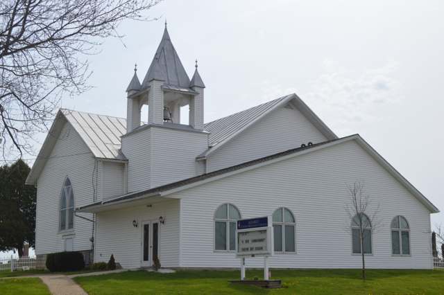
Photo: Nyttend / Wikimedia Commons, public domain · Wikimedia Commons
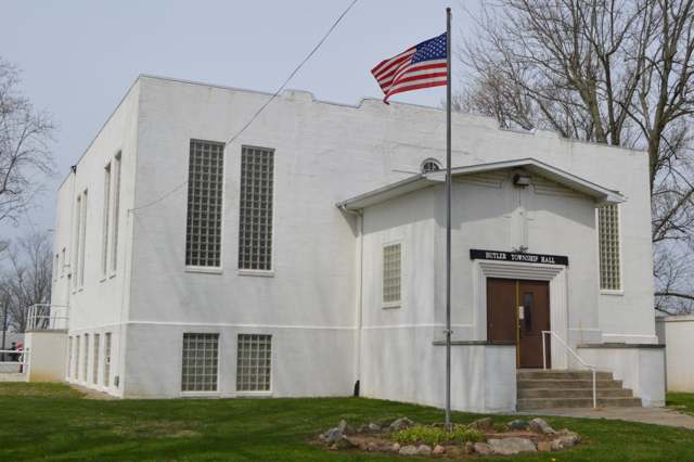
Photo: Nyttend / Wikimedia Commons, public domain · Wikimedia Commons
Local history sources: en.wikipedia.org · en.wikipedia.org · richland.ohgenweb.org · richlandcountyhistory.com · en.wikipedia.org · en.wikipedia.org · en.wikipedia.org · archive.org · archive.org · archive.org · archive.org · archive.org · commons.wikimedia.org · commons.wikimedia.org
Water
Mostly private wells The water here
- Greenwich Village49% of residentsGroundwater wells (6 wells)
- Ashland City22% of residentsJerome Fork Basin sand-and-gravel aquifer (wells)
- Shiloh Village15% of residentsGroundwater wells (2 wells)
- Rural Lorain Co. Water A11% of residentsMostly Lake Erie (bought from Avon Lake); some New London Reservoir and Ashland wells
- Northern Ohio Rural Water - SE District3% of residentsLake Erie
- Bailey Lakes Village0% of residentsLake Erie
- Hayesville Village0% of residentsGroundwater wells (2 wells)
Hospitals, fire stations and more
Inside Butler Township, Richland County's boundary: 1 poor-rated bridge, 1 Toxics Release Inventory facility and 1 spill case. Press a pin or a name for its whole record and its source.
Bridges rated poor (1)
-
Townline Rd over Clear CreekPoor · built 1940
- Condition
- Poor: a deck, superstructure, substructure or culvert rated 4 or below on the 0 to 9 scale
- What it is
- Bridge
- Built
- 1940
- Length
- 10 ft
- Owner
- County
- Vehicles a day
- 324
- Coordinates
- 40.97588, -82.43187
National Bridge Inventory (source) ↗ Street map and directions ↗
Source: FHWA National Bridge Inventory 2025. "Poor" means one major part rated 4 or below on the 0 to 9 scale; it calls for repair, not closing, unless the state posts or closes the bridge.
Facilities reporting toxic releases (1)
-
Noble Road LandfillToxics Release Inventory · Shiloh
- Address
- 170 Noble Rd E, Shiloh, OH 44878
- County
- Richland County
- Status
- Reports to the Toxics Release Inventory
- EPA program ID
- TRI_OFFSITE_1799
- EPA registry ID
- 110006278866
EPA facility record ↗ EPA Facility Registry Service (source) ↗ Street map and directions ↗
Source: EPA Facility Registry Service, Toxics Release Inventory reporters. Reporting a release is required of large users of listed chemicals; it is not by itself a violation.
Spills reported since 2021 (1)
-
Fuel Diesel / Diesel Fuel (Vehicle On Or Off Road)2023-10-27 · Butler Twp
- Reported
- 2023-10-27
- What spilled
- Fuel Diesel / Diesel Fuel (Vehicle On Or Off Road)
- Largest amount reported
- 30 gallons
- Where
- Butler Twp, Richland County
- Ohio EPA district office
- NWDO
- Ohio EPA case number
- 2310EPA0001840
Ohio EPA spill reports (source) ↗ Street map and directions ↗
Source: Ohio EPA emergency response spill reports, 2021 to September 2026, one point per case where Ohio EPA placed it. A report is what the caller or responder recorded; amounts are often blank or estimated.
Its ZIP codes
Each ZIP code that touches Butler Township, Richland County, with the share of its residents who live here and the same headline figures as the ZIP page.
| ZIP | Share | Water | Radon | Home value | Schools | Flood |
|---|---|---|---|---|---|---|
| 44837 Greenwich | 15% | Mostly private wells | 4.1 pCi/L average radon | Median year built 1974 | South Central Local · 3.5 stars overall | 1.0% of residents in the 1% floodplain |
| 44878 Bloominggrove Township and Shiloh | 11% | Mostly private wells | 5.2 pCi/L average radon | Median year built 1952 | Plymouth-Shiloh Local · 4 stars overall | 3.6% of residents in the 1% floodplain |
| 44805 Ashland | 1% | Wells (14 listed as active in EPA SDWIS: Wells 1-7 and 10-15; Well 9 was deactivated 2025-11-17) in the Jerome Fork Basin sand-and-gravel aquifer, sited generally north of the treatment plant on Cleveland Road | 5.8 pCi/L average radon | Median year built 1964 | Ashland City · 4 stars overall | 2.6% of residents in the 1% floodplain |
The county
Huron County: 10 ZIP codes, 30 cities, villages and townships, 60,416 people.
Nearby places
Quick answers
What county is Butler Township, Ohio in?
Butler Township, Richland County is a township in Huron County, Ohio, with 1,167 residents.
When was Butler Township, Ohio founded?
Butler Township, Richland County was settled 1815 (Jacob Foulks and Abraham Claberg, on the Whetstone); incorporated March 5, 1849 (organized as a township). Founders on record: organized from Clear Creek and Blooming Grove townships. Source
How did Butler Township, Ohio get its name?
Named for Gen. Source
What ZIP code is Butler Township, Ohio?
Butler Township, Richland County is served by ZIP codes 44837 and 44878; 44837 holds the largest share of its residents.
Where does Butler Township, Ohio get its water?
The main water source for Butler Township, Richland County (Greenwich Village): Mostly private wells.
Cite this page
Cite this page as:
Cracked Buckeye, "Butler Township, Richland County", https://crackedbuckeye.com/place/butler-township-richland-county/, built 2026-10-31, accessed [date].
How to cite · Report a correction · Built 2026-10-31
