Local events in Malvern
Nothing is posted for Malvern itself yet; here is what is on within 10 miles. All local events in Malvern
Know a calendar we should watch? Send the link
Checked October 20; the events page is refreshed daily.
How Malvern began
Malvern began as Troy, platted in November 1834 by the Reverend William Hardesty, and was renamed Malvern in 1840 to avoid confusion with the many other Troys in Ohio; it incorporated as a village on May 31, 1869. A station on the Cleveland & Pittsburgh Railroad, it grew into one of Ohio's earliest and largest paving-brick manufacturing centers in the 1880s and 1890s, work that still shows in brick streets and foundations around town. The village sits on the historic Great Trail, an Indigenous trade route that a Revolutionary War army camped on in 1778 on its way to build Fort Laurens, and it later gave the country AT&T's founding president, Theodore Vail. Today Malvern is a village of about 1,110 people near Lake Mohawk, a large private reservoir built in 1963 just south of town.
Platted 1834, incorporated 1869-05-31, by Rev. William Hardesty, who platted it as the village of Troy.
Where the name comes from
The settlement was originally platted as Troy in November 1834; it was renamed Malvern in 1840, most likely to end confusion with the several other Troys already registered in Ohio post offices.
Before the town
Malvern sits directly on the Great Trail (also called the Tuscarawas Path), an Algonquian and Iroquoian overland route linking the forks of the Ohio River to Lake Erie that was used for travel and trade by the Lenape (Delaware), Wyandot, Shawnee and Mingo. In November 1778, during the American Revolution, a 1,200-man Continental Army expedition under Brigadier General Lachlan McIntosh — marching with allied Delaware guides toward the Sandusky towns and, ultimately, to build Fort Laurens on the Tuscarawas River — camped for two nights at a site now inside Malvern's Village Park (the expedition's 'Camp No. 9'). A historical marker there commemorates the stop. No earlier mound-builder or specific village site inside present Malvern was located in the sources checked.
Nations recorded here: Lenape (Delaware), Wyandot, Shawnee, Mingo (Seneca-Cayuga).
- The Great Trail / McIntosh Expedition Camp No. 9 (trail|camp) — Malvern Village Park, West Canal Street, pre-contact trade route; camped November 13-14, 1778 (yourohionews.com)
Timeline
- — General Lachlan McIntosh's 1,200-man Continental Army expedition, guided in part by allied Delawares, camped two nights on the Great Trail at what is now Malvern Village Park before marching on to build Fort Laurens.
- — Rev. William Hardesty platted the settlement of Troy.
- — The village was renamed Malvern.
- — Theodore Newton Vail, future general manager of Bell Telephone and founding president of AT&T, was born in Malvern.
- — Malvern was incorporated as a village on May 31.
- — The Malvern Clay Company and the Canton & Malvern Fire Clay Paving Brick Company together produced roughly 16.5 million paving bricks in a single year.
- — The Odessa Theater was built on Main Street; it later became the Hollywood Milk Company, a milk and chocolate processing plant.
- — American Realty Service Corporation dammed Middle Run, a Sandy Creek tributary, on 1,728 acres just south of Malvern to create Lake Mohawk, a private gated-community reservoir.
- — Malvern's Methodist Episcopal Church at 121 West Wood Street was added to the National Register of Historic Places.
Stories
Two nights on the Great Trail, 1778
In the fall of 1778, with the Revolution still very much undecided in the west, Brigadier General Lachlan McIntosh led some 1,200 Continental soldiers and militia out of Fort Pitt, aiming to strike British-allied towns on the Sandusky River. The column — soldiers, camp followers, Scotch-Irish and German speakers, African Americans, and livestock, guided in part by Delaware allies — followed the old Great Trail westward. On the nights of November 13 and 14, 1778, they made camp at a site that is now Malvern's Village Park; historians number it 'Camp No. 9' along the march. From there the expedition pushed on to the Tuscarawas River and built Fort Laurens, the only Continental Army fort raised in Ohio during the Revolution. Fort Laurens itself sits in Tuscarawas County, but the campaign passed directly through what is now Carroll County, and a marker in the park remembers the stop.
The village that paved Ohio's streets
Malvern's clay beds and its station on the Cleveland & Pittsburgh Railroad made it a natural home for the paving-brick trade that took off across Ohio in the 1880s and 1890s. In 1893 alone, the Malvern Clay Company and the Canton & Malvern Fire Clay Paving Brick Company turned out about 16.5 million bricks between them — roughly 7.5 million from one plant and 9 million from the other — fired hard enough to survive decades of wagon and streetcar traffic. Those bricks still surface in Malvern's own streets, building foundations and sidewalks, a durable trace of an industry that once shipped Malvern's name across the state.
The telephone man from a railroad depot town
Theodore Newton Vail was born in Malvern on July 16, 1845, in a village then defined by its brickyards and its Cleveland & Pittsburgh Railroad depot. Vail went to work for the Railway Mail Service before Gardiner Hubbard recruited him to the young Bell Telephone Company, where he became general manager in 1878 and helped the company defend its patents and adopt copper wire. He went on to found American Telephone & Telegraph in 1885 and led it again from 1907 to 1919, pushing the then-radical idea that a telephone company should run as a regulated public utility rather than chase maximum private profit. When Vail died in 1920, AT&T stopped telephone service across the entire country for one minute during his funeral — roughly 12 million phones went silent at once, in tribute to a man born in a small Carroll County railroad town.
Photographs
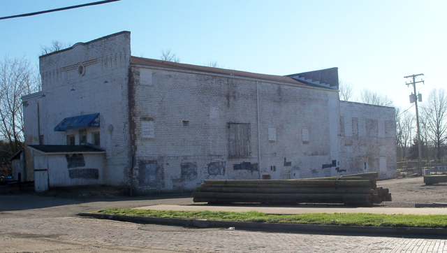
Photo: Roseohioresident, via Wikimedia Commons, CC BY-SA 4.0 · Wikimedia Commons
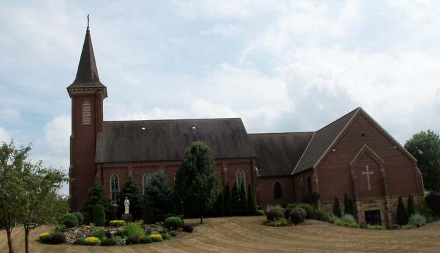
Photo: Roseohioresident, via Wikimedia Commons, CC BY-SA 3.0 · Wikimedia Commons
Local history sources: en.wikipedia.org · en.wikipedia.org · en.wikipedia.org · yourohionews.com · en.wikipedia.org · en.wikipedia.org · en.wikipedia.org · en.wikipedia.org · commons.wikimedia.org · commons.wikimedia.org
Water
Eight active wells and two treatment plants feeding one distribution system, plus water bought from Malvern; public records do not say which wells feed which plant. The water here
- Aqua Ohio - Mohawk53% of residentsGroundwater wells (8 wells)
- Malvern Village43% of residentsGroundwater wells (2 wells)
- Green Acres Mobile Estates4% of residentsGroundwater wells (2 wells)
Hospitals, fire stations and more
Inside Malvern's boundary: 2 fire and EMS stations, 3 public schools, 1 library, 1 Superfund site and 2 spill cases. Press a pin or a name for its whole record and its source.
Fire and EMS stations (2)
-
Great Trail Fire Department South StationMalvern
- Address
- 300 Bridge Street, Malvern, OH 44644
- Coordinates
- 40.68795, -81.17909
USGS National Map structures (source) ↗ Street map and directions ↗
-
Great Trail Fire District - Malvern StationMalvern
- Address
- 120 Water Street, Malvern, OH 44644
- Coordinates
- 40.69030, -81.18131
USGS National Map structures (source) ↗ Street map and directions ↗
Source: USGS National Map structures (most Ohio records last updated 2019 to 2022), checked against the Columbus and Cleveland station lists. The department that answers a call is set by jurisdiction and mutual aid, not by distance.
Public schools (3)
-
Malvern Elementary School3.5 of 5 stars · Malvern
- Address
- 3242 Coral Rd NW, Malvern, OH 44644
- School district
- Brown Local School District
- Kind (NCES)
- Regular School
- Students, 2023-24
- 268
- Teachers (full-time equivalent)
- 20.79
- Report card, 2025-26
- 3.5 of 5 stars
- Performance index
- 79.6%
- Ohio building IRN
- 022350
- NCES school ID
- 390461702461
NCES school record ↗ Ohio School Report Card ↗ Street map and directions ↗
-
Malvern High School4 of 5 stars · Malvern
- Address
- 3242 Coral Rd NW, Malvern, OH 44644
- School district
- Brown Local School District
- Kind (NCES)
- Regular School
- Students, 2023-24
- 174
- Teachers (full-time equivalent)
- 21.2
- Report card, 2025-26
- 4 of 5 stars
- Performance index
- 76.3%
- Four-year graduation rate
- 100%
- Ohio building IRN
- 022368
- NCES school ID
- 390461702462
NCES school record ↗ Ohio School Report Card ↗ Street map and directions ↗
-
Malvern Middle School2.5 of 5 stars · Malvern
- Address
- 3242 Coral Rd NW, Malvern, OH 44644
- School district
- Brown Local School District
- Kind (NCES)
- Regular School
- Students, 2023-24
- 134
- Teachers (full-time equivalent)
- 7.08
- Report card, 2025-26
- 2.5 of 5 stars
- Performance index
- 70.2%
- Ohio building IRN
- 000291
- NCES school ID
- 390461705296
NCES school record ↗ Ohio School Report Card ↗ Street map and directions ↗
Source: NCES EDGE public school locations 2024-25 and Common Core of Data 2023-24 (type, students, teachers); Ohio School Report Cards 2025-26 (Department of Education and Workforce), matched by name within the district.
Public libraries (1)
-
Malvern Branch LibraryBranch · Malvern
- Address
- 710 E Porter St, Malvern, OH 44644
- What it is
- Branch
- Library system
- Carroll County District Library
- Open
- 2,340 hours a year, 52 weeks
- Building
- 3,300 sq ft
- System's visits, FY2024
- 140,400
- System's loans, FY2024
- 190,961
- People the system serves
- 21,721
- Phone
- (330) 863-0636
IMLS Public Libraries Survey (source) ↗ Street map and directions ↗
Source: IMLS Public Libraries Survey FY2024 (outlets and their systems). Any Ohio resident can get a free card at any Ohio public library.
Superfund sites (1)
-
Former Perfect Products CompanySuperfund program · Malvern
- Address
- 265 Morges Rd, Malvern, OH 44644
- County
- Carroll County
- Status
- Superfund program site, not on the National Priorities List
- EPA program ID
- OHR000039354
- EPA registry ID
- 110071711900
EPA facility record ↗ EPA Facility Registry Service (source) ↗ Street map and directions ↗
Source: EPA Facility Registry Service, Superfund (SEMS) and National Priorities List sites. Many program sites were assessed and needed no cleanup.
Spills reported since 2021 (2)
-
Bentonite / Drilling Mud2024-06-06 · Malvern
- Reported
- 2024-06-06
- What spilled
- Bentonite / Drilling Mud
- Where
- Malvern, Carroll County
- Ohio EPA district office
- NEDO
- Ohio EPA case number
- 2406EPA0000953
Ohio EPA spill reports (source) ↗ Street map and directions ↗
-
Sewage Human Reached water2021-09-19 · Malvern
- Reported
- 2021-09-19
- What spilled
- Sewage Human
- Reached a waterway
- 99 - Unnamed
- Where
- Malvern, Carroll County
- Ohio EPA district office
- NEDO
- Ohio EPA case number
- 2109EPA0001476
Ohio EPA spill reports (source) ↗ Street map and directions ↗
Source: Ohio EPA emergency response spill reports, 2021 to September 2026, one point per case where Ohio EPA placed it. A report is what the caller or responder recorded; amounts are often blank or estimated.
Its ZIP codes
Each ZIP code that touches Malvern, with the share of its residents who live here and the same headline figures as the ZIP page.
| ZIP | Share | Water | Radon | Home value | Schools | Flood |
|---|---|---|---|---|---|---|
| 44644 Brown Township and Malvern | 25% | Eight active wells and two treatment plants feeding one distribution system, plus water bought from Malvern; public records do not say which wells feed which plant. | 11.7 pCi/L average radon | Median year built 1975 | Brown Local · 3.5 stars overall | 17% of residents in the 1% floodplain |
Local government
The state auditor's record.
Auditor of State record
- No fiscal caution, watch or emergency on the Auditor of State's lists.
- Financial Audit, 2023 to 2024, released 2026-05-07
On the November 3, 2026 ballot
Statewide question: State Issue 3: Voter ID
Local questions for Malvern, Carroll County and its school district:
- Carroll County: Renews a 1.4-mill property tax levy to maintain & operate County Home of Carroll County for 5 years, beginning in 2027.
Races, candidates and every question for an address: your ballot. County offices and judges are on your county board's sample ballot.
The county
Carroll County: 7 ZIP codes, 15 cities, villages and townships with pages here, 26,475 people (Census Bureau estimate, July 2025).
Nearby places
Rain and snow
How much has actually fallen on Malvern, day by day, from 1893 to now. Daily totals, not averages.
- rain, last 30 days
- 1.53 in
- 2026-10-01 to 2026-10-30
- rain so far in 2026
- 41.0 in
- 5.5 in above normal for the date
- snow so far in 2026
- 27.7 in
- a normal year brings 33.1 in
- a normal year
- 41.6 in
- average of 30 years, 1991-2020
| Month | Rain (in) | Snow (in) | Days counted |
|---|---|---|---|
| October 2026 | 1.53 | — | 30 |
| September 2026 | 5.72 | — | 30 |
| August 2026 | 6.82 | — | 31 |
| July 2026 | 5.16 | — | 31 |
| June 2026 | 3.23 | — | 30 |
| May 2026 | 5.21 | — | 31 |
| April 2026 | 5.29 | 0.1 | 30 |
| March 2026 | 4.88 | 2.5 | 31 |
| February 2026 | 1.01 | 4.7 | 28 |
| January 2026 | 2.13 | 20.4 | 31 |
| December 2025 | 2.66 | 10.8 | 31 |
| November 2025 | 1.80 | 0.3 | 30 |
| Wettest year (estimated) | 2004 — 53.9 in |
|---|---|
| Driest year (estimated) | 1991 — 26.6 in |
| Snowiest year (estimated) | 1894 — 66.5 in |
| Wettest day (estimated) | 5 July 1969 — 3.35 in |
| Heaviest snowfall in a day (estimated) | 20 April 1901 — 15.99 in |
| Deepest snow on the ground (estimated) | 20 April 1901 — 20.59 in |
Estimated, not measured. No rain gauge has ever stood inside Malvern, so every figure here is worked out from the gauges around it - the nearest ones weighted most. Treat them as close estimates rather than readings.
48,752 days of records, 1893-01-01 to 2026-10-30. Source: NOAA NCEI GHCN-Daily, 3,240 gauges in and around Ohio. A day is "gauged" when a gauge standing inside the boundary reported it, and the value is the mean of those gauges. Otherwise it is interpolated by inverse distance from every gauge reporting within 50 miles. Nothing is carried forward, back-filled or smoothed. Against NOAA nClimDiv county monthly precipitation over 136,848 complete county-months (checked 2026-11-01): correlation 0.9515, median absolute difference 0.217 in a month. Built 2026-11-01 from the Cracked Buckeye precipitation archive. Snow is the softer number — snowfall is measured by hand with a ruler, no agency publishes a gridded county snowfall series, and blowing snow defeats every observer.
Environmental permits and filings
What Ohio EPA has on file for Malvern: permits, inspections, violations, cleanups and the state loans behind sewer and water work. Every line links to the agency's own document.
- facilities and sites on file
- 5
- those placed on the map inside Malvern
| Program | Facilities and sites |
|---|---|
| State water loans | 2 |
| Hazardous waste | 1 |
| Public drinking water | 1 |
| Source-water protection | 1 |
| Date | Facility or site | What |
|---|---|---|
| MALVERN VILLAGE PWS | Public drinking water compliance letter | |
| MALVERN VILLAGE PWS | Public drinking water warning letter | |
| MALVERN VILLAGE PWS | Public drinking water report | |
| MALVERN VILLAGE PWS | Public drinking water inspection | |
| MALVERN VILLAGE PWS | Public drinking water notice of violation | |
| MALVERN VILLAGE PWS | Public drinking water notice of violation | |
| MALVERN VILLAGE PWS | Public drinking water report | |
| MALVERN VILLAGE PWS | Public drinking water inspection | |
| MALVERN VILLAGE PWS | Public drinking water letter | |
| MALVERN VILLAGE PWS | Public drinking water notice of violation | |
| MALVERN VILLAGE PWS | Public drinking water inspection | |
| MALVERN VILLAGE PWS | Public drinking water plan | |
| MALVERN VILLAGE PWS | Public drinking water warning letter | |
| MALVERN VILLAGE PWS | Public drinking water report | |
| MALVERN VILLAGE PWS | Public drinking water compliance letter | |
| MALVERN VILLAGE PWS | Public drinking water report | |
| MALVERN VILLAGE PWS | Public drinking water report | |
| MALVERN VILLAGE PWS | Public drinking water notice of violation | |
| MALVERN VILLAGE PWS | Public drinking water inspection | |
| MALVERN VILLAGE PWS | Public drinking water notice of violation | |
| MALVERN VILLAGE PWS | Public drinking water inspection | |
| MALVERN VILLAGE PWS | Public drinking water inspection | |
| MALVERN VILLAGE PWS | Source-water protection report | |
| MALVERN VILLAGE PWS | Public drinking water compliance letter | |
| MALVERN VILLAGE PWS | Public drinking water notice of violation |
Source: Ohio EPA eDocument portal (edocpub.epa.ohio.gov), indexed 2026-10-14. Facilities are placed on the map from Ohio EPA's own map layers, EPA's Facility Registry, coordinates written in the filings, or a geocoded street address. A permit filed under a private person's name (most are household septic systems) is counted but never named, placed or linked; licenses for individual workers and open-burning notices are left out entirely.
Quick answers
What county is Malvern, Ohio in?
Malvern is a village in Carroll County, Ohio, with 1,110 residents.
When was Malvern, Ohio founded?
Malvern was laid out 1834; incorporated 1869-05-31. Founders on record: Rev. William Hardesty, who platted it as the village of Troy. Source
How did Malvern, Ohio get its name?
The settlement was originally platted as Troy in November 1834; it was renamed Malvern in 1840, most likely to end confusion with the several other Troys already registered in Ohio post offices. Source
What ZIP code is Malvern, Ohio?
Most of Malvern is in ZIP code 44644.
Where does Malvern, Ohio get its water?
The main water source for Malvern (Aqua Ohio - Mohawk): Eight active wells and two treatment plants feeding one distribution system, plus water bought from Malvern; public records do not say which wells feed which plant.
Cite this page
Cite this page as:
Cracked Buckeye, "Malvern, Carroll County", https://crackedbuckeye.com/place/malvern/, built 2026-10-31, accessed [date].
How to cite · Report a correction · Built 2026-10-31