Local events in Bloomfield Township, Jackson County
Nothing is posted for Bloomfield Township itself yet; here is what is on within 20 miles. All local events in Bloomfield Township, Jackson County
Know a calendar we should watch? Send the link
Checked October 20; the events page is refreshed daily.
How Bloomfield Township, Jackson County began
Bloomfield Township, in eastern Jackson County, was one of the five townships the county started with in 1816; its township 8, range 17 had been surveyed in October 1801, and Hugh Poor was settled there by 1811. Its first recorded business was a tavern licensed in 1816 on petition of the freeholders of 'the Bloomfield town house', and John Stephenson of Bloomfield was one of the county's first three commissioners. Its best-known landmark is the Keystone Furnace, a charcoal iron furnace that began operation in 1848 and ran until 1885, around which the unincorporated company town of Keystone grew. The township had 721 people in 1840, 1,557 in 1880 and 1,155 in 2020, and has no incorporated village.
Settled 1811 (Hugh Poor, the earliest settler named in the county history), incorporated 1816 (one of Jackson County's five original townships; township 8, range 17, surveyed October 1801), by Hugh Poor, John Stephenson and other early settlers.
Where the name comes from
No source explains the name Bloomfield. The 1900 county history says Milton was named for the poet and two other townships for American statesmen, and Lick for the salt springs, but gives no reason for Bloomfield; the Jackson County GenWeb name-origins page is also silent on it.
Before the town
No village, mound or treaty event is recorded inside Bloomfield Township, but it carries one of the county's better-known legends: a tradition that Indians worked a lead mine somewhere in the ravines of 'Jimmy Adams' hollow' near the John Ware bridge by Keystone Furnace. The 1900 county history prints a March 13, 1897 letter from Charles A. Lackey of Rocky Hill, whose people settled there in 1806, saying a white captive had been taken to the mine blindfolded and reported beech trees carved with turkeys, turtles and deer. The historian prints it as tradition only, and notes that geologist Caleb Briggs in 1837 found no lead veins in the county. No such mine has been found. Jackson County as a whole has a Shawnee, Adena, Hopewell and Fort Ancient record.
Nations recorded here: Shawnee.
- Legendary Indian lead mine (unlocated) (other) — Said to lie in Jimmy Adams' hollow, running through the old Lackey homestead to the John Ware bridge near Keystone Furnace; never found, undated tradition (archive.org)
Timeline
- — Benjamin F. Stone surveys Bloomfield (township 8, range 17) in October; it lies east of the 'true meridian' correction line that explains the jogs in the section lines along the Milton-Bloomfield-Madison line.
- — Hugh Poor settles in what is now Bloomfield Township; John Stephenson, a South Carolina native by way of Cabell County, Virginia, enters land here in 1814.
- — On election day John Hale and Joel Long agree to 'box and fight each other at fisticuffs' at the Bloomfield town house; both plead guilty at the first term of court that August and are fined $12 each.
- — Bloomfield is one of the five townships Jackson County starts with, and John Stephenson of Bloomfield polls 114 votes and is elected one of the county's first three commissioners; the township cast 37 of the 220 votes in that first election.
- — The commissioners order that township 8, range 17 'remain incorporated according to its original surveyed boundaries, by the name of Bloomfield'; Andrew Donnally's tavern license, petitioned by Bloomfield freeholders on July 10, is granted on August 13.
- — Freeholders of Bloomfield petition for a tavern license for James Lackey, whose family settled at Rocky Hill in 1806.
- — Bloomfield's population is 721 in the federal census.
- — The Raccoon Navigation Company is incorporated with $100,000 capital to slack-water the Raccoon; Keystone and Buckeye furnaces on the Little Raccoon were built before any railroad reached the county.
- — A post office opens as Hughes; it is renamed Keystone on October 1, 1849 and discontinued on July 16, 1853.
- — Keystone Furnace is under construction (the Filson Historical Society says it began operating in 1848); its stack, carved from solid sandstone, produces about 12 tons of charcoal pig iron a day.
- — Green, Benner, Campbell & Co. buy the furnace, enlarge the stack to 36 feet and raise capacity to 24 tons a day.
- — The furnace stops work while its owners raise the 27th Ohio Volunteer Infantry.
- — Hezekiah Sanford Bundy buys Keystone Furnace.
- — Bloomfield's population reaches 1,557, more than double the 1840 count.
- — Bundy's operation closes Keystone Furnace; the Filson page gives no reason.
- — Keystone Furnace is listed on the National Register of Historic Places.
- — The census counts 1,155 people in the township.
Stories
A furnace carved from sandstone
The Keystone Furnace was built by John McConnell & Co. and began operation in 1848, financed by Jackson County businessmen who wanted a share of the iron trade then booming across the Hanging Rock Iron Region of southern Ohio and northern Kentucky. Its 33-foot stack was carved from solid sandstone; it turned out about 12 tons of charcoal iron a day at first, and when a new ownership group bought it in 1853 they raised the stack to 36 feet and doubled output to 24 tons. The Filson Historical Society, which holds the furnace's ledgers, says the furnace began operating in 1848; Wikipedia's article on Keystone dates the building to 1849-1853. The company-store ledgers of 1852-1870 record what the families of Keystone bought: tobacco, coffee, salt, meat, kitchenware, garden tools and cloth. The furnace was idle in 1861-1863 while its owners formed the 27th Ohio Volunteer Infantry, and it closed in 1885. The stack still stands on private land, and Keystone survives as an unincorporated community.
The Indian lead mine nobody found
In 1897 Charles A. Lackey of Rocky Hill wrote to the Jackson Standard-Journal to set down a tradition he had from his people, who came to Bloomfield Township in 1806. The Indians, he said, had found and used a lead mine somewhere in 'Jimmy Adams' hollow', which runs through the old Lackey homestead and ends at the John Ware bridge near Keystone Furnace. A white man taken captive was supposedly led to the mine blindfolded so he could never find it again, and later told of beech trees there cut with figures of turkeys, turtles and deer. Lackey could not name the captive, whose informant was dead, and vouched only for the springs that made his grandfather choose the farm. County historian Williams printed the letter beside the geologist Caleb Briggs's 1837 report that no lead veins had been found, only loose lumps on the surface, and a lump found in Liberty Township about 1860. The mine, if it ever existed, was never located.
Fists and a tavern at the Bloomfield town house
The new county's first criminal case came out of Bloomfield. On April 1, 1816, election day, John Hale and Joel Long agreed to settle a quarrel with their fists at the Bloomfield town house, and at the first term of court in August they pleaded guilty and were fined $12 and costs each. The same court term licensed Bloomfield's first recorded tavern. On July 10, 1816, Bloomfield freeholders, among them Hugh Poor, Andrew Boggs, Moses Hale and two Stephensons, petitioned that a public house 'would conduse to the publick convenience' and recommended Andrew Donnally, who wrote the petition himself in his own variable spelling. The judges granted the license on August 13. Two years later the freeholders asked for another at the house of James Lackey, whose family had settled the hollow where the lead-mine legend later placed its mine.
Photographs
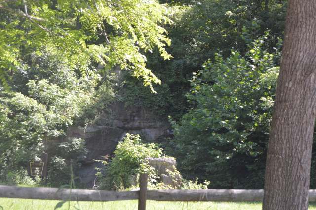
Photo: Nyttend, public domain · Wikimedia Commons
Local history sources: en.wikipedia.org · filsonhistorical.org · en.wikipedia.org · jackson.ohgenweb.org · en.wikipedia.org · archive.org · genealogytrails.com · en.wikipedia.org · commons.wikimedia.org
Water
Mostly private wells The water here
- Jackson, City Of94% of residentsJisco Lake + Hammertown Lake (Jackson City Reservoir)
- Wellston City6% of residentsLake Rupert + Lake Alma (Little Raccoon Creek reservoirs)
Hospitals, fire stations and more
Inside Bloomfield Township, Jackson County's boundary: 1 fire or EMS station, 3 poor-rated bridges and 9 spill cases. Press a pin or a name for its whole record and its source.
Fire and EMS stations (1)
-
Bloomfield Volunteer Fire DepartmentJackson
- Address
- 1424 Dixon Run Road, Jackson, OH 45640
- Coordinates
- 38.98511, -82.53450
USGS National Map structures (source) ↗ Street map and directions ↗
Source: USGS National Map structures (most Ohio records last updated 2019 to 2022), checked against the Columbus and Cleveland station lists. The department that answers a call is set by jurisdiction and mutual aid, not by distance.
Bridges rated poor (3)
-
C. H. & D. over Symmes CreekPoor · built 1941
- Condition
- Poor: a deck, superstructure, substructure or culvert rated 4 or below on the 0 to 9 scale
- What it is
- Bridge
- Built
- 1941
- Length
- 11 ft
- Owner
- County
- Vehicles a day
- 913
- Coordinates
- 38.96053, -82.53237
National Bridge Inventory (source) ↗ Street map and directions ↗
-
Ebb Tomblin over Sugar RunPoor · built 1932
- Condition
- Poor: a deck, superstructure, substructure or culvert rated 4 or below on the 0 to 9 scale
- What it is
- Bridge
- Built
- 1932
- Length
- 8 ft
- Owner
- County
- Vehicles a day
- 351
- Coordinates
- 38.95258, -82.48600
National Bridge Inventory (source) ↗ Street map and directions ↗
-
Ridgeland over Dickason RunPoor · built 1900
- Condition
- Poor: a deck, superstructure, substructure or culvert rated 4 or below on the 0 to 9 scale
- What it is
- Bridge
- Built
- 1900
- Length
- 13 ft
- Owner
- County
- Vehicles a day
- 351
- Coordinates
- 39.01687, -82.50360
National Bridge Inventory (source) ↗ Street map and directions ↗
Source: FHWA National Bridge Inventory 2025. "Poor" means one major part rated 4 or below on the 0 to 9 scale; it calls for repair, not closing, unless the state posts or closes the bridge.
Spills reported since 2021 (9)
-
Fuel Diesel / Diesel Fuel (Vehicle On Or Off Road)2025-12-19 · Bloomfield Twp
- Reported
- 2025-12-19
- What spilled
- Fuel Diesel / Diesel Fuel (Vehicle On Or Off Road)
- Where
- Bloomfield Twp, Jackson County
- Ohio EPA district office
- SEDO
- Ohio EPA case number
- 2512EPA0002027
Ohio EPA spill reports (source) ↗ Street map and directions ↗
-
Fuel Diesel / Diesel Fuel (Vehicle On Or Off Road)2025-07-16 · Bloomfield Twp
- Reported
- 2025-07-16
- What spilled
- Fuel Diesel / Diesel Fuel (Vehicle On Or Off Road)
- Largest amount reported
- 5,000 gallons
- Where
- Bloomfield Twp, Jackson County
- Ohio EPA district office
- SEDO
- Ohio EPA case number
- 2507EPA0001186
Ohio EPA spill reports (source) ↗ Street map and directions ↗
-
Fuel Diesel / Diesel Fuel (Vehicle On Or Off Road)2025-03-29 · Bloomfield Twp
- Reported
- 2025-03-29
- What spilled
- Fuel Diesel / Diesel Fuel (Vehicle On Or Off Road)
- Largest amount reported
- 100 gallons
- Where
- Bloomfield Twp, Jackson County
- Ohio EPA district office
- SEDO
- Ohio EPA case number
- 2503EPA0000458
Ohio EPA spill reports (source) ↗ Street map and directions ↗
-
Drum(S)2024-05-09 · Bloomfield Twp
- Reported
- 2024-05-09
- What spilled
- Drum(S)
- Where
- Bloomfield Twp, Jackson County
- Ohio EPA district office
- SEDO
- Ohio EPA case number
- 2405EPA0000778
Ohio EPA spill reports (source) ↗ Street map and directions ↗
-
Other / All Other / Trade Name / Mixture / Solution Etc2024-01-18 · Bloomfield Twp
- Reported
- 2024-01-18
- What spilled
- Other / All Other / Trade Name / Mixture / Solution Etc; Fuel Diesel / Diesel Fuel (Vehicle On Or Off Road)
- Where
- Bloomfield Twp, Jackson County
- Ohio EPA district office
- SEDO
- Ohio EPA case number
- 2401EPA0000092
Ohio EPA spill reports (source) ↗ Street map and directions ↗
-
Fuel Diesel / Diesel Fuel (Vehicle On Or Off Road)2022-08-30 · Bloomfield Twp
- Reported
- 2022-08-30
- What spilled
- Fuel Diesel / Diesel Fuel (Vehicle On Or Off Road)
- Largest amount reported
- 200 gallons
- Where
- Bloomfield Twp, Jackson County
- Ohio EPA district office
- SEDO
- Ohio EPA case number
- 2208EPA0001334
Ohio EPA spill reports (source) ↗ Street map and directions ↗
-
Fuel Diesel / Diesel Fuel (Vehicle On Or Off Road)2026-07-05 · Bloomfield Twp
- Reported
- 2026-07-05
- What spilled
- Fuel Diesel / Diesel Fuel (Vehicle On Or Off Road)
- Where
- Bloomfield Twp, Jackson County
- Ohio EPA district office
- SEDO
- Ohio EPA case number
- 2607EPA0001211
Ohio EPA spill reports (source) ↗ Street map and directions ↗
-
Fuel Gasoline ( 25% Ethanol Not E85)2026-06-22 · Bloomfield Twp
- Reported
- 2026-06-22
- What spilled
- Fuel Gasoline ( 25% Ethanol Not E85)
- Where
- Bloomfield Twp, Jackson County
- Ohio EPA district office
- SEDO
- Ohio EPA case number
- 2606EPA0001125
Ohio EPA spill reports (source) ↗ Street map and directions ↗
-
Fuel Diesel / Diesel Fuel (Vehicle On Or Off Road)2026-02-04 · Bloomfield Twp
- Reported
- 2026-02-04
- What spilled
- Fuel Diesel / Diesel Fuel (Vehicle On Or Off Road)
- Largest amount reported
- 60 gallons
- Where
- Bloomfield Twp, Jackson County
- Ohio EPA district office
- SEDO
- Ohio EPA case number
- 2602EPA0000129
Ohio EPA spill reports (source) ↗ Street map and directions ↗
Source: Ohio EPA emergency response spill reports, 2021 to September 2026, one point per case where Ohio EPA placed it. A report is what the caller or responder recorded; amounts are often blank or estimated.
Its ZIP codes
Each ZIP code that touches Bloomfield Township, Jackson County, with the share of its residents who live here and the same headline figures as the ZIP page.
| ZIP | Share | Water | Radon | Home value | Schools | Flood |
|---|---|---|---|---|---|---|
| 45685 Raccoon Township and Thurman | 30% | Mostly private wells | Too few radon tests | Median year built 1988 | Gallia County Local · 3 stars overall | 1.7% of residents in the 1% floodplain |
| 45640 Jackson | 5% | Hammertown Lake (primary); Jisco Lake (backup) | 2.4 pCi/L average radon | Median year built 1971 | Jackson City · 3.5 stars overall | 4.3% of residents in the 1% floodplain |
Local government
Who holds office in Bloomfield Township, Jackson County, how its elections and ballot issues came out, and the state auditor's record.
Elections for office
| Date | Office | Candidates and votes |
|---|---|---|
| 2023-11-07 | Township Fiscal Officer | Mark Hemming 197, 100.0% |
| 2017-11-07 | Township Trustee | Roy L. Arthur 89, 40.09%; Tim Jones 133, 59.91% |
Winners in bold. Results from the county board of elections' official canvass unless marked.
Auditor of State record
- No fiscal caution, watch or emergency on the Auditor of State's lists.
- Agreed Upon Procedures, 2023 to 2024, released 2025-07-22
The county
Jackson County: 4 ZIP codes, 16 cities, villages and townships, 31,291 people.
Nearby places
Quick answers
What county is Bloomfield Township, Ohio in?
Bloomfield Township, Jackson County is a township in Jackson County, Ohio, with 1,155 residents.
When was Bloomfield Township, Ohio founded?
Bloomfield Township, Jackson County was settled 1811 (Hugh Poor, the earliest settler named in the county history); incorporated 1816 (one of Jackson County's five original townships; township 8, range 17, surveyed October 1801). Founders on record: Hugh Poor, John Stephenson and other early settlers. Source
What ZIP code is Bloomfield Township, Ohio?
Bloomfield Township, Jackson County is served by ZIP codes 45685 and 45640; 45685 holds the largest share of its residents.
Where does Bloomfield Township, Ohio get its water?
The main water source for Bloomfield Township, Jackson County (Jackson, City Of): Mostly private wells.
Cite this page
Cite this page as:
Cracked Buckeye, "Bloomfield Township, Jackson County", https://crackedbuckeye.com/place/bloomfield-township-jackson-county/, built 2026-10-31, accessed [date].
How to cite · Report a correction · Built 2026-10-31
