Local events in Union
Union itself has 4 events posted in the next 90 days; the others here are within 10 miles. All local events in Union
Checked October 20; the events page is refreshed daily.
How Union began
Union is a city on the west side of the Stillwater River, in Montgomery and Miami counties, settled in 1806 and named Union in 1816. Daniel Rasor and David Hoover platted it in 1816, and Daniel Hoover had built the township's first mill about 1803 beside a 56-foot fall. It grew slowly as a farm village (224 residents in 1880), then rose to 3,654 residents by 1970 with Dayton's suburban expansion, and incorporated as a city in 1982. It had 6,859 residents in 2020.
Settled 1802 (settlers led by Mast and Hoover from North Carolina came to Randolph and Butler townships); 1806 per Wikipedia, platted 1816, incorporated 1982, by Platted by Daniel Rasor and David Hoover.
Where the name comes from
The settlement was named Union in 1816. The origin of the name is not recorded. Wikipedia notes that Union ironically lies west of West Union, Ohio, the Adams County seat.
Before the town
No Native village or trail within Union's bounds is documented. Drury's 1909 county history notes that Randolph Township, in which Union stands, had a mound and an Indian cemetery a short distance north of Englewood, both of which had disappeared by 1909. The city sits on the Stillwater River, a documented corridor of Shawnee and Miami travel and settlement in the 1700s, within the region ceded at the Treaty of Greenville (1795).
Timeline
- — A party of settlers led by Mast and Hoover, many from Randolph County, North Carolina, cuts a road from Dayton and settles in Randolph and Butler townships; David Hoover enters the land at section 10 in February.
- — Daniel Hoover builds the first mill in the township on section 10, using springs that flow together to a 56-foot fall; a gristmill, stillhouse, chair factory and sawmill are later strung along the three-quarter mile of stream down to the Stillwater.
- — The settlement that became Union was established on the west side of the Stillwater River in what is now Montgomery and Miami counties.
- — Martin Sheets, whose celebrated gun factory bored and rifled its own barrels, holds a government contract to furnish one hundred guns at $12 each.
- — Union is platted by Daniel Rasor and David Hoover, and the mills at the place send flatboat cargoes of corn, flour and bacon down the Stillwater and Great Miami to New Orleans; the village has two or three hat shops, three shoemakers and two or three tanyards.
- — A Methodist class is organized at Union, and a meeting house is built.
- — The Krug House was built at what is now 3473 Sweet Potato Ridge Road in Union; it was later listed on the National Register of Historic Places.
- — Union had a recorded population of 224 residents, still a small farm village.
- — Union has about 300 inhabitants and a physician, Dr. F. W. Smith, and shares with Englewood a transportation improved by the Dayton and Northern traction line and the Delphos branch of the Cincinnati, Hamilton and Dayton Railroad.
- — The census counts 1,072 residents, up from 370 in 1950; it grows to 3,654 in 1970 and 5,219 in 1980.
- — Union's population reached 3,654, a 241% increase over 1960, as Dayton's postwar suburban growth reached the town.
- — Union incorporated as a city.
- — The census counts 6,859 residents, up from 6,419 in 2010.
Stories
From 224 people to a Dayton suburb
Union stayed a small farm village after its 1806 settlement, with 224 residents as late as 1880. After World War II its population rose about 190% in the 1950s and 241% in the 1960s, reaching 3,654 residents by 1970, and in 1982 Union incorporated as a city.
A fifty-six-foot fall and a gun factory
Union owed its start to a waterfall. Daniel Hoover bought land on section 10 of Randolph Township in 1802 and in 1803 built the township's first mill, using water from a number of very large springs that flowed together to an abrupt fall of fifty-six feet, three-quarters of a mile above the Stillwater. As Drury's 1909 county history tells it, in time a gristmill with an overshot and an undershot wheel each twenty-five feet across, a stillhouse, a chair factory and a sawmill were built one below another, and a second stream near it ran machinery for boring rifles. The gun factory founded by Martin Sheets was celebrated in its day; in 1812 he had a government contract for one hundred guns at $12 each, doing his own boring and rifling and making his own flintlocks. Cargoes of corn, flour and bacon went from Union on flatboats down the Stillwater and the Miami to New Orleans, and Randolph Township, the history adds, had perhaps more distilleries than any equal area. Daniel Rasor and David Hoover platted the town in 1816, and the settlers had come in 1802 from Randolph County, North Carolina, which gave the township its name.
Photographs
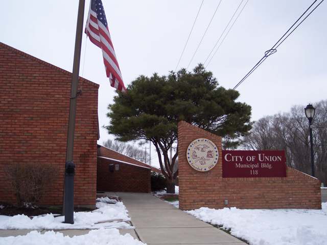
Photo: Joebengo, public domain · Wikimedia Commons
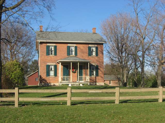
Photo: Nyttend, public domain · Wikimedia Commons
Local history sources: en.wikipedia.org · en.wikipedia.org · en.wikipedia.org · commons.wikimedia.org · commons.wikimedia.org · archive.org
Historic places
1 place in Union on the National Register of Historic Places. Press a pin or a name for its whole record.
-
Krug HouseBuilding · Union · listed 1992
- Address
- 3473 Sweet Potato Ridge Rd.
- Where
- Union, Montgomery County · ZIP 45322
- What it is
- Building
- Listed on the National Register
- 1992
- NRIS reference number
- 92000973
- Coordinates
- 39.89169, -84.31932
National Register file (NPS) ↗ Search Wikipedia ↗ Street map and directions ↗ On the Cracked Buckeye map
Source: National Park Service, National Register of Historic Places point file. The listing year is shown where NPS's certification date agrees with the listing's reference number. Listing recognizes significance; it does not restrict a private owner.
Water
Seven production wells spread across three well fields tapping the shallow (under 14 feet deep) Stillwater Buried Valley Aquifer beneath Englewood; well water is pumped to the city's Water Treatment Plant for iron/manganese filtration, fluoridation… The water here
- Englewood City41% of residentsStillwater Buried Valley Aquifer (wells)
- Union City38% of residentsGroundwater wells (4 wells)
- Montgomery County Water Services 220% of residentsGreat Miami Buried Valley Aquifer wells (recharged by Great Miami & Mad Rivers)
- Dayton Public Water System0% of residentsGreat Miami Buried Valley Aquifer wells (recharged by Great Miami & Mad Rivers)
Hospitals, fire stations and more
Inside Union's boundary: 1 fire or EMS station, 1 public school, 1 poor-rated bridge, 1 police station, 2 Superfund sites and 4 spill cases. Press a pin or a name for its whole record and its source.
Fire and EMS stations (1)
-
Union Fire Department - Station 81Union
- Address
- 109 West Martindale Road, Union, OH 45322
- Coordinates
- 39.89756, -84.30772
USGS National Map structures (source) ↗ Street map and directions ↗
Source: USGS National Map structures (most Ohio records last updated 2019 to 2022), checked against the Columbus and Cleveland station lists. The department that answers a call is set by jurisdiction and mutual aid, not by distance.
Public schools (1)
-
Union Elementary School3.5 of 5 stars · Union
- Address
- 418 W Martindale Rd, Union, OH 45322
- School district
- Northmont City School District
- Kind (NCES)
- Regular School
- Students, 2023-24
- 551
- Teachers (full-time equivalent)
- 27
- Report card, 2025-26
- 3.5 of 5 stars
- Performance index
- 76.8%
- Ohio building IRN
- 037754
- NCES school ID
- 390487203377
NCES school record ↗ Ohio School Report Card ↗ Street map and directions ↗
Source: NCES EDGE public school locations 2024-25 and Common Core of Data 2023-24 (type, students, teachers); Ohio School Report Cards 2025-26 (Department of Education and Workforce), matched by name within the district.
Bridges rated poor (1)
-
Kessler-Frederick over Stoner DitchPoor · built 1954
- Condition
- Poor: a deck, superstructure, substructure or culvert rated 4 or below on the 0 to 9 scale
- What it is
- Bridge
- Built
- 1954
- Length
- 7 ft
- Owner
- County
- Vehicles a day
- 3,227
- Coordinates
- 39.92333, -84.27500
National Bridge Inventory (source) ↗ Street map and directions ↗
Source: FHWA National Bridge Inventory 2025. "Poor" means one major part rated 4 or below on the 0 to 9 scale; it calls for repair, not closing, unless the state posts or closes the bridge.
Police stations (1)
-
Union Police DepartmentUnion
- Address
- 118 North Main Street, Union, OH 45322
- Coordinates
- 39.89955, -84.30641
USGS National Map structures (source) ↗ Street map and directions ↗
Source: USGS National Map structures, police stations, corrected and completed by hand (September 2026). The department that answers a call is set by jurisdiction, not by distance.
Superfund sites (2)
-
Garland Road LandfillSuperfund program · W Milton
- Address
- Garland Road Stillwater River, W Milton, OH 45383
- County
- Miami County
- Status
- Superfund program site, not on the National Priorities List
- EPA program ID
- OHD981960545
- EPA registry ID
- 110009304957
EPA facility record ↗ EPA Facility Registry Service (source) ↗ Street map and directions ↗
-
Old Springfield RoadSuperfund program · Union
- Address
- Old Springfield Road, Union, OH 45322
- County
- Montgomery County
- Status
- Superfund program site, not on the National Priorities List
- EPA program ID
- OH0001119064
- EPA registry ID
- 110009304109
EPA facility record ↗ EPA Facility Registry Service (source) ↗ Street map and directions ↗
Source: EPA Facility Registry Service, Superfund (SEMS) and National Priorities List sites. Many program sites were assessed and needed no cleanup.
Spills reported since 2021 (4)
-
Oil Cutting /Cutting Oil / Coolant / Lubricant2024-07-26 · Union
- Reported
- 2024-07-26
- What spilled
- Oil Cutting /Cutting Oil / Coolant / Lubricant
- Where
- Union, Montgomery County
- Ohio EPA district office
- SWDO
- Ohio EPA case number
- 2407EPA0001279
Ohio EPA spill reports (source) ↗ Street map and directions ↗
-
Fuel Diesel / Diesel Fuel (Vehicle On Or Off Road) Reached water2022-03-28 · Union
- Reported
- 2022-03-28
- What spilled
- Fuel Diesel / Diesel Fuel (Vehicle On Or Off Road)
- Largest amount reported
- 200 gallons
- Reached a waterway
- 99 - Unnamed
- Where
- Union, Montgomery County
- Ohio EPA district office
- SWDO
- Ohio EPA case number
- 2203EPA0000421
Ohio EPA spill reports (source) ↗ Street map and directions ↗
-
Antifreeze Vehicle Cooling2021-08-08 · Union
- Reported
- 2021-08-08
- What spilled
- Antifreeze Vehicle Cooling; Oil Motor / Lube Oil / Vehicle
- Largest amount reported
- 5 gallons
- Where
- Union, Montgomery County
- Ohio EPA district office
- SWDO
- Ohio EPA case number
- 2108EPA0001209
Ohio EPA spill reports (source) ↗ Street map and directions ↗
-
Mercury / Quicksilver (Hg)2026-01-22 · Union
- Reported
- 2026-01-22
- What spilled
- Mercury / Quicksilver (Hg)
- Where
- Union, Montgomery County
- Ohio EPA district office
- SWDO
- Ohio EPA case number
- 2601EPA0000084
Ohio EPA spill reports (source) ↗ Street map and directions ↗
Source: Ohio EPA emergency response spill reports, 2021 to September 2026, one point per case where Ohio EPA placed it. A report is what the caller or responder recorded; amounts are often blank or estimated.
Its ZIP codes
Each ZIP code that touches Union, with the share of its residents who live here and the same headline figures as the ZIP page.
Local government
Who holds office in Union, how its elections and ballot issues came out, and the state auditor's record.
Money issues on the ballot since 2025: 1 of 3 passed; of those asking for new or higher taxes, 0 of 2.
Ballot issues
| Date | Issue | For | Against | Result |
|---|---|---|---|---|
| 2026-05-05 | Issue: City of Union - Additional 1% Income tax for Police and Fire - Con't period of time | 499 | 709 | Failed (41.31% for) |
| 2026-05-05 | Issue: City of Union - Renewal - Road - 3 Mills - 5 yrs (3.0 mills, renewal) | 610 | 603 | Passed (50.29% for) |
| 2025-11-04 | Issue: City of Union - Additional 1% Income tax - Cont. Period of time | 443 | 935 | Failed (32.15% for), unofficial |
Elections for office
| Date | Office | Candidates and votes |
|---|---|---|
| 2025-11-04 | Council Member (this county's part) (unofficial count) | Linda Black 930, 33.2%; Stephen Brookover 482, 17.21%; Robert Jay Niemann 348, 12.42%; Helen Oberer 454, 16.21%; Josh Rarick 587, 20.96% |
Winners in bold. Results from the county board of elections' official canvass unless marked.
Auditor of State record
- No fiscal caution, watch or emergency on the Auditor of State's lists.
- Financial Health Indicators (the Auditor of State's 17 measures; critical / cautionary / positive): 2020 3 / 0 / 14; 2021 4 / 1 / 12; 2022 1 / 0 / 16; 2023 5 / 1 / 11; 2024 0 / 1 / 16; 2025 1 / 2 / 14.
- Financial Audit, 2025, released 2026-09-01
- Financial Audit, 2024, released 2026-02-03
- Financial Audit, 2023, released 2024-10-03
The county
Montgomery County: 33 ZIP codes, 27 cities, villages and townships, 531,614 people.
Nearby places
Rain and snow
How much has actually fallen on Union, day by day, from 1893 to now. Daily totals, not averages.
- rain, last 30 days
- 1.09 in
- 2026-09-30 to 2026-10-29
- rain so far in 2026
- 43.2 in
- 7.8 in above normal for the date
- snow so far in 2026
- 18.3 in
- a normal year brings 21.3 in
- a normal year
- 41.9 in
- average of 30 years, 1991-2020
| Month | Rain (in) | Snow (in) | Days counted |
|---|---|---|---|
| October 2026 | 1.09 | — | 29 |
| September 2026 | 3.52 | — | 30 |
| August 2026 | 9.72 | — | 31 |
| July 2026 | 4.26 | — | 31 |
| June 2026 | 2.69 | — | 30 |
| May 2026 | 9.13 | — | 31 |
| April 2026 | 3.66 | — | 30 |
| March 2026 | 5.96 | 1.7 | 31 |
| February 2026 | 1.31 | 2.5 | 28 |
| January 2026 | 1.90 | 14.1 | 31 |
| December 2025 | 1.76 | 7.8 | 31 |
| November 2025 | 1.95 | 5.0 | 30 |
| Wettest year | 2011 — 60.0 in |
|---|---|
| Driest year | 1987 — 25.3 in |
| Snowiest year | 1978 — 49.2 in |
| Wettest day on record | 6 November 2017 — 3.87 in |
| Heaviest snowfall in a day | 26 January 1978 — 10.83 in |
| Deepest snow on the ground | 21 January 1978 — 20.15 in |
Mostly estimated. Only 9% of these days come from a gauge standing inside Union - the rest are worked out from the nearest gauges around it, so read them as close estimates rather than readings.
48,225 days of records, 1893-06-02 to 2026-10-29. Source: NOAA NCEI GHCN-Daily, 3,240 gauges in and around Ohio. A day is "gauged" when a gauge standing inside the boundary reported it, and the value is the mean of those gauges. Otherwise it is interpolated by inverse distance from every gauge reporting within 50 miles. Nothing is carried forward, back-filled or smoothed. Against NOAA nClimDiv county monthly precipitation over 136,848 complete county-months (checked 2026-10-31): correlation 0.9515, median absolute difference 0.217 in a month. Built 2026-10-31 from the Cracked Buckeye precipitation archive. Snow is the softer number — snowfall is measured by hand with a ruler, no agency publishes a gridded county snowfall series, and blowing snow defeats every observer.
Environmental permits and filings
What Ohio EPA has on file for Union: permits, inspections, violations, cleanups and the state loans behind sewer and water work. Every line links to the agency's own document.
- facilities and sites on file
- 21
- those placed on the map inside Union
Data centers, power and big tech here. Ohio EPA files that name a data-center company, a power plant or substation, or a large technology firm:
- AMAZON.COM SERVICES LLC - LUK2 (hazardous waste, latest Sep 10, 2024)
| Program | Facilities and sites |
|---|---|
| Hazardous waste | 7 |
| Site assessment | 4 |
| Wastewater and stormwater discharge | 4 |
| Air pollution | 2 |
| Contaminated-site cleanup | 2 |
| Public drinking water | 1 |
| State water loans | 1 |
| Date | Facility or site | What |
|---|---|---|
| UNION CITY PWS | Public drinking water compliance letter | |
| SRM CONCRETE PLANT 228 B | Air pollution permit | |
| SRM CONCRETE PLANT 228 B | Air pollution report | |
| UNION CITY PWS | Public drinking water notice of violation | |
| UNION CITY PWS | Public drinking water report | |
| UNION CITY PWS | Public drinking water plan | |
| UNION CITY PWS | Public drinking water plan | |
| UNION CITY PWS | Public drinking water inspection | |
| UNION CITY PWS | Public drinking water plan | |
| UNION CITY PWS | Public drinking water plan | |
| UNION CITY PWS | Public drinking water inspection | |
| PARLIAMENT PLACE | Wastewater and stormwater discharge permit | |
| UNION CITY PWS | Public drinking water plan | |
| PARLIAMENT PLACE | Wastewater and stormwater discharge permit | |
| UNION WWTP | Wastewater and stormwater discharge permit | |
| UNION CITY PWS | Public drinking water withdrawn | |
| UNION CITY PWS | Public drinking water notice of violation | |
| UNION CITY PWS | Public drinking water inspection | |
| UNION DAYTON BUILDING 2 | Wastewater and stormwater discharge permit | |
| UNION CITY PWS | Public drinking water compliance letter | |
| UNION CITY PWS | Public drinking water report | |
| WINSUPPLY | Wastewater and stormwater discharge permit | |
| UNION CITY PWS | Public drinking water compliance letter | |
| UNION CITY PWS | Public drinking water inspection | |
| TE-CO MFG LLC | Hazardous waste notice of violation |
Source: Ohio EPA eDocument portal (edocpub.epa.ohio.gov), indexed 2026-10-14. Facilities are placed on the map from Ohio EPA's own map layers, EPA's Facility Registry, coordinates written in the filings, or a geocoded street address. A permit filed under a private person's name (most are household septic systems) is counted but never named, placed or linked; licenses for individual workers and open-burning notices are left out entirely.
Quick answers
What county is Union, Ohio in?
Union is a city in Montgomery County, Ohio, with 6,888 residents.
When was Union, Ohio founded?
Union was settled 1802 (settlers led by Mast and Hoover from North Carolina came to Randolph and Butler townships); 1806 per Wikipedia; laid out 1816; incorporated 1982. Founders on record: Platted by Daniel Rasor and David Hoover. Source
How did Union, Ohio get its name?
The settlement was named Union in 1816. Source
What ZIP code is Union, Ohio?
Union is served by ZIP codes 45322 and 45377; 45322 holds the largest share of its residents.
Where does Union, Ohio get its water?
The main water source for Union (Englewood City): Seven production wells spread across three well fields tapping the shallow (under 14 feet deep) Stillwater Buried Valley Aquifer beneath Englewood; well water is pumped to the city's Water Treatment Plant for iron/manganese filtration, fluoridation….
Cite this page
Cite this page as:
Cracked Buckeye, "Union, Montgomery County", https://crackedbuckeye.com/place/union/, built 2026-10-31, accessed [date].
How to cite · Report a correction · Built 2026-10-31
