Local events in Vandalia
55 events in the next 90 days from 4 public calendars. All local events in Vandalia
Checked October 20; the events page is refreshed daily.
History from Vandalia
People and inventions tied to this place, each with its sources. All people · All inventions
How Vandalia began
Vandalia grew from a single stop for travelers on the National Road: on August 17, 1838, Pennsylvania-born settler Benjamin Wilhelm built a home and general store near the intersection of what became U.S. 40 and U.S. 25A and laid out a 38-lot village around it. Incorporated as "The Village of Vandalia" on February 7, 1848 with Wilhelm as its first mayor, the town grew slowly as a crossroads community until the Dixie Highway (routed from 1915) and, later, a group of Dayton industrialists' 1928 airfield purchase turned it into a transportation hub. Vandalia became a charter city on January 2, 1960 after voters adopted a council-manager government, and it is now best known as the home of Dayton International Airport.
Settled 1838, platted 1838, incorporated 1848, by Benjamin Wilhelm.
Where the name comes from
Two accounts are given in the historical record and neither is confirmed as definitive. One holds that Benjamin Wilhelm, en route west, had intended to settle in Vandalia, Illinois and named his Ohio stop after that destination. The other holds that early travelers were unsure whether the National Road was meant to extend all the way to Vandalia, Illinois, and the name was applied locally out of that uncertainty.
Before the town
No Native American village, trail, mound, or treaty-signing event specific to the present site of Vandalia or Butler Township is turned up in the sources checked (Vandalia's Wikipedia article and its references, and Ohio History Central). The Hopewell-era earthworks and mounds often associated with the name "Butler" in this part of Ohio — Fortified Hill and the Great Mound at Middletown — belong to Butler County, a different county roughly 30 miles south, not to Butler Township in Montgomery County, and are not part of Vandalia's history. At the broader level: Montgomery County lies within the land the Wyandot, Shawnee, Lenape (Delaware), Miami (Myaamia), and other nations of the Northwest Indian Confederacy ceded to the United States under the Treaty of Greenville, signed August 3, 1795 at Fort Greenville (modern Greenville, Ohio, in neighboring Darke County) following the Battle of Fallen Timbers. Dayton, the county seat a few miles south of Vandalia, was founded the following year, 1796, once that cession opened the area to American settlement.
Nations recorded here: Shawnee, Wyandot, Lenape (Delaware), Miami.
Timeline
- — Benjamin Wilhelm settles near the intersection of the future U.S. 40 and U.S. 25A and builds a home and general store as a stop for travelers heading west, founding what becomes Vandalia.
- — The town is incorporated as "The Village of Vandalia" on February 7, with Benjamin Wilhelm serving as its first mayor.
- — The Dixie Highway, organized in December 1914, has its route set in 1915; it runs through Vandalia, connecting northern and southern states and putting the village at what boosters called the "Crossroads of America."
- — A group of Dayton industrialists, including Charles Kettering of General Motors and the presidents of Frigidaire and National Cash Register, buy about 311 acres near Vandalia and build a private airfield with two hangars and three short macadam runways, then called the "Dayton Airport."
- — A two-day dedication, July 31-August 1, opens the new Vandalia airfield, by then built out to two 80-by-120-foot hangars, a brick office and machine-shop building, a water tower, and a gas station topped by a yellow Ivan Driggs monoplane called "The Bumble Bee."
- — The field reopens as the "Dayton Municipal Airport" on December 17 with three 3,600-foot concrete runways, the start of its growth into today's Dayton International Airport, still sited in Vandalia.
- — Vandalia becomes a Charter City of the State of Ohio on January 2, after residents vote in 1959 to adopt a council-manager form of government.
- — The John Beard Farm, south of Vandalia on Mulberry Lane, is listed on the National Register of Historic Places on May 5.
- — The John Beard Farm listing is removed from the National Register on February 2; the property was in the process of being demolished when it had been listed.
- — The Amateur Trapshooting Association of America, long headquartered on U.S. 40 in Vandalia, relocates its national shoot to Sparta, Illinois as the adjacent Dayton airport expands.
Stories
A store on the National Road becomes an airfield's neighbor
Vandalia began as nothing more than Benjamin Wilhelm's home and store, set down in 1838 where the National Road crossed the north-south route that would later become U.S. 25A. For most of the nineteenth century it stayed a small crossroads village of 38 platted lots, its business built around travelers, farmers, and the trades a rural county seat's satellite town needed: a sawmill, a carriage shop, blacksmiths, meat markets, and churches. Its fortunes changed twice in the twentieth century, first when the Dixie Highway, laid out from 1915, routed long-distance auto traffic through town, and then far more dramatically in 1928, when a syndicate of Dayton manufacturing executives quietly bought roughly 311 acres just outside the village to build a private airfield. Within a decade that field, dedicated in 1929 and reopened as Dayton Municipal Airport in 1936, had eclipsed the town that gave it its original name, and Vandalia grew up around an airport rather than the other way around. Today the field is Dayton International Airport, still physically sited within Vandalia's limits even though it long ago outgrew the town's own population.
The trapshooters leave for the airport's sake
For decades the Amateur Trapshooting Association of America's Grand American World Trapshooting Championships were a fixture on U.S. 40 in Vandalia, drawing competitive shooters from across the country to the association's national headquarters and grounds beside the growing airport. As Dayton International Airport expanded its runways and safety buffers in the early 2000s, the shotgun ranges next door became incompatible neighbors, and in 2005 the association moved to Sparta, Illinois, ending the sport's long association with the town. A 1930s-to-1940s postcard of the association's Vandalia grounds, published by a Springfield, Ohio company and now held in the Boston Public Library's Tichnor Brothers collection, is one of the few surviving period images of that chapter of the town's history.
Photographs
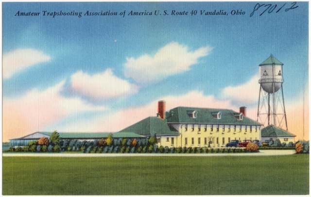
Photo: Published by H. V. Mc Kee, Springfield, Ohio; Tichnor Bros., Inc., Boston (Boston Public Library, Tichnor Brothers collection), Public domain · Wikimedia Commons
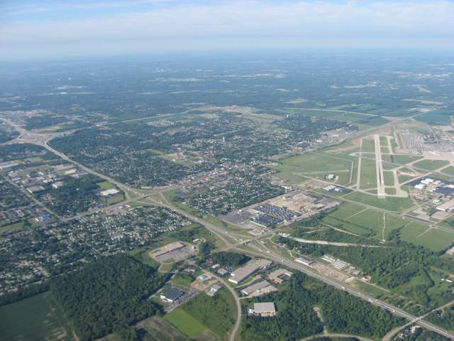
Photo: Nyttend, Public domain · Wikimedia Commons
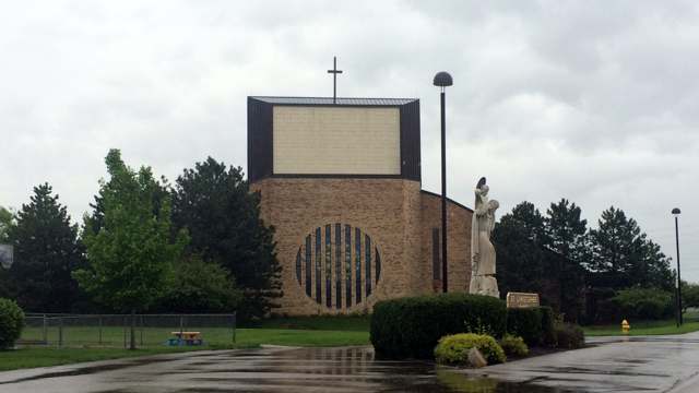
Photo: Nheyob, CC BY-SA 4.0 · Wikimedia Commons
Local history sources: en.wikipedia.org · en.wikipedia.org · en.wikipedia.org · en.wikipedia.org · en.wikipedia.org · commons.wikimedia.org · commons.wikimedia.org · commons.wikimedia.org
Water
Mostly private wells The water here
- Montgomery County Water Services 260% of residentsGreat Miami Buried Valley Aquifer wells (recharged by Great Miami & Mad Rivers)
- Union City29% of residentsGroundwater wells (4 wells)
- Dayton Public Water System8% of residentsGreat Miami Buried Valley Aquifer wells (recharged by Great Miami & Mad Rivers)
- Montgomery County Water Services 13% of residentsGreat Miami Buried Valley Aquifer wells (recharged by Great Miami & Mad Rivers)
Hospitals, fire stations and more
Inside Vandalia's boundary: 1 nursing home, 3 fire and EMS stations, 1 college, 1 high-hazard dam, 5 public schools, 1 private school, 2 poor-rated bridges, 1 library, 2 museums, 1 police station, 11 public charging sites, 1 Superfund site, 15 Toxics Release Inventory facilities, 2 stations and terminals and 21 spill cases. Press a pin or a name for its whole record and its source.
Nursing homes (1)
-
Momentous Health at Vandalia2 of 5 stars · Vandalia
- Address
- 208 North Cassel Road, Vandalia, OH 45377
- Certified beds
- 118
- Residents on an average day
- 110
- Medicare overall rating
- 2 of 5 stars
- Health inspections
- 2 of 5 stars
- Staffing
- 1 of 5 stars
- Quality measures
- 5 of 5 stars
- Penalties since 2023
- none
- Ownership
- For profit - Limited Liability company
- Takes
- Medicare and Medicaid
- Phone
- (937) 898-4202
- Medicare ID
- 366035
Medicare Care Compare ↗ CMS nursing home data (source) ↗ Street map and directions ↗
Source: CMS Care Compare nursing home provider and penalties files; Medicare star ratings run 1 to 5.
Fire and EMS stations (3)
-
Vandalia Division of Fire Station 1Vandalia
- Address
- 8705 Peters Pike, Vandalia, OH 45377
- Coordinates
- 39.87424, -84.22780
USGS National Map structures (source) ↗ Street map and directions ↗
-
Vandalia Division of Fire Station 2Vandalia
- Address
- 725 South Brown School Road, Vandalia, OH 45377
- Coordinates
- 39.88243, -84.18064
USGS National Map structures (source) ↗ Street map and directions ↗
-
Vandalia Division of Fire Station 3Vandalia
- Address
- 257 North Dixie Drive, Vandalia, OH 45377
- Coordinates
- 39.89553, -84.19895
USGS National Map structures (source) ↗ Street map and directions ↗
Source: USGS National Map structures (most Ohio records last updated 2019 to 2022), checked against the Columbus and Cleveland station lists. The department that answers a call is set by jurisdiction and mutual aid, not by distance.
Colleges (1)
-
Creative Images Institute of Cosmetology-North DaytonFor-profit two-year college · Dayton
- What it is
- For-profit two-year college
- City
- Dayton
- Students, 2023-24 (12-month count)
- 350
- Graduation rate
- 66% within three years (a class of 105)
- IPEDS unit ID
- 434830
College Navigator (NCES) ↗ IPEDS data (source) ↗ Street map and directions ↗
Source: NCES IPEDS 2024 directory, 2023-24 enrollment and tuition, graduation rates for the 2017 (four-year) and 2020 (two-year) entering classes.
High-hazard dams (1)
-
Taylorsville DamGreat Miami River · condition: fair
- Hazard class
- High: a failure would probably cost a life
- Condition
- Fair (assessed 09/25/2019)
- River or stream
- Great Miami River
- Purpose
- Flood Risk Reduction
- Type
- Earth
- Height
- 78 ft
- Storage
- 386,000 acre-feet
- Completed
- 1922
- Owner type
- Local Government
- County
- Montgomery County
- Nearest town (NID)
- Taylorsville
- Last inspection
- 10/23/2024
- Emergency action plan
- Yes
- NID ID
- OH00427
National Inventory of Dams record ↗ National Inventory of Dams (source) ↗ Street map and directions ↗
Source: U.S. Army Corps of Engineers National Inventory of Dams, August 2026. "High hazard" rates what a failure would cost downstream, not how likely one is; the condition is the state's assessment.
Public schools (5)
-
Butler High School4.5 of 5 stars · Vandalia
- Address
- 600 S Dixie Dr, Vandalia, OH 45377
- School district
- Vandalia-Butler City School District
- Kind (NCES)
- Regular School
- Students, 2023-24
- 903
- Teachers (full-time equivalent)
- 48
- Report card, 2025-26
- 4.5 of 5 stars
- Performance index
- 82.5%
- Four-year graduation rate
- 97.7%
- Ohio building IRN
- 004416
- NCES school ID
- 390449501875
NCES school record ↗ Ohio School Report Card ↗ Street map and directions ↗
-
Demmitt Elementary School3.5 of 5 stars · Vandalia
- Address
- 1010 E National Rd, Vandalia, OH 45377
- School district
- Vandalia-Butler City School District
- Kind (NCES)
- Regular School
- Students, 2023-24
- 357
- Teachers (full-time equivalent)
- 21
- Report card, 2025-26
- 3.5 of 5 stars
- Ohio building IRN
- 008375
- NCES school ID
- 390449501876
NCES school record ↗ Ohio School Report Card ↗ Street map and directions ↗
-
Helke Early Learning Center4 of 5 stars · Vandalia
- Address
- 611 Randler Ave, Vandalia, OH 45377
- School district
- Vandalia-Butler City School District
- Kind (NCES)
- Regular School
- Students, 2023-24
- 431
- Teachers (full-time equivalent)
- 21
- Report card, 2025-26
- 4 of 5 stars
- Ohio building IRN
- 061382
- NCES school ID
- 390449501877
NCES school record ↗ Ohio School Report Card ↗ Street map and directions ↗
-
Morton Middle School3 of 5 stars · Vandalia
- Address
- 8555 Peters Pike, Vandalia, OH 45377
- School district
- Vandalia-Butler City School District
- Kind (NCES)
- Regular School
- Students, 2023-24
- 670
- Teachers (full-time equivalent)
- 41
- Report card, 2025-26
- 3 of 5 stars
- Performance index
- 72.6%
- Ohio building IRN
- 025619
- NCES school ID
- 390449501879
NCES school record ↗ Ohio School Report Card ↗ Street map and directions ↗
-
Vandalia-Butler PreschoolVandalia
- Address
- 140 Elva Ct, Vandalia, OH 45377
- Kind (NCES)
- Regular School
- Students, 2023-24
- 138
- Teachers (full-time equivalent)
- 5
- NCES school ID
- 390449506013
Source: NCES EDGE public school locations 2024-25 and Common Core of Data 2023-24 (type, students, teachers); Ohio School Report Cards 2025-26 (Department of Education and Workforce), matched by name within the district.
Private schools (1)
-
St ChristopherPrivate, Catholic · Vandalia
- Address
- 405 E National Rd, Vandalia, OH 45377
- Kind
- Catholic
- Students, 2023-24
- 295
- Teachers (full-time equivalent)
- 27.5
- Students per teacher
- 10.7273
- Phone
- (937) 898-5104
- NCES private school ID
- 01056427
Source: NCES Private School Survey 2023-24.
Bridges rated poor (2)
-
S Cassel Road over Poplar CreekPoor · built 1915
- Condition
- Poor: a deck, superstructure, substructure or culvert rated 4 or below on the 0 to 9 scale
- What it is
- Bridge
- Built
- 1915
- Length
- 14 ft
- Owner
- City
- Vehicles a day
- 452
- Coordinates
- 39.86450, -84.17117
National Bridge Inventory (source) ↗ Street map and directions ↗
-
Stop Eight Rd-T108 over I75 Poe AvenuePoor · built 1971
- Condition
- Poor: a deck, superstructure, substructure or culvert rated 4 or below on the 0 to 9 scale
- What it is
- Bridge
- Built
- 1971
- Length
- 76 ft
- Owner
- State
- Vehicles a day
- 2,438
- Coordinates
- 39.83458, -84.18986
National Bridge Inventory (source) ↗ Street map and directions ↗
Source: FHWA National Bridge Inventory 2025. "Poor" means one major part rated 4 or below on the 0 to 9 scale; it calls for repair, not closing, unless the state posts or closes the bridge.
Public libraries (1)
-
Vandalia Branch LibraryBranch · Vandalia
- Address
- 330 S. Dixie Dr., Vandalia, OH 45377
- What it is
- Branch
- Library system
- Dayton Metro Library
- Open
- 3,042 hours a year, 52 weeks
- Building
- 19,465 sq ft
- System's visits, FY2024
- 1,987,700
- System's loans, FY2024
- 4,831,439
- People the system serves
- 452,238
- Phone
- (937) 463-2665
IMLS Public Libraries Survey (source) ↗ Street map and directions ↗
Source: IMLS Public Libraries Survey FY2024 (outlets and their systems). Any Ohio resident can get a free card at any Ohio public library.
Museums, historical societies, gardens and zoos (2)
-
Historical Society Of Vandalia ButlerHistorical society · Vandalia
- What it is
- Historical society
- City
- Vandalia
- Coordinates
- 39.88295, -84.19387
Search Wikipedia ↗ IMLS Museum Data Files (source) ↗ Street map and directions ↗
The museum list is IMLS's 2018 file; a museum may have closed or moved since.
-
Trapshooting Hall Of FameMuseum · Vandalia
- What it is
- Museum
- City
- Vandalia
- Coordinates
- 39.89011, -84.20848
Search Wikipedia ↗ IMLS Museum Data Files (source) ↗ Street map and directions ↗
The museum list is IMLS's 2018 file; a museum may have closed or moved since.
Source: IMLS Museum Data Files, 2018.
Police stations (1)
-
Vandalia Police DepartmentVandalia
- Address
- 245 James Bohanan Memorial Drive, Vandalia, OH 45377
- Coordinates
- 39.89307, -84.19505
USGS National Map structures (source) ↗ Street map and directions ↗
Source: USGS National Map structures, police stations, corrected and completed by hand (September 2026). The department that answers a call is set by jurisdiction, not by distance.
Public EV charging (11)
-
Beau Townsend S7 DC fast4 DC fast · 12 Level 2 · Vandalia
- Address
- 1020 West National Road, Vandalia, OH 45377
- Ports
- 4 DC fast · 12 Level 2
- Plugs
- CCS, J1772
- Network
- Blink Network
- Hours
- 24 hours daily
- Phone
- 888-998-2546
Station Locator (NREL) ↗ Alternative Fuels Data Center (source) ↗ Street map and directions ↗
-
DOAE JATC DAYTON JATC2 Level 2 · Dayton
- Address
- 6550 Poe Ave, Dayton, OH 45414
- Ports
- 2 Level 2
- Plugs
- J1772
- Network
- ChargePoint Network
- Hours
- 24 hours daily
- Phone
- 888-758-4389
Station Locator (NREL) ↗ Alternative Fuels Data Center (source) ↗ Street map and directions ↗
-
Golf Course Parking lot4 Level 2 · Vandalia
- Address
- 200 Clubhouse Way, Vandalia, OH 45377
- Ports
- 4 Level 2
- Plugs
- J1772
- Network
- Blink Network
- Hours
- Mon: 7:00am-10:00pm; Tue: 7:00am-10:00pm; Wed: 7:00am-10:00pm; Thu: 7:00am-10:00pm; Fri: 7:00am-10:00pm; Sat: 7:00am-10:00pm; Sun: 7:00am-10:00pm
- Phone
- 888-998-2546
Station Locator (NREL) ↗ Alternative Fuels Data Center (source) ↗ Street map and directions ↗
-
Justice Center Parking Lot4 Level 2 · Vandalia
- Address
- 210 James Bohanan Drive, Vandalia, OH 45377
- Ports
- 4 Level 2
- Plugs
- J1772
- Network
- Blink Network
- Hours
- Mon: 7:00am-11:00pm; Tue: 7:00am-11:00pm; Wed: 7:00am-11:00pm; Thu: 7:00am-11:00pm; Fri: 7:00am-11:00pm; Sat: 7:00am-11:00pm; Sun: 7:00am-11:00pm
- Phone
- 888-998-2546
Station Locator (NREL) ↗ Alternative Fuels Data Center (source) ↗ Street map and directions ↗
-
Kendall 769 Center Dr2 Level 2 · Vandalia
- Address
- 769 Center Dr, Vandalia, OH 45377
- Ports
- 2 Level 2
- Plugs
- J1772
- Network
- LOOP
- Hours
- 24 hours daily
- Price
- $1 activation fee
- Phone
- 888-385-6671
Station Locator (NREL) ↗ Alternative Fuels Data Center (source) ↗ Street map and directions ↗
-
Legrand2 Level 2 · Dayton
- Address
- 6500 Poe Ave, Dayton, OH 45414
- Ports
- 2 Level 2
- Plugs
- J1772
- Network
- Non-Networked
- Hours
- 24 hours daily
- Phone
- 937-276-3356
Station Locator (NREL) ↗ Alternative Fuels Data Center (source) ↗ Street map and directions ↗
-
Municipal Bldg6 Level 2 · Vandalia
- Address
- 341 James Bohanan Drive, Vandalia, OH 45377
- Ports
- 6 Level 2
- Plugs
- J1772
- Network
- Blink Network
- Hours
- Mon: 7:00am-11:00pm; Tue: 7:00am-11:00pm; Wed: 7:00am-11:00pm; Thu: 7:00am-11:00pm; Fri: 7:00am-11:00pm; Sat: 7:00am-11:00pm; Sun: 7:00am-11:00pm
- Phone
- 888-998-2546
Station Locator (NREL) ↗ Alternative Fuels Data Center (source) ↗ Street map and directions ↗
-
MVRPC(EV#17)2 Level 2 · Vandalia
- Address
- 330 South Dixie Drive, Vandalia, OH 45377
- Ports
- 2 Level 2
- Plugs
- J1772
- Network
- Blink Network
- Hours
- 24 hours daily
- Phone
- 888-998-2546
Station Locator (NREL) ↗ Alternative Fuels Data Center (source) ↗ Street map and directions ↗
-
Rec Center6 Level 2 · Dayton
- Address
- 1111 Stonequarry Road, Dayton, OH 45414
- Ports
- 6 Level 2
- Plugs
- J1772
- Network
- Blink Network
- Hours
- Mon: 7:00am-11:00pm; Tue: 7:00am-11:00pm; Wed: 7:00am-11:00pm; Thu: 7:00am-11:00pm; Fri: 7:00am-11:00pm; Sat: 7:00am-11:00pm; Sun: 7:00am-11:00pm
- Phone
- 888-998-2546
Station Locator (NREL) ↗ Alternative Fuels Data Center (source) ↗ Street map and directions ↗
-
Rec Center Soccer Fields4 Level 2 · Vandalia
- Address
- 1151 Stonequarry Road, Vandalia, OH 45377
- Ports
- 4 Level 2
- Plugs
- J1772
- Network
- Blink Network
- Hours
- Mon: 7:00am-10:00pm; Tue: 7:00am-10:00pm; Wed: 7:00am-10:00pm; Thu: 7:00am-10:00pm; Fri: 7:00am-10:00pm; Sat: 7:00am-10:00pm; Sun: 7:00am-10:00pm
- Phone
- 888-998-2546
Station Locator (NREL) ↗ Alternative Fuels Data Center (source) ↗ Street map and directions ↗
-
Warehouse 4 Coffee2 Level 2 · Vandalia
- Address
- 335 South Dixie Drive, Vandalia, OH 45377
- Ports
- 2 Level 2
- Plugs
- J1772
- Network
- Blink Network
- Hours
- 24 hours daily
- Phone
- 888-998-2546
Station Locator (NREL) ↗ Alternative Fuels Data Center (source) ↗ Street map and directions ↗
Source: NREL Alternative Fuels Data Center station list (May 2026), public and open stations, the posts at one address counted as one site.
Superfund sites (1)
-
Kenbrook Medical Center Mercury SpillSuperfund program · Vandalia
- Address
- 107 Kenbrook Drive, Vandalia, OH 45377
- County
- Montgomery County
- Status
- Superfund program site, not on the National Priorities List
- EPA program ID
- OHN000508310
- EPA registry ID
- 110013799210
EPA facility record ↗ EPA Facility Registry Service (source) ↗ Street map and directions ↗
Source: EPA Facility Registry Service, Superfund (SEMS) and National Priorities List sites. Many program sites were assessed and needed no cleanup.
Facilities reporting toxic releases (15)
-
Adare Pharmaceuticals, Inc. (0857171794)Toxics Release Inventory · Vandalia
- Address
- 845 Center Dr., Vandalia, OH 45377
- County
- Montgomery County
- Status
- Reports to the Toxics Release Inventory (active)
- EPA program ID
- 45377RNDMR845CE
- EPA registry ID
- 110000394485
EPA facility record ↗ EPA Facility Registry Service (source) ↗ Street map and directions ↗
-
Certa Vandalia, Llc. (0857170126)Toxics Release Inventory · Vandalia
- Address
- 250 Northwoods Blvd., Vandalia, OH 45377
- County
- Montgomery County
- Status
- Reports to the Toxics Release Inventory (active)
- EPA program ID
- 45377NLNDF250NO
- EPA registry ID
- 110000394476
EPA facility record ↗ EPA Facility Registry Service (source) ↗ Street map and directions ↗
-
Delphi Energy & Chassis Systems - Vandalia (0857170125)Toxics Release Inventory · Vandalia
- Address
- 480 N. Dixie Dr., Vandalia, OH 45377
- County
- Montgomery County
- Status
- Reports to the Toxics Release Inventory (active)
- EPA program ID
- 45377NLNDD480ND
- EPA registry ID
- 110000394467
EPA facility record ↗ EPA Facility Registry Service (source) ↗ Street map and directions ↗
-
Dss, Inc.Toxics Release Inventory · Dayton
- Address
- 7476 Webster St., Dayton, OH 45414
- County
- Montgomery County
- Status
- Reports to the Toxics Release Inventory (active)
- EPA program ID
- 45414DSSNC7476W
- EPA registry ID
- 110000394724
EPA facility record ↗ EPA Facility Registry Service (source) ↗ Street map and directions ↗
-
Eftec North America LlcToxics Release Inventory · Dayton
- Address
- 3345 Stop Eight Road, Dayton, OH 45414
- County
- Montgomery County
- Status
- Reports to the Toxics Release Inventory (closed)
- EPA program ID
- 45414PRTCT3345S
- EPA registry ID
- 110007157753
EPA facility record ↗ EPA Facility Registry Service (source) ↗ Street map and directions ↗
-
Ge Aviation Systems LlcToxics Release Inventory · Vandalia
- Address
- 740 E National Rd, Vandalia, OH 45377
- County
- Montgomery County
- Status
- Reports to the Toxics Release Inventory (active)
- EPA program ID
- 45377LLNDL740EN
- EPA registry ID
- 110002113695
EPA facility record ↗ EPA Facility Registry Service (source) ↗ Street map and directions ↗
-
Heraeus Epurio LlcToxics Release Inventory · Vandalia
- Address
- 970 Industrial Park Dr, Vandalia, OH 45377
- County
- Montgomery County
- Status
- Reports to the Toxics Release Inventory (***unchanged***)
- EPA program ID
- 4537WHRSPR97IND
- EPA registry ID
- 110004656961
EPA facility record ↗ EPA Facility Registry Service (source) ↗ Street map and directions ↗
-
Independent Can CompanyToxics Release Inventory · Vandalia
- Address
- 1650 Capstone Way, Vandalia, OH 45377
- County
- Montgomery County
- Status
- Reports to the Toxics Release Inventory
- EPA program ID
- 4537WNDPND165CA
- EPA registry ID
- 110061054139
EPA facility record ↗ EPA Facility Registry Service (source) ↗ Street map and directions ↗
-
Metokote Corporation Plant 6Toxics Release Inventory · Dayton
- Address
- 3435 Stop Eight Road, Dayton, OH 45414
- County
- Montgomery County
- Status
- Reports to the Toxics Release Inventory (active)
- EPA program ID
- 45414MTKTC3435S
- EPA registry ID
- 110000394751
EPA facility record ↗ EPA Facility Registry Service (source) ↗ Street map and directions ↗
-
Ochs Industries IncToxics Release Inventory · Vandalia
- Address
- 849 Scholz Dr., Vandalia, OH 45377
- County
- Montgomery County
- Status
- Reports to the Toxics Release Inventory (active)
- EPA program ID
- 45377CHSND849SC
- EPA registry ID
- 110002113677
EPA facility record ↗ EPA Facility Registry Service (source) ↗ Street map and directions ↗
-
Projects Unlimited IncToxics Release Inventory · Dayton
- Address
- 3680 Wyse Road, Dayton, OH 45414
- County
- Montgomery County
- Status
- Reports to the Toxics Release Inventory (active)
- EPA program ID
- 45414PRJCT3680W
- EPA registry ID
- 110004594804
EPA facility record ↗ EPA Facility Registry Service (source) ↗ Street map and directions ↗
-
Projects Unlimited Inc.Toxics Release Inventory · Dayton
- Address
- 6300 Sand Lake Rd, Dayton, OH 45414
- County
- Montgomery County County
- Status
- Reports to the Toxics Release Inventory
- EPA program ID
- 4541WPRJCT63SAN
- EPA registry ID
- 110070550766
EPA facility record ↗ EPA Facility Registry Service (source) ↗ Street map and directions ↗
-
Saia-Burgess Inc *Toxics Release Inventory · Vandalia
- Address
- 801 Scholz Drive, Vandalia, OH 45377
- County
- Montgomery County
- Status
- Reports to the Toxics Release Inventory (open)
- EPA program ID
- 45377LCSLD801SC
- EPA registry ID
- 110002113686
EPA facility record ↗ EPA Facility Registry Service (source) ↗ Street map and directions ↗
-
Tech Development IncToxics Release Inventory · Dayton
- Address
- 6800 Poe Avenue, Dayton, OH 45414
- County
- Montgomery County
- Status
- Reports to the Toxics Release Inventory (active)
- EPA program ID
- 45414TCHDV6800P
- EPA registry ID
- 110004593814
EPA facility record ↗ EPA Facility Registry Service (source) ↗ Street map and directions ↗
-
Unibilt Industries, Inc.Toxics Release Inventory · Vandalia
- Address
- 4671 Poplar Creek Rd, Vandalia, OH 45377
- County
- Montgomery County
- Status
- Reports to the Toxics Release Inventory (active)
- EPA program ID
- 45377NBLTN4671P
- EPA registry ID
- 110006287703
EPA facility record ↗ EPA Facility Registry Service (source) ↗ Street map and directions ↗
Source: EPA Facility Registry Service, Toxics Release Inventory reporters. Reporting a release is required of large users of listed chemicals; it is not by itself a violation.
Stations and terminals (2)
-
curbside bus stopIntercity bus stop · Vandalia
- What it is
- Intercity bus stop
- City
- Vandalia
- Coordinates
- 39.89032, -84.20476
BTS Intermodal Passenger Connectivity Database (source) ↗ Street map and directions ↗
-
curbside bus stopIntercity bus stop · Vandalia
- What it is
- Intercity bus stop
- City
- Vandalia
- Coordinates
- 39.89094, -84.19138
BTS Intermodal Passenger Connectivity Database (source) ↗ Street map and directions ↗
Source: BTS Intermodal Passenger Connectivity Database and National Transit Map (2025). Bus stops are counted on the card and drawn on the full map.
Spills reported since 2021 (21)
-
Fuel Diesel / Diesel Fuel (Vehicle On Or Off Road)2025-11-12 · Vandalia
- Reported
- 2025-11-12
- What spilled
- Fuel Diesel / Diesel Fuel (Vehicle On Or Off Road)
- Where
- Vandalia, Montgomery County
- Ohio EPA district office
- SWDO
- Ohio EPA case number
- 2511EPA0001843
Ohio EPA spill reports (source) ↗ Street map and directions ↗
-
Other / All Other / Trade Name / Mixture / Solution Etc2025-10-03 · Vandalia
- Reported
- 2025-10-03
- What spilled
- Other / All Other / Trade Name / Mixture / Solution Etc
- Largest amount reported
- 165 gallons
- Where
- Vandalia, Montgomery County
- Ohio EPA district office
- SWDO
- Ohio EPA case number
- 2510EPA0001635
Ohio EPA spill reports (source) ↗ Street map and directions ↗
-
Fuel Diesel / Diesel Fuel (Vehicle On Or Off Road)2025-08-19 · Vandalia
- Reported
- 2025-08-19
- What spilled
- Fuel Diesel / Diesel Fuel (Vehicle On Or Off Road)
- Largest amount reported
- 50 gallons
- Where
- Vandalia, Montgomery County
- Ohio EPA district office
- SWDO
- Ohio EPA case number
- 2508EPA0001406
Ohio EPA spill reports (source) ↗ Street map and directions ↗
-
Hydrochloric Acid / Muriatic Acid (Hcl)2025-07-08 · Vandalia
- Reported
- 2025-07-08
- What spilled
- Hydrochloric Acid / Muriatic Acid (Hcl)
- Where
- Vandalia, Montgomery County
- Ohio EPA district office
- SWDO
- Ohio EPA case number
- 2507EPA0001125
Ohio EPA spill reports (source) ↗ Street map and directions ↗
-
Sewage Human2025-02-16 · Vandalia
- Reported
- 2025-02-16
- What spilled
- Sewage Human
- Where
- Vandalia, Montgomery County
- Ohio EPA district office
- SWDO
- Ohio EPA case number
- 2502EPA0000212
Ohio EPA spill reports (source) ↗ Street map and directions ↗
-
Sewage Human Reached water2024-12-29 · Vandalia
- Reported
- 2024-12-29
- What spilled
- Sewage Human
- Reached a waterway
- 57 - Great Miami River
- Where
- Vandalia, Montgomery County
- Ohio EPA district office
- SWDO
- Ohio EPA case number
- 2412EPA0002088
Ohio EPA spill reports (source) ↗ Street map and directions ↗
-
Fuel Diesel / Diesel Fuel (Vehicle On Or Off Road)2024-12-27 · Vandalia
- Reported
- 2024-12-27
- What spilled
- Fuel Diesel / Diesel Fuel (Vehicle On Or Off Road)
- Where
- Vandalia, Montgomery County
- Ohio EPA district office
- SWDO
- Ohio EPA case number
- 2412EPA0002072
Ohio EPA spill reports (source) ↗ Street map and directions ↗
-
Oil Transformer Non Pcb2024-09-28 · Vandalia
- Reported
- 2024-09-28
- What spilled
- Oil Transformer Non Pcb
- Largest amount reported
- 15 gallons
- Where
- Vandalia, Montgomery County
- Ohio EPA district office
- SWDO
- Ohio EPA case number
- 2409EPA0001669
Ohio EPA spill reports (source) ↗ Street map and directions ↗
-
Oil Transformer Non Pcb2024-08-02 · Vandalia
- Reported
- 2024-08-02
- What spilled
- Oil Transformer Non Pcb
- Where
- Vandalia, Montgomery County
- Ohio EPA district office
- SWDO
- Ohio EPA case number
- 2408EPA0001324
Ohio EPA spill reports (source) ↗ Street map and directions ↗
-
Material Unknown2024-01-22 · Vandalia
- Reported
- 2024-01-22
- What spilled
- Material Unknown
- Where
- Vandalia, Montgomery County
- Ohio EPA district office
- SWDO
- Ohio EPA case number
- 2401EPA0000104
Ohio EPA spill reports (source) ↗ Street map and directions ↗
-
Fuel Diesel / Diesel Fuel (Vehicle On Or Off Road)2023-08-30 · Vandalia
- Reported
- 2023-08-30
- What spilled
- Fuel Diesel / Diesel Fuel (Vehicle On Or Off Road)
- Where
- Vandalia, Montgomery County
- Ohio EPA district office
- SWDO
- Ohio EPA case number
- 2308EPA0001532
Ohio EPA spill reports (source) ↗ Street map and directions ↗
-
Orphan Drum(S)2023-03-01 · Butler Twp
- Reported
- 2023-03-01
- What spilled
- Orphan Drum(S)
- Largest amount reported
- 42 gallons
- Where
- Butler Twp, Montgomery County
- Ohio EPA district office
- SWDO
- Ohio EPA case number
- 2303EPA0000314
Ohio EPA spill reports (source) ↗ Street map and directions ↗
-
Fuel Diesel / Diesel Fuel (Vehicle On Or Off Road)2022-12-29 · Vandalia
- Reported
- 2022-12-29
- What spilled
- Fuel Diesel / Diesel Fuel (Vehicle On Or Off Road)
- Where
- Vandalia, Montgomery County
- Ohio EPA district office
- SWDO
- Ohio EPA case number
- 2212EPA0001930
Ohio EPA spill reports (source) ↗ Street map and directions ↗
-
Material Gray Reached water2022-11-22 · Vandalia
- Reported
- 2022-11-22
- What spilled
- Material Gray
- Reached a waterway
- Poplar Creek
- Where
- Vandalia, Montgomery County
- Ohio EPA district office
- SWDO
- Ohio EPA case number
- 2211EPA0001734
Ohio EPA spill reports (source) ↗ Street map and directions ↗
-
Fuel Diesel / Diesel Fuel (Vehicle On Or Off Road)2022-04-21 · Vandalia
- Reported
- 2022-04-21
- What spilled
- Fuel Diesel / Diesel Fuel (Vehicle On Or Off Road)
- Largest amount reported
- 25 gallons
- Where
- Vandalia, Montgomery County
- Ohio EPA district office
- SWDO
- Ohio EPA case number
- 2204EPA0000551
Ohio EPA spill reports (source) ↗ Street map and directions ↗
-
Material Green Reached water2022-01-27 · Vandalia
- Reported
- 2022-01-27
- What spilled
- Material Green
- Reached a waterway
- 99 - Unnamed
- Where
- Vandalia, Montgomery County
- Ohio EPA district office
- SWDO
- Ohio EPA case number
- 2201EPA0000083
Ohio EPA spill reports (source) ↗ Street map and directions ↗
-
Fuel Diesel / Diesel Fuel (Vehicle On Or Off Road)2021-09-28 · Vandalia
- Reported
- 2021-09-28
- What spilled
- Fuel Diesel / Diesel Fuel (Vehicle On Or Off Road)
- Largest amount reported
- 100 gallons
- Where
- Vandalia, Montgomery County
- Ohio EPA district office
- SWDO
- Ohio EPA case number
- 2109EPA0001540
Ohio EPA spill reports (source) ↗ Street map and directions ↗
-
Fuel Diesel / Diesel Fuel (Vehicle On Or Off Road) Reached water2021-08-21 · Vandalia
- Reported
- 2021-08-21
- What spilled
- Fuel Diesel / Diesel Fuel (Vehicle On Or Off Road)
- Reached a waterway
- 99 - Unnamed
- Where
- Vandalia, Montgomery County
- Ohio EPA district office
- SWDO
- Ohio EPA case number
- 2108EPA0001310
Ohio EPA spill reports (source) ↗ Street map and directions ↗
-
Fuel Diesel / Diesel Fuel (Vehicle On Or Off Road)2021-07-24 · Vandalia
- Reported
- 2021-07-24
- What spilled
- Fuel Diesel / Diesel Fuel (Vehicle On Or Off Road)
- Largest amount reported
- 100 gallons
- Where
- Vandalia, Montgomery County
- Ohio EPA district office
- SWDO
- Ohio EPA case number
- 2107EPA0001119
Ohio EPA spill reports (source) ↗ Street map and directions ↗
-
Fuel Diesel / Diesel Fuel (Vehicle On Or Off Road)2021-01-31 · Vandalia
- Reported
- 2021-01-31
- What spilled
- Fuel Diesel / Diesel Fuel (Vehicle On Or Off Road)
- Largest amount reported
- 100 gallons
- Where
- Vandalia, Montgomery County
- Ohio EPA district office
- SWDO
- Ohio EPA case number
- 2101EPA0000136
Ohio EPA spill reports (source) ↗ Street map and directions ↗
-
Refrigerant Other Or Unk Type2026-06-05 · Vandalia
- Reported
- 2026-06-05
- What spilled
- Refrigerant Other Or Unk Type
- Where
- Vandalia, Montgomery County
- Ohio EPA district office
- SWDO
- Ohio EPA case number
- 2606EPA0000990
Ohio EPA spill reports (source) ↗ Street map and directions ↗
Source: Ohio EPA emergency response spill reports, 2021 to September 2026, one point per case where Ohio EPA placed it. A report is what the caller or responder recorded; amounts are often blank or estimated.
Its ZIP codes
Each ZIP code that touches Vandalia, with the share of its residents who live here and the same headline figures as the ZIP page.
| ZIP | Share | Water | Radon | Home value | Schools | Flood |
|---|---|---|---|---|---|---|
| 45377 Vandalia | 90% | Mostly private wells | 4.5 pCi/L average radon | Median year built 1968 | Vandalia-Butler City · 4 stars overall | 0.6% of residents in the 1% floodplain |
| 45414 Harrison Township and Dayton | 7% | Miami Well Field wells by the Great Miami River at Wagner Ford/Needmore Rd and Rip Rap Road Island, north Dayton | 4.8 pCi/L average radon | Median year built 1960 | Northridge Local · 2.5 stars overall | 1.2% of residents in the 1% floodplain |
Local government
Who holds office in Vandalia, how its elections and ballot issues came out, and the state auditor's record.
Elections for office
| Date | Office | Candidates and votes |
|---|---|---|
| 2025-11-04 | Council Member (unofficial count) | Emily Bradford 1,472, 25.76%; Mike Flannery 894, 15.64%; Rick Ford 1,098, 19.21%; Alex Gonter-Dray 959, 16.78%; Aaron Hathaway 1,292, 22.61% |
Winners in bold. Results from the county board of elections' official canvass unless marked.
Auditor of State record
- No fiscal caution, watch or emergency on the Auditor of State's lists.
- Financial Health Indicators (the Auditor of State's 17 measures; critical / cautionary / positive): 2020 0 / 2 / 15; 2021 0 / 1 / 16; 2022 0 / 3 / 14; 2023 0 / 1 / 16; 2024 0 / 5 / 12; 2025 0 / 2 / 14.
- Financial Audit, 2024, released 2025-10-07
- OPERS Examination, 2024, released 2025-04-22
- Financial Audit, 2023, released 2024-08-20
- Compliance Examination, 2023, released 2024-07-25
The county
Montgomery County: 33 ZIP codes, 27 cities, villages and townships, 531,614 people.
Nearby places
Rain and snow
How much has actually fallen on Vandalia, day by day, from 1893 to now. Daily totals, not averages.
- rain, last 30 days
- 2.00 in
- 2026-09-30 to 2026-10-29
- rain so far in 2026
- 43.1 in
- 7.8 in above normal for the date
- snow so far in 2026
- 21.4 in
- a normal year brings 22.9 in
- a normal year
- 41.7 in
- average of 30 years, 1991-2020
| Month | Rain (in) | Snow (in) | Days counted |
|---|---|---|---|
| October 2026 | 2.00 | — | 29 |
| September 2026 | 4.37 | — | 30 |
| August 2026 | 7.50 | — | 31 |
| July 2026 | 3.30 | — | 31 |
| June 2026 | 2.90 | — | 30 |
| May 2026 | 9.52 | — | 31 |
| April 2026 | 3.16 | — | 30 |
| March 2026 | 6.74 | 1.5 | 31 |
| February 2026 | 1.70 | 3.7 | 28 |
| January 2026 | 1.92 | 16.1 | 31 |
| December 2025 | 1.94 | 10.5 | 31 |
| November 2025 | 2.00 | 4.5 | 30 |
| Wettest year | 2011 — 58.6 in |
|---|---|
| Driest year | 1934 — 24.5 in |
| Snowiest year | 1978 — 50.3 in |
| Wettest day on record | 18 July 1931 — 4.30 in |
| Heaviest snowfall in a day | 25 January 2026 — 12.99 in |
| Deepest snow on the ground | 21 January 1978 — 20.78 in |
Mostly estimated. Only 2% of these days come from a gauge standing inside Vandalia - the rest are worked out from the nearest gauges around it, so read them as close estimates rather than readings.
46,366 days of records, 1893-06-02 to 2026-10-29. Source: NOAA NCEI GHCN-Daily, 3,240 gauges in and around Ohio. A day is "gauged" when a gauge standing inside the boundary reported it, and the value is the mean of those gauges. Otherwise it is interpolated by inverse distance from every gauge reporting within 50 miles. Nothing is carried forward, back-filled or smoothed. Against NOAA nClimDiv county monthly precipitation over 136,848 complete county-months (checked 2026-10-31): correlation 0.9515, median absolute difference 0.217 in a month. Built 2026-10-31 from the Cracked Buckeye precipitation archive. Snow is the softer number — snowfall is measured by hand with a ruler, no agency publishes a gridded county snowfall series, and blowing snow defeats every observer.
Environmental permits and filings
What Ohio EPA has on file for Vandalia: permits, inspections, violations, cleanups and the state loans behind sewer and water work. Every line links to the agency's own document.
- facilities and sites on file
- 66
- those placed on the map inside Vandalia
| Program | Facilities and sites |
|---|---|
| Hazardous waste | 20 |
| Air pollution | 17 |
| Wastewater and stormwater discharge | 9 |
| Voluntary cleanup | 8 |
| Site assessment | 4 |
| Wetland and stream fill | 3 |
| Contaminated-site cleanup | 1 |
| Landfills | 1 |
| Public drinking water | 1 |
| Sewer and water-line construction | 1 |
| State sewer loans | 1 |
Source: Ohio EPA eDocument portal (edocpub.epa.ohio.gov), indexed 2026-10-14. Facilities are placed on the map from Ohio EPA's own map layers, EPA's Facility Registry, coordinates written in the filings, or a geocoded street address. A permit filed under a private person's name (most are household septic systems) is counted but never named, placed or linked; licenses for individual workers and open-burning notices are left out entirely.
Quick answers
What county is Vandalia, Ohio in?
Vandalia is a city in Montgomery County, Ohio, with 15,111 residents.
When was Vandalia, Ohio founded?
Vandalia was settled 1838; laid out 1838; incorporated 1848. Founders on record: Benjamin Wilhelm. Source
How did Vandalia, Ohio get its name?
Two accounts are given in the historical record and neither is confirmed as definitive. Source
What ZIP code is Vandalia, Ohio?
Vandalia is served by ZIP codes 45377 and 45414; 45377 holds the largest share of its residents.
Where does Vandalia, Ohio get its water?
The main water source for Vandalia (Montgomery County Water Services 2): Mostly private wells.
Cite this page
Cite this page as:
Cracked Buckeye, "Vandalia, Montgomery County", https://crackedbuckeye.com/place/vandalia/, built 2026-10-31, accessed [date].
How to cite · Report a correction · Built 2026-10-31
