Local events in Clay Township, Montgomery County
Nothing is posted for Clay Township itself yet; here is what is on within 10 miles. All local events in Clay Township, Montgomery County
Know a calendar we should watch? Send the link
Checked October 20; the events page is refreshed daily.
How Clay Township, Montgomery County began
Clay Township was set off from Randolph Township on June 8, 1825, in the northwestern corner of Montgomery County, and was named for the statesman Henry Clay. Early settlement lagged the rest of the county because much of the upland was swampy and unattractive to farmers; most buyers took eighty-acre lots, and by local tradition the township was the last in the county to be settled even though it was not the last formed. Its economy grew around sawmills on the Wolf Creek forks and the springs of its level upland, which feeds the headwaters of Ludlow Creek, Twin Creek, Bear Creek and Wolf Creek. The township today contains the platted town of Brookville (only partly within the township, the rest an independent city), the village of Phillipsburg, part of the village of Verona, and the unincorporated communities of Arlington, Bachman and Dodson; it remains largely rural farmland close to the Dayton metropolitan area.
Settled unclear; sources describe it as settled later than most Montgomery County townships despite being organized relatively early, incorporated 1825-06-08 (organized as a township, set off from Randolph Township).
Where the name comes from
Clay Township is named for the statesman Henry Clay, one of nine townships in Ohio bearing his name.
Before the town
No site-specific Native American village, trail, mound or encounter within Clay Township itself is recorded; the 1909 county history's Clay Township chapter names none. The township lies within the roughly two-thirds of Ohio ceded by the Wyandot, Shawnee, Lenape (Delaware), Miami, Potawatomi, Ottawa, Chippewa and other nations of the Western Confederacy to the United States under the Treaty of Greenville, signed August 3, 1795, at Fort Greenville (present-day Greenville, Ohio, in neighboring Darke County, which Clay Township borders). The treaty line ran near Fort Loramie on a branch of the Great Miami River, not far northwest of the township, and opened this part of western Ohio to survey and settlement in the years that followed. This is general regional context, not a claim of a specific site in Clay Township.
Nations recorded here: Shawnee, Miami, Lenape (Delaware), Wyandot, Ottawa, Potawatomi.
Timeline
- — Clay Township is organized, set off from Randolph Township, Montgomery County.
- — First township officers are elected at the residence of John Rohrer.
- — The township's first schoolhouse is built in the northwest quarter of Section 13.
- — The community of Bachman is platted within the township.
- — Jacob Flory plats the town of Brookville, the township's principal town (only part of present Brookville lies within the township, the remainder is an independent city).
- — A Catholic church is erected in the township; by the time of the 1909 county history it was reported no longer standing.
- — The Joseph Flory House, northwest of Clayton on Diamond Mill Road within Clay Township, is listed on the National Register of Historic Places.
Stories
The last-settled township
Clay Township was organized in 1825, comparatively early among Montgomery County's townships, yet local historians recorded it as the last township in the county to actually be settled. The reason was the land itself: much of the elevated upland in the northwest corner of the county was swampy and unappealing to the first wave of farmers moving through the Great Miami valley, who passed it by for better-drained ground closer to the rivers. When the land was bought, eighty-acre lots were the prevailing size. Early buyers recorded in the county history include Daniel Chribe in 1805, John Thomas in 1816, Joseph Christian in 1822, Edward Thomas in 1827 and John Corcoran in 1830 -- a slow trickle rather than a rush, spread across a quarter century. Once settled, the same springs and headwater streams that had made the ground swampy became an asset, feeding sawmills along the branches of Wolf Creek and giving the township its rural, farm-mill economy through the nineteenth century.
Photographs
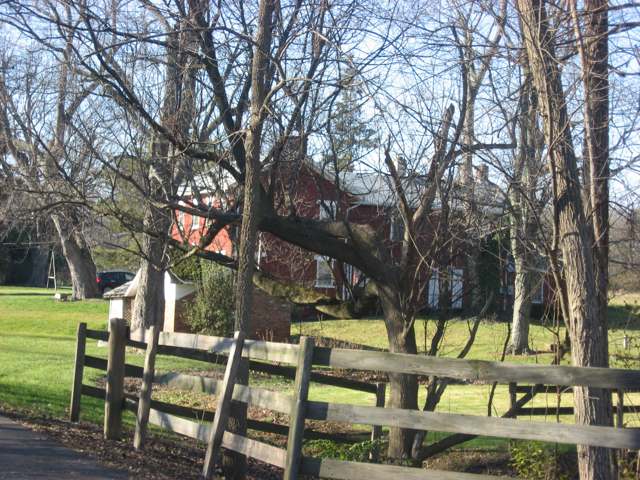
Photo: Nyttend, public domain · Wikimedia Commons
Local history sources: en.wikipedia.org · ohiogenealogyexpress.com · en.wikipedia.org · en.wikipedia.org · commons.wikimedia.org · commons.wikimedia.org
Historic places
1 place in Clay Township, Montgomery County on the National Register of Historic Places. Press a pin or a name for its whole record.
-
Flory, Joseph, HouseBuilding · Clayton · listed 1978
- Address
- NW of Clayton on Diamond Mill Rd.
- Where
- Clayton, Montgomery County · ZIP 45315
- What it is
- Building
- Listed on the National Register
- 1978
- NRIS reference number
- 78002143
- Coordinates
- 39.86615, -84.36847
National Register file (NPS) ↗ Search Wikipedia ↗ Street map and directions ↗ On the Cracked Buckeye map
Source: National Park Service, National Register of Historic Places point file. The listing year is shown where NPS's certification date agrees with the listing's reference number. Listing recognizes significance; it does not restrict a private owner.
Water
Mad River Well Field wells along the Mad River east of Dayton, refilled by river water let into recharge lagoons The water here
- Brookville Municipality78% of residentsGreat Miami Buried Valley Aquifer wells (recharged by Great Miami & Mad Rivers)
- Montgomery County Water Services 26% of residentsGreat Miami Buried Valley Aquifer wells (recharged by Great Miami & Mad Rivers)
- Phillipsburg Village6% of residentsGroundwater wells (4 wells)
- Englewood City5% of residentsStillwater Buried Valley Aquifer (wells)
- Union City3% of residentsGroundwater wells (4 wells)
- Verona, Village Of1% of residentsGroundwater wells (3 wells)
- Dayton Public Water System1% of residentsGreat Miami Buried Valley Aquifer wells (recharged by Great Miami & Mad Rivers)
Hospitals, fire stations and more
Inside Clay Township, Montgomery County's boundary: 1 museum, 1 police station and 5 spill cases. Press a pin or a name for its whole record and its source.
Museums, historical societies, gardens and zoos (1)
-
Algonac/Clay Township Historical SocietyHistorical society · Brookville
- What it is
- Historical society
- City
- Brookville
- Coordinates
- 39.86343, -84.42618
Search Wikipedia ↗ IMLS Museum Data Files (source) ↗ Street map and directions ↗
The museum list is IMLS's 2018 file; a museum may have closed or moved since.
Source: IMLS Museum Data Files, 2018.
Police stations (1)
-
Clay Township Police DepartmentBrookville
- Address
- 8207 Arlington Road, Brookville, OH 45309
- Coordinates
- 39.86331, -84.42659
USGS National Map structures (source) ↗ Street map and directions ↗
Source: USGS National Map structures, police stations, corrected and completed by hand (September 2026). The department that answers a call is set by jurisdiction, not by distance.
Spills reported since 2021 (5)
-
Fuel Diesel / Diesel Fuel (Vehicle On Or Off Road)2023-09-11 · Clay Twp
- Reported
- 2023-09-11
- What spilled
- Fuel Diesel / Diesel Fuel (Vehicle On Or Off Road)
- Where
- Clay Twp, Montgomery County
- Ohio EPA district office
- SWDO
- Ohio EPA case number
- 2309EPA0001592
Ohio EPA spill reports (source) ↗ Street map and directions ↗
-
Fuel Diesel / Diesel Fuel (Vehicle On Or Off Road)2022-04-03 · Clay Twp
- Reported
- 2022-04-03
- What spilled
- Fuel Diesel / Diesel Fuel (Vehicle On Or Off Road)
- Largest amount reported
- 100 gallons
- Where
- Clay Twp, Montgomery County
- Ohio EPA district office
- SWDO
- Ohio EPA case number
- 2204EPA0000461
Ohio EPA spill reports (source) ↗ Street map and directions ↗
-
Sheen Rainbow / Hydrocarbon Reached water2021-11-05 · Clay Twp
- Reported
- 2021-11-05
- What spilled
- Sheen Rainbow / Hydrocarbon
- Reached a waterway
- 57 - Wolf Creek
- Where
- Clay Twp, Montgomery County
- Ohio EPA district office
- SWDO
- Ohio EPA case number
- 2111EPA0001699
Ohio EPA spill reports (source) ↗ Street map and directions ↗
-
Fuel Diesel / Diesel Fuel (Vehicle On Or Off Road) Reached water2021-07-13 · Clay Twp
- Reported
- 2021-07-13
- What spilled
- Fuel Diesel / Diesel Fuel (Vehicle On Or Off Road)
- Reached a waterway
- 57 - Twin Creek
- Where
- Clay Twp, Montgomery County
- Ohio EPA district office
- SWDO
- Ohio EPA case number
- 2107EPA0001043
Ohio EPA spill reports (source) ↗ Street map and directions ↗
-
Fuel Diesel / Diesel Fuel (Vehicle On Or Off Road)2021-06-30 · Clay Twp
- Reported
- 2021-06-30
- What spilled
- Fuel Diesel / Diesel Fuel (Vehicle On Or Off Road)
- Where
- Clay Twp, Montgomery County
- Ohio EPA district office
- SWDO
- Ohio EPA case number
- 2106EPA0000958
Ohio EPA spill reports (source) ↗ Street map and directions ↗
Source: Ohio EPA emergency response spill reports, 2021 to September 2026, one point per case where Ohio EPA placed it. A report is what the caller or responder recorded; amounts are often blank or estimated.
Its ZIP codes
Each ZIP code that touches Clay Township, Montgomery County, with the share of its residents who live here and the same headline figures as the ZIP page.
Local government
Who holds office in Clay Township, Montgomery County, how its elections and ballot issues came out, and the state auditor's record.
Money issues on the ballot since 2026: 1 of 1 passed; of those asking for new or higher taxes, 1 of 1.
Ballot issues
| Date | Issue | For | Against | Result |
|---|---|---|---|---|
| 2026-05-05 | Issue: Clay Township - Additional - Fire & EMS - 2.5 Mills - Con't period of time (2.5 mills, additional) | 996 | 594 | Passed (62.64% for) |
Elections for office
| Date | Office | Candidates and votes |
|---|---|---|
| 2025-11-04 | Trustee (unofficial count) | Lori Hartman 700, 28.27%; Mark Haworth 955, 38.57%; Angela Howell 821, 33.16% |
| 2025-11-04 | Trustee (unofficial count) | Dale Winner 1,116, 100.0% |
| 2025-11-04 | Fiscal Officer (unofficial count) | Write-in 57, 100.0% |
Winners in bold. Results from the county board of elections' official canvass unless marked.
The county
Montgomery County: 33 ZIP codes, 27 cities, villages and townships, 531,614 people.
Nearby places
Quick answers
What county is Clay Township, Ohio in?
Clay Township, Montgomery County is a township in Montgomery County, Ohio, with 3,633 residents.
When was Clay Township, Ohio founded?
Clay Township, Montgomery County was settled unclear; sources describe it as settled later than most Montgomery County townships despite being organized relatively early; incorporated 1825-06-08 (organized as a township, set off from Randolph Township). Source
How did Clay Township, Ohio get its name?
Clay Township is named for the statesman Henry Clay, one of nine townships in Ohio bearing his name. Source
What ZIP code is Clay Township, Ohio?
Clay Township, Montgomery County is served by ZIP codes 45309, 45354, 45378 and 45315; 45309 holds the largest share of its residents.
Where does Clay Township, Ohio get its water?
The main water source for Clay Township, Montgomery County (Brookville Municipality): Mad River Well Field wells along the Mad River east of Dayton, refilled by river water let into recharge lagoons.
Cite this page
Cite this page as:
Cracked Buckeye, "Clay Township, Montgomery County", https://crackedbuckeye.com/place/clay-township-montgomery-county/, built 2026-10-31, accessed [date].
How to cite · Report a correction · Built 2026-10-31
