Local events in Englewood
125 events in the next 90 days from 4 public calendars. All local events in Englewood
Checked October 20; the events page is refreshed daily.
History from Englewood
People and inventions tied to this place, each with its sources. All people · All inventions
How Englewood began
Englewood grew up in Randolph Township along the Stillwater River, where families including the Hoovers, Masts, Ewings and McClintocks began settling around 1800 and shipped grain and bacon downriver to Dayton and beyond. The place itself dates its founding to May 6, 1841, and carried two earlier names, Harrisburg and then Iamton, before a businessmen's contest in 1898 chose Englewood. The village incorporated May 15, 1914, with Jacob Hoover as its first mayor, and it stayed a small farming and milling crossroads through the early twentieth century before postwar growth along U.S. 40 and Interstate 70 turned it into a Dayton suburb, becoming a city in 1971.
Settled c. 1800, platted 1841-05-06, incorporated 1914-05-15, by Early settlers included the Hoover, Mast, Ewing and McClintock families; the village was incorporated in 1914 with Jacob Hoover as first mayor.
Where the name comes from
The settlement was first called Harrisburg, after the Pennsylvania hometown of early settlers, then renamed Iamton in 1870. In 1898 local businessmen held a contest to pick a new name, and Englewood was the winning entry.
Before the town
No mound, village or earthwork site specific to present-day Englewood is recorded; the county-level record should be consulted for prehistoric and historic-era sites along the Stillwater and Great Miami valleys generally. Englewood's own Wikipedia history states only that 'there were many Native Americans in the area in the early days that traded with the settlers,' without naming a people, village or place. The broader Stillwater River valley lay within land used by the Miami and, by agreement with the Miami, the Shawnee, who held hunting grounds and villages through the Ohio country into the late 1600s and 1700s; the land was opened to settlement by the 1795 Treaty of Greenville, four to five years before the first documented settler families reached the Englewood area.
Nations recorded here: Miami, Shawnee.
Timeline
- — Settler families including the Hoovers, Masts, Ewings and McClintocks began arriving in what was then Randolph Township, farming along the Stillwater River and shipping grain and bacon by flatboat downriver to Dayton and as far as New Orleans.
- — The place that became Englewood was founded, then known as Harrisburg for the Pennsylvania hometown of early settlers.
- — The settlement was renamed Iamton.
- — Local businessmen held a contest to rename the town again; Englewood was chosen.
- — The Village of Englewood incorporated, with Jacob Hoover as its first mayor.
- — Natural gas service reached Englewood.
- — Englewood built its first municipal water works.
- — Englewood completed its original sewer system.
- — Englewood became a city.
Stories
Three names for one crossroads
Before it was Englewood, the town on the Stillwater River answered to two other names in less than sixty years. Settlers from Pennsylvania named their new home Harrisburg after the town they had left behind, and it carried that name from its 1841 founding until 1870, when it became Iamton. Neither name stuck for good: in 1898 the town's businessmen decided the place needed something more fitting and ran a contest to choose a new one. Englewood won, and it is the name that has lasted into the twenty-first century, long after the reasons for Harrisburg and Iamton were forgotten by most residents.
Flatboats on the Stillwater
Long before Englewood had a name at all, the families who settled the Randolph Township farmland along the Stillwater River around 1800 built flat-bottomed boats to move what they grew. Grain and bacon went down the Stillwater to the Great Miami and on to Dayton, and in good years farmers pushed shipments as far as New Orleans, a trip of weeks down two rivers and the Mississippi. It was river trade, not a rail line or a turnpike, that first connected this stretch of Montgomery County farmland to markets beyond the county, and it shaped where the earliest roads and mills in the area were built.
Photographs
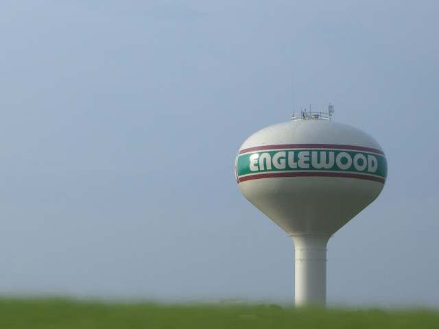
Photo: Wikimedia Commons contributor, public domain · Wikimedia Commons
Local history sources: en.wikipedia.org · thislocallife.com · en.wikipedia.org · en.wikipedia.org · commons.wikimedia.org
Water
Seven production wells spread across three well fields tapping the shallow (under 14 feet deep) Stillwater Buried Valley Aquifer beneath Englewood; well water is pumped to the city's Water Treatment Plant for iron/manganese filtration, fluoridation… The water here
- Englewood City42% of residentsStillwater Buried Valley Aquifer (wells)
- Union City33% of residentsGroundwater wells (4 wells)
- Montgomery County Water Services 223% of residentsGreat Miami Buried Valley Aquifer wells (recharged by Great Miami & Mad Rivers)
- Dayton Public Water System2% of residentsGreat Miami Buried Valley Aquifer wells (recharged by Great Miami & Mad Rivers)
Hospitals, fire stations and more
Inside Englewood's boundary: 1 hospital, 3 nursing homes, 2 fire and EMS stations, 1 college, 1 high-hazard dam, 5 public schools, 1 library, 1 museum, 1 police station, 2 public charging sites, 4 Toxics Release Inventory facilities and 12 spill cases. Press a pin or a name for its whole record and its source.
Hospitals (1)
-
Miami Valley Hospital NorthGeneral hospital · Dayton
- What it is
- General hospital
- Address
- 9000 North Main Street, Dayton, OH 45415
- County
- Montgomery County
- Beds
- 46
- Helipad
- Yes
- Ownership
- Non-profit
- Phone
- (937) 208-8000
Where HIFLD got this record ↗ HIFLD hospitals (source) ↗ Street map and directions ↗
Source: HIFLD hospitals inventory via FEMA (closed hospitals it still lists left out, hospitals opened since added), with Medicare Care Compare ratings matched by name and address.
Nursing homes (3)
-
Cypress Pointe Health Campus5 of 5 stars · Englewood
- Address
- 600 West National Road, Englewood, OH 45322
- Certified beds
- 70
- Residents on an average day
- 67
- Medicare overall rating
- 5 of 5 stars
- Health inspections
- 4 of 5 stars
- Staffing
- 4 of 5 stars
- Quality measures
- 5 of 5 stars
- Penalties since 2023
- none
- Ownership
- For profit - Corporation
- Chain
- TRILOGY HEALTH SERVICES
- Continuing care retirement community
- Yes
- Takes
- Medicare and Medicaid
- Phone
- (937) 836-3149
- Medicare ID
- 366384
Medicare Care Compare ↗ CMS nursing home data (source) ↗ Street map and directions ↗
-
Englewood Health and Rehab1 of 5 stars · Englewood
- Address
- 425 Lauricella Court, Englewood, OH 45322
- Certified beds
- 116
- Residents on an average day
- 94
- Medicare overall rating
- 1 of 5 stars
- Health inspections
- 2 of 5 stars
- Staffing
- 1 of 5 stars
- Quality measures
- 4 of 5 stars
- Penalties since 2023
- none
- Ownership
- For profit - Limited Liability company
- Chain
- SIMCHA HYMAN & NAFTALI ZANZIPER
- Takes
- Medicare and Medicaid
- Phone
- (937) 836-5143
- Medicare ID
- 365088
Medicare Care Compare ↗ CMS nursing home data (source) ↗ Street map and directions ↗
-
Grace Brethren Village4 of 5 stars · Englewood
- Address
- 1010 Taywood Road, Englewood, OH 45322
- Certified beds
- 45
- Residents on an average day
- 36
- Medicare overall rating
- 4 of 5 stars
- Health inspections
- 3 of 5 stars
- Staffing
- 3 of 5 stars
- Quality measures
- 5 of 5 stars
- Penalties since 2023
- none
- Ownership
- For profit - Corporation
- Takes
- Medicare and Medicaid
- Phone
- (937) 836-4011
- Medicare ID
- 366263
Medicare Care Compare ↗ CMS nursing home data (source) ↗ Street map and directions ↗
Source: CMS Care Compare nursing home provider and penalties files; Medicare star ratings run 1 to 5.
Fire and EMS stations (2)
-
Englewood Fire Department - Station 98Englewood
- Address
- 333 West National Road, Englewood, OH 45322
- Coordinates
- 39.87775, -84.30843
USGS National Map structures (source) ↗ Street map and directions ↗
-
Englewood Fire Department Station 99Englewood
- Address
- 1099 Union Road, Englewood, OH 45322
- Coordinates
- 39.85658, -84.31221
USGS National Map structures (source) ↗ Street map and directions ↗
Source: USGS National Map structures (most Ohio records last updated 2019 to 2022), checked against the Columbus and Cleveland station lists. The department that answers a call is set by jurisdiction and mutual aid, not by distance.
Colleges (1)
-
Miami Valley Career Technology CenterPublic career school · Englewood
- What it is
- Public career school
- City
- Englewood
- Students, 2023-24 (12-month count)
- 92
- IPEDS unit ID
- 204158
College Navigator (NCES) ↗ IPEDS data (source) ↗ Street map and directions ↗
Source: NCES IPEDS 2024 directory, 2023-24 enrollment and tuition, graduation rates for the 2017 (four-year) and 2020 (two-year) entering classes.
High-hazard dams (1)
-
Englewood DamStillwater River · condition: fair
- Hazard class
- High: a failure would probably cost a life
- Condition
- Fair (assessed 09/25/2019)
- River or stream
- Stillwater River
- Purpose
- Flood Risk Reduction
- Type
- Earth
- Height
- 121 ft
- Storage
- 413,000 acre-feet
- Completed
- 1922
- Owner type
- Local Government
- County
- Montgomery County
- Nearest town (NID)
- Little York
- Last inspection
- 10/23/2024
- Emergency action plan
- Yes
- NID ID
- OH00431
National Inventory of Dams record ↗ National Inventory of Dams (source) ↗ Street map and directions ↗
Source: U.S. Army Corps of Engineers National Inventory of Dams, August 2026. "High hazard" rates what a failure would cost downstream, not how likely one is; the condition is the state's assessment.
Public schools (5)
-
Englewood Hills Elementary School3.5 of 5 stars · Englewood
- Address
- 508 Durst Dr, Englewood, OH 45322
- School district
- Northmont City School District
- Kind (NCES)
- Regular School
- Students, 2023-24
- 377
- Teachers (full-time equivalent)
- 20
- Report card, 2025-26
- 3.5 of 5 stars
- Performance index
- 77.6%
- Ohio building IRN
- 010603
- NCES school ID
- 390487203371
NCES school record ↗ Ohio School Report Card ↗ Street map and directions ↗
-
Kleptz Early Childhood Learning Center3 of 5 stars · Clayton
- Address
- 1100 National Rd, Clayton, OH 45315
- School district
- Northmont City School District
- Kind (NCES)
- Regular School
- Students, 2023-24
- 837
- Teachers (full-time equivalent)
- 40.8
- Report card, 2025-26
- 3 of 5 stars
- Ohio building IRN
- 013126
- NCES school ID
- 390487205742
NCES school record ↗ Ohio School Report Card ↗ Street map and directions ↗
-
Miami Valley CtcEnglewood
- Address
- 6800 Hoke Rd, Englewood, OH 45315
- Kind (NCES)
- Career and Technical School
- Students, 2023-24
- 1,706
- NCES school ID
- 390512804076
-
Miami Valley Ctc AlternativeEnglewood
- Address
- 6800 Hoke Rd, Englewood, OH 45315
- Kind (NCES)
- Career and Technical School
- Students, 2023-24
- 24
- Teachers (full-time equivalent)
- 4
- NCES school ID
- 390512804668
-
Northmoor Elementary School4.5 of 5 stars · Englewood
- Address
- 4421 Old Salem Rd, Englewood, OH 45322
- School district
- Northmont City School District
- Kind (NCES)
- Regular School
- Students, 2023-24
- 452
- Teachers (full-time equivalent)
- 26.5
- Report card, 2025-26
- 4.5 of 5 stars
- Performance index
- 90.3%
- Ohio building IRN
- 027714
- NCES school ID
- 390487203374
NCES school record ↗ Ohio School Report Card ↗ Street map and directions ↗
Source: NCES EDGE public school locations 2024-25 and Common Core of Data 2023-24 (type, students, teachers); Ohio School Report Cards 2025-26 (Department of Education and Workforce), matched by name within the district.
Public libraries (1)
-
Northmont Branch LibraryBranch · Englewood
- Address
- 700 W. National Rd., Englewood, OH 45322
- What it is
- Branch
- Library system
- Dayton Metro Library
- Open
- 3,042 hours a year, 52 weeks
- Building
- 20,000 sq ft
- System's visits, FY2024
- 1,987,700
- System's loans, FY2024
- 4,831,439
- People the system serves
- 452,238
- Phone
- (937) 463-2665
IMLS Public Libraries Survey (source) ↗ Street map and directions ↗
Source: IMLS Public Libraries Survey FY2024 (outlets and their systems). Any Ohio resident can get a free card at any Ohio public library.
Museums, historical societies, gardens and zoos (1)
-
Randolph Township Historical SocietyHistorical society · Englewood
- What it is
- Historical society
- City
- Englewood
- Coordinates
- 39.87962, -84.30193
Search Wikipedia ↗ IMLS Museum Data Files (source) ↗ Street map and directions ↗
The museum list is IMLS's 2018 file; a museum may have closed or moved since.
Source: IMLS Museum Data Files, 2018.
Police stations (1)
-
Englewood Police DepartmentEnglewood
- Address
- 333 West National Road, Englewood, OH 45322
- Coordinates
- 39.87813, -84.30825
USGS National Map structures (source) ↗ Street map and directions ↗
Source: USGS National Map structures, police stations, corrected and completed by hand (September 2026). The department that answers a call is set by jurisdiction, not by distance.
Public EV charging (2)
-
Meijer - Tesla Supercharger DC fast8 DC fast · Dayton
- Address
- 9200 N Main Street, Dayton, OH 45415
- Ports
- 8 DC fast
- Plugs
- Tesla (NACS)
- Network
- Tesla
- Hours
- 24 hours daily. Please check Tesla's online station map to see if an adapter is required at this location.
- Phone
- 877-798-3752
Station Locator (NREL) ↗ Alternative Fuels Data Center (source) ↗ Street map and directions ↗
-
ODOT District 7 Garage2 Level 2 · Clayton
- Address
- 300 Smith Dr., Clayton, OH 45315
- Ports
- 2 Level 2
- Plugs
- J1772
- Network
- FLO
- Hours
- 24 hours daily
- Phone
- 888-356-8911
Station Locator (NREL) ↗ Alternative Fuels Data Center (source) ↗ Street map and directions ↗
Source: NREL Alternative Fuels Data Center station list (May 2026), public and open stations, the posts at one address counted as one site.
Facilities reporting toxic releases (4)
-
CaptiveaireToxics Release Inventory · Englewood
- Address
- 40 Harrisburg Dr, Englewood, OH 45322
- County
- Montgomery County County
- Status
- Reports to the Toxics Release Inventory (***unchanged***)
- EPA program ID
- 4532WCPTVR4HARR
- EPA registry ID
- 110071284166
EPA facility record ↗ EPA Facility Registry Service (source) ↗ Street map and directions ↗
-
Dayton Polymeric ProdsToxics Release Inventory · Englewood
- Address
- 75 Harrisburg Dr., Englewood, OH 45322
- County
- Montgomery County
- Status
- Reports to the Toxics Release Inventory (active)
- EPA program ID
- 45322DYTNP75HAR
- EPA registry ID
- 110000766939
EPA facility record ↗ EPA Facility Registry Service (source) ↗ Street map and directions ↗
-
Lau Industries IncToxics Release Inventory · Clayton
- Address
- 1 Lau Pkwy, Clayton, OH 45315
- County
- Montgomery County
- Status
- Reports to the Toxics Release Inventory (active)
- EPA program ID
- 45315LNDSNONELA
- EPA registry ID
- 110000393994
EPA facility record ↗ EPA Facility Registry Service (source) ↗ Street map and directions ↗
-
Platers Service IncToxics Release Inventory · Englewood
- Address
- 40 Harrisburg Dr., Englewood, OH 45322
- County
- Montgomery County
- Status
- Reports to the Toxics Release Inventory (active)
- EPA program ID
- 45322PLTRS40HAR
- EPA registry ID
- 110002113524
EPA facility record ↗ EPA Facility Registry Service (source) ↗ Street map and directions ↗
Source: EPA Facility Registry Service, Toxics Release Inventory reporters. Reporting a release is required of large users of listed chemicals; it is not by itself a violation.
Spills reported since 2021 (12)
-
Paint Nos / Lacquer (Not Specified)2025-07-28 · Englewood
- Reported
- 2025-07-28
- What spilled
- Paint Nos / Lacquer (Not Specified)
- Largest amount reported
- 5 gallons
- Where
- Englewood, Montgomery County
- Ohio EPA district office
- SWDO
- Ohio EPA case number
- 2507EPA0001259
Ohio EPA spill reports (source) ↗ Street map and directions ↗
-
Other / All Other / Trade Name / Mixture / Solution Etc2024-07-22 · Englewood
- Reported
- 2024-07-22
- What spilled
- Other / All Other / Trade Name / Mixture / Solution Etc
- Where
- Englewood, Montgomery County
- Ohio EPA district office
- SWDO
- Ohio EPA case number
- 2407EPA0001249
Ohio EPA spill reports (source) ↗ Street map and directions ↗
-
Sewage Sludge / Biosolids2024-07-02 · Englewood
- Reported
- 2024-07-02
- What spilled
- Sewage Sludge / Biosolids
- Where
- Englewood, Montgomery County
- Ohio EPA district office
- SWDO
- Ohio EPA case number
- 2407EPA0001111
Ohio EPA spill reports (source) ↗ Street map and directions ↗
-
Paint Nos / Lacquer (Not Specified)2024-02-25 · Englewood
- Reported
- 2024-02-25
- What spilled
- Paint Nos / Lacquer (Not Specified)
- Where
- Englewood, Montgomery County
- Ohio EPA district office
- SWDO
- Ohio EPA case number
- 2402EPA0000293
Ohio EPA spill reports (source) ↗ Street map and directions ↗
-
Fuel Gasoline ( 25% Ethanol Not E85)2024-02-25 · Englewood
- Reported
- 2024-02-25
- What spilled
- Fuel Gasoline ( 25% Ethanol Not E85)
- Where
- Englewood, Montgomery County
- Ohio EPA district office
- SWDO
- Ohio EPA case number
- 2402EPA0000291
Ohio EPA spill reports (source) ↗ Street map and directions ↗
-
Fuel Diesel / Diesel Fuel (Vehicle On Or Off Road)2023-09-26 · Englewood
- Reported
- 2023-09-26
- What spilled
- Fuel Diesel / Diesel Fuel (Vehicle On Or Off Road)
- Largest amount reported
- 100 gallons
- Where
- Englewood, Montgomery County
- Ohio EPA district office
- SWDO
- Ohio EPA case number
- 2309EPA0001667
Ohio EPA spill reports (source) ↗ Street map and directions ↗
-
Fuel Diesel / Diesel Fuel (Vehicle On Or Off Road)2023-08-07 · Englewood
- Reported
- 2023-08-07
- What spilled
- Fuel Diesel / Diesel Fuel (Vehicle On Or Off Road)
- Largest amount reported
- 75 gallons
- Where
- Englewood, Montgomery County
- Ohio EPA district office
- SWDO
- Ohio EPA case number
- 2308EPA0001343
Ohio EPA spill reports (source) ↗ Street map and directions ↗
-
Material Unknown2023-06-23 · Englewood
- Reported
- 2023-06-23
- What spilled
- Material Unknown
- Largest amount reported
- 30 gallons
- Where
- Englewood, Montgomery County
- Ohio EPA district office
- SWDO
- Ohio EPA case number
- 2306EPA0001039
Ohio EPA spill reports (source) ↗ Street map and directions ↗
-
Fuel Diesel / Diesel Fuel (Vehicle On Or Off Road)2022-10-31 · Englewood
- Reported
- 2022-10-31
- What spilled
- Fuel Diesel / Diesel Fuel (Vehicle On Or Off Road)
- Largest amount reported
- 50 gallons
- Where
- Englewood, Montgomery County
- Ohio EPA district office
- SWDO
- Ohio EPA case number
- 2210EPA0001622
Ohio EPA spill reports (source) ↗ Street map and directions ↗
-
Fuel Diesel / Diesel Fuel (Vehicle On Or Off Road)2022-09-24 · Englewood
- Reported
- 2022-09-24
- What spilled
- Fuel Diesel / Diesel Fuel (Vehicle On Or Off Road)
- Largest amount reported
- 30 gallons
- Where
- Englewood, Montgomery County
- Ohio EPA district office
- SWDO
- Ohio EPA case number
- 2209EPA0001465
Ohio EPA spill reports (source) ↗ Street map and directions ↗
-
Material Unknown2022-05-24 · Englewood
- Reported
- 2022-05-24
- What spilled
- Material Unknown
- Where
- Englewood, Montgomery County
- Ohio EPA district office
- SWDO
- Ohio EPA case number
- 2205EPA0000765
Ohio EPA spill reports (source) ↗ Street map and directions ↗
-
Fuel Diesel / Diesel Fuel (Vehicle On Or Off Road)2026-01-27 · Englewood
- Reported
- 2026-01-27
- What spilled
- Fuel Diesel / Diesel Fuel (Vehicle On Or Off Road)
- Where
- Englewood, Montgomery County
- Ohio EPA district office
- SWDO
- Ohio EPA case number
- 2601EPA0000096
Ohio EPA spill reports (source) ↗ Street map and directions ↗
Source: Ohio EPA emergency response spill reports, 2021 to September 2026, one point per case where Ohio EPA placed it. A report is what the caller or responder recorded; amounts are often blank or estimated.
Its ZIP codes
Each ZIP code that touches Englewood, with the share of its residents who live here and the same headline figures as the ZIP page.
Local government
Who holds office in Englewood, how its elections and ballot issues came out, and the state auditor's record.
Elections for office
| Date | Office | Candidates and votes |
|---|---|---|
| 2025-11-04 | Council Member (unofficial count) | Andrew Gough 1,213, 21.55%; Jake Jagels 1,121, 19.92%; Ryan Ley 511, 9.08%; Brad Rarick 1,209, 21.48%; Courtney Rietman 1,574, 27.97% |
Winners in bold. Results from the county board of elections' official canvass unless marked.
Auditor of State record
- No fiscal caution, watch or emergency on the Auditor of State's lists.
- Financial Health Indicators (the Auditor of State's 17 measures; critical / cautionary / positive): 2020 2 / 5 / 10; 2021 0 / 1 / 16; 2022 0 / 3 / 14; 2023 1 / 2 / 14; 2024 0 / 5 / 12; 2025 3 / 1 / 13.
- Financial Audit, 2025, released 2026-08-11
- Financial Audit, 2024, released 2025-11-06
- Financial Audit, 2023, released 2024-10-01
The county
Montgomery County: 33 ZIP codes, 27 cities, villages and townships, 531,614 people.
Nearby places
Rain and snow
How much has actually fallen on Englewood, day by day, from 1893 to now. Daily totals, not averages.
- rain, last 30 days
- 1.51 in
- 2026-09-30 to 2026-10-29
- rain so far in 2026
- 45.2 in
- 9.4 in above normal for the date
- snow so far in 2026
- 19.8 in
- a normal year brings 21.1 in
- a normal year
- 42.1 in
- average of 30 years, 1991-2020
| Month | Rain (in) | Snow (in) | Days counted |
|---|---|---|---|
| October 2026 | 1.51 | — | 29 |
| September 2026 | 4.46 | — | 30 |
| August 2026 | 9.09 | — | 31 |
| July 2026 | 3.82 | — | 31 |
| June 2026 | 3.20 | — | 30 |
| May 2026 | 9.66 | — | 31 |
| April 2026 | 3.39 | — | 30 |
| March 2026 | 6.41 | 1.9 | 31 |
| February 2026 | 1.67 | 2.9 | 28 |
| January 2026 | 1.95 | 15.1 | 31 |
| December 2025 | 1.88 | 8.4 | 31 |
| November 2025 | 2.14 | 4.3 | 30 |
| Wettest year | 2011 — 59.8 in |
|---|---|
| Driest year | 1934 — 24.8 in |
| Snowiest year | 1978 — 47.9 in |
| Wettest day on record | 28 February 2024 — 5.50 in |
| Heaviest snowfall in a day | 17 February 1910 — 10.51 in |
| Deepest snow on the ground | 21 January 1978 — 20.15 in |
Mostly estimated. Only 2% of these days come from a gauge standing inside Englewood - the rest are worked out from the nearest gauges around it, so read them as close estimates rather than readings.
48,225 days of records, 1893-06-02 to 2026-10-29. Source: NOAA NCEI GHCN-Daily, 3,240 gauges in and around Ohio. A day is "gauged" when a gauge standing inside the boundary reported it, and the value is the mean of those gauges. Otherwise it is interpolated by inverse distance from every gauge reporting within 50 miles. Nothing is carried forward, back-filled or smoothed. Against NOAA nClimDiv county monthly precipitation over 136,848 complete county-months (checked 2026-10-31): correlation 0.9515, median absolute difference 0.217 in a month. Built 2026-10-31 from the Cracked Buckeye precipitation archive. Snow is the softer number — snowfall is measured by hand with a ruler, no agency publishes a gridded county snowfall series, and blowing snow defeats every observer.
Environmental permits and filings
What Ohio EPA has on file for Englewood: permits, inspections, violations, cleanups and the state loans behind sewer and water work. Every line links to the agency's own document.
- facilities and sites on file
- 20
- those placed on the map inside Englewood
| Program | Facilities and sites |
|---|---|
| Hazardous waste | 8 |
| Wastewater and stormwater discharge | 4 |
| Public drinking water | 3 |
| Air pollution | 2 |
| Sewer and water-line construction | 1 |
| Source-water protection | 1 |
| Wetland and stream fill | 1 |
| Date | Facility or site | What |
|---|---|---|
| WESTBROOK MEADOWS SECTION 4 SUBDIVISION | Wastewater and stormwater discharge permit | |
| WESTBROOK MEADOWS SECTION 4 SUBDIVISION | Wastewater and stormwater discharge permit | |
| ENGLEWOOD CITY PWS | Public drinking water inspection | |
| ENGLEWOOD CITY PWS | Public drinking water compliance letter | |
| WESTBROOK MEADOWS SECTION 4 SUBDIVISION | Wastewater and stormwater discharge permit | |
| WESTBROOK MEADOWS SECTION 4 SUBDIVISION | Wastewater and stormwater discharge permit | |
| WESTBROOK MEADOWS SECTION 4 SUBDIVISION | Wastewater and stormwater discharge permit | |
| ENGLEWOOD CITY PWS | Public drinking water report | |
| WESTBROOK MEADOWS SECTION 4 SUBDIVISION | Wastewater and stormwater discharge permit | |
| MELODY POOL PWS | Public drinking water notice of violation | |
| MELODY POOL PWS | Public drinking water notice of violation | |
| NISSIN PRECISION NORTH AMERICA INC | Air pollution report | |
| GARBER ELECTRIC | Wastewater and stormwater discharge permit | |
| KROGER A938 FUEL CENTER | Wastewater and stormwater discharge permit | |
| WESTBROOK MEADOWS SECTION 4 SUBDIVISION | Wastewater and stormwater discharge permit | |
| WESTBROOK MEADOWS SECTION 4 SUBDIVISION | Wastewater and stormwater discharge permit | |
| WESTBROOK MEADOWS SECTION 4 SUBDIVISION | Wastewater and stormwater discharge permit | |
| WESTBROOK MEADOWS SECTION 4 SUBDIVISION | Wastewater and stormwater discharge permit | |
| ENGLEWOOD CITY | Source-water protection report | |
| ENGLEWOOD CITY PWS | Public drinking water plan | |
| ENGLEWOOD CITY PWS | Public drinking water inspection | |
| WESTBROOK MEADOWS SECTION 4 SUBDIVISION | Wastewater and stormwater discharge permit | |
| WESTBROOK MEADOWS SECTION 4 SUBDIVISION | Wastewater and stormwater discharge permit | |
| PARLIAMENT PLACE | Sewer and water-line construction permit | |
| PARLIAMENT PLACE | Sewer and water-line construction permit |
Source: Ohio EPA eDocument portal (edocpub.epa.ohio.gov), indexed 2026-10-14. Facilities are placed on the map from Ohio EPA's own map layers, EPA's Facility Registry, coordinates written in the filings, or a geocoded street address. A permit filed under a private person's name (most are household septic systems) is counted but never named, placed or linked; licenses for individual workers and open-burning notices are left out entirely.
Quick answers
What county is Englewood, Ohio in?
Englewood is a city in Montgomery County, Ohio, with 13,221 residents.
When was Englewood, Ohio founded?
Englewood was settled c. 1800; laid out 1841-05-06; incorporated 1914-05-15. Founders on record: Early settlers included the Hoover, Mast, Ewing and McClintock families; the village was incorporated in 1914 with Jacob Hoover as first mayor. Source
How did Englewood, Ohio get its name?
The settlement was first called Harrisburg, after the Pennsylvania hometown of early settlers, then renamed Iamton in 1870. Source
What ZIP code is Englewood, Ohio?
Englewood is served by ZIP codes 45322 and 45315; 45322 holds the largest share of its residents.
Where does Englewood, Ohio get its water?
The main water source for Englewood (Englewood City): Seven production wells spread across three well fields tapping the shallow (under 14 feet deep) Stillwater Buried Valley Aquifer beneath Englewood; well water is pumped to the city's Water Treatment Plant for iron/manganese filtration, fluoridation….
Cite this page
Cite this page as:
Cracked Buckeye, "Englewood, Montgomery County", https://crackedbuckeye.com/place/englewood/, built 2026-10-31, accessed [date].
How to cite · Report a correction · Built 2026-10-31
