Local events in Sherrodsville
Nothing is posted for Sherrodsville itself yet; here is what is on within 20 miles. All local events in Sherrodsville
Know a calendar we should watch? Send the link
Checked October 20; the events page is refreshed daily.
Lakes near Sherrodsville
The history under the water: the valley before, the dam, the stories. All Ohio lakes
How Sherrodsville began
Sherrodsville was laid out in 1882 by John and Allen Pearch on land owned by Charles Sherrod, on Conotton Creek in southwestern Carroll County's Orange Township, and grew quickly enough on coal and the Wheeling and Lake Erie Railway to reach 926 residents by 1900 - its all-time peak. A fire on August 11, 1911 burned eighteen buildings (Wikipedia says 23) and reshaped the village center that stands today. The coal economy that built the town faded through the 20th century, and the village settled to 222 residents by 2020; its best-known native son, Edmund Rowe, went from its coal mines to one term in the U.S. House of Representatives.
Platted April 18, 1882 (John Pearch, southwest quarter of section 8; Henry Barrick platted the part in Monroe Township), incorporated an incorporated village by 1920 (date not given in the 1921 county history), by John and Allen Pearch, on land owned by Charles Sherrod.
Where the name comes from
The village was named for Charles Sherrod, the original owner of the town site the Pearch brothers platted in 1882.
Before the town
No mound, earthwork, or named Native village has been documented specifically at Sherrodsville, and no Carroll County-level history file exists yet to check further. The village stands on Conotton Creek, which early settlers of the surrounding township knew as 'One Leg' creek after a one-legged Native man said to have lived along its banks - the closest site-specific Native reference found for this stretch of the creek. As with the rest of Carroll County, the land passed to the United States under the Treaty of Fort McIntosh (1785); the historic Lenape (Delaware) and Wyandot both traveled and hunted the Conotton valley before removal.
Nations recorded here: Lenape (Delaware), Wyandot.
- 'One Leg' (Conotton Creek) (other) — Conotton Creek, at Sherrodsville, pre-settlement, undated (en.wikipedia.org)
Timeline
- — John and Allen Pearch plat the village of Sherrodsville on Charles Sherrod's land on Conotton Creek.
- — The Conotton Valley narrow-gauge railroad is built to Sherrodsville, and the Wheeling & Lake Erie from Carrollton reaches the village in the fall of 1885.
- — A great fire wipes out most of the village's business houses.
- — Edmund Rowe, later a one-term U.S. Representative from Ohio, is born in Sherrodsville.
- — The village builds a two-story frame town hall.
- — The village reaches its historical population peak of 926 residents, built on coal mining and the railroad.
- — Quarrying of building stone is developed here between 1900 and 1903; coal output begins to fall about 1905, and the miners' monthly pay-roll drops from $40,000 to about $8,000 by 1920.
- — A fire on August 11 burns eighteen buildings in the village center, a loss of $45,000 with little insurance (Wikipedia gives 23 buildings); neighbours from Carrollton, Leesville and Bowerston rush to help but can do little.
- — The Ohio Buff Sand Stone Company takes over the old Craig quarry two miles east in the autumn and by 1920 holds contracts for buildings in Milwaukee and New York, including a Catholic cathedral; the village subscribes $1,300 to the Fourth Liberty Loan.
- — Population has fallen to 377, less than half its 1900 peak, as the local coal economy contracts.
- — Sherrodsville has a mayor, a flour mill thirty years old, general stores, a garage, a dance hall and Lutheran, Methodist, Catholic and Congregational churches; population is near 400.
- — Sherrodsville-born Edmund Rowe takes his seat in the 78th Congress, having worked in the coal mines from 1905 to 1909 before entering the rubber industry.
- — The population rises to 480 from 333 in 1940.
- — The census counts 222 residents; the Conotton Valley schools are in the village.
Stories
From the coal face to Congress
Edmund Rowe was born in Sherrodsville on December 21, 1892. He worked in the coal mines from 1905 to 1909 and in the rubber industry from 1909 to 1913, then at the machinist trade from 1913 to 1916. He served in the U.S. Navy from 1917 to 1919 and was a member of the Akron city council from 1928 to 1942, serving one term as its president. Elected as a Republican to the 78th Congress, he served from January 3, 1943 to January 3, 1945 and was an unsuccessful candidate for reelection in 1944.
Eighteen buildings in one night
On August 11, 1911 fire swept through Sherrodsville and burned eighteen buildings with a loss of $45,000, the 1921 county history reports, and very little of it insured, because the village's poor fire protection made the insurance companies unwilling to cover such risks. Citizens of Carrollton, Leesville and Bowerston hurried to the scene, but combined they could do little. Wikipedia counts the buildings lost at 23. It was not the village's first great fire; about 1889 most of its business houses had been wiped out. The 1911 fire came as the coal economy was failing, and many of the burned houses were never rebuilt, because about the same time the mining company dismantled its property; the county historian says the results of the fire could still be seen in 1920 in the affairs of the once prosperous village.
Photographs
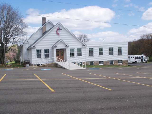
Photo: Roseohioresident, Wikimedia Commons, CC BY-SA 4.0 · Wikimedia Commons
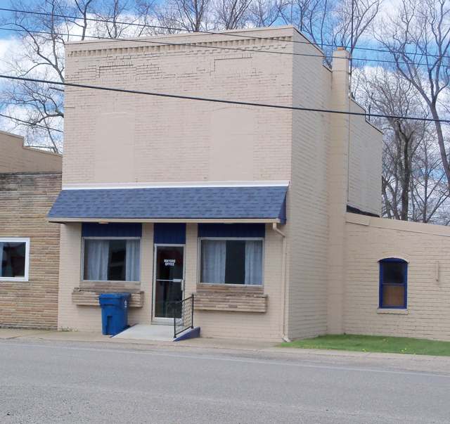
Photo: Roseohioresident, Wikimedia Commons, CC BY-SA 4.0 · Wikimedia Commons
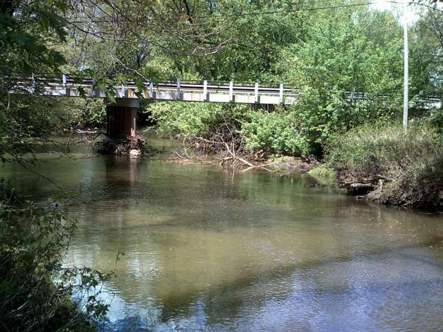
Photo: Roseohioresident, Wikimedia Commons, public domain · Wikimedia Commons
Local history sources: en.wikipedia.org · ohiogenealogyexpress.com · en.wikipedia.org · en.wikipedia.org · en.wikipedia.org · commons.wikimedia.org · commons.wikimedia.org · commons.wikimedia.org · archive.org
Water
Mostly private wells The water here
- Fohl Village MHP100% of residentsGroundwater wells (2 wells)
Hospitals, fire stations and more
Inside Sherrodsville's boundary: 1 fire or EMS station. Press a pin or a name for its whole record and its source.
Fire and EMS stations (1)
-
Sherrodsville Community Fire DepartmentSherrodsville
- Address
- 4 Sherrod Avenue, Sherrodsville, OH 44675
- Coordinates
- 40.49423, -81.24279
USGS National Map structures (source) ↗ Street map and directions ↗
Source: USGS National Map structures (most Ohio records last updated 2019 to 2022), checked against the Columbus and Cleveland station lists. The department that answers a call is set by jurisdiction and mutual aid, not by distance.
Its ZIP codes
Each ZIP code that touches Sherrodsville, with the share of its residents who live here and the same headline figures as the ZIP page.
| ZIP | Share | Water | Radon | Home value | Schools | Flood |
|---|---|---|---|---|---|---|
| 44675 Monroe Township and Sherrodsville | 12% | Mostly private wells | 10.7 pCi/L average radon | Median year built 1974 | Conotton Valley Union Local · 4.5 stars overall | 3.8% of residents in the 1% floodplain |
Local government
Who holds office in Sherrodsville, how its elections and ballot issues came out, and the state auditor's record.
Auditor of State record
- No fiscal caution, watch or emergency on the Auditor of State's lists.
- Basic Audit, 2024 to 2025, released 2026-09-15
- Basic Audit, 2022 to 2023, released 2024-08-29
The county
Carroll County: 7 ZIP codes, 15 cities, villages and townships, 19,207 people.
Nearby places
Rain and snow
How much has actually fallen on Sherrodsville, day by day, from 1893 to now. Daily totals, not averages.
- rain, last 30 days
- 1.05 in
- 2026-09-30 to 2026-10-29
- rain so far in 2026
- 37.4 in
- 2.0 in above normal for the date
- snow so far in 2026
- 25.8 in
- a normal year brings 22.0 in
- a normal year
- 41.7 in
- average of 30 years, 1991-2020
| Month | Rain (in) | Snow (in) | Days counted |
|---|---|---|---|
| October 2026 | 1.05 | — | 29 |
| September 2026 | 3.73 | — | 30 |
| August 2026 | 6.63 | — | 31 |
| July 2026 | 4.21 | — | 31 |
| June 2026 | 3.36 | — | 30 |
| May 2026 | 4.73 | — | 31 |
| April 2026 | 4.88 | — | 30 |
| March 2026 | 5.51 | 1.8 | 31 |
| February 2026 | 1.29 | 3.2 | 28 |
| January 2026 | 2.04 | 20.8 | 31 |
| December 2025 | 2.43 | 10.5 | 31 |
| November 2025 | 2.09 | 0.1 | 30 |
| Wettest year | 2004 — 59.5 in |
|---|---|
| Driest year | 1930 — 26.1 in |
| Snowiest year | 1910 — 61.1 in |
| Wettest day on record | 16 June 1970 — 4.55 in |
| Heaviest snowfall in a day | 20 April 1901 — 12.71 in |
| Deepest snow on the ground | 27 November 1950 — 20.73 in |
Estimated, not measured. No rain gauge has ever stood inside Sherrodsville, so every figure here is worked out from the gauges around it - the nearest ones weighted most. Treat them as close estimates rather than readings.
48,741 days of records, 1893-01-01 to 2026-10-29. Source: NOAA NCEI GHCN-Daily, 3,240 gauges in and around Ohio. A day is "gauged" when a gauge standing inside the boundary reported it, and the value is the mean of those gauges. Otherwise it is interpolated by inverse distance from every gauge reporting within 50 miles. Nothing is carried forward, back-filled or smoothed. Against NOAA nClimDiv county monthly precipitation over 136,848 complete county-months (checked 2026-10-31): correlation 0.9515, median absolute difference 0.217 in a month. Built 2026-10-31 from the Cracked Buckeye precipitation archive. Snow is the softer number — snowfall is measured by hand with a ruler, no agency publishes a gridded county snowfall series, and blowing snow defeats every observer.
Environmental permits and filings
What Ohio EPA has on file for Sherrodsville: permits, inspections, violations, cleanups and the state loans behind sewer and water work. Every line links to the agency's own document.
- facilities and sites on file
- 4
- those placed on the map inside Sherrodsville
| Program | Facilities and sites |
|---|---|
| Public drinking water | 3 |
| Source-water protection | 1 |
| Date | Facility or site | What |
|---|---|---|
| DAVES DINER PWS | Public drinking water inspection | |
| DAVES DINER PWS | Public drinking water inspection | |
| DAVES DINER PWS | Public drinking water inspection | |
| DAVES DINER PWS | Public drinking water monitoring results | |
| DAVES DINER PWS | Public drinking water inspection | |
| DAVES DINER PWS | Public drinking water compliance letter | |
| DAVES DINER PWS | Source-water protection letter | |
| DAVES DINER PWS | Source-water protection report | |
| SHERRODSVILLE LIONS CLUB PWS | Public drinking water inspection | |
| SHERRODSVILLE LIONS CLUB PWS | Public drinking water inspection | |
| SHERRODSVILLE LIONS CLUB PWS | Public drinking water compliance letter | |
| DAVES DINER PWS | Public drinking water compliance letter | |
| DAVES DINER PWS | Public drinking water inspection | |
| SHERRODSVILLE LIONS CLUB PWS | Public drinking water permit | |
| DAVES DINER PWS | Public drinking water permit | |
| SHERRODSVILLE LIONS CLUB PWS | Public drinking water inspection | |
| SHERRODSVILLE LIONS CLUB PWS | Public drinking water notice of violation | |
| DAVES DINER PWS | Public drinking water warning letter | |
| DAVES DINER PWS | Public drinking water inspection | |
| DAVES DINER PWS | Public drinking water notice of violation | |
| SHERRODSVILLE LIONS CLUB PWS | Public drinking water inspection | |
| DAVES DINER PWS | Public drinking water inspection | |
| DAVES DINER PWS | Public drinking water inspection | |
| DAVES DINER PWS | Public drinking water inspection | |
| SHERRODSVILLE LIONS CLUB PWS | Public drinking water inspection |
Source: Ohio EPA eDocument portal (edocpub.epa.ohio.gov), indexed 2026-10-14. Facilities are placed on the map from Ohio EPA's own map layers, EPA's Facility Registry, coordinates written in the filings, or a geocoded street address. A permit filed under a private person's name (most are household septic systems) is counted but never named, placed or linked; licenses for individual workers and open-burning notices are left out entirely.
Quick answers
What county is Sherrodsville, Ohio in?
Sherrodsville is a village in Carroll County, Ohio, with 222 residents.
When was Sherrodsville, Ohio founded?
Sherrodsville was laid out April 18, 1882 (John Pearch, southwest quarter of section 8; Henry Barrick platted the part in Monroe Township); incorporated an incorporated village by 1920 (date not given in the 1921 county history). Founders on record: John and Allen Pearch, on land owned by Charles Sherrod. Source
How did Sherrodsville, Ohio get its name?
The village was named for Charles Sherrod, the original owner of the town site the Pearch brothers platted in 1882. Source
What ZIP code is Sherrodsville, Ohio?
Most of Sherrodsville is in ZIP code 44675.
Where does Sherrodsville, Ohio get its water?
The main water source for Sherrodsville (Fohl Village MHP): Mostly private wells.
Cite this page
Cite this page as:
Cracked Buckeye, "Sherrodsville, Carroll County", https://crackedbuckeye.com/place/sherrodsville/, built 2026-10-31, accessed [date].
How to cite · Report a correction · Built 2026-10-31
