How Shawnee Hills began
Shawnee Hills is one of the youngest places in this batch, platted in the 1920s as a resort fishing community on the newly created O'Shaughnessy Reservoir of the Scioto River, in Concord Township. Developers laid out more than 3,600 small lots, typically only 35 by 70 feet, meant for weekend cottages rather than year-round homes, and dedicated three small parks and lake access to the future village. Because no public water or sewer service reached the lots for decades, growth stayed slow; only after an agreement with the City of Columbus brought sanitary sewers around the 2000s did Shawnee Hills begin building out toward its platted capacity. It remains today the nearest incorporated place to the O'Shaughnessy Dam, a small, still-growing village of well under a thousand people.
Platted 1920s, as the "Shawnee Hills Additions," over 3,600 lots.
Where the name comes from
No source consulted explains who chose the name Shawnee Hills or why. The village's own history page and every other source found describe only what the name evokes and when it was applied: a 1920s real-estate plat for a resort fishing community on the new reservoir. Ohio had, and has, no documented Shawnee village or camp recorded at this exact spot on the Scioto; the Shawnee nation's own major eighteenth-century towns, as recorded in Ohio's historical sources, lay well to the south and west, in the Scioto valley around modern Portsmouth and around Xenia, Springfield and Piqua. The name appears to be a twentieth-century developer's choice rather than a marker of a documented historic site, but no source was found that says so explicitly, so this remains an inference rather than a confirmed fact.
Before the town
No source found records a Native village, camp, mound or trail on the specific ground platted as Shawnee Hills in the 1920s; the village's name was applied by twentieth-century developers, long after removal, rather than inherited from a documented site. The broader Scioto River valley in which it sits does carry real Native history: the Wyandot, Shawnee, Lenape (Delaware) and Mingo all hunted, traveled or lived along the Scioto and its central-Ohio tributaries in the 1700s, the Mingo chief Pluggy kept his town on the river at what is now the city of Delaware from 1772 until 1776, and the 1795 Treaty of Greenville, signed by the Wyandot, Shawnee, Lenape and other nations, is what opened this stretch of the valley to American settlement. None of that history is tied by any source to the Shawnee Hills site itself; for the fuller regional record, see the Delaware County file.
Nations recorded here: Shawnee, Wyandot, Lenape (Delaware), Mingo (Seneca-Cayuga).
Timeline
- — The Treaty of Greenville cedes the Scioto valley around the future village to the United States.
- — Columbus completes an earlier, smaller storage dam about ten miles downstream on the Scioto, the predecessor to the later O'Shaughnessy project.
- — Columbus builds the O'Shaughnessy Dam on the Scioto River in Concord and Liberty townships, creating the reservoir the future village would be platted around; the dam is designed by architect Frank Packard and named for water-works superintendent Jerry O'Shaughnessy.
- — Developers plat the Shawnee Hills Additions, more than 3,600 small resort lots meant for fishing cottages on the new reservoir, dedicating three parks and lake access to the future village.
- — The O'Shaughnessy Dam and bridge, immediately upstream of the village, are listed on the National Register of Historic Places on July 5.
- — An agreement with the City of Columbus brings sanitary sewer service to the village for the first time, ending decades of septic-only development on the small platted lots.
- — The village's population rises from 419 (2000) to 681 (2010) to 835 (2020), a 62.5 percent jump in one decade followed by a further 22.6 percent.
Stories
A Resort That Took a Century to Fill In
Shawnee Hills was never meant to be a farming township's slow-grown village; it was a real-estate product from the start. In the 1920s, developers platted the Shawnee Hills Additions directly onto the shoreline of the brand-new O'Shaughnessy Reservoir, more than 3,600 lots at a time when Columbus's dam-building was turning a stretch of the Scioto into what contemporaries called the finest inland waterway in the United States. Most lots measured only 35 by 70 feet, sized for a small fishing cottage rather than a permanent house, and the developers set aside three parks and shared lake access for the future village government to hold in common. But no one ran water or sewer lines out to the subdivision, and for most of the twentieth century that single fact kept Shawnee Hills small and thinly built. Only once Columbus agreed to extend sanitary sewer service, sometime around the 2000s, could the village begin filling in its ninety-year-old plat, and its population has climbed sharply ever since.
The Dam That Made the Village Possible
Shawnee Hills exists because of a piece of engineering built just upstream from it. Columbus began construction on the O'Shaughnessy Dam in 1922 and finished in 1925, moving its water-storage works ten miles north of an older 1908 dam and naming the new structure for Jerry O'Shaughnessy, the water-works superintendent whose recommendations led to it. Architect Frank Packard gave the dam a Classical Revival face, and the reservoir it backed up, 845 acres holding some 6.3 billion gallons, was described at the time as the finest inland waterway in the United States. Wikipedia's own article on the dam names Shawnee Hills as the nearest community to it today. The dam and its bridge were added to the National Register of Historic Places in 1990, and the reservoir remains a working part of the Columbus water supply as well as the recreational lake the 1920s developers had been counting on all along.
Photographs
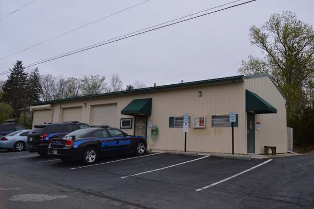
Photo: Nyttend, via Wikimedia Commons, public domain · Wikimedia Commons
Local history sources: shawneehillsoh.org · en.wikipedia.org · en.wikipedia.org · en.wikipedia.org · en.wikipedia.org · commons.wikimedia.org
Water
Del-Co's own raw-water intake on O'Shaughnessy Reservoir (Scioto River) near Rathbone, Concord Township The water here
- Del-co Water Company, Inc.84% of residentsOlentangy River, O'Shaughnessy and Alum Creek reservoirs, plus Knox County wells
- Columbus Public Water System16% of residentsScioto River (Griggs & O'Shaughnessy), Hoover Reservoir on Big Walnut Ck, plus wells
Its ZIP codes
Each ZIP code that touches Shawnee Hills, with the share of its residents who live here and the same headline figures as the ZIP page.
| ZIP | Share | Water | Radon | Home value | Schools | Flood |
|---|---|---|---|---|---|---|
| 43065 Powell | 2% | Del-Co's own raw-water intake on O'Shaughnessy Reservoir (Scioto River) near Rathbone, Concord Township | 6.2 pCi/L average radon | Parcel list only | Olentangy Local · 5 stars overall | 0.3% of residents in the 1% floodplain |
The county
Delaware County: 11 ZIP codes, 26 cities, villages and townships, 214,126 people.
Nearby places
Cite this page
Cite this page as:
Cracked Buckeye (Open Shower Co), "Shawnee Hills, Delaware County", https://crackedbuckeye.com/place/shawnee-hills/, built 2026-09-16, accessed [date].
Machine-readable: /api/place/shawnee-hills.json (open JSON, CC BY 4.0 for the compilation; the underlying records keep their own terms) · How to cite · Report a correction · Built 2026-09-16