How Brown Township, Franklin County began
Brown Township, in western Franklin County along Big Darby Creek, was carved from parts of Norwich, Prairie, and Washington townships and organized separately in the spring of 1830. It lies in the Virginia Military District, on land once owned by Michael Sullivant and Lyne Starling, kin of Franklinton founder Lucas Sullivant. Its main town, Hilliard, grew from a ten-acre purchase by John Reed Hilliard in 1852 into a station on the Piqua and Indiana Railroad, platted in 1853 and incorporated as a village in 1869. Today most of the township's population lives in and around Hilliard, while outlying land remains in farms.
Settled by 1810, incorporated 1830.
Where the name comes from
The 1880 county history does not explain why the township is called Brown; it simply records that 'the territory, as at present embraced within the boundaries of Brown township, was formerly a part of the townships of Norwich, Prairie, and Washington,' and 'was erected a separate township in the spring of 1830.' No source consulted confirms who or what the name honors.
Before the town
The 1880 county history records that along Big Darby Creek 'there existed ... many evidences of that mysterious people ... the Mound Builders': an extensive mound remained on Henry Francis's farm, and an earthwork fort with 'two circles, enclosing perhaps one-half acre' stood on the property of H. C. Alder, with stone hatchets, arrow points, and skinning knives found in the area. As with neighboring townships, the source does not name the culture responsible, though the mound-and-earthwork pattern matches the Adena and Hopewell traditions documented elsewhere in central Ohio. No historic-era Native village, trail, or camp is recorded specifically within the township. Brown Township lies within the Virginia Military District, the irregularly surveyed tract Virginia set aside for its Revolutionary War veterans west of the Scioto River; the 1880 history records that 'Michael Sullivant and Lyne Starling formerly owned much of the land in this township,' and that a later landowner, S. J. Woolley, bought part of his farm 'from Mr. M. L. Sullivant, the great Illinois farmer' at fifteen dollars an acre. This is the same Sullivant family whose patriarch, Lucas Sullivant, surveyed the Virginia Military District for the state of Virginia and founded Franklinton, Franklin County's first permanent settlement, in 1797. The land itself was opened to settlement by the Treaty of Greenville, signed August 3, 1795, in which the Wyandot, Shawnee, Lenape (Delaware), Miami, Ottawa and other nations ceded most of what is now Ohio to the United States.
Nations recorded here: Wyandot, Shawnee, Lenape (Delaware), Miami, Ottawa, Adena culture, Hopewell culture.
- Henry Francis farm mound (mound) — Henry Francis's farm, along Big Darby Creek, Brown Township, unknown (pre-contact) (ohiogenealogyexpress.com)
- H. C. Alder earthwork fort (earthwork) — H. C. Alder's property, Brown Township, unknown (pre-contact) (ohiogenealogyexpress.com)
Timeline
- — The Treaty of Greenville cedes most of what becomes Ohio, including the future Brown Township, to the United States.
- — Lucas Sullivant founds Franklinton, Franklin County's first permanent settlement; his family later holds much of the land that becomes Brown Township.
- — John Patterson, from Virginia, settles in the area; Adam Blount, also from Virginia, is remembered as the township's earliest settler (date not given), arriving with his son-in-law Joseph Belchey.
- — John Hayden arrives from Pennsylvania.
- — The township's first school opens for the winter term in a log cabin on Adam Blount's farm, taught by Marantha Adams.
- — Brown Township is organized in the spring, separated out of Norwich, Prairie, and Washington townships.
- — Isaac Hayden builds the township's first sawmill, on Big Darby Creek.
- — The Welsh Congregational Church organizes; it builds a brick church building in 1860.
- — John Reed Hilliard buys ten acres of farmland from Hoseah High and Abraham Wendell in what becomes the town of Hilliard.
- — Hilliard is platted by John Hilliard on September 1, beside the route of the Piqua and Indiana Railroad.
- — A post office opens as Hilliard's Station; the word 'Station' is later dropped from the town's name.
- — The Village of Hilliard is incorporated on July 13, with 280 residents.
- — Hilliard's first railroad depot is built on the north side of the tracks, west of Main Street.
- — Railroad passenger and freight service through Hilliard ends.
Stories
Land of the Sullivants
Long before Brown Township had a name of its own, much of its ground belonged to two men: Michael Sullivant and Lyne Starling. The Sullivant name runs through the whole history of Franklin County — Lucas Sullivant, Michael's relative, had surveyed the Virginia Military District for the state of Virginia in the 1790s and used his fee to found Franklinton, the county's first permanent settlement, in 1797. Decades later, the 1880 county history notes that one local farmer, S. J. Woolley, bought part of his land 'from Mr. M. L. Sullivant, the great Illinois farmer,' at fifteen dollars an acre — a reminder that the family's landholdings, and its wealth, had by then spread far beyond Ohio.
The Mound Builders of Big Darby Creek
When nineteenth-century farmers worked the bottomland along Big Darby Creek, they kept turning up evidence of an older world. The 1880 county history describes 'many evidences of that mysterious people ... the Mound Builders' along the creek: a substantial mound still standing on Henry Francis's farm, and, on land owned by H. C. Alder, the remains of an earthwork fort made of two circles enclosing about half an acre. Stone hatchets, arrow points, and skinning knives turned up in the fields nearby. Nobody working the land in 1880 could say who had built the fort or piled the mound — only that someone had lived and worked this same stretch of creek long before Ohio was a state.
A Farm Becomes a Railroad Town
Hilliard exists because a farmer named John Reed Hilliard bought ten acres from Hoseah High and Abraham Wendell in 1852 and, the next year, platted a town on it along the coming route of the Piqua and Indiana Railroad. He called it Hilliard's Station, and when a post office opened there in 1854, the name stuck in shortened form. The location proved well chosen: the depot became, as one history puts it, 'an ideal shipping point for agricultural products going to market and supplies coming to the farmers in the area,' and the village grew quickly enough to incorporate by 1869, with 280 residents. Trains kept running through the middle of town until 1962, when rail service finally ended.
A Congregation, and Later a Barn
Not every institution in Brown Township's early history survived. The 1880 county history mentions a McCoy Methodist Episcopal congregation that once served local families, in a building that by 1880 had been converted into a barn — a small, matter-of-fact detail that captures how quickly rural congregations could rise and fade as population shifted. The Welsh Congregational Church fared better: organized in 1845 by the area's Welsh farm families, it built a lasting brick church in 1860 that outlived its Methodist neighbor by generations.
Photographs
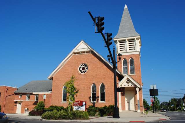
Photo: Wdzinc, via Wikimedia Commons, CC BY-SA 4.0 · Wikimedia Commons
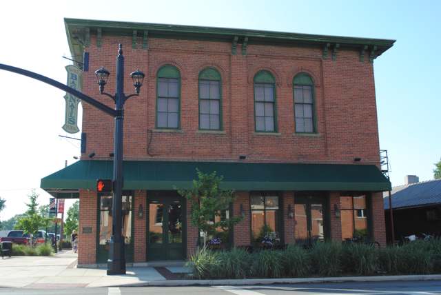
Photo: Wdzinc, via Wikimedia Commons, CC BY-SA 4.0 · Wikimedia Commons
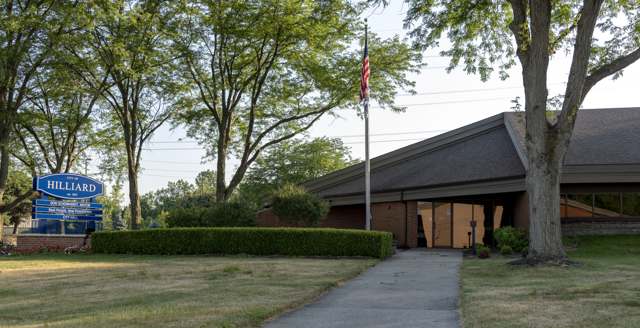
Photo: Sixflashphoto, via Wikimedia Commons, CC BY-SA 4.0 · Wikimedia Commons
Local history sources: ohiogenealogyexpress.com · en.wikipedia.org · en.wikipedia.org · en.wikipedia.org · en.wikipedia.org · en.wikipedia.org · commons.wikimedia.org · commons.wikimedia.org · commons.wikimedia.org
Water
Scioto River intake at the plant on Dublin Rd, a few miles below Griggs Dam, opposite Marble Cliff The water here
- Columbus Public Water System97% of residentsScioto River (Griggs & O'Shaughnessy), Hoover Reservoir on Big Walnut Ck, plus wells
- Aqua Ohio - Lake Darby3% of residentsGroundwater wells (2 wells)
- Greentree Mobile Home Park0% of residentsGroundwater wells (1 wells)
- Aqua Ohio - Timberbrook Pw0% of residentsGroundwater wells (2 wells)
- Suburbans Community MHP0% of residentsGroundwater wells (2 wells)
Its ZIP codes
Each ZIP code that touches Brown Township, Franklin County, with the share of its residents who live here and the same headline figures as the ZIP page.
| ZIP | Share | Water | Radon | Home value | Schools | Flood |
|---|---|---|---|---|---|---|
| 43026 Hilliard | 3% | Scioto River intake at the plant on Dublin Rd, a few miles below Griggs Dam, opposite Marble Cliff | 6.2 pCi/L average radon | Median year built 1995 | Hilliard City · 4 stars overall | 3.0% of residents in the 1% floodplain |
| 43119 Columbus and Galloway | 2% | Scioto River intake at the plant on Dublin Rd, a few miles below Griggs Dam, opposite Marble Cliff | 6.0 pCi/L average radon | Median year built 1996 | South-Western City · 3 stars overall | 2.1% of residents in the 1% floodplain |
The county
Franklin County: 45 ZIP codes, 42 cities, villages and townships, 1,356,733 people.
Nearby places
Cite this page
Cite this page as:
Cracked Buckeye (Open Shower Co), "Brown Township, Franklin County", https://crackedbuckeye.com/place/brown-township-franklin-county/, built 2026-09-16, accessed [date].
Machine-readable: /api/place/brown-township-franklin-county.json (open JSON, CC BY 4.0 for the compilation; the underlying records keep their own terms) · How to cite · Report a correction · Built 2026-09-16