Local events in Oxford
134 events in the next 90 days from 4 public calendars. All local events in Oxford
Checked October 20; the events page is refreshed daily.
Lakes near Oxford
The history under the water: the valley before, the dam, the stories. All Ohio lakes
Deep dives about Oxford
Long reads built from maps, newspapers and public records. All deep dives
Notable people from Oxford
Ohioans tied to this place, each with a sourced profile. All notable Ohioans
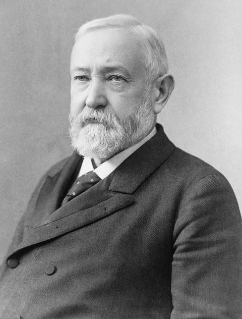 Benjamin Harrison1833-1901Twenty-third president, grandson of William Henry Harrison, born at North Bend a...
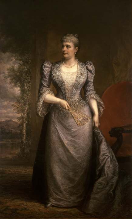 Caroline Harrison1832-1892Oxford-born music teacher and china painter who was first lady from 1889 to 1892...
 Rita Dove1952-Akron-born poet whose Thomas and Beulah, about her grandparents' life in Akron, ...
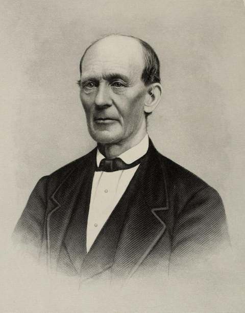 William Holmes McGuffey1800-1873Miami University professor who compiled the first McGuffey Eclectic Readers in O...
History from Oxford
People and inventions tied to this place, each with its sources. All people · All inventions
Videos about Oxford
Short videos we made from the old maps and records. All videos

How Oxford began
Oxford exists because of Miami University: Congress granted Ohio a full township of land in 1803 to endow a state college, the legislature chose the site along Four Mile Creek, and the university was chartered in 1809, a year before James Heaton platted the town of Oxford itself in 1810, naming it for England's university city. The village incorporated in 1830 with 128 original lots and grew slowly through the 19th century as a college town, home also to the Western College for Women (1853-1974) and Oxford College for Women (1867-1928), both later merged into Miami University. Elliott Hall on the Miami campus was the birthplace of Phi Delta Theta fraternity in 1848, one of the 'Miami Triad' of national fraternities founded there, and in June 1964 Western College hosted the volunteer training sessions for the Mississippi Freedom Summer campaign, days before three of the project's civil rights workers were murdered in Mississippi. Oxford became a city in 1971 and remains, above all, a university town.
Platted 1810, incorporated 1830 (city status 1971), by James Heaton, under a February 6, 1810 Ohio General Assembly order.
Where the name comes from
Oxford was named for Oxford, England, home of the University of Oxford, reflecting the town's founding purpose as the site of Ohio's new state university (chartered as Miami University in 1809, a year before the town itself was platted).
Before the town
No Native village, trail, or burial site specifically within Oxford was found in the sources consulted. Miami and Shawnee people were present in the Great and Little Miami valleys before the 1795 Treaty of Greenville. The township that became Oxford was itself set aside by Congress in 1803, eight years after that treaty ceded the land, for the university that gave the town its purpose.
Timeline
- — Congress grants Ohio one full township of land, later sited along Four Mile Creek, to endow a state university.
- — Miami University is chartered, a year before the town of Oxford is platted around it.
- — James Heaton plats the town of Oxford on March 29, following a February 6 Ohio General Assembly order, naming it for Oxford, England.
- — Elliott Hall is built on the Miami University campus.
- — Oxford incorporates as a village with 128 original lots; population is 258 by 1820 and grows gradually thereafter.
- — William Holmes McGuffey, a Miami University professor and compiler of the widely used McGuffey Readers, builds his home on campus.
- — Six Miami University students found Phi Delta Theta fraternity on December 26 in Elliott Hall, one of the three 'Miami Triad' fraternities founded on campus.
- — Western College for Women is founded in Oxford; it merges into Miami University in 1974.
- — Oxford College for Women is founded; it merges into Miami University in 1928.
- — Western College for Women hosts two week-long Freedom Summer volunteer training sessions, June 14-27, preparing over 1,000 mostly student volunteers for civil rights work in Mississippi.
- — Oxford becomes a city.
Stories
Training ground for Freedom Summer
In June 1964, Western College for Women's campus in Oxford filled with more than a thousand mostly white, mostly affluent college students from across the country, gathered for two week-long orientation sessions ahead of the Mississippi Freedom Summer voter-registration campaign. Organizers had originally planned to hold the training at Berea College in Kentucky, but switched to Oxford after Berea's alumni objected; once in Ohio, staff screened out volunteers who showed what organizers called a 'John Brown complex,' drilling into everyone that they were there to support local Black Mississippians' own organizing, not to rescue anyone. The first session ran June 14 to 20, the second beginning June 21 -- the same day three civil rights workers connected to the campaign, James Chaney, Andrew Goodman, and Michael Schwerner, were arrested and released from a Mississippi jail, then abducted and murdered by Ku Klux Klan members near Philadelphia, Mississippi. The Oxford training sessions continued even as word of the disappearances reached campus, and Miami University's Western campus, home to Kumler Chapel, is remembered today as the place where Freedom Summer volunteers learned what they were walking into before most of them ever crossed into Mississippi.
A snowball fight and a fraternity
Elliott Hall, one of the oldest buildings on the Miami University campus, was the site on December 26, 1848 of a very different kind of founding. Six students -- Robert Morrison, John McMillan Wilson, Robert Thompson Drake, John Wolfe Lindley, Ardivan Walker Rodgers, and Andrew Watts Rogers, later remembered as the 'Immortal Six' -- organized a new secret society the day after Christmas, in the aftermath of what students called the Great Snowball Rebellion of 1848, a campus disturbance that had led to expulsions. That society became Phi Delta Theta, one of three national fraternities founded at Miami and grouped together as the 'Miami Triad' along with Beta Theta Pi and Sigma Chi -- a small-college snowball fight's improbable legacy in the modern Greek system.
Photographs
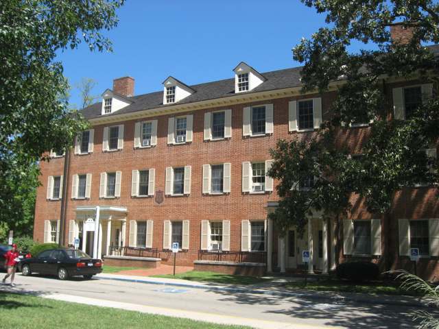
Photo: Nyttend, public domain · Wikimedia Commons
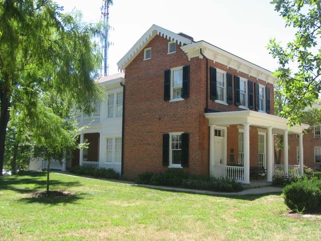
Photo: Nyttend, public domain · Wikimedia Commons
Local history sources: en.wikipedia.org · en.wikipedia.org · en.wikipedia.org · commons.wikimedia.org · commons.wikimedia.org
Historic places
11 places in Oxford on the National Register of Historic Places, 2 of them National Historic Landmarks. Press a pin or a name for its whole record.
-
Langstroth Cottage LandmarkBuilding · Oxford · listed 1976
- Address
- 303 Patterson Ave.
- Where
- Oxford, Butler County · ZIP 45056
- What it is
- Building
- Listed on the National Register
- 1976
- National Historic Landmark
- Yes
- NRIS reference number
- 76001378
- Coordinates
- 39.50658, -84.73017
National Register file (NPS) ↗ Search Wikipedia ↗ Street map and directions ↗ On the Cracked Buckeye map
-
McGuffey, William H., House LandmarkBuilding · Oxford · listed 1966
- Address
- 401 E. Spring St.
- Where
- Oxford, Butler County · ZIP 45056
- What it is
- Building
- Listed on the National Register
- 1966
- National Historic Landmark
- Yes
- NRIS reference number
- 66000605
- Coordinates
- 39.50706, -84.73597
National Register file (NPS) ↗ Search Wikipedia ↗ Street map and directions ↗ On the Cracked Buckeye map
-
Alexander, Dr. William S., HouseBuilding · Oxford · listed 1987
- Address
- 22 N. College Ave.
- Where
- Oxford, Butler County · ZIP 45056
- What it is
- Building
- Listed on the National Register
- 1987
- NRIS reference number
- 86003498
- Coordinates
- 39.51121, -84.74561
National Register file (NPS) ↗ Search Wikipedia ↗ Street map and directions ↗ On the Cracked Buckeye map
-
Dewitt, Zachariah Price, CabinBuilding · Oxford · listed 1973
- Address
- E of Oxford on U.S. 73
- Where
- Oxford, Butler County · ZIP 45056
- What it is
- Building
- Listed on the National Register
- 1973
- NRIS reference number
- 73001392
- Coordinates
- 39.51068, -84.71864
National Register file (NPS) ↗ Search Wikipedia ↗ Street map and directions ↗ On the Cracked Buckeye map
-
Elliott and Stoddard Halls, Miami UniversityBuilding · Oxford · listed 1973
- Address
- Miami University campus
- Where
- Oxford, Butler County · ZIP 45056
- What it is
- Building
- Listed on the National Register
- 1973
- NRIS reference number
- 73001391
- Coordinates
- 39.50875, -84.73510
National Register file (NPS) ↗ Search Wikipedia ↗ Street map and directions ↗ On the Cracked Buckeye map
-
Herron GymnasiumBuilding · Oxford · listed 1979
- Address
- Miami University campus
- Where
- Oxford, Butler County · ZIP 45056
- What it is
- Building
- Listed on the National Register
- 1979
- NRIS reference number
- 79001788
- Coordinates
- 39.50954, -84.73380
National Register file (NPS) ↗ Search Wikipedia ↗ Street map and directions ↗ On the Cracked Buckeye map
-
Kumler, Elias, HouseBuilding · Oxford · listed 1980
- Address
- 120 S. Main St.
- Where
- Oxford, Butler County · ZIP 45056
- What it is
- Building
- Listed on the National Register
- 1980
- NRIS reference number
- 80002948
- Coordinates
- 39.50836, -84.74250
National Register file (NPS) ↗ Search Wikipedia ↗ Street map and directions ↗ On the Cracked Buckeye map
-
Maltby, Henry, HouseBuilding · Oxford · listed 1979
- Address
- 216 E. Church St
- Where
- Oxford, Butler County · ZIP 45056
- What it is
- Building
- Listed on the National Register
- 1979
- NRIS reference number
- 79001789
- Coordinates
- 39.51179, -84.73849
National Register file (NPS) ↗ Search Wikipedia ↗ Street map and directions ↗ On the Cracked Buckeye map
-
Oxford Female InstituteBuilding · Oxford · listed 1976
- Address
- High St. and College Ave.
- Where
- Oxford, Butler County · ZIP 45056
- What it is
- Building
- Listed on the National Register
- 1976
- NRIS reference number
- 76001379
- Coordinates
- 39.50995, -84.74600
National Register file (NPS) ↗ Search Wikipedia ↗ Street map and directions ↗ On the Cracked Buckeye map
-
Oxford Railroad Depot and Junction HouseBuilding · Oxford · listed 1980
- Address
- S. Elm and W. Spring St.
- Where
- Oxford, Butler County · ZIP 45056
- What it is
- Building
- Listed on the National Register
- 1980
- NRIS reference number
- 80002949
- Coordinates
- 39.50764, -84.74741
National Register file (NPS) ↗ Search Wikipedia ↗ Street map and directions ↗ On the Cracked Buckeye map
-
Sigma Aplpha Epsilon Chapter House of Miami UniversityBuilding · Oxford · listed 2005
- Address
- 310 Tallawanda Rd.
- Where
- Oxford, Butler County · ZIP 45056
- What it is
- Building
- Listed on the National Register
- 2005
- NRIS reference number
- 05000022
- Coordinates
- 39.51419, -84.73506
National Register file (NPS) ↗ Search Wikipedia ↗ Street map and directions ↗ On the Cracked Buckeye map
Source: National Park Service, National Register of Historic Places point file. The listing year is shown where NPS's certification date agrees with the listing's reference number. Listing recognizes significance; it does not restrict a private owner.
Water
Seven active wells drawing from the sand-and-gravel Great Miami buried valley aquifer near Oxford The water here
- Oxford City81% of residentsGreat Miami Buried Valley Aquifer (wells)
- Southwest Regional Water District19% of residentsGreat Miami Buried Valley Aquifer (wells)
Hospitals, fire stations and more
Inside Oxford's boundary: 1 hospital, 1 health center, 1 nursing home, 1 fire or EMS station, 1 college, 3 public schools, 1 private school, 1 library, 5 museums, 2 police stations, 8 public charging sites, 1 Toxics Release Inventory facility, 1 station or terminal and 9 spill cases. Press a pin or a name for its whole record and its source.
Hospitals (1)
-
Mccullough - Hyde Memorial HospGeneral hospital · Oxford
- What it is
- General hospital
- Address
- 110 N Poplar Street, Oxford, OH 45056
- County
- Butler County
- Beds
- 76
- Helipad
- Yes
- Ownership
- Non-profit
- Medicare overall rating
- 3 of 5 stars
- Emergency department (Medicare)
- Yes
- Medicare reports it as
- Mccullough-Hyde Memorial Hospital
- Phone
- (513) 524-5502
- Medicare ID
- 360046
Medicare Care Compare ↗ Where HIFLD got this record ↗ HIFLD hospitals (source) ↗ Street map and directions ↗
Source: HIFLD hospitals inventory via FEMA (closed hospitals it still lists left out, hospitals opened since added), with Medicare Care Compare ratings matched by name and address.
Community health centers (1)
-
Oxford Community Health CenterHealth center · Oxford
- Run by
- a federally qualified health center
- Setting
- Clinic
- City
- Oxford
- Coordinates
- 39.51104, -84.75008
Find a Health Center (HRSA) ↗ HRSA data (source) ↗ Street map and directions ↗
Source: HRSA health center service delivery sites, active, September 2026 (school-based sites left out). Health centers see patients whether or not they have insurance, with fees on a sliding scale.
Nursing homes (1)
-
Knolls of Oxford5 of 5 stars · Oxford
- Address
- 6727 Contreras Road, Oxford, OH 45056
- Certified beds
- 50
- Residents on an average day
- 45
- Medicare overall rating
- 5 of 5 stars
- Health inspections
- 5 of 5 stars
- Staffing
- 4 of 5 stars
- Quality measures
- 5 of 5 stars
- Penalties since 2023
- none
- Ownership
- Non profit - Corporation
- Chain
- BHI SENIOR LIVING
- Continuing care retirement community
- Yes
- Takes
- Medicare and Medicaid
- Phone
- (513) 524-7980
- Medicare ID
- 366282
Medicare Care Compare ↗ CMS nursing home data (source) ↗ Street map and directions ↗
Source: CMS Care Compare nursing home provider and penalties files; Medicare star ratings run 1 to 5.
Fire and EMS stations (1)
-
Oxford Fire DepartmentOxford
- Address
- 217 South Elm Street, Oxford, OH 45056
- Coordinates
- 39.50783, -84.74688
USGS National Map structures (source) ↗ Street map and directions ↗
Source: USGS National Map structures (most Ohio records last updated 2019 to 2022), checked against the Columbus and Cleveland station lists. The department that answers a call is set by jurisdiction and mutual aid, not by distance.
Colleges (1)
-
Miami University-OxfordPublic university · Oxford
- What it is
- Public university
- City
- Oxford
- Students, 2023-24 (12-month count)
- 19,817
- Tuition and fees, in state
- $17,809
- Tuition and fees, out of state
- $40,025
- Graduation rate
- 82% of bachelor's students, within six years (a class of 3,817)
- IPEDS unit ID
- 204024
College Navigator (NCES) ↗ IPEDS data (source) ↗ Street map and directions ↗
Source: NCES IPEDS 2024 directory, 2023-24 enrollment and tuition, graduation rates for the 2017 (four-year) and 2020 (two-year) entering classes.
Public schools (3)
-
Kramer Elementary School4 of 5 stars · Oxford
- Address
- 400 W Sycamore St, Oxford, OH 45056
- School district
- Talawanda City School District
- Kind (NCES)
- Regular School
- Students, 2023-24
- 529
- Teachers (full-time equivalent)
- 26
- Report card, 2025-26
- 4 of 5 stars
- Performance index
- 80.3%
- Ohio building IRN
- 019323
- NCES school ID
- 390461502454
NCES school record ↗ Ohio School Report Card ↗ Street map and directions ↗
-
Talawanda High School4 of 5 stars · Oxford
- Address
- 5301 University Park Blvd, Oxford, OH 45056
- School district
- Talawanda City School District
- Kind (NCES)
- Regular School
- Students, 2023-24
- 901
- Teachers (full-time equivalent)
- 54
- Report card, 2025-26
- 4 of 5 stars
- Performance index
- 79.4%
- Four-year graduation rate
- 99.6%
- Ohio building IRN
- 036863
- NCES school ID
- 390461502460
NCES school record ↗ Ohio School Report Card ↗ Street map and directions ↗
-
Talawanda Middle School4 of 5 stars · Oxford
- Address
- 4030 Oxford Reily Rd, Oxford, OH 45056
- School district
- Talawanda City School District
- Kind (NCES)
- Regular School
- Students, 2023-24
- 673
- Teachers (full-time equivalent)
- 45
- Report card, 2025-26
- 4 of 5 stars
- Performance index
- 79.7%
- Ohio building IRN
- 099754
- NCES school ID
- 390461504370
NCES school record ↗ Ohio School Report Card ↗ Street map and directions ↗
Source: NCES EDGE public school locations 2024-25 and Common Core of Data 2023-24 (type, students, teachers); Ohio School Report Cards 2025-26 (Department of Education and Workforce), matched by name within the district.
Private schools (1)
-
Mcguffey Montessori SchoolPrivate, nonsectarian, special program · Oxford
- Address
- 5128 Westgate Dr, Oxford, OH 45056
- Kind
- nonsectarian, special program
- Students, 2023-24
- 46
- Teachers (full-time equivalent)
- 8.3
- Students per teacher
- 5.54217
- Phone
- (513) 523-7742
- NCES private school ID
- 02118586
Source: NCES Private School Survey 2023-24.
Public libraries (1)
-
Oxford BranchBranch · Oxford
- Address
- 15 S. College Ave., Oxford, OH 45056
- What it is
- Branch
- Library system
- Lane Public Library
- Open
- 3,432 hours a year, 52 weeks
- Building
- 24,000 sq ft
- System's visits, FY2024
- 562,172
- System's loans, FY2024
- 1,860,647
- People the system serves
- 187,371
- Phone
- (513) 523-7531
IMLS Public Libraries Survey (source) ↗ Street map and directions ↗
Source: IMLS Public Libraries Survey FY2024 (outlets and their systems). Any Ohio resident can get a free card at any Ohio public library.
Museums, historical societies, gardens and zoos (5)
-
Delta Zeta National Historical MuseumHistorical society · Oxford
- What it is
- Historical society
- City
- Oxford
- Coordinates
- 39.51157, -84.73882
Search Wikipedia ↗ IMLS Museum Data Files (source) ↗ Street map and directions ↗
The museum list is IMLS's 2018 file; a museum may have closed or moved since.
-
Hefner Zoology MuseumScience or technology museum · Oxford
- What it is
- Science or technology museum
- City
- Oxford
- Coordinates
- 39.51030, -84.73522
Search Wikipedia ↗ IMLS Museum Data Files (source) ↗ Street map and directions ↗
The museum list is IMLS's 2018 file; a museum may have closed or moved since.
-
Karl Limper Geology MuseumScience or technology museum · Oxford
- What it is
- Science or technology museum
- City
- Oxford
- Coordinates
- 39.51030, -84.73522
Search Wikipedia ↗ IMLS Museum Data Files (source) ↗ Street map and directions ↗
The museum list is IMLS's 2018 file; a museum may have closed or moved since.
-
Miami University Art MuseumArt museum · Oxford
- What it is
- Art museum
- City
- Oxford
- Coordinates
- 39.51030, -84.73522
Search Wikipedia ↗ IMLS Museum Data Files (source) ↗ Street map and directions ↗
The museum list is IMLS's 2018 file; a museum may have closed or moved since.
-
William Holmes Mcguffey House And MuseumHistorical society · Oxford
- What it is
- Historical society
- City
- Oxford
- Coordinates
- 39.51030, -84.73522
Search Wikipedia ↗ IMLS Museum Data Files (source) ↗ Street map and directions ↗
The museum list is IMLS's 2018 file; a museum may have closed or moved since.
Source: IMLS Museum Data Files, 2018.
Police stations (2)
-
Miami University Police DepartmentOxford
- Address
- 4945 Oxford - Trenton Road, Oxford, OH 45056-1917
- Coordinates
- 39.50731, -84.72088
USGS National Map structures (source) ↗ Street map and directions ↗
-
Oxford Police DepartmentOxford
- Address
- 11 South Poplar Street, Oxford, OH 45056-2318
- Coordinates
- 39.51004, -84.74052
USGS National Map structures (source) ↗ Street map and directions ↗
Source: USGS National Map structures, police stations, corrected and completed by hand (September 2026). The department that answers a call is set by jurisdiction, not by distance.
Public EV charging (8)
-
BUTLERRURALELEC TALAWANDA2 Level 2 · Oxford
- Address
- 5301 University Park Blvd, Oxford, OH 45056
- Ports
- 2 Level 2
- Plugs
- J1772
- Network
- ChargePoint Network
- Hours
- 24 hours daily
- Phone
- 888-758-4389
Station Locator (NREL) ↗ Alternative Fuels Data Center (source) ↗ Street map and directions ↗
-
Miami University - Tesla Destination4 Level 2 · Oxford
- Address
- 645 E Withrow St, Oxford, OH 45056
- Ports
- 4 Level 2
- Plugs
- J1772, Tesla (NACS)
- Network
- Tesla Destination
- Phone
- 877-798-3752
Station Locator (NREL) ↗ Alternative Fuels Data Center (source) ↗ Street map and directions ↗
-
MUO CHESTNUT-EAST4 Level 2 · Oxford
- Address
- 101 W Chestnut St, Oxford, OH 45056
- Ports
- 4 Level 2
- Plugs
- J1772
- Network
- ChargePoint Network
- Hours
- 24 hours daily
- Phone
- 888-758-4389
Station Locator (NREL) ↗ Alternative Fuels Data Center (source) ↗ Street map and directions ↗
-
MUO DITMER-WEST4 Level 2 · Oxford
- Address
- 4945 Oxford Trenton Rd, Oxford, OH 45056
- Ports
- 4 Level 2
- Plugs
- J1772
- Network
- ChargePoint Network
- Hours
- 24 hours daily
- Phone
- 888-758-4389
Station Locator (NREL) ↗ Alternative Fuels Data Center (source) ↗ Street map and directions ↗
-
MUO MARCUM CONF CTR2 Level 2 · Oxford
- Address
- 951 E Withrow St., Oxford, OH 45056
- Ports
- 2 Level 2
- Plugs
- J1772
- Network
- ChargePoint Network
- Hours
- 24 hours daily
- Phone
- 888-758-4389
Station Locator (NREL) ↗ Alternative Fuels Data Center (source) ↗ Street map and directions ↗
-
MUO MILLETT-WEST4 Level 2 · Oxford
- Address
- Weeb Ewbank Way, Oxford, OH 45056
- Ports
- 4 Level 2
- Plugs
- J1772
- Network
- ChargePoint Network
- Hours
- 24 hours daily
- Phone
- 888-758-4389
Station Locator (NREL) ↗ Alternative Fuels Data Center (source) ↗ Street map and directions ↗
-
PARKING GARAGE STATION 12 Level 2 · Oxford
- Address
- 6 W Walnut St, Oxford, OH 45056
- Ports
- 2 Level 2
- Plugs
- J1772
- Network
- ChargePoint Network
- Hours
- 24 hours daily
- Phone
- 888-758-4389
Station Locator (NREL) ↗ Alternative Fuels Data Center (source) ↗ Street map and directions ↗
-
TRIHEALTH MHMH2 Level 2 · Oxford
- Address
- 110 N Poplar St, Oxford, OH 45056
- Ports
- 2 Level 2
- Plugs
- J1772
- Network
- ChargePoint Network
- Hours
- 24 hours daily
- Phone
- 888-758-4389
Station Locator (NREL) ↗ Alternative Fuels Data Center (source) ↗ Street map and directions ↗
Source: NREL Alternative Fuels Data Center station list (May 2026), public and open stations, the posts at one address counted as one site.
Facilities reporting toxic releases (1)
-
Schneider ElectricToxics Release Inventory · Oxford
- Address
- 5735 College Corner Road, Oxford, OH 45056
- County
- Butler County
- Status
- Reports to the Toxics Release Inventory (active)
- EPA program ID
- 45056SQRDC5735C
- EPA registry ID
- 110000392637
EPA facility record ↗ EPA Facility Registry Service (source) ↗ Street map and directions ↗
Source: EPA Facility Registry Service, Toxics Release Inventory reporters. Reporting a release is required of large users of listed chemicals; it is not by itself a violation.
Stations and terminals (1)
-
Miami UniversityIntercity bus stop · Greyhound Lines
- What it is
- Intercity bus stop
- Operator
- Greyhound Lines
- City
- Oxford
- Coordinates
- 39.50726, -84.73452
BTS Intermodal Passenger Connectivity Database (source) ↗ Street map and directions ↗
Source: BTS Intermodal Passenger Connectivity Database and National Transit Map (2025). Bus stops are counted on the card and drawn on the full map.
Spills reported since 2021 (9)
-
Oil Hydraulic Fluid(S)2024-08-22 · Oxford
- Reported
- 2024-08-22
- What spilled
- Oil Hydraulic Fluid(S)
- Largest amount reported
- 25 gallons
- Where
- Oxford, Butler County
- Ohio EPA district office
- SWDO
- Ohio EPA case number
- 2408EPA0001454
Ohio EPA spill reports (source) ↗ Street map and directions ↗
-
Fuel Gasoline ( 25% Ethanol Not E85)2024-07-23 · Oxford
- Reported
- 2024-07-23
- What spilled
- Fuel Gasoline ( 25% Ethanol Not E85)
- Where
- Oxford, Butler County
- Ohio EPA district office
- SWDO
- Ohio EPA case number
- 2407EPA0001256
Ohio EPA spill reports (source) ↗ Street map and directions ↗
-
Other / All Other / Trade Name / Mixture / Solution Etc2024-03-12 · Oxford
- Reported
- 2024-03-12
- What spilled
- Other / All Other / Trade Name / Mixture / Solution Etc
- Where
- Oxford, Butler County
- Ohio EPA district office
- SWDO
- Ohio EPA case number
- 2403EPA0000389
Ohio EPA spill reports (source) ↗ Street map and directions ↗
-
Lead (Pb)2023-05-24 · Oxford
- Reported
- 2023-05-24
- What spilled
- Lead (Pb)
- Where
- Oxford, Butler County
- Ohio EPA district office
- SWDO
- Ohio EPA case number
- 2305EPA0000859
Ohio EPA spill reports (source) ↗ Street map and directions ↗
-
Oil Petroleum Not Otherwise Specified (Nos) Reached water2023-05-16 · Oxford
- Reported
- 2023-05-16
- What spilled
- Oil Petroleum Not Otherwise Specified (Nos)
- Reached a waterway
- 99 - Unnamed
- Where
- Oxford, Butler County
- Ohio EPA district office
- SWDO
- Ohio EPA case number
- 2305EPA0000796
Ohio EPA spill reports (source) ↗ Street map and directions ↗
-
Fuel Diesel / Diesel Fuel (Vehicle On Or Off Road) Reached water2023-05-05 · Oxford
- Reported
- 2023-05-05
- What spilled
- Fuel Diesel / Diesel Fuel (Vehicle On Or Off Road)
- Largest amount reported
- 200 gallons
- Reached a waterway
- 99 - Unnamed
- Where
- Oxford, Holmes County
- Ohio EPA district office
- SWDO
- Ohio EPA case number
- 2305EPA0000728
Ohio EPA spill reports (source) ↗ Street map and directions ↗
-
Fuel Diesel / Diesel Fuel (Vehicle On Or Off Road)2023-02-07 · Oxford
- Reported
- 2023-02-07
- What spilled
- Fuel Diesel / Diesel Fuel (Vehicle On Or Off Road)
- Largest amount reported
- 40 gallons
- Where
- Oxford, Butler County
- Ohio EPA district office
- SWDO
- Ohio EPA case number
- 2302EPA0000188
Ohio EPA spill reports (source) ↗ Street map and directions ↗
-
Fuel Oil/ Home Heating / Heating Oil2022-07-12 · Oxford
- Reported
- 2022-07-12
- What spilled
- Fuel Oil/ Home Heating / Heating Oil
- Where
- Oxford, Butler County
- Ohio EPA district office
- SWDO
- Ohio EPA case number
- 2207EPA0001054
Ohio EPA spill reports (source) ↗ Street map and directions ↗
-
Refrigerant Other Or Unk Type2022-05-31 · Oxford
- Reported
- 2022-05-31
- What spilled
- Refrigerant Other Or Unk Type
- Where
- Oxford, Butler County
- Ohio EPA district office
- SWDO
- Ohio EPA case number
- 2205EPA0000800
Ohio EPA spill reports (source) ↗ Street map and directions ↗
Source: Ohio EPA emergency response spill reports, 2021 to September 2026, one point per case where Ohio EPA placed it. A report is what the caller or responder recorded; amounts are often blank or estimated.
Its ZIP codes
Each ZIP code that touches Oxford, with the share of its residents who live here and the same headline figures as the ZIP page.
| ZIP | Share | Water | Radon | Home value | Schools | Flood |
|---|---|---|---|---|---|---|
| 45056 Oxford | 80% | Seven active wells drawing from the sand-and-gravel Great Miami buried valley aquifer near Oxford | 3.8 pCi/L average radon | Median year built 1975 | Talawanda City · 4.5 stars overall | 0.2% of residents in the 1% floodplain |
Local government
Who holds office in Oxford, how its elections and ballot issues came out, and the state auditor's record.
Who holds office
| Office | Name | Party | Term ends | Contact |
|---|---|---|---|---|
| Member of Council | Mike Smith | 11/02/2027 | ||
| Member of Council | Jason Bracken | 11/02/2027 | ||
| Member of Council | William B. Snavely | 11/02/2027 | ||
| Member of Council | Amber Franklin | 11/06/2029 | ||
| Member of Council | Alexandria French | 11/06/2029 | ||
| Member of Council | Roxanne Ornelas | 11/06/2029 | ||
| Member of Council | James Vinch | 11/06/2029 |
Roster as of 2026-07-27: county board of elections.
Auditor of State record
- No fiscal caution, watch or emergency on the Auditor of State's lists.
- Financial Health Indicators (the Auditor of State's 17 measures; critical / cautionary / positive): 2020 0 / 2 / 15; 2021 0 / 0 / 17; 2022 0 / 1 / 16; 2023 0 / 1 / 16; 2024 0 / 2 / 15; 2025 0 / 2 / 15.
- Financial Audit, 2025, released 2026-07-07
- Financial Audit, 2024, released 2025-07-08
- Financial Audit, 2023, released 2024-08-06
The county
Butler County: 13 ZIP codes, 22 cities, villages and townships, 382,868 people.
Nearby places
Rain and snow
How much has actually fallen on Oxford, day by day, from 1893 to now. Daily totals, not averages.
- rain, last 30 days
- 0.87 in
- 2026-09-30 to 2026-10-29
- rain so far in 2026
- 48.1 in
- 10.7 in above normal for the date
- snow so far in 2026
- 15.2 in
- a normal year brings 18.0 in
- a normal year
- 44.3 in
- average of 30 years, 1991-2020
| Month | Rain (in) | Snow (in) | Days counted |
|---|---|---|---|
| October 2026 | 0.87 | — | 29 |
| September 2026 | 3.60 | — | 30 |
| August 2026 | 10.59 | — | 31 |
| July 2026 | 2.67 | — | 31 |
| June 2026 | 5.28 | — | 30 |
| May 2026 | 7.42 | — | 31 |
| April 2026 | 4.40 | — | 30 |
| March 2026 | 8.85 | 0.6 | 31 |
| February 2026 | 2.71 | 2.8 | 28 |
| January 2026 | 1.70 | 11.8 | 31 |
| December 2025 | 2.40 | 10.2 | 31 |
| November 2025 | 2.77 | 1.6 | 30 |
| Wettest year | 2011 — 62.8 in |
|---|---|
| Driest year | 1934 — 22.1 in |
| Snowiest year | 1917 — 55.5 in |
| Wettest day on record | 4 January 1949 — 3.94 in |
| Heaviest snowfall in a day | 23 December 2004 — 14.33 in |
| Deepest snow on the ground | 20 December 1919 — 30.00 in |
Mostly estimated. Only 10% of these days come from a gauge standing inside Oxford - the rest are worked out from the nearest gauges around it, so read them as close estimates rather than readings.
48,224 days of records, 1893-01-01 to 2026-10-29. Source: NOAA NCEI GHCN-Daily, 3,240 gauges in and around Ohio. A day is "gauged" when a gauge standing inside the boundary reported it, and the value is the mean of those gauges. Otherwise it is interpolated by inverse distance from every gauge reporting within 50 miles. Nothing is carried forward, back-filled or smoothed. Against NOAA nClimDiv county monthly precipitation over 136,848 complete county-months (checked 2026-10-31): correlation 0.9515, median absolute difference 0.217 in a month. Built 2026-10-31 from the Cracked Buckeye precipitation archive. Snow is the softer number — snowfall is measured by hand with a ruler, no agency publishes a gridded county snowfall series, and blowing snow defeats every observer.
Environmental permits and filings
What Ohio EPA has on file for Oxford: permits, inspections, violations, cleanups and the state loans behind sewer and water work. Every line links to the agency's own document.
- facilities and sites on file
- 27
- those placed on the map inside Oxford
| Program | Facilities and sites |
|---|---|
| Wastewater and stormwater discharge | 10 |
| Air pollution | 4 |
| Sewer and water-line construction | 4 |
| Hazardous waste | 2 |
| Cessation Of Regulated Operations | 1 |
| Composting | 1 |
| Landfills | 1 |
| Public drinking water | 1 |
| State water loans | 1 |
| Voluntary cleanup | 1 |
| Wetland and stream fill | 1 |
| Date | Facility or site | What |
|---|---|---|
| OXFORD MUNICIPAL LANDFILL | Landfills report | |
| OXFORD TRACTOR SUPPLY | Wastewater and stormwater discharge permit | |
| OXFORD CITY PWS | Public drinking water notice of violation | |
| MIAMI UNIVERSITY-NEW ARENA | Sewer and water-line construction permit | |
| MIAMI UNIVERSITY-NEW ARENA | Sewer and water-line construction permit | |
| OXFORD CITY PWS | Public drinking water plan | |
| FOUR MILE CREEK DAM REMOVAL & RESTORATION | Wetland and stream fill permit | |
| OXFORD TRACTOR SUPPLY | Wastewater and stormwater discharge inspection | |
| MIAMI UNIVERSITY-NEW ARENA | Wastewater and stormwater discharge permit | |
| OXFORD MUNICIPAL LANDFILL | Landfills inspection | |
| OXFORD MUNICIPAL LANDFILL | Landfills inspection | |
| OXFORD MUNICIPAL LANDFILL | Landfills permit | |
| MIAMI UNIVERSITY-NEW ARENA | Sewer and water-line construction permit | |
| OXFORD CITY PWS | Public drinking water plan | |
| OXFORD MUNICIPAL LANDFILL | Landfills report | |
| OXFORD CITY PWS | State water loans | |
| OXFORD CITY PWS | Public drinking water compliance letter | |
| OXFORD CITY PWS | State water loans | |
| OXFORD MUNICIPAL LANDFILL | Landfills inspection | |
| OXFORD MUNICIPAL LANDFILL | Cessation Of Regulated Operations inspection | |
| OXFORD CITY PWS | Public drinking water report | |
| OXFORD MUNICIPAL LANDFILL | Landfills plan | |
| SOUTH FARM IV | Wastewater and stormwater discharge permit | |
| OXFORD CITY PWS | State water loans | |
| OXFORD CITY PWS | Public drinking water plan |
Source: Ohio EPA eDocument portal (edocpub.epa.ohio.gov), indexed 2026-10-14. Facilities are placed on the map from Ohio EPA's own map layers, EPA's Facility Registry, coordinates written in the filings, or a geocoded street address. A permit filed under a private person's name (most are household septic systems) is counted but never named, placed or linked; licenses for individual workers and open-burning notices are left out entirely.
Quick answers
What county is Oxford, Ohio in?
Oxford is a city in Butler County, Ohio, with 23,049 residents.
When was Oxford, Ohio founded?
Oxford was laid out 1810; incorporated 1830 (city status 1971). Founders on record: James Heaton, under a February 6, 1810 Ohio General Assembly order. Source
How did Oxford, Ohio get its name?
Oxford was named for Oxford, England, home of the University of Oxford, reflecting the town's founding purpose as the site of Ohio's new state university (chartered as Miami University in 1809, a year before the town itself was platted). Source
What ZIP code is Oxford, Ohio?
Most of Oxford is in ZIP code 45056.
Where does Oxford, Ohio get its water?
The main water source for Oxford (Oxford City): Seven active wells drawing from the sand-and-gravel Great Miami buried valley aquifer near Oxford.
Cite this page
Cite this page as:
Cracked Buckeye, "Oxford, Butler County", https://crackedbuckeye.com/place/oxford/, built 2026-10-31, accessed [date].
How to cite · Report a correction · Built 2026-10-31
