Local events in Milford
Milford itself has 5 events posted in the next 90 days; the others here are within 10 miles. All local events in Milford
Checked October 20; the events page is refreshed daily.
History from Milford
People and inventions tied to this place, each with its sources. All people · All inventions
How Milford began
Milford grew up on a 230-acre tract first surveyed in 1788 for speculator John Nancarrow, who envisioned a future metropolis there before commercial reverses forced him to sell. The Rev. Francis McCormick settled just above the site in 1796 and, the following year, organized the first Methodist class in the Northwest Territory at his cabin -- a claim to fame the city still celebrates as the root of American Methodism west of the Appalachians. John Hageman, who bought part of the old Nancarrow survey, laid out the town on January 17, 1806, as Hageman's Mills; a local newspaper renamed it Milford that February for its status as the first safe ford north of the Ohio River on the Little Miami River. Incorporated as a village on January 23, 1836, and jokingly nicknamed "Gandertown" by 19th-century rivals, Milford became a city in 1982 and today includes the Gatch Site, a National Register-listed Hopewell-era village on the old Gatch family farm.
Settled 1796, platted 1806-01-17, incorporated 1836-01-23, by Rev. Francis McCormick (settlement, 1796); John Hageman (platted as Hageman's Mills, 1806).
Where the name comes from
The town was first platted and known as Hageman's Mills, for founder John Hageman. A local newspaper began using the name "Milford" in February 1806, for the site's status as the first safe ford across the Little Miami River north of the Ohio, a crossing point tied to the mill operations already established there; the newer name gradually displaced the old one.
Before the town
The Gatch Site, a roughly 75-acre Middle Woodland (Hopewell-era) village and burial ground on the Little Miami River, sits within present Milford on the old Gatch family farm and is listed on the National Register of Historic Places; excavations there recovered firepits, campsites and burials. The 1880 county history separately describes what is almost certainly the same complex as an 18-acre, two-part, trapezoid-shaped earthwork "near Milford, on the farm of Rev. George Gatch," with corner openings and outlying low mounds, judged from its defensible, spring-fed setting to have served a sacred purpose. No source found ties this work to a named historic nation. In the historic period the site lay within Little Miami valley country the Miami nation considered its original homeland before withdrawing northwest and the Shawnee took up the ground in turn; John Nancarrow had the original Milford survey laid out in 1788, seven years before the Treaty of Greenville formally opened the region to settlement, and Francis McCormick's 1796 settlement followed immediately after that cession.
Nations recorded here: Miami, Shawnee, Hopewell culture.
- Gatch Site / Gatch enclosure (earthwork) — within present Milford, on the Little Miami River (former George Gatch farm), Middle Woodland, Hopewell-era (en.wikipedia.org)
Timeline
- — May 28: John Nancarrow has the 230-acre tract that becomes Milford surveyed on military warrants, intending to found a great city there.
- — The Rev. Francis McCormick, a Revolutionary War veteran who had served under Lafayette at Yorktown, settles on a 1,000-acre survey above the future town site.
- — McCormick organizes the first Methodist class in the Northwest Territory at his cabin, an event Milford still commemorates as the root of Methodism in the American West.
- — December 20: Nancarrow sells the Milford survey to the Rev. Philip Gatch for $920; Gatch in turn sells part of it to Judge Ranson, who sells 64 acres to John Hageman.
- — January 17: John Hageman lays out the town, then called Hageman's Mills, into 46 lots; the following month a local newspaper begins calling the settlement Milford, for its river ford, and the name takes hold.
- — January 23: Milford is incorporated as a village by act of the Ohio General Assembly; the first village election is held March 26, electing William Williams mayor.
- — Milford's population passes 5,232, and the village becomes a city.
Stories
Gandertown
Among Milford's earliest tradesmen were the brothers Thomas and John Cook, settlers of the young village not long after John Hageman laid out its 46 original lots in 1806. Thomas Cook was, by the county historian's account, a man of prodigious physical strength, and he became locally famous for a particular feat of horsemanship: riding at a gallop through the village, he would reach up and pull the head clean off a live gander that had been suspended just low enough to be reached from the saddle, a rough-and-tumble amusement common on the frontier. The stunt was memorable enough that rival villages took to calling Milford "Gandertown" in good-natured mockery, a nickname the town wore for years before finally outgrowing it as it grew from a mill hamlet into a proper county town, incorporated in 1836 with its own mayor, recorder and marshal.
Photographs
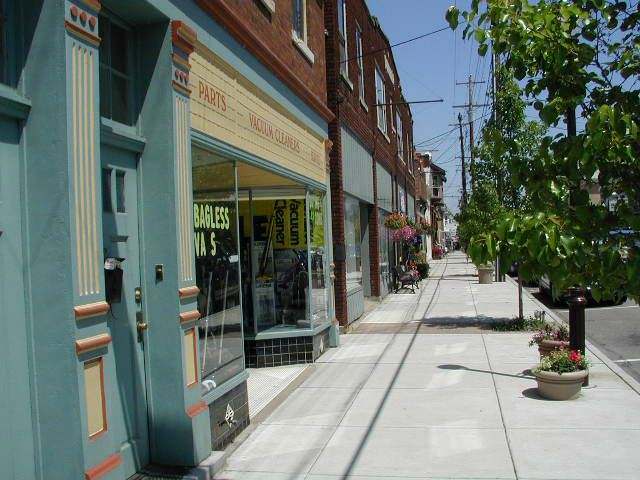
Photo: Bill Stockland, CC BY-SA 3.0 · Wikimedia Commons
Local history sources: en.wikipedia.org · archive.org · en.wikipedia.org · commons.wikimedia.org · commons.wikimedia.org
Historic places
1 place in Milford on the National Register of Historic Places. Press a pin or a name for its whole record.
-
Pleasant HillBuilding · Milford · listed 2008
- Address
- 909 OH 131
- Where
- Milford, Clermont County · ZIP 45150
- What it is
- Building
- Listed on the National Register
- 2008
- NRIS reference number
- 08000112
- Coordinates
- 39.17652, -84.25650
National Register file (NPS) ↗ Search Wikipedia ↗ Street map and directions ↗ On the Cracked Buckeye map
Source: National Park Service, National Register of Historic Places point file. The listing year is shown where NPS's certification date agrees with the listing's reference number. Listing recognizes significance; it does not restrict a private owner.
Water
Five wells in the sand-and-gravel aquifer of the Little Miami River valley at Miamiville, Miami Township The water here
- Clermont Public Water System84% of residentsWilliam H. Harsha Lake plus wells in the Little Miami River and Ohio River aquifers
- Milford City16% of residentsGroundwater wells (4 wells)
- Indian Hill City0% of residentsLittle Miami River valley aquifer (wells near Milford)
Hospitals, fire stations and more
Inside Milford's boundary: 1 nursing home, 1 fire or EMS station, 1 public school, 2 museums, 1 police station, 1 public charging site, 1 Superfund site, 1 Toxics Release Inventory facility, 5 spill cases and 1 mound or earthwork. Press a pin or a name for its whole record and its source.
Nursing homes (1)
-
S.E.M. Haven Health Care Center5 of 5 stars · Milford
- Address
- 225 Cleveland Avenue, Milford, OH 45150
- Certified beds
- 93
- Residents on an average day
- 76
- Medicare overall rating
- 5 of 5 stars
- Health inspections
- 4 of 5 stars
- Staffing
- 4 of 5 stars
- Quality measures
- 5 of 5 stars
- Penalties since 2023
- none
- Ownership
- Non profit - Other
- Chain
- UNITED CHURCH HOMES
- Takes
- Medicare and Medicaid
- Phone
- (513) 248-1270
- Medicare ID
- 365628
Medicare Care Compare ↗ CMS nursing home data (source) ↗ Street map and directions ↗
Source: CMS Care Compare nursing home provider and penalties files; Medicare star ratings run 1 to 5.
Fire and EMS stations (1)
-
Milford Community Fire DepartmentMilford
- Address
- 687 B US Highway 50, Milford, OH 45150
- Coordinates
- 39.17198, -84.27357
USGS National Map structures (source) ↗ Street map and directions ↗
Source: USGS National Map structures (most Ohio records last updated 2019 to 2022), checked against the Columbus and Cleveland station lists. The department that answers a call is set by jurisdiction and mutual aid, not by distance.
Public schools (1)
-
Pattison Elementary School4.5 of 5 stars · Milford
- Address
- 5330 S Milford Rd, Milford, OH 45150
- School district
- Milford Ex Vill School District
- Kind (NCES)
- Regular School
- Students, 2023-24
- 479
- Teachers (full-time equivalent)
- 25
- Report card, 2025-26
- 4.5 of 5 stars
- Performance index
- 88.4%
- Ohio building IRN
- 151951
- NCES school ID
- 390455004579
NCES school record ↗ Ohio School Report Card ↗ Street map and directions ↗
Source: NCES EDGE public school locations 2024-25 and Common Core of Data 2023-24 (type, students, teachers); Ohio School Report Cards 2025-26 (Department of Education and Workforce), matched by name within the district.
Museums, historical societies, gardens and zoos (2)
-
Milford Area Historical SocietyHistorical society · Milford
- What it is
- Historical society
- City
- Milford
- Coordinates
- 39.17993, -84.27799
Search Wikipedia ↗ IMLS Museum Data Files (source) ↗ Street map and directions ↗
The museum list is IMLS's 2018 file; a museum may have closed or moved since.
-
Promont House MuseumMuseum · Milford
- What it is
- Museum
- City
- Milford
- Coordinates
- 39.17993, -84.27799
Search Wikipedia ↗ IMLS Museum Data Files (source) ↗ Street map and directions ↗
The museum list is IMLS's 2018 file; a museum may have closed or moved since.
Source: IMLS Museum Data Files, 2018.
Police stations (1)
-
Milford Police DepartmentMilford
- Address
- 745 Center Street, Milford, OH 45150
- Coordinates
- 39.17753, -84.28690
USGS National Map structures (source) ↗ Street map and directions ↗
Source: USGS National Map structures, police stations, corrected and completed by hand (September 2026). The department that answers a call is set by jurisdiction, not by distance.
Public EV charging (1)
-
CORP STATIONS CORP 4- DC FAST DC fast1 DC fast · 4 Level 2 · Milford
- Address
- 401 Milford Pkwy, Milford, OH 45150
- Ports
- 1 DC fast · 4 Level 2
- Plugs
- CCS, CHAdeMO, J1772
- Network
- ChargePoint Network
- Hours
- 24 hours daily
- Phone
- 888-758-4389
Station Locator (NREL) ↗ Alternative Fuels Data Center (source) ↗ Street map and directions ↗
Source: NREL Alternative Fuels Data Center station list (May 2026), public and open stations, the posts at one address counted as one site.
Superfund sites (1)
-
Milford Contaminated Aquifer NPLSuperfund, NPL · Milford
- Address
- 101 Race Street, Milford, OH 45150
- County
- Clermont County
- Status
- On the National Priorities List
- EPA program ID
- OHSFN0507973
- EPA registry ID
- 110009305171
EPA facility record ↗ EPA Facility Registry Service (source) ↗ Street map and directions ↗
Source: EPA Facility Registry Service, Superfund (SEMS) and National Priorities List sites. Many program sites were assessed and needed no cleanup.
Facilities reporting toxic releases (1)
-
Global Scrap ManagementToxics Release Inventory · Milford
- Address
- 715 Us-50, Milford, OH 45150
- County
- Hamilton County
- Status
- Reports to the Toxics Release Inventory
- EPA program ID
- TRI_OFFSITE_864
- EPA registry ID
- 110070692112
EPA facility record ↗ EPA Facility Registry Service (source) ↗ Street map and directions ↗
Source: EPA Facility Registry Service, Toxics Release Inventory reporters. Reporting a release is required of large users of listed chemicals; it is not by itself a violation.
Spills reported since 2021 (5)
-
Sewage Human2025-05-11 · Milford
- Reported
- 2025-05-11
- What spilled
- Sewage Human
- Where
- Milford, Clermont County
- Ohio EPA district office
- SWDO
- Ohio EPA case number
- 2505EPA0000741
Ohio EPA spill reports (source) ↗ Street map and directions ↗
-
Fuel Diesel / Diesel Fuel (Vehicle On Or Off Road)2025-01-23 · Milford
- Reported
- 2025-01-23
- What spilled
- Fuel Diesel / Diesel Fuel (Vehicle On Or Off Road)
- Where
- Milford, Clermont County
- Ohio EPA district office
- SWDO
- Ohio EPA case number
- 2501EPA0000088
Ohio EPA spill reports (source) ↗ Street map and directions ↗
-
Fuel Diesel / Diesel Fuel (Vehicle On Or Off Road)2022-07-23 · Milford
- Reported
- 2022-07-23
- What spilled
- Fuel Diesel / Diesel Fuel (Vehicle On Or Off Road)
- Largest amount reported
- 50 gallons
- Where
- Milford, Clermont County
- Ohio EPA district office
- SWDO
- Ohio EPA case number
- 2207EPA0001122
Ohio EPA spill reports (source) ↗ Street map and directions ↗
-
Oil Transformer Non Pcb2022-07-18 · Milford
- Reported
- 2022-07-18
- What spilled
- Oil Transformer Non Pcb
- Largest amount reported
- 100 gallons
- Where
- Milford, Hamilton County
- Ohio EPA district office
- SWDO
- Ohio EPA case number
- 2207EPA0001090
Ohio EPA spill reports (source) ↗ Street map and directions ↗
-
Fish Kill Reached water2021-09-14 · Milford
- Reported
- 2021-09-14
- What spilled
- Fish Kill; Sewage Human
- Largest amount reported
- 3,000 gallons
- Reached a waterway
- 99 - Unnamed
- Where
- Milford, Clermont County
- Ohio EPA district office
- SWDO
- Ohio EPA case number
- 2109EPA0001453
Ohio EPA spill reports (source) ↗ Street map and directions ↗
Source: Ohio EPA emergency response spill reports, 2021 to September 2026, one point per case where Ohio EPA placed it. A report is what the caller or responder recorded; amounts are often blank or estimated.
Mounds and earthworks (1)
-
Gatch SiteEarthwork · Middle Woodland
- What it is
- Earthwork
- Also named
- Gatch Site / Gatch enclosure
- Age
- Middle Woodland, Hopewell-era
- Where
- within present Milford, on the Little Miami River (former George Gatch farm)
- County
- Clermont County
- Named in the history of
- Milford (city), Miami Township, Clermont County, Clermont County
- Map point
- from the site's Wikipedia article
Wikipedia article (point and source) ↗ Street map and directions ↗
Many mounds stand on private land; visit only those open to the public.
Source: the History records' native sites, each placed by its own Wikipedia article; sites no article places are named on the History card but not pinned.
Its ZIP codes
Each ZIP code that touches Milford, with the share of its residents who live here and the same headline figures as the ZIP page.
| ZIP | Share | Water | Radon | Home value | Schools | Flood |
|---|---|---|---|---|---|---|
| 45150 Miami Township and Milford | 19% | Five wells in the sand-and-gravel aquifer of the Little Miami River valley at Miamiville, Miami Township | 3.8 pCi/L average radon | Median year built 1982 | Milford Exempted Village · 4.5 stars overall | 1.1% of residents in the 1% floodplain |
Local government
Who holds office in Milford, how its elections and ballot issues came out, and the state auditor's record.
Money issues on the ballot since 2019: 2 of 4 passed; of those asking for new or higher taxes, 0 of 1.
Ballot issues
| Date | Issue | For | Against | Result |
|---|---|---|---|---|
| 2025-11-04 | Issue: Proposed Charter Revisions City of Milford | 523 | 617 | Failed (45.88% for) |
| 2025-11-04 | Issue 5: PROPOSED CHARTER REVISIONS CITY OF MILFORD | 3 | 3 | Failed (50.0% for) |
| 2024-11-05 | Issue: Proposed Tax Levy City of Milford | 2,178 | 1,327 | Passed (62.14% for) |
| 2024-11-05 | Issue 9: PROPOSED TAX LEVY (RENEWAL) CITY OF MILFORD | 9 | 10 | Failed (47.37% for) |
| 2021-11-02 | Issue 5: PROPOSED CHARTER AMENDMENT CITY OF MILFORD: PROPOSED REVISED CHARTER | 0 | 5 | Failed |
| 2021-11-02 | Issue 6: PROPOSED TAX LEVY (ADDITIONAL) CITY OF MILFORD: PARKS AND RECREATION | 1 | 4 | Failed (20.0% for) |
| 2019-11-05 | Issue: Milford City - Tax Levy | 928 | 313 | Passed (74.78% for) |
Elections for office
| Date | Office | Candidates and votes |
|---|---|---|
| 2025-11-04 | Member of Council-at-Large | Cathy Barney 762, 30.89%; Sandy Russell 597, 24.2%; Mike Brown 593, 24.04%; Janet Cooper 515, 20.88% |
| 2025-11-04 | Member of Council at Large | Cathy Barney 4, 25.0%; Mike Brown 4, 25.0%; Janet Cooper 4, 25.0%; Sandy Russell 4, 25.0% |
| 2023-11-07 | Member of Council-at-Large | Ralph Vilardo, Jr. 1,282, 29.96%; Brad Price 1,055, 24.66%; Mark Thompson 1,035, 24.19%; Kristopher Parrish 907, 21.2% |
| 2023-11-07 | Member of Council at Large | Mark Thompson 5, 29.41%; Ralph Vilardo, Jr. 5, 29.41%; Kristopher Parrish 4, 23.53%; Brad Price 3, 17.65% |
| 2021-11-02 | Member of Council-at-Large | Lisa Evans 909, 36.58%; Janet Cooper 797, 32.07%; Kim Chamberland 779, 31.35% |
| 2021-11-02 | Member of Council at Large | Kim Chamberland 4, 33.33%; Janet Cooper 4, 33.33%; Lisa Evans 4, 33.33% |
| 2019-11-05 | Member of Council-at-Large | Sandra K. Russell 757, 28.46%; Ted Haskins 673, 25.3%; Kyle Mitchell 628, 23.61%; Benjamin E. Redman 602, 22.63% |
| 2015-11-03 | Member of Council | Ed Brady 1,031, 24.25%; Ted Haskins 929, 21.85%; Sandy Russell 859, 20.21%; Justin A. Bonnell 754, 17.74%; Margaret Giuffre 678, 15.95%; David Grenier - WITHDREW 0 |
Winners in bold. Results from the county board of elections' official canvass unless marked.
Auditor of State record
- No fiscal caution, watch or emergency on the Auditor of State's lists.
- Financial Health Indicators (the Auditor of State's 17 measures; critical / cautionary / positive): 2020 1 / 3 / 13; 2021 0 / 2 / 15; 2022 0 / 3 / 14; 2023 0 / 2 / 15; 2024 0 / 2 / 14; 2025 0 / 2 / 14.
- OP&F Examination, 2024, released 2026-05-07
- Financial Audit, 2022 to 2023, released 2025-06-24
The county
Clermont County: 16 ZIP codes, 26 cities, villages and townships, 218,581 people.
Nearby places
Rain and snow
How much has actually fallen on Milford, day by day, from 1893 to now. Daily totals, not averages.
- rain, last 30 days
- 1.01 in
- 2026-09-29 to 2026-10-28
- rain so far in 2026
- 45.0 in
- 4.7 in above normal for the date
- snow so far in 2026
- 13.9 in
- a normal year brings 12.9 in
- a normal year
- 47.4 in
- average of 30 years, 1991-2020
| Month | Rain (in) | Snow (in) | Days counted |
|---|---|---|---|
| October 2026 | 1.01 | — | 28 |
| September 2026 | 6.71 | — | 30 |
| August 2026 | 5.55 | — | 31 |
| July 2026 | 5.42 | — | 31 |
| June 2026 | 6.27 | — | 30 |
| May 2026 | 6.59 | — | 31 |
| April 2026 | 4.18 | — | 30 |
| March 2026 | 6.63 | 0.1 | 31 |
| February 2026 | 1.14 | 4.8 | 28 |
| January 2026 | 1.51 | 8.9 | 31 |
| December 2025 | 2.75 | 10.4 | 31 |
| November 2025 | 3.94 | 1.8 | 30 |
| Wettest year | 2011 — 66.9 in |
|---|---|
| Driest year | 1901 — 22.4 in |
| Snowiest year | 2010 — 45.6 in |
| Wettest day on record | 3 August 1932 — 5.20 in |
| Heaviest snowfall in a day | 6 January 1910 — 10.00 in |
| Deepest snow on the ground | 20 January 1978 — 17.01 in |
28% of these days are measurements from a gauge inside Milford; the rest are estimated from the nearest gauges around it.
44,010 days of records, 1893-01-01 to 2026-10-28. Source: NOAA NCEI GHCN-Daily, 3,240 gauges in and around Ohio. A day is "gauged" when a gauge standing inside the boundary reported it, and the value is the mean of those gauges. Otherwise it is interpolated by inverse distance from every gauge reporting within 50 miles. Nothing is carried forward, back-filled or smoothed. Against NOAA nClimDiv county monthly precipitation over 136,848 complete county-months (checked 2026-10-31): correlation 0.9515, median absolute difference 0.217 in a month. Built 2026-10-31 from the Cracked Buckeye precipitation archive. Snow is the softer number — snowfall is measured by hand with a ruler, no agency publishes a gridded county snowfall series, and blowing snow defeats every observer.
Environmental permits and filings
What Ohio EPA has on file for Milford: permits, inspections, violations, cleanups and the state loans behind sewer and water work. Every line links to the agency's own document.
- facilities and sites on file
- 25
- those placed on the map inside Milford
| Program | Facilities and sites |
|---|---|
| Contaminated-site cleanup | 6 |
| Hazardous waste | 4 |
| Site assessment | 3 |
| State water loans | 3 |
| Air pollution | 2 |
| Public drinking water | 2 |
| Composting | 1 |
| Medical waste | 1 |
| Source-water protection | 1 |
| State sewer loans | 1 |
| Wastewater and stormwater discharge | 1 |
| Date | Facility or site | What |
|---|---|---|
| MERIDIAN BIOSCIENCE INC | Medical waste registration | |
| VALLEY VIEW FOUNDATION | Composting registration | |
| MILFORD WELL FIELD UNKNOWN SOURCE | Contaminated-site cleanup cleanup response | |
| VALLEY VIEW FOUNDATION | Composting registration | |
| MILFORD CITY PWS | Public drinking water report | |
| MILFORD WELL FIELD UNKNOWN SOURCE | Contaminated-site cleanup cleanup response | |
| VALLEY VIEW FOUNDATION | Composting registration | |
| MILFORD CITY PWS | Public drinking water withdrawn | |
| MILFORD CITY PWS | Public drinking water notice of violation | |
| MILFORD CITY PWS | Public drinking water plan | |
| MILFORD CITY PWS | Public drinking water inspection | |
| MILFORD WELL FIELD UNKNOWN SOURCE | Contaminated-site cleanup cleanup response | |
| VALLEY VIEW FOUNDATION | Composting registration | |
| EAST FORK LITTLE MIAMI RIVER | Wastewater and stormwater discharge permit | |
| MILFORD CITY PWS | Public drinking water notice of violation | |
| MILFORD WELL FIELD UNKNOWN SOURCE | Contaminated-site cleanup cleanup response | |
| MILFORD WELL FIELD UNKNOWN SOURCE | Contaminated-site cleanup cleanup response | |
| MILFORD CITY PWS | Public drinking water inspection | |
| MILFORD CITY PWS | Public drinking water report | |
| MILFORD CITY PWS | Public drinking water inspection | |
| MILFORD WELL FIELD UNKNOWN SOURCE | Contaminated-site cleanup cleanup response | |
| MILFORD WELL FIELD UNKNOWN SOURCE | Contaminated-site cleanup cleanup response | |
| MILFORD WELL FIELD UNKNOWN SOURCE | Contaminated-site cleanup cleanup response | |
| MILFORD CITY PWS | Public drinking water notice of violation | |
| MILFORD CITY PWS | Public drinking water compliance letter |
Source: Ohio EPA eDocument portal (edocpub.epa.ohio.gov), indexed 2026-10-14. Facilities are placed on the map from Ohio EPA's own map layers, EPA's Facility Registry, coordinates written in the filings, or a geocoded street address. A permit filed under a private person's name (most are household septic systems) is counted but never named, placed or linked; licenses for individual workers and open-burning notices are left out entirely.
Quick answers
What county is Milford, Ohio in?
Milford is a city in Clermont County, Ohio, with 6,586 residents.
When was Milford, Ohio founded?
Milford was settled 1796; laid out 1806-01-17; incorporated 1836-01-23. Founders on record: Rev. Francis McCormick (settlement, 1796); John Hageman (platted as Hageman's Mills, 1806). Source
How did Milford, Ohio get its name?
The town was first platted and known as Hageman's Mills, for founder John Hageman. Source
What ZIP code is Milford, Ohio?
Most of Milford is in ZIP code 45150.
Where does Milford, Ohio get its water?
The main water source for Milford (Clermont Public Water System): Five wells in the sand-and-gravel aquifer of the Little Miami River valley at Miamiville, Miami Township.
Cite this page
Cite this page as:
Cracked Buckeye, "Milford, Clermont County", https://crackedbuckeye.com/place/milford/, built 2026-10-31, accessed [date].
How to cite · Report a correction · Built 2026-10-31
