Local events in Dover
7 events in the next 90 days from 4 public calendars. All local events in Dover
Checked October 20; the events page is refreshed daily.
Lakes near Dover
The history under the water: the valley before, the dam, the stories. All Ohio lakes
How Dover began
Dover began as land platted in 1807 by Christian Deardorff and Jesse Slingluff at the mouth of Sugar Creek on the Tuscarawas River, and was known as "Canal Dover" for its place on the Ohio and Erie Canal. A post office opened in 1815, the town incorporated as a village in 1842, and it became a city under Ohio's 1903 municipal code; on February 12, 1916 it dropped the canal-era name and became simply Dover. The canal, and later the railroads, built Dover into an industrial town alongside its county-seat neighbor New Philadelphia, with which it has held a football rivalry for more than a century. It is the home of woodcarver Ernest "Mooney" Warther, whose home and workshop on Karl Avenue are preserved as a museum.
Platted 1807, incorporated 1842 (village); city under Ohio's 1903 municipal code), by Christian Deardorff and Jesse Slingluff.
Where the name comes from
The town was platted and long known as "Canal Dover," for its position on the Ohio and Erie Canal; the origin of the base name "Dover" itself is not given in the sources consulted (it may echo Dover, England or another eastern-seaboard Dover, as with many Ohio place names, but that is not confirmed here). On February 12, 1916 the city dropped the canal prefix and was renamed simply Dover.
Before the town
No Native village, mound, or treaty line specific to the Dover townsite itself is documented in the sources consulted. In outline: the Tuscarawas River valley in which Dover sits was Delaware (Lenape) country in the 18th century, part of the Great Trail/Portage Path corridor linking the Cuyahoga and Tuscarawas watersheds, and lay within the area ceded to the United States by the Treaty of Greenville in 1795 after having briefly been set as a boundary line (never enforced) by the Treaty of Fort McIntosh in 1785. The nearest documented Moravian Delaware mission towns, Schoenbrunn (1772) and Gnadenhutten (1772, site of the 1782 massacre), lay a few miles south and southeast of the Dover site along the same river. Dover's own city history page notes only that the town was "laid out" in 1807 after the valley had already passed to American settlement; it makes no claim of a Native town or camp at this specific spot.
Nations recorded here: Lenape (Delaware).
Timeline
- — Christian Deardorff and Jesse Slingluff have the land platted at the mouth of Sugar Creek on the Tuscarawas River, the beginning of the town later known as Canal Dover.
- — A post office is established at the settlement.
- — The town's first schoolhouse is built.
- — Canal Dover incorporates as a village.
- — Voters approve a $5,000 bond issue for an electric light plant, and city water works are established.
- — Canal Dover, a village since 1842, becomes a city under Ohio's new municipal code.
- — A local prohibition vote closes 22 saloons and two breweries in the city.
- — On February 12 the city officially changes its name from Canal Dover to Dover.
- — A coal strike halts steel operations in the city for 13 months.
- — On January 23 an airplane crash during a war-bond drive kills three people.
- — The Warther Family Home and Museum at 331 Karl Avenue is listed on the National Register of Historic Places on May 30 (reference #100009003).
Stories
Mooney Warther's knife and locomotives
Ernest "Mooney" Warther grew up in Dover and became known nationally as a woodcarver. Working in ebony, walnut, and ivory, he carved detailed miniature steam locomotives and other mechanical models by hand, work precise enough that it drew national attention. His home and workshop on Karl Avenue in Dover became the Warther Museum, which still displays his carvings and knives made by the family's cutlery business. The house and museum grounds were added to the National Register of Historic Places on May 30, 2023.
From canal town to steel town
Canal Dover's fortunes turned on the Ohio and Erie Canal, and by 1900 its population had grown nearly tenfold from 598 in 1840 to 5,422. The 20th century brought labor trouble along with growth: a 1920 coal strike idled the steel mills for thirteen months, and during the Second World War women at the city's steel plants produced shell casings for the war effort. A wartime tragedy struck close to home on January 23, 1943, when an airplane crashed during a local war-bond drive and killed three people.
Photographs
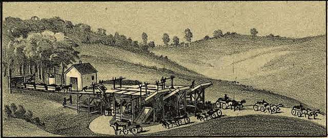
Photo: T.M. Fowler and A.E. Downs, Library of Congress Geography & Map Division (digital ID g4084d.pm006840), public domain · Wikimedia Commons
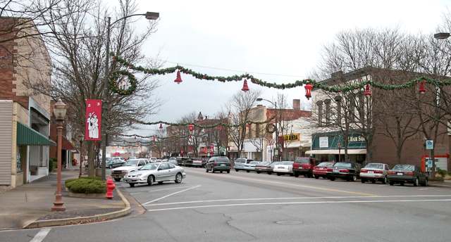
Photo: Tim Kiser (User:Malepheasant), CC BY-SA 2.5 · Wikimedia Commons
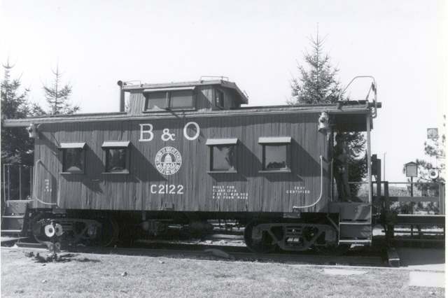
Photo: Chris Light, uploaded to Wikimedia Commons, CC BY-SA 4.0 · Wikimedia Commons
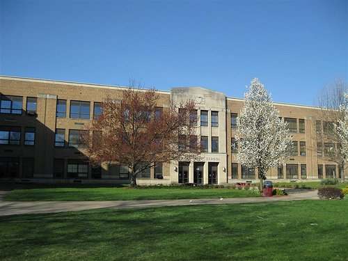
Photo: Cpage27, uploaded to Wikimedia Commons, CC BY-SA 3.0 · Wikimedia Commons
Local history sources: en.wikipedia.org · doverohio.com · en.wikipedia.org · en.wikipedia.org · en.wikipedia.org · commons.wikimedia.org · commons.wikimedia.org · commons.wikimedia.org · commons.wikimedia.org
Historic places
7 places in Dover on the National Register of Historic Places. Press a pin or a name for its whole record.
-
Bernhard, Frederick, HouseBuilding · Dover · listed 1988
- Address
- 211 E. Front St.
- Where
- Dover, Tuscarawas County · ZIP 44622
- What it is
- Building
- Listed on the National Register
- 1988
- NRIS reference number
- 88002748
- Coordinates
- 40.52231, -81.47205
National Register file (NPS) ↗ Search Wikipedia ↗ Street map and directions ↗ On the Cracked Buckeye map
-
Cooper, Katherine, HouseBuilding · Dover · listed 1996
- Address
- 118 W. 7th St.
- Where
- Dover, Tuscarawas County · ZIP 44622
- What it is
- Building
- Listed on the National Register
- 1996
- NRIS reference number
- 95001487
- Coordinates
- 40.52561, -81.48034
National Register file (NPS) ↗ Search Wikipedia ↗ Street map and directions ↗ On the Cracked Buckeye map
-
Deis, John, HouseBuilding · Dover · listed 1988
- Address
- 203 W. Sixth St.
- Where
- Dover, Tuscarawas County · ZIP 44622
- What it is
- Building
- Listed on the National Register
- 1988
- NRIS reference number
- 88000980
- Coordinates
- 40.52416, -81.48151
National Register file (NPS) ↗ Search Wikipedia ↗ Street map and directions ↗ On the Cracked Buckeye map
-
Reeves, Jeremiah, House and Carriage HouseBuilding · Dover · listed 1982
- Address
- 325 E. Iron Ave.
- Where
- Dover, Tuscarawas County · ZIP 44622
- What it is
- Building
- Listed on the National Register
- 1982
- NRIS reference number
- 82003661
- Coordinates
- 40.51586, -81.46256
National Register file (NPS) ↗ Search Wikipedia ↗ Street map and directions ↗ On the Cracked Buckeye map
-
Rinderknecht, Christian H., HouseBuilding · Dover · listed 1991
- Address
- 602 N. Wooster Ave.
- Where
- Dover, Tuscarawas County · ZIP 44622
- What it is
- Building
- Listed on the National Register
- 1991
- NRIS reference number
- 91000972
- Coordinates
- 40.52552, -81.47986
National Register file (NPS) ↗ Search Wikipedia ↗ Street map and directions ↗ On the Cracked Buckeye map
-
Slingluff, Dr. Joseph, HouseBuilding · Dover · listed 1998
- Address
- 606 N. Wooster Ave.
- Where
- Dover, Tuscarawas County · ZIP 44622
- What it is
- Building
- Listed on the National Register
- 1998
- NRIS reference number
- 98001384
- Coordinates
- 40.52570, -81.47986
National Register file (NPS) ↗ Search Wikipedia ↗ Street map and directions ↗ On the Cracked Buckeye map
-
Warther Family Home and MuseumBuilding · Dover
- Address
- 331 Karl Ave.
- Where
- Dover, Tuscarawas County · ZIP 44622
- What it is
- Building
- Latest NPS certification action
- 2023
- NRIS reference number
- 100009003
- Coordinates
- 40.52527, -81.48795
National Register file (NPS) ↗ Search Wikipedia ↗ Street map and directions ↗ On the Cracked Buckeye map
Source: National Park Service, National Register of Historic Places point file. The listing year is shown where NPS's certification date agrees with the listing's reference number. Listing recognizes significance; it does not restrict a private owner.
Water
Sugar Creek Basin sand-and-gravel aquifer (Dover wellfield) The water here
- Dover City100% of residentsSugar Creek Basin sand-and-gravel aquifer (Dover wellfield)
Hospitals, fire stations and more
Inside Dover's boundary: 1 hospital, 3 health centers, 1 dialysis center, 4 nursing homes, 1 fire or EMS station, 2 power plants, 5 public schools, 1 private school, 2 libraries, 5 museums, 1 police station, 1 public charging site, 1 Superfund site, 16 Toxics Release Inventory facilities and 8 spill cases. Press a pin or a name for its whole record and its source.
Hospitals (1)
-
Union Hospital Assoc.General hospital · Dover
- What it is
- General hospital
- Address
- 659 Boulevard St, Dover, OH 44622
- County
- Tuscarawas County
- Beds
- 126
- Helipad
- Yes
- Ownership
- Non-profit
- Medicare overall rating
- 3 of 5 stars
- Emergency department (Medicare)
- Yes
- Medicare reports it as
- Union Hospital
- Phone
- (330) 343-3311
- Medicare ID
- 360010
Medicare Care Compare ↗ Hospital's website ↗ Where HIFLD got this record ↗ HIFLD hospitals (source) ↗ Street map and directions ↗
Source: HIFLD hospitals inventory via FEMA (closed hospitals it still lists left out, hospitals opened since added), with Medicare Care Compare ratings matched by name and address.
Community health centers (3)
-
204 Bellevue St.Health center · Dover
- Run by
- a federally qualified health center
- Setting
- Clinic
- City
- Dover
- Coordinates
- 40.51174, -81.45524
Find a Health Center (HRSA) ↗ HRSA data (source) ↗ Street map and directions ↗
-
Administration - 201 Hospital DriveHealth center · Dover
- Run by
- a federally qualified health center
- Setting
- Clinic
- City
- Dover
- Coordinates
- 40.51535, -81.45435
Find a Health Center (HRSA) ↗ HRSA data (source) ↗ Street map and directions ↗
-
Oxford St.Health center · Dover
- Run by
- a federally qualified health center
- Setting
- Clinic
- City
- Dover
- Coordinates
- 40.51827, -81.46809
Find a Health Center (HRSA) ↗ HRSA data (source) ↗ Street map and directions ↗
Source: HRSA health center service delivery sites, active, September 2026 (school-based sites left out). Health centers see patients whether or not they have insurance, with fees on a sliding scale.
Dialysis centers (1)
-
Davita Dover Community DialysisDialysis · Dover
- Address
- 899 E. Iron Ave., Dover, OH 44622
- Dialysis stations
- 16
- Medicare star rating
- 3 of 5 stars
- Services
- in-center hemodialysis, peritoneal dialysis
- Ownership
- for profit
- Chain
- DaVita
- Medicare certified since
- 2010-12-01
- Phone
- (330) 364-6309
- Medicare ID
- 362765
Medicare Care Compare ↗ CMS dialysis facility list (source) ↗ Street map and directions ↗
Source: CMS dialysis facility list, September 2026, geocoded with the Census Bureau batch geocoder (an address it could not place sits at its ZIP center).
Nursing homes (4)
-
Country Club Center I Abuse citation2 of 5 stars · Dover
- Address
- 860 Iron Avenue, Dover, OH 44622
- Certified beds
- 72
- Residents on an average day
- 56
- Medicare overall rating
- 2 of 5 stars
- Health inspections
- 1 of 5 stars
- Staffing
- 1 of 5 stars
- Quality measures
- 5 of 5 stars
- Penalties since 2023
- 4 fines totalling $193,787, 1 payment denial (latest 2026-04-17)
- Abuse citation (CMS icon)
- Yes
- Special focus facility
- SFF Candidate
- Ownership
- For profit - Limited Liability company
- Chain
- COUNTRY CLUB REHABILITATION CAMPUS
- Continuing care retirement community
- Yes
- Takes
- Medicare and Medicaid
- Phone
- (330) 343-5568
- Medicare ID
- 365417
Medicare Care Compare ↗ CMS nursing home data (source) ↗ Street map and directions ↗
-
Hennis Care Centre of Dover4 of 5 stars · Dover
- Address
- 1720 Cross Street, Dover, OH 44622
- Certified beds
- 120
- Residents on an average day
- 83
- Medicare overall rating
- 4 of 5 stars
- Health inspections
- 3 of 5 stars
- Staffing
- 4 of 5 stars
- Quality measures
- 5 of 5 stars
- Penalties since 2023
- 1 fine totalling $9,527 (latest 2023-09-05)
- Ownership
- For profit - Individual
- Takes
- Medicare and Medicaid
- Phone
- (330) 364-8849
- Medicare ID
- 365838
Medicare Care Compare ↗ CMS nursing home data (source) ↗ Street map and directions ↗
-
New Dawn Rehabilitation and Healthcare Center1 of 5 stars · Dover
- Address
- 865 East Iron Avenue, Dover, OH 44622
- Certified beds
- 98
- Residents on an average day
- 68
- Medicare overall rating
- 1 of 5 stars
- Health inspections
- 1 of 5 stars
- Staffing
- 3 of 5 stars
- Quality measures
- 4 of 5 stars
- Penalties since 2023
- none
- Ownership
- For profit - Limited Liability company
- Chain
- DAVID OBERLANDER
- Takes
- Medicare and Medicaid
- Phone
- (330) 343-5521
- Medicare ID
- 365990
Medicare Care Compare ↗ CMS nursing home data (source) ↗ Street map and directions ↗
-
Park Village Health Care Center Inc4 of 5 stars · Dover
- Address
- 1525 Crater Avenue, Dover, OH 44622
- Certified beds
- 90
- Residents on an average day
- 73
- Medicare overall rating
- 4 of 5 stars
- Health inspections
- 3 of 5 stars
- Staffing
- 5 of 5 stars
- Quality measures
- 4 of 5 stars
- Penalties since 2023
- 1 fine totalling $77,552, 1 payment denial (latest 2023-12-27)
- Ownership
- For profit - Individual
- Continuing care retirement community
- Yes
- Takes
- Medicare and Medicaid
- Phone
- (330) 364-4436
- Medicare ID
- 366093
Medicare Care Compare ↗ CMS nursing home data (source) ↗ Street map and directions ↗
Source: CMS Care Compare nursing home provider and penalties files; Medicare star ratings run 1 to 5.
Fire and EMS stations (1)
-
Dover Fire DepartmentDover
- Address
- 116 East Third Street, Dover, OH 44622
- Coordinates
- 40.52284, -81.47554
USGS National Map structures (source) ↗ Street map and directions ↗
Source: USGS National Map structures (most Ohio records last updated 2019 to 2022), checked against the Columbus and Cleveland station lists. The department that answers a call is set by jurisdiction and mutual aid, not by distance.
Power plants (2)
-
DoverCoal · 41 MW
- Capacity
- 41 MW
- By fuel
- coal 23 MW, natural gas 15 MW, oil 2 MW
- Main source
- Coal
- Technology
- Conventional Steam Coal; Natural Gas Fired Combustion Turbine; Petroleum Liquids
- Operator
- City of Dover - (OH)
- Sector
- Electric Utility
- Where
- Dover, Tuscarawas County
- Generating units
- 4
- Built
- 1954 (first unit); newest unit 1992
- EIA plant code
- 2914
EIA plant page ↗ EIA-860 (source) ↗ Street map and directions ↗
-
Dover PeakingPetroleum · 11 MW
- Capacity
- 11 MW
- Main source
- Petroleum
- Technology
- Petroleum Liquids
- Operator
- American Mun Power-Ohio, Inc
- Sector
- Electric Utility
- Where
- Dover, Tuscarawas County
- Generating units
- 6
- Built
- 1999
- EIA plant code
- 7777
EIA plant page ↗ EIA-860 (source) ↗ Street map and directions ↗
Source: EIA-860 power plant inventory via HIFLD (February 2025), with plant codes, units and years from EIA-860 2025.
Public schools (5)
-
Dover Avenue Elementary School5 of 5 stars · Dover
- Address
- 125 W 13th St, Dover, OH 44622
- School district
- Dover City School District
- Kind (NCES)
- Regular School
- Students, 2023-24
- 375
- Teachers (full-time equivalent)
- 20
- Report card, 2025-26
- 5 of 5 stars
- Performance index
- 86.2%
- Ohio building IRN
- 008706
- NCES school ID
- 390438900856
NCES school record ↗ Ohio School Report Card ↗ Street map and directions ↗
-
Dover High School3 of 5 stars · Dover
- Address
- 520 N Walnut St, Dover, OH 44622
- School district
- Dover City School District
- Kind (NCES)
- Regular School
- Students, 2023-24
- 847
- Teachers (full-time equivalent)
- 40.5
- Report card, 2025-26
- 3 of 5 stars
- Performance index
- 80.1%
- Four-year graduation rate
- 86%
- Ohio building IRN
- 008722
- NCES school ID
- 390438900855
NCES school record ↗ Ohio School Report Card ↗ Street map and directions ↗
-
Dover Middle School4 of 5 stars · Dover
- Address
- 2131 N Wooster Ave, Dover, OH 44622
- School district
- Dover City School District
- Kind (NCES)
- Regular School
- Students, 2023-24
- 613
- Teachers (full-time equivalent)
- 34
- Report card, 2025-26
- 4 of 5 stars
- Performance index
- 81.6%
- Ohio building IRN
- 071068
- NCES school ID
- 390438900857
NCES school record ↗ Ohio School Report Card ↗ Street map and directions ↗
-
East Elementary School4 of 5 stars · Dover
- Address
- 325 Betscher Ave, Dover, OH 44622
- School district
- Dover City School District
- Kind (NCES)
- Regular School
- Students, 2023-24
- 387
- Teachers (full-time equivalent)
- 19
- Report card, 2025-26
- 4 of 5 stars
- Performance index
- 82.7%
- Ohio building IRN
- 009274
- NCES school ID
- 390438900858
NCES school record ↗ Ohio School Report Card ↗ Street map and directions ↗
-
South Elementary School2.5 of 5 stars · Dover
- Address
- 280 E Shafer Ave, Dover, OH 44622
- School district
- Dover City School District
- Kind (NCES)
- Regular School
- Students, 2023-24
- 429
- Teachers (full-time equivalent)
- 20
- Report card, 2025-26
- 2.5 of 5 stars
- Ohio building IRN
- 034934
- NCES school ID
- 390438900860
NCES school record ↗ Ohio School Report Card ↗ Street map and directions ↗
Source: NCES EDGE public school locations 2024-25 and Common Core of Data 2023-24 (type, students, teachers); Ohio School Report Cards 2025-26 (Department of Education and Workforce), matched by name within the district.
Private schools (1)
-
Tuscarawas Central Catholic Elementary SchoolPrivate, Catholic · Dover
- Address
- 600 N Tuscarawas Ave, Dover, OH 44622
- Kind
- Catholic
- Students, 2023-24
- 139
- Teachers (full-time equivalent)
- 11.1
- Students per teacher
- 12.5225
- Phone
- (330) 343-9134
- NCES private school ID
- 01059574
Source: NCES Private School Survey 2023-24.
Public libraries (2)
-
Dover Public LibraryCentral library · Dover
- Address
- 525 N. Walnut St., Dover, OH 44622
- What it is
- Central library
- Library system
- Dover Public Library
- Open
- 2,912 hours a year, 52 weeks
- Building
- 22,797 sq ft
- System's visits, FY2024
- 118,456
- System's loans, FY2024
- 296,715
- People the system serves
- 17,426
- Phone
- (330) 343-6123
IMLS Public Libraries Survey (source) ↗ Street map and directions ↗
-
Tuscarawas County Senior Center BranchBranch · Dover
- Address
- 426 Prospect St, Dover, OH 44622
- What it is
- Branch
- Library system
- Dover Public Library
- Open
- 1,300 hours a year, 52 weeks
- Building
- 125 sq ft
- System's visits, FY2024
- 118,456
- System's loans, FY2024
- 296,715
- People the system serves
- 17,426
- Phone
- (330) 364-6611
IMLS Public Libraries Survey (source) ↗ Street map and directions ↗
Source: IMLS Public Libraries Survey FY2024 (outlets and their systems). Any Ohio resident can get a free card at any Ohio public library.
Museums, historical societies, gardens and zoos (5)
-
Auman Museum Of Radio & TelevisionMuseum · Dover
- What it is
- Museum
- City
- Dover
- Coordinates
- 40.51941, -81.47836
Search Wikipedia ↗ IMLS Museum Data Files (source) ↗ Street map and directions ↗
The museum list is IMLS's 2018 file; a museum may have closed or moved since.
-
Dover Historical SocietyHistorical society · Dover
- What it is
- Historical society
- City
- Dover
- Coordinates
- 40.51549, -81.46295
Search Wikipedia ↗ IMLS Museum Data Files (source) ↗ Street map and directions ↗
The museum list is IMLS's 2018 file; a museum may have closed or moved since.
-
Historic Canal Dover AssociationHistorical society · Dover
- What it is
- Historical society
- City
- Dover
- Coordinates
- 40.54800, -81.48277
Search Wikipedia ↗ IMLS Museum Data Files (source) ↗ Street map and directions ↗
The museum list is IMLS's 2018 file; a museum may have closed or moved since.
-
Tuscarawas Valley Pioneer Power AssociationHistorical society · Dover
- What it is
- Historical society
- City
- Dover
- Coordinates
- 40.53453, -81.47997
Search Wikipedia ↗ IMLS Museum Data Files (source) ↗ Street map and directions ↗
The museum list is IMLS's 2018 file; a museum may have closed or moved since.
-
Warther MuseumMuseum · Dover
- What it is
- Museum
- City
- Dover
- Coordinates
- 40.52551, -81.48731
Search Wikipedia ↗ IMLS Museum Data Files (source) ↗ Street map and directions ↗
The museum list is IMLS's 2018 file; a museum may have closed or moved since.
Source: IMLS Museum Data Files, 2018.
Police stations (1)
-
Dover Police DepartmentDover
- Address
- 110 East Third Street, Dover, OH 44622
- Coordinates
- 40.52264, -81.47561
USGS National Map structures (source) ↗ Street map and directions ↗
Source: USGS National Map structures, police stations, corrected and completed by hand (September 2026). The department that answers a call is set by jurisdiction, not by distance.
Public EV charging (1)
-
Parkway Honda1 Level 2 · Dover
- Address
- 855 Commercial Parkway, Dover, OH 44622
- Ports
- 1 Level 2
- Plugs
- J1772
- Network
- Blink Network
- Hours
- 24 hours daily
- Phone
- 888-998-2546
Station Locator (NREL) ↗ Alternative Fuels Data Center (source) ↗ Street map and directions ↗
Source: NREL Alternative Fuels Data Center station list (May 2026), public and open stations, the posts at one address counted as one site.
Superfund sites (1)
-
Reilly Tar & Chemical Corp. (Dover Plant) NPLSuperfund, NPL · Dover
- Address
- Third St, Dover, OH 44622
- County
- Tuscarawas County
- Status
- On the National Priorities List
- EPA program ID
- OHD980610042
- EPA registry ID
- 110009304751
EPA facility record ↗ EPA Facility Registry Service (source) ↗ Street map and directions ↗
Source: EPA Facility Registry Service, Superfund (SEMS) and National Priorities List sites. Many program sites were assessed and needed no cleanup.
Facilities reporting toxic releases (16)
-
Ak Steel Corp Dover OperationsToxics Release Inventory · Dover
- Address
- 303 Oxford Street, Dover, OH 44622
- County
- Tuscarawas County
- Status
- Reports to the Toxics Release Inventory (active)
- EPA program ID
- 44622RMCNC303OX
- EPA registry ID
- 110000390354
EPA facility record ↗ EPA Facility Registry Service (source) ↗ Street map and directions ↗
-
Allied Machine & EngineeringToxics Release Inventory · Dover
- Address
- 120 Deeds Dr, Dover, OH 44622
- County
- Tuscarawas County County
- Status
- Reports to the Toxics Release Inventory (active)
- EPA program ID
- 4462WLLDMC12DEE
- EPA registry ID
- 110070814046
EPA facility record ↗ EPA Facility Registry Service (source) ↗ Street map and directions ↗
-
Allied Machine & Engineering CorporationToxics Release Inventory · Dover
- Address
- 485 W Third St, Dover, OH 44622
- County
- Tuscarawas County
- Status
- Reports to the Toxics Release Inventory (active)
- EPA program ID
- 4462WLLDMC485WE
- EPA registry ID
- 110004726903
EPA facility record ↗ EPA Facility Registry Service (source) ↗ Street map and directions ↗
-
Arizona Chemical Company, LlcToxics Release Inventory · Dover
- Address
- 875 Harger Street, Dover, OH 44622
- County
- Tuscarawas County
- Status
- Reports to the Toxics Release Inventory (open)
- EPA program ID
- 44622NNCMP875HA
- EPA registry ID
- 110000496981
EPA facility record ↗ EPA Facility Registry Service (source) ↗ Street map and directions ↗
-
Baerlocher Usa LlcToxics Release Inventory · Dover
- Address
- 3676 Davis Rd Nw, Dover, OH 44622
- County
- Tuscarawas County
- Status
- Reports to the Toxics Release Inventory (open)
- EPA program ID
- 44622BRLCH3676D
- EPA registry ID
- 110000390336
EPA facility record ↗ EPA Facility Registry Service (source) ↗ Street map and directions ↗
-
Dover Municipal Light Plant (0679010146)Toxics Release Inventory · Dover
- Address
- 303 East Broadway, Dover, OH 44622
- County
- Tuscarawas County
- Status
- Reports to the Toxics Release Inventory (active)
- EPA program ID
- 44622DVRLG303EB
- EPA registry ID
- 110041120578
EPA facility record ↗ EPA Facility Registry Service (source) ↗ Street map and directions ↗
-
Ge Dover Products PlantToxics Release Inventory · Dover
- Address
- 200 W Broadway, Dover, OH 44622
- County
- Tuscarawas County
- Status
- Reports to the Toxics Release Inventory (active)
- EPA program ID
- 44622DVRPR200WB
- EPA registry ID
- 110000701492
EPA facility record ↗ EPA Facility Registry Service (source) ↗ Street map and directions ↗
-
Inca Presswood Pallets Ltd.Toxics Release Inventory · Dover
- Address
- 3005 Progress St, Dover, OH 44622
- County
- Tuscarawas County
- Status
- Reports to the Toxics Release Inventory (active)
- EPA program ID
- 44622NCPRS3005P
- EPA registry ID
- 110001628800
EPA facility record ↗ EPA Facility Registry Service (source) ↗ Street map and directions ↗
-
Marlite (0679010124)Toxics Release Inventory · Dover
- Address
- 202 Harger Street, Dover, OH 44622
- County
- Tuscarawas County
- Status
- Reports to the Toxics Release Inventory (active)
- EPA program ID
- 44622MRLTD202HA
- EPA registry ID
- 110000390363
EPA facility record ↗ EPA Facility Registry Service (source) ↗ Street map and directions ↗
-
Meteor Sealing Systems Llc (0679015004)Toxics Release Inventory · Dover
- Address
- 400 S Tuscarawas Ave, Dover, OH 44622
- County
- Tuscarawas County
- Status
- Reports to the Toxics Release Inventory (open)
- EPA program ID
- 44622MTRSL4STUS
- EPA registry ID
- 110020518313
EPA facility record ↗ EPA Facility Registry Service (source) ↗ Street map and directions ↗
-
Minteq International Inc Zedmark DivToxics Release Inventory · Dover
- Address
- 5864 Crown Rd Nw Township Rd 164, Dover, OH 44622
- County
- Tuscarawas County
- Status
- Reports to the Toxics Release Inventory (open)
- EPA program ID
- 44622QGLYCTOWNS
- EPA registry ID
- 110002112008
EPA facility record ↗ EPA Facility Registry Service (source) ↗ Street map and directions ↗
-
Rti Alloys - Clarion WarehouseToxics Release Inventory · Dover
- Address
- 465 W 3Rd St, Dover, OH 44622
- County
- Tuscarawas County
- Status
- Reports to the Toxics Release Inventory
- EPA program ID
- TRI_OFFSITE_1794
- EPA registry ID
- 110070691423
EPA facility record ↗ EPA Facility Registry Service (source) ↗ Street map and directions ↗
-
Shenango IncToxics Release Inventory · Dover
- Address
- 465 W. 3Rd St., Dover, OH 44622
- County
- Tuscarawas County
- Status
- Reports to the Toxics Release Inventory (active)
- EPA program ID
- 44622THSHN465WE
- EPA registry ID
- 110002112017
EPA facility record ↗ EPA Facility Registry Service (source) ↗ Street map and directions ↗
-
Snyder Manufacturing IncToxics Release Inventory · Dover
- Address
- 3001 Progress St, Dover, OH 44622
- County
- Tuscarawas County
- Status
- Reports to the Toxics Release Inventory (***unchanged***)
- EPA program ID
- 4462WSNYDR31PRG
- EPA registry ID
- 110004628449
EPA facility record ↗ EPA Facility Registry Service (source) ↗ Street map and directions ↗
-
W W Henry CoToxics Release Inventory · Dover
- Address
- 520 W. 3Rd St., Dover, OH 44622
- County
- Tuscarawas County
- Status
- Reports to the Toxics Release Inventory (closed)
- EPA program ID
- 44622WWHNR520WT
- EPA registry ID
- 110002112026
EPA facility record ↗ EPA Facility Registry Service (source) ↗ Street map and directions ↗
-
Zimmer OspToxics Release Inventory · Dover
- Address
- 200 West Ohio Avenue, Dover, OH 44622
- County
- Tuscarawas County
- Status
- Reports to the Toxics Release Inventory (active)
- EPA program ID
- 44622ZMMRP200WE
- EPA registry ID
- 110000390372
EPA facility record ↗ EPA Facility Registry Service (source) ↗ Street map and directions ↗
Source: EPA Facility Registry Service, Toxics Release Inventory reporters. Reporting a release is required of large users of listed chemicals; it is not by itself a violation.
Spills reported since 2021 (8)
-
Chemical(S) Unk2025-10-29 · Dover
- Reported
- 2025-10-29
- What spilled
- Chemical(S) Unk
- Where
- Dover, Tuscarawas County
- Ohio EPA district office
- SEDO
- Ohio EPA case number
- 2510EPA0001766
Ohio EPA spill reports (source) ↗ Street map and directions ↗
-
Natural Gas2024-05-25 · Dover
- Reported
- 2024-05-25
- What spilled
- Natural Gas
- Where
- Dover, Tuscarawas County
- Ohio EPA district office
- SEDO
- Ohio EPA case number
- 2405EPA0000877
Ohio EPA spill reports (source) ↗ Street map and directions ↗
-
Fuel Gasoline ( 25% Ethanol Not E85)2023-12-04 · Dover
- Reported
- 2023-12-04
- What spilled
- Fuel Gasoline ( 25% Ethanol Not E85)
- Largest amount reported
- 100 gallons
- Where
- Dover, Tuscarawas County
- Ohio EPA district office
- SEDO
- Ohio EPA case number
- 2312EPA0002016
Ohio EPA spill reports (source) ↗ Street map and directions ↗
-
Material White Reached water2023-07-21 · Dover
- Reported
- 2023-07-21
- What spilled
- Material White
- Reached a waterway
- Goettge Run
- Where
- Dover, Tuscarawas County
- Ohio EPA district office
- SEDO
- Ohio EPA case number
- 2307EPA0001229
Ohio EPA spill reports (source) ↗ Street map and directions ↗
-
Material White Reached water2023-06-11 · Dover
- Reported
- 2023-06-11
- What spilled
- Material White
- Reached a waterway
- 79 - Tuscarawas River
- Where
- Dover, Tuscarawas County
- Ohio EPA district office
- SEDO
- Ohio EPA case number
- 2306EPA0000963
Ohio EPA spill reports (source) ↗ Street map and directions ↗
-
Fuel Diesel / Diesel Fuel (Vehicle On Or Off Road)2022-05-13 · Dover
- Reported
- 2022-05-13
- What spilled
- Fuel Diesel / Diesel Fuel (Vehicle On Or Off Road)
- Largest amount reported
- 30 gallons
- Where
- Dover, Tuscarawas County
- Ohio EPA district office
- SEDO
- Ohio EPA case number
- 2205EPA0000697
Ohio EPA spill reports (source) ↗ Street map and directions ↗
-
Chemical(S) Unk2021-08-15 · Dover
- Reported
- 2021-08-15
- What spilled
- Chemical(S) Unk
- Where
- Dover, Tuscarawas County
- Ohio EPA district office
- SEDO
- Ohio EPA case number
- 2109EPA0001455
Ohio EPA spill reports (source) ↗ Street map and directions ↗
-
Paint Waste(S) Reached water2026-05-14 · Tuscarawas County
- Reported
- 2026-05-14
- What spilled
- Paint Waste(S)
- Largest amount reported
- 12 gallons
- Reached a waterway
- 99 - Unnamed
- Where
- Tuscarawas County, Tuscarawas County
- Ohio EPA district office
- SEDO
- Ohio EPA case number
- 2605EPA0000802
Ohio EPA spill reports (source) ↗ Street map and directions ↗
Source: Ohio EPA emergency response spill reports, 2021 to September 2026, one point per case where Ohio EPA placed it. A report is what the caller or responder recorded; amounts are often blank or estimated.
Its ZIP codes
Each ZIP code that touches Dover, with the share of its residents who live here and the same headline figures as the ZIP page.
| ZIP | Share | Water | Radon | Home value | Schools | Flood |
|---|---|---|---|---|---|---|
| 44622 Dover | 69% | Sugar Creek Basin sand-and-gravel aquifer (Dover wellfield) | 6.0 pCi/L average radon | Median year built 1956 | Dover City · 3.5 stars overall | 2.9% of residents in the 1% floodplain |
Local government
Who holds office in Dover, how its elections and ballot issues came out, and the state auditor's record.
Ballot issues
| Date | Issue | For | Against | Result |
|---|---|---|---|---|
| 2021-05-04 | 1: 1 City of Dover Dover | 690 | 191 | Passed (78.32% for) |
Elections for office
| Date | Office | Candidates and votes |
|---|---|---|
| 2019-11-05 | Member of Council, Ward 4 | Robert A. Mueller 280, 100.0% |
| 2019-11-05 | Member of Council, Ward 3 | Sandy Moss 381, 100.0% |
| 2019-11-05 | Member of Council, Ward 2 | John W. McFadden 957, 100.0% |
| 2019-11-05 | Member of Council, Ward 1 | Gregory M. Bair 319, 100.0% |
| 2019-11-05 | Mayor | Richard P. Homrighausen 2,004, 100.0% |
| 2019-11-05 | Auditor | Nicole L. Stoldt 1,925, 100.0% |
Winners in bold. Results from the county board of elections' official canvass unless marked.
Auditor of State record
- No fiscal caution, watch or emergency on the Auditor of State's lists.
- Financial Health Indicators (the Auditor of State's 17 measures; critical / cautionary / positive): 2020 1 / 3 / 13; 2021 2 / 3 / 12; 2022 1 / 2 / 14; 2023 0 / 1 / 16; 2024 0 / 5 / 12; 2025 1 / 4 / 12.
- Financial Audit, 2025, released 2026-06-30
- Financial Audit, 2024, released 2025-10-09
- Financial Audit, 2023, released 2024-12-03
- Special Audit, 2014 to 2021, released 2024-10-08
The county
Tuscarawas County: 17 ZIP codes, 40 cities, villages and townships, 92,903 people.
Nearby places
Rain and snow
How much has actually fallen on Dover, day by day, from 1893 to now. Daily totals, not averages.
- rain, last 30 days
- 0.88 in
- 2026-09-30 to 2026-10-29
- rain so far in 2026
- 35.5 in
- about normal for the date
- snow so far in 2026
- 25.0 in
- a normal year brings 22.8 in
- a normal year
- 41.4 in
- average of 30 years, 1991-2020
| Month | Rain (in) | Snow (in) | Days counted |
|---|---|---|---|
| October 2026 | 0.88 | — | 29 |
| September 2026 | 3.34 | — | 30 |
| August 2026 | 6.21 | — | 31 |
| July 2026 | 3.42 | — | 31 |
| June 2026 | 3.14 | — | 30 |
| May 2026 | 5.09 | — | 31 |
| April 2026 | 5.24 | 0.0 | 30 |
| March 2026 | 5.03 | 2.0 | 31 |
| February 2026 | 1.29 | 3.6 | 28 |
| January 2026 | 1.82 | 19.4 | 31 |
| December 2025 | 2.36 | 11.0 | 31 |
| November 2025 | 2.03 | 0.2 | 30 |
| Wettest year | 2011 — 57.0 in |
|---|---|
| Driest year | 1963 — 27.6 in |
| Snowiest year | 1910 — 78.4 in |
| Wettest day on record | 5 July 1969 — 5.02 in |
| Heaviest snowfall in a day | 4 April 1987 — 12.58 in |
| Deepest snow on the ground | 21 April 1901 — 20.00 in |
28% of these days are measurements from a gauge inside Dover; the rest are estimated from the nearest gauges around it.
48,530 days of records, 1893-01-01 to 2026-10-29. Source: NOAA NCEI GHCN-Daily, 3,240 gauges in and around Ohio. A day is "gauged" when a gauge standing inside the boundary reported it, and the value is the mean of those gauges. Otherwise it is interpolated by inverse distance from every gauge reporting within 50 miles. Nothing is carried forward, back-filled or smoothed. Against NOAA nClimDiv county monthly precipitation over 136,848 complete county-months (checked 2026-10-31): correlation 0.9515, median absolute difference 0.217 in a month. Built 2026-10-31 from the Cracked Buckeye precipitation archive. Snow is the softer number — snowfall is measured by hand with a ruler, no agency publishes a gridded county snowfall series, and blowing snow defeats every observer.
Environmental permits and filings
What Ohio EPA has on file for Dover: permits, inspections, violations, cleanups and the state loans behind sewer and water work. Every line links to the agency's own document.
- facilities and sites on file
- 67
- those placed on the map inside Dover
Data centers, power and big tech here. Ohio EPA files that name a data-center company, a power plant or substation, or a large technology firm:
- DOVER MUNICIPAL LIGHT PLANT-SOUTH SUBSTATION (hazardous waste, latest Jun 25, 2019)
| Program | Facilities and sites |
|---|---|
| Hazardous waste | 37 |
| Air pollution | 9 |
| Wastewater and stormwater discharge | 7 |
| Contaminated-site cleanup | 4 |
| Sewer and water-line construction | 3 |
| Underground injection wells | 3 |
| Cessation Of Regulated Operations | 2 |
| Public drinking water | 1 |
| Voluntary cleanup | 1 |
| Date | Facility or site | What |
|---|---|---|
| REILLY TAR & CHEMICAL CORP, DOVER | Contaminated-site cleanup cleanup response | |
| MARLITE | Air pollution permit | |
| DOVER CITY PWS | Public drinking water compliance letter | |
| DOVER WWTP | Sewer and water-line construction permit | |
| DOVER WWTP | Sewer and water-line construction permit | |
| KRATON CHEMICAL COMPANY | Cessation Of Regulated Operations compliance letter | |
| MARLITE | Air pollution permit | |
| REILLY TAR & CHEMICAL CORP, DOVER | Contaminated-site cleanup cleanup response | |
| DOVER LIGHT & POWER | Air pollution permit | |
| KRATON CHEMICAL COMPANY | Wastewater and stormwater discharge permit | |
| KRATON CHEMICAL COMPANY | Wastewater and stormwater discharge covenant | |
| DOVER LIGHT & POWER | Air pollution permit | |
| DOVER CITY PWS | Public drinking water report | |
| ZIMMER BIOMET SURGICAL INC | Air pollution report | |
| CLEVELAND CLINIC UNION HOSPITAL | Air pollution report | |
| DOVER LIGHT & POWER | Air pollution permit | |
| ALDI HIN STORE #109 - DOVER | Wastewater and stormwater discharge permit | |
| DOVER CITY PWS | Public drinking water notice of violation | |
| MARLITE | Air pollution permit | |
| MARLITE | Air pollution permit | |
| GENERAL ELECTRIC CO DOVER PRODUCTS PLANT | Hazardous waste assessment | |
| KRATON CHEMICAL COMPANY | Cessation Of Regulated Operations compliance letter | |
| DOVER CITY PWS | Public drinking water plan | |
| DOVER CITY PWS | Public drinking water inspection | |
| REILLY TAR & CHEMICAL CORP, DOVER | Contaminated-site cleanup cleanup response |
Source: Ohio EPA eDocument portal (edocpub.epa.ohio.gov), indexed 2026-10-14. Facilities are placed on the map from Ohio EPA's own map layers, EPA's Facility Registry, coordinates written in the filings, or a geocoded street address. A permit filed under a private person's name (most are household septic systems) is counted but never named, placed or linked; licenses for individual workers and open-burning notices are left out entirely.
Quick answers
What county is Dover, Ohio in?
Dover is a city in Tuscarawas County, Ohio, with 13,137 residents.
When was Dover, Ohio founded?
Dover was laid out 1807; incorporated 1842 (village); city under Ohio's 1903 municipal code). Founders on record: Christian Deardorff and Jesse Slingluff. Source
How did Dover, Ohio get its name?
The town was platted and long known as "Canal Dover," for its position on the Ohio and Erie Canal; the origin of the base name "Dover" itself is not given in the sources consulted (it may echo Dover, England or another eastern-seaboard Dover, as with many Ohio place names, but that is not confirmed here). Source
What ZIP code is Dover, Ohio?
Most of Dover is in ZIP code 44622.
Where does Dover, Ohio get its water?
The main water source for Dover (Dover City): Sugar Creek Basin sand-and-gravel aquifer (Dover wellfield).
Cite this page
Cite this page as:
Cracked Buckeye, "Dover, Tuscarawas County", https://crackedbuckeye.com/place/dover/, built 2026-10-31, accessed [date].
How to cite · Report a correction · Built 2026-10-31
