Water system
Dover City
EPA ID OH7900412 · Tuscarawas County · 13,253 people served · owned by a local government
Dover City treats its own water from Sugar Creek Basin sand-and-gravel aquifer (Dover wellfield).
The system's record
- Aquifer
- Sugar Creek Basin Aquifer
- Active wells
- 5
- Serves
- 13,253 people · Tuscarawas County
- EPA ID
- OH7900412
5 wells at the Dover Wellfield (390 W. 17th St.) draw from the Sugar Creek Basin sand-and-gravel aquifer near the confluence of Sugar Creek and the Tuscarawas River.
About this area's water
Did you know
- Dover draws its entire supply from just five wells in one wellfield at 390 West 17th Street, and still delivers about two million gallons a day.
- The utility's watershed, the Tuscarawas Watershed, covers roughly 2,614 square miles, most of it under forest cover or in agriculture.
- Because the source is protected groundwater, Dover's treatment train is unusually simple — iron and manganese filtration plus chlorination, with none of the coagulation and sedimentation a surface-water system needs.
- Dover's water quality reports have carried a W.H. Auden line tucked in beside the watershed description: "Thousands have lived without love, not one without water."
- Dover's Lead and Copper Rule inventory came back clean across the board: no lead service lines, no galvanized lines needing replacement, and no lines of unknown material — a rare result for a city of its age.
History6
- 1993Nitrates first detected in City of Dover water wells — cited in the utility's Wellhead Protection Plan and Source Water Assessment as evidence of the aquifer's high susceptibility.
- 2020Lead and copper tap round: lead 90th percentile 7.07 ppb, copper 0.175 ppm, 0 of 32 sites above the action level.
- 2023Lead and copper tap round: lead 90th percentile fell to 2.00 ppb and copper to 0.127 ppm, 0 of 34 sites above the action level.
- 2024Service line inventory completed under the Lead and Copper Rule using historical records, inspections, public survey, service installation data and statistical analysis — it found no lead service…
- 2025Most recent Consumer Confidence Report (reporting year 2025) shows no monitoring or MCL violations and a current, unconditioned license to operate.
- 2025City began a $3.3 million north-end infrastructure package — retention pond, 3,500 feet of storm sewer, Crown Road widening and a rail-line culvert — ahead of a Schaeffler Group USA manufacturing…
Treatment & pressure
How it is treated
Groundwater from five wells in the Dover Well Field at 390 West 17th Street, drawing on the sand-and-gravel Sugar Creek Basin Aquifer, is pumped to the city treatment plant. Iron and manganese are removed by filtration and chlorine is added as a precaution against bacteria; chlorine levels are…
Source: doverohio.comdoverohio.com
Water pressure
Not published in the CCR or on the utility pages reviewed.
Source: doverohio.com
What it costs
No current water or sewer rate schedule is published on doverohio.com; the utility office page links only a 'Utility Rates 2020' document and the compare-rates page carries…
Source: doverohio.comdoverohio.com
Water quality & impurities10
| Contaminant | Level | Limit | Year |
|---|---|---|---|
| Barium Erosion of natural deposits and discharge from drilling wastes; well below the MCL. | 0.07 ppm | 2 | 2025 |
| Chlorine Residual disinfectant; compliant. | 1.02 (range… ppm | 4 (MRDL) | 2025 |
| Fluoride Low — essentially natural background, at about 2% of the MCL. | 0.09 ppm | 4 | 2025 |
| HAA5 (haloacetic acids) Non-detect. | ND (not… ppb | 60 | 2025 |
| Nitrate About 6% of the MCL — low, despite nitrate having been detectable in the wellfield since 1993 and despite the aquifer's… | 0.61 ppm | 10 | 2025 |
| TTHM (total trihalomethanes) Disinfection byproduct; about 14% of the MCL, low because groundwater carries little organic precursor material. | 11 (range… ppb | 80 | 2025 |
| Copper (90th percentile) Range 0.00494-0.533; 0 of 34 sites above the action level. Down from 0.175 ppm in 2020. | 0.127 ppm | 1.3 (Action… | 2023 |
| Lead (90th percentile) Range ND-2.91; 0 of 34 sites above the action level. Down sharply from 7.07 ppb in 2020. The system's service line… | 2.00 ppb | 15 (Action… | 2023 |
| Sulfate Secondary (aesthetic) standard; naturally occurring, at about 73% of the SMCL. | 182 ppm | 250 (SMCL) | 2025 |
| Hardness Very hard water, typical of a sand-and-gravel aquifer. Was 399 ppm in 2022. The city does not soften. | 372 ppm | unregulated | 2024 |
Source: doverohio.comdoverohio.comdoverohio.com
EPA compliance record
Lead at the tap: 90th-percentile result 2 ppb in 2023 (action level 15 ppb).
EPA record: no health-based violations since 2015.
3 violations of any kind logged since 2020, 3 of them paperwork (monitoring, reporting, public notice or consumer report).
Projects & plans1
Recent and current work
- North end infrastructure improvements · $3.3 million · 2025-2026 · under construction
Retention pond between Interstate 77 and the R.J. Corman railroad, about 3,500 feet of storm water lines (roughly $1.7 million), Crown Road widening with a…
Source: yourohionews.com
Supply stress
Ohio EPA continues to assess Dover's source as HIGH susceptibility to contamination, for four stated reasons: a thin, highly permeable sandy loam soil layer that offers little protection from spillage above; shallow depth to water in the sand-and-gravel aquifer, generally 5 to 15 feet below ground surface; generally flat topography that…
Source: doverohio.comdoverohio.com
Sewers
Sanitary
Operated by the same City of Dover Water/Wastewater Department; the Dover Wastewater Treatment Plant can be reached at (330) 343-3443. Plant capacity, receiving stream and any consent-decree status are not published on the city pages reachable in this review.
Storm
The city is installing about 3,500 feet of new storm water lines and a retention pond between I-77 and the R.J. Corman railroad, plus a culvert under the rail line, as part of the $3.3 million north-end package, to eliminate Crown Road flooding. A separate…
Sourcesverified
Compiled from the utility's own reports and public records, then independently re-checked against primary sources.
Main supplier in 1 ZIP code
Serves
Main water supplier in 1 ZIP code
- 44622 · Dover71% of residents
Also present in 1 more ZIP code
- 44663 · New Philadelphia0% of residents
Population-weighted resident shares; a ZIP code can have more than one system on record. Recomputed from each ZIP's own system list, not from the map's cached footprint.
Buys from · Sells to
Dover City does not buy water from another system on record; it treats its own source water.
No other system is on record buying water from Dover City.
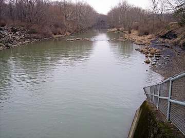
Photograph
On the map
Show this system's territory on the map — 2 ZIP codes in all.
Sources
U.S. EPA SDWIS and Community Water System Service Area Boundaries (v3, 2026), Ohio EPA primacy data, 2020 census blocks: the system serving most residents, traced through purchases to the treating utility; Ohio EPA 2023 Sewer and Water Rate Survey (Ohio State, May 2025) for household bills; Ohio EPA DEFA loan awards since 2016 for the loans paragraph · EPA SDWIS · EPA service area boundaries · Ohio EPA drinking water · Ohio EPA rate survey
Dover City's own pages: doverohio.com, en.wikipedia.org
Notable facts: doverohio.com, doverohio.com, doverohio.com, registerherald.com
History: doverohio.com, doverohio.com, doverohio.com, yourohionews.com
Water quality: doverohio.com, doverohio.com, doverohio.com
Water pressure: doverohio.com
Capital projects: yourohionews.com
Rates: doverohio.com, doverohio.com
Sewers: doverohio.com, doverohio.com, yourohionews.com
Treatment: doverohio.com, doverohio.com
Supply stress: doverohio.com, doverohio.com