Cleveland Heights
City · Cuyahoga County · 45,312 residents · 2.25% municipal income tax
Local events in Cleveland Heights
74 events in the next 90 days from 3 public calendars. All local events in Cleveland Heights
Checked October 20; the events page is refreshed daily.
Deep dives about Cleveland Heights
Long reads built from maps, newspapers and public records. All deep dives
- Flock Cameras in OhioAbout 6,900 mapped plate readers in 80 Ohio counties: who runs them, who searched the data, the case for and against, and the bills before the legislature.
- Lake View CemeteryLake View Cemetery in Cleveland, Ohio, founded in 1869, holds President James A. Garfield's 180-foot memorial, dedicated in 1890, and John D. Rockefeller's grave.
Notable people from Cleveland Heights
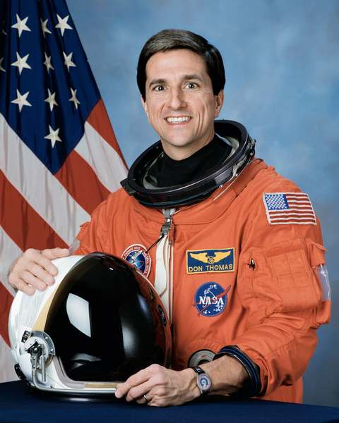
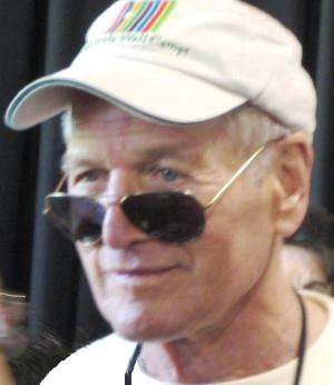
Ohioans tied to this place, each with a sourced profile. All notable Ohioans
How Cleveland Heights began
Cleveland Heights stayed timber, orchard and quarry land atop the Portage Escarpment east of Cleveland well into the 1800s -- Mayfield Road, its first real thoroughfare, took two years to build and was not finished until 1828 -- until electric streetcar lines reached the heights in the 1890s and touched off rapid suburban growth. It organized as a hamlet in 1901, incorporated as a village in 1903, and was chartered as a city on August 9, 1921, its population tripling again in the 1920s. Industrialist John D. Rockefeller bought 700 acres here in 1873 for a summer estate whose mansion burned in 1917; his son later gave the land to Cleveland Heights and neighboring East Cleveland, and it opened as Forest Hill Park in 1938. A wave of Jewish migration from Cleveland in the mid-20th century, followed by organized, relatively peaceful racial integration, shaped the diverse inner-ring suburb of about 45,000 that Cleveland Heights is today.
Settled 1800s (scattered farms, orchards and quarries), incorporated 1901 (hamlet); 1903 (village); 1921-08-09 (city), by Gradual settlement out of East Cleveland Township; quarryman Duncan McFarland's 'Bluestone' settlement was an early nucleus.
Where the name comes from
Cleveland Heights takes its name straightforwardly from its position on high ground -- the Portage Escarpment -- above and east of the city of Cleveland; no source we reviewed records a more specific naming event or namer.
Before the town
No source we reviewed names a specific Native American village, trail or burial site within present Cleveland Heights. The area sits within the Connecticut Western Reserve, secured for settlement by the 1785 Treaty of Fort McIntosh and the 1795 Treaty of Greenville.
Timeline
- — Mayfield Road, the area's first real thoroughfare, is completed after two years of construction.
- — John D. Rockefeller buys 700 acres on the heights east of Cleveland as a summer estate.
- — A town center forms around the intersection of Mayfield and Superior roads as electric streetcar lines reach the heights.
- — The area organizes as a hamlet with about 1,500 residents.
- — Cleveland Heights incorporates as a village.
- — The Rockefeller family ends its use of the Forest Hill summer estate.
- — Fire destroys the Rockefeller mansion at Forest Hill.
- — Cleveland Heights' population reaches 15,396.
- — Cleveland Heights is chartered as a city.
- — Cleveland Heights' population has roughly tripled since 1920 amid the decade's suburban building boom.
- — John D. Rockefeller Jr. deeds the former Forest Hill estate to Cleveland Heights (one-third) and East Cleveland (two-thirds); landscape architect Albert Davis Taylor's park design is completed in 1938.
- — Cleveland Heights' population reaches 61,813, its historic peak.
- — Cleveland Heights declares itself a nuclear-free zone.
- — Forest Hill Park is listed on the National Register of Historic Places.
Stories
The summer estate that became two cities' park
In 1873, years before Standard Oil made him the country's richest man, John D. Rockefeller bought 700 acres on the wooded heights east of Cleveland as a summer retreat for his family, building it out over the following decades with a mansion, a toboggan run and formal grounds. The family stopped using the estate around 1915, and in 1917 fire destroyed the mansion itself, leaving the grounds empty. Rather than redevelop the land, Rockefeller's son, John D. Rockefeller Jr., deeded it in the mid-1930s to the two municipalities it straddled -- roughly a third to Cleveland Heights, two-thirds to East Cleveland -- and landscape architect Albert Davis Taylor laid out a public park across the old estate, completed in 1938. Forest Hill Park's 248 acres of trails, ball fields and the old toboggan hill still mark, in outline, the shape of a Gilded Age summer estate, and the park was added to the National Register of Historic Places in 1998.
From farm township to streetcar suburb in a generation
As late as the 1880s, the high ground east of Cleveland later called Cleveland Heights was still mostly timber, orchards, vineyards and stone quarries -- Duncan McFarland's bluestone quarrying operation gave one early cluster of houses the name Bluestone. Everything changed once electric streetcar lines reached the escarpment in the 1890s: a town center grew up around Mayfield and Superior roads by about 1890, the area organized as a hamlet of some 1,500 people in 1901, incorporated as a village in 1903, and was chartered a city in 1921 with a population of over 15,000. The 1920s alone tripled that population again, filling in the old farm and quarry land with the streetcar-suburb housing stock that still defines much of Cleveland Heights today.
Photographs
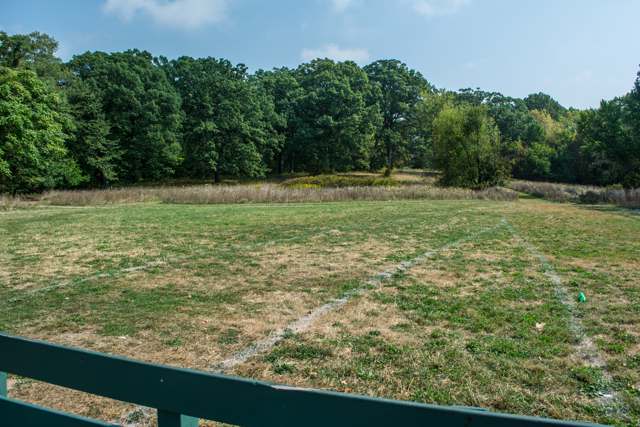
Photo: Tim Evanson (Wikimedia Commons, via Flickr), CC BY-SA 2.0 · Wikimedia Commons
Local history sources: en.wikipedia.org · en.wikipedia.org · commons.wikimedia.org
Historic places
9 places in Cleveland Heights on the National Register of Historic Places. Press a pin or a name for its whole record.
-
Alcazar HotelBuilding · Cleveland Heights · listed 1979
- Address
- Surrey and Derbyshire Rds.
- Where
- Cleveland Heights, Cuyahoga County · ZIP 44106
- What it is
- Building
- Listed on the National Register
- 1979
- NRIS reference number
- 79001805
- Coordinates
- 41.50202, -81.59257
National Register file (NPS) ↗ Search Wikipedia ↗ Street map and directions ↗ On the Cracked Buckeye map
-
Brown, John Hartness, HouseBuilding · Cleveland Heights · listed 1976
- Address
- 2380 Overlook Rd.
- Where
- Cleveland Heights, Cuyahoga County · ZIP 44106
- What it is
- Building
- Listed on the National Register
- 1976
- NRIS reference number
- 76001389
- Coordinates
- 41.50669, -81.59525
National Register file (NPS) ↗ Search Wikipedia ↗ Street map and directions ↗ On the Cracked Buckeye map
-
Burdick, Harold B., HouseBuilding · Cleveland Heights · listed 1974
- Address
- 2424 Stratford Rd.
- Where
- Cleveland Heights, Cuyahoga County · ZIP 44118
- What it is
- Building
- Listed on the National Register
- 1974
- NRIS reference number
- 74001434
- Coordinates
- 41.49349, -81.57128
National Register file (NPS) ↗ Search Wikipedia ↗ Street map and directions ↗ On the Cracked Buckeye map
-
East Cleveland District 9 SchoolBuilding · Cleveland Heights · listed 1979
- Address
- 14391 Superior Rd
- Where
- Cleveland Heights, Cuyahoga County · ZIP 44118
- What it is
- Building
- Listed on the National Register
- 1979
- NRIS reference number
- 79001806
- Coordinates
- 41.50962, -81.56855
National Register file (NPS) ↗ Search Wikipedia ↗ Street map and directions ↗ On the Cracked Buckeye map
-
Forest Hill Realty Sales OfficeBuilding · Cleveland Heights · listed 2007
- Address
- 2419 Lee Blvd.
- Where
- Cleveland Heights, Cuyahoga County · ZIP 44118
- What it is
- Building
- Listed on the National Register
- 2007
- NRIS reference number
- 07000580
- Coordinates
- 41.51813, -81.56974
National Register file (NPS) ↗ Search Wikipedia ↗ Street map and directions ↗ On the Cracked Buckeye map
-
Heights Rockfeller BuildingBuilding · Cleveland Heights · listed 1986
- Address
- 3091 Mayfield Rd.
- Where
- Cleveland Heights, Cuyahoga County · ZIP 44118
- What it is
- Building
- Listed on the National Register
- 1986
- NRIS reference number
- 86001058
- Coordinates
- 41.51620, -81.56885
National Register file (NPS) ↗ Search Wikipedia ↗ Street map and directions ↗ On the Cracked Buckeye map
-
Overlook Road Carriage House DistrictHistoric district · Cleveland Heights · listed 1974
- Address
- 1--5 Herrick Mews
- Where
- Cleveland Heights, Cuyahoga County · ZIP 44106
- What it is
- Historic district
- Listed on the National Register
- 1974
- NRIS reference number
- 74001449
- Coordinates
- 41.50326, -81.59713
National Register file (NPS) ↗ Search Wikipedia ↗ Street map and directions ↗ On the Cracked Buckeye map
-
Temple on the HeightsBuilding · Cleveland Heights · listed 1984
- Address
- 3130 Mayfield Rd.
- Where
- Cleveland Heights, Cuyahoga County · ZIP 44118
- What it is
- Building
- Listed on the National Register
- 1984
- NRIS reference number
- 84003653
- Coordinates
- 41.51600, -81.57220
National Register file (NPS) ↗ Search Wikipedia ↗ Street map and directions ↗ On the Cracked Buckeye map
-
Tremaine-Gallagher ResidenceBuilding · Cleveland Heights · listed 1973
- Address
- 3001 Fairmount Blvd.
- Where
- Cleveland Heights, Cuyahoga County · ZIP 44118
- What it is
- Building
- Listed on the National Register
- 1973
- NRIS reference number
- 73001419
- Coordinates
- 41.48844, -81.57148
National Register file (NPS) ↗ Search Wikipedia ↗ Street map and directions ↗ On the Cracked Buckeye map
Source: National Park Service, National Register of Historic Places point file. The listing year is shown where NPS's certification date agrees with the listing's reference number. Listing recognizes significance; it does not restrict a private owner.
Water
The Five Mile Crib, a small structure about 5 miles out in Lake Erie north of Cleveland's Edgewater Park The water here
- Cleveland Public Water System100% of residentsLake Erie
Hospitals, fire stations and more
Inside Cleveland Heights's boundary: 1 hospital, 1 nursing home, 2 fire and EMS stations, 1 college, 2 high-hazard dams, 11 public schools, 7 private schools, 3 libraries, 2 museums, 1 police station, 1 Toxics Release Inventory facility and 10 spill cases. Press a pin or a name for its whole record and its source.
Hospitals (1)
-
Metrohealth Cleveland Heights Hospital Trauma level IGeneral hospital · Cleveland Heights
- What it is
- General hospital
- Address
- 10 Severance Circle, Cleveland Heights, OH 44118
- County
- Cuyahoga County
- Beds
- 12
- Trauma center
- Level I Adult, Level II Pediatric
- Ownership
- Government - local
- Phone
- (216) 778-7800
Where HIFLD got this record ↗ HIFLD hospitals (source) ↗ Street map and directions ↗
Source: HIFLD hospitals inventory via FEMA (closed hospitals it still lists left out, hospitals opened since added), with Medicare Care Compare ratings matched by name and address.
Nursing homes (1)
-
Cedarwood Plaza3 of 5 stars · Cleveland Heights
- Address
- 12504 Cedar Road, Cleveland Heights, OH 44106
- Certified beds
- 115
- Residents on an average day
- 103
- Medicare overall rating
- 3 of 5 stars
- Health inspections
- 2 of 5 stars
- Staffing
- 2 of 5 stars
- Quality measures
- 5 of 5 stars
- Penalties since 2023
- 1 fine totalling $8,171 (latest 2024-05-15)
- Ownership
- For profit - Corporation
- Chain
- LEGACY HEALTH SERVICES
- Takes
- Medicare and Medicaid
- Phone
- (216) 371-3600
- Medicare ID
- 365033
Medicare Care Compare ↗ CMS nursing home data (source) ↗ Street map and directions ↗
Source: CMS Care Compare nursing home provider and penalties files; Medicare star ratings run 1 to 5.
Fire and EMS stations (2)
-
Cleveland Heights Fire Department - Station 1Cleveland Heights
- Address
- 3445 Mayfield Road, Cleveland Heights, OH 44118
- Coordinates
- 41.52083, -81.55492
USGS National Map structures (source) ↗ Street map and directions ↗
-
Cleveland Heights Fire Department Station 2Cleveland Heights
- Address
- 12560 Cedar Road, Cleveland Heights, OH 44106
- Coordinates
- 41.50038, -81.58857
USGS National Map structures (source) ↗ Street map and directions ↗
Source: USGS National Map structures (most Ohio records last updated 2019 to 2022), checked against the Columbus and Cleveland station lists. The department that answers a call is set by jurisdiction and mutual aid, not by distance.
Colleges (1)
-
Lakewood UniversityPrivate nonprofit college · Cleveland Heights
- What it is
- Private nonprofit college
- City
- Cleveland Heights
- Students, 2023-24 (12-month count)
- 378
- Tuition and fees, in state
- $10,479
- IPEDS unit ID
- 496706
College Navigator (NCES) ↗ IPEDS data (source) ↗ Street map and directions ↗
Source: NCES IPEDS 2024 directory, 2023-24 enrollment and tuition, graduation rates for the 2017 (four-year) and 2020 (two-year) entering classes.
High-hazard dams (2)
-
Lakeview Cemetery Flood Control DamDugway Brook · condition: fair
- Hazard class
- High: a failure would probably cost a life
- Condition
- Fair (assessed 03/07/2024)
- River or stream
- Dugway Brook
- Purpose
- Flood Risk Reduction
- Type
- Concrete
- Height
- 89 ft
- Storage
- 354 acre-feet
- Completed
- 1978
- Owner type
- Local Government
- County
- Cuyahoga County
- Nearest town (NID)
- East Cleveland
- Last inspection
- 04/26/2023
- Emergency action plan
- Yes
- NID ID
- OH00945
National Inventory of Dams record ↗ National Inventory of Dams (source) ↗ Street map and directions ↗
-
Lower Shaker Lake Dam PoorDoan Brook · condition: poor
- Hazard class
- High: a failure would probably cost a life
- Condition
- Poor (assessed 05/01/2023)
- River or stream
- Doan Brook
- Purpose
- Recreation
- Type
- Earth
- Height
- 17 ft
- Storage
- 178 acre-feet
- Completed
- 1830
- Owner type
- Local Government
- County
- Cuyahoga County
- Nearest town (NID)
- Cleveland Heights
- Last inspection
- 03/29/2023
- Emergency action plan
- Yes
- NID ID
- OH00352
National Inventory of Dams record ↗ National Inventory of Dams (source) ↗ Street map and directions ↗
Source: U.S. Army Corps of Engineers National Inventory of Dams, August 2026. "High hazard" rates what a failure would cost downstream, not how likely one is; the condition is the state's assessment.
Public schools (11)
-
Boulevard Elementary School3.5 of 5 stars · Cleveland Heights
- Address
- 1749 Lee Rd, Cleveland Heights, OH 44118
- School district
- Cleveland Hts-Univ Hts City School District
- Kind (NCES)
- Regular School
- Students, 2023-24
- 258
- Teachers (full-time equivalent)
- 18
- Report card, 2025-26
- 3.5 of 5 stars
- Performance index
- 72.3%
- Ohio building IRN
- 003251
- NCES school ID
- 390437900566
NCES school record ↗ Ohio School Report Card ↗ Street map and directions ↗
-
Caledonia Elementary School3.5 of 5 stars · Cleveland Heights
- Address
- 914 Caledonia Ave, Cleveland Heights, OH 44112
- School district
- East Cleveland City School District
- Kind (NCES)
- Regular School
- Students, 2023-24
- 234
- Teachers (full-time equivalent)
- 14
- Report card, 2025-26
- 3.5 of 5 stars
- Ohio building IRN
- 004598
- NCES school ID
- 390439000861
NCES school record ↗ Ohio School Report Card ↗ Street map and directions ↗
-
Canterbury Elementary School3.5 of 5 stars · Cleveland Heights
- Address
- 2530 Canterbury Rd, Cleveland Heights, OH 44118
- School district
- Cleveland Hts-Univ Hts City School District
- Kind (NCES)
- Regular School
- Students, 2023-24
- 305
- Teachers (full-time equivalent)
- 22.5
- Report card, 2025-26
- 3.5 of 5 stars
- Performance index
- 86.2%
- Ohio building IRN
- 004804
- NCES school ID
- 390437900567
NCES school record ↗ Ohio School Report Card ↗ Street map and directions ↗
-
Cleveland Heights High School4 of 5 stars · Cleveland Heights
- Address
- 13263 Cedar Rd, Cleveland Heights, OH 44118
- School district
- Cleveland Hts-Univ Hts City School District
- Kind (NCES)
- Regular School
- Students, 2023-24
- 1,636
- Teachers (full-time equivalent)
- 107
- Report card, 2025-26
- 4 of 5 stars
- Performance index
- 71.8%
- Four-year graduation rate
- 92.1%
- Ohio building IRN
- 015842
- NCES school ID
- 390437900571
NCES school record ↗ Ohio School Report Card ↗ Street map and directions ↗
-
Fairfax Elementary School4 of 5 stars · Cleveland Heights
- Address
- 3150 Fairfax Rd, Cleveland Heights, OH 44118
- School district
- Cleveland Hts-Univ Hts City School District
- Kind (NCES)
- Regular School
- Students, 2023-24
- 304
- Teachers (full-time equivalent)
- 23
- Report card, 2025-26
- 4 of 5 stars
- Performance index
- 78.5%
- Ohio building IRN
- 010967
- NCES school ID
- 390437900569
NCES school record ↗ Ohio School Report Card ↗ Street map and directions ↗
-
Monticello Middle SchoolCleveland Heights
- Address
- 3665 Monticello Blvd, Cleveland Heights, OH 44121
- Kind (NCES)
- Regular School
- Students, 2023-24
- 528
- Teachers (full-time equivalent)
- 45.5
- NCES school ID
- 390437900573
-
Noble Elementary School2.5 of 5 stars · Cleveland Heights
- Address
- 1293 Ardoon St, Cleveland Heights, OH 44121
- School district
- Cleveland Hts-Univ Hts City School District
- Kind (NCES)
- Regular School
- Students, 2023-24
- 388
- Teachers (full-time equivalent)
- 23
- Report card, 2025-26
- 2.5 of 5 stars
- Performance index
- 70.3%
- Ohio building IRN
- 027250
- NCES school ID
- 390437900574
NCES school record ↗ Ohio School Report Card ↗ Street map and directions ↗
-
Oxford Elementary School2.5 of 5 stars · Cleveland Heights
- Address
- 939 Quilliams Rd, Cleveland Heights, OH 44121
- School district
- Cleveland Hts-Univ Hts City School District
- Kind (NCES)
- Regular School
- Students, 2023-24
- 279
- Teachers (full-time equivalent)
- 17.5
- Report card, 2025-26
- 2.5 of 5 stars
- Performance index
- 58.8%
- Ohio building IRN
- 028993
- NCES school ID
- 390437900576
NCES school record ↗ Ohio School Report Card ↗ Street map and directions ↗
-
Roxboro Elementary School4 of 5 stars · Cleveland Heights
- Address
- 2405 Roxboro Rd, Cleveland Heights, OH 44106
- School district
- Cleveland Hts-Univ Hts City School District
- Kind (NCES)
- Regular School
- Students, 2023-24
- 224
- Teachers (full-time equivalent)
- 15.5
- Report card, 2025-26
- 4 of 5 stars
- Performance index
- 84.3%
- Ohio building IRN
- 032839
- NCES school ID
- 390437900577
NCES school record ↗ Ohio School Report Card ↗ Street map and directions ↗
-
Roxboro Middle School4 of 5 stars · Cleveland Heights
- Address
- 2400 Roxboro Rd, Cleveland Heights, OH 44106
- School district
- Cleveland Hts-Univ Hts City School District
- Kind (NCES)
- Regular School
- Students, 2023-24
- 566
- Teachers (full-time equivalent)
- 47.5
- Report card, 2025-26
- 4 of 5 stars
- Performance index
- 70.9%
- Ohio building IRN
- 032847
- NCES school ID
- 390437900578
NCES school record ↗ Ohio School Report Card ↗ Street map and directions ↗
-
Tiger Virtual AcademyCleveland Heights
- Address
- 14780 Superior Rd, Cleveland Heights, OH 44118
- Kind (NCES)
- Regular School
- Students, 2023-24
- 44
- Teachers (full-time equivalent)
- 2
- NCES school ID
- 390437906200
Source: NCES EDGE public school locations 2024-25 and Common Core of Data 2023-24 (type, students, teachers); Ohio School Report Cards 2025-26 (Department of Education and Workforce), matched by name within the district.
Private schools (7)
-
Beaumont High SchoolPrivate, Catholic · Cleveland Heights
- Address
- 3301 N Park Blvd, Cleveland Heights, OH 44118
- Kind
- Catholic
- Students, 2023-24
- 297
- Teachers (full-time equivalent)
- 43.1
- Students per teacher
- 6.89095
- Phone
- (216) 321-2954
- NCES private school ID
- BB201406
-
Communion of Saints SchoolPrivate, Catholic · Cleveland Heights
- Address
- 2160 Stillman Rd, Cleveland Heights, OH 44118
- Kind
- Catholic
- Students, 2023-24
- 182
- Teachers (full-time equivalent)
- 15
- Students per teacher
- 12.1333
- Phone
- (216) 932-4177
- NCES private school ID
- 01057249
-
Horizon Montessori SchoolPrivate, nonsectarian, special program · Cleveland Heights
- Address
- 3175 Mayfield Rd, Cleveland Heights, OH 44118
- Kind
- nonsectarian, special program
- Students, 2023-24
- 27
- Teachers (full-time equivalent)
- 1
- Students per teacher
- 27
- Phone
- (216) 321-9034
- NCES private school ID
- A9503241
-
Lutheran High School EastPrivate, religious, denomination-affiliated · Cleveland Heights
- Address
- 3565 Mayfield Rd, Cleveland Heights, OH 44118
- Kind
- religious, denomination-affiliated
- Students, 2023-24
- 354
- Teachers (full-time equivalent)
- 36.3
- Students per teacher
- 9.75207
- Phone
- (216) 382-6100
- NCES private school ID
- 01063321
-
Ruffing Montessori SchoolPrivate, nonsectarian, special program · Cleveland Heights
- Address
- 3380 Fairmount Blvd, Cleveland Heights, OH 44118
- Kind
- nonsectarian, special program
- Students, 2023-24
- 215
- Teachers (full-time equivalent)
- 33
- Students per teacher
- 6.51515
- Phone
- (216) 321-7571
- NCES private school ID
- 02049452
-
The Hebrew Academy of Cleveland-Oakwood CampusPrivate, religious, denomination-affiliated · Cleveland
- Address
- 1516 Warrensville Center Rd, Cleveland, OH 44121
- Kind
- religious, denomination-affiliated
- Students, 2023-24
- 1,225
- Teachers (full-time equivalent)
- 247.8
- Students per teacher
- 4.9435
- Phone
- (216) 382-3300
- NCES private school ID
- A2302354
-
Yeshiva Derech HatorahPrivate, religious, denomination-affiliated · Cleveland Heights
- Address
- 1508 Warrensville Center Rd, Cleveland Heights, OH 44121
- Kind
- religious, denomination-affiliated
- Students, 2023-24
- 856
- Teachers (full-time equivalent)
- 54.6
- Students per teacher
- 15.6777
- Phone
- (216) 382-6248
- NCES private school ID
- A1903528
Source: NCES Private School Survey 2023-24.
Public libraries (3)
-
Cleveland Heights-University Heights Pl (Cleveland Heights)Branch · Cleveland Heights
- Address
- 2345 Lee Road, Cleveland Heights, OH 44118
- What it is
- Branch
- Library system
- Cleveland Heights-University Heights Pl
- Open
- 3,588 hours a year, 52 weeks
- Building
- 110,000 sq ft
- System's visits, FY2024
- 510,120
- System's loans, FY2024
- 1,676,318
- People the system serves
- 57,712
- Phone
- (216) 932-3600
IMLS Public Libraries Survey (source) ↗ Street map and directions ↗
-
Coventry Branch LibraryBranch · Cleveland Heights
- Address
- 1925 Coventry Rd., Cleveland Heights, OH 44118
- What it is
- Branch
- Library system
- Cleveland Heights-University Heights Pl
- Open
- 2,782 hours a year, 52 weeks
- Building
- 5,105 sq ft
- System's visits, FY2024
- 510,120
- System's loans, FY2024
- 1,676,318
- People the system serves
- 57,712
- Phone
- (216) 321-3400
IMLS Public Libraries Survey (source) ↗ Street map and directions ↗
-
Noble Branch LibraryBranch · Cleveland Heights
- Address
- 2800 Noble Rd., Cleveland Heights, OH 44121
- What it is
- Branch
- Library system
- Cleveland Heights-University Heights Pl
- Open
- 2,174 hours a year, 52 weeks
- Building
- 19,223 sq ft
- System's visits, FY2024
- 510,120
- System's loans, FY2024
- 1,676,318
- People the system serves
- 57,712
- Phone
- (216) 291-5665
IMLS Public Libraries Survey (source) ↗ Street map and directions ↗
Source: IMLS Public Libraries Survey FY2024 (outlets and their systems). Any Ohio resident can get a free card at any Ohio public library.
Museums, historical societies, gardens and zoos (2)
-
Future HeightsHistorical society · Cleveland Heights
- What it is
- Historical society
- City
- Cleveland Heights
- Coordinates
- 41.50706, -81.57759
Search Wikipedia ↗ IMLS Museum Data Files (source) ↗ Street map and directions ↗
The museum list is IMLS's 2018 file; a museum may have closed or moved since.
-
Hellenic Preservation SocietyHistorical society · Broadview Heights
- What it is
- Historical society
- City
- Broadview Heights
- Coordinates
- 41.50298, -81.55664
Search Wikipedia ↗ IMLS Museum Data Files (source) ↗ Street map and directions ↗
The museum list is IMLS's 2018 file; a museum may have closed or moved since.
Source: IMLS Museum Data Files, 2018.
Police stations (1)
-
Cleveland Heights Police DepartmentCleveland Heights
- Address
- 40 Severance Circle, Cleveland Heights, OH 44118
- Coordinates
- 41.51945, -81.55395
USGS National Map structures (source) ↗ Street map and directions ↗
Source: USGS National Map structures, police stations, corrected and completed by hand (September 2026). The department that answers a call is set by jurisdiction, not by distance.
Facilities reporting toxic releases (1)
-
Dean Foods Hillside DairyToxics Release Inventory · Cleveland Heights
- Address
- 1418 Warrensville Center Rd., Cleveland Heights, OH 44121
- County
- Cuyahoga County
- Status
- Reports to the Toxics Release Inventory (active)
- EPA program ID
- 44121DNFDS1418W
- EPA registry ID
- 110000387331
EPA facility record ↗ EPA Facility Registry Service (source) ↗ Street map and directions ↗
Source: EPA Facility Registry Service, Toxics Release Inventory reporters. Reporting a release is required of large users of listed chemicals; it is not by itself a violation.
Spills reported since 2021 (10)
-
Fuel Diesel / Diesel Fuel (Vehicle On Or Off Road)2025-05-14 · Shaker Heights
- Reported
- 2025-05-14
- What spilled
- Fuel Diesel / Diesel Fuel (Vehicle On Or Off Road)
- Largest amount reported
- 1 gallons
- Where
- Shaker Heights, Cuyahoga County
- Ohio EPA district office
- NEDO
- Ohio EPA case number
- 2505EPA0000767
Ohio EPA spill reports (source) ↗ Street map and directions ↗
-
Other / All Other / Trade Name / Mixture / Solution Etc2025-03-14 · Cleveland Heights
- Reported
- 2025-03-14
- What spilled
- Other / All Other / Trade Name / Mixture / Solution Etc
- Where
- Cleveland Heights, Cuyahoga County
- Ohio EPA district office
- NEDO
- Ohio EPA case number
- 2503EPA0000359
Ohio EPA spill reports (source) ↗ Street map and directions ↗
-
Fuel Diesel / Diesel Fuel (Vehicle On Or Off Road)2024-08-12 · Cleveland Heights
- Reported
- 2024-08-12
- What spilled
- Fuel Diesel / Diesel Fuel (Vehicle On Or Off Road)
- Where
- Cleveland Heights, Cuyahoga County
- Ohio EPA district office
- NEDO
- Ohio EPA case number
- 2408EPA0001393
Ohio EPA spill reports (source) ↗ Street map and directions ↗
-
Sewage Human2023-05-18 · Cleveland Heights
- Reported
- 2023-05-18
- What spilled
- Sewage Human
- Where
- Cleveland Heights, Cuyahoga County
- Ohio EPA district office
- NEDO
- Ohio EPA case number
- 2305EPA0000813
Ohio EPA spill reports (source) ↗ Street map and directions ↗
-
Material Undetermined / Other2023-04-24 · Cleveland Heights
- Reported
- 2023-04-24
- What spilled
- Material Undetermined / Other
- Where
- Cleveland Heights, Cuyahoga County
- Ohio EPA district office
- NEDO
- Ohio EPA case number
- 2304EPA0000652
Ohio EPA spill reports (source) ↗ Street map and directions ↗
-
Fuel Gasoline ( 25% Ethanol Not E85)2021-04-23 · Cleveland Heights
- Reported
- 2021-04-23
- What spilled
- Fuel Gasoline ( 25% Ethanol Not E85)
- Where
- Cleveland Heights, Cuyahoga County
- Ohio EPA district office
- NEDO
- Ohio EPA case number
- 2104EPA0000555
Ohio EPA spill reports (source) ↗ Street map and directions ↗
-
Oil Transformer Non Pcb2026-07-03 · Cleveland Heights
- Reported
- 2026-07-03
- What spilled
- Oil Transformer Non Pcb
- Where
- Cleveland Heights, Cuyahoga County
- Ohio EPA district office
- NEDO
- Ohio EPA case number
- 2607EPA0001191
Ohio EPA spill reports (source) ↗ Street map and directions ↗
-
Material Gray2026-05-15 · Cleveland Heights
- Reported
- 2026-05-15
- What spilled
- Material Gray
- Where
- Cleveland Heights, Cuyahoga County
- Ohio EPA district office
- NEDO
- Ohio EPA case number
- 2605EPA0000809
Ohio EPA spill reports (source) ↗ Street map and directions ↗
-
Material White Reached water2026-05-13 · Cleveland Heights
- Reported
- 2026-05-13
- What spilled
- Material White; Concrete
- Reached a waterway
- 99 - Unnamed
- Where
- Cleveland Heights, Cuyahoga County
- Ohio EPA district office
- NEDO
- Ohio EPA case number
- 2605EPA0000798
Ohio EPA spill reports (source) ↗ Street map and directions ↗
-
Oil Hydraulic Fluid(S)2026-04-16 · Cleveland Heights
- Reported
- 2026-04-16
- What spilled
- Oil Hydraulic Fluid(S)
- Largest amount reported
- 5 gallons
- Where
- Cleveland Heights, Lorain County
- Ohio EPA district office
- NEDO
- Ohio EPA case number
- 2604EPA0000637
Ohio EPA spill reports (source) ↗ Street map and directions ↗
Source: Ohio EPA emergency response spill reports, 2021 to September 2026, one point per case where Ohio EPA placed it. A report is what the caller or responder recorded; amounts are often blank or estimated.
Its ZIP codes
Each ZIP code that touches Cleveland Heights, with the share of its residents who live here and the same headline figures as the ZIP page.
Local government
Who holds office in Cleveland Heights, how its elections and ballot issues came out, and the state auditor's record.
Auditor of State record
- No fiscal caution, watch or emergency on the Auditor of State's lists.
- Financial Health Indicators (the Auditor of State's 17 measures; critical / cautionary / positive): 2019 0 / 1 / 16; 2020 0 / 2 / 15; 2021 0 / 1 / 16; 2022 0 / 1 / 16; 2023 0 / 2 / 15; 2024 0 / 3 / 13.
- Agreed Upon Procedures, 2023, released 2026-03-19
The county
Cuyahoga County: 52 ZIP codes, 59 cities, villages and townships, 1,270,867 people.
Nearby places
Rain and snow
How much has actually fallen on Cleveland Heights, day by day, from 1871 to now. Daily totals, not averages.
- rain, last 30 days
- 1.90 in
- 2026-09-29 to 2026-10-28
- rain so far in 2026
- 33.4 in
- about normal for the date
- snow so far in 2026
- 50.3 in
- a normal year brings 66.3 in
- a normal year
- 40.9 in
- average of 27 years, 1991-2020
| Month | Rain (in) | Snow (in) | Days counted |
|---|---|---|---|
| October 2026 | 1.89 | — | 28 |
| September 2026 | 2.89 | — | 30 |
| August 2026 | 7.48 | — | 31 |
| July 2026 | 2.04 | — | 31 |
| June 2026 | 2.71 | — | 30 |
| May 2026 | 3.68 | — | 31 |
| April 2026 | 5.83 | 0.0 | 30 |
| March 2026 | 3.59 | 3.4 | 31 |
| February 2026 | 0.66 | 8.7 | 28 |
| January 2026 | 2.56 | 38.2 | 31 |
| December 2025 | 3.18 | 18.9 | 31 |
| November 2025 | 2.75 | 11.0 | 30 |
| Wettest year | 1996 — 62.5 in |
|---|---|
| Driest year | 1963 — 20.9 in |
| Snowiest year | 1996 — 121.3 in |
| Wettest day on record | 1 September 1901 — 3.71 in |
| Heaviest snowfall in a day | 25 December 2020 — 14.60 in |
| Deepest snow on the ground | 14 November 1996 — 32.99 in |
Estimated, not measured. No rain gauge has ever stood inside Cleveland Heights, so every figure here is worked out from the gauges around it - the nearest ones weighted most. Treat them as close estimates rather than readings.
52,726 days of records, 1871-01-01 to 2026-10-28. Source: NOAA NCEI GHCN-Daily, 3,240 gauges in and around Ohio. A day is "gauged" when a gauge standing inside the boundary reported it, and the value is the mean of those gauges. Otherwise it is interpolated by inverse distance from every gauge reporting within 50 miles. Nothing is carried forward, back-filled or smoothed. Against NOAA nClimDiv county monthly precipitation over 136,848 complete county-months (checked 2026-10-31): correlation 0.9515, median absolute difference 0.217 in a month. Built 2026-10-31 from the Cracked Buckeye precipitation archive. Snow is the softer number — snowfall is measured by hand with a ruler, no agency publishes a gridded county snowfall series, and blowing snow defeats every observer.
Environmental permits and filings
What Ohio EPA has on file for Cleveland Heights: permits, inspections, violations, cleanups and the state loans behind sewer and water work. Every line links to the agency's own document.
- facilities and sites on file
- 24
- those placed on the map inside Cleveland Heights
| Program | Facilities and sites |
|---|---|
| Wastewater and stormwater discharge | 8 |
| Air pollution | 7 |
| Hazardous waste | 4 |
| Sewer and water-line construction | 2 |
| Municipal Solid Waste Transfer Facilities | 1 |
| Public drinking water | 1 |
| State sewer loans | 1 |
| Date | Facility or site | What |
|---|---|---|
| PIR 3939 - MAYFIELD AND MIDDLETON | Wastewater and stormwater discharge permit | |
| PIR 3957 – FAIRMOUNT BOULEVARD | Wastewater and stormwater discharge permit | |
| CLEVELAND HEIGHTS TRANSFER FACILITY | Municipal Solid Waste Transfer Facilities inspection | |
| CITY OF CLEVELAND HEIGHTS | Sewer and water-line construction permit | |
| PIR 3994 - SELWYN AND SYLVANHURST | Wastewater and stormwater discharge permit | |
| DOMINIC TOMARO SERVICE CENTER | Air pollution report | |
| FORMER HILLSIDE DAIRY | Wastewater and stormwater discharge permit | |
| PARK ARTS | Wastewater and stormwater discharge permit | |
| CLEVELAND HEIGHTS TRANSFER FACILITY | Municipal Solid Waste Transfer Facilities report | |
| CAIN PARK | Wastewater and stormwater discharge permit | |
| PIR 3831 - COLERIDGE AND CORYDON | Wastewater and stormwater discharge permit | |
| CITY OF CLEVELAND HEIGHTS | Sewer and water-line construction permit | |
| PARK ARTS | Wastewater and stormwater discharge permit | |
| CLEVELAND HEIGHTS TRANSFER FACILITY | Municipal Solid Waste Transfer Facilities inspection | |
| PIR 3957 – FAIRMOUNT BOULEVARD | Wastewater and stormwater discharge permit | |
| CLEVELAND HEIGHTS TRANSFER FACILITY | Municipal Solid Waste Transfer Facilities report | |
| CLEVELAND HEIGHTS TRANSFER FACILITY | Municipal Solid Waste Transfer Facilities technical help | |
| CITY OF CLEVELAND HEIGHTS | Sewer and water-line construction permit | |
| PIR 3831 - COLERIDGE AND CORYDON | Wastewater and stormwater discharge permit | |
| CITY OF CLEVELAND HEIGHTS | Sewer and water-line construction permit | |
| COVENTRY LIBRARY PEACE PARK | Wastewater and stormwater discharge permit | |
| NEORSD EASTERLY WWTP | State sewer loans | |
| NEORSD EASTERLY WWTP | State sewer loans | |
| CLEVELAND HEIGHTS TRANSFER FACILITY | Municipal Solid Waste Transfer Facilities report | |
| NEORSD EASTERLY WWTP | State sewer loans |
Source: Ohio EPA eDocument portal (edocpub.epa.ohio.gov), indexed 2026-10-14. Facilities are placed on the map from Ohio EPA's own map layers, EPA's Facility Registry, coordinates written in the filings, or a geocoded street address. A permit filed under a private person's name (most are household septic systems) is counted but never named, placed or linked; licenses for individual workers and open-burning notices are left out entirely.
Quick answers
What county is Cleveland Heights, Ohio in?
Cleveland Heights is a city in Cuyahoga County, Ohio, with 45,312 residents.
When was Cleveland Heights, Ohio founded?
Cleveland Heights was settled 1800s (scattered farms, orchards and quarries); incorporated 1901 (hamlet); 1903 (village); 1921-08-09 (city). Founders on record: Gradual settlement out of East Cleveland Township; quarryman Duncan McFarland's 'Bluestone' settlement was an early nucleus. Source
How did Cleveland Heights, Ohio get its name?
Cleveland Heights takes its name straightforwardly from its position on high ground -- the Portage Escarpment -- above and east of the city of Cleveland; no source we reviewed records a more specific naming event or namer. Source
What ZIP code is Cleveland Heights, Ohio?
Cleveland Heights is served by ZIP codes 44118, 44121, 44106 and 44112; 44118 holds the largest share of its residents.
Where does Cleveland Heights, Ohio get its water?
The main water source for Cleveland Heights (Cleveland Public Water System): The Five Mile Crib, a small structure about 5 miles out in Lake Erie north of Cleveland's Edgewater Park.
Cite this page
Cite this page as:
Cracked Buckeye, "Cleveland Heights, Cuyahoga County", https://crackedbuckeye.com/place/cleveland-heights/, built 2026-10-31, accessed [date].
How to cite · Report a correction · Built 2026-10-31
