Local events in Cheshire
Nothing is posted for Cheshire itself yet; here is what is on within 20 miles. All local events in Cheshire
Know a calendar we should watch? Send the link
Checked October 20; the events page is refreshed daily.
How Cheshire began
Cheshire, a small Ohio River village founded in 1811 and named for the English county of Cheshire, spent much of its later history in the shadow of the Gavin Power Plant, a large coal-fired station built just outside town. By 2000, residents were reporting sulfurous gas clouds and acid rain they traced to the plant; rather than face prolonged litigation, plant owner American Electric Power offered a buyout, ultimately worth about $20 million, that most of the village's roughly 221 residents accepted in 2002. The village never disincorporated, and a shrunken population has stayed on, pursuing annexation in the years since to keep some municipal footing.
Settled about 1794 (settlement on the Ohio bank near the village, per Hardesty), by Paul and Abram Darst, Adam Rousch and Edward McMullen (first cabins).
Where the name comes from
The village was named after the county of Cheshire in England.
Before the town
No source found records a Native village, mound, trail, or treaty event specific to Cheshire. The village lies within Gallia County's broader Shawnee homeland of the pre-1795 Ohio River valley.
Nations recorded here: Shawnee.
Timeline
- — A settlement is made on the Ohio bank near the present village on land bought from the Ohio Company's agent; Paul and Abram Darst, Adam Rousch and Edward McMullen build three cabins.
- — The first church society, a Free-will Baptist congregation, is organized on December 15 at Paul Darst's house with Rev. Eli Stedman as pastor.
- — Cheshire is founded and named for the English county of Cheshire.
- — Cheshire Township is formed from Kyger Township on March 3; the first election of which a record survives is held September 4, 1814.
- — A two-story brick academy is built at Cheshire for $6,000 and furnished with over $700 of astronomical and philosophical instruments; the Presbyterians later use it for services.
- — Morgan's raiders cross Cheshire Township to the Ohio River, try to cross, are scared off by a tow-boat they take for a gunboat, and are caught by Union forces.
- — The census counts 195 people in the village, which has a hotel, several stores, a flour mill and a barrel factory and no saloon.
- — Cheshire's population peaks at 369 residents.
- — The census counts 315 residents, down from the 1960 peak of 369.
- — The first of two 1,300-megawatt units of the Gavin Power Plant goes into service beside the village; the second follows in 1975.
- — Cheshire's population stands at 221 as residents begin reporting sulfurous gas clouds and acid rain they attribute to the neighboring Gavin Power Plant.
- — American Electric Power, owner of the Gavin Power Plant, settles with most Cheshire residents in a buyout ultimately worth about $20 million; most of the village's population accepts and leaves.
- — Village leaders explore expanding Cheshire's municipal boundaries through annexation as the remaining population regroups after the buyout.
- — Cheshire's census population stands at 123, down from 132 in 2010 and far below its 1960 peak of 369.
Stories
The village AEP bought out
Cheshire had sat quietly on the Ohio River since 1811, but by the turn of the millennium its roughly 221 residents were living next to one of the largest coal-fired power plants on the river, the Gavin Power Plant. Around 2000, people in town began describing sulfurous gas clouds drifting over their houses and acid rain eating at paint and metal, and a group of residents hired lawyers to press the plant's owner, American Electric Power, for damages. Rather than fight a case that threatened years of litigation and bad publicity, AEP investigated the complaints and came back with an offer: a buyout for residents willing to sell and leave, adding up in total to roughly $20 million. Most of the village took the deal in 2002 and moved away, leaving Cheshire's houses and lots largely empty; the company reportedly considered using the cleared land for river-dock facilities. A remnant of the community stayed on, and by 2004 the residents who remained were exploring annexation to try to shore up what was left of the village's municipal status. Cheshire's population, 369 at its 1960 peak, was 123 by the 2020 census -- one of the starkest examples in the county of an entire town being priced out by its industrial neighbor rather than fading gradually.
Photographs
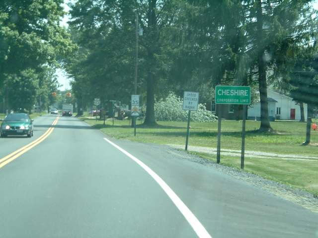
Photo: Analogue Kid, CC BY 2.5 · Wikimedia Commons
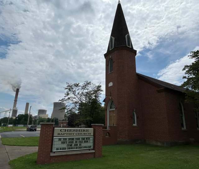
Photo: JECWV, CC BY-SA 4.0 · Wikimedia Commons
Local history sources: en.wikipedia.org · en.wikipedia.org · commons.wikimedia.org · commons.wikimedia.org · en.wikipedia.org · ohiogenealogyexpress.com · ohiogenealogyexpress.com
Water
Mostly private wells The water here
- Middleport Village100% of residentsGroundwater wells (3 wells)
Hospitals, fire stations and more
Inside Cheshire's boundary: 1 health center. Press a pin or a name for its whole record and its source.
Community health centers (1)
-
Cheshire REACHHealth center · Cheshire
- Run by
- a federally qualified health center
- Setting
- Clinic
- City
- Cheshire
- Coordinates
- 38.94967, -82.10852
Find a Health Center (HRSA) ↗ HRSA data (source) ↗ Street map and directions ↗
Source: HRSA health center service delivery sites, active, September 2026 (school-based sites left out). Health centers see patients whether or not they have insurance, with fees on a sliding scale.
Its ZIP codes
Each ZIP code that touches Cheshire, with the share of its residents who live here and the same headline figures as the ZIP page.
| ZIP | Share | Water | Radon | Home value | Schools | Flood |
|---|---|---|---|---|---|---|
| 45620 Cheshire Township and Cheshire | 14% | Mostly private wells | Too few radon tests | Median year built 1971 | Gallia County Local · 3 stars overall | 18% of residents in the 1% floodplain |
Local government
Who holds office in Cheshire, how its elections and ballot issues came out, and the state auditor's record.
Auditor of State record
- No fiscal caution, watch or emergency on the Auditor of State's lists.
- Basic Audit, 2024 to 2025, released 2026-06-02
The county
Gallia County: 8 ZIP codes, 22 cities, villages and townships, 30,753 people.
Nearby places
Rain and snow
How much has actually fallen on Cheshire, day by day, from 1890 to now. Daily totals, not averages.
- rain, last 30 days
- 1.98 in
- 2026-09-30 to 2026-10-29
- rain so far in 2026
- 44.0 in
- 6.9 in above normal for the date
- snow so far in 2026
- 14.4 in
- a normal year brings 14.7 in
- a normal year
- 44.0 in
- average of 30 years, 1991-2020
| Month | Rain (in) | Snow (in) | Days counted |
|---|---|---|---|
| October 2026 | 1.98 | — | 29 |
| September 2026 | 9.33 | — | 30 |
| August 2026 | 8.63 | — | 31 |
| July 2026 | 3.62 | — | 31 |
| June 2026 | 4.40 | — | 30 |
| May 2026 | 5.95 | — | 31 |
| April 2026 | 2.33 | — | 30 |
| March 2026 | 4.64 | 3.8 | 31 |
| February 2026 | 1.00 | 4.1 | 28 |
| January 2026 | 2.16 | 6.5 | 31 |
| December 2025 | 1.77 | 7.2 | 31 |
| November 2025 | 3.30 | 0.7 | 30 |
| Wettest year | 1890 — 63.1 in |
|---|---|
| Driest year | 1930 — 24.9 in |
| Snowiest year | 1917 — 44.9 in |
| Wettest day on record | 9 September 2004 — 4.03 in |
| Heaviest snowfall in a day | 17 January 1994 — 18.90 in |
| Deepest snow on the ground | 27 November 1950 — 19.47 in |
Estimated, not measured. No rain gauge has ever stood inside Cheshire, so every figure here is worked out from the gauges around it - the nearest ones weighted most. Treat them as close estimates rather than readings.
49,831 days of records, 1890-01-01 to 2026-10-29. Source: NOAA NCEI GHCN-Daily, 3,240 gauges in and around Ohio. A day is "gauged" when a gauge standing inside the boundary reported it, and the value is the mean of those gauges. Otherwise it is interpolated by inverse distance from every gauge reporting within 50 miles. Nothing is carried forward, back-filled or smoothed. Against NOAA nClimDiv county monthly precipitation over 136,848 complete county-months (checked 2026-10-31): correlation 0.9515, median absolute difference 0.217 in a month. Built 2026-10-31 from the Cracked Buckeye precipitation archive. Snow is the softer number — snowfall is measured by hand with a ruler, no agency publishes a gridded county snowfall series, and blowing snow defeats every observer.
Environmental permits and filings
What Ohio EPA has on file for Cheshire: permits, inspections, violations, cleanups and the state loans behind sewer and water work. Every line links to the agency's own document.
- facilities and sites on file
- 2
- those placed on the map inside Cheshire
Data centers, power and big tech here. Ohio EPA files that name a data-center company, a power plant or substation, or a large technology firm:
- LOP COORDINATION - LRH-2013-583 GAVIN POWER PLANT (wetland and stream fill, latest Dec 17, 2024)
| Program | Facilities and sites |
|---|---|
| Wetland and stream fill | 2 |
| Date | Facility or site | What |
|---|---|---|
| GAVIN POWER MAINTENANCE DREDGING PERMIT RENEWAL | Wetland and stream fill permit | |
| LOP COORDINATION - LRH-2013-583 GAVIN POWER PLANT | Wetland and stream fill permit |
Source: Ohio EPA eDocument portal (edocpub.epa.ohio.gov), indexed 2026-10-14. Facilities are placed on the map from Ohio EPA's own map layers, EPA's Facility Registry, coordinates written in the filings, or a geocoded street address. A permit filed under a private person's name (most are household septic systems) is counted but never named, placed or linked; licenses for individual workers and open-burning notices are left out entirely.
Quick answers
What county is Cheshire, Ohio in?
Cheshire is a village in Gallia County, Ohio, with 123 residents.
When was Cheshire, Ohio founded?
Cheshire was settled about 1794 (settlement on the Ohio bank near the village, per Hardesty). Founders on record: Paul and Abram Darst, Adam Rousch and Edward McMullen (first cabins). Source
How did Cheshire, Ohio get its name?
The village was named after the county of Cheshire in England. Source
What ZIP code is Cheshire, Ohio?
Most of Cheshire is in ZIP code 45620.
Where does Cheshire, Ohio get its water?
The main water source for Cheshire (Middleport Village): Mostly private wells.
Cite this page
Cite this page as:
Cracked Buckeye, "Cheshire, Gallia County", https://crackedbuckeye.com/place/cheshire/, built 2026-10-31, accessed [date].
How to cite · Report a correction · Built 2026-10-31
