Local events in Brush Creek Township, Highland County
Nothing is posted for Brush Creek Township itself yet; here is what is on within 20 miles. All local events in Brush Creek Township, Highland County
Know a calendar we should watch? Send the link
Checked October 20; the events page is refreshed daily.
How Brush Creek Township, Highland County began
Brushcreek Township occupies the southeastern corner of Highland County, Ohio, 43.4 square miles of hill country drained by Ohio Brush Creek. It holds the incorporated village of Sinking Spring, platted by Jacob Hiestand in 1815 around a losing stream that gave the place its name, and the unincorporated community of Carmel. The township's dominant landmark is Fort Hill, a 35-acre Hopewell hilltop earthwork enclosing a summit 500 feet above the creek, excavated and mapped by Squier and Davis in 1846. It remains rural and sparsely settled: 1,418 residents at the 2020 census, one incorporated village, farms, and a scatter of nineteenth-century houses and churches.
Where the name comes from
The township is named for Ohio Brush Creek, the stream that drains it; Wikipedia's township article notes it is "the only Brushcreek Township statewide," though Brush Creek Townships (two words) exist in Adams, Jefferson, Muskingum and Scioto counties. Sinking Spring, the township's one incorporated village, takes its own name from a "losing stream" (one that sinks underground) near the original townsite.
Before the town
The township's one substantial, site-specific Native American record is Fort Hill itself: a Hopewell-culture hilltop enclosure built roughly 2,000 years ago (Middle Woodland period, about 100 BC to AD 500), more than 1.5 miles in circumference, enclosing 35.3 acres on a summit about 500 feet above Ohio Brush Creek, with 36 confirmed constructed gateways and a second, harder-to-see earthwork (the Circle Mound/Circle Earthwork) nearby. Archaeologists read it as a ceremonial/gathering site rather than a defensive fort despite the name. Ephraim Squier and Edwin Davis surveyed and engraved it in 1846 for their 1848 'Ancient Monuments of the Mississippi Valley.' No source we found names a specific historic-era (1700s) Shawnee, Wyandot, or other nation village, camp, or trail within Brush Creek Township itself, and none of the sources consulted describes how the 1795 Treaty of Greenville line ran relative to this specific township.
Nations recorded here: Hopewell culture.
- Fort Hill (earthwork) — Brush Creek Township, on a hilltop above Ohio Brush Creek near Sinking Spring; now Fort Hill State Memorial / Fort Hill Earthworks & Nature Preserve, Middle Woodland, Hopewell culture, roughly 100 BC - AD 500 (en.wikipedia.org)
Timeline
- — Jacob Hiestand plats the town of Sinking Spring in southeastern Brushcreek Township.
- — A post office opens at Sinking Spring.
- — The Octagonal Schoolhouse is built at Sinking Spring.
- — Sinking Spring Methodist Church is built; it is later documented as the oldest church in Highland County still used as a church.
- — Ephraim George Squier and Edwin Hamilton Davis survey and excavate the Fort Hill earthwork, publishing their findings in 1848's Ancient Monuments of the Mississippi Valley.
- — Period of significance cited for the Eubanks-Tytus House, an Italianate house southeast of Hillsboro on State Route 41 in Brushcreek Township, later listed on the National Register.
- — Historic American Buildings Survey photographer Eugene F. Schrand photographs the Octagonal Schoolhouse at Sinking Spring.
- — Fort Hill State Memorial is added to the National Register of Historic Places; it is designated a National Natural Landmark four years later, in 1974.
- — The Eubanks-Tytus House is listed on the National Register of Historic Places.
Stories
Fort Hill: a mountain-top enclosure, not a fort
On a summit some 500 feet above Ohio Brush Creek, Hopewell people built an earthen and stone wall over a mile and a half long, enclosing more than 35 acres of the flat hilltop and standing 6 to 15 feet high with dozens of gateways through it. Nineteenth-century surveyors who found it assumed it was a fortification and named it accordingly. When Ephraim Squier and Edwin Davis mapped and excavated the site in 1846, their engraving of it became one of the plates in their landmark 1848 study of ancient American earthworks. Archaeologists now believe Fort Hill was not built for war at all, but as a ceremonial or gathering place for a Hopewell population that left no written record of why they raised such a wall. It stands today inside a 1,300-acre nature preserve managed by the Arc of Appalachia and the Ohio History Connection, one of the best-preserved hilltop enclosures in the state.
A schoolhouse built to a different shape
In 1831 the schoolhouse at Sinking Spring was built octagonal rather than the usual rectangle — an unusual choice for a rural Ohio school of the period. The building survived long enough to be documented in 1937 by Eugene F. Schrand for the federal Historic American Buildings Survey, and photographs from that survey are held at the Library of Congress and on Wikimedia Commons. It stands today as one of Sinking Spring's oldest surviving structures, alongside the 1844 Methodist church a few blocks away.
Photographs
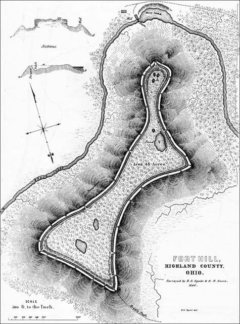
Photo: Ephraim George Squier and Edwin Hamilton Davis, Ancient Monuments of the Mississippi Valley (1848), Public domain · Wikimedia Commons
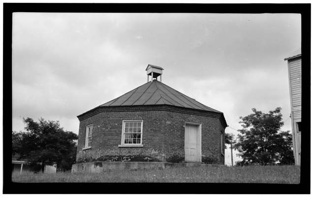
Photo: Eugene F. Schrand, Historic American Buildings Survey (Library of Congress), Public domain · Wikimedia Commons
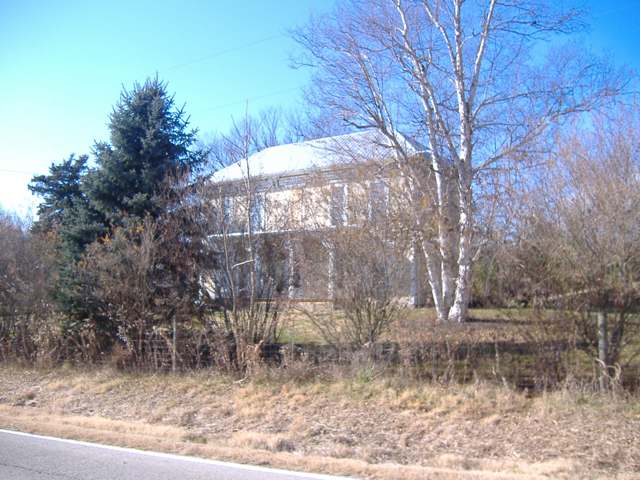
Photo: Wikimedia Commons contributor, CC BY-SA 3.0 · Wikimedia Commons
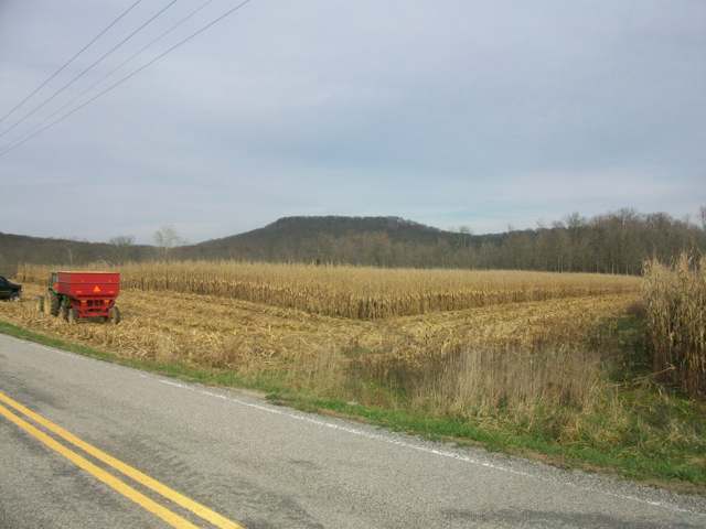
Photo: Wikimedia Commons contributor, CC BY-SA 3.0 · Wikimedia Commons
Local history sources: en.wikipedia.org · en.wikipedia.org · en.wikipedia.org · ohiohistory.org · en.wikipedia.org · npgallery.nps.gov · en.wikipedia.org · commons.wikimedia.org · commons.wikimedia.org · commons.wikimedia.org · commons.wikimedia.org · commons.wikimedia.org
Historic places
1 place in Brush Creek Township, Highland County on the National Register of Historic Places. Press a pin or a name for its whole record.
-
Eubanks-Tytus HouseBuilding · Hillsboro · listed 1979
- Address
- SE of Hillsboro on OH 41
- Where
- Hillsboro, Highland County · ZIP 45133
- What it is
- Building
- Listed on the National Register
- 1979
- NRIS reference number
- 79001865
- Coordinates
- 39.14862, -83.36621
National Register file (NPS) ↗ Search Wikipedia ↗ Street map and directions ↗ On the Cracked Buckeye map
Source: National Park Service, National Register of Historic Places point file. The listing year is shown where NPS's certification date agrees with the listing's reference number. Listing recognizes significance; it does not restrict a private owner.
Water
Mostly private wells The water here
- Hillsboro City64% of residentsClear Creek (via Selph Road & Liberty Park Reservoirs)
- Highland County Water Company, Inc.22% of residentsSand-and-gravel aquifer wells (Ross/Highland Co. well fields; local wells)
- Peebles Public Water System10% of residentsOhio River Valley Aquifer (wells near Manchester)
- Adams County Regional Wd4% of residentsOhio River Valley Aquifer (wells near Manchester)
Hospitals, fire stations and more
Inside Brush Creek Township, Highland County's boundary: 1 mound or earthwork. Press a pin or a name for its whole record and its source.
Mounds and earthworks (1)
-
Fort Hill State MemorialEarthwork · Middle Woodland
- What it is
- Earthwork
- Also named
- Fort Hill
- Age
- Middle Woodland, Hopewell culture, roughly 100 BC - AD 500
- Where
- Brush Creek Township, on a hilltop above Ohio Brush Creek near Sinking Spring; now Fort Hill State Memorial / Fort Hill Earthworks & Nature Preserve
- County
- Highland County
- Named in the history of
- Brush Creek Township, Highland County, Highland County
- Map point
- from the site's Wikipedia article
Wikipedia article (point and source) ↗ Street map and directions ↗
Many mounds stand on private land; visit only those open to the public.
Source: the History records' native sites, each placed by its own Wikipedia article; sites no article places are named on the History card but not pinned.
Its ZIP codes
Each ZIP code that touches Brush Creek Township, Highland County, with the share of its residents who live here and the same headline figures as the ZIP page.
| ZIP | Share | Water | Radon | Home value | Schools | Flood |
|---|---|---|---|---|---|---|
| 45133 Hillsboro | 5% | Mostly private wells | 4.2 pCi/L average radon | Appraisal records without year built | Hillsboro City · 3.5 stars overall | 0.2% of residents in the 1% floodplain |
| 45660 Meigs Township and Peebles | 3% | Mostly private wells | 5.0 pCi/L average radon | Median year built 1981 | Adams County/Ohio Valley Local · 3 stars overall | 2.0% of residents in the 1% floodplain |
Local government
Who holds office in Brush Creek Township, Highland County, how its elections and ballot issues came out, and the state auditor's record.
Money issues on the ballot since 2021: 1 of 1 passed.
Ballot issues
| Date | Issue | For | Against | Result |
|---|---|---|---|---|
| 2021-11-02 | Issue: Brushcreek Township-Renewal | 92 | 25 | Passed (78.63% for), unofficial |
Elections for office
| Date | Office | Candidates and votes |
|---|---|---|
| 2021-11-02 | Township Trustee (unofficial count) | Nick Greiner 96, 50.79%; Elon Davis 93, 49.21% |
Winners in bold. Results from the county board of elections' official canvass unless marked.
The county
Highland County: 7 ZIP codes, 26 cities, villages and townships, 42,302 people.
Nearby places
Quick answers
What county is Brush Creek Township, Ohio in?
Brush Creek Township, Highland County is a township in Highland County, Ohio, with 1,302 residents.
How did Brush Creek Township, Ohio get its name?
The township is named for Ohio Brush Creek, the stream that drains it; Wikipedia's township article notes it is "the only Brushcreek Township statewide," though Brush Creek Townships (two words) exist in Adams, Jefferson, Muskingum and Scioto counties. Source
What ZIP code is Brush Creek Township, Ohio?
Brush Creek Township, Highland County is served by ZIP codes 45133 and 45660; 45133 holds the largest share of its residents.
Where does Brush Creek Township, Ohio get its water?
The main water source for Brush Creek Township, Highland County (Hillsboro City): Mostly private wells.
Cite this page
Cite this page as:
Cracked Buckeye, "Brush Creek Township, Highland County", https://crackedbuckeye.com/place/brush-creek-township-highland-county/, built 2026-10-31, accessed [date].
How to cite · Report a correction · Built 2026-10-31
