Water system
Adams County Regional Wd
EPA ID OH0100012 · Adams County · 21,810 people served · owned by a local government
Adams County Regional Wd treats its own water from Ohio River Valley Aquifer (wells near Manchester).
The system's record
- Aquifer
- Ohio River Valley Aquifer
- Active wells
- 8
- Serves
- 21,810 people · Adams County
- EPA ID
- OH0100012
About this area's water
Did you know
- The district pumped 374,801,000 gallons out of the Ohio River Buried Valley Aquifer in 2025 — from just eight production wells, none deeper than 73 feet.
- Backwash from the iron and manganese filters goes into a distinctive red tank, where the sludge settles out before the water moves on.
- Thirteen separate monitoring wells sit alongside the eight production wells purely to watch the aquifer's water quality.
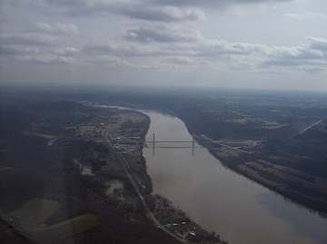
- The groundwater feeding the wells seeps east to west, the same direction the Ohio River flows past them.
- ACRWD's service-line inventory found no lead, no galvanized-requiring-replacement, and no unknown-material service lines anywhere in the system.
History5
- 1969Adams County Regional Water District formed; its 2025 CCR masthead reads '57 years of service! 1969-2026'.
- 1987The district's water treatment plant was built; Rick Adamson, who joined ACRWD in January 1987 as a laborer/operator, oversaw its construction.
- 2003Ohio EPA completed a source water assessment of the district's wellfield, rating the aquifer highly susceptible to contamination. The study was revised in 2024.
- 2024In November the district began installing roughly 130,000 feet of water line, improving existing mains and extending service to customers who had no access.
- 2026General Manager Rick Adamson retired after a 39-year ACRWD career (GM since 2004); Johnny Hayslip became general manager and Nathan Crothers distribution supervisor.
Treatment & pressure
How it is treated
Groundwater only. Eight production wells drilled 65 to 73 feet into the sand-and-gravel Ohio River Buried Valley Aquifer, in a wellfield west of Wrightsville along the Ohio River, feed the district's treatment plant on Buckeye Station Road. Treatment removes iron and manganese by filtration —…
Source: acrwd.comacrwd.comacrwd.com
Water pressure
Not published. ACRWD's website, CCR and rate schedule give no distribution pressure figures.
What it costs
$11.00 per 1,000 gallons
Typical household bill about $56 a month for water.
District rate schedule (billed monthly, all accounts): $23.00 minimum monthly charge on a 5/8-inch meter, which includes the first 1,000 gallons; all usage above the minimum is…
Source: acrwd.com
Water quality & impurities8
| Contaminant | Level | Limit | Year |
|---|---|---|---|
| Total Trihalomethanes (TTHM) Range 17.4-38.4 ppb; no violation. | 38.4 ppb | 80 | 2025 |
| Haloacetic Acids (HAA5) Range ND-7.6 ppb; no violation. | 7.6 ppb | 60 | 2025 |
| Total Chlorine Range 0.92-1.13 ppm; water additive used to control microbes. | 1.02 ppm | 4 (MRDL) | 2025 |
| Fluoride Range 0.78-1.01 ppm; natural deposits plus additive. | 0.91 ppm | 4 | 2025 |
| Nitrate Well below the MCL; no range reported. | 0.22 ppm | 10 | 2025 |
| Barium Monitored less than annually; most recent sample 2023. | 0.021 ppm | 2 | 2023 |
| Lead (90th percentile) 0 of 30 samples exceeded the action level. | 1.8 ppb | 15 (action… | 2025 |
| Copper (90th percentile) 0 of 30 samples exceeded the action level. | 0.854 ppm | 1.3 (action… | 2025 |
Source: acrwd.com
EPA compliance record
Lead at the tap: 90th-percentile result 1.8 ppb in 2025 (action level 15 ppb).
EPA record: no health-based violations since 2015.
Projects & plans4
Recent and current work
- Waterline installation and replacement program (~130,000 feet) · 2024-2026 · under construction
Began November 2024; the 2025 CCR, published in April 2026, says the district is 'currently finishing' it. Improved existing infrastructure and extended…
Source: acrwd.compeoplesdefender.com
Planned or needed
- Winchester Waterline Project · 2026 · planned
The 2025 CCR says the district will begin the project 'later this year' to provide water service to the Winchester Industrial Park. ACRWD publishes no cost.… - US 52 ductile iron waterline replacement · planned
In the planning phase per the 2025 CCR. Numerous leaks along US 52 make replacement a priority for reliability. No cost or timeline published. - Ginger Ridge Road waterline upgrade · planned
In the planning phase; a continuation of an earlier project that installed an 8-inch line from Clayton Pike to Ginger Ridge Road. Would improve supply to Old…
Source: acrwd.comadamscountyohecd.com
Supply stress
Not a quantity problem but a vulnerability one. Ohio EPA's assessment (2003, revised 2024) rates the aquifer supplying ACRWD as highly susceptible to contamination because there is no protective clay layer over it, the aquifer is shallow, and significant potential contaminant sources sit within the protection area. Groundwater seeps very…
Sewers
Sanitary
ACRWD is a water-only district and provides no sanitary sewer service; none of its published materials address wastewater. No countywide sanitary operator was identified for its rural service area (Cherry Fork, Bentonville, Aberdeen). The Village of Winchester runs a municipal sewer system that is being expanded — a new 700,000 GPD…
Storm
We found no public record of a storm sewer system or stormwater utility for the district's largely unincorporated service area.
Source: acrwd.comjobsohio.com
Sourcesverified
Compiled from the utility's own reports and public records, then independently re-checked against primary sources.
Main supplier in 2 ZIP codes
Serves
Main water supplier in 3 ZIP codes
- 45105 · Sprigg Township and Bentonville100% of residents
- 45618 · Wayne Township and Cherry Fork100% of residents
- 45115 · Byrd Township and Decatur16% of residents
Also present in 8 more ZIP codes
- 45697 · Wayne Township and Winchester10% of residents
- 45660 · Meigs Township and Peebles10% of residents
- 45693 · West Union9% of residents
- 45144 · Manchester7% of residents
- 45684 · Nile Township and Stout6% of residents
- 45679 · Scott Township and Seaman3% of residents
- 45101 · Aberdeen1% of residents
- 45167 · Ripley0% of residents
Population-weighted resident shares; a ZIP code can have more than one system on record. Recomputed from each ZIP's own system list, not from the map's cached footprint.
Buys from · Sells to
Adams County Regional Wd does not buy water from another system on record; it treats its own source water.
4 systems on record buy water from Adams County Regional Wd: Peebles Public Water System, Seaman Village, West Union Public Water System, Winchester Public Water System.
What the records show about Adams County Regional Wd
Who runs it
EPA's record describes Adams County Regional Wd as owned by a local government. It has 7,311 service connections and serves 21,810 people.
EPA classes it as a community water system, one that serves the same residents all year.
Its office telephone on EPA's record is 937-544-2396.
Source: EPA Safe Drinking Water Information System (SDWIS), water system record.
How the water is treated
EPA's treatment table registers these steps for Adams County Regional Wd: corrosion control, chlorine disinfection, iron and manganese removal, and fluoridation.
The list is what each system registered with EPA for treatment plants EPA still shows as active, and it can lag a plant upgrade.
Source: EPA Safe Drinking Water Information System (SDWIS) treatment table (EPA Envirofacts, pulled September 2026).
Violations
EPA's record shows no health-based violations for Adams County Regional Wd since 2015.
EPA logs no violations of any kind for Adams County Regional Wd since 2020.
Source: EPA Safe Drinking Water Information System (SDWIS) violation records: health-based violations with compliance periods beginning in 2015 or later, all violations from 2020 or later (EPA Envirofacts, pulled September 2026).
Lead and copper at the tap
In the sampling period ending December 2025, the 90th-percentile lead result at Adams County Regional Wd was 1.8 ppb, under both the current 15 ppb action level and the 10 ppb level that applies from 2027.
The highest result on file is 2.6 ppb, in the period ending December 2017.
EPA has 9 sampling periods on file for Adams County Regional Wd since 2016, the first ending in 2017; no period was above 10 ppb.
Every water system has to inventory its service lines, the pipes from the main to each building. In the inventory Adams County Regional Wd sent EPA, 7,434 lines are counted.
| Material | Lines |
|---|---|
| Lead | 0 |
| Galvanized, needing replacement | 0 |
| Unknown material | 0 |
| Not lead | 7,434 |
| All lines | 7,434 |
Systems sample taps in the homes most likely to have lead pipes or solder. The 90th-percentile result is the level nine in ten of the sampled homes were at or below. Lead comes mostly from service lines and house plumbing, not the source water, so a low result for the system does not clear an old house.
EPA's dashboard status for this inventory: reported all required service line types.
Source: EPA Safe Drinking Water Information System (SDWIS) lead and copper 90th-percentile results (EPA Envirofacts), sampling periods ending 2016 or later; EPA's service line inventory dashboard, Ohio's 2026 Q2 submission.
PFAS
EPA's fifth national round of testing (UCMR 5) took 2 samples of the water entering the pipes of Adams County Regional Wd in 2024 to 2025 and measured 29 PFAS. No PFAS was detected, PFOA and PFOS (federal limit 4 ng/L each) among them.
Ohio EPA's own statewide sampling tested 1 plant of Adams County Regional Wd (latest sample June 2020). Not one of the six PFAS tested (PFOA, PFOS, PFHxS, PFNA, GenX and PFBS) was detected.
Ohio EPA's current sampling status map lists 1 plant of Adams County Regional Wd as sampled, most recently July 2026.
PFAS are the 'forever chemicals' from firefighting foam, plating shops and non-stick coatings. Results are for water leaving the plant, not your tap.
Source: EPA UCMR 5 occurrence data (final release, August 2026); Ohio EPA statewide PFAS sampling, 2019 to 2021, and its sampling status map.
Disinfection byproducts
Chlorine that disinfects water also reacts with organic matter to form byproducts. Two groups have federal limits: total trihalomethanes (TTHM, 80 µg/L) and five haloacetic acids (HAA5, 60 µg/L), judged on running yearly averages at each sampling site.
For TTHM, the average of Adams County Regional Wd's samples in 2019, the last year it was sampled, was 28 µg/L. The worst yearly average was 31.8 µg/L and the highest single sample was 39.5 µg/L, from 39 samples taken from 2012 to 2019.
For HAA5, the average in the last year sampled was 0 µg/L. The worst yearly average was 7.7 µg/L and the highest single sample was 11.3 µg/L, from 39 samples.
| Byproduct | Limit | Latest yearly average | Worst yearly average | Highest sample | Samples |
|---|---|---|---|---|---|
| TTHM | 80 µg/L | 28 µg/L (2019) | 31.8 µg/L | 39.5 µg/L | 39 |
| HAA5 | 60 µg/L | 0 µg/L | 7.7 µg/L | 11.3 µg/L | 39 |
A yearly average of 0 means nothing was detected in that year's samples. EPA's file stops at 2019; Ohio EPA's Drinking Water Watch has newer results.
Source: EPA Six-Year Review 4 compliance monitoring data, 2012 to 2019, distribution-system samples (non-detects counted as zero).
Nitrate, arsenic and radioactivity
Nitrate: the highest of 8 samples was 0.29 mg/L (as nitrogen) in 2014; in 2019, the last year sampled, nitrate was not detected. No sample was over the limit of 10 mg/L. Nitrate above 10 is unsafe for infants.
Arsenic was not detected in 2 samples (limit 10 µg/L).
| Contaminant | Samples | Highest result | Limit | Samples over limit |
|---|---|---|---|---|
| Nitrate (as nitrogen) | 8 | 0.29 mg/L | 10 mg/L | 0 |
| Arsenic | 2 | not detected | 10 µg/L | 0 |
Measured in finished water: at the plant's entry points and in the distribution system; raw well and intake samples are left out. Non-detects count as zero.
Source: EPA Six-Year Review 4 compliance monitoring data, 2012 to 2019, finished water.
Solvents and fuels
EPA's file holds results for all six solvent and fuel compounds it checked. Benzene, carbon tetrachloride, 1,2-dichloroethane, trichloroethylene, tetrachloroethylene, and vinyl chloride were not detected in 2 samples each.
| Compound | Limit | Samples | Detected in | Highest result | Samples over limit |
|---|---|---|---|---|---|
| Benzene | 5 µg/L | 2 | 0 of 2 | not detected | 0 |
| Carbon tetrachloride | 5 µg/L | 2 | 0 of 2 | not detected | 0 |
| 1,2-dichloroethane | 5 µg/L | 2 | 0 of 2 | not detected | 0 |
| Trichloroethylene (TCE) | 5 µg/L | 2 | 0 of 2 | not detected | 0 |
| Tetrachloroethylene (PCE) | 5 µg/L | 2 | 0 of 2 | not detected | 0 |
| Vinyl chloride | 2 µg/L | 2 | 0 of 2 | not detected | 0 |
"Not detected" means the lab's result was below what its method can measure, not that the compound is absent. Non-detects count as zero in the highest-result column.
Source: EPA Six-Year Review 4 compliance monitoring data, 2012 to 2019, finished water.
Farm chemicals and metals
EPA's file holds results for 8 of the nine herbicides and metals it checked. Detected: barium in 2 of 2 samples, highest 25.3 µg/L (limit 2,000). Not detected: atrazine in 2 samples, alachlor in 2 samples, chromium in 3 samples, cadmium in 2 samples, mercury in 2 samples, selenium in 2 samples, thallium in 2 samples.
| Substance | Kind | Limit | Samples | Detected in | Highest result | Samples over limit |
|---|---|---|---|---|---|---|
| Atrazine | Farm chemical | 3 µg/L | 2 | 0 of 2 | not detected | 0 |
| Alachlor | Farm chemical | 2 µg/L | 2 | 0 of 2 | not detected | 0 |
| Chromium | Metal | 100 µg/L | 3 | 0 of 3 | not detected | 0 |
| Cadmium | Metal | 5 µg/L | 2 | 0 of 2 | not detected | 0 |
| Barium | Metal | 2,000 µg/L | 2 | 2 of 2 | 25.3 µg/L | 0 |
| Mercury | Metal | 2 µg/L | 2 | 0 of 2 | not detected | 0 |
| Selenium | Metal | 50 µg/L | 2 | 0 of 2 | not detected | 0 |
| Thallium | Metal | 2 µg/L | 2 | 0 of 2 | not detected | 0 |
Non-detects count as zero in the highest-result column.
Source: EPA Six-Year Review 4 compliance monitoring data, 2012 to 2019, finished water.
Bacteria in the pipes
From 2012 to 2019, 0 of 2,010 routine total coliform samples taken in the distribution system at Adams County Regional Wd tested positive (0%); in 2019, the last year on file, 0 of 300 did.
A positive coliform test is a warning sign, not a violation by itself. E. coli is a sign that human or animal waste may have reached the water. Coliform counts are routine samples only; E. coli counts include repeat samples.
Source: EPA Six-Year Review 4 compliance monitoring data, 2012 to 2019, distribution-system presence/absence tests for total coliform and E. coli.
Fluoride
The Ohio Department of Health's report to the CDC (My Water's Fluoride) says Adams County Regional Wd adjusts the fluoride level to the recommended level for preventing tooth decay.
EPA's treatment table lists fluoridation among the steps at Adams County Regional Wd.
Measured fluoride: 0.91 mg/L on average at the plant's entry points in 2017 (in the range dentists aim for); samples ran from 0.91 to 0.97 mg/L across 2 samples in 2012 to 2019.
The recommended level for preventing tooth decay is 0.7 mg/L; the federal limit is 4 mg/L. The treatment list is what each system registered with EPA and can lag a plant upgrade.
Source: CDC My Water's Fluoride (fluoridation status as reported by the Ohio Department of Health, fetched September 2026); EPA Safe Drinking Water Information System (SDWIS) treatment table; EPA Six-Year Review 4 compliance monitoring data, 2012 to 2019, entry-point fluoride samples.
Lithium
Lithium was not detected in 2 UCMR 5 samples at Adams County Regional Wd, last sampled in 2025 (the method reports from 9 µg/L).
Lithium is not regulated. EPA's draft health reference level is 10 µg/L, and it occurs naturally in deep groundwater, so well systems in the northwest run highest.
Source: EPA UCMR 5 occurrence data (final release, August 2026), samples from 2023 to 2025.
How well the service area is mapped
The service area drawn on the map for Adams County Regional Wd comes from the utility's own map.
Counting the people who live in the ZIP codes it overlaps, this atlas estimates 2,625 residents are inside the boundary, 12% of the 21,810 people Adams County Regional Wd reports serving. With so much of its territory outside the polygon, part of the system shows on the map as private wells.
The resident count is an estimate from 2020 Census ZIP-code populations, not a count of customers.
Source: EPA Service Area Boundaries; resident estimate by this atlas from ZIP-code overlap.
Photograph
On the map
Show this system's territory on the map — 11 ZIP codes in all.
Sources
U.S. EPA SDWIS and Community Water System Service Area Boundaries (v3, 2026), Ohio EPA primacy data, 2020 census blocks: the system serving most residents, traced through purchases to the treating utility; Ohio EPA 2023 Sewer and Water Rate Survey (Ohio State, May 2025) for household bills; Ohio EPA DEFA loan awards since 2016 for the loans paragraph · EPA SDWIS · EPA service area boundaries · Ohio EPA drinking water · Ohio EPA rate survey
EPA's own record for this system: Enforcement and Compliance History report for OH0100012 (EPA ECHO).
Adams County Regional Wd's own pages: acrwd.com, acrwd.com
Notable facts: acrwd.com, acrwd.com, acrwd.com, acrwd.com
History: acrwd.com, acrwd.com, acrwd.com, acrwd.com
Water quality: acrwd.com
Planned work: acrwd.com, adamscountyohecd.com
Capital projects: acrwd.com, peoplesdefender.com
Rates: acrwd.com
Sewers: acrwd.com, jobsohio.com
