Local events in Bethlehem Township, Coshocton County
Nothing is posted for Bethlehem Township itself yet; here is what is on within 10 miles. All local events in Bethlehem Township, Coshocton County
Know a calendar we should watch? Send the link
Checked October 20; the events page is refreshed daily.
How Bethlehem Township, Coshocton County began
Bethlehem Township, in north-central Coshocton County, takes in the valleys of the Walhonding River and the Killbuck, where Denman's prairie drew the first settlers in the county in the spring of 1800. It was organized in 1826 and named by William Speaks, a Revolutionary soldier and the oldest resident, who was given the honor. Two Delaware (Lenape) towns lay in the valley a century earlier, including Custaloga's Town in the forks of the Walhonding and Killbuck, and the river's old name, White Woman's creek, comes from Mary Harris, whom Christopher Gist heard of in 1751. The land is entirely military land and the township has never had a village; the Walhonding canal, rafting of logs and farming made its living. It had 1,054 residents in 2020.
Settled 1800 (Denman's prairie: Charles Williams, William Morrison, Isaac and Henry Hoagland), incorporated 1826 (township organized), by William Speaks was given the honor of naming it.
Where the name comes from
The 1881 county history says that when the township was organized in 1826 'the honor of naming it was given to William Speaks, a revolutionary soldier, who was the oldest resident of the township at that time'; it gives no reason for the name Bethlehem.
Before the town
The 1881 county history gives this valley a long Native record. Killbuck Creek was named for a noted Delaware (Lenape) chief whose town stood farther up the stream, between Millersburg and Wooster. 'A hundred years ago' (about 1780) two Delaware villages stood in the valley, three and ten miles above Coshocton, and in the forks of the Walhonding and Killbuck stood Custaloga's Town, probably the residence of Mary Harris, for whom the river was called the White Woman's River, and where Christopher Gist stayed in the winter of 1750-51; Custaloga, a Delaware chief and orator, was with twenty warriors the first to deliver up prisoners to Colonel Bouquet and spoke at the Fort Pitt treaty. The Walhonding name is given as meaning 'the White Woman' in the Indian tongue. Two mounds are known in the township: a large one about fifteen feet high on John Hogle's farm on the east reserve of the Rathbone section, near the Walhonding, and a smaller one on the Moffitt farm in the Killbuck valley. Indians from the Tuscarawas still came to the Killbuck to trap and hunt in the summer as late as 1822. The land was ceded by the Treaty of Greenville (1795).
Nations recorded here: Lenape (Delaware), Wyandot.
- White Woman's Village (White Woman's Town) (village) — on the Walhonding River near Warsaw, Coshocton County, c. 1750-1777 (accessgenealogy.com)
- Custaloga's Town (village) — in the forks of the Walhonding River and Killbuck Creek, 18th century (archive.org)
- Mound on John Hogle's farm (east reserve of the Rathbone section) (mound) — near the Walhonding River, Bethlehem Township, prehistoric; undated (archive.org)
- Mound on the Moffitt farm (mound) — Killbuck valley, northwest of the township center, prehistoric; undated (archive.org)
Timeline
- — Mary Harris, an English captive married to the chief Eagle Feather, is living at White Woman's Town in the forks of the Walhonding and Killbuck, according to the 1881 county history.
- — Christopher Gist, a surveyor for the Ohio Land Company, stays at White Woman's Town from December 14, 1750 to January 15, 1751 and, the county history says, spends the winter festivities with Mary Harris, who tells him her story.
- — In the spring Charles Williams, William Morrison and Isaac and Henry Hoagland settle on Denman's prairie, the first settlement in what is now Coshocton County; Ebenezer Buckingham settles at the mouth of the Killbuck for two years.
- — Samuel Morrison, Ira Kimberly, George Carpenter and James Craig join them on the prairie; Mrs. Sallie Kimberly swims the Walhonding to fetch a deer her brother-in-law shot.
- — A school is said to have been taught on the prairie up the Walhonding in 1802 or 1803, the first in the county, though its teacher is unknown.
- — Henry Carr settles on lot 11 of the southwest section and runs a small still, trading whisky at a gallon for a bushel of corn; John Bantum, a Revolutionary veteran, settles on the Rathbone section.
- — Michael Hogle, from Vermont, settles in April and raises nineteen children; Albert Torrey, the township's first mechanic, settles as a blacksmith.
- — John Markley, one of Adam Markley's sons, is killed at an election at Coshocton by George Arnold of the Bethlehem area, the first murder committed in the county.
- — A Methodist class is formed under Samuel Clark and others; a schoolhouse is built about 1821 near the center on the Killbuck with Matthew Boner the first teacher.
- — Bethlehem Township is organized and named by William Speaks, the oldest resident.
- — Thomas H. Miller builds the township's only sawmill near the mouth of the Killbuck; rafting logs down the Killbuck to Zanesville, Roscoe and Coshocton is the chief industry.
- — The Rathbone section is surveyed into thirty lots of 100 to 150 acres, with two mill-site reserves on the river; little of it was sold before 1835.
- — The Mount Zion Methodist Protestant church, a hewed-log building, is erected in the northwest on land given by John C. Frederick.
- — A bridge across the Walhonding at Fry's Ford replaces the ferry; the masonry cost about $5,700 and the wooden superstructure $6,100.
- — Bethlehem Township has 1,054 residents.
Stories
Two accounts of the White Woman
The Walhonding River is said in the Indian tongue to mean 'the White Woman', and the 1881 county history gives two accounts of the name. Along the west bank on the Denman farm, a broken ledge of rock overlooks the river, and a legend traced to the Carpenters, who came to the county in 1801, says a beautiful young captive preferred death to life among the Indians, fled from their camp in a storm and leaped from the rock into the flooded stream. In one version the water closed over her; in another she hid under a ledge until her pursuers gave up and then slipped away. The earliest white witness tells it differently: The county history says that Christopher Gist, who stayed at White Woman's Town from December 1750 to January 1751, met there Mary Harris, the white woman for whom the town and river were named and the wife of the chief Eagle Feather. The county historian guessed that she lived at Custaloga's Town in the forks of the Walhonding and the Killbuck.
The deer and the neckerchief
In the early years on Denman's prairie, William Morrison saw a deer across the Walhonding, shot it, and was too unwell to fetch it himself. His wife's sister, Sallie Kimberly, who was visiting, agreed to bring it over. The river was deep and nowhere fordable, but she sprang in and swam across, tied her large neckerchief around the deer's neck, and holding the other end of the cloth in her teeth swam back towing the animal to the near shore. The county historian says the women of the Carpenter family, who had grown up on the Ohio during the border wars, were known for strength and endurance; their father had once been left for dead by Indians while his wife outran them to a fort. The story is from the 1881 county history.
Photographs
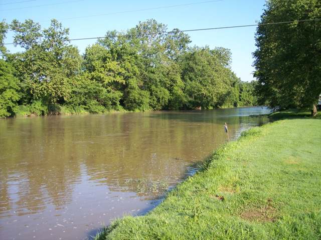
Photo: Tim Kiser (Malepheasant), Wikimedia Commons, CC BY-SA 2.5 · Wikimedia Commons
Local history sources: en.wikipedia.org · accessgenealogy.com · en.wikipedia.org · commons.wikimedia.org · archive.org · jhmuseum.org · web.archive.org
Water
Mostly private wells The water here
- Coshocton79% of residentsSand & gravel aquifer near Walhonding River/Mill Creek valley (wells)
- Warsaw20% of residentsGroundwater wells (2 wells)
- Bomac Mobile Home Park1% of residentsGroundwater wells (2 wells)
Hospitals, fire stations and more
Inside Bethlehem Township, Coshocton County's boundary: 2 public schools and 1 spill case. Press a pin or a name for its whole record and its source.
Public schools (2)
-
River View High School3.5 of 5 stars · Warsaw
- Address
- 26496 State Route 60, Warsaw, OH 43844
- School district
- River View Local School District
- Kind (NCES)
- Regular School
- Students, 2023-24
- 712
- Teachers (full-time equivalent)
- 38
- Report card, 2025-26
- 3.5 of 5 stars
- Performance index
- 74.4%
- Four-year graduation rate
- 95.6%
- Ohio building IRN
- 031880
- NCES school ID
- 390464802570
NCES school record ↗ Ohio School Report Card ↗ Street map and directions ↗
-
River View Intermediate School3.5 of 5 stars · Warsaw
- Address
- 26546 State Route 60, Warsaw, OH 43844
- School district
- River View Local School District
- Kind (NCES)
- Regular School
- Students, 2023-24
- 478
- Teachers (full-time equivalent)
- 23
- Report card, 2025-26
- 3.5 of 5 stars
- Performance index
- 74.7%
- Ohio building IRN
- 084988
- NCES school ID
- 390464804164
NCES school record ↗ Ohio School Report Card ↗ Street map and directions ↗
Source: NCES EDGE public school locations 2024-25 and Common Core of Data 2023-24 (type, students, teachers); Ohio School Report Cards 2025-26 (Department of Education and Workforce), matched by name within the district.
Spills reported since 2021 (1)
-
Other / All Other / Trade Name / Mixture / Solution Etc2025-08-17 · Bethlehem Twp
- Reported
- 2025-08-17
- What spilled
- Other / All Other / Trade Name / Mixture / Solution Etc
- Where
- Bethlehem Twp, Coshocton County
- Ohio EPA district office
- SEDO
- Ohio EPA case number
- 2508EPA0001389
Ohio EPA spill reports (source) ↗ Street map and directions ↗
Source: Ohio EPA emergency response spill reports, 2021 to September 2026, one point per case where Ohio EPA placed it. A report is what the caller or responder recorded; amounts are often blank or estimated.
Its ZIP codes
Each ZIP code that touches Bethlehem Township, Coshocton County, with the share of its residents who live here and the same headline figures as the ZIP page.
| ZIP | Share | Water | Radon | Home value | Schools | Flood |
|---|---|---|---|---|---|---|
| 43844 Jefferson Township and Warsaw | 15% | Mostly private wells | 16.6 pCi/L average radon | Median year built 1979 | River View Local · 3 stars overall | 6.7% of residents in the 1% floodplain |
| 43812 Coshocton | 3% | Wells in a buried sand-and-gravel valley aquifer just off State Route 83 N, near where Mill Creek meets the Walhonding River north of downtown Coshocton | 9.4 pCi/L average radon | Median year built 1950 | Coshocton City · 3.5 stars overall | 4.3% of residents in the 1% floodplain |
Local government
Who holds office in Bethlehem Township, Coshocton County, how its elections and ballot issues came out, and the state auditor's record.
Money issues on the ballot since 2019: 1 of 1 passed.
Ballot issues
| Date | Issue | For | Against | Result |
|---|---|---|---|---|
| 2019-11-05 | Issue 2: Bethlehem Township (levy type not on the results report) | 268 | 167 | Passed (61.61% for) |
Elections for office
| Date | Office | Candidates and votes |
|---|---|---|
| 2019-11-05 | Township Trustee | James A. Hoy 156, 36.88%; Mark A. McCombs Sr. 104, 24.59%; Michael Varns 163, 38.53% |
| 2019-11-05 | Township Fiscal Officer | Tammy L. Pope 344, 100.0% |
Winners in bold. Results from the county board of elections' official canvass unless marked.
Auditor of State record
- No fiscal caution, watch or emergency on the Auditor of State's lists.
- Basic Audit, 2024 to 2025, released 2026-07-07
The county
Coshocton County: 8 ZIP codes, 25 cities, villages and townships, 33,626 people.
Nearby places
Quick answers
What county is Bethlehem Township, Ohio in?
Bethlehem Township, Coshocton County is a township in Coshocton County, Ohio, with 1,054 residents.
When was Bethlehem Township, Ohio founded?
Bethlehem Township, Coshocton County was settled 1800 (Denman's prairie: Charles Williams, William Morrison, Isaac and Henry Hoagland); incorporated 1826 (township organized). Founders on record: William Speaks was given the honor of naming it. Source
How did Bethlehem Township, Ohio get its name?
The 1881 county history says that when the township was organized in 1826 'the honor of naming it was given to William Speaks, a revolutionary soldier, who was the oldest resident of the township at that time'; it gives no reason for the name Bethlehem. Source
What ZIP code is Bethlehem Township, Ohio?
Bethlehem Township, Coshocton County is served by ZIP codes 43844 and 43812; 43844 holds the largest share of its residents.
Where does Bethlehem Township, Ohio get its water?
The main water source for Bethlehem Township, Coshocton County (Coshocton): Mostly private wells.
Cite this page
Cite this page as:
Cracked Buckeye, "Bethlehem Township, Coshocton County", https://crackedbuckeye.com/place/bethlehem-township-coshocton-county/, built 2026-10-31, accessed [date].
How to cite · Report a correction · Built 2026-10-31