Local events in Keene Township, Coshocton County
Nothing is posted for Keene Township itself yet; here is what is on within 10 miles. All local events in Keene Township, Coshocton County
Know a calendar we should watch? Send the link
Checked October 20; the events page is refreshed daily.
How Keene Township, Coshocton County began
Keene Township, in north-central Coshocton County, was organized in 1824, having been part of Mill Creek Township. Among its earliest settlers were Nicholas Miller, a Virginian who took up land in 1806 with $36 and two axes, Garrett Moore (1806), Benjamin Burrell (about 1807), James Oglesby (1810) and the hunter George Bible (1816). In the northwest, New Englanders from Cheshire County, New Hampshire, led by Jesse Beals, laid out the village of Keene in 1820 and named it for their home; its academy (about 1845) drew students from afar. Keene hoped to be the county seat until Holmes County was cut off in 1824. Newport, a canal town of 1830, vanished into Canal Lewisville. The township had 1,623 residents in 2020.
Settled 1806, platted 1820 (Keene); 1830 (Newport), incorporated 1824 (township organized from Mill Creek Township), by Nicholas Miller (1806); Jesse Beals (Keene village).
Where the name comes from
The village of Keene was named by Jesse Beals, who emigrated from near Keene, Cheshire County, New Hampshire, as did many of its first settlers; the township took the village's name.
Before the town
The 1881 county history says archaeological remains are not numerous in Keene Township, because in Coshocton County they are found mainly in the broad valleys of the larger streams and only the Walhonding touches the township's southwest corner. On the farm of K. D. Miller, on a hill point overlooking that valley, stood a stone mound about 12 feet across and 3 feet high, its stones 'nicely fitted together like mason work' (much of it hauled away, never explored); about a mile southeast, near Saul Miller's, was a flat circular rise covering about an acre, where a plow struck a layer of stone like a pavement leading to a spring; and across the road from Miller's house a sandy hilltop held several pits about ten feet deep of unknown purpose. The source does not date or attribute any of them. The 1881 history also tells that when Nicholas Miller attended a militia muster at Coshocton, an Indian tried to steal his horse and Miller gave him a drubbing; the man threatened revenge but never came. At the county level, the Lenape (Delaware) had their principal town, Goschachgunk (anglicized to Coshocton), at the forks of the Muskingum, and American settlement followed the 1795 Treaty of Greenville.
- Stone mound on the K. D. Miller farm (mound) — Hill point overlooking the Walhonding valley, southwest corner of Keene Township, undated; never explored (archive.org)
- Flat circular rise with stone pavement (other) — Ridge just west of Saul Miller's residence, about a mile southeast of the stone mound, undated (archive.org)
Timeline
- — President John Adams signs the patent for the southwestern quarter to Robert Underwood, a Treasury official who never lived in the county, and on May 16 the southeastern quarter to James Hamilton of Carlisle, Pennsylvania; both sell the land in lots of about 100 acres.
- — About this year Ebenezer Buckingham of Zanesville has a dam built for a sawmill on Mill Creek on the Underwood section; high water sweeps it away the same fall and the project is dropped, one account adding that a workman died of a rattlesnake bite.
- — Nicholas Miller, 'with $36 and two axes,' takes up residence on the Underwood section, paying for part of his 72 acres by helping survey it; Garrett Moore and others settle the same year.
- — Benjamin Burrell of Frederick County, Maryland settles on the 500 acres that surveyor J. Matthews had received for locating the section; he dies soon after the War of 1812.
- — James Oglesby of Virginia, later the oldest resident of the township, settles by leasing a place from Isaac Evans; he serves twice in the War of 1812.
- — Nicholas Miller builds the first permanent mill in the township; George Bible of Virginia settles on the Underwood section, where he kills 100 to 150 deer a year.
- — Timothy Emerson of Ashley, Massachusetts settles in the northwest, which fills with New Englanders from Cheshire County, New Hampshire; the Farwells follow in 1825. He starts the township's first Sunday school.
- — Jesse Beals lays out the village of Keene, sixteen lots a little northwest of the township's center.
- — Dr. Benjamin Hills of Cheshire County, New Hampshire, the township's first physician, settles at Keene about 1820 or 1821; the first school in Keene village, a leaky log cabin, is taught the winter of 1821 by Adam Johnson.
- — Keene Township was organized as a civil township of Coshocton County.
- — The earliest township records preserved show Timothy Emerson, John Eader and George Ford as trustees and Henry Barnes as clerk.
- — Solomon Vail lays out Newport on the new Ohio Canal near the township's southern line; two warehouses and a tavern open, but the rival Canal Lewisville half a mile east soon swallows it.
- — The First Presbyterian Church of Keene is incorporated; its first building, a large frame structure, was put up in 1834 by Charles Farwell, and the present church was dedicated in May 1879.
- — A stock company of ten or twelve citizens builds the Keene academy about this year; for several years it enrolls over 100 students from a distance before it is merged into the public schools.
- — The German Baptist (Dunkard) church is built on lot 25 and dedicated on July 7, the first church building of that denomination in the county.
- — The village of Keene has about 275 residents, two stores, two hotels, three blacksmith shops and two churches, Presbyterian and Methodist Episcopal.
- — The census counts 1,623 people in Keene Township.
Stories
Who came first to Keene? Miller, Bible and Oglesby
Among the earliest settlers, according to the 1881 county history, was Nicholas Miller, who took up residence on the Underwood section in 1806; Garrett Moore also came that year, and Benjamin Burrell about 1807. George Bible, a Virginian remembered as a famous hunter who brought down 100 to 150 deer a year and devoted most of his time to the chase, did not arrive until 1816. James Oglesby, also from Virginia, came in 1810, leased a place from Isaac Evans, and by 1881 was the oldest resident of the township. Some later summaries make Bible the first settler and say Oglesby paddled up the Muskingum and Walhonding by canoe; the 1881 history, written when Oglesby was alive, says he came through to Coshocton from Virginia by team.
Thirty-six dollars and two axes
Nicholas Miller came to Coshocton County from Hampshire County, Virginia, in 1804 with his father Henry, who had served seven years in the Revolution as a sharpshooter under General Morgan. After two years at his uncle's in Franklin Township he moved to Keene in 1806; his whole fortune, the 1881 county history says, was $36 and two axes. He bought 72 acres on the Underwood section and paid for part of it by helping survey the section. One winter he slept under a jutting rock rather than walk home each night; when a bear approached he raised such a yell it ran off, and on another occasion he shot a wounded bear dead after it had killed his dog. At a militia muster in Coshocton he caught an Indian trying to steal his horse and gave him a beating. He married Mary Darling, who had driven a four-horse team from Virginia at eighteen, and he went on to add a great deal of land and to build the township's first lasting mill in 1816.
Keene's bid to be the county seat
Keene was settled largely by New Englanders, who named it for their native Keene, New Hampshire, and who brought a taste for schools and sheep with them. When Coshocton County still included much of what is now Holmes County, the village of Coshocton was small and far from the center of the county, and Keene argued strongly that it had the more central location. The formation of Holmes County in 1824 put an end to that hope. According to the 1881 history, prominent men in Coshocton, fearing for their county seat, helped to have the new county cut off. The town built an academy about 1845, and in 1881 it was still a village of about 275.
Photographs
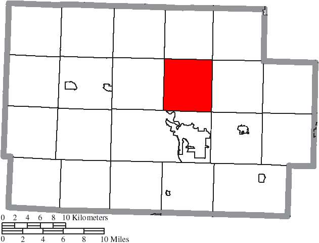
Photo: Ruhrfisch and Nyttend, Wikimedia Commons, CC BY-SA 3.0 · Wikimedia Commons
Local history sources: en.wikipedia.org · en.wikipedia.org · en.wikipedia.org · commons.wikimedia.org · archive.org
Historic places
1 place in Keene Township, Coshocton County on the National Register of Historic Places. Press a pin or a name for its whole record.
-
Milligan, Cuthbert, HouseBuilding · Coshocton · listed 1980
- Address
- N of Coshocton
- Where
- Coshocton, Coshocton County · ZIP 43812
- What it is
- Building
- Listed on the National Register
- 1980
- NRIS reference number
- 80002966
- Coordinates
- 40.33427, -81.88890
National Register file (NPS) ↗ Search Wikipedia ↗ Street map and directions ↗ On the Cracked Buckeye map
Source: National Park Service, National Register of Historic Places point file. The listing year is shown where NPS's certification date agrees with the listing's reference number. Listing recognizes significance; it does not restrict a private owner.
Water
Wells in a buried sand-and-gravel valley aquifer just off State Route 83 N, near where Mill Creek meets the Walhonding River north of downtown Coshocton The water here
- Coshocton99% of residentsSand & gravel aquifer near Walhonding River/Mill Creek valley (wells)
- Bomac Mobile Home Park1% of residentsGroundwater wells (2 wells)
Hospitals, fire stations and more
Inside Keene Township, Coshocton County's boundary: 1 fire or EMS station, 1 private school, 2 poor-rated bridges and 4 shale and injection wells. Press a pin or a name for its whole record and its source.
Fire and EMS stations (1)
-
Three Rivers Fire District North StationCoshocton
- Address
- 24199 State Highway 621, Coshocton, OH 43812
- Coordinates
- 40.30358, -81.83792
USGS National Map structures (source) ↗ Street map and directions ↗
Source: USGS National Map structures (most Ohio records last updated 2019 to 2022), checked against the Columbus and Cleveland station lists. The department that answers a call is set by jurisdiction and mutual aid, not by distance.
Private schools (1)
-
North KeenePrivate, religious, independent · Fresno
- Address
- 28542 Township Rd 194, Fresno, OH 43824
- Kind
- religious, independent
- Students, 2023-24
- 28
- Teachers (full-time equivalent)
- 2
- Students per teacher
- 14
- Phone
- (740) 610-4224
- NCES private school ID
- A2102993
Source: NCES Private School Survey 2023-24.
Bridges rated poor (2)
-
Township Road 206 over Mill CreekPoor · built 1970
- Condition
- Poor: a deck, superstructure, substructure or culvert rated 4 or below on the 0 to 9 scale
- What it is
- Bridge
- Built
- 1970
- Length
- 12 ft
- Owner
- County
- Vehicles a day
- 351
- Coordinates
- 40.36757, -81.85563
National Bridge Inventory (source) ↗ Street map and directions ↗
-
Township Road 322 over Mill CreekPoor · built 1974
- Condition
- Poor: a deck, superstructure, substructure or culvert rated 4 or below on the 0 to 9 scale
- What it is
- Bridge
- Built
- 1974
- Length
- 13 ft
- Owner
- County
- Vehicles a day
- 351
- Coordinates
- 40.32380, -81.85796
National Bridge Inventory (source) ↗ Street map and directions ↗
Source: FHWA National Bridge Inventory 2025. "Poor" means one major part rated 4 or below on the 0 to 9 scale; it calls for repair, not closing, unless the state posts or closes the bridge.
Shale and injection wells (4)
-
Adams (Swiw #10) 1 InjectionInjection well (Class II)
- What it is
- Injection well (Class II)
- Operator
- Buckeye Brine Llc
- County
- Coshocton County
- API well number
- 34031271770000
- Coordinates
- 40.30090, -81.84803
ODNR oil and gas wells (source) ↗ Street map and directions ↗
-
Adams (Swiw #11) 2 InjectionInjection well (Class II)
- What it is
- Injection well (Class II)
- Operator
- Buckeye Brine Llc
- County
- Coshocton County
- API well number
- 34031271780000
- Coordinates
- 40.30254, -81.84619
ODNR oil and gas wells (source) ↗ Street map and directions ↗
-
Adams (Swiw #12) 3 InjectionInjection well (Class II)
- What it is
- Injection well (Class II)
- Operator
- Buckeye Brine Llc
- County
- Coshocton County
- API well number
- 34031272410000
- Coordinates
- 40.30215, -81.85090
ODNR oil and gas wells (source) ↗ Street map and directions ↗
-
Raymond & Margaret Pew {Swiw#9} 2 InjectionInjection well (Class II)
- What it is
- Injection well (Class II)
- Operator
- Diversified Production Llc
- County
- Coshocton County
- API well number
- 34031241780000
- Coordinates
- 40.32520, -81.85913
ODNR oil and gas wells (source) ↗ Street map and directions ↗
Source: ODNR Division of Oil and Gas Resources well inventory (September 2026): drilled Utica, Marcellus and horizontal wells and Class II injection wells not plugged. Older vertical wells are on the full map.
Its ZIP codes
Each ZIP code that touches Keene Township, Coshocton County, with the share of its residents who live here and the same headline figures as the ZIP page.
| ZIP | Share | Water | Radon | Home value | Schools | Flood |
|---|---|---|---|---|---|---|
| 43812 Coshocton | 8% | Wells in a buried sand-and-gravel valley aquifer just off State Route 83 N, near where Mill Creek meets the Walhonding River north of downtown Coshocton | 9.4 pCi/L average radon | Median year built 1950 | Coshocton City · 3.5 stars overall | 4.3% of residents in the 1% floodplain |
| 43824 Crawford Township and Fresno | 6% | Mostly private wells | 4.8 pCi/L average radon | Median year built 1988 | Ridgewood Local · 4 stars overall | 5.3% of residents in the 1% floodplain |
Local government
Who holds office in Keene Township, Coshocton County, how its elections and ballot issues came out, and the state auditor's record.
Money issues on the ballot since 2019: 1 of 1 passed.
Ballot issues
| Date | Issue | For | Against | Result |
|---|---|---|---|---|
| 2019-11-05 | Issue 6: Keene Township (levy type not on the results report) | 386 | 198 | Passed (66.1% for) |
Elections for office
| Date | Office | Candidates and votes |
|---|---|---|
| 2019-11-05 | Township Trustee | Bruce O. Horn 507, 100.0% |
| 2019-11-05 | Township Fiscal Officer | Robert Raber 484, 100.0% |
Winners in bold. Results from the county board of elections' official canvass unless marked.
Auditor of State record
- No fiscal caution, watch or emergency on the Auditor of State's lists.
- Financial Audit, 2023 to 2024, released 2025-07-22
The county
Coshocton County: 8 ZIP codes, 25 cities, villages and townships, 33,626 people.
Nearby places
Quick answers
What county is Keene Township, Ohio in?
Keene Township, Coshocton County is a township in Coshocton County, Ohio, with 1,623 residents.
When was Keene Township, Ohio founded?
Keene Township, Coshocton County was settled 1806; laid out 1820 (Keene); 1830 (Newport); incorporated 1824 (township organized from Mill Creek Township). Founders on record: Nicholas Miller (1806); Jesse Beals (Keene village). Source
How did Keene Township, Ohio get its name?
The village of Keene was named by Jesse Beals, who emigrated from near Keene, Cheshire County, New Hampshire, as did many of its first settlers; the township took the village's name. Source
What ZIP code is Keene Township, Ohio?
Keene Township, Coshocton County is served by ZIP codes 43812 and 43824; 43812 holds the largest share of its residents.
Where does Keene Township, Ohio get its water?
The main water source for Keene Township, Coshocton County (Coshocton): Wells in a buried sand-and-gravel valley aquifer just off State Route 83 N, near where Mill Creek meets the Walhonding River north of downtown Coshocton.
Cite this page
Cite this page as:
Cracked Buckeye, "Keene Township, Coshocton County", https://crackedbuckeye.com/place/keene-township-coshocton-county/, built 2026-10-31, accessed [date].
How to cite · Report a correction · Built 2026-10-31
