Water system
Coshocton
EPA ID OH1600012 · Coshocton County · 13,537 people served
Coshocton treats its own water from Sand & gravel aquifer near Walhonding River/Mill Creek valley (wells).
The system's record
- Aquifer
- Walhonding River valley sand & gravel aquifer
- Active wells
- 8
- Serves
- 13,537 people · Coshocton County
- EPA ID
- OH1600012
8 wells tap a buried valley sand-and-gravel aquifer near Mill Creek and the Walhonding River, not the surface river itself.
About this area's water
Did you know
- Coshocton bills water by the 1,000 cubic feet rather than the 1,000 gallons, and its 2022 rate ordinance locked in a raise every June from 2022 through 2029 — so a resident can look up what their 2029 bill will be today.
- The water plant runs a 24/7 self-serve bulk station at a penny a gallon, with volume breaks down to $0.006 a gallon for anyone hauling more than 2 million gallons a month.
- The city's stormwater fee is a quarter a month for a house and a dollar for a business.
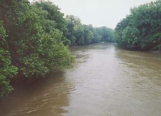
- The wells sit in a buried sand-and-gravel valley where Mill Creek meets the Walhonding, just upstream of the point in town where the Walhonding and Tuscarawas join to form the Muskingum.
- A 2020 statewide PFAS survey and the 2024 UCMR 5 round both came back non-detect for Coshocton's finished water.
Source: cityofcoshocton.comcityofcoshocton.comcityofcoshocton.com
History6
- 2008Water treatment plant expansion completed; on Ohio EPA criteria the plant is rated to deliver up to 15 million gallons per day.
- 2008Wastewater treatment plant renovated: all three trickling filters rebuilt and a new high-strength BOD removal system installed.
- 2020System sampled under Ohio's statewide drinking water PFAS Sampling Initiative; six PFAS compounds tested, none detected in finished water.
- 2021Waterline expansion carried city water out to West Lafayette, the template later cited for the Warsaw extension.
- 2022Revised Ordinance 12-22 set an eight-year schedule of annual water and sewer rate increases from the June 2022 billing through June 2029, along with trash, stormwater, tap, bulk water and…
- 2024System participated in the fifth round of the federal Unregulated Contaminant Monitoring Rule (UCMR 5); all samples came back non-detect.
Source: cityofcoshocton.comcityofcoshocton.comcityofcoshocton.com
Treatment & pressure
How it is treated
Water comes from a well field just off State Route 83 N near the junction of Mill Creek and the Walhonding River, in a submersed valley geology tapping a large saturated sand-and-gravel aquifer. At the plant the water goes through lime softening, stabilization by recarbonation, filtration…
Source: cityofcoshocton.comcityofcoshocton.com
Water pressure
Not published. Neither the 2025 CCR nor the utilities department page gives a distribution pressure figure.
What it costs
$8.77 per 1,000 gallons
Typical household bill about $59 a month for water.
Coshocton bills by the 1,000 CUBIC FEET, not the 1,000 gallons; 1,000 CF = 7,480 gallons. Inside city limits for the June 2026 billing (Revised Ordinance 12-22): $29.78 minimum…
Source: cityofcoshocton.com
Water quality & impurities8
| Contaminant | Level | Limit | Year |
|---|---|---|---|
| Total Chlorine Highest level detected, range 1.24-1.57 over calendar year 2025; disinfectant residual, compliant. | 1.399 ppm | 4 (MRDL) | 2025 |
| Total Trihalomethanes (TTHM) Highest level detected 9/10/2025, range 12.3-16.8; disinfection byproduct, well under the limit. | 16.8 ppb | 80 | 2025 |
| Haloacetic Acids (HAA5) Below the detection limit of 6 ppb on 9/10/2025. | <6 ppb | 60 | 2025 |
| Fluoride Highest level detected, range 0.55-1.16 over calendar year 2025; compliant. | 1.16 ppm | 4.0 | 2025 |
| Barium Naturally occurring; monitored less than annually. | 0.033 ppm | 2 | 2023 |
| Nitrate (as N) Single sample 5/5/2025; low. | 0.585 ppm | 10 | 2025 |
| Copper 90th percentile from sampling 6/13/2024-9/16/2024; 0 of 30 samples over the action level. | 0.038 ppm | 1.3 (Action… | 2024 |
| Lead 90th percentile from sampling 6/13/2024-9/16/2024; 0 of 30 samples over the action level. | 0 ppb | 15 (Action… | 2024 |
Source: cityofcoshocton.com
EPA compliance record
Lead at the tap: 90th-percentile result 0 ppb in 2024 (action level 15 ppb).
EPA record: no health-based violations since 2015.
1 violation of any kind logged since 2020, 1 of them paperwork (monitoring, reporting, public notice or consumer report).
Projects & plans7
Recent and current work
- Water treatment plant expansion · 2008 · completed
Left the plant rated to deliver up to 15 MGD on Ohio EPA criteria. No cost is published in the sources reviewed. - Wastewater treatment plant trickling-filter renovation · 2008 · completed
All three trickling filters rebuilt and a high-strength BOD removal system added. No cost is published in the sources reviewed. - West Lafayette waterline expansion · 2021 · completed
Extended city water service out to West Lafayette; cited in 2024 as the model for the Warsaw project. No cost is published in the sources reviewed. - Lead service line inventory · 2025 · completed
Citywide inventory of service line materials required under the Lead and Copper Rule, dated 5/20/2025 and linked from the city's water quality report. - Wastewater plant digester improvements · $11 million · 2024 · planned
Water Pollution Control Loan Fund agreement, first reading May 2024, repaid through sewer usage charges. The two primary digesters and one secondary digester… - Well field equipment and power supply upgrade · $1.1 million · 2024 · planned
Revised estimate of $1.1 million to replace well field equipment and systems dating to the 1960s, including an electrical refeed by American Electric Power…
Source: cityofcoshocton.comaol.comcityofcoshocton.com
Planned or needed
- Coshocton-to-Warsaw waterline extension · $5 million · 2024 · planned
About 44,000 linear feet of waterline along U.S. Route 36 from Coshocton to the Village of Warsaw, plus a new water storage tank and replacement of all service…
Source: aol.comcontent.govdelivery.com
Supply stress
Ohio EPA's drinking water source assessment classifies Coshocton as a High Susceptibility PWS based on high sensitivity: the aquifer is sensitive in nature and potential contaminant sources have been identified nearby. The city stresses this does not mean the well field will be contaminated, only that conditions allow it. There is no…
Sewers
Sanitary
City-operated wastewater treatment plant at 2742 County Road 271, a trickling-filter facility with 4.4 MGD total capacity and about 2.7 MGD still available; all three filters were rebuilt and a high-strength BOD removal system added in 2008. An $11.25 million digester improvement project financed through Ohio EPA's Water Pollution…
Storm
The city bills a stormwater charge under Revised Ordinance 12-22 of $0.25 per month per residential unit and $1.00 per commercial unit — among the smallest published stormwater fees in Ohio and, unlike water and sewer, not on an escalation schedule. Whether…
Sourcesverified
Compiled from the utility's own reports and public records, then independently re-checked against primary sources.
Main supplier in 1 ZIP code
Serves
Main water supplier in 1 ZIP code
- 43812 · Coshocton64% of residents
Population-weighted resident shares; a ZIP code can have more than one system on record. Recomputed from each ZIP's own system list, not from the map's cached footprint.
Buys from · Sells to
Coshocton does not buy water from another system on record; it treats its own source water.
No other system is on record buying water from Coshocton.
Photograph
On the map
Show this system's territory on the map — 1 ZIP code in all.
Sources
U.S. EPA SDWIS and Community Water System Service Area Boundaries (v3, 2026), Ohio EPA primacy data, 2020 census blocks: the system serving most residents, traced through purchases to the treating utility; Ohio EPA 2023 Sewer and Water Rate Survey (Ohio State, May 2025) for household bills; Ohio EPA DEFA loan awards since 2016 for the loans paragraph · EPA SDWIS · EPA service area boundaries · Ohio EPA drinking water · Ohio EPA rate survey
Coshocton's own pages: cityofcoshocton.com, coshoctoncounty.net
Notable facts: cityofcoshocton.com, cityofcoshocton.com, cityofcoshocton.com, en.wikipedia.org
History: cityofcoshocton.com, cityofcoshocton.com, cityofcoshocton.com, aol.com
Water quality: cityofcoshocton.com
Planned work: aol.com, content.govdelivery.com
Capital projects: cityofcoshocton.com, aol.com, cityofcoshocton.com
Rates: cityofcoshocton.com
Sewers: cityofcoshocton.com, cityofcoshocton.com, aol.com
Treatment: cityofcoshocton.com, cityofcoshocton.com
Supply stress: cityofcoshocton.com, cityofcoshocton.com, aol.com