Local events in Amanda Township, Allen County
Nothing is posted for Amanda Township itself yet; here is what is on within 20 miles. All local events in Amanda Township, Allen County
Know a calendar we should watch? Send the link
Checked October 20; the events page is refreshed daily.
How Amanda Township, Allen County began
Amanda Township, in the southwest of Allen County, was 'the first to fall into the possession of the American pioneer' in the county, according to the 1885 county history, with settlers arriving as early as 1817 -- Andrew Russell, Peter Diltz and William Van Ausdall among them. It takes its name from Fort Amanda, the War of 1812 supply depot that Colonel Robert Pogue's troops built in 1812 and named for his wife (or daughter, by another account), though the fort itself stood just across the county line in Auglaize County. The township organized under Mercer County authority in 1830, before Allen County itself existed, and the village of Amanda was platted in 1832.
Settled 1817 (Andrew Russell, Peter Diltz, William Van Ausdall), platted village of Amanda platted 1832 by Samuel Washburn, incorporated township organized 1830 under Mercer County authority, with thirteen eligible voters present, by Samuel Baxter (clerk), Daniel Hoak (justice of the peace).
Where the name comes from
Amanda Township is named for Fort Amanda, the War of 1812 supply depot built in the fall of 1812 by troops under Lieutenant Colonel Robert Pogue and named for a woman in his family -- his wife by one account, his daughter Hannah Amanda by another. The fort itself stood on the west bank of the Auglaize River in what is now Logan Township, Auglaize County, not within the boundaries of Amanda Township, Allen County; the township took the name from its proximity to the fort and the road leading to it.
Before the town
Amanda Township was, per the 1885 county history, 'the first [ground] to fall into the possession of the American pioneer' in Allen County, with white settlement beginning in 1817 -- the same year as the Treaty of the Maumee Rapids that set aside the Hog Creek Shawnee reservation elsewhere in the county -- suggesting this ground was among the first opened by that treaty's cessions. No Shawnee village, mound or other Native site specific to the township's own ground was found in the sources checked; the township's name and early identity are tied instead to Fort Amanda, the War of 1812 depot just across the county line that itself was built on ground the Shawnee, Wyandot and Ottawa had used before 1812. Allen County's wider record includes the Hog Creek reservation and the 1817 and 1831 treaties.
Nations recorded here: Shawnee.
Timeline
- — Fall: Troops under Lieutenant Colonel Robert Pogue build Fort Amanda, a War of 1812 supply depot on the Auglaize River just south of the future township, naming it for a woman in Pogue's family.
- — Fort Amanda is abandoned after the war; its buildings are later repurposed by settlers.
- — Andrew Russell, Peter Diltz and William Van Ausdall become the township's first settlers.
- — Henry Hartel, Dye Sunderland, William Stewart and George Kephart arrive, building out the township's early community.
- — Amanda Township organizes under Mercer County authority (Allen County not yet fully organized), with thirteen eligible voters present; Samuel Baxter serves as clerk and Daniel Hoak as justice of the peace.
- — Baptists organize a congregation in the township.
- — Samuel Washburn, who married the widow of early settler Andrew Russell, plats the village of Amanda.
- — The Baptist congregation completes its first church building.
- — Armstrong Village develops around a newly built flour mill.
- — Methodists build a church in the township at a cost of about $1,000, completed by 1848.
- — A granite memorial obelisk is erected at the Fort Amanda site, replacing the vanished original fort structures.
Stories
Named for a fort across the line
Amanda Township's name has nothing to do with anything inside its own boundaries. In the fall of 1812, with the United States at war and Detroit just surrendered to the British, Lieutenant Colonel Robert Pogue's troops built a supply depot on the west bank of the Auglaize River, part of General William Henry Harrison's chain of forts protecting the Ohio frontier. They named it Fort Amanda, for a woman in the colonel's family -- his wife, by one account, or his daughter Hannah Amanda, by another. The fort itself, abandoned in 1815 and marked since 1915 by a granite memorial obelisk, stands in Logan Township, Auglaize County, not in Allen County at all. But its name traveled: when the township just north of the old fort organized in 1830, it took the name Amanda, close enough to the old depot to share its identity without sharing its ground.
The first ground taken
The 1885 county history makes a specific claim for Amanda Township: that it was 'the first to fall into the possession of the American pioneer' anywhere in what became Allen County. Andrew Russell, Peter Diltz and William Van Ausdall arrived in 1817, the same year the Treaty of the Maumee Rapids opened the Hog Creek Shawnee reservation lands to the east, suggesting this stretch of the county was among the very earliest ceded and settled. The three men's names do not appear often elsewhere in the county's early record, but one piece of their story survived: Samuel Washburn, who came later, married Andrew Russell's widow and in 1832 platted the village of Amanda on land tied to that first 1817 settlement, fifteen years after Russell had first cleared it.
Photographs
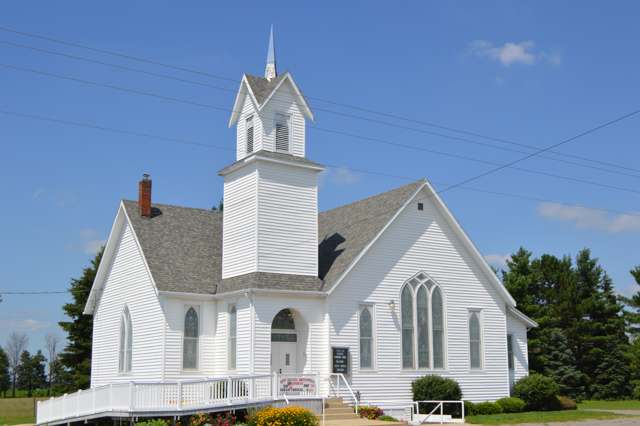
Photo: Nyttend, public domain · Wikimedia Commons
Local history sources: genealogytrails.com · en.wikipedia.org · en.wikipedia.org · en.wikipedia.org · en.wikipedia.org · commons.wikimedia.org
Water
Mostly private wells The water here
- Spencerville Village36% of residentsGroundwater wells (3 wells)
- Lima City31% of residentsAuglaize River and Ottawa River, stored in city upground reservoirs
- Cridersville Village14% of residentsGroundwater wells (4 wells)
- Delphos City9% of residentsLittle Auglaize River, stored in city reservoir
- Elida Village8% of residentsAuglaize River and Ottawa River, stored in city upground reservoirs
- Brightstar Lima MHP1% of residentsGroundwater wells (2 wells)
Hospitals, fire stations and more
Inside Amanda Township, Allen County's boundary: 2 high-hazard dams, 1 poor-rated bridge and 3 spill cases. Press a pin or a name for its whole record and its source.
High-hazard dams (2)
-
Bresler Upground ReservoirMcBRIDE DITCH - OFFSTREAM · condition: fair
- Hazard class
- High: a failure would probably cost a life
- Condition
- Fair (assessed 06/19/2023)
- River or stream
- McBRIDE DITCH - OFFSTREAM
- Purpose
- Water Supply;Recreation
- Type
- Earth
- Height
- 38 ft
- Storage
- 18,140 acre-feet
- Completed
- 1970
- Owner type
- Local Government
- County
- Allen County
- Nearest town (NID)
- Elida
- Last inspection
- 05/19/2022
- Emergency action plan
- Yes
- NID ID
- OH00525
National Inventory of Dams record ↗ National Inventory of Dams (source) ↗ Street map and directions ↗
-
Williams ReservoirHoney Run · condition: satisfactory
- Hazard class
- High: a failure would probably cost a life
- Condition
- Satisfactory (assessed 06/19/2023)
- River or stream
- Honey Run
- Purpose
- Water Supply
- Type
- Earth
- Height
- 53 ft
- Storage
- 18,682 acre-feet
- Completed
- 2012
- Owner type
- Local Government
- County
- Allen County
- Nearest town (NID)
- Lima
- Last inspection
- 05/19/2022
- Emergency action plan
- Yes
- NID ID
- OH03174
National Inventory of Dams record ↗ National Inventory of Dams (source) ↗ Street map and directions ↗
Source: U.S. Army Corps of Engineers National Inventory of Dams, August 2026. "High hazard" rates what a failure would cost downstream, not how likely one is; the condition is the state's assessment.
Bridges rated poor (1)
-
Sunderland Rd. over Stream Sunderland RdPoor · built 1977
- Condition
- Poor: a deck, superstructure, substructure or culvert rated 4 or below on the 0 to 9 scale
- What it is
- Culvert
- Built
- 1977
- Length
- 9 ft
- Owner
- County
- Vehicles a day
- 343
- Coordinates
- 40.70870, -84.26129
National Bridge Inventory (source) ↗ Street map and directions ↗
Source: FHWA National Bridge Inventory 2025. "Poor" means one major part rated 4 or below on the 0 to 9 scale; it calls for repair, not closing, unless the state posts or closes the bridge.
Spills reported since 2021 (3)
-
Oil Motor / Lube Oil / Vehicle2025-04-17 · Amanda Twp
- Reported
- 2025-04-17
- What spilled
- Oil Motor / Lube Oil / Vehicle
- Where
- Amanda Twp, Allen County
- Ohio EPA district office
- NWDO
- Ohio EPA case number
- 2504EPA0000587
Ohio EPA spill reports (source) ↗ Street map and directions ↗
-
Fuel Gasoline ( 25% Ethanol Not E85) Reached water2024-04-28 · Amanda Twp
- Reported
- 2024-04-28
- What spilled
- Fuel Gasoline ( 25% Ethanol Not E85)
- Reached a waterway
- 99 - Unnamed
- Where
- Amanda Twp, Allen County
- Ohio EPA district office
- NWDO
- Ohio EPA case number
- 2404EPA0000702
Ohio EPA spill reports (source) ↗ Street map and directions ↗
-
Manure Nos (Not Specified) Reached water2026-05-19 · Amanda Twp
- Reported
- 2026-05-19
- What spilled
- Manure Nos (Not Specified)
- Reached a waterway
- 99 - Unnamed
- Where
- Amanda Twp, Allen County
- Ohio EPA district office
- NWDO
- Ohio EPA case number
- 2605EPA0000839
Ohio EPA spill reports (source) ↗ Street map and directions ↗
Source: Ohio EPA emergency response spill reports, 2021 to September 2026, one point per case where Ohio EPA placed it. A report is what the caller or responder recorded; amounts are often blank or estimated.
Its ZIP codes
Each ZIP code that touches Amanda Township, Allen County, with the share of its residents who live here and the same headline figures as the ZIP page.
Local government
Who holds office in Amanda Township, Allen County, how its elections and ballot issues came out, and the state auditor's record.
Elections for office
| Date | Office | Candidates and votes |
|---|---|---|
| 2017-11-07 | Township Trustee | Bob Barnt 344, 49.64%; Douglas C. Post 349, 50.36% |
| 2015-11-03 | Township Trustee | Brad J. Core 614, 100.0% |
| 2015-11-03 | Township Fiscal Officer | Brenda Core 571, 100.0% |
Winners in bold. Results from the county board of elections' official canvass unless marked.
Auditor of State record
- No fiscal caution, watch or emergency on the Auditor of State's lists.
- Financial Audit, 2024 to 2025, released 2026-07-14
- Agreed Upon Procedures, 2022 to 2023, released 2024-08-20
The county
Allen County: 13 ZIP codes, 26 cities, villages and townships, 110,066 people.
Nearby places
Quick answers
What county is Amanda Township, Ohio in?
Amanda Township, Allen County is a township in Allen County, Ohio, with 2,061 residents.
When was Amanda Township, Ohio founded?
Amanda Township, Allen County was settled 1817 (Andrew Russell, Peter Diltz, William Van Ausdall); laid out village of Amanda platted 1832 by Samuel Washburn; incorporated township organized 1830 under Mercer County authority, with thirteen eligible voters present. Founders on record: Samuel Baxter (clerk), Daniel Hoak (justice of the peace). Source
How did Amanda Township, Ohio get its name?
Amanda Township is named for Fort Amanda, the War of 1812 supply depot built in the fall of 1812 by troops under Lieutenant Colonel Robert Pogue and named for a woman in his family -- his wife by one account, his daughter Hannah Amanda by another. Source
What ZIP code is Amanda Township, Ohio?
Amanda Township, Allen County is served by ZIP codes 45887, 45806 and 45807; 45887 holds the largest share of its residents.
Where does Amanda Township, Ohio get its water?
The main water source for Amanda Township, Allen County (Spencerville Village): Mostly private wells.
Cite this page
Cite this page as:
Cracked Buckeye, "Amanda Township, Allen County", https://crackedbuckeye.com/place/amanda-township-allen-county/, built 2026-10-31, accessed [date].
How to cite · Report a correction · Built 2026-10-31
