Local events in Cridersville
Nothing is posted for Cridersville itself yet; here is what is on within 10 miles. All local events in Cridersville
Know a calendar we should watch? Send the link
Checked October 20; the events page is refreshed daily.
How Cridersville began
Cridersville was platted in 1856 by Ephraim and Polly Crider, who had farmed 80 acres in Duchouquet Township, Auglaize County, for two decades along the surveyed route of the Dayton & Michigan Railroad. The village grew once that line was completed in 1858, giving area farmers rail access to larger markets. On May 2, 1918, a wind-driven fire destroyed most of its downtown, an event still marked by a state historical marker. Cridersville sits about halfway between Lima and Wapakoneta, immediately west of Allen County's Shawnee Township, and remains a small rail-side village today.
Settled 1836, platted 1856, by Ephraim and Polly Crider.
Where the name comes from
The village was named for its founding family, Ephraim and Polly Crider, who farmed the land before platting the town along the proposed Dayton & Michigan Railroad route in 1856.
Before the town
No Native American site, village, or trail specific to Cridersville itself is recorded in the sources checked. The documented Hog Creek Shawnee reservation set off by the 1817 Treaty of the Maumee Rapids lay in present-day Shawnee Township, Allen County, immediately to the east of Cridersville, not in Duchouquet Township, Auglaize County, where Cridersville actually sits — so it is noted here as a neighboring, not a site-specific, association. Fort Amanda, a War of 1812 U.S. Army supply depot built in November 1812 on Lt. Robert Pogue's orders on the west bank of the Auglaize River, and listed on the National Register on November 10, 1970, stands on the site of a former Ottawa village — but it is located in Logan Township, Auglaize County, well southwest of Lima and a different township from Cridersville's Duchouquet Township. It is not attributed to Cridersville here; it belongs with a Logan Township or Auglaize County entry.
Nations recorded here: Shawnee, Ottawa.
- Fort Amanda (other) — Logan Township, Auglaize County, on the west bank of the Auglaize River (not Cridersville/Duchouquet Township), War of 1812 (built November 1812, abandoned 1815); site of an earlier Ottawa village (en.wikipedia.org)
Timeline
- — Ephraim Crider and his son Isaac came from Fairfield County and purchased 80 acres of land in Duchouquet Township that the family farmed for two decades.
- — A Methodist society is organized in the Burk settlement near the future Cridersville and meets in the Burk school house; its log building served as church and schoolhouse until a frame church was raised in 1868.
- — Ephraim and Polly Crider platted the village of Cridersville along the proposed route of the Dayton & Michigan Railroad.
- — John Mumaw keeps the first store in the new village, about the date of its organization; James McMillin's general store was the second place of business.
- — The Dayton & Michigan Railroad was completed through the village, giving area farmers rail access to larger markets and spurring the town's growth.
- — A large grain warehouse is built at Cridersville, later owned by John Reichelderfer, from which grain and other farm produce were shipped by rail.
- — Cridersville is first counted by the census, with 167 residents.
- — The United Brethren Church is organized (its church building followed in 1878) and the village builds a two-story, four-room brick school.
- — The Methodist frame church of 1868 is moved from the Burk settlement into Cridersville.
- — The census counts 260 residents; the village then has two dry-goods stores, two groceries, a furniture store, a hotel, a steam grist mill and a steam sawmill.
- — The oil pools near Cridersville are tapped on the Delong and Sellers farms, part of the Allen County field that reaches into Duchouquet Township.
- — The Free Methodist congregation, organized in 1896, builds its church.
- — John Bierline builds a tile factory and Smith Bear a sawmill.
- — A fire driven by 40-mph winds broke out about 3 p.m. and by 6 p.m. had destroyed Cridersville's downtown: 32 structures, including two stores, a harness shop, the Home Bank of Cridersville, a physician's office, and eight residences, leaving 50 people homeless.
- — Cridersville passes 1,000 residents for the first time (1,053), up from 684 in 1950.
- — The census counts 1,791 residents.
Stories
The Great Fire of 1918
Cridersville's roughly 400 residents woke on May 2, 1918, to an ordinary day. About three o'clock that afternoon the fire bell rang, and within an hour both sides of Main Street were ablaze, pushed by a wind blowing near 40 miles an hour. The village had a single hand pumper to fight it. Firefighters drew from the town pond, but it ran dry within the hour, and Lima and Wapakoneta sent their fire companies, with Boy Scouts and soldiers from Lima joining the effort. By six that evening the downtown was gone: two stores, a harness shop, the Home Bank of Cridersville, a doctor's office, and eight houses, 32 buildings in all, leaving 50 people without homes. Only the bank's cast-iron safe was found standing in the ashes. The smoke column was visible for miles, and the heat kept trains from passing through town, but remarkably no one was seriously hurt.
A railroad town platted on the Crider farm
Ephraim and Polly Crider brought their family from Fairfield County to Duchouquet Township in 1836 and farmed 80 acres for twenty years. When surveyors laid out the route of the Dayton & Michigan Railroad through their land in the 1850s, the Criders platted a village along it in 1856 rather than simply sell the right-of-way. The gamble paid off: the railroad reached completion in 1858, and the station it brought let area farmers ship crops and livestock to city markets and bring goods back in, turning the Criders' farm town into a working village that eventually became part of the Baltimore and Ohio Railroad system.
Oil under the farms, 1886
Cridersville was a quiet railroad village of a few hundred until the oil boom of the mid-1880s. In 1886 drillers struck the great pools near the village on the Delong and Sellers farms, a southward extension of the Allen County field, and wells followed one another in quick succession; the county history notes that Duchouquet Township's oil lay in a twelve-foot rock layer under a hard cap. For several years afterward grocers, clothiers and dry-goods houses did what the 1905 history calls an extensive business supplying the oil workers, and some Cridersville merchants made handsome fortunes and retired.
Photographs
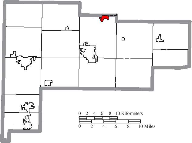
Photo: Ruhrfisch and Nyttend, Wikimedia Commons, CC BY-SA 3.0 · Wikimedia Commons
Local history sources: en.wikipedia.org · hmdb.org · limaohio.com · en.wikipedia.org · ohiohistory.org · en.wikipedia.org · commons.wikimedia.org · archive.org · archive.org
Water
Auglaize River water fills the Bresler and Williams upground reservoirs west of Lima; Ottawa River water fills the Ferguson, Metzger Lake and Lost Creek reservoirs east of Lima; both feed the East Wayne Street treatment plant The water here
- Lima City61% of residentsAuglaize River and Ottawa River, stored in city upground reservoirs
- Cridersville Village36% of residentsGroundwater wells (4 wells)
- Brightstar Lima MHP3% of residentsGroundwater wells (2 wells)
Hospitals, fire stations and more
Inside Cridersville's boundary: 2 nursing homes, 1 fire or EMS station, 1 public school, 1 library, 1 museum, 1 public charging site and 1 spill case. Press a pin or a name for its whole record and its source.
Nursing homes (2)
-
Cridersville Nursing and Rehab1 of 5 stars · Cridersville
- Address
- 603 East Main Street, Cridersville, OH 45806
- Certified beds
- 50
- Residents on an average day
- 38
- Medicare overall rating
- 1 of 5 stars
- Health inspections
- 1 of 5 stars
- Staffing
- 1 of 5 stars
- Quality measures
- 4 of 5 stars
- Penalties since 2023
- 3 fines totalling $112,610 (latest 2025-09-25)
- Ownership
- For profit - Corporation
- Chain
- LIONSTONE CARE
- Takes
- Medicare and Medicaid
- Phone
- (419) 645-4468
- Medicare ID
- 366171
Medicare Care Compare ↗ CMS nursing home data (source) ↗ Street map and directions ↗
-
Otterbein-Cridersville3 of 5 stars · Cridersville
- Address
- 100 Red Oak Drive, Cridersville, OH 45806
- Certified beds
- 50
- Residents on an average day
- 45
- Medicare overall rating
- 3 of 5 stars
- Health inspections
- 3 of 5 stars
- Staffing
- 3 of 5 stars
- Quality measures
- 4 of 5 stars
- Penalties since 2023
- none
- Ownership
- Non profit - Corporation
- Chain
- OTTERBEIN SENIORLIFE
- Continuing care retirement community
- Yes
- Takes
- Medicare and Medicaid
- Phone
- (419) 645-5114
- Medicare ID
- 366050
Medicare Care Compare ↗ CMS nursing home data (source) ↗ Street map and directions ↗
Source: CMS Care Compare nursing home provider and penalties files; Medicare star ratings run 1 to 5.
Fire and EMS stations (1)
-
Cridersville Fire DepartmentCridersville
- Address
- 100 East Main Street, Cridersville, OH 45806
- Coordinates
- 40.65399, -84.14364
USGS National Map structures (source) ↗ Street map and directions ↗
Source: USGS National Map structures (most Ohio records last updated 2019 to 2022), checked against the Columbus and Cleveland station lists. The department that answers a call is set by jurisdiction and mutual aid, not by distance.
Public schools (1)
-
Cridersville Elementary School2 of 5 stars · Cridersville
- Address
- 501 Reichelderfer Road, Cridersville, OH 45806
- School district
- Wapakoneta City School District
- Kind (NCES)
- Regular School
- Students, 2023-24
- 358
- Teachers (full-time equivalent)
- 18.98
- Report card, 2025-26
- 2 of 5 stars
- Performance index
- 68.8%
- Ohio building IRN
- 007757
- NCES school ID
- 390449801901
NCES school record ↗ Ohio School Report Card ↗ Street map and directions ↗
Source: NCES EDGE public school locations 2024-25 and Common Core of Data 2023-24 (type, students, teachers); Ohio School Report Cards 2025-26 (Department of Education and Workforce), matched by name within the district.
Public libraries (1)
-
Cridersville Public LibraryBranch · Cridersville
- Address
- 116 W. Main St., Cridersville, OH 45806
- What it is
- Branch
- Library system
- Auglaize County Public District Library
- Open
- 1,352 hours a year, 52 weeks
- Building
- 1,200 sq ft
- System's visits, FY2024
- 124,800
- System's loans, FY2024
- 242,767
- People the system serves
- 32,752
- Phone
- (419) 645-5447
IMLS Public Libraries Survey (source) ↗ Street map and directions ↗
Source: IMLS Public Libraries Survey FY2024 (outlets and their systems). Any Ohio resident can get a free card at any Ohio public library.
Museums, historical societies, gardens and zoos (1)
-
Cridersville Historical SocietyHistorical society · Cridersville
- What it is
- Historical society
- City
- Cridersville
- Coordinates
- 40.65517, -84.14369
Search Wikipedia ↗ IMLS Museum Data Files (source) ↗ Street map and directions ↗
The museum list is IMLS's 2018 file; a museum may have closed or moved since.
Source: IMLS Museum Data Files, 2018.
Public EV charging (1)
-
Casey's #3535 - Cridersville DC fast4 DC fast · Cridersville
- Address
- 100 S Dixie Hwy, Cridersville, OH 45806
- Ports
- 4 DC fast
- Plugs
- CCS
- Network
- FCN
- Hours
- 24 hours daily
- Phone
- 800-489-1588
Station Locator (NREL) ↗ Alternative Fuels Data Center (source) ↗ Street map and directions ↗
Source: NREL Alternative Fuels Data Center station list (May 2026), public and open stations, the posts at one address counted as one site.
Spills reported since 2021 (1)
-
Fuel Diesel / Diesel Fuel (Vehicle On Or Off Road)2024-02-23 · Cridersville
- Reported
- 2024-02-23
- What spilled
- Fuel Diesel / Diesel Fuel (Vehicle On Or Off Road)
- Largest amount reported
- 150 gallons
- Where
- Cridersville, Auglaize County
- Ohio EPA district office
- NWDO
- Ohio EPA case number
- 2402EPA0000277
Ohio EPA spill reports (source) ↗ Street map and directions ↗
Source: Ohio EPA emergency response spill reports, 2021 to September 2026, one point per case where Ohio EPA placed it. A report is what the caller or responder recorded; amounts are often blank or estimated.
Its ZIP codes
Each ZIP code that touches Cridersville, with the share of its residents who live here and the same headline figures as the ZIP page.
| ZIP | Share | Water | Radon | Home value | Schools | Flood |
|---|---|---|---|---|---|---|
| 45806 Shawnee Township and Lima | 16% | Auglaize River water fills the Bresler and Williams upground reservoirs west of Lima; Ottawa River water fills the Ferguson, Metzger Lake and Lost Creek reservoirs east of Lima; both feed the East Wayne Street treatment plant | 4.7 pCi/L average radon | Appraisal records without year built | Shawnee Local · 4 stars overall | 1.2% of residents in the 1% floodplain |
Local government
Who holds office in Cridersville, how its elections and ballot issues came out, and the state auditor's record.
Money issues on the ballot since 2020: 1 of 1 passed; of those asking for new or higher taxes, 1 of 1.
Ballot issues
| Date | Issue | For | Against | Result |
|---|---|---|---|---|
| 2020-11-03 | Issue: Village of Cridersville-Fire Levy | 536 | 329 | Passed (61.97% for) |
Elections for office
| Date | Office | Candidates and votes |
|---|---|---|
| 2023-11-07 | Member of Council (unofficial count) | Joseph A. Bailey 368, 49.33%; Stacey L. Cook 378, 50.67% |
| 2023-11-07 | Member of Council (unofficial count) | Steve Numbers 460, 100.0% |
| 2023-11-07 | Mayor (unofficial count) | Rick D. Walls 469, 100.0% |
| 2021-11-02 | Member of Council (unofficial count) | Dylan Lauck 103, 29.18%; Dorance Thompson 120, 33.99%; Eric West 130, 36.83% |
Winners in bold. Results from the county board of elections' official canvass unless marked.
Auditor of State record
- No fiscal caution, watch or emergency on the Auditor of State's lists.
- Financial Audit, 2023 to 2024, released 2026-01-22
The county
Allen County: 13 ZIP codes, 26 cities, villages and townships, 110,066 people.
Nearby places
Rain and snow
How much has actually fallen on Cridersville, day by day, from 1893 to now. Daily totals, not averages.
- rain, last 30 days
- 0.78 in
- 2026-09-30 to 2026-10-29
- rain so far in 2026
- 41.9 in
- 7.7 in above normal for the date
- snow so far in 2026
- 13.2 in
- a normal year brings 20.6 in
- a normal year
- 40.1 in
- average of 30 years, 1991-2020
| Month | Rain (in) | Snow (in) | Days counted |
|---|---|---|---|
| October 2026 | 0.78 | — | 29 |
| September 2026 | 6.52 | — | 30 |
| August 2026 | 9.61 | — | 31 |
| July 2026 | 3.42 | — | 31 |
| June 2026 | 4.74 | — | 30 |
| May 2026 | 4.63 | — | 31 |
| April 2026 | 5.84 | — | 30 |
| March 2026 | 4.57 | 0.8 | 31 |
| February 2026 | 0.63 | 3.5 | 28 |
| January 2026 | 1.18 | 9.0 | 31 |
| December 2025 | 2.24 | 7.3 | 31 |
| November 2025 | 1.57 | 5.0 | 30 |
| Wettest year | 2011 — 55.6 in |
|---|---|
| Driest year | 1963 — 22.7 in |
| Snowiest year | 1914 — 52.6 in |
| Wettest day on record | 5 September 1937 — 3.47 in |
| Heaviest snowfall in a day | 13 January 1964 — 15.42 in |
| Deepest snow on the ground | 2 March 1912 — 37.99 in |
Estimated, not measured. No rain gauge has ever stood inside Cridersville, so every figure here is worked out from the gauges around it - the nearest ones weighted most. Treat them as close estimates rather than readings.
48,862 days of records, 1893-01-01 to 2026-10-29. Source: NOAA NCEI GHCN-Daily, 3,240 gauges in and around Ohio. A day is "gauged" when a gauge standing inside the boundary reported it, and the value is the mean of those gauges. Otherwise it is interpolated by inverse distance from every gauge reporting within 50 miles. Nothing is carried forward, back-filled or smoothed. Against NOAA nClimDiv county monthly precipitation over 136,848 complete county-months (checked 2026-10-31): correlation 0.9515, median absolute difference 0.217 in a month. Built 2026-10-31 from the Cracked Buckeye precipitation archive. Snow is the softer number — snowfall is measured by hand with a ruler, no agency publishes a gridded county snowfall series, and blowing snow defeats every observer.
Environmental permits and filings
What Ohio EPA has on file for Cridersville: permits, inspections, violations, cleanups and the state loans behind sewer and water work. Every line links to the agency's own document.
- facilities and sites on file
- 12
- those placed on the map inside Cridersville
| Program | Facilities and sites |
|---|---|
| State sewer loans | 3 |
| Wastewater and stormwater discharge | 3 |
| Sewer and water-line construction | 2 |
| Air pollution | 1 |
| Hazardous waste | 1 |
| Public drinking water | 1 |
| Underground injection wells | 1 |
| Date | Facility or site | What |
|---|---|---|
| CRIDERSVILLE WWTP | Wastewater and stormwater discharge report | |
| CRIDERSVILLE VILLAGE PWS | Public drinking water notice of violation | |
| CRIDERSVILLE VILLAGE PWS | Public drinking water violation resolved | |
| CRIDERSVILLE VILLAGE PWS | Public drinking water notice of violation | |
| CRIDERSVILLE WWTP | State sewer loans | |
| CRIDERSVILLE VILLAGE PWS | Public drinking water compliance letter | |
| BAYLIFF & SON FUNERAL HOME INC | Air pollution report | |
| CRIDERSVILLE VILLAGE PWS | Public drinking water report | |
| CRIDERSVILLE VILLAGE PWS | Public drinking water notice of violation | |
| CRIDERSVILLE VILLAGE PWS | Public drinking water inspection | |
| CRIDERSVILLE VILLAGE PWS | Public drinking water inspection | |
| CRIDERSVILLE VILLAGE PWS | Public drinking water compliance letter | |
| BAYLIFF & SON FUNERAL HOME INC | Air pollution permit | |
| BAYLIFF & SON FUNERAL HOME INC | Air pollution permit | |
| CRIDERSVILLE VILLAGE PWS | Public drinking water notice of violation | |
| CRIDERSVILLE VILLAGE PWS | Public drinking water plan | |
| CRIDERSVILLE VILLAGE PWS | Public drinking water inspection | |
| CRIDERSVILLE VILLAGE PWS | Public drinking water notice of violation | |
| CRIDERSVILLE WWTP | Wastewater and stormwater discharge report | |
| CRIDERSVILLE VILLAGE PWS | Public drinking water inspection | |
| CRIDERSVILLE VILLAGE PWS | Public drinking water notice of violation | |
| CRIDERSVILLE VILLAGE PWS | Public drinking water compliance letter | |
| CRIDERSVILLE VILLAGE PWS | Public drinking water notice of violation | |
| CRIDERSVILLE VILLAGE PWS | Public drinking water report | |
| VILLAGE OF CRIDERSVILLE | Wastewater and stormwater discharge report |
Source: Ohio EPA eDocument portal (edocpub.epa.ohio.gov), indexed 2026-10-14. Facilities are placed on the map from Ohio EPA's own map layers, EPA's Facility Registry, coordinates written in the filings, or a geocoded street address. A permit filed under a private person's name (most are household septic systems) is counted but never named, placed or linked; licenses for individual workers and open-burning notices are left out entirely.
Quick answers
What county is Cridersville, Ohio in?
Cridersville is a village in Allen County, Ohio, with 1,791 residents.
When was Cridersville, Ohio founded?
Cridersville was settled 1836; laid out 1856. Founders on record: Ephraim and Polly Crider. Source
How did Cridersville, Ohio get its name?
The village was named for its founding family, Ephraim and Polly Crider, who farmed the land before platting the town along the proposed Dayton & Michigan Railroad route in 1856. Source
What ZIP code is Cridersville, Ohio?
Most of Cridersville is in ZIP code 45806.
Where does Cridersville, Ohio get its water?
The main water source for Cridersville (Lima City): Auglaize River water fills the Bresler and Williams upground reservoirs west of Lima; Ottawa River water fills the Ferguson, Metzger Lake and Lost Creek reservoirs east of Lima; both feed the East Wayne Street treatment plant.
Cite this page
Cite this page as:
Cracked Buckeye, "Cridersville, Allen County", https://crackedbuckeye.com/place/cridersville/, built 2026-10-31, accessed [date].
How to cite · Report a correction · Built 2026-10-31
