Local events in Xenia
47 events in the next 90 days from 3 public calendars. All local events in Xenia
Checked October 20; the events page is refreshed daily.
Lakes near Xenia
The history under the water: the valley before, the dam, the stories. All Ohio lakes
Deep dives about Xenia
Long reads built from maps, newspapers and public records. All deep dives
Notable people from Xenia
Ohioans tied to this place, each with a sourced profile. All notable Ohioans
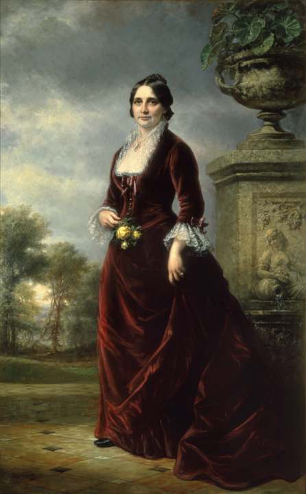
History from Xenia
People and inventions tied to this place, each with its sources. All people · All inventions
How Xenia began
Xenia was founded in 1803, the year Ohio entered the Union, when pioneer John Paul bought 2,000 acres along the Shawnee Run and Massies Creek and surveyor Joseph C. Vance platted a 257-acre town site the following year; town-meeting tradition gave it a Greek name meaning 'hospitality.' Named the Greene County seat from the start, it grew as a milling, banking and railroad town through the 1800s and became home to a significant African American community. On April 3, 1974, an F5 tornado - part of the national Super Outbreak - tore through the middle of the city, killing 34 people and destroying or heavily damaging roughly half of its buildings; Xenia rebuilt and later remade its abandoned rail corridors into the bicycle-trail network that gives it the nickname 'Bicycle Capital of the Midwest.'
Settled 1803, platted 1804, incorporated 1817, by John Paul (land purchase, 1803) and surveyor Joseph C. Vance, who platted and sold the town site (1804).
Where the name comes from
According to local tradition recorded in Xenia's own history, Vance called a town meeting to pick a name for the new county seat. Rev. Robert Armstrong proposed 'Xenia,' the Greek word for 'hospitality,' citing the welcome he had received in the community; the vote tied and Laticia Davis, wife of settler Owen Davis, cast the deciding ballot for Xenia. The name has no recorded connection to a lottery or drawing of lots despite that story circulating locally - it was decided by a town-meeting vote.
Before the town
No source found assigns Xenia's own town site to a specific Native village, but the surrounding Massies Creek and Little Miami valley carries a long, well-documented Native presence. Adena people (roughly 800 BC to AD 100) built the Williamson Mound, a burial mound about 27 to 30 feet high, on a bluff above Massies Creek at what is now Indian Mound Reserve near Cedarville, roughly 10 to 15 miles northeast of Xenia; Hopewell people later built the nearby Pollock Works, a 12-acre hilltop enclosure with crescent-shaped earthworks and three gateways, in stages beginning in the first century AD. Robert S. Dills' 1881 county history also records a fortification of mingled earth and stone on Massies Creek about seven miles east of Xenia, with a separate oblong enclosure, semicircle and mound nearby. In the historic period, Shawnee people held a major town, later called Old Chillicothe (also Oldtown), on the Little Miami River in what is now Xenia Township a few miles north of the city; it was one of the largest Shawnee settlements in Ohio. Local and historical-marker tradition long identified this town as Tecumseh's 1768 birthplace, but Wikipedia's sourced account of Tecumseh notes this Little Miami Chillicothe was not founded until 1777, after Shawnees relocated there from an earlier Chillicothe on the Scioto River near present-day Chillicothe, Ohio - so the Xenia-area birthplace tradition is now understood by historians to rest on a mistaken identification, even though the official state marker for it stands in the area. The land that became Greene County was ceded to the United States, along with most of the rest of Ohio south and east of the Greenville Treaty Line, by the Treaty of Greenville on August 3, 1795, signed by the Wyandot, Delaware (Lenape), Shawnee, Ottawa, Chippewa, Potawatomi, Miami and other nations. The fuller regional picture also includes other village sites, the removals of the 1830s, and place names of Native origin.
Nations recorded here: Shawnee, Adena culture, Hopewell culture.
- Williamson Mound (mound) — Indian Mound Reserve, near Cedarville, Greene County (roughly 10-15 miles northeast of Xenia), Adena, c. 800 BC - AD 100 (en.wikipedia.org)
- Pollock Works (earthwork) — Indian Mound Reserve, near Cedarville, Greene County, Hopewell, beginning 1st century AD (en.wikipedia.org)
- Massies Creek fortification and mound group (earthwork) — on Massies Creek, about seven miles east of Xenia, unspecified (prehistoric) (archive.org)
- Old Chillicothe (Oldtown) (village) — on the Little Miami River, Xenia Township, Greene County, a few miles north of Xenia, Shawnee town, founded 1777, associated with the (disputed) Tecumseh birthplace tradition (en.wikipedia.org)
Timeline
- — John Paul buys 2,000 acres from Thomas and Elizabeth Richardson; Ohio enters the Union the same year and Xenia is chosen as the Greene County seat.
- — Surveyor Joseph C. Vance plats a 257-acre town site, bought from John Paul for $250; William Beattie opens a tavern and John Marshall builds Xenia's first house.
- — Xenia's first log schoolhouse is built.
- — A petition with 66 signatures, filed March 24, leads the county court to grant Xenia's incorporation as a municipal corporation on October 27.
- — Xenia is granted city status.
- — The Little Miami Railroad reaches Xenia, spurring new industry; its corridor is today the Little Miami Scenic Trail.
- — The city builds its first water works system.
- — Xenia is operating its own sewage system by this year.
- — Charles Young, the U.S. Army's third Black West Point graduate and its highest-ranking Black officer in World War I, buys the brick house on Columbus Pike near Wilberforce, just outside Xenia, that bears his name.
- — On March 30, the Col. Charles Young House is listed on the National Register of Historic Places as a National Historic Landmark.
- — On April 3, an F5 tornado - one of 149 tornadoes in the national Super Outbreak - cuts through the middle of Xenia between about 4:40 and 4:55 p.m., killing 32 people in the city (34 counting two Ohio Air National Guardsmen who died in a barracks fire two weeks later) and heavily damaging or destroying about 1,400 buildings, roughly half the town.
- — The last railroads serving Xenia cease operation; the corridors are converted into the city's bicycle trail network.
Stories
The April 3, 1974 tornado
Late on a Wednesday afternoon, a tornado that had formed near Bellbrook intensified as it tracked northeast at roughly 50 miles an hour and struck Xenia's west side. In under 15 minutes it cut a path directly through downtown and the residential blocks beyond, then continued on toward Wilberforce and Clark County before dissipating near South Vienna - a track of about 30 miles. Winds were estimated as high as 305 miles an hour, among the strongest ever recorded for a tornado, and it was rated F5, the top of the Fujita scale. It killed 32 people in Xenia outright; two Ohio Air National Guardsmen assigned to disaster duty died on April 17 in a fire at their temporary barracks, bringing the toll memorialized today to 34. About 1,150 people were injured, roughly 1,400 buildings - close to half the city - were destroyed or severely damaged, Xenia High School was wrecked, and an estimated 10,000 people were left homeless. Damage was put at about $100 million in 1974 dollars. It was the single deadliest tornado of the 1974 Super Outbreak, which produced 149 tornadoes across 13 states and Ontario on April 3 and 4. Xenia rebuilt over the following years; the disaster remains the defining event in the city's modern history and is still marked locally, including at the Galloway log house historical marker.
Col. Charles Young's house
Charles Young was born enslaved in Kentucky in 1864 and became the third Black graduate of West Point and the U.S. Army's highest-ranking Black officer during World War I, eventually reaching the rank of colonel after a career that included service with the Buffalo Soldiers and as a military attache. In 1894 Young was appointed Professor of Military Science and Tactics at Wilberforce University, just north of Xenia, and in 1907 he bought a two-and-a-half-story brick house on Columbus Pike between Clifton and Stevenson roads, near Wilberforce in Xenia Township. The house - an eclectic brick building with deep eaves and a T-shaped porch - was listed as a National Historic Landmark on March 30, 1974, the same year as the Xenia tornado, in recognition of Young's rank-breaking military career. It sits just outside Xenia's city limits but is bound up with the city's history and is now part of the Charles Young Buffalo Soldiers National Monument.
Second Street's Gilded Age houses
East Second Street was once one of Xenia's most fashionable addresses, and a stretch of it survives as the East Second Street Historic District, listed on the National Register in 1973 and expanded in 1979. Its centerpiece is 'Eden Hall' at 235 Second Street, a 42-room, three-story Italianate mansion built around 1840 by Abraham Hivling; nearby stand an 1881 brick house built for state representative John B. Allen, two circa-1880 Eastlake and Italianate houses, and a Queen Anne house built around 1885 for a local industrialist. Together the houses on this short block record the wealth Xenia's milling, banking and railroad trade produced in the second half of the nineteenth century, and the neighborhood survived the 1974 tornado well enough to keep its Gilded Age character today.
Photographs
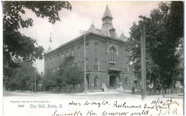
Photo: Columbus Metropolitan Library, via DPLA / Ohio Digital Network, no known copyright restrictions · Wikimedia Commons
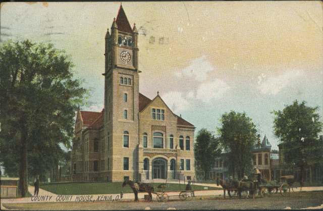
Photo: Columbus Metropolitan Library, via DPLA / Ohio Digital Network, no known copyright restrictions · Wikimedia Commons
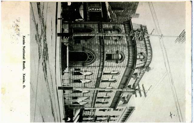
Photo: Columbus Metropolitan Library, via DPLA / Ohio Digital Network, no known copyright restrictions · Wikimedia Commons
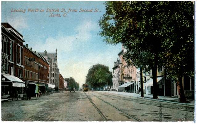
Photo: Columbus Metropolitan Library, via DPLA / Ohio Digital Network, no known copyright restrictions · Wikimedia Commons
Local history sources: en.wikipedia.org · en.wikipedia.org · britannica.com · npgallery.nps.gov · en.wikipedia.org · archive.org · en.wikipedia.org · en.wikipedia.org · en.wikipedia.org · en.wikipedia.org · remarkableohio.org · commons.wikimedia.org · commons.wikimedia.org · commons.wikimedia.org · commons.wikimedia.org
Historic places
7 places in Xenia on the National Register of Historic Places. Press a pin or a name for its whole record.
-
Bank Of XeniaBuilding · Xenia · listed 1973
- Address
- NE corner of Detroit and E. 2nd Sts.
- Where
- Xenia, Greene County · ZIP 45385
- What it is
- Building
- Listed on the National Register
- 1973
- NRIS reference number
- 73001450
- Coordinates
- 39.68390, -83.92876
National Register file (NPS) ↗ Search Wikipedia ↗ Street map and directions ↗ On the Cracked Buckeye map
-
Conner, Alexander, HouseBuilding · Xenia · listed 1987
- Address
- 99 E. Second St.
- Where
- Xenia, Greene County · ZIP 45385
- What it is
- Building
- Listed on the National Register
- 1987
- NRIS reference number
- 87000460
- Coordinates
- 39.68392, -83.92818
National Register file (NPS) ↗ Search Wikipedia ↗ Street map and directions ↗ On the Cracked Buckeye map
-
East Second Street DistrictHistoric district · Xenia · listed 1973
- Address
- 235 and 209-213-215 E. 2nd St.
- Where
- Xenia, Greene County · ZIP 45385
- What it is
- Historic district
- Listed on the National Register
- 1973
- NRIS reference number
- 73001451
- Coordinates
- 39.68382, -83.92514
National Register file (NPS) ↗ Search Wikipedia ↗ Street map and directions ↗ On the Cracked Buckeye map
-
Hollencamp HouseBuilding · Xenia · listed 1980
- Address
- 339 E. 2nd St.
- Where
- Xenia, Greene County · ZIP 45385
- What it is
- Building
- Listed on the National Register
- 1980
- NRIS reference number
- 80003029
- Coordinates
- 39.68422, -83.92329
National Register file (NPS) ↗ Search Wikipedia ↗ Street map and directions ↗ On the Cracked Buckeye map
-
Millen-Schmidt HouseBuilding · Xenia · listed 1976
- Address
- 184 N. King St.
- Where
- Xenia, Greene County · ZIP 45385
- What it is
- Building
- Listed on the National Register
- 1976
- NRIS reference number
- 76001432
- Coordinates
- 39.68725, -83.93170
National Register file (NPS) ↗ Search Wikipedia ↗ Street map and directions ↗ On the Cracked Buckeye map
-
Patterson, Samuel N., HouseBuilding · Xenia · listed 1976
- Address
- 364 N. King St.
- Where
- Xenia, Greene County · ZIP 45385
- What it is
- Building
- Listed on the National Register
- 1976
- NRIS reference number
- 76001433
- Coordinates
- 39.68985, -83.93216
National Register file (NPS) ↗ Search Wikipedia ↗ Street map and directions ↗ On the Cracked Buckeye map
-
Xenia Carnegie LibraryBuilding · Xenia · listed 2015
- Address
- 194 E. Church St.
- Where
- Xenia, Greene County · ZIP 45385
- What it is
- Building
- Listed on the National Register
- 2015
- NRIS reference number
- 15000041
- Coordinates
- 39.68579, -83.92640
National Register file (NPS) ↗ Search Wikipedia ↗ Street map and directions ↗ On the Cracked Buckeye map
Source: National Park Service, National Register of Historic Places point file. The listing year is shown where NPS's certification date agrees with the listing's reference number. Listing recognizes significance; it does not restrict a private owner.
Water
11 wells drawing from two aquifers straddling US-68, north of Oldtown and downtown Xenia (the city says the aquifers could safely supply 11 million gallons a day; it pumps 4 to 5 million on average) The water here
- Xenia City84% of residentsGreat Miami/Mad River Buried Valley Aquifer (wells near US-68/SR-235)
- Greene County - northwest Reg Water15% of residentsLittle Miami River Buried Valley Aquifer (2 wellfields, Beavercreek area)
- Greene County - southwest Reg Water1% of residentsGroundwater wells (2 wells)
- Greene County Eastern Regional0% of residentsLittle Miami River Buried Valley Aquifer (2 wellfields, Beavercreek area)
Hospitals, fire stations and more
Inside Xenia's boundary: 1 hospital, 1 health center, 1 dialysis center, 3 nursing homes, 2 fire and EMS stations, 1 college, 10 public schools, 1 private school, 2 poor-rated bridges, 2 libraries, 2 museums, 2 police stations, 2 public charging sites, 2 Superfund sites, 6 Toxics Release Inventory facilities and 14 spill cases. Press a pin or a name for its whole record and its source.
Hospitals (1)
-
Greene Memorial Hospital, Inc Trauma level IIIGeneral hospital · Xenia
- What it is
- General hospital
- Address
- 1141 North Monroe Drive, Xenia, OH 45385
- County
- Greene County
- Beds
- 41
- Trauma center
- Level IIi
- Helipad
- Yes
- Ownership
- Non-profit
- Medicare overall rating
- 5 of 5 stars
- Emergency department (Medicare)
- Yes
- Medicare reports it as
- Kettering Health Greene Memorial
- Phone
- (937) 352-2000
- Medicare ID
- 360026
Medicare Care Compare ↗ Hospital's website ↗ Where HIFLD got this record ↗ HIFLD hospitals (source) ↗ Street map and directions ↗
Source: HIFLD hospitals inventory via FEMA (closed hospitals it still lists left out, hospitals opened since added), with Medicare Care Compare ratings matched by name and address.
Community health centers (1)
-
Five Rivers Xenia CampusHealth center · Xenia
- Run by
- a federally qualified health center
- Setting
- Clinic
- City
- Xenia
- Coordinates
- 39.68319, -83.94377
Find a Health Center (HRSA) ↗ HRSA data (source) ↗ Street map and directions ↗
Source: HRSA health center service delivery sites, active, September 2026 (school-based sites left out). Health centers see patients whether or not they have insurance, with fees on a sliding scale.
Dialysis centers (1)
-
Davita Southwest Ohio DialysisDialysis · Xenia
- Address
- 215 South Allison Avenue, Xenia, OH 45385
- Dialysis stations
- 16
- Medicare star rating
- 3 of 5 stars
- Services
- in-center hemodialysis, peritoneal dialysis
- Ownership
- for profit
- Chain
- DaVita
- Medicare certified since
- 1998-05-20
- Phone
- (937) 376-1453
- Medicare ID
- 362594
Medicare Care Compare ↗ CMS dialysis facility list (source) ↗ Street map and directions ↗
Source: CMS dialysis facility list, September 2026, geocoded with the Census Bureau batch geocoder (an address it could not place sits at its ZIP center).
Nursing homes (3)
-
Alpine Nursing and Rehabilitation Center2 of 5 stars · Xenia
- Address
- 164 Office Park Drive, Xenia, OH 45385
- Certified beds
- 99
- Residents on an average day
- 75
- Medicare overall rating
- 2 of 5 stars
- Health inspections
- 2 of 5 stars
- Staffing
- 2 of 5 stars
- Quality measures
- 4 of 5 stars
- Penalties since 2023
- 1 fine totalling $28,130 (latest 2025-04-08)
- Ownership
- For profit - Limited Liability company
- Takes
- Medicare and Medicaid
- Phone
- (937) 419-4500
- Medicare ID
- 365601
Medicare Care Compare ↗ CMS nursing home data (source) ↗ Street map and directions ↗
-
Atrium Nursing and Rehabilitation2 of 5 stars · Xenia
- Address
- 1301 North Monroe Drive, Xenia, OH 45385
- Certified beds
- 99
- Residents on an average day
- 16
- Medicare overall rating
- 2 of 5 stars
- Health inspections
- 1 of 5 stars
- Staffing
- 4 of 5 stars
- Quality measures
- 5 of 5 stars
- Penalties since 2023
- 4 fines totalling $193,839, 3 payment denials (latest 2024-08-14)
- Ownership
- For profit - Limited Liability company
- Takes
- Medicare and Medicaid
- Phone
- (937) 372-4495
- Medicare ID
- 365022
Medicare Care Compare ↗ CMS nursing home data (source) ↗ Street map and directions ↗
-
Xenia Health and Rehab1 of 5 stars · Xenia
- Address
- 126 Wilson Drive, Xenia, OH 45385
- Certified beds
- 51
- Residents on an average day
- 31
- Medicare overall rating
- 1 of 5 stars
- Health inspections
- 2 of 5 stars
- Staffing
- 1 of 5 stars
- Quality measures
- 4 of 5 stars
- Penalties since 2023
- none
- Ownership
- For profit - Limited Liability company
- Chain
- SIMCHA HYMAN & NAFTALI ZANZIPER
- Takes
- Medicare and Medicaid
- Phone
- (937) 376-2121
- Medicare ID
- 365187
Medicare Care Compare ↗ CMS nursing home data (source) ↗ Street map and directions ↗
Source: CMS Care Compare nursing home provider and penalties files; Medicare star ratings run 1 to 5.
Fire and EMS stations (2)
-
Xenia Fire and EMS DivisionXenia
- Address
- 225 East Main Street, Xenia, OH 45385
- Coordinates
- 39.68513, -83.92532
USGS National Map structures (source) ↗ Street map and directions ↗
-
Xenia Fire Department Station 2Xenia
- Address
- 849 West 2nd Street, Xenia, OH 45385
- Coordinates
- 39.68216, -83.94403
USGS National Map structures (source) ↗ Street map and directions ↗
Source: USGS National Map structures (most Ohio records last updated 2019 to 2022), checked against the Columbus and Cleveland station lists. The department that answers a call is set by jurisdiction and mutual aid, not by distance.
Colleges (1)
-
Greene County Career CenterPublic career school · Xenia
- What it is
- Public career school
- City
- Xenia
- Students, 2023-24 (12-month count)
- 22
- IPEDS unit ID
- 365240
College Navigator (NCES) ↗ IPEDS data (source) ↗ Street map and directions ↗
Source: NCES IPEDS 2024 directory, 2023-24 enrollment and tuition, graduation rates for the 2017 (four-year) and 2020 (two-year) entering classes.
Public schools (10)
-
Arrowood Elementary4 of 5 stars · Xenia
- Address
- 1588 Pawnee Dr, Xenia, OH 45385
- School district
- Xenia Community City School District
- Kind (NCES)
- Regular School
- Students, 2023-24
- 454
- Teachers (full-time equivalent)
- 24
- Report card, 2025-26
- 4 of 5 stars
- Performance index
- 84.1%
- Ohio building IRN
- 018838
- NCES school ID
- 390451502054
NCES school record ↗ Ohio School Report Card ↗ Street map and directions ↗
-
Community STE(A)M Academy - XeniaXenia
- Address
- 135 E Church St, Xenia, OH 45385
- Kind (NCES)
- Regular School
- Students, 2023-24
- 155
- Teachers (full-time equivalent)
- 7.6
- NCES school ID
- 391004610861
-
Cox Elementary School3 of 5 stars · Xenia
- Address
- 506 Dayton Ave, Xenia, OH 45385
- School district
- Xenia Community City School District
- Kind (NCES)
- Regular School
- Students, 2023-24
- 227
- Teachers (full-time equivalent)
- 14
- Report card, 2025-26
- 3 of 5 stars
- Performance index
- 72.8%
- Ohio building IRN
- 007542
- NCES school ID
- 390451502051
NCES school record ↗ Ohio School Report Card ↗ Street map and directions ↗
-
Greene County Career CenterXenia
- Address
- 532 Innovation Dr, Xenia, OH 45385
- Kind (NCES)
- Career and Technical School
- Students, 2023-24
- 665
- Teachers (full-time equivalent)
- 48
- NCES school ID
- 390510404064
-
McKinley Elementary School4.5 of 5 stars · Xenia
- Address
- 829 Colorado Dr, Xenia, OH 45385
- School district
- Xenia Community City School District
- Kind (NCES)
- Regular School
- Students, 2023-24
- 316
- Teachers (full-time equivalent)
- 15.4
- Report card, 2025-26
- 4.5 of 5 stars
- Performance index
- 81.8%
- Ohio building IRN
- 023671
- NCES school ID
- 390451502052
NCES school record ↗ Ohio School Report Card ↗ Street map and directions ↗
-
Shawnee Elementary School3.5 of 5 stars · Xenia
- Address
- 92 E Ankeney Mill Rd, Xenia, OH 45385
- School district
- Xenia Community City School District
- Kind (NCES)
- Regular School
- Students, 2023-24
- 459
- Teachers (full-time equivalent)
- 21.5
- Report card, 2025-26
- 3.5 of 5 stars
- Performance index
- 79.3%
- Ohio building IRN
- 034249
- NCES school ID
- 390451502053
NCES school record ↗ Ohio School Report Card ↗ Street map and directions ↗
-
Summit Academy Community School Alternative Learners -XeniaXenia
- Address
- 1694 Pawnee Dr, Xenia, OH 45385
- Kind (NCES)
- Regular School
- Students, 2023-24
- 139
- Teachers (full-time equivalent)
- 15
- NCES school ID
- 390009704036
-
Warner Middle School3 of 5 stars · Xenia
- Address
- 600 Buckskin Trl, Xenia, OH 45385
- School district
- Xenia Community City School District
- Kind (NCES)
- Regular School
- Students, 2023-24
- 791
- Teachers (full-time equivalent)
- 45
- Report card, 2025-26
- 3 of 5 stars
- Performance index
- 68.5%
- Ohio building IRN
- 040568
- NCES school ID
- 390451502058
NCES school record ↗ Ohio School Report Card ↗ Street map and directions ↗
-
Xenia High School3 of 5 stars · Xenia
- Address
- 303 Kinsey Rd, Xenia, OH 45385
- School district
- Xenia Community City School District
- Kind (NCES)
- Regular School
- Students, 2023-24
- 947
- Teachers (full-time equivalent)
- 54
- Report card, 2025-26
- 3 of 5 stars
- Performance index
- 72.7%
- Four-year graduation rate
- 87.9%
- Ohio building IRN
- 042408
- NCES school ID
- 390451502059
NCES school record ↗ Ohio School Report Card ↗ Street map and directions ↗
-
Xenia PreschoolXenia
- Address
- 425 Edison Blvd, Xenia, OH 45385
- Kind (NCES)
- Regular School
- Students, 2023-24
- 239
- Teachers (full-time equivalent)
- 14
- NCES school ID
- 390451502050
Source: NCES EDGE public school locations 2024-25 and Common Core of Data 2023-24 (type, students, teachers); Ohio School Report Cards 2025-26 (Department of Education and Workforce), matched by name within the district.
Private schools (1)
-
Legacy Christian AcademyPrivate, conservative Christian · Xenia
- Address
- 1101 Wesley Ave, Xenia, OH 45385
- Kind
- conservative Christian
- Students, 2023-24
- 563
- Teachers (full-time equivalent)
- 40.9
- Students per teacher
- 13.7653
- Phone
- (937) 352-1640
- NCES private school ID
- A0108695
Source: NCES Private School Survey 2023-24.
Bridges rated poor (2)
-
S Patton St over Shawnee Ck & Bike TrailPoor · built 1976
- Condition
- Poor: a deck, superstructure, substructure or culvert rated 4 or below on the 0 to 9 scale
- What it is
- Bridge
- Built
- 1976
- Length
- 53 ft
- Owner
- City
- Vehicles a day
- 200
- Coordinates
- 39.66939, -83.91491
National Bridge Inventory (source) ↗ Street map and directions ↗
-
Sycamore Street over Shawnee Creek N BranchPoor · built 1900
- Condition
- Poor: a deck, superstructure, substructure or culvert rated 4 or below on the 0 to 9 scale
- What it is
- Bridge
- Built
- 1900
- Length
- 10 ft
- Owner
- City
- Vehicles a day
- 100
- Coordinates
- 39.68165, -83.92966
National Bridge Inventory (source) ↗ Street map and directions ↗
Source: FHWA National Bridge Inventory 2025. "Poor" means one major part rated 4 or below on the 0 to 9 scale; it calls for repair, not closing, unless the state posts or closes the bridge.
Public libraries (2)
-
Greene County District LibraryBookmobile stop · Xenia
- Address
- 76 E. Market, Xenia, OH 45385
- What it is
- Bookmobile stop
- Library system
- Greene County Public Library
- Open
- 2,080 hours a year, 52 weeks
- System's visits, FY2024
- 427,596
- System's loans, FY2024
- 2,831,847
- People the system serves
- 167,966
- Phone
- (937) 352-4000
IMLS Public Libraries Survey (source) ↗ Street map and directions ↗
-
Xenia BranchBranch · Xenia
- Address
- 76 East Market St, Xenia, OH 45385
- What it is
- Branch
- Library system
- Greene County Public Library
- Open
- 2,924 hours a year, 52 weeks
- Building
- 25,000 sq ft
- System's visits, FY2024
- 427,596
- System's loans, FY2024
- 2,831,847
- People the system serves
- 167,966
- Phone
- (937) 352-4000
IMLS Public Libraries Survey (source) ↗ Street map and directions ↗
Source: IMLS Public Libraries Survey FY2024 (outlets and their systems). Any Ohio resident can get a free card at any Ohio public library.
Museums, historical societies, gardens and zoos (2)
-
Greene County Ohio Historical SocietyHistorical society · Xenia
- What it is
- Historical society
- City
- Xenia
- Coordinates
- 39.68713, -83.93092
Search Wikipedia ↗ IMLS Museum Data Files (source) ↗ Street map and directions ↗
The museum list is IMLS's 2018 file; a museum may have closed or moved since.
-
National Afro-American Museum And Cultural CenterMuseum · Xenia
- What it is
- Museum
- City
- Xenia
- Coordinates
- 39.68329, -83.94116
Search Wikipedia ↗ IMLS Museum Data Files (source) ↗ Street map and directions ↗
The museum list is IMLS's 2018 file; a museum may have closed or moved since.
Source: IMLS Museum Data Files, 2018.
Police stations (2)
-
Greene County Sheriff's OfficeXenia
- Address
- 120 East Main Street, Xenia, OH 45385
- Coordinates
- 39.68602, -83.92762
USGS National Map structures (source) ↗ Street map and directions ↗
-
Xenia Police DivisionXenia
- Address
- 101 North Detroit Street, Xenia, OH 45385
- Coordinates
- 39.68645, -83.92919
USGS National Map structures (source) ↗ Street map and directions ↗
Source: USGS National Map structures, police stations, corrected and completed by hand (September 2026). The department that answers a call is set by jurisdiction, not by distance.
Public EV charging (2)
-
CITY OF XENIA CITY OF XENIA 24 Level 2 · Xenia
- Address
- 66 W 2nd St, Xenia, OH 45385
- Ports
- 4 Level 2
- Plugs
- J1772
- Network
- ChargePoint Network
- Hours
- 24 hours daily
- Phone
- 888-758-4389
Station Locator (NREL) ↗ Alternative Fuels Data Center (source) ↗ Street map and directions ↗
-
Warner Middle School6 Level 2 · Xenia
- Address
- 600 Buckskin Trail, Xenia, OH 45385
- Ports
- 6 Level 2
- Plugs
- J1772
- Network
- EVGATEWAY
- Hours
- 24 hours daily
- Phone
- 949-945-2000
Station Locator (NREL) ↗ Alternative Fuels Data Center (source) ↗ Street map and directions ↗
Source: NREL Alternative Fuels Data Center station list (May 2026), public and open stations, the posts at one address counted as one site.
Superfund sites (2)
-
Former Capitol Cleaners - XeniaSuperfund program · Xenia
- Address
- 810 West Second Street, Xenia, OH 45385
- County
- Greene County
- Status
- Superfund program site, not on the National Priorities List
- EPA program ID
- OHN000506334
- EPA registry ID
- 110071101952
EPA facility record ↗ EPA Facility Registry Service (source) ↗ Street map and directions ↗
-
Hospitality Home East Mercury SpillSuperfund program · Xenia
- Address
- 1301 North Monroe, Xenia, OH 45385
- County
- Greene County
- Status
- Superfund program site, not on the National Priorities List
- EPA program ID
- OHN000508260
- EPA registry ID
- 110013799167
EPA facility record ↗ EPA Facility Registry Service (source) ↗ Street map and directions ↗
Source: EPA Facility Registry Service, Superfund (SEMS) and National Priorities List sites. Many program sites were assessed and needed no cleanup.
Facilities reporting toxic releases (6)
-
American Metal Technologies LlcToxics Release Inventory · Xenia
- Address
- 851 Bellbrook Ave., Xenia, OH 45385
- County
- Greene County
- Status
- Reports to the Toxics Release Inventory (active)
- EPA program ID
- 45385YDRDC851BE
- EPA registry ID
- 110015680342
EPA facility record ↗ EPA Facility Registry Service (source) ↗ Street map and directions ↗
-
Cil Isotope Separations, Inc.Toxics Release Inventory · Xenia
- Address
- 1689 Burnett Dr, Xenia, OH 45385
- County
- Greene County County
- Status
- Reports to the Toxics Release Inventory (***unchanged***)
- EPA program ID
- 4538WCLSTP1689B
- EPA registry ID
- 110071360644
EPA facility record ↗ EPA Facility Registry Service (source) ↗ Street map and directions ↗
-
Ksh IncToxics Release Inventory · Xenia
- Address
- 825 Bellbrook, Xenia, OH 45385
- County
- Greene County
- Status
- Reports to the Toxics Release Inventory (active)
- EPA program ID
- 45385KSHNC825BE
- EPA registry ID
- 110002113720
EPA facility record ↗ EPA Facility Registry Service (source) ↗ Street map and directions ↗
-
Twist IncToxics Release Inventory · Xenia
- Address
- 1380 Lavelle Dr., Xenia, OH 45385
- County
- Greene County
- Status
- Reports to the Toxics Release Inventory (active)
- EPA program ID
- 45385CCCLD1380L
- EPA registry ID
- 110001129751
EPA facility record ↗ EPA Facility Registry Service (source) ↗ Street map and directions ↗
-
Twist, Inc.Toxics Release Inventory · Xenia
- Address
- 1370 Lavelle Dr., Xenia, OH 45385
- County
- Greene County
- Status
- Reports to the Toxics Release Inventory (active)
- EPA program ID
- 45385TWSTN1370L
- EPA registry ID
- 110024424229
EPA facility record ↗ EPA Facility Registry Service (source) ↗ Street map and directions ↗
-
Vernay Prods IncToxics Release Inventory · Xenia
- Address
- 915 Trumbull Street, Xenia, OH 45385
- County
- Greene County
- Status
- Reports to the Toxics Release Inventory (active)
- EPA program ID
- 45385VRNYP915TR
- EPA registry ID
- 110004640915
EPA facility record ↗ EPA Facility Registry Service (source) ↗ Street map and directions ↗
Source: EPA Facility Registry Service, Toxics Release Inventory reporters. Reporting a release is required of large users of listed chemicals; it is not by itself a violation.
Spills reported since 2021 (14)
-
Fuel Diesel / Diesel Fuel (Vehicle On Or Off Road)2025-09-20 · Xenia
- Reported
- 2025-09-20
- What spilled
- Fuel Diesel / Diesel Fuel (Vehicle On Or Off Road)
- Where
- Xenia, Greene County
- Ohio EPA district office
- SWDO
- Ohio EPA case number
- 2509EPA0001570
Ohio EPA spill reports (source) ↗ Street map and directions ↗
-
Oil Cutting /Cutting Oil / Coolant / Lubricant2025-06-24 · Xenia
- Reported
- 2025-06-24
- What spilled
- Oil Cutting /Cutting Oil / Coolant / Lubricant
- Where
- Xenia, Greene County
- Ohio EPA district office
- SWDO
- Ohio EPA case number
- 2506EPA0001042
Ohio EPA spill reports (source) ↗ Street map and directions ↗
-
Fuel Gasoline ( 25% Ethanol Not E85)2025-06-03 · Xenia
- Reported
- 2025-06-03
- What spilled
- Fuel Gasoline ( 25% Ethanol Not E85)
- Largest amount reported
- 21 gallons
- Where
- Xenia, Greene County
- Ohio EPA district office
- SWDO
- Ohio EPA case number
- 2506EPA0000896
Ohio EPA spill reports (source) ↗ Street map and directions ↗
-
Material Undetermined / Other2024-10-24 · Xenia
- Reported
- 2024-10-24
- What spilled
- Material Undetermined / Other
- Where
- Xenia, Greene County
- Ohio EPA district office
- SWDO
- Ohio EPA case number
- 2410EPA0001786
Ohio EPA spill reports (source) ↗ Street map and directions ↗
-
Mercury / Quicksilver (Hg)2024-06-05 · Xenia
- Reported
- 2024-06-05
- What spilled
- Mercury / Quicksilver (Hg)
- Where
- Xenia, Greene County
- Ohio EPA district office
- SWDO
- Ohio EPA case number
- 2406EPA0000939
Ohio EPA spill reports (source) ↗ Street map and directions ↗
-
Oil Petroleum Not Otherwise Specified (Nos)2024-05-01 · Xenia
- Reported
- 2024-05-01
- What spilled
- Oil Petroleum Not Otherwise Specified (Nos)
- Largest amount reported
- 20 gallons
- Where
- Xenia, Greene County
- Ohio EPA district office
- SWDO
- Ohio EPA case number
- 2405EPA0000723
Ohio EPA spill reports (source) ↗ Street map and directions ↗
-
Fuel Diesel / Diesel Fuel (Vehicle On Or Off Road)2024-01-12 · Xenia
- Reported
- 2024-01-12
- What spilled
- Fuel Diesel / Diesel Fuel (Vehicle On Or Off Road)
- Largest amount reported
- 1 gallons
- Where
- Xenia, Greene County
- Ohio EPA district office
- SWDO
- Ohio EPA case number
- 2401EPA0000071
Ohio EPA spill reports (source) ↗ Street map and directions ↗
-
Oil Transformer Non Pcb2023-10-18 · Xenia
- Reported
- 2023-10-18
- What spilled
- Oil Transformer Non Pcb
- Largest amount reported
- 25 gallons
- Where
- Xenia, Greene County
- Ohio EPA district office
- SWDO
- Ohio EPA case number
- 2310EPA0001796
Ohio EPA spill reports (source) ↗ Street map and directions ↗
-
Chemical(S) Unk2023-08-28 · Xenia
- Reported
- 2023-08-28
- What spilled
- Chemical(S) Unk
- Where
- Xenia, Greene County
- Ohio EPA district office
- SWDO
- Ohio EPA case number
- 2308EPA0001511
Ohio EPA spill reports (source) ↗ Street map and directions ↗
-
Fuel Diesel / Diesel Fuel (Vehicle On Or Off Road)2023-04-23 · Xenia
- Reported
- 2023-04-23
- What spilled
- Fuel Diesel / Diesel Fuel (Vehicle On Or Off Road)
- Largest amount reported
- 35 gallons
- Where
- Xenia, Greene County
- Ohio EPA district office
- SWDO
- Ohio EPA case number
- 2304EPA0000650
Ohio EPA spill reports (source) ↗ Street map and directions ↗
-
Oil Motor / Lube Oil / Vehicle2021-09-01 · Xenia
- Reported
- 2021-09-01
- What spilled
- Oil Motor / Lube Oil / Vehicle
- Where
- Xenia, Greene County
- Ohio EPA district office
- SWDO
- Ohio EPA case number
- 2109EPA0001388
Ohio EPA spill reports (source) ↗ Street map and directions ↗
-
Oil Motor / Lube Oil / Vehicle2021-08-11 · Xenia
- Reported
- 2021-08-11
- What spilled
- Oil Motor / Lube Oil / Vehicle
- Where
- Xenia, Greene County
- Ohio EPA district office
- SWDO
- Ohio EPA case number
- 2108EPA0001230
Ohio EPA spill reports (source) ↗ Street map and directions ↗
-
Oil Hydraulic Fluid(S)2021-03-01 · Xenia
- Reported
- 2021-03-01
- What spilled
- Oil Hydraulic Fluid(S)
- Largest amount reported
- 35 gallons
- Where
- Xenia, Greene County
- Ohio EPA district office
- SWDO
- Ohio EPA case number
- 2103EPA0000262
Ohio EPA spill reports (source) ↗ Street map and directions ↗
-
Fuel Diesel / Diesel Fuel (Vehicle On Or Off Road)2026-01-10 · Xenia
- Reported
- 2026-01-10
- What spilled
- Fuel Diesel / Diesel Fuel (Vehicle On Or Off Road)
- Where
- Xenia, Greene County
- Ohio EPA district office
- SWDO
- Ohio EPA case number
- 2601EPA0000032
Ohio EPA spill reports (source) ↗ Street map and directions ↗
Source: Ohio EPA emergency response spill reports, 2021 to September 2026, one point per case where Ohio EPA placed it. A report is what the caller or responder recorded; amounts are often blank or estimated.
Its ZIP codes
Each ZIP code that touches Xenia, with the share of its residents who live here and the same headline figures as the ZIP page.
| ZIP | Share | Water | Radon | Home value | Schools | Flood |
|---|---|---|---|---|---|---|
| 45385 Xenia | 65% | 11 wells drawing from two aquifers straddling US-68, north of Oldtown and downtown Xenia (the city says the aquifers could safely supply 11 million gallons a day; it pumps 4 to 5 million on average) | 5.8 pCi/L average radon | Median year built 1971 | Xenia Community City · 3 stars overall | 2.0% of residents in the 1% floodplain |
Local government
Who holds office in Xenia, how its elections and ballot issues came out, and the state auditor's record.
Ballot issues
| Date | Issue | For | Against | Result |
|---|---|---|---|---|
| 2022-08-02 | Issue: City of Xenia - Proposed Charter Amendments | 1,091 | 294 | Passed (78.77% for) |
| 2020-11-03 | Issue: Xenia City 305 Local Option Aldi | 397 | 181 | Passed (68.69% for) |
| 2019-11-05 | Issue: Xenia City 320 Local Option Casey | 141 | 77 | Passed (64.68% for) |
| 2019-05-07 | Issue: 8 Xenia City Oper Exp Ren 3.5M (3.5 mills) | 653 | 418 | Passed (60.97% for) |
| 2018-11-06 | Issue: 11 Xenia City Add Streets, Rds, Bridges | 3,916 | 4,520 | Failed (46.42% for) |
| 2017-11-07 | Issue: Xenia City Pct 301 Local Option | 128 | 39 | Passed (76.65% for) |
Elections for office
| Date | Office | Candidates and votes |
|---|---|---|
| 2021-11-02 | Member of Council | Levi P. Dean 2,447, 37.84%; Ethan Reynolds 1,739, 26.89%; William Urschel 2,281, 35.27% |
| 2021-11-02 | Member of Council | Jeremy Cox 1,444, 42.11%; Wesley Smith 1,985, 57.89% |
| 2021-11-02 | Mayor | Dale Louderback 1,503, 39.49%; Sarah J. Mays 2,303, 60.51% |
| 2019-11-05 | Council | Rebekah Dean 1,715, 35.1%; Thomas Scrivens 1,467, 30.02%; Edgar Wallace 1,544, 31.6%; Write-In: Cody Brannum 160, 3.27% |
| 2017-11-07 | Mayor | Sarah J. Mays 2,984, 100.0% |
| 2017-11-07 | Council | Billie Carrico 1,183, 17.14%; Edward A. Council 420, 6.09%; Levi P. Dean 2,258, 32.72%; Dennis R. Propes 384, 5.56%; Phillip Rene Shaw 361, 5.23%; Wesley Smith 1,483, 21.49%; Eric V. A. Winston 813, 11.78% |
Winners in bold. Results from the county board of elections' official canvass unless marked.
Auditor of State record
- No fiscal caution, watch or emergency on the Auditor of State's lists.
- Financial Health Indicators (the Auditor of State's 17 measures; critical / cautionary / positive): 2020 0 / 1 / 15; 2021 0 / 0 / 16; 2022 1 / 3 / 12; 2023 0 / 1 / 15; 2024 0 / 0 / 16; 2025 0 / 0 / 16.
- Agreed Upon Procedures, 2025, released 2026-08-06
- Agreed Upon Procedures, 2024, released 2025-09-16
The county
Greene County: 17 ZIP codes, 23 cities, villages and townships, 178,891 people.
Nearby places
Rain and snow
How much has actually fallen on Xenia, day by day, from 1893 to now. Daily totals, not averages.
- rain, last 30 days
- 0.59 in
- 2026-09-30 to 2026-10-29
- rain so far in 2026
- 48.9 in
- 11.7 in above normal for the date
- snow so far in 2026
- 20.3 in
- a normal year brings 21.5 in
- a normal year
- 42.9 in
- average of 25 years, 1991-2020
| Month | Rain (in) | Snow (in) | Days counted |
|---|---|---|---|
| October 2026 | 0.59 | — | 29 |
| September 2026 | 8.72 | — | 30 |
| August 2026 | 9.90 | — | 31 |
| July 2026 | 2.28 | — | 31 |
| June 2026 | 4.09 | — | 30 |
| May 2026 | 7.93 | — | 31 |
| April 2026 | 3.64 | — | 30 |
| March 2026 | 7.31 | 0.2 | 31 |
| February 2026 | 3.03 | 4.0 | 28 |
| January 2026 | 1.35 | 16.1 | 31 |
| December 2025 | 2.35 | 9.8 | 31 |
| November 2025 | 2.68 | 3.3 | 30 |
| Wettest year | 2011 — 66.8 in |
|---|---|
| Driest year | 1953 — 24.8 in |
| Snowiest year | 1920 — 50.6 in |
| Wettest day on record | 4 July 1975 — 5.03 in |
| Heaviest snowfall in a day | 19 March 1896 — 10.27 in |
| Deepest snow on the ground | 21 January 1978 — 22.01 in |
Mostly estimated. Only 10% of these days come from a gauge standing inside Xenia - the rest are worked out from the nearest gauges around it, so read them as close estimates rather than readings.
48,194 days of records, 1893-01-01 to 2026-10-29. Source: NOAA NCEI GHCN-Daily, 3,240 gauges in and around Ohio. A day is "gauged" when a gauge standing inside the boundary reported it, and the value is the mean of those gauges. Otherwise it is interpolated by inverse distance from every gauge reporting within 50 miles. Nothing is carried forward, back-filled or smoothed. Against NOAA nClimDiv county monthly precipitation over 136,848 complete county-months (checked 2026-10-31): correlation 0.9515, median absolute difference 0.217 in a month. Built 2026-10-31 from the Cracked Buckeye precipitation archive. Snow is the softer number — snowfall is measured by hand with a ruler, no agency publishes a gridded county snowfall series, and blowing snow defeats every observer.
Environmental permits and filings
What Ohio EPA has on file for Xenia: permits, inspections, violations, cleanups and the state loans behind sewer and water work. Every line links to the agency's own document.
- facilities and sites on file
- 75
- those placed on the map inside Xenia
| Program | Facilities and sites |
|---|---|
| Hazardous waste | 15 |
| Voluntary cleanup | 13 |
| Wastewater and stormwater discharge | 11 |
| Air pollution | 10 |
| Site assessment | 9 |
| Sewer and water-line construction | 6 |
| Brownfield | 3 |
| State sewer loans | 3 |
| Contaminated-site cleanup | 2 |
| Construction-debris landfills | 1 |
| Landfills | 1 |
| Public drinking water | 1 |
| Date | Facility or site | What |
|---|---|---|
| XENIA MUNICIPAL LANDFILL | Landfills inspection | |
| ROYAL KERCKHAERT USA INC | Air pollution permit | |
| SUMMER BROOKE SOUTH SUBDIVISION - SECTION 6A | Wastewater and stormwater discharge permit | |
| XENIA MUNICIPAL LANDFILL | Landfills report | |
| HOOVEN & ALLISON CO | Voluntary cleanup inspection | |
| SUMMER BROOKE SOUTH SUBDIVISION - SECTION 6A | Wastewater and stormwater discharge permit | |
| XENIA DEMOLITION LANDFILL | Construction-debris landfills director's approval | |
| GRANDSTONE TRACE SECTION 3&4 | Wastewater and stormwater discharge permit | |
| HOOVEN & ALLISON CO | Voluntary cleanup inspection | |
| SUMMER BROOKE SOUTH SUBDIVISION - SECTION 6A | Wastewater and stormwater discharge permit | |
| XENIA CITY PWS | Public drinking water compliance letter | |
| XENIA DEMOLITION LANDFILL | Construction-debris landfills director's approval | |
| XENIA DEMOLITION LANDFILL | Construction-debris landfills director's approval | |
| XENIA MUNICIPAL LANDFILL | Landfills inspection | |
| SUMMER BROOKE SOUTH SUBDIVISION - SECTION 6A | Wastewater and stormwater discharge permit | |
| XENIA MUNICIPAL LANDFILL | Landfills report | |
| SUMMER BROOKE SOUTH SUBDIVISION - SECTION 6A | Wastewater and stormwater discharge permit | |
| XENIA CITY PWS | Public drinking water compliance letter | |
| SUMMER BROOKE SOUTH SUBDIVISION - SECTION 6A | Wastewater and stormwater discharge permit | |
| XENIA CITY PWS | Public drinking water compliance letter | |
| XENIA CITY PWS | Public drinking water warning letter | |
| SUMMER BROOKE SOUTH SUBDIVISION - SECTION 6A | Wastewater and stormwater discharge permit | |
| SUMMER BROOKE SOUTH SUBDIVISION - SECTION 6A | Wastewater and stormwater discharge permit | |
| XENIA MUNICIPAL LANDFILL | Landfills inspection | |
| XENIA CITY PWS | Public drinking water compliance letter |
Source: Ohio EPA eDocument portal (edocpub.epa.ohio.gov), indexed 2026-10-14. Facilities are placed on the map from Ohio EPA's own map layers, EPA's Facility Registry, coordinates written in the filings, or a geocoded street address. A permit filed under a private person's name (most are household septic systems) is counted but never named, placed or linked; licenses for individual workers and open-burning notices are left out entirely.
Quick answers
What county is Xenia, Ohio in?
Xenia is a city in Greene County, Ohio, with 25,456 residents.
When was Xenia, Ohio founded?
Xenia was settled 1803; laid out 1804; incorporated 1817. Founders on record: John Paul (land purchase, 1803) and surveyor Joseph C. Vance, who platted and sold the town site (1804). Source
How did Xenia, Ohio get its name?
According to local tradition recorded in Xenia's own history, Vance called a town meeting to pick a name for the new county seat. Source
What ZIP code is Xenia, Ohio?
Most of Xenia is in ZIP code 45385.
Where does Xenia, Ohio get its water?
The main water source for Xenia (Xenia City): 11 wells drawing from two aquifers straddling US-68, north of Oldtown and downtown Xenia (the city says the aquifers could safely supply 11 million gallons a day; it pumps 4 to 5 million on average).
Cite this page
Cite this page as:
Cracked Buckeye, "Xenia, Greene County", https://crackedbuckeye.com/place/xenia/, built 2026-10-31, accessed [date].
How to cite · Report a correction · Built 2026-10-31
