Local events in Washington Township, Henry County
Nothing is posted for Washington Township itself yet; here is what is on within 20 miles. All local events in Washington Township, Henry County
Know a calendar we should watch? Send the link
Checked October 20; the events page is refreshed daily.
How Washington Township, Henry County began
Washington Township, in Henry County's northeast corner along the Maumee River, was originally organized under the name Myo, for an Ottawa sub-chief whose small band was among the last Native people to leave the county; it took its present name only after the township's boundaries were redrawn along the river in the late 1840s. Its village of Texas, platted in 1849 on the north bank of the Maumee, was for decades the county's busiest trading point and a serious rival to Napoleon for the county seat, built on canal trade and, briefly, an 1866 natural-gas strike. The unincorporated communities of Colton and Texas remain within the township today, along with a small part of the village of Liberty Center.
Settled by 1814 at Prairie du Masque (the section later split into Washington and Liberty townships); township organized as Myo by the late 1830s, platted Texas platted April 2, 1849, by James Durbin, incorporated township renamed Washington between the 1847 and 1848 tax duplicates, when the Maumee River became its southern boundary, by Henry County; Texas platted by James Durbin.
Where the name comes from
The township was first organized as Myo, honoring an Ottawa sub-chief of that name who was among the last three Native leaders (with Oxinoxica and Wauseon) to hold out in the area. Once the Maumee River was made the township's southern boundary in the late 1840s and land from Damascus Township was annexed, the name was changed to Washington; the reason for the choice is not recorded.
Before the town
Before its present boundaries existed, the area was organized as Myo Township, named for an Ottawa sub-chief the 1888 county history calls 'Little Chief' -- one of three chiefs, with Oxinoxica and Wauseon, who led the last Ottawa band reluctant to leave as white settlement advanced. Myo died on the Maumee, and the same history records the unsettling detail that his skull was kept for some years by Dr. L. L. Patrick, one of Napoleon's pioneer physicians. A reservation held by the Ottawa under the 1817 Treaty of the Maumee Rapids and its 1818 supplement extended into the township's northeast corner, described in the county history as running from a point north of the half-section line of section 24 southwest to the northeast quarter of section 34, then southeast to the Maumee in section 2 -- making this stretch of the township, in the historian's words, 'the hunting ground of the last of the Ottawas' in the county and in northwestern Ohio generally. No named village site within the reservation survives in the record; only the tract's boundary and its association with Myo, Oxinoxica and Wauseon are documented.
Nations recorded here: Ottawa.
- Myo (Ottawa) reservation (treaty) — northeast corner of Washington Township, from north of the section 24 half-line southwest to section 34 and southeast to the Maumee River in section 2, reserved under the 1817 Treaty of the Maumee Rapids and 1818 supplement; held into the 1830s (archive.org)
Timeline
- — The first white settlers reach Prairie du Masque on the Maumee, in territory later split between Washington and Liberty townships.
- — The township, organized as Myo Township and named for an Ottawa sub-chief, records eleven voters, including Edward Murphy, Michael Connelly Sr. and David J. Cory.
- — A post office opens at Texas, the canal village on the Maumee; it closes in 1903.
- — The Maumee River is made the township's southern boundary, sections from Damascus Township are annexed, and the name is changed from Myo to Washington.
- — James Durbin records the plat of Texas, on the north bank of the Maumee, which becomes the township's principal village and a rival to Napoleon for the county seat.
- — John R. Osborn records the plat of Colton on the Wabash, St. Louis and Pacific Railroad; its post office opens in 1856.
- — Washington Township has 894 people.
- — Captain George Carver's Henry & Lucas Oil and Mining Company, drilling for oil near Texas, strikes a powerful vein of natural gas instead, at a depth of about 400 feet.
- — The township's population reaches 1,141.
- — The township's population reaches 1,249.
- — The township has ten school districts and three churches: a Protestant Methodist church at Texas and a Church of God and a Methodist Episcopal church at Colton.
- — The Texas post office closes.
- — The Colton post office, open since 1856, closes.
- — The census counts 1,991 people in Washington Township.
Stories
Texas, the town that rivaled Napoleon
Long before Napoleon was platted as a county seat, a trading post already stood at the site that James Durbin recorded as the village of Texas in April 1849, on the north bank of the Maumee where the Miami and Erie Canal's outlet lock and a public ferry crossed the slack water backed up by the dam at Providence. The village made the first brick manufactured in Henry County, and the brick for the county's first courthouse in Napoleon was floated downriver from Texas by canal. In its early years Texas was the busiest trading point for miles around and, by the county historian's own account, 'a formidable rival of Napoleon for the county-seat.' By the 1880s the county history described the once-promising town as a 'Sleepy Hollow,' its trade lost to Napoleon and its storefronts weather-beaten.
A sanitarium on a failed oil well
In 1865 Captain George Carver thought there was oil under Texas and formed the Henry and Lucas Oil and Mining Company in February 1866. At about 400 feet the drill struck a vein of gas strong enough to blow 1,500 pounds of tools out of the hole and send water twenty feet into the air for days. The crew kept boring in the water without casing to over 1,100 feet and stopped, not knowing what natural gas was good for. The water was sulphurous and so charged that fresh from the well it sparkled like champagne, and a corked bottle of it would burst. Captain J. W. Geering bought the land, built a large hotel and meant to open a sanitarium; the county historian says his dreams failed and the hotel had become a big residence by 1888.
Photographs
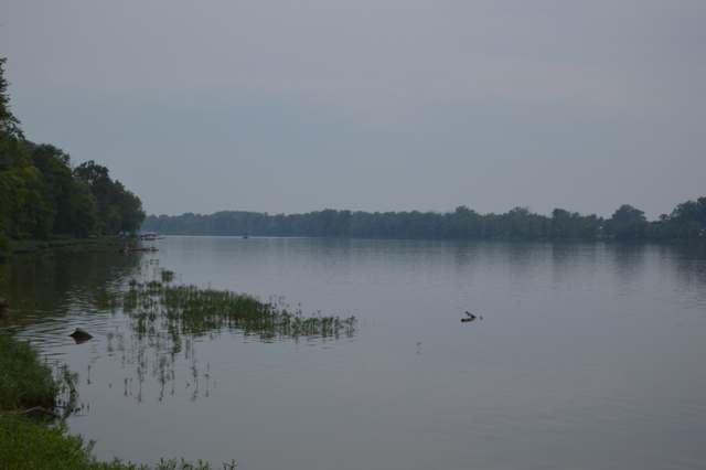
Photo: Nyttend, public domain · Wikimedia Commons
Local history sources: archive.org · archive.org · en.wikipedia.org · en.wikipedia.org · commons.wikimedia.org · postalhistory.com · postalhistory.com
Water
Mostly private wells The water here
- Liberty Center Village98% of residentsMaumee River (via Bowling Green Reservoir)
- Grand Rapids Village2% of residentsMaumee River (via Bowling Green Reservoir)
- Whispering Winds Mhc0% of residentsGroundwater wells (1 wells)
Hospitals, fire stations and more
Inside Washington Township, Henry County's boundary: 1 poor-rated bridge, 1 museum and 2 spill cases. Press a pin or a name for its whole record and its source.
Bridges rated poor (1)
-
CO. Rd. 4a over Bad CreekPoor · built 1970
- Condition
- Poor: a deck, superstructure, substructure or culvert rated 4 or below on the 0 to 9 scale
- What it is
- Bridge
- Built
- 1970
- Length
- 24 ft
- Owner
- County
- Vehicles a day
- 236
- Coordinates
- 41.44417, -83.95556
National Bridge Inventory (source) ↗ Street map and directions ↗
Source: FHWA National Bridge Inventory 2025. "Poor" means one major part rated 4 or below on the 0 to 9 scale; it calls for repair, not closing, unless the state posts or closes the bridge.
Museums, historical societies, gardens and zoos (1)
-
Liberty Center Historical SocietyHistorical society · Liberty Center
- What it is
- Historical society
- City
- Liberty Center
- Coordinates
- 41.44991, -83.98154
Search Wikipedia ↗ IMLS Museum Data Files (source) ↗ Street map and directions ↗
The museum list is IMLS's 2018 file; a museum may have closed or moved since.
Source: IMLS Museum Data Files, 2018.
Spills reported since 2021 (2)
-
Nitrogen Fertilizer 28%2023-06-29 · Washington Twp
- Reported
- 2023-06-29
- What spilled
- Nitrogen Fertilizer 28%
- Largest amount reported
- 500 gallons
- Where
- Washington Twp, Henry County
- Ohio EPA district office
- NWDO
- Ohio EPA case number
- 2306EPA0001071
Ohio EPA spill reports (source) ↗ Street map and directions ↗
-
Fuel Diesel / Diesel Fuel (Vehicle On Or Off Road)2022-06-20 · Washington Twp
- Reported
- 2022-06-20
- What spilled
- Fuel Diesel / Diesel Fuel (Vehicle On Or Off Road)
- Largest amount reported
- 200 gallons
- Where
- Washington Twp, Lucas County
- Ohio EPA district office
- NWDO
- Ohio EPA case number
- 2206EPA0000926
Ohio EPA spill reports (source) ↗ Street map and directions ↗
Source: Ohio EPA emergency response spill reports, 2021 to September 2026, one point per case where Ohio EPA placed it. A report is what the caller or responder recorded; amounts are often blank or estimated.
Its ZIP codes
Each ZIP code that touches Washington Township, Henry County, with the share of its residents who live here and the same headline figures as the ZIP page.
| ZIP | Share | Water | Radon | Home value | Schools | Flood |
|---|---|---|---|---|---|---|
| 43510 Washington Township and Colton | 100% | Mostly private wells | Too few radon tests | Median year built 1962 | Liberty Center Local · 4 stars overall | No digital FEMA flood map for this county |
| 43532 Washington Township and Liberty Center | 44% | Mostly private wells | 2.5 pCi/L average radon | Median year built 1971 | Liberty Center Local · 4 stars overall | No digital FEMA flood map for this county |
| 43522 Providence Township and Grand Rapids | 1% | Mostly private wells | 3.4 pCi/L average radon | Appraisal records without year built | Otsego Local · 4 stars overall | 6.0% of residents in the 1% floodplain |
Local government
Who holds office in Washington Township, Henry County, how its elections and ballot issues came out, and the state auditor's record.
Who holds office
| Office | Name | Party | Term ends | Contact |
|---|---|---|---|---|
| Township Trustee | John R. Patrick | 2029 | 419-467-2531 4321 County Road V, Liberty Center, OH 43532 | |
| Township Trustee | Franklin R. Godwin | 2027 | 419-966-1206 1128 County Rd T3, Grand Rapids, OH 43522 | |
| Township Trustee | Julian Westhoven | 2029 | 419-392-2005 S051 County Road 3B, Liberty Center, OH 43532 | |
| Township Fiscal Officer | Pat Myers | 2027 | 419-261-0115 S246 County Road 5B, Liberty Center, OH 43532 |
Roster as of 2026-09-17: county board of elections.
Money issues on the ballot since 2025: 1 of 1 passed.
Ballot issues
| Date | Issue | For | Against | Result |
|---|---|---|---|---|
| 2025-11-04 | Issue: None | 306 | 97 | Passed (75.93% for) |
Elections for office
| Date | Office | Candidates and votes |
|---|---|---|
| 2025-11-04 | Township Trustee | Julian Thomas Westhoven 252, 39.25%; John R. Patrick 260, 40.5%; Jason Maunz 130, 20.25% |
Winners in bold. Results from the county board of elections' official canvass unless marked.
Auditor of State record
- No fiscal caution, watch or emergency on the Auditor of State's lists.
- Agreed Upon Procedures, 2023 to 2024, released 2025-06-17
The county
Henry County: 11 ZIP codes, 23 cities, villages and townships, 27,623 people.
Nearby places
Quick answers
What county is Washington Township, Ohio in?
Washington Township, Henry County is a township in Henry County, Ohio, with 1,847 residents.
When was Washington Township, Ohio founded?
Washington Township, Henry County was settled by 1814 at Prairie du Masque (the section later split into Washington and Liberty townships); township organized as Myo by the late 1830s; laid out Texas platted April 2, 1849, by James Durbin; incorporated township renamed Washington between the 1847 and 1848 tax duplicates, when the Maumee River became its southern boundary. Founders on record: Henry County; Texas platted by James Durbin. Source
How did Washington Township, Ohio get its name?
The township was first organized as Myo, honoring an Ottawa sub-chief of that name who was among the last three Native leaders (with Oxinoxica and Wauseon) to hold out in the area. Source
What ZIP code is Washington Township, Ohio?
Washington Township, Henry County is served by ZIP codes 43510 and 43532; 43510 holds the largest share of its residents.
Where does Washington Township, Ohio get its water?
The main water source for Washington Township, Henry County (Liberty Center Village): Mostly private wells.
Cite this page
Cite this page as:
Cracked Buckeye, "Washington Township, Henry County", https://crackedbuckeye.com/place/washington-township-henry-county/, built 2026-10-31, accessed [date].
How to cite · Report a correction · Built 2026-10-31
