Local events in Oberlin
15 events in the next 90 days from 2 public calendars. All local events in Oberlin
Checked October 20; the events page is refreshed daily.
Deep dives about Oberlin
Long reads built from maps, newspapers and public records. All deep dives
- Columbus Day in OhioColumbus Day in Ohio: state law, how the capital got its name in 1812, Ohio's statues and cities, and what the record shows about Columbus.
- Oberlin CollegeFounded in 1833, Oberlin College voted to admit Black students in 1835 and gave women arts degrees in 1841; its town led the 1858 Oberlin-Wellington Rescue.
Notable people from Oberlin
Ohioans tied to this place, each with a sourced profile. All notable Ohioans
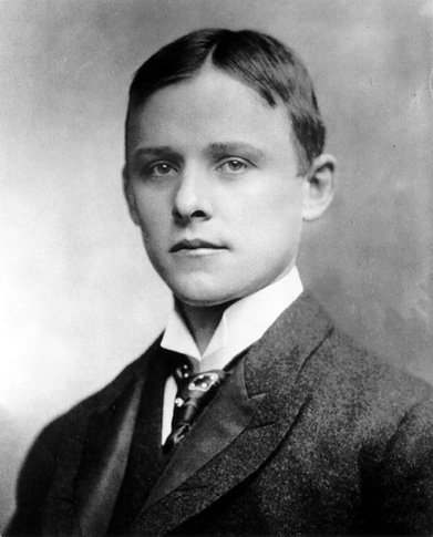 Charles Martin Hall1863-1914In 1886, in a woodshed behind his family's Oberlin home, discovered a cheap elec...
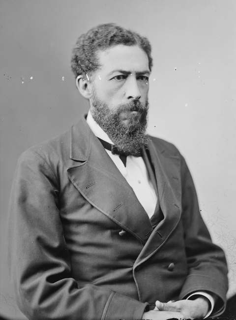 John Mercer Langston1829-1897Oberlin-trained lawyer who in 1855 was elected clerk of Brownhelm Township, Lora...
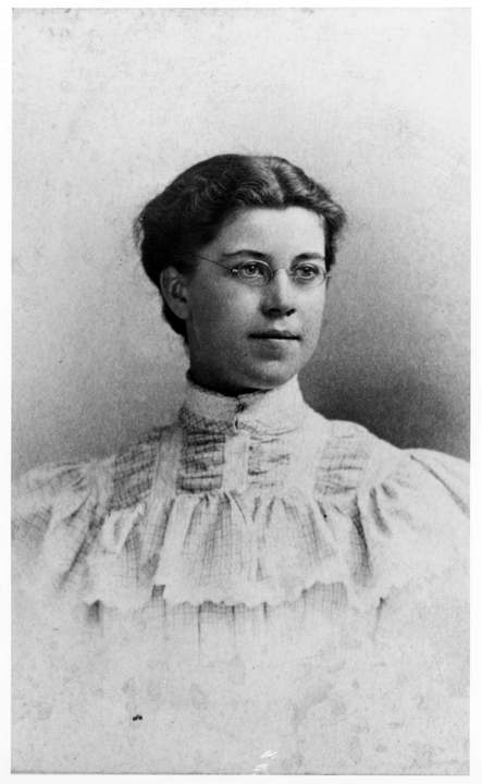 Katharine Wright1874-1929Dayton Latin teacher, Oberlin trustee and suffragist who was the indispensable p...
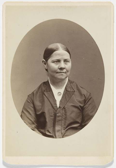 Lucy Stone1818-1893Abolitionist and suffrage orator who graduated from Oberlin College in 1847, the...
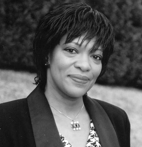 Rita Dove1952-Akron-born poet whose Thomas and Beulah, about her grandparents' life in Akron, ...
History from Oberlin
People and inventions tied to this place, each with its sources. All people · All inventions
- Anna Julia CooperPerson · 1858-1964
- Betsey Mix CowlesPerson · 1810-1876
- Charles Grandison FinneyPerson · 1792-1875
- Charles Henry LangstonPerson · 1817-1892
- John Anthony Copeland Jr.Person · 1834-1859
- John Wesley PowellPerson · 1834-1902
- Lewis Sheridan LearyPerson · 1835-1859
- Lucien Lucius NunnPerson · 1853-1925
- Mary Church TerrellPerson · 1863-1954
- Hall process for aluminumInvention or first · 1886
- Oberlin admits women and Black studentsInvention or first · 1833-1837
- Oberlin-Wellington RescueInvention or first · 1858
How Oberlin began
Oberlin was founded in 1833 by Presbyterian ministers John Jay Shipherd and Philo P. Stewart, who met in nearby Elyria the previous summer and set out to build a religious community with a school for training missionaries; after searching the surrounding forest, they chose a site about eight miles south of Elyria under an elm tree where they had stopped to pray. Shipherd secured 500 donated acres and bought 5,000 more at $1.50 an acre, naming the settlement for the Alsatian minister J. F. Oberlin. Oberlin Collegiate Institute opened in 1834 with four freshmen under the motto 'Learning and Labor.' The town's character shifted in 1835 when Lane Seminary students who had walked out over the school's refusal to admit Black students on equal terms enrolled instead at Oberlin, and it became a key Underground Railroad stop, most famously in the 1858 Oberlin-Wellington Rescue. Oberlin was also the birthplace of the Anti-Saloon League and of the Hall-Heroult process for industrial aluminum production.
Settled 1833, platted 1833, incorporated 1834 (Oberlin Collegiate Institute chartered), by John Jay Shipherd and Philo P. Stewart.
Where the name comes from
The town was named for Jean-Frederic (J. F.) Oberlin (1740-1826), an Alsatian Protestant minister whose educational work among the poor impressed founders John Jay Shipherd and Philo P. Stewart.
Before the town
No Native American village, trail, or site specific to Oberlin itself is documented in the sources consulted; the founders' 1833 search for a town site is described as passing through Ohio forest rather than through any identified Native settlement. Lorain County's broader Native history includes a Moravian mission attempt on the Black River in 1787, decades before Oberlin's founding and in a different part of the county.
Timeline
- — John Jay Shipherd and Philo P. Stewart meet in Elyria and begin planning a religious community and missionary school.
- — Shipherd secures 500 donated acres and buys 5,000 more at $1.50 per acre, founding Oberlin under an elm tree where the founders had stopped to pray.
- — Oberlin Collegiate Institute is chartered and opens with four freshman students under the motto 'Learning and Labor.'
- — The 'Lane Rebels,' students who left Lane Theological Seminary over its refusal to treat Black and white students equally, enroll at Oberlin, reshaping the town's character toward abolitionism.
- — Oberlin and Wellington residents free the fugitive John Price from federal custody in the Oberlin-Wellington Rescue; Price is smuggled to Canada.
- — Former Oberlin residents Lewis Sheridan Leary, Shields Green, and John Anthony Copeland Jr. take part in John Brown's raid on Harpers Ferry.
- — A photograph documents the town's Water Works, including its distinctive tower.
Stories
An elm tree, a prayer, and a town built on a motto
John Jay Shipherd and Philo P. Stewart met in Elyria in the summer of 1832, both troubled by what they saw as weak Christian morals on the frontier, and decided the answer was to build a community from scratch: a religious settlement wrapped around a school for training missionaries. They searched the forest south of Elyria before stopping to rest, and pray, under an elm tree about eight miles out -- and decided that was the spot. Shipherd talked a landowner into donating 500 acres and bought another 5,000 at $1.50 an acre, naming the whole enterprise for J. F. Oberlin, an Alsatian minister whose work in poor communities had impressed him. The Oberlin Collegiate Institute opened in 1834 with just four freshmen, operating under the motto 'Learning and Labor': tuition was free, but students worked to build and sustain the town around them. The founders had not set out to build an abolitionist stronghold, but that is largely what Oberlin became a year later, when students expelled from Cincinnati's Lane Theological Seminary for demanding equal treatment of Black classmates enrolled at Oberlin instead, and the town's path toward the Underground Railroad and the 1858 Oberlin-Wellington Rescue was set.
Photographs
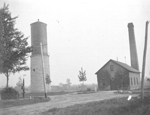
Photo: Toledo Lucas County Public Library, via Digital Public Library of America and the Ohio Digital Network, public domain · Wikimedia Commons
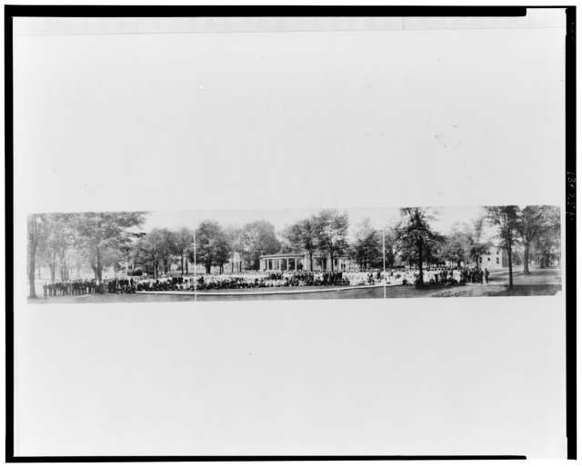
Photo: R. W. Johnston, via U.S. Library of Congress, Prints and Photographs Division, public domain · Wikimedia Commons
Local history sources: en.wikipedia.org · en.wikipedia.org · commons.wikimedia.org · commons.wikimedia.org
Historic places
9 places in Oberlin on the National Register of Historic Places, 2 of them National Historic Landmarks. Press a pin or a name for its whole record.
-
Evans, Wilson Bruce, House LandmarkBuilding · Oberlin · listed 1980
- Address
- 33 E. Vine St.
- Where
- Oberlin, Lorain County · ZIP 44074
- What it is
- Building
- Listed on the National Register
- 1980
- National Historic Landmark
- Yes
- NRIS reference number
- 80003143
- Coordinates
- 41.28859, -82.21631
National Register file (NPS) ↗ Search Wikipedia ↗ Street map and directions ↗ On the Cracked Buckeye map
-
Langston, John Mercer, House LandmarkBuilding · Oberlin · listed 1975
- Address
- 207 E. College St.
- Where
- Oberlin, Lorain County · ZIP 44074
- What it is
- Building
- Listed on the National Register
- 1975
- National Historic Landmark
- Yes
- NRIS reference number
- 75001464
- Coordinates
- 41.29127, -82.20979
National Register file (NPS) ↗ Search Wikipedia ↗ Street map and directions ↗ On the Cracked Buckeye map
-
Burrell-King HouseBuilding · Oberlin · listed 1979
- Address
- 317 E. College St.
- Where
- Oberlin, Lorain County · ZIP 44074
- What it is
- Building
- Listed on the National Register
- 1979
- NRIS reference number
- 79001886
- Coordinates
- 41.29095, -82.20584
National Register file (NPS) ↗ Search Wikipedia ↗ Street map and directions ↗ On the Cracked Buckeye map
-
Christ Episcopal ChurchBuilding · Oberlin · listed 1978
- Address
- 156 S. Main St.
- Where
- Oberlin, Lorain County · ZIP 44074
- What it is
- Building
- Listed on the National Register
- 1978
- NRIS reference number
- 78002114
- Coordinates
- 41.28749, -82.21796
National Register file (NPS) ↗ Search Wikipedia ↗ Street map and directions ↗ On the Cracked Buckeye map
-
Congregational Church of ChristBuilding · Oberlin · listed 1974
- Address
- W. Lorain and N. Main Sts.
- Where
- Oberlin, Lorain County · ZIP 44074
- What it is
- Building
- Listed on the National Register
- 1974
- NRIS reference number
- 74001554
- Coordinates
- 41.29443, -82.21809
National Register file (NPS) ↗ Search Wikipedia ↗ Street map and directions ↗ On the Cracked Buckeye map
-
Jewett, Frank, HouseBuilding · Oberlin · listed 1979
- Address
- 73 S. Professor St.
- Where
- Oberlin, Lorain County · ZIP 44074
- What it is
- Building
- Listed on the National Register
- 1979
- NRIS reference number
- 79001887
- Coordinates
- 41.29000, -82.21944
National Register file (NPS) ↗ Search Wikipedia ↗ Street map and directions ↗ On the Cracked Buckeye map
-
Oberlin Gas Lighting Company Gasholder HouseStructure · Oberlin · listed 1998
- Address
- 291 S. Main St.
- Where
- Oberlin, Lorain County · ZIP 44074
- What it is
- Structure
- Listed on the National Register
- 1998
- NRIS reference number
- 98001397
- Coordinates
- 41.28446, -82.21570
National Register file (NPS) ↗ Search Wikipedia ↗ Street map and directions ↗ On the Cracked Buckeye map
-
Oberlin Lake Shore And Michigan Southern StationBuilding · Oberlin · listed 1979
- Address
- Depot Park
- Where
- Oberlin, Lorain County · ZIP 44074
- What it is
- Building
- Listed on the National Register
- 1979
- NRIS reference number
- 79001888
- Coordinates
- 41.28456, -82.21868
National Register file (NPS) ↗ Search Wikipedia ↗ Street map and directions ↗ On the Cracked Buckeye map
-
Westervelt HallBuilding · Oberlin · listed 1974
- Address
- 39 S. Main St.
- Where
- Oberlin, Lorain County · ZIP 44074
- What it is
- Building
- Listed on the National Register
- 1974
- NRIS reference number
- 74001555
- Coordinates
- 41.29066, -82.21671
National Register file (NPS) ↗ Search Wikipedia ↗ Street map and directions ↗ On the Cracked Buckeye map
Source: National Park Service, National Register of Historic Places point file. The listing year is shown where NPS's certification date agrees with the listing's reference number. Listing recognizes significance; it does not restrict a private owner.
Water
West Branch Black River, via Oberlin Upground Reservoir The water here
- Oberlin Water Department77% of residentsWest Branch Black River, via Oberlin Upground Reservoir
- Rural Lorain Co. Water A23% of residentsMostly Lake Erie (bought from Avon Lake); some New London Reservoir and Ashland wells
- South Amherst Village0% of residentsLake Erie
Hospitals, fire stations and more
Inside Oberlin's boundary: 1 hospital, 1 health center, 2 nursing homes, 1 fire or EMS station, 1 college, 1 power plant, 3 public schools, 3 poor-rated bridges, 1 library, 6 museums, 1 police station, 9 public charging sites, 1 Superfund site, 3 Toxics Release Inventory facilities and 1 spill case. Press a pin or a name for its whole record and its source.
Hospitals (1)
-
Mercy Health - Allen Hospital, LlcCritical access hospital · Oberlin
- What it is
- Critical access hospital
- Address
- 200 West Lorain Street, Oberlin, OH 44074
- County
- Lorain County
- Beds
- 25
- Helipad
- Yes
- Ownership
- Non-profit
- Medicare overall rating
- 5 of 5 stars
- Emergency department (Medicare)
- Yes
- Medicare reports it as
- Mercy Allen Hospital
- Phone
- (440) 775-1211
- Medicare ID
- 361306
Medicare Care Compare ↗ Hospital's website ↗ Where HIFLD got this record ↗ HIFLD hospitals (source) ↗ Street map and directions ↗
Source: HIFLD hospitals inventory via FEMA (closed hospitals it still lists left out, hospitals opened since added), with Medicare Care Compare ratings matched by name and address.
Community health centers (1)
-
OberlinHealth center · Oberlin
- Run by
- a federally qualified health center
- Setting
- Clinic
- City
- Oberlin
- Coordinates
- 41.28409, -82.21796
Find a Health Center (HRSA) ↗ HRSA data (source) ↗ Street map and directions ↗
Source: HRSA health center service delivery sites, active, September 2026 (school-based sites left out). Health centers see patients whether or not they have insurance, with fees on a sliding scale.
Nursing homes (2)
-
Kendal at Oberlin5 of 5 stars · Oberlin
- Address
- 600 Kendal Drive, Oberlin, OH 44074
- Certified beds
- 5
- Residents on an average day
- 2
- Medicare overall rating
- 5 of 5 stars
- Health inspections
- 5 of 5 stars
- Penalties since 2023
- none
- Ownership
- Non profit - Corporation
- Takes
- Medicare
- Phone
- (440) 775-0094
- Medicare ID
- 365956
Medicare Care Compare ↗ CMS nursing home data (source) ↗ Street map and directions ↗
-
Welcome Nursing Home Abuse citation2 of 5 stars · Oberlin
- Address
- 417 South Main Street, Oberlin, OH 44074
- Certified beds
- 99
- Residents on an average day
- 90
- Medicare overall rating
- 2 of 5 stars
- Health inspections
- 2 of 5 stars
- Staffing
- 4 of 5 stars
- Quality measures
- 4 of 5 stars
- Penalties since 2023
- none
- Abuse citation (CMS icon)
- Yes
- Ownership
- For profit - Corporation
- Takes
- Medicare and Medicaid
- Phone
- (440) 775-1491
- Medicare ID
- 365508
Medicare Care Compare ↗ CMS nursing home data (source) ↗ Street map and directions ↗
Source: CMS Care Compare nursing home provider and penalties files; Medicare star ratings run 1 to 5.
Fire and EMS stations (1)
-
Oberlin Fire DepartmentOberlin
- Address
- 430 South Main Street, Oberlin, OH 44074
- Coordinates
- 41.28011, -82.21815
USGS National Map structures (source) ↗ Street map and directions ↗
Source: USGS National Map structures (most Ohio records last updated 2019 to 2022), checked against the Columbus and Cleveland station lists. The department that answers a call is set by jurisdiction and mutual aid, not by distance.
Colleges (1)
-
Oberlin CollegePrivate nonprofit college · Oberlin
- What it is
- Private nonprofit college
- City
- Oberlin
- Students, 2023-24 (12-month count)
- 4,160
- Tuition and fees, in state
- $64,646
- Graduation rate
- 79% of bachelor's students, within six years (a class of 726)
- IPEDS unit ID
- 204501
College Navigator (NCES) ↗ IPEDS data (source) ↗ Street map and directions ↗
Source: NCES IPEDS 2024 directory, 2023-24 enrollment and tuition, graduation rates for the 2017 (four-year) and 2020 (two-year) entering classes.
Power plants (1)
-
Oberlin (OH)Natural gas · 18 MW
- Capacity
- 18 MW
- By fuel
- natural gas 17 MW, oil 1 MW
- Main source
- Natural gas
- Technology
- Natural Gas Internal Combustion Engine; Petroleum Liquids;
- Operator
- City of Oberlin - (OH)
- Sector
- Electric Utility
- Where
- Oberlin, Lorain County
- Generating units
- 9
- Built
- 1948 (first unit); newest unit 2001
- EIA plant code
- 2933
EIA plant page ↗ EIA-860 (source) ↗ Street map and directions ↗
Source: EIA-860 power plant inventory via HIFLD (February 2025), with plant codes, units and years from EIA-860 2025.
Public schools (3)
-
Langston Middle School3.5 of 5 stars · Oberlin
- Address
- 150 N Pleasant St, Oberlin, OH 44074
- School district
- Oberlin City School District
- Kind (NCES)
- Regular School
- Students, 2023-24
- 196
- Teachers (full-time equivalent)
- 18.84
- Report card, 2025-26
- 3.5 of 5 stars
- Performance index
- 77.7%
- Ohio building IRN
- 028381
- NCES school ID
- 390445901472
NCES school record ↗ Ohio School Report Card ↗ Street map and directions ↗
-
Oberlin Elementary School3 of 5 stars · Oberlin
- Address
- 210 N Park St, Oberlin, OH 44074
- School district
- Oberlin City School District
- Kind (NCES)
- Regular School
- Students, 2023-24
- 361
- Teachers (full-time equivalent)
- 28.06
- Report card, 2025-26
- 3 of 5 stars
- Performance index
- 71.1%
- Ohio building IRN
- 009738
- NCES school ID
- 390445901470
NCES school record ↗ Ohio School Report Card ↗ Street map and directions ↗
-
Oberlin High School4 of 5 stars · Oberlin
- Address
- 281 N Pleasant St, Oberlin, OH 44074
- School district
- Oberlin City School District
- Kind (NCES)
- Regular School
- Students, 2023-24
- 225
- Teachers (full-time equivalent)
- 22.5
- Report card, 2025-26
- 4 of 5 stars
- Performance index
- 77%
- Four-year graduation rate
- 98.5%
- Ohio building IRN
- 028399
- NCES school ID
- 390445901471
NCES school record ↗ Ohio School Report Card ↗ Street map and directions ↗
Source: NCES EDGE public school locations 2024-25 and Common Core of Data 2023-24 (type, students, teachers); Ohio School Report Cards 2025-26 (Department of Education and Workforce), matched by name within the district.
Bridges rated poor (3)
-
East Vine Street over Plum CreekPoor · built 1930
- Condition
- Poor: a deck, superstructure, substructure or culvert rated 4 or below on the 0 to 9 scale
- What it is
- Bridge
- Built
- 1930
- Length
- 8 ft
- Owner
- City
- Vehicles a day
- 1,949
- Coordinates
- 41.28888, -82.21717
National Bridge Inventory (source) ↗ Street map and directions ↗
-
Morgan Street over Plum CreekPoor · built 1930
- Condition
- Poor: a deck, superstructure, substructure or culvert rated 4 or below on the 0 to 9 scale
- What it is
- Bridge
- Built
- 1930
- Length
- 8 ft
- Owner
- City
- Vehicles a day
- 1,290
- Coordinates
- 41.28700, -82.22050
National Bridge Inventory (source) ↗ Street map and directions ↗
-
Pleasant Street over Plum CreekPoor · built 1930
- Condition
- Poor: a deck, superstructure, substructure or culvert rated 4 or below on the 0 to 9 scale
- What it is
- Bridge
- Built
- 1930
- Length
- 10 ft
- Owner
- City
- Vehicles a day
- 707
- Coordinates
- 41.28981, -82.21496
National Bridge Inventory (source) ↗ Street map and directions ↗
Source: FHWA National Bridge Inventory 2025. "Poor" means one major part rated 4 or below on the 0 to 9 scale; it calls for repair, not closing, unless the state posts or closes the bridge.
Public libraries (1)
-
Oberlin Public LibraryCentral library · Oberlin
- Address
- 65 S. Main St., Oberlin, OH 44074
- What it is
- Central library
- Library system
- Oberlin Public Library
- Open
- 3,100 hours a year, 52 weeks
- Building
- 19,640 sq ft
- System's visits, FY2024
- 36,920
- System's loans, FY2024
- 154,891
- People the system serves
- 10,938
- Phone
- (440) 775-4790
IMLS Public Libraries Survey (source) ↗ Street map and directions ↗
Source: IMLS Public Libraries Survey FY2024 (outlets and their systems). Any Ohio resident can get a free card at any Ohio public library.
Museums, historical societies, gardens and zoos (6)
-
Allen Memorial Art MuseumArt museum · Oberlin
- What it is
- Art museum
- City
- Oberlin
- Coordinates
- 41.29401, -82.21042
Search Wikipedia ↗ IMLS Museum Data Files (source) ↗ Street map and directions ↗
The museum list is IMLS's 2018 file; a museum may have closed or moved since.
-
Leadership OhioMuseum · Oberlin
- What it is
- Museum
- City
- Oberlin
- Coordinates
- 41.28886, -82.22526
Search Wikipedia ↗ IMLS Museum Data Files (source) ↗ Street map and directions ↗
The museum list is IMLS's 2018 file; a museum may have closed or moved since.
-
Oberlin African-American Genealogy & History GroupHistorical society · Oberlin
- What it is
- Historical society
- City
- Oberlin
- Coordinates
- 41.28886, -82.22526
Search Wikipedia ↗ IMLS Museum Data Files (source) ↗ Street map and directions ↗
The museum list is IMLS's 2018 file; a museum may have closed or moved since.
-
Oberlin Heritage CenterMuseum · Oberlin
- What it is
- Museum
- City
- Oberlin
- Coordinates
- 41.28886, -82.22526
Search Wikipedia ↗ IMLS Museum Data Files (source) ↗ Street map and directions ↗
The museum list is IMLS's 2018 file; a museum may have closed or moved since.
-
Oberlin Historical And Improvement OrganizationHistorical society · Oberlin
- What it is
- Historical society
- City
- Oberlin
- Coordinates
- 41.28892, -82.21902
Search Wikipedia ↗ IMLS Museum Data Files (source) ↗ Street map and directions ↗
The museum list is IMLS's 2018 file; a museum may have closed or moved since.
-
Oberlin Underground Railroad CenterHistorical society · Oberlin
- What it is
- Historical society
- City
- Oberlin
- Coordinates
- 41.28886, -82.22526
Search Wikipedia ↗ IMLS Museum Data Files (source) ↗ Street map and directions ↗
The museum list is IMLS's 2018 file; a museum may have closed or moved since.
Source: IMLS Museum Data Files, 2018.
Police stations (1)
-
Oberlin Police DepartmentOberlin
- Address
- 85 South Main Street, Oberlin, OH 44074
- Coordinates
- 41.28938, -82.21672
USGS National Map structures (source) ↗ Street map and directions ↗
Source: USGS National Map structures, police stations, corrected and completed by hand (September 2026). The department that answers a call is set by jurisdiction, not by distance.
Public EV charging (9)
-
George A Abram Pavillion1 Level 2 · Oberlin
- Address
- 40 Edison St, Oberlin, OH 44074
- Ports
- 1 Level 2
- Plugs
- J1772
- Network
- AMPUP
- Hours
- 24 hours daily
- Phone
- 833-692-6787
Station Locator (NREL) ↗ Alternative Fuels Data Center (source) ↗ Street map and directions ↗
-
Kendal at Oberlin2 Level 2 · Oberlin
- Address
- 600 Kendal Drive, Oberlin, OH 44074
- Ports
- 2 Level 2
- Plugs
- J1772
- Network
- Blink Network
- Hours
- 24 hours daily
- Phone
- 888-998-2546
Station Locator (NREL) ↗ Alternative Fuels Data Center (source) ↗ Street map and directions ↗
-
Oberlin City Hall1 Level 2 · Oberlin
- Address
- 85 S Main St, Oberlin, OH 44074
- Ports
- 1 Level 2
- Plugs
- J1772
- Network
- AMPUP
- Hours
- 24 hours daily
- Price
- $0.18 per kWh
Station Locator (NREL) ↗ Alternative Fuels Data Center (source) ↗ Street map and directions ↗
-
Oberlin College - Woodland Res Hall4 Level 2 · Oberlin
- Address
- 150 Woodland St, Oberlin, OH 44074
- Ports
- 4 Level 2
- Plugs
- J1772
- Network
- OpConnect
- Hours
- 24 hours daily
- Phone
- 855-885-9571
Station Locator (NREL) ↗ Alternative Fuels Data Center (source) ↗ Street map and directions ↗
-
Oberlin Elementary School4 Level 2 · Oberlin
- Address
- 210 N Park St, Oberlin, OH 44074
- Ports
- 4 Level 2
- Plugs
- J1772
- Network
- Non-Networked
- Hours
- 24 hours daily
- Price
- $1.55 per kWh
Station Locator (NREL) ↗ Alternative Fuels Data Center (source) ↗ Street map and directions ↗
-
Oberlin PD lot DC fast1 DC fast · Oberlin
- Address
- 85 South Main St, Oberlin, OH 44074
- Ports
- 1 DC fast
- Plugs
- CCS, CHAdeMO
- Network
- FLO
- Hours
- 24 hours daily
- Phone
- 888-356-8911
Station Locator (NREL) ↗ Alternative Fuels Data Center (source) ↗ Street map and directions ↗
-
OMLPS CITY HALL2 Level 2 · Oberlin
- Address
- 85 S Main St, Oberlin, OH 44074
- Ports
- 2 Level 2
- Plugs
- J1772
- Network
- ChargePoint Network
- Hours
- 24 hours daily
- Phone
- 888-758-4389
Station Locator (NREL) ↗ Alternative Fuels Data Center (source) ↗ Street map and directions ↗
-
OMLPS FINANCE OFFICE2 Level 2 · Oberlin
- Address
- 69 S Main St, Oberlin, OH 44074
- Ports
- 2 Level 2
- Plugs
- J1772
- Network
- ChargePoint Network
- Hours
- 24 hours daily
- Phone
- 888-758-4389
Station Locator (NREL) ↗ Alternative Fuels Data Center (source) ↗ Street map and directions ↗
-
OMLPS PAVILLION2 Level 2 · Oberlin
- Address
- 260 S Main St, Oberlin, OH 44074
- Ports
- 2 Level 2
- Plugs
- J1772
- Network
- ChargePoint Network
- Hours
- 24 hours daily
- Phone
- 888-758-4389
Station Locator (NREL) ↗ Alternative Fuels Data Center (source) ↗ Street map and directions ↗
Source: NREL Alternative Fuels Data Center station list (May 2026), public and open stations, the posts at one address counted as one site.
Superfund sites (1)
-
Oberlin Leaking UstSuperfund program · Oberlin
- Address
- 550 West College Street, Oberlin, OH 44074
- County
- Lorain County
- Status
- Superfund program site, not on the National Priorities List
- EPA program ID
- OHN000506029
- EPA registry ID
- 110067350529
EPA facility record ↗ EPA Facility Registry Service (source) ↗ Street map and directions ↗
Source: EPA Facility Registry Service, Superfund (SEMS) and National Priorities List sites. Many program sites were assessed and needed no cleanup.
Facilities reporting toxic releases (3)
-
General Plug & Manufacturing Co.Toxics Release Inventory · Oberlin
- Address
- 132 Artino St, Oberlin, OH 44074
- County
- Lorain County
- Status
- Reports to the Toxics Release Inventory (active)
- EPA program ID
- 4407WGNRLP132AR
- EPA registry ID
- 110000840332
EPA facility record ↗ EPA Facility Registry Service (source) ↗ Street map and directions ↗
-
Johnson Controls Inc.Toxics Release Inventory · Oberlin
- Address
- 450 Stern St., Oberlin, OH 44074
- County
- Lorain County
- Status
- Reports to the Toxics Release Inventory (active)
- EPA program ID
- 44074JHNSN450ST
- EPA registry ID
- 110008057565
EPA facility record ↗ EPA Facility Registry Service (source) ↗ Street map and directions ↗
-
Quebecor World Oberlin DivToxics Release Inventory · Oberlin
- Address
- 235 Artino Street, Oberlin, OH 44074
- County
- Lorain County
- Status
- Reports to the Toxics Release Inventory (active)
- EPA program ID
- 44074QBCRW235AR
- EPA registry ID
- 110004591184
EPA facility record ↗ EPA Facility Registry Service (source) ↗ Street map and directions ↗
Source: EPA Facility Registry Service, Toxics Release Inventory reporters. Reporting a release is required of large users of listed chemicals; it is not by itself a violation.
Spills reported since 2021 (1)
-
Chemical(S) Unk2024-02-01 · Oberlin
- Reported
- 2024-02-01
- What spilled
- Chemical(S) Unk; Fuel Diesel / Diesel Fuel (Vehicle On Or Off Road); Fuel Gasoline ( 25% Ethanol Not E85)
- Where
- Oberlin, Lorain County
- Ohio EPA district office
- NEDO
- Ohio EPA case number
- 2402EPA0000176
Ohio EPA spill reports (source) ↗ Street map and directions ↗
Source: Ohio EPA emergency response spill reports, 2021 to September 2026, one point per case where Ohio EPA placed it. A report is what the caller or responder recorded; amounts are often blank or estimated.
Its ZIP codes
Each ZIP code that touches Oberlin, with the share of its residents who live here and the same headline figures as the ZIP page.
| ZIP | Share | Water | Radon | Home value | Schools | Flood |
|---|---|---|---|---|---|---|
| 44074 Oberlin | 72% | West Branch Black River, via Oberlin Upground Reservoir | 3.6 pCi/L average radon | Median year built 1960 | Oberlin City · 4 stars overall | 2.5% of residents in the 1% floodplain |
Local government
Who holds office in Oberlin, how its elections and ballot issues came out, and the state auditor's record.
Money issues on the ballot since 2025: 2 of 2 passed.
Ballot issues
| Date | Issue | For | Against | Result |
|---|---|---|---|---|
| 2025-11-04 | Issue 11: Current Expenses | 1,842 | 525 | Passed (77.82% for) |
| 2025-11-04 | Issue 12: Garbage | 1,957 | 423 | Passed (82.23% for) |
Elections for office
| Date | Office | Candidates and votes |
|---|---|---|
| 2025-11-04 | Member of Council at Large | Eboni A. Johnson 1,704, 16.12%; Libni Lopez 1,542, 14.59%; Kristin L. Peterson 1,542, 14.59%; Jessa D. New 1,479, 13.99%; Michael McFarlin 1,463, 13.84%; Joe Waltzer 1,431, 13.54%; Sandra Miller 1,410, 13.34% |
Winners in bold. Results from the county board of elections' official canvass unless marked.
Auditor of State record
- No fiscal caution, watch or emergency on the Auditor of State's lists.
- Financial Health Indicators (the Auditor of State's 17 measures; critical / cautionary / positive): 2020 1 / 1 / 15; 2021 2 / 3 / 12; 2022 2 / 3 / 12; 2023 2 / 2 / 13; 2024 0 / 2 / 15; 2025 0 / 1 / 15.
- OPERS Examination, 2025, released 2026-05-26
- Financial Audit, 2024, released 2025-11-06
- Financial Audit, 2023, released 2024-08-13
The county
Lorain County: 15 ZIP codes, 32 cities, villages and townships, 304,042 people.
Nearby places
Rain and snow
How much has actually fallen on Oberlin, day by day, from 1893 to now. Daily totals, not averages.
- rain, last 30 days
- 2.66 in
- 2026-09-30 to 2026-10-29
- rain so far in 2026
- 35.5 in
- about normal for the date
- snow so far in 2026
- 42.1 in
- a normal year brings 50.2 in
- a normal year
- 40.0 in
- average of 30 years, 1991-2020
| Month | Rain (in) | Snow (in) | Days counted |
|---|---|---|---|
| October 2026 | 2.66 | — | 29 |
| September 2026 | 2.84 | — | 30 |
| August 2026 | 5.33 | — | 31 |
| July 2026 | 3.37 | — | 31 |
| June 2026 | 3.62 | — | 30 |
| May 2026 | 4.52 | — | 31 |
| April 2026 | 7.21 | — | 30 |
| March 2026 | 2.70 | 1.0 | 31 |
| February 2026 | 0.58 | 7.2 | 28 |
| January 2026 | 2.71 | 33.9 | 31 |
| December 2025 | 1.74 | 6.3 | 31 |
| November 2025 | 1.94 | 0.3 | 30 |
| Wettest year | 2011 — 56.0 in |
|---|---|
| Driest year | 1963 — 17.9 in |
| Snowiest year | 2008 — 82.6 in |
| Wettest day on record | 25 June 1937 — 4.12 in |
| Heaviest snowfall in a day | 1 March 1954 — 15.98 in |
| Deepest snow on the ground | 4 March 1954 — 22.01 in |
Almost every day here is a measurement: 97% of them come from a rain gauge standing inside Oberlin itself.
48,074 days of records, 1893-04-01 to 2026-10-29. Source: NOAA NCEI GHCN-Daily, 3,240 gauges in and around Ohio. A day is "gauged" when a gauge standing inside the boundary reported it, and the value is the mean of those gauges. Otherwise it is interpolated by inverse distance from every gauge reporting within 50 miles. Nothing is carried forward, back-filled or smoothed. Against NOAA nClimDiv county monthly precipitation over 136,848 complete county-months (checked 2026-10-31): correlation 0.9515, median absolute difference 0.217 in a month. Built 2026-10-31 from the Cracked Buckeye precipitation archive. Snow is the softer number — snowfall is measured by hand with a ruler, no agency publishes a gridded county snowfall series, and blowing snow defeats every observer.
Environmental permits and filings
What Ohio EPA has on file for Oberlin: permits, inspections, violations, cleanups and the state loans behind sewer and water work. Every line links to the agency's own document.
- facilities and sites on file
- 28
- those placed on the map inside Oberlin
| Program | Facilities and sites |
|---|---|
| Wastewater and stormwater discharge | 10 |
| Hazardous waste | 8 |
| Air pollution | 5 |
| Sewer and water-line construction | 2 |
| Site assessment | 2 |
| Public drinking water | 1 |
| Date | Facility or site | What |
|---|---|---|
| OBERLIN COLLEGE | Air pollution permit | |
| OMEGA HEALTH SERVICES LLC | Wastewater and stormwater discharge violation resolved | |
| OBERLIN MUNICIPAL LIGHT & POWER SYSTEM | Air pollution permit | |
| LORAIN COUNTY RNG FACILITY | Air pollution permit | |
| OMEGA HEALTH SERVICES LLC | Wastewater and stormwater discharge inspection | |
| OBERLIN WATER DEPARTMENT PWS | Public drinking water plan | |
| OBERLIN MUNICIPAL LIGHT & POWER SYSTEM | Air pollution permit | |
| LORAIN COUNTY RNG FACILITY | Air pollution permit | |
| OBERLIN WATER DEPARTMENT PWS | Public drinking water inspection | |
| OBERLIN WATER DEPARTMENT PWS | Public drinking water monitoring results | |
| TACO BELL - OBERLIN | Wastewater and stormwater discharge permit | |
| TACO BELL - OBERLIN | Sewer and water-line construction permit | |
| FOREST STREET IMPROVEMENTS PROJECT | Wastewater and stormwater discharge permit | |
| TACO BELL - OBERLIN | Wastewater and stormwater discharge permit | |
| OBERLIN WATER DEPARTMENT PWS | Public drinking water report | |
| OBERLIN WATER DEPARTMENT PWS | Public drinking water plan | |
| OBERLIN WATER DEPARTMENT PWS | Public drinking water inspection | |
| OBERLIN WATER DEPARTMENT PWS | Public drinking water inspection | |
| OMEGA HEALTH SERVICES LLC | Wastewater and stormwater discharge inspection | |
| OBERLIN WATER DEPARTMENT PWS | Public drinking water plan | |
| TACO BELL - OBERLIN | Sewer and water-line construction permit | |
| OBERLIN WATER DEPARTMENT PWS | Public drinking water inspection | |
| OBERLIN PLACE | Wastewater and stormwater discharge permit | |
| OBERLIN WATER DEPARTMENT PWS | Public drinking water plan | |
| LORAIN COUNTY RNG FACILITY | Air pollution violation resolved |
Source: Ohio EPA eDocument portal (edocpub.epa.ohio.gov), indexed 2026-10-14. Facilities are placed on the map from Ohio EPA's own map layers, EPA's Facility Registry, coordinates written in the filings, or a geocoded street address. A permit filed under a private person's name (most are household septic systems) is counted but never named, placed or linked; licenses for individual workers and open-burning notices are left out entirely.
Quick answers
What county is Oberlin, Ohio in?
Oberlin is a city in Lorain County, Ohio, with 8,609 residents.
When was Oberlin, Ohio founded?
Oberlin was settled 1833; laid out 1833; incorporated 1834 (Oberlin Collegiate Institute chartered). Founders on record: John Jay Shipherd and Philo P. Stewart. Source
How did Oberlin, Ohio get its name?
The town was named for Jean-Frederic (J. Source
What ZIP code is Oberlin, Ohio?
Most of Oberlin is in ZIP code 44074.
Where does Oberlin, Ohio get its water?
The main water source for Oberlin (Oberlin Water Department): West Branch Black River, via Oberlin Upground Reservoir.
Cite this page
Cite this page as:
Cracked Buckeye, "Oberlin, Lorain County", https://crackedbuckeye.com/place/oberlin/, built 2026-10-31, accessed [date].
How to cite · Report a correction · Built 2026-10-31
