Local events in Jackson Township, Ashland County
Nothing is posted for Jackson Township itself yet; here is what is on within 10 miles. All local events in Jackson Township, Ashland County
Know a calendar we should watch? Send the link
Checked October 20; the events page is refreshed daily.
How Jackson Township, Ashland County began
Jackson Township was surveyed in 1807 by Mansfield Ludlow and organized on February 12, 1819, out of Perry Township, then part of Wayne County; it became part of Ashland County on February 24, 1846. Charles Hoy, who came from Stark County in May 1817, found five families already there, and the township held 236 people in 1820 and 1,645 in 1840. Three villages were laid out: Perrysburg in 1830 (its post office was called Albion), Albany in 1832 and Polk in 1849, and by 1862 the township had Methodist, German Reformed, Lutheran, German Baptist and United Brethren congregations. The Muddy Fork valley, where an ancient earthwork called Ramsey's Fort stood, is described in the 1880 county history as a place the Delawares once favored. The township is mostly farmland today, with the community of Cinnamon Lake in its north end.
Settled 1817, incorporated 1819-02-12 (organized from Perry Township), by organized from Perry Township; surveyed by Mansfield (Maxfield) Ludlow, 1807.
Where the name comes from
Not stated in any source read. The 1880 county history records that John Jackson, one of the pioneers of 1819, was the township's first justice of the peace, but neither it nor the 1863 or 1909 histories says whether the township was named for him, for Andrew Jackson, or for anyone else.
Before the town
The clearest site-specific record is Ramsey's Fort, an ancient earthwork on the land of John Ramsey in the southwest quarter of section 28. The 1880 county history describes it as quadrangular, a little over two acres, with an embankment about three feet high when first found, on the west side of a ridge overlooking the Muddy Fork valley, which it calls 'very fertile and was once a favorite resort of the Delawares' (Lenape). The fort had been plowed for about twenty-five years by 1880, and a grooved, polished stone hammer was turned up inside it. No named historic-era village or trail inside the township turned up in the sources searched.
Nations recorded here: Lenape (Delaware).
- Ramsey's Fort (earthwork) — southwest quarter of section 28, Jackson Township, on land of John Ramsey, prehistoric (unspecified culture) (archive.org)
Timeline
- — Jackson Township is surveyed by Mansfield (Maxfield) Ludlow.
- — Charles Hoy settles in the township in May; among the first wave of Pennsylvania-born settlers.
- — Jackson Township is organized on February 12 out of the territory of Perry Township, by the commissioners of Wayne County.
- — In March, Charles Hoy raises a cabin on his new quarter in section 27 and walks home through a snowstorm at night by following Wolf Run and the Muddy Fork, reaching his family between midnight and one o'clock.
- — Josiah Lee arrives in July from Ontario County, New York; he later lays out Perrysburg.
- — The township's population is counted at 236.
- — Sixty-seven men vote at the October election, with Jesse Matthews, John Bryan and Jacob Kiplinger as judges.
- — German Reformed and Lutheran families begin a church building where Polk now stands; services start there in the summer of 1828.
- — The village of Perrysburg is platted in the township on October 13.
- — Emigration to Michigan creates the first real market for the township's grain: wheat sells for 56 cents a bushel at the Lake Erie ports, only to fall to 40 cents in 1831.
- — Jacob Kiplinger lays out the village of Albany on April 23.
- — Robert Buchanan deeds the lot for the Methodist Episcopal church at Perrysburg on May 11; a second Methodist church goes up at the Polk site that fall.
- — The township's German Reformed and Lutheran congregation builds a 35-by-40-foot church half a mile west of Perrysburg, seating three hundred.
- — Wayne County's western townships, including Jackson, are set off into the newly formed Ashland County on February 24.
- — The village of Polk, the only one of the township's three platted villages still on the map today, is laid out on May 12.
- — A separate German Reformed church is organized on March 30 under Rev. Joseph M. Dixon and builds a 35-by-45-foot church that summer.
- — John Snowbarger gives a former meeting house on the township's south line, half a mile west of Lafayette, to the German Baptists (Dunkers) on September 29.
- — The United Brethren organize their first class in the township in September and build a 30-by-36-foot chapel near the southwest corner in 1861.
- — The township's population is counted at 1,511, and Perrysburg's at 115.
Stories
The salt well that never paid
Between 1817 and 1819, Hoy and Meason sank a well in the township to nearly 460 feet, chasing the brine deposits that had made salt-boiling a profitable sideline elsewhere in frontier Ohio. Salt was scarce and valuable on the Ohio frontier, worth the enormous labor of a hand-dug well of that depth. The venture came up dry of usable brine and was abandoned, a reminder that Jackson Township's fortune, unlike some of its neighbors, turned out to be in farmland and timber rather than minerals.
Charles Hoy's night march
Charles Hoy moved his family from Stark County to Jackson Township in May 1817, when only five families lived there. In March 1819 he bought a quarter in section 27, still unbroken forest, and raised a cabin on it with help gathered from as far away as the site of Rowsburg. At the end of the day he set out for home, five miles off, with nothing but blazed trees to guide him. Halfway there a snowstorm and darkness stopped him; he tried to find the blazes by feeling the trunks with his hands and could not. Rather than spend the night in the storm, he found the bed of Wolf Run, followed it down to the Muddy Fork and then up that stream to his home on its bank, nine or ten miles over fallen timber and brush. He reached the cabin between midnight and one in the morning to find his wife still awake. Hoy had served in the War of 1812, and he said later that he never made a more exhausting march.
Photographs
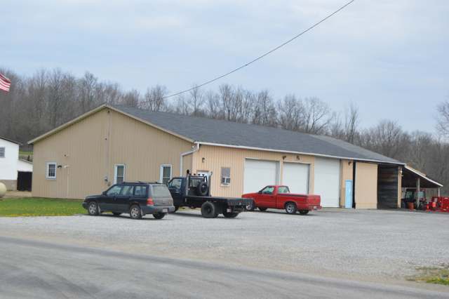
Photo: Nyttend, public domain · Wikimedia Commons
Local history sources: en.wikipedia.org · genealogytrails.com · archive.org · en.wikipedia.org · archive.org · archive.org · archive.org · archive.org · archive.org · archive.org · archive.org · archive.org · archive.org · commons.wikimedia.org
Water
Mostly private wells The water here
- Rural Lorain Co. Water A66% of residentsMostly Lake Erie (bought from Avon Lake); some New London Reservoir and Ashland wells
- West Salem Village34% of residentsGroundwater wells (4 wells)
Hospitals, fire stations and more
Inside Jackson Township, Ashland County's boundary: 1 high-hazard dam, 10 shale and injection wells, 1 Superfund site, 3 Toxics Release Inventory facilities and 6 spill cases. Press a pin or a name for its whole record and its source.
High-hazard dams (1)
-
Cinnamon Lake DamMuddy Fork · condition: fair
- Hazard class
- High: a failure would probably cost a life
- Condition
- Fair (assessed 03/13/2025)
- River or stream
- Muddy Fork
- Purpose
- Recreation
- Type
- Earth
- Height
- 45 ft
- Storage
- 3,577 acre-feet
- Completed
- 1970
- Owner type
- Private
- County
- Ashland County
- Nearest town (NID)
- West Salem
- Last inspection
- 10/30/2024
- Emergency action plan
- Yes
- NID ID
- OH00095
National Inventory of Dams record ↗ National Inventory of Dams (source) ↗ Street map and directions ↗
Source: U.S. Army Corps of Engineers National Inventory of Dams, August 2026. "High hazard" rates what a failure would cost downstream, not how likely one is; the condition is the state's assessment.
Shale and injection wells (10)
-
Brown Unit {Erp 19} W-4 InjectionInjection well (Class II)
- What it is
- Injection well (Class II)
- Operator
- Deep Resources Llc
- County
- Ashland County
- API well number
- 34005219180000
- Coordinates
- 40.90246, -82.14572
ODNR oil and gas wells (source) ↗ Street map and directions ↗
-
Brown Unit {Erp#19} W-1 InjectionInjection well (Class II)
- What it is
- Injection well (Class II)
- Operator
- Deep Resources Llc
- County
- Ashland County
- API well number
- 34005225100000
- Coordinates
- 40.90346, -82.14738
ODNR oil and gas wells (source) ↗ Street map and directions ↗
-
Brown Unit {Erp#19} W-10 InjectionInjection well (Class II)
- What it is
- Injection well (Class II)
- Operator
- Deep Resources Llc
- County
- Ashland County
- API well number
- 34005222760000
- Coordinates
- 40.90110, -82.14916
ODNR oil and gas wells (source) ↗ Street map and directions ↗
-
Brown Unit {Erp#19} W-3 InjectionInjection well (Class II)
- What it is
- Injection well (Class II)
- Operator
- Deep Resources Llc
- County
- Ashland County
- API well number
- 34005225200000
- Coordinates
- 40.90258, -82.14731
ODNR oil and gas wells (source) ↗ Street map and directions ↗
-
Brown Unit {Erp#19} W-5 InjectionInjection well (Class II)
- What it is
- Injection well (Class II)
- Operator
- Deep Resources Llc
- County
- Ashland County
- API well number
- 34005225190000
- Coordinates
- 40.90220, -82.14825
ODNR oil and gas wells (source) ↗ Street map and directions ↗
-
Brown Unit {Erp#19} W-6 InjectionInjection well (Class II)
- What it is
- Injection well (Class II)
- Operator
- Deep Resources Llc
- County
- Ashland County
- API well number
- 34005225150000
- Coordinates
- 40.90203, -82.14659
ODNR oil and gas wells (source) ↗ Street map and directions ↗
-
Brown Unit {Erp#19} W-7 InjectionInjection well (Class II)
- What it is
- Injection well (Class II)
- Operator
- Deep Resources Llc
- County
- Ashland County
- API well number
- 34005222770000
- Coordinates
- 40.90151, -82.14862
ODNR oil and gas wells (source) ↗ Street map and directions ↗
-
Brown Unit {Erp#19} W-8 InjectionInjection well (Class II)
- What it is
- Injection well (Class II)
- Operator
- Deep Resources Llc
- County
- Ashland County
- API well number
- 34005238390000
- Coordinates
- 40.90137, -82.14699
ODNR oil and gas wells (source) ↗ Street map and directions ↗
-
Brown Unit {Erp#19} W-9 InjectionInjection well (Class II)
- What it is
- Injection well (Class II)
- Operator
- Deep Resources Llc
- County
- Ashland County
- API well number
- 34005221960000
- Coordinates
- 40.90111, -82.15079
ODNR oil and gas wells (source) ↗ Street map and directions ↗
-
Brown Unit(Erp #19) W-2 InjectionInjection well (Class II)
- What it is
- Injection well (Class II)
- Operator
- Deep Resources Llc
- County
- Ashland County
- API well number
- 34005225330000
- Coordinates
- 40.90295, -82.14635
ODNR oil and gas wells (source) ↗ Street map and directions ↗
Source: ODNR Division of Oil and Gas Resources well inventory (September 2026): drilled Utica, Marcellus and horizontal wells and Class II injection wells not plugged. Older vertical wells are on the full map.
Superfund sites (1)
-
B & D Enterprises International FireSuperfund program · Polk
- Address
- 229 County Road 800, Polk, OH 44866
- County
- Ashland County
- Status
- Superfund program site, not on the National Priorities List
- EPA program ID
- OHN000520665
- EPA registry ID
- 110071102377
EPA facility record ↗ EPA Facility Registry Service (source) ↗ Street map and directions ↗
Source: EPA Facility Registry Service, Superfund (SEMS) and National Priorities List sites. Many program sites were assessed and needed no cleanup.
Facilities reporting toxic releases (3)
-
American AugersToxics Release Inventory · West Salem
- Address
- 135 Us-42 N, West Salem, OH 44287
- County
- Ashland County County
- Status
- Reports to the Toxics Release Inventory (***unchanged***)
- EPA program ID
- 4428WMRCNG135UB
- EPA registry ID
- 110071284827
EPA facility record ↗ EPA Facility Registry Service (source) ↗ Street map and directions ↗
-
American Augers IncToxics Release Inventory · West Salem
- Address
- 135 Us Rte 42, West Salem, OH 44287
- County
- Wayne County
- Status
- Reports to the Toxics Release Inventory (active)
- EPA program ID
- 4428WMRCNG135US
- EPA registry ID
- 110006234486
EPA facility record ↗ EPA Facility Registry Service (source) ↗ Street map and directions ↗
-
American Augers-American AugersToxics Release Inventory · West Salem
- Address
- 135 Us Route 42, West Salem, OH 44287
- County
- Ashland County
- Status
- Reports to the Toxics Release Inventory (***unchanged***)
- EPA program ID
- 4428WMRCNG135UC
- EPA registry ID
- 110051422206
EPA facility record ↗ EPA Facility Registry Service (source) ↗ Street map and directions ↗
Source: EPA Facility Registry Service, Toxics Release Inventory reporters. Reporting a release is required of large users of listed chemicals; it is not by itself a violation.
Spills reported since 2021 (6)
-
Drilling Waste / Cuttings2025-08-24 · Cambridge Twp
- Reported
- 2025-08-24
- What spilled
- Drilling Waste / Cuttings
- Where
- Cambridge Twp, Guernsey County
- Ohio EPA district office
- NWDO
- Ohio EPA case number
- 2508EPA0001444
Ohio EPA spill reports (source) ↗ Street map and directions ↗
-
Fertilizer(S) Nos (Not Specified)2024-04-29 · Jackson Twp
- Reported
- 2024-04-29
- What spilled
- Fertilizer(S) Nos (Not Specified)
- Largest amount reported
- 1,000 gallons
- Where
- Jackson Twp, Ashland County
- Ohio EPA district office
- NWDO
- Ohio EPA case number
- 2404EPA0000707
Ohio EPA spill reports (source) ↗ Street map and directions ↗
-
Fuel Diesel / Diesel Fuel (Vehicle On Or Off Road)2023-11-01 · Jackson Twp
- Reported
- 2023-11-01
- What spilled
- Fuel Diesel / Diesel Fuel (Vehicle On Or Off Road)
- Where
- Jackson Twp, Ashland County
- Ohio EPA district office
- NWDO
- Ohio EPA case number
- 2311EPA0001866
Ohio EPA spill reports (source) ↗ Street map and directions ↗
-
Fuel Diesel / Diesel Fuel (Vehicle On Or Off Road)2021-12-15 · Jackson Twp
- Reported
- 2021-12-15
- What spilled
- Fuel Diesel / Diesel Fuel (Vehicle On Or Off Road)
- Where
- Jackson Twp, Ashland County
- Ohio EPA district office
- NWDO
- Ohio EPA case number
- 2112EPA0001862
Ohio EPA spill reports (source) ↗ Street map and directions ↗
-
Chemical(S) Unk2021-05-06 · Jackson Twp
- Reported
- 2021-05-06
- What spilled
- Chemical(S) Unk
- Where
- Jackson Twp, Ashland County
- Ohio EPA district office
- NWDO
- Ohio EPA case number
- 2105EPA0000630
Ohio EPA spill reports (source) ↗ Street map and directions ↗
-
Sewage Human2026-08-01 · Jackson Twp
- Reported
- 2026-08-01
- What spilled
- Sewage Human
- Largest amount reported
- 100 gallons
- Where
- Jackson Twp, Ashland County
- Ohio EPA district office
- NWDO
- Ohio EPA case number
- 2608EPA0001405
Ohio EPA spill reports (source) ↗ Street map and directions ↗
Source: Ohio EPA emergency response spill reports, 2021 to September 2026, one point per case where Ohio EPA placed it. A report is what the caller or responder recorded; amounts are often blank or estimated.
Its ZIP codes
Each ZIP code that touches Jackson Township, Ashland County, with the share of its residents who live here and the same headline figures as the ZIP page.
| ZIP | Share | Water | Radon | Home value | Schools | Flood |
|---|---|---|---|---|---|---|
| 44866 Jackson Township and Polk | 42% | Mostly private wells | 4.9 pCi/L average radon | Median year built 1992 | Mapleton Local · 4 stars overall | 0.0% of residents in the 1% floodplain |
| 44287 Jackson Township and West Salem | 33% | Mostly private wells | 4.1 pCi/L average radon | Median year built 1986 | Northwestern Local · 4 stars overall | 1.0% of residents in the 1% floodplain |
| 44235 Homer Township and Homerville | 2% | Wells (14 listed as active in EPA SDWIS: Wells 1-7 and 10-15; Well 9 was deactivated 2025-11-17) in the Jerome Fork Basin sand-and-gravel aquifer, sited generally north of the treatment plant on Cleveland Road | 4.3 pCi/L average radon | Median year built 1977 | Black River Local · 3.5 stars overall | 1.1% of residents in the 1% floodplain |
The county
Wayne County: 15 ZIP codes, 33 cities, villages and townships, 124,210 people.
Nearby places
Quick answers
What county is Jackson Township, Ohio in?
Jackson Township, Ashland County is a township in Wayne County, Ohio, with 3,574 residents.
When was Jackson Township, Ohio founded?
Jackson Township, Ashland County was settled 1817; incorporated 1819-02-12 (organized from Perry Township). Founders on record: organized from Perry Township; surveyed by Mansfield (Maxfield) Ludlow, 1807. Source
How did Jackson Township, Ohio get its name?
Not stated in any source read. Source
What ZIP code is Jackson Township, Ohio?
Jackson Township, Ashland County is served by ZIP codes 44866, 44287 and 44235; 44866 holds the largest share of its residents.
Where does Jackson Township, Ohio get its water?
The main water source for Jackson Township, Ashland County (Rural Lorain Co. Water A): Mostly private wells.
Cite this page
Cite this page as:
Cracked Buckeye, "Jackson Township, Ashland County", https://crackedbuckeye.com/place/jackson-township-ashland-county/, built 2026-10-31, accessed [date].
How to cite · Report a correction · Built 2026-10-31
