Grandview Heights
City · Franklin County · 8,085 residents · 2.5% municipal income tax
How Grandview Heights began
Grandview Heights takes its name from 'Grand View Heights,' developer George Urlin's plat on the bluff above the Scioto River, one of several subdivisions merged into the Hamlet of Marble Cliff when it incorporated in 1901. When Columbus refused to extend water and electric service to the hamlet's southern section after it split off in 1903, its roughly 200 residents incorporated as the independent Village of Grandview Heights in 1906 rather than go without utilities. It grew fast, becoming a city by 1931, and later fought Columbus for two decades over a 426-acre annexation that happened to include Columbus's own waterworks and filtration plant. Today, after a long sequence of early-twentieth-century annexations, it is a dense, walkable inner-ring suburb of about a square mile and a half that still supplies fire, police, and library service to next-door Marble Cliff.
Settled 1797 (Lucas Sullivant's survey of the original Franklin Township, which included this land), platted by 1901 (George Urlin's 'Grand View Heights' subdivision, one of several merged into the Hamlet of Marble Cliff that year), incorporated 1906, by About 200 residents of the section that detached from the Hamlet of Marble Cliff in January 1903, who incorporated as the Village of Grandview Heights after Columbus denied their request for water and electric service.
Where the name comes from
The name descends from 'Grand View Heights,' the name real-estate developer George Urlin gave his subdivision on the southern bluff overlooking the Scioto River. It was one of several plats, along with Price and Griswold's Arlington Place and Croughton, Denmead, and Pope's Grand View subdivision, folded into the Hamlet of Marble Cliff when that village incorporated in November 1901; the hamlet's own name was nearly 'Arlington' before organizers changed it to avoid mail confusion with a different Arlington in southern Ohio. When the southern section split off as its own village in 1906, it kept Urlin's descriptive name for the bluff.
Before the town
The best-documented Native site connected to Grandview Heights is what came to be called the Toephner Mound (also Anderson Mound, then Pope Mound), an Adena burial mound whose construction began around 400 BC, roughly 1.5 miles above the confluence of the Scioto and Olentangy rivers near the west edge of what is now Grandview Heights/Marble Cliff, close to the intersection of Grandview Avenue and Dublin Road. It stood nearly 20 feet tall and was never excavated until a forced salvage dig in 1953-54 (see the Toephner Mound story below), which recorded more than 85 burials along with sandstone and slate gorgets and Adena tubular pipes, one an unusual form resembling later Hopewell pipe styles. A second mound, remembered locally as the 'Herschler Mound,' once stood at the site of the present Grandview Heights Municipal Building on Grandview Avenue, though far less has been recorded about it. This land lay south and east of the Greenville Treaty Line and so was ceded to the United States by the 1795 Treaty of Greenville; surveyor Lucas Sullivant, who laid out Franklinton in 1797, subsequently purchased most of the lots of the original Franklin Township, which included this area. No source found names a historic-era Native village, trail, or resident nation specific to this exact site beyond the mound itself; broader county-level context will be in the Franklin County file.
Nations recorded here: Adena culture.
- Toephner Mound (Anderson Mound; Pope Mound) (mound) — near the intersection of Grandview Avenue and Dublin Road, about 30 yards from present Riverside Drive/SR-33, close to the Scioto River, Adena culture, beginning about 400 BC (ghmchs.org)
- Herschler Mound (mound) — site of the present Grandview Heights Municipal Building, Grandview Avenue, unknown; not further documented in sources checked (ghmchs.org)
Timeline
- — The Treaty of Greenville cedes this part of Ohio, lying south and east of the treaty line, to the United States.
- — Adena people begin building what will later be called the Toephner Mound, above the confluence of the Scioto and Olentangy rivers near the future Grandview Heights.
- — Lucas Sullivant surveys the area and lays out Franklinton; he goes on to purchase most of the lots of the original Franklin Township, which included the land that becomes Grandview Heights and Marble Cliff.
- — In November, the Hamlet of Marble Cliff incorporates, merging several subdivisions, including George Urlin's 'Grand View Heights' plat on the southern bluff and the community of Sellsville, winter home of the Sells Circus.
- — In January, under a new state law, the hamlet's southern territories, Arlington, Grandview, and Chester Heights, detach themselves from Marble Cliff.
- — After Columbus refuses to supply water and electricity to the roughly 200 residents of the detached area, they vote to incorporate as the Village of Grandview Heights.
- — Grandview Heights annexes a sequence of subdivided blocks north to the railroad, deliberately routing the boundary to exclude an Italian immigrant enclave between Third and Fifth avenues.
- — A major eastward annexation extends the village to its present boundary, adding the Northwest Boulevard Company's developments and the Willard and Salzgaber farms.
- — Developer Don M. Casto Sr. builds the Grandview Avenue Shopping Center, later called the Bank Block, described as the nation's first automobile-oriented strip shopping center; its 1928 opening features an appearance by the 'Our Gang' child film stars.
- — Grandview Heights' population passes 5,000, and under Ohio law it is recognized as a city.
- — Car dealer Joseph Toephner's plan to level the Adena mound on land he bought in 1946 is repeatedly delayed by preservationists; the Ohio State Museum, led by Dr. Raymond Baby, finally conducts a salvage excavation between October 1953 and May 1954, after which the mound is gone.
- — Columbus restricts new water-main and sewer connections outside its city limits to pressure suburbs into annexation; Franklin County commissioners nonetheless grant Grandview Heights a 1956 annexation of 426 acres that includes the Columbus waterworks and filtration plant.
- — The annexed land, nicknamed the 'Golden Finger' and by 1971 worth nearly a quarter of Grandview Heights' entire tax base, is stripped of its school-funding status by the state board of education in 1971; the Ohio Supreme Court upholds the transfer to Columbus City Schools in 1975.
- — Developers the Wagenbrenner brothers begin a roughly $750,000 renovation of the derelict Bank Block, reviving it as a dining and shopping destination.
Stories
A name from a bluff, a village born of a grudge
When the Hamlet of Marble Cliff organized in November 1901, it stitched together a handful of existing subdivisions: Sellsville, winter quarters of the Sells Circus; the Price and Griswold Arlington Place plat on the western bluff; and, on the southern bluff overlooking the Scioto, developer George Urlin's Grand View Heights. Friction between the hamlet's north and south over money and morals, the mayor, a teetotaling minister, fined patrons of the saloons and the Arlington Country Club, split the community almost from the start. In January 1903 the southern section, using a new state law, detached itself. Its roughly 200 residents then asked Columbus for water and electric service; Columbus said no. In 1906 they incorporated instead as their own village, the Village of Grandview Heights, keeping Urlin's name for the bluff their homes sat on.
The mound that took eight years to lose
An Adena mound had stood above the Scioto near what is now Grandview Avenue and Dublin Road since about 400 BC, known through the years as the Anderson Mound and then, for the fifty years the Pope family owned it and kept it landscaped, with a pergola built on its summit for cool evenings, the Pope Mound. In 1946, car dealer Joseph Toephner bought the property and announced he would level the mound for a truck facility. What followed was an eight-year standoff: a tipped-off museum curator, a widow in California asked to intervene, a bulldozer halted twice by public pressure, in 1949 and again threatened in 1954, and a former state museum director's failed 1930s campaign to buy the mound as a park. When Toephner's patience finally ran out, archaeologist Dr. Raymond Baby led a salvage excavation from October 1953 to May 1954, recording more than 85 Adena burials and distinctive carved pipes and gorgets before the mound came down for good. The findings were published in a peer-reviewed journal in 1985; one of the pipes is still on display at the Ohio History Connection's museum.
The nation's first strip mall
In 1927, Columbus developer Don M. Casto Sr. built a shopping center on Grandview Avenue meant to serve the fast-growing new neighborhoods of Grandview Heights and Upper Arlington, designed around a new fact of American life: the automobile. Rather than lining storefronts directly on the sidewalk as was then standard, Casto set his thirty shops back from the street with parking for 400 cars behind them, a design later credited as the country's first shopping strip center and its first regional shopping center, with three national grocery chains under one roof. It opened in 1928 to national press attention and a visit from the child stars of the 'Our Gang' film shorts. Anchored by a bank, it became known as the Bank Block, thrived for years, then sank into decades of absentee-owner neglect until, by 1976, only a hardware store and an office-supply shop were left. The Wagenbrenner brothers' renovation that year, anchored by chef Hubert Seifert's Gourmet Market, eventually revived it.
The Golden Finger
In 1956, over the objections of Columbus city officials, Franklin County commissioners let Grandview Heights annex 426 acres running along Dublin Road, land that happened to include Columbus's own waterworks and filtration plant, along with a Marble Cliff Quarries operation and the future site of a Sears store and WBNS-TV. The strip became known locally as the 'Golden Finger': by 1971 its assessed value, nearly $17.9 million, made up close to a quarter of tiny Grandview Heights' entire tax base, most of it flowing to the small Grandview school district. That year the state board of education reversed course and reassigned the tax revenue to Columbus City Schools instead, a blow Grandview fought in court for four years before the Ohio Supreme Court upheld the loss in 1975, a reminder of how much was riding, financially, on which side of a municipal line a water plant happened to sit.
Photographs
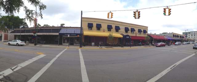
Photo: Xavier86, CC BY-SA 3.0 · Wikimedia Commons
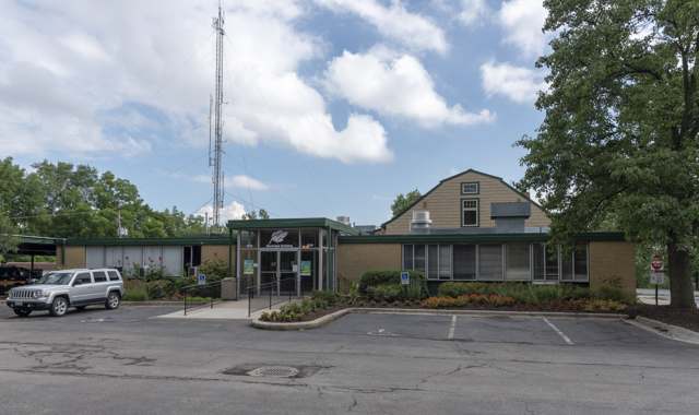
Photo: Sixflashphoto, CC BY-SA 4.0 · Wikimedia Commons
Local history sources: en.wikipedia.org · ghmchs.org · ghmchs.org · ghmchs.org · ghmchs.org · en.wikipedia.org · commons.wikimedia.org · commons.wikimedia.org
Water
Scioto River intake at the plant on Dublin Rd, a few miles below Griggs Dam, opposite Marble Cliff The water here
- Columbus Public Water System100% of residentsScioto River (Griggs & O'Shaughnessy), Hoover Reservoir on Big Walnut Ck, plus wells
Its ZIP codes
Each ZIP code that touches Grandview Heights, with the share of its residents who live here and the same headline figures as the ZIP page.
| ZIP | Share | Water | Radon | Home value | Schools | Flood |
|---|---|---|---|---|---|---|
| 43212 Columbus | 33% | Scioto River intake at the plant on Dublin Rd, a few miles below Griggs Dam, opposite Marble Cliff | 4.8 pCi/L average radon | Median year built 1942 | Columbus City · 2 stars overall | 0.0% of residents in the 1% floodplain |
The county
Franklin County: 45 ZIP codes, 42 cities, villages and townships, 1,356,733 people.
Nearby places
Cite this page
Cite this page as:
Cracked Buckeye (Open Shower Co), "Grandview Heights, Franklin County", https://crackedbuckeye.com/place/grandview-heights/, built 2026-09-16, accessed [date].
Machine-readable: /api/place/grandview-heights.json (open JSON, CC BY 4.0 for the compilation; the underlying records keep their own terms) · How to cite · Report a correction · Built 2026-09-16