Local events in Forest
Nothing is posted for Forest itself yet; here is what is on within 10 miles. All local events in Forest
Know a calendar we should watch? Send the link
Checked October 20; the events page is refreshed daily.
How Forest began
Forest grew up in 1855 as a stop where a new railroad crossed a stretch of tall-grass prairie broken by woodland, and took its name from that forest. A post office had already opened there in 1854, ahead of the tracks, and the village incorporated in 1865 once a second railroad crossed the first, making it a transfer point between two lines. That crossing - the Pittsburgh, Fort Wayne and Chicago and the Big Four - shaped the town for the rest of the century; a brick freight depot built in 1887 to serve it still stands and today houses the branch library. Forest sits astride the Hardin-Wyandot county line and in 2024 fell inside the path of totality for the April 8 solar eclipse.
Platted 1855, incorporated 1865.
Where the name comes from
Forest was named for the forest that stood on the town site, within a larger area of tall-grass prairie that surrounded it.
Before the town
No treaty line, village, or trail specific to the village site is documented in the sources checked. One local tourism source, not corroborated elsewhere, names a site called 'Devil's Backbone' near Forest as a burial ground of the Glacial Kame culture; because it could not be confirmed against Ohio History Central, the National Register, or the Wikipedia article on the Glacial Kame culture (which instead names the Ridgeway Site, elsewhere in Hardin County, as that culture's type site), it is included below only as a single-source lead, not a confirmed fact. At the county level, Hardin County was Wyandot and Shawnee ground before and after the War of 1812, with the last documented Native village in the county abandoned in 1817.
- Devil's Backbone (reported, unconfirmed) (burial) — near Forest, Hardin County, Glacial Kame culture (Archaic, about 8000-1000 BC) (historicbyway.com)
Timeline
- — A post office opens at Forest, ahead of the railroad that will give the place its start.
- — The railroad reaches the site and Forest is platted as a town, taking its name from the forest standing there amid tall-grass prairie.
- — Forest is incorporated as a village.
- — A freight house already stands at the site of the future 1887 depot, the town's only rail station at that date.
- — A brick freight depot is built on West Lima Street where the Pittsburgh, Fort Wayne and Chicago line crosses the Big Four, replacing the earlier union station and interlocking tower on the same diamond.
- — Forest lies on the route of the Lincoln Highway, the first transcontinental road across the United States.
- — Forest falls within the path of totality for the April 8 total solar eclipse, with nearly four minutes of totality.
Stories
A town built on a rail crossing
Forest exists because two railroads crossed each other on a patch of prairie woodland in 1855. The Pittsburgh, Fort Wayne and Chicago line and the line that became the Big Four met at a diamond crossing, and for decades the town's whole layout followed from that intersection: a union station sat on the southeast corner with platforms serving both railroads, and an interlocking tower stood across the Big Four tracks to keep trains from colliding. By 1879 a freight house already stood on West Lima Street, and in 1887, as traffic grew, the railroads replaced it with the brick freight depot that survives today. That building has since been converted into Forest's branch library, so the town's oldest surviving public building is, fittingly, a former railroad depot.
Photographs
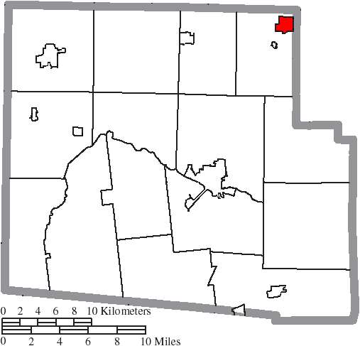
Photo: Ruhrfisch and Nyttend, Wikimedia Commons, CC BY-SA 3.0 · Wikimedia Commons
Local history sources: en.wikipedia.org · west2k.com · historicbyway.com · en.wikipedia.org · hardincountyohio.gov · commons.wikimedia.org
Water
Mostly private wells The water here
- Forest Village100% of residentsGroundwater wells (3 wells)
Hospitals, fire stations and more
Inside Forest's boundary: 1 fire or EMS station, 1 library, 1 police station, 1 Toxics Release Inventory facility and 2 spill cases. Press a pin or a name for its whole record and its source.
Fire and EMS stations (1)
-
Forest Fire DepartmentForest
- Address
- 211 West Lima Street, Forest, OH 45843
- Coordinates
- 40.80140, -83.51437
USGS National Map structures (source) ↗ Street map and directions ↗
Source: USGS National Map structures (most Ohio records last updated 2019 to 2022), checked against the Columbus and Cleveland station lists. The department that answers a call is set by jurisdiction and mutual aid, not by distance.
Public libraries (1)
-
Forest-Jackson Public LibraryCentral library · Forest
- Address
- 102 W. Lima St, Forest, OH 45843
- What it is
- Central library
- Library system
- Forest-Jackson Public Library
- Open
- 2,600 hours a year, 52 weeks
- Building
- 5,350 sq ft
- System's visits, FY2024
- 22,620
- System's loans, FY2024
- 44,565
- People the system serves
- 5,606
- Phone
- (419) 273-2400
IMLS Public Libraries Survey (source) ↗ Street map and directions ↗
Source: IMLS Public Libraries Survey FY2024 (outlets and their systems). Any Ohio resident can get a free card at any Ohio public library.
Police stations (1)
-
Forest Police DepartmentForest
- Address
- 211 West Lima Street, Forest, OH 45843
- Coordinates
- 40.80138, -83.51452
USGS National Map structures (source) ↗ Street map and directions ↗
Source: USGS National Map structures, police stations, corrected and completed by hand (September 2026). The department that answers a call is set by jurisdiction, not by distance.
Facilities reporting toxic releases (1)
-
Triumph Thermal Systems IncToxics Release Inventory · Forest
- Address
- 200 Railroad Street, Forest, OH 45843
- County
- Hardin County
- Status
- Reports to the Toxics Release Inventory (active)
- EPA program ID
- 45843NTDRCNORTH
- EPA registry ID
- 110000395714
EPA facility record ↗ EPA Facility Registry Service (source) ↗ Street map and directions ↗
Source: EPA Facility Registry Service, Toxics Release Inventory reporters. Reporting a release is required of large users of listed chemicals; it is not by itself a violation.
Spills reported since 2021 (2)
-
Hydrochloric Acid / Muriatic Acid (Hcl)2024-05-16 · Forest
- Reported
- 2024-05-16
- What spilled
- Hydrochloric Acid / Muriatic Acid (Hcl)
- Largest amount reported
- 100 gallons
- Where
- Forest, Hardin County
- Ohio EPA district office
- NWDO
- Ohio EPA case number
- 2405EPA0000819
Ohio EPA spill reports (source) ↗ Street map and directions ↗
-
Hydrochloric Acid / Muriatic Acid (Hcl)2021-09-23 · Forest
- Reported
- 2021-09-23
- What spilled
- Hydrochloric Acid / Muriatic Acid (Hcl)
- Where
- Forest, Hardin County
- Ohio EPA district office
- NWDO
- Ohio EPA case number
- 2109EPA0001513
Ohio EPA spill reports (source) ↗ Street map and directions ↗
Source: Ohio EPA emergency response spill reports, 2021 to September 2026, one point per case where Ohio EPA placed it. A report is what the caller or responder recorded; amounts are often blank or estimated.
Its ZIP codes
Each ZIP code that touches Forest, with the share of its residents who live here and the same headline figures as the ZIP page.
| ZIP | Share | Water | Radon | Home value | Schools | Flood |
|---|---|---|---|---|---|---|
| 45843 Forest | 36% | Mostly private wells | 4.0 pCi/L average radon | Median year built 1974 | Riverdale Local · 3 stars overall | 1.2% of residents in the 1% floodplain |
Local government
Who holds office in Forest, how its elections and ballot issues came out, and the state auditor's record.
Elections for office
| Date | Office | Candidates and votes |
|---|---|---|
| 2021-11-02 | Council | David Book 158, 28.06%; Ashley Gullifer 119, 21.14%; Danielle Lambrite 117, 20.78%; Paula Mills 75, 13.32%; Jerrie Whitling 94, 16.7% |
| 2019-11-05 | Mayor | Dean A. Hankins 177, 60.0%; Tom Seem 118, 40.0% |
| 2019-11-05 | Council | Derek Hastings 140, 26.52%; P.J. Noascono 121, 22.92%; John Parthemore 71, 13.45%; Loretta J. Perkins 196, 37.12% |
Winners in bold. Results from the county board of elections' official canvass unless marked.
The county
Hardin County: 10 ZIP codes, 23 cities, villages and townships, 31,735 people.
Nearby places
Rain and snow
How much has actually fallen on Forest, day by day, from 1893 to now. Daily totals, not averages.
- rain, last 30 days
- 0.96 in
- 2026-09-29 to 2026-10-28
- rain so far in 2026
- 35.2 in
- 2.5 in above normal for the date
- snow so far in 2026
- 13.2 in
- a normal year brings 26.9 in
- a normal year
- 38.5 in
- average of 30 years, 1991-2020
| Month | Rain (in) | Snow (in) | Days counted |
|---|---|---|---|
| October 2026 | 0.96 | — | 28 |
| September 2026 | 5.18 | — | 30 |
| August 2026 | 5.26 | — | 31 |
| July 2026 | 2.85 | — | 31 |
| June 2026 | 4.46 | — | 30 |
| May 2026 | 4.86 | — | 31 |
| April 2026 | 5.89 | — | 30 |
| March 2026 | 4.15 | 0.3 | 31 |
| February 2026 | 0.45 | 3.4 | 28 |
| January 2026 | 1.19 | 9.5 | 31 |
| December 2025 | 1.77 | 7.5 | 31 |
| November 2025 | 1.32 | 1.5 | 30 |
| Wettest year | 2011 — 56.9 in |
|---|---|
| Driest year | 1934 — 21.2 in |
| Snowiest year | 1895 — 66.0 in |
| Wettest day on record | 21 August 2007 — 5.39 in |
| Heaviest snowfall in a day | 23 December 2004 — 11.15 in |
| Deepest snow on the ground | 1 February 1978 — 19.29 in |
Estimated, not measured. No rain gauge has ever stood inside Forest, so every figure here is worked out from the gauges around it - the nearest ones weighted most. Treat them as close estimates rather than readings.
48,878 days of records, 1893-01-01 to 2026-10-28. Source: NOAA NCEI GHCN-Daily, 3,240 gauges in and around Ohio. A day is "gauged" when a gauge standing inside the boundary reported it, and the value is the mean of those gauges. Otherwise it is interpolated by inverse distance from every gauge reporting within 50 miles. Nothing is carried forward, back-filled or smoothed. Against NOAA nClimDiv county monthly precipitation over 136,848 complete county-months (checked 2026-10-31): correlation 0.9515, median absolute difference 0.217 in a month. Built 2026-10-31 from the Cracked Buckeye precipitation archive. Snow is the softer number — snowfall is measured by hand with a ruler, no agency publishes a gridded county snowfall series, and blowing snow defeats every observer.
Environmental permits and filings
What Ohio EPA has on file for Forest: permits, inspections, violations, cleanups and the state loans behind sewer and water work. Every line links to the agency's own document.
- facilities and sites on file
- 8
- those placed on the map inside Forest
| Program | Facilities and sites |
|---|---|
| Hazardous waste | 4 |
| State sewer loans | 2 |
| Air pollution | 1 |
| Public drinking water | 1 |
| Date | Facility or site | What |
|---|---|---|
| FOREST VILLAGE PWS | Public drinking water warning letter | |
| FOREST VILLAGE PWS | Public drinking water inspection | |
| FOREST VILLAGE PWS | Public drinking water plan | |
| FOREST VILLAGE PWS | Public drinking water notice of violation | |
| FOREST VILLAGE PWS | Public drinking water warning letter | |
| FOREST VILLAGE PWS | Public drinking water monitoring results | |
| TRIUMPH THERMAL SYSTEMS INC | Air pollution report | |
| FOREST VILLAGE PWS | Public drinking water inspection | |
| FOREST VILLAGE PWS | Public drinking water inspection | |
| FOREST VILLAGE PWS | Public drinking water inspection | |
| FOREST VILLAGE PWS | Public drinking water notice of violation | |
| FOREST VILLAGE PWS | Public drinking water warning letter | |
| FOREST VILLAGE PWS | Public drinking water monitoring results | |
| FOREST VILLAGE PWS | Public drinking water compliance letter | |
| FOREST VILLAGE PWS | Public drinking water compliance letter | |
| FOREST VILLAGE PWS | Public drinking water report | |
| FOREST VILLAGE PWS | Public drinking water warning letter | |
| FOREST VILLAGE PWS | Public drinking water warning letter | |
| FOREST VILLAGE PWS | Public drinking water inspection | |
| FOREST VILLAGE PWS | Public drinking water notice of violation | |
| FOREST VILLAGE PWS | Public drinking water inspection | |
| FOREST VILLAGE PWS | Public drinking water compliance letter | |
| FOREST WWTP | State sewer loans | |
| FOREST VILLAGE PWS | Public drinking water notice of violation | |
| FOREST VILLAGE PWS | Public drinking water notice of violation |
Source: Ohio EPA eDocument portal (edocpub.epa.ohio.gov), indexed 2026-10-14. Facilities are placed on the map from Ohio EPA's own map layers, EPA's Facility Registry, coordinates written in the filings, or a geocoded street address. A permit filed under a private person's name (most are household septic systems) is counted but never named, placed or linked; licenses for individual workers and open-burning notices are left out entirely.
Quick answers
What county is Forest, Ohio in?
Forest is a village in Hardin County, Ohio, with 1,375 residents.
When was Forest, Ohio founded?
Forest was laid out 1855; incorporated 1865. Source
How did Forest, Ohio get its name?
Forest was named for the forest that stood on the town site, within a larger area of tall-grass prairie that surrounded it. Source
What ZIP code is Forest, Ohio?
Most of Forest is in ZIP code 45843.
Where does Forest, Ohio get its water?
The main water source for Forest (Forest Village): Mostly private wells.
Cite this page
Cite this page as:
Cracked Buckeye, "Forest, Hardin County", https://crackedbuckeye.com/place/forest/, built 2026-10-31, accessed [date].
How to cite · Report a correction · Built 2026-10-31
