Local events in Madison Township, Hancock County
Nothing is posted for Madison Township itself yet; here is what is on within 10 miles. All local events in Madison Township, Hancock County
Know a calendar we should watch? Send the link
Checked October 20; the events page is refreshed daily.
How Madison Township, Hancock County began
Madison Township lies in southern Hancock County, Ohio, and was organized by the county commissioners on June 1, 1840, after an earlier attempt to erect the township had failed; it was named for President James Madison. The township is farmland interspersed with small woods, and its two villages grew up along transportation routes: Williamstown, laid out in 1834 by John W. Williams at what became the crossing of U.S. Routes 30 and 68, and Arlington, platted in 1844 by Robert Hurd after his sons built the area's first log cabin there in 1834. Arlington grew into a railroad crossroads and incorporated village with its own newspaper and schools by the turn of the 20th century, while Williamstown stayed a crossroads hamlet, briefly a busy Lincoln Highway truck stop before a 1950s overpass diverted traffic and the settlement declined. As of the 2020 census the township's population was 869.
Settled 1834, incorporated 1840, by Hancock County commissioners (township organization); Robert Hurd (Arlington, platted 1844); John W. Williams (Williamstown, laid out 1834).
Where the name comes from
The township was named for James Madison, the fourth President of the United States, a naming pattern repeated in nineteen other Madison Townships across Ohio.
Before the town
No source specific to Madison Township describing Native American villages, trails, mounds, encounters, or treaty-era residents was found in the sources we checked. Hancock County as a whole lay within lands ceded by the Wyandot and Shawnee under the Treaty of Fort Meigs (1817) and related agreements, and the county's Native history should be researched and recorded at the county level in Hancock County's own history file; nothing found here ties any of that record to Madison Township specifically.
Timeline
- — The first log cabin on the future site of Arlington is built by sons of Robert Hurd; the same year John W. Williams lays out Williamstown in the southern part of the township, where a post office named Eagle opens.
- — The Hancock County commissioners organize Madison Township, after an earlier attempt to erect it had failed.
- — Robert Hurd plats the village of Arlington with sixteen lots, naming it for Arlington, Virginia.
- — A post office begins operating at Arlington.
- — An Asiatic cholera epidemic strikes Arlington, killing 40 people.
- — The Williamstown post office, originally named Eagle in 1834, is renamed Williamstown.
- — Arlington incorporates as a village, with Jim Huff elected its first mayor.
- — Arlington's first newspaper, the Arlington Gazette, begins publishing.
- — The Williamstown post office, suspended in 2007, is formally discontinued.
Stories
Arlington's cholera summer
Ten years after Robert Hurd platted Arlington's sixteen lots in 1844, the young village was hit by an outbreak of Asiatic cholera. According to the historical marker placed in the village, the 1854 epidemic killed forty people, a heavy toll for a settlement only a decade old and still finding its feet as a farming crossroads in southern Hancock County. Arlington recovered, and by the 1890s it had incorporated as a village, elected Jim Huff as its first mayor in 1892, and started its own newspaper, the Arlington Gazette, in 1897. The marker frames the cholera year alongside the Civil War departure of the town's men in 1861 as one of the hard passages in the village's first half-century, before its railroad-era growth into telephones (1900) and a first high school graduating class (1905).
From Eagle post office to 'Bill-town': the rise and fade of Williamstown
In 1834, the same year Arlington's first log cabin went up, John W. Williams laid out a settlement in the southern part of Madison Township and a post office opened there under the name Eagle. The office was renamed Williamstown in 1868, after its founder. The crossroads sat where U.S. Routes 30 and 68 cross, and after the Lincoln Highway routed traffic through it, Williamstown became a fueling and eating stop for truckers, who called it 'Bill-town'; gas stations and diners lined the intersection. The crossroads' fortunes turned in the late 1950s, when an overpass was built to carry the busy north-south route over the intersection, cutting off the local businesses from through traffic. Williamstown never recovered the trade; its post office limped on until it was suspended in 2007 and discontinued in 2009, and the community today is largely a ghost town that nonetheless still carries its own ZIP code, 45897.
Photographs
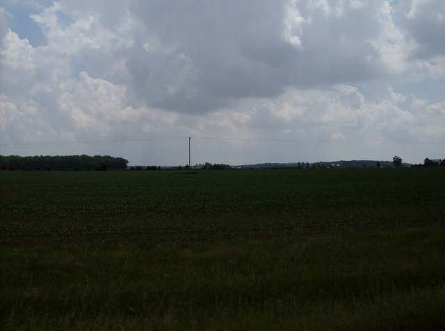
Photo: Nyttend (own work), public domain · Wikimedia Commons
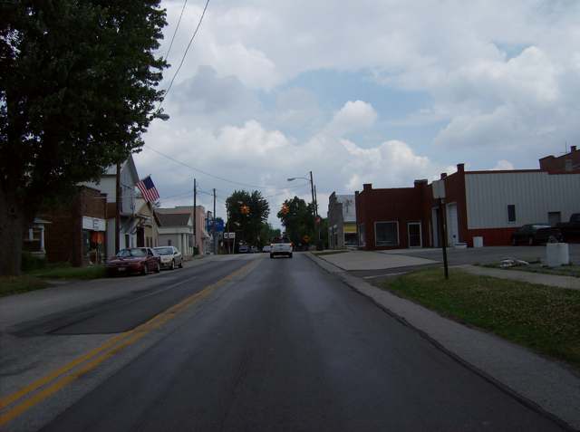
Photo: Nyttend (own work), public domain · Wikimedia Commons
Local history sources: en.wikipedia.org · en.wikipedia.org · en.wikipedia.org · hmdb.org · en.wikipedia.org · commons.wikimedia.org · commons.wikimedia.org · commons.wikimedia.org
Water
Mostly private wells The water here
- Arlington Village69% of residentsGroundwater wells (3 wells)
- Forest Village28% of residentsGroundwater wells (3 wells)
- Dunkirk Village2% of residentsGroundwater wells (2 wells)
Hospitals, fire stations and more
Inside Madison Township, Hancock County's boundary: 1 poor-rated bridge, 1 museum and 2 spill cases. Press a pin or a name for its whole record and its source.
Bridges rated poor (1)
-
SR 103 over Buck RunPoor · built 1977
- Condition
- Poor: a deck, superstructure, substructure or culvert rated 4 or below on the 0 to 9 scale
- What it is
- Bridge
- Built
- 1977
- Length
- 7 ft
- Owner
- State
- Vehicles a day
- 929
- Coordinates
- 40.89195, -83.64345
National Bridge Inventory (source) ↗ Street map and directions ↗
Source: FHWA National Bridge Inventory 2025. "Poor" means one major part rated 4 or below on the 0 to 9 scale; it calls for repair, not closing, unless the state posts or closes the bridge.
Museums, historical societies, gardens and zoos (1)
-
Eagle Creek Historical OrganizationHistorical society · Arlington
- What it is
- Historical society
- City
- Arlington
- Coordinates
- 40.89650, -83.64187
Search Wikipedia ↗ IMLS Museum Data Files (source) ↗ Street map and directions ↗
The museum list is IMLS's 2018 file; a museum may have closed or moved since.
Source: IMLS Museum Data Files, 2018.
Spills reported since 2021 (2)
-
Fuel Diesel / Diesel Fuel (Vehicle On Or Off Road)2023-09-01 · Madison Twp
- Reported
- 2023-09-01
- What spilled
- Fuel Diesel / Diesel Fuel (Vehicle On Or Off Road)
- Where
- Madison Twp, Hancock County
- Ohio EPA district office
- NWDO
- Ohio EPA case number
- 2309EPA0001545
Ohio EPA spill reports (source) ↗ Street map and directions ↗
-
Fuel Diesel / Diesel Fuel (Vehicle On Or Off Road)2026-08-28 · Madison Twp
- Reported
- 2026-08-28
- What spilled
- Fuel Diesel / Diesel Fuel (Vehicle On Or Off Road)
- Largest amount reported
- 75 gallons
- Where
- Madison Twp, Hancock County
- Ohio EPA district office
- NWDO
- Ohio EPA case number
- 2608EPA0001612
Ohio EPA spill reports (source) ↗ Street map and directions ↗
Source: Ohio EPA emergency response spill reports, 2021 to September 2026, one point per case where Ohio EPA placed it. A report is what the caller or responder recorded; amounts are often blank or estimated.
Its ZIP codes
Each ZIP code that touches Madison Township, Hancock County, with the share of its residents who live here and the same headline figures as the ZIP page.
| ZIP | Share | Water | Radon | Home value | Schools | Flood |
|---|---|---|---|---|---|---|
| 45897 Madison Township and Williamstown | 100% | Mostly private wells | Too few radon tests | Parcel list only | Arlington Local · 4 stars overall | 0.0% of residents in the 1% floodplain |
| 45814 Arlington | 17% | Groundwater wells (3 wells) | 3.4 pCi/L average radon | Parcel list only | Arlington Local · 4 stars overall | 4.8% of residents in the 1% floodplain |
| 45843 Forest | 8% | Mostly private wells | 4.0 pCi/L average radon | Median year built 1974 | Riverdale Local · 3 stars overall | 1.2% of residents in the 1% floodplain |
| 45836 Dunkirk | 1% | Groundwater wells (2 wells) | Too few radon tests | Median year built 1979 | Hardin Northern Local · 4 stars overall | 0.8% of residents in the 1% floodplain |
Local government
Who holds office in Madison Township, Hancock County, how its elections and ballot issues came out, and the state auditor's record.
Who holds office
| Office | Name | Party | Term ends | Contact |
|---|---|---|---|---|
| Trustee | Tom Inbody | 419-722-1136 | ||
| Trustee | Mark Hartman | 419-721-1236 | ||
| Trustee | James Heacock | 419-306-1428 | ||
| Fiscal Officer | Mitch Heacock | 419-957-7003 |
Roster as of 2026 edition (Directory of Officials): county board of elections.
Elections for office
| Date | Office | Candidates and votes |
|---|---|---|
| 2025-11-04 | Trustee | Mark L. Hartman 341, 100.0% |
| 2023-11-07 | Trustee | Thomas B. Inbody (write-in) 25, 100.0% |
| 2023-11-07 | Fiscal Officer | Mitchell Heacock 721, 100.0% |
| 2021-11-02 | Trustee | Mark L. Hartman 468, 53.86%; Ed Rettig 401, 46.14% |
| 2019-11-05 | Trustee | Thomas B. Inbody 237, 100.0% |
| 2019-11-05 | Fiscal Officer | Mitchell J. Heacock 224, 100.0% |
Winners in bold. Results from the county board of elections' official canvass unless marked.
Auditor of State record
- No fiscal caution, watch or emergency on the Auditor of State's lists.
- Basic Audit, 2022 to 2023, released 2024-09-17
The county
Hancock County: 12 ZIP codes, 26 cities, villages and townships, 68,477 people.
Nearby places
Quick answers
What county is Madison Township, Ohio in?
Madison Township, Hancock County is a township in Hancock County, Ohio, with 869 residents.
When was Madison Township, Ohio founded?
Madison Township, Hancock County was settled 1834; incorporated 1840. Founders on record: Hancock County commissioners (township organization); Robert Hurd (Arlington, platted 1844); John W. Williams (Williamstown, laid out 1834). Source
How did Madison Township, Ohio get its name?
The township was named for James Madison, the fourth President of the United States, a naming pattern repeated in nineteen other Madison Townships across Ohio. Source
What ZIP code is Madison Township, Ohio?
Madison Township, Hancock County is served by ZIP codes 45897, 45814 and 45843; 45897 holds the largest share of its residents.
Where does Madison Township, Ohio get its water?
The main water source for Madison Township, Hancock County (Arlington Village): Mostly private wells.
Cite this page
Cite this page as:
Cracked Buckeye, "Madison Township, Hancock County", https://crackedbuckeye.com/place/madison-township-hancock-county/, built 2026-10-31, accessed [date].
How to cite · Report a correction · Built 2026-10-31
