Local events in Dellroy
Nothing is posted for Dellroy itself yet; here is what is on within 20 miles. All local events in Dellroy
Know a calendar we should watch? Send the link
Checked October 20; the events page is refreshed daily.
Lakes near Dellroy
The history under the water: the valley before, the dam, the stories. All Ohio lakes
How Dellroy began
Dellroy was laid out in 1849 as Cannonsburg, a railroad-age name on Carroll County's western edge, and was renamed Dellroy around 1878 for reasons no surviving record settles. It grew modestly through the 19th century, peaking near 664 residents in 1880, then found a second identity in the 1930s when the Muskingum Watershed Conservancy District dammed Indian Fork, a tributary of Conotton Creek, nearby to form Atwood Lake, flooding the older village of Atwood a few miles upstream and making Dellroy the lake's eastern gateway town. It has been a small recreation and retirement village ever since, with 268 residents in 2020.
Settled 1849, platted 1849 (as Cannonsburg).
Where the name comes from
The village was platted in 1849 as Cannonsburg and renamed Dellroy around 1878; Wikipedia's own article states plainly that the origin of the name Dellroy is disputed, and no other source consulted resolves it.
Before the town
No mound, earthwork, or named Native village has been documented specifically at Dellroy; see the Carroll County file for the county-wide picture. The village sits a few miles from the old settlement of Atwood, now under Atwood Lake, whose own name traces only to the pioneer Atwood family rather than any Native reference. As with the rest of Carroll County, this land passed to the United States under the Treaty of Fort McIntosh (1785); the historic Lenape (Delaware) and Wyandot both traveled and hunted the Conotton and Tuscarawas valleys nearby, though no source ties either nation to a site at Dellroy itself.
Nations recorded here: Lenape (Delaware), Wyandot.
Timeline
- — Baptismal records of the United Presbyterian Church show Atwood, a few miles from present Dellroy, already a thriving village on Conotton Creek.
- — The village of Cannonsburg - later Dellroy - is platted.
- — The railroad reaches the area and Cannonsburg's business shifts to the new rail site, which becomes Atwood village's successor and, around this same year, Cannonsburg itself is renamed Dellroy.
- — Dellroy's population reaches 664, its historical high point.
- — The Muskingum Watershed Conservancy District builds Atwood Dam on Indian Fork, a tributary of Conotton Creek; the old village of Atwood is purchased, demolished, and inundated to form Atwood Lake.
- — Dellroy becomes established as the lake's eastern gateway village as recreational use of the new reservoir grows.
- — The Atwood Lake Resort and Conference Center opens nearby, anchoring the area's tourist economy for the next half-century.
Stories
The village under the lake
A few miles upstream of Dellroy, the village of Atwood was old enough that a Presbyterian congregation was baptizing children there by 1834 and thriving enough to keep its own businesses until the railroad came through in 1878 and pulled trade away to the rail site. Atwood held on as a smaller place for another half-century until the Muskingum Watershed Conservancy District, rebuilding flood control across the Tuscarawas system after the disastrous 1913 flood, chose the site for a dam. The village was bought out, torn down, and drowned under what became Atwood Lake between 1932 and 1936. When the reservoir runs low, visitors can still see the foundation stones of Atwood's vanished buildings and the roadbed of its old rail spur breaking the surface near Dellroy - the only trace left of a town that was once the more important of the two.
Photographs
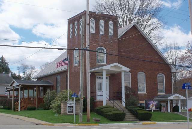
Photo: Roseohioresident, Wikimedia Commons, CC BY-SA 4.0 · Wikimedia Commons
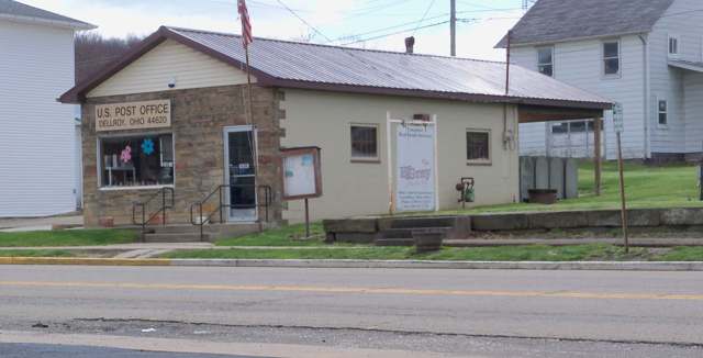
Photo: Roseohioresident, Wikimedia Commons, CC BY-SA 4.0 · Wikimedia Commons
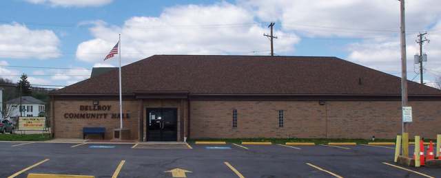
Photo: Roseohioresident, Wikimedia Commons, CC BY-SA 4.0 · Wikimedia Commons
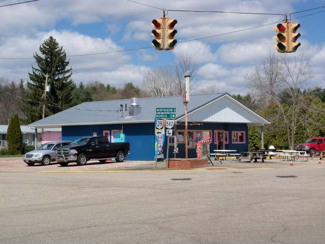
Photo: Roseohioresident, Wikimedia Commons, CC BY-SA 4.0 · Wikimedia Commons
Local history sources: en.wikipedia.org · en.wikivoyage.org · en.wikipedia.org · en.wikipedia.org · commons.wikimedia.org · commons.wikimedia.org · commons.wikimedia.org · commons.wikimedia.org
Water
Mostly private wells The water here
- Fohl Village MHP100% of residentsGroundwater wells (2 wells)
Hospitals, fire stations and more
Inside Dellroy's boundary: 1 fire or EMS station. Press a pin or a name for its whole record and its source.
Fire and EMS stations (1)
-
Dellroy Community Fire DepartmentDellroy
- Address
- 5 North Ohio Street, Dellroy, OH 44620
- Coordinates
- 40.55508, -81.19835
USGS National Map structures (source) ↗ Street map and directions ↗
Source: USGS National Map structures (most Ohio records last updated 2019 to 2022), checked against the Columbus and Cleveland station lists. The department that answers a call is set by jurisdiction and mutual aid, not by distance.
Its ZIP codes
Each ZIP code that touches Dellroy, with the share of its residents who live here and the same headline figures as the ZIP page.
| ZIP | Share | Water | Radon | Home value | Schools | Flood |
|---|---|---|---|---|---|---|
| 44620 Rose Township and Dellroy | 19% | Mostly private wells | 11.5 pCi/L average radon | Median year built 1978 | Carrollton Exempted Village · 4 stars overall | 2.9% of residents in the 1% floodplain |
Local government
Who holds office in Dellroy, how its elections and ballot issues came out, and the state auditor's record.
Auditor of State record
- No fiscal caution, watch or emergency on the Auditor of State's lists.
- Basic Audit, 2022 to 2023, released 2024-11-12
The county
Carroll County: 7 ZIP codes, 15 cities, villages and townships, 19,207 people.
Nearby places
Rain and snow
How much has actually fallen on Dellroy, day by day, from 1893 to now. Daily totals, not averages.
- rain, last 30 days
- 1.23 in
- 2026-09-30 to 2026-10-29
- rain so far in 2026
- 39.7 in
- 4.3 in above normal for the date
- snow so far in 2026
- 27.6 in
- a normal year brings 24.8 in
- a normal year
- 41.7 in
- average of 30 years, 1991-2020
| Month | Rain (in) | Snow (in) | Days counted |
|---|---|---|---|
| October 2026 | 1.23 | — | 29 |
| September 2026 | 4.57 | — | 30 |
| August 2026 | 7.02 | — | 31 |
| July 2026 | 4.63 | — | 31 |
| June 2026 | 3.31 | — | 30 |
| May 2026 | 4.88 | — | 31 |
| April 2026 | 5.09 | — | 30 |
| March 2026 | 5.61 | 2.2 | 31 |
| February 2026 | 1.19 | 3.8 | 28 |
| January 2026 | 2.17 | 21.6 | 31 |
| December 2025 | 2.48 | 10.6 | 31 |
| November 2025 | 2.01 | 0.1 | 30 |
| Wettest year | 2004 — 58.2 in |
|---|---|
| Driest year | 1930 — 26.7 in |
| Snowiest year | 1910 — 65.3 in |
| Wettest day on record | 5 July 1969 — 3.72 in |
| Heaviest snowfall in a day | 20 April 1901 — 14.46 in |
| Deepest snow on the ground | 27 November 1950 — 20.34 in |
Estimated, not measured. No rain gauge has ever stood inside Dellroy, so every figure here is worked out from the gauges around it - the nearest ones weighted most. Treat them as close estimates rather than readings.
48,744 days of records, 1893-01-01 to 2026-10-29. Source: NOAA NCEI GHCN-Daily, 3,240 gauges in and around Ohio. A day is "gauged" when a gauge standing inside the boundary reported it, and the value is the mean of those gauges. Otherwise it is interpolated by inverse distance from every gauge reporting within 50 miles. Nothing is carried forward, back-filled or smoothed. Against NOAA nClimDiv county monthly precipitation over 136,848 complete county-months (checked 2026-10-31): correlation 0.9515, median absolute difference 0.217 in a month. Built 2026-10-31 from the Cracked Buckeye precipitation archive. Snow is the softer number — snowfall is measured by hand with a ruler, no agency publishes a gridded county snowfall series, and blowing snow defeats every observer.
Environmental permits and filings
What Ohio EPA has on file for Dellroy: permits, inspections, violations, cleanups and the state loans behind sewer and water work. Every line links to the agency's own document.
- facilities and sites on file
- 4
- those placed on the map inside Dellroy
| Program | Facilities and sites |
|---|---|
| Public drinking water | 4 |
| Date | Facility or site | What |
|---|---|---|
| CHURCH OF THE NAZARENE PWS | Public drinking water notice of violation | |
| DELLROY DRIVE-IN RESTAURANT PWS | Public drinking water inspection | |
| DELLROY DRIVE-IN RESTAURANT PWS | Public drinking water notice of violation | |
| CHURCH OF THE NAZARENE PWS | Public drinking water notice of violation | |
| CHURCH OF THE NAZARENE PWS | Public drinking water warning letter | |
| CHURCH OF THE NAZARENE PWS | Public drinking water notice of violation | |
| CHURCH OF THE NAZARENE PWS | Public drinking water notice of violation | |
| DELLROY DRIVE-IN RESTAURANT PWS | Public drinking water compliance letter | |
| DELLROY DRIVE-IN RESTAURANT PWS | Public drinking water letter | |
| CHURCH OF THE NAZARENE PWS | Public drinking water inspection | |
| CHURCH OF THE NAZARENE PWS | Public drinking water inspection | |
| DELLROY DRIVE-IN RESTAURANT PWS | Public drinking water notice of violation | |
| DELLROY DRIVE-IN RESTAURANT PWS | Public drinking water inspection | |
| CHURCH OF THE NAZARENE PWS | Public drinking water inspection | |
| CHURCH OF THE NAZARENE PWS | Public drinking water notice of violation | |
| CHRIST COMMUNITY CHURCH PWS | Public drinking water inspection | |
| CHRIST COMMUNITY CHURCH PWS | Public drinking water monitoring results | |
| CHRIST COMMUNITY CHURCH PWS | Public drinking water notice of violation | |
| DELLROY DRIVE-IN RESTAURANT PWS | Public drinking water compliance letter | |
| CHRIST COMMUNITY CHURCH PWS | Public drinking water inspection | |
| CHRIST COMMUNITY CHURCH PWS | Public drinking water violation resolved | |
| DELLROY DRIVE-IN RESTAURANT PWS | Public drinking water permit | |
| DELLROY DRIVE-IN RESTAURANT PWS | Public drinking water monitoring results | |
| CHRIST COMMUNITY CHURCH PWS | Public drinking water notice of violation | |
| DELLROY DRIVE-IN RESTAURANT PWS | Public drinking water inspection |
Source: Ohio EPA eDocument portal (edocpub.epa.ohio.gov), indexed 2026-10-14. Facilities are placed on the map from Ohio EPA's own map layers, EPA's Facility Registry, coordinates written in the filings, or a geocoded street address. A permit filed under a private person's name (most are household septic systems) is counted but never named, placed or linked; licenses for individual workers and open-burning notices are left out entirely.
Quick answers
What county is Dellroy, Ohio in?
Dellroy is a village in Carroll County, Ohio, with 268 residents.
When was Dellroy, Ohio founded?
Dellroy was settled 1849; laid out 1849 (as Cannonsburg). Source
How did Dellroy, Ohio get its name?
The village was platted in 1849 as Cannonsburg and renamed Dellroy around 1878; Wikipedia's own article states plainly that the origin of the name Dellroy is disputed, and no other source consulted resolves it. Source
What ZIP code is Dellroy, Ohio?
Most of Dellroy is in ZIP code 44620.
Where does Dellroy, Ohio get its water?
The main water source for Dellroy (Fohl Village MHP): Mostly private wells.
Cite this page
Cite this page as:
Cracked Buckeye, "Dellroy, Carroll County", https://crackedbuckeye.com/place/dellroy/, built 2026-10-31, accessed [date].
How to cite · Report a correction · Built 2026-10-31
