Local events in Darbyville
Nothing is posted for Darbyville itself yet; here is what is on within 20 miles. All local events in Darbyville
Know a calendar we should watch? Send the link
Checked October 20; the events page is refreshed daily.
How Darbyville began
Darbyville was platted July 27, 1826, on the west bank of Darby Creek on land patented by Cornelius Baldwin, surveyed by Joel Walker for George Hill and David Thomas; at the time the ground lay within the older township of Darby, and only became part of Muhlenberg Township when that township was carved out of Darby, Jackson, Scioto, and Monroe townships in 1830. It grew up on the site of a Shawnee camp and burying ground, and its first store, blacksmith shop, and post office all opened within a year or two of the plat being recorded. A small farm-country trading village ever since, it has long supported more churches than its population might suggest, and for a time ran its own segregated school for the Black children of the township. It remains the only incorporated village in Muhlenberg Township.
Settled by 1805-1806, when the site already held an Indian camp and burying ground, platted July 27, 1826, by land patented by Cornelius Baldwin; platted for George Hill and David Thomas, surveyed by Joel Walker.
Where the name comes from
The village takes its name from Darby Creek, on whose west bank it stands. The creek itself, the 1880 and 1906 county histories agree, was named for an Indian chief called Darby who lived on its banks in the early days and whose band camped and is buried just above the village site.
Before the town
The ground Darbyville was platted on in 1826 had been Shawnee territory within living memory of its first settlers. A large burying ground lay on the opposite bank of the creek a short distance above the village, behind the old camp of the band led by the chief, Darby, the creek's namesake; another camp stood near the old toll-gate just south of the village, and a third farther downstream near the township line. In 1805, at the camp just below the future village site, an Indian duel fought with knives between two men, one known as "Old Pounder," ended in Pounder's death; he was buried near the creek bank, his grave later disturbed and re-covered by settlers' children who stumbled on it. Shawnee families continued returning to the area every spring for years after white settlement to make maple sugar, moving on toward the Sandusky River and Lake Erie each fall. No sources consulted describe any surviving mound or earthwork within the village itself; two small mounds are recorded elsewhere in the township.
Nations recorded here: Shawnee.
- Burying ground and camp of Chief Darby's band (burial) — east bank of Darby Creek, immediately above the village, occupied into the early 1800s (archive.org)
- Site of the 1805 Indian duel (camp) — just below Darbyville, on Darby Creek, 1805 (archive.org)
Timeline
- — An Indian known as "Old Pounder" is killed in a knife duel at a Shawnee camp just below the future village site and buried near the creek bank.
- — The village is platted on land patented by Cornelius Baldwin, surveyed by Joel Walker for owners George Hill and David Thomas.
- — Samuel Scott opens the first general store; a blacksmith shop is run in the village by Charles McFeters, described in the county history as "a mulatto."
- — Darbyville's first post office opens, with Rev. George Ambrose as its first postmaster; before this, residents rode to Circleville for their mail.
- — A union school district is organized for the village on April 9, with a schoolhouse built the same year for $1,500.
- — A separate schoolhouse for the township's Black children is built in Darbyville at a cost of $632, taught by John R. Gibson, a student of Wilberforce University.
- — A township house is built on the main street for $1,200, its upper floor shared by the Good Templars and the Good Samaritan Grange.
- — A branch of the African Methodist Episcopal church is organized in the village, meeting in the schoolhouse built for Black children.
- — A new grist and saw mill is completed in Darbyville, replacing the old mill on Francis Hill's farm just below the village, which is torn down the same year.
Stories
Doctor Rafe and Botherum
Darbyville's first resident physician, a Frenchman named Dr. Rafe, settled in the village around 1826 or 1827 and practiced there until his death some years later. The county history remembers him as "a weak little man of no great force," generous to a fault and just as slack in collecting what his patients owed him as he was in paying his own debts. When a creditor grew tired of waiting, the usual remedy was to attach Dr. Rafe's faithful horse, Botherum, in place of payment. Whenever this happened, the doctor would appear at Col. Elias Florence's door with a lugubrious face and announce, "I'm ruined. My creditors had taken Botherum again," and Florence, more than once, helped buy the horse back so the doctor could keep making his rounds.
A Store, a Forge, and a Post Office in Two Years
Darbyville went from an empty plat to a working village almost as soon as its lots were recorded in July 1826. Samuel Scott opened a general store within a year, and a grocery followed soon after from George and J. P. Hill. A blacksmith shop was run in the village that same year by Charles McFeters, remembered in the 1880 county history simply as "a mulatto," one of the few Black tradesmen named in the township's earliest business record. By 1827 the village had its own post office, with the Baptist minister Rev. George Ambrose serving as first postmaster; before that, residents had ridden to Circleville, eight miles off, for their mail.
A Schoolhouse Becomes a Church
In 1872 Muhlenberg township built a schoolhouse in Darbyville for the education of its Black children and youth, at a cost of $632, with instruction given by John R. Gibson, who had studied at Wilberforce University near Xenia. Six years later, in the spring of 1878, a branch of the African Methodist Episcopal church organized in the village, and some of the people behind it, the county history notes, had helped build the schoolhouse in the first place on the understanding that it would also serve as their church. Its first quarterly meeting was held there soon after the congregation formed, with plans to be supplied as a mission from Circleville.
Photographs
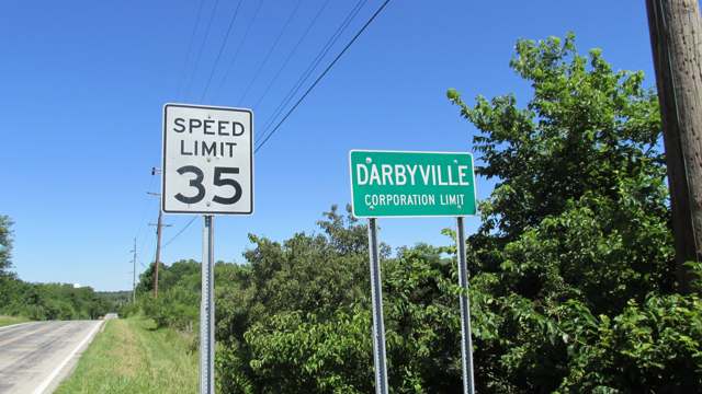
Photo: Aesopposea, via Wikimedia Commons, CC BY-SA 3.0 · Wikimedia Commons
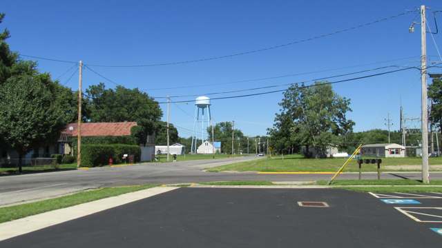
Photo: Aesopposea, via Wikimedia Commons, CC BY-SA 3.0 · Wikimedia Commons
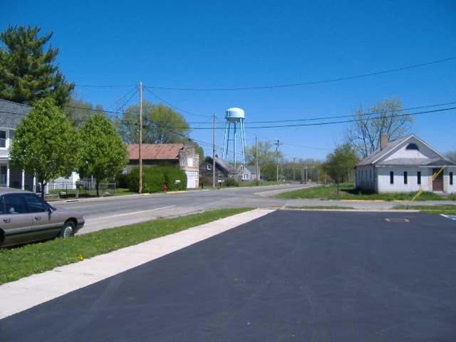
Photo: Aesopposea, via Wikimedia Commons, CC BY-SA 3.0 · Wikimedia Commons
Local history sources: archive.org · archive.org · en.wikipedia.org · commons.wikimedia.org · commons.wikimedia.org · commons.wikimedia.org
Water
Mostly private wells The water here
- Williamsport Village80% of residentsGroundwater wells (2 wells)
- Darbyville Village12% of residentsGroundwater wells (3 wells)
- Commercial Point Village3% of residentsGroundwater wells (6 wells)
- Village of Orient3% of residentsGroundwater wells (7 wells)
- Columbus Public Water System1% of residentsScioto River (Griggs & O'Shaughnessy), Hoover Reservoir on Big Walnut Ck, plus wells
- Johnson Mobile Home Park1% of residentsGroundwater wells (2 wells)
- Timberlake Water System0% of residentsGroundwater wells (2 wells)
Its ZIP codes
Each ZIP code that touches Darbyville, with the share of its residents who live here and the same headline figures as the ZIP page.
| ZIP | Share | Water | Radon | Home value | Schools | Flood |
|---|---|---|---|---|---|---|
| 43164 Williamsport | 5% | Mostly private wells | 2.5 pCi/L average radon | Median year built 1964 | Westfall Local · 3 stars overall | 6.2% of residents in the 1% floodplain |
| 43146 Scioto Township and Orient | 1% | Mostly private wells | 8.0 pCi/L average radon | Median year built 1988 | Teays Valley Local · 4 stars overall | 1.4% of residents in the 1% floodplain |
Local government
Who holds office in Darbyville, how its elections and ballot issues came out, and the state auditor's record.
Auditor of State record
- No fiscal caution, watch or emergency on the Auditor of State's lists.
- Basic Audit, 2023 to 2024, released 2025-07-29
The county
Pickaway County: 8 ZIP codes, 22 cities, villages and townships, 56,176 people.
Nearby places
Rain and snow
How much has actually fallen on Darbyville, day by day, from 1893 to now. Daily totals, not averages.
- rain, last 30 days
- 0.75 in
- 2026-09-30 to 2026-10-29
- rain so far in 2026
- 44.6 in
- 8.7 in above normal for the date
- snow so far in 2026
- 19.5 in
- a normal year brings 17.1 in
- a normal year
- 42.2 in
- average of 30 years, 1991-2020
| Month | Rain (in) | Snow (in) | Days counted |
|---|---|---|---|
| October 2026 | 0.75 | — | 29 |
| September 2026 | 6.96 | — | 30 |
| August 2026 | 8.79 | — | 31 |
| July 2026 | 5.26 | — | 31 |
| June 2026 | 2.90 | — | 30 |
| May 2026 | 5.91 | — | 31 |
| April 2026 | 3.46 | — | 30 |
| March 2026 | 7.29 | 1.2 | 31 |
| February 2026 | 1.92 | 5.0 | 28 |
| January 2026 | 1.40 | 13.2 | 31 |
| December 2025 | 2.34 | 11.0 | 31 |
| November 2025 | 2.38 | 1.2 | 30 |
| Wettest year | 2018 — 59.1 in |
|---|---|
| Driest year | 1930 — 23.8 in |
| Snowiest year | 1910 — 46.0 in |
| Wettest day on record | 14 September 1979 — 4.64 in |
| Heaviest snowfall in a day | 17 February 1910 — 11.91 in |
| Deepest snow on the ground | 14 April 1916 — 30.00 in |
Estimated, not measured. No rain gauge has ever stood inside Darbyville, so every figure here is worked out from the gauges around it - the nearest ones weighted most. Treat them as close estimates rather than readings.
48,844 days of records, 1893-01-01 to 2026-10-29. Source: NOAA NCEI GHCN-Daily, 3,240 gauges in and around Ohio. A day is "gauged" when a gauge standing inside the boundary reported it, and the value is the mean of those gauges. Otherwise it is interpolated by inverse distance from every gauge reporting within 50 miles. Nothing is carried forward, back-filled or smoothed. Against NOAA nClimDiv county monthly precipitation over 136,848 complete county-months (checked 2026-10-31): correlation 0.9515, median absolute difference 0.217 in a month. Built 2026-10-31 from the Cracked Buckeye precipitation archive. Snow is the softer number — snowfall is measured by hand with a ruler, no agency publishes a gridded county snowfall series, and blowing snow defeats every observer.
Environmental permits and filings
What Ohio EPA has on file for Darbyville: permits, inspections, violations, cleanups and the state loans behind sewer and water work. Every line links to the agency's own document.
- facilities and sites on file
- 8
- those placed on the map inside Darbyville
| Program | Facilities and sites |
|---|---|
| Wastewater and stormwater discharge | 4 |
| Public drinking water | 2 |
| Source-water protection | 1 |
| State water loans | 1 |
| Date | Facility or site | What |
|---|---|---|
| SUNSET MOBILE HOME PARK PWS | Public drinking water compliance letter | |
| DARBYVILLE VILLAGE PWS | Public drinking water notice of violation | |
| DARBYVILLE VILLAGE PWS | Public drinking water violation resolved | |
| DRY RUN SWITCH - BIG DARBY SWITCH 69 KV LINE REBUILD | Wastewater and stormwater discharge permit | |
| DARBYVILLE VILLAGE PWS | Public drinking water report | |
| SUNSET MOBILE HOME PARK PWS | Public drinking water report | |
| SUNSET MOBILE HOME PARK PWS | Public drinking water notice of violation | |
| SUNSET MOBILE HOME PARK PWS | Public drinking water notice of violation | |
| DARBYVILLE VILLAGE PWS | Public drinking water violation resolved | |
| DARBYVILLE VILLAGE PWS | Public drinking water notice of violation | |
| DARBYVILLE VILLAGE PWS | Public drinking water notice of violation | |
| SUNSET MOBILE HOME PARK PWS | Public drinking water plan | |
| SUNSET MOBILE HOME PARK PWS | Public drinking water notice of violation | |
| SUNSET MOBILE HOME PARK PWS | Public drinking water inspection | |
| DARBYVILLE (ORIENT) DG | Wastewater and stormwater discharge permit | |
| SUNSET MOBILE HOME PARK PWS | Public drinking water notice of violation | |
| DARBYVILLE VILLAGE PWS | Public drinking water notice of violation | |
| DARBYVILLE VILLAGE PWS | Public drinking water inspection | |
| DARBYVILLE VILLAGE PWS | Public drinking water violation resolved | |
| DARBYVILLE VILLAGE PWS | Public drinking water notice of violation | |
| SUNSET MOBILE HOME PARK PWS | Public drinking water notice of violation | |
| DARBYVILLE VILLAGE PWS | Public drinking water notice of violation | |
| DARBYVILLE VILLAGE PWS | Public drinking water notice of violation | |
| SUNSET MOBILE HOME PARK PWS | Public drinking water inspection | |
| DARBYVILLE VILLAGE PWS | Public drinking water inspection |
Source: Ohio EPA eDocument portal (edocpub.epa.ohio.gov), indexed 2026-10-14. Facilities are placed on the map from Ohio EPA's own map layers, EPA's Facility Registry, coordinates written in the filings, or a geocoded street address. A permit filed under a private person's name (most are household septic systems) is counted but never named, placed or linked; licenses for individual workers and open-burning notices are left out entirely.
Quick answers
What county is Darbyville, Ohio in?
Darbyville is a village in Pickaway County, Ohio, with 186 residents.
When was Darbyville, Ohio founded?
Darbyville was settled by 1805-1806, when the site already held an Indian camp and burying ground; laid out July 27, 1826. Founders on record: land patented by Cornelius Baldwin; platted for George Hill and David Thomas, surveyed by Joel Walker. Source
How did Darbyville, Ohio get its name?
The village takes its name from Darby Creek, on whose west bank it stands. Source
What ZIP code is Darbyville, Ohio?
Most of Darbyville is in ZIP code 43164.
Where does Darbyville, Ohio get its water?
The main water source for Darbyville (Williamsport Village): Mostly private wells.
Cite this page
Cite this page as:
Cracked Buckeye, "Darbyville, Pickaway County", https://crackedbuckeye.com/place/darbyville/, built 2026-10-31, accessed [date].
How to cite · Report a correction · Built 2026-10-31
