Local events in Damascus Township, Henry County
Nothing is posted for Damascus Township itself yet; here is what is on within 20 miles. All local events in Damascus Township, Henry County
Know a calendar we should watch? Send the link
Checked October 20; the events page is refreshed daily.
How Damascus Township, Henry County began
Damascus Township, on the Maumee River east of Napoleon, was first organized as a voting precinct in 1823, when it covered the whole of Henry County and its polling place stood at Independence, now in Defiance County. General Anthony Wayne's army camped on this stretch of river in 1794, at a place long called Prairie du Masque, a name the county history credits to early French adventurers and traders, a name the township later replaced with Damascus. Timber cut here in the nineteenth century was rafted down the Maumee to Toledo and shipped as far as Liverpool, England; the township's only village, McClure, was platted in 1880 on the line of the Delphos and Toledo narrow-gauge railroad.
Settled 1794 (Wayne's encampment); permanent settlement from the late 1830s and 1840s, platted McClure platted April 15, 1880, by John McClure, incorporated Damascus organized as a voting precinct in 1823; McClure village incorporated in 1886, by Henry County (precinct); John McClure (village).
Where the name comes from
The reason for the name Damascus is not recorded. Before that name was adopted, the site was known as Prairie du Masque, a name the 1888 county history attributes to early French adventurers, traders or missionaries drawn to the Maumee valley.
Before the town
Damascus Township's central documented Native-history connection is indirect but concrete: the riverbank the township now occupies was known before white settlement as Prairie du Masque, and it was here that General Anthony Wayne's army camped in August 1794 on its march down the Maumee toward the Battle of Fallen Timbers -- placing the township squarely within the campaign that broke the Western Confederacy's military position in the region and opened the way to the 1795 Treaty of Greenville. No named Native village, mound or Ottawa/Wyandot/Shawnee site within the township's own boundaries is documented; the 1888 county history explicitly frames its account of the township's 'three stages of civilization' as beginning only with the white hunter-adventurer, not with any preceding Native settlement it could identify.
- Prairie du Masque (Wayne's encampment) (camp) — on the Maumee River in what became Damascus Township, August 1794, General Wayne's army en route to the Battle of Fallen Timbers; French-named earlier (archive.org)
Timeline
- — General Anthony Wayne's army camps at Prairie du Masque, on the river ground that becomes Damascus Township, en route to the Battle of Fallen Timbers.
- — Damascus is organized as a voting precinct covering the whole of Henry County, with its polling place at Independence, now in Defiance County.
- — Only 385 acres of what is now Damascus Township are on the tax duplicate.
- — The township, then still combined with Richfield and Flat Rock and covering all of the county south of the Maumee, has a population of 489.
- — James Reid and James Fiser, the latter from Virginia, settle in what becomes Damascus Township; Abraham Snyder had come from Virginia in 1840 but first settled in neighboring Washington (then Myo) Township, and Samuel Domer follows in 1849.
- — Damascus Township, reduced to its present size, has 761 people.
- — The township's population reaches 1,179.
- — John McClure records the plat of the village of McClure, on the line of the Delphos and Toledo narrow-gauge railroad.
- — The township's population reaches 1,415.
- — The village of McClure is formally incorporated.
- — McClure is heated and lighted with natural gas, and the township has two railroads, the Coldwater, Mansfield and Lake Michigan and the Clover Leaf; the county historian says it has more churches and school-houses than any other township in the county.
- — The census counts 1,783 people in Damascus Township.
Stories
From the ax to the stave factory
The 1888 county history describes Damascus Township's settlement as passing through three distinct types of people: first the solitary hunter-adventurer, who cleared barely a corn patch and lived by rifle and trap; then the timberman, whose ax and saw-mill felled the giant oaks that were hewed, sledded to the Maumee, rafted to Toledo, and shipped on to Montreal, Quebec and finally Liverpool, England, to be built into vessels; and only then the settled farmer who stayed and built a lasting community. By the time the narrow-gauge 'Clover Leaf' railroad cut through the township in the 1880s, that third wave had produced, in the historian's words, more churches and schoolhouses than almost any other township in the county or, he claimed, 'in most any other county' -- a landscape transformed within two human generations from a wilderness whose only landmark had been a French traders' name for a bend in the river.
Boys who left the farm
The 1888 chapter on Damascus Township is full of opinion, but one passage is concrete. It says that three-fourths of the land was in a high state of cultivation, worth twenty-five to eighty-five dollars an acre, and that several pioneers who had bought government land cheaply, endured the wilderness and cleared it were persuaded in old age by their sons to sell and move to town to keep store, a business neither father nor sons knew. The historian blamed young men's dissatisfaction with farm life on what they saw of their mothers' labor, and urged farmers to give their wives the labor-saving conveniences they gave themselves. It was written while McClure, platted in 1880, was growing into the township's only village.
Photographs
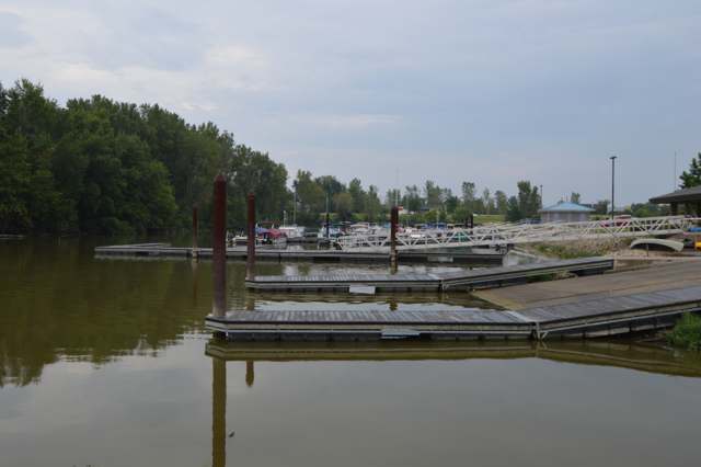
Photo: Nyttend, public domain · Wikimedia Commons
Local history sources: archive.org · archive.org · en.wikipedia.org · commons.wikimedia.org · postalhistory.com
Water
Mostly private wells The water here
- Napoleon City91% of residentsMaumee River (with Wauseon reservoirs as backup/blend storage)
- Northwestern W and SD - Sr 1084% of residentsMaumee River (with Wauseon reservoirs as backup/blend storage)
- Florida Village3% of residentsMaumee River (with Wauseon reservoirs as backup/blend storage)
- Northwestern W and SD - Co. Rd P2% of residentsMaumee River (with Wauseon reservoirs as backup/blend storage)
Hospitals, fire stations and more
Inside Damascus Township, Henry County's boundary: 1 poor-rated bridge and 1 spill case. Press a pin or a name for its whole record and its source.
Bridges rated poor (1)
-
CO. Rd. P over Ditch 1074-3Poor · built 1964
- Condition
- Poor: a deck, superstructure, substructure or culvert rated 4 or below on the 0 to 9 scale
- What it is
- Bridge
- Built
- 1964
- Length
- 12 ft
- Owner
- County
- Vehicles a day
- 263
- Coordinates
- 41.38611, -83.93389
National Bridge Inventory (source) ↗ Street map and directions ↗
Source: FHWA National Bridge Inventory 2025. "Poor" means one major part rated 4 or below on the 0 to 9 scale; it calls for repair, not closing, unless the state posts or closes the bridge.
Spills reported since 2021 (1)
-
Sewage Human2024-08-28 · Damascus Twp
- Reported
- 2024-08-28
- What spilled
- Sewage Human
- Where
- Damascus Twp, Henry County
- Ohio EPA district office
- NWDO
- Ohio EPA case number
- 2408EPA0001480
Ohio EPA spill reports (source) ↗ Street map and directions ↗
Source: Ohio EPA emergency response spill reports, 2021 to September 2026, one point per case where Ohio EPA placed it. A report is what the caller or responder recorded; amounts are often blank or estimated.
Its ZIP codes
Each ZIP code that touches Damascus Township, Henry County, with the share of its residents who live here and the same headline figures as the ZIP page.
| ZIP | Share | Water | Radon | Home value | Schools | Flood |
|---|---|---|---|---|---|---|
| 43534 Damascus Township and Mc Clure | 43% | Mostly private wells | 2.5 pCi/L average radon | Median year built 1956 | Napoleon Area City · 3.5 stars overall | No digital FEMA flood map for this county |
| 43523 Monroe Township and Grelton | 13% | Mostly private wells | Too few radon tests | Median year built 1952 | Patrick Henry Local · 4.5 stars overall | No digital FEMA flood map for this county |
| 43545 Napoleon | 2% | Maumee River (with Wauseon reservoirs as backup/blend storage) | 4.5 pCi/L average radon | Median year built 1957 | Napoleon Area City · 3.5 stars overall | No digital FEMA flood map for this county |
Local government
Who holds office in Damascus Township, Henry County, how its elections and ballot issues came out, and the state auditor's record.
Who holds office
| Office | Name | Party | Term ends | Contact |
|---|---|---|---|---|
| Township Trustee | Nathan A. Johnson | 2027 | 419-572-0071 2593 U.S. Highway 6, McClure, OH 43534 | |
| Township Trustee | Ryan Arno | 2029 | 419-260-0597 6818 State Route 110, Napoleon, OH 43545 | |
| Township Trustee | Kyle Sworden | 2029 | 419-966-1597 3519 State Route 65, McClure, OH 43534 | |
| Township Fiscal Officer | Corina Smith | 2027 | 419-906-4547 P218 County Road 7, Napoleon, OH 43545 |
Roster as of 2026-09-17: county board of elections.
Ballot issues
| Date | Issue | For | Against | Result |
|---|---|---|---|---|
| 2026-05-05 | Issue: None | 213 | 67 | Passed (76.07% for) |
Elections for office
| Date | Office | Candidates and votes |
|---|---|---|
| 2025-11-04 | Township Trustee | Ryan Michael Arno 117, 43.33%; Kyle Sworden 153, 56.67% |
| 2025-11-04 | Township Fiscal Officer | Corina M. Smith 158, 100.0% |
Winners in bold. Results from the county board of elections' official canvass unless marked.
Auditor of State record
- No fiscal caution, watch or emergency on the Auditor of State's lists.
- Agreed Upon Procedures, 2023 to 2024, released 2025-09-09
The county
Henry County: 11 ZIP codes, 23 cities, villages and townships, 27,623 people.
Nearby places
Quick answers
What county is Damascus Township, Ohio in?
Damascus Township, Henry County is a township in Henry County, Ohio, with 1,080 residents.
When was Damascus Township, Ohio founded?
Damascus Township, Henry County was settled 1794 (Wayne's encampment); permanent settlement from the late 1830s and 1840s; laid out McClure platted April 15, 1880, by John McClure; incorporated Damascus organized as a voting precinct in 1823; McClure village incorporated in 1886. Founders on record: Henry County (precinct); John McClure (village). Source
How did Damascus Township, Ohio get its name?
The reason for the name Damascus is not recorded. Source
What ZIP code is Damascus Township, Ohio?
Damascus Township, Henry County is served by ZIP codes 43534, 43523 and 43545; 43534 holds the largest share of its residents.
Where does Damascus Township, Ohio get its water?
The main water source for Damascus Township, Henry County (Napoleon City): Mostly private wells.
Cite this page
Cite this page as:
Cracked Buckeye, "Damascus Township, Henry County", https://crackedbuckeye.com/place/damascus-township-henry-county/, built 2026-10-31, accessed [date].
How to cite · Report a correction · Built 2026-10-31
